Little Castle Lake and Heart Lake
in Shasta-Trinity National Forest
You are bound to fall in love with the hike to Heart Lake. This pint-sized heart-shaped attraction in the Castle Crags Wilderness of Shasta-Trinity National Forest boasts views of Mount Shasta, Black Butte, and surrounding Klamath Mountains. The hike to Heart Lake begins from a trailhead at Castle Lake, a larger mountain lake wrapped by pines and granite cliffs. For a two-lake trek, you can hike out and back between Castle Lake and Heart Lake for a two miler with 645 feet of elevation change. Those who really like lakes can hike more of Castle Lake Trail to a third lake, Little Castle Lake for a 2.9-mile outing. Little Castle Lake is less endearing than Heart Lake and adds a rather steep 260-foot descent and ascent to the itinerary.
This write-up describes the trails to both Little Castle Lake and Heart Lake. Another variation is to venture off trail to the summit above Heart Lake, which has extraordinary views of the Castle Crags. The hike from Castle Lake to Heart Lake and Castle Peak is around 3.2 miles round trip with 1,180 feet of elevation change.
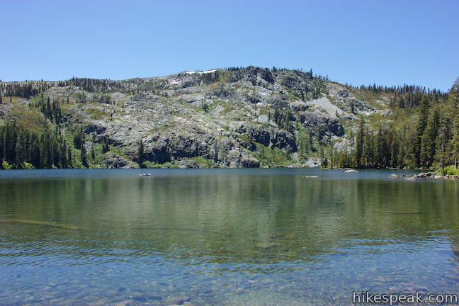
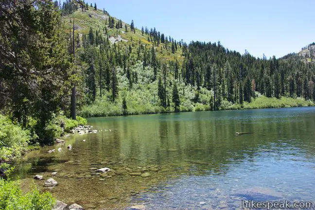
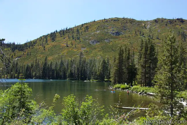
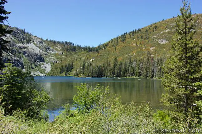
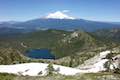
Make your way to the end of Castle Lake Road in the mountains southwest of the city of Mount Shasta, located below the massive snow-covered volcano with the same name. At road’s end, you’ll find the clear, blue water of Castle Lake. Take a few steps through a pine forest to reach the shore of this sizeable mountain lake. Tall granite cliffs border the lake on the opposite side to the south. This large tranquil lake may have a couple boats or a few swimmers enjoying its waters.
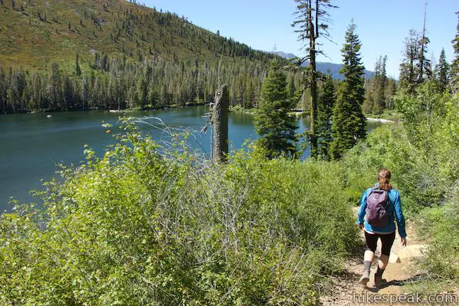
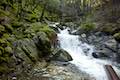
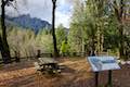
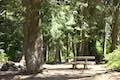
Back down the road a bit, you’ll find a vault toilet and a trail that goes along the west side of the lake. This trail does not go all the way around Castle Lake and does lead to the other two lakes in the area. To reach them, set out on Castle Lake Trail, which heads east from the end of Castle Lake Road. Hike past picnic sites placed along the lake and hop over Castle Lake Creek about 100 yards from the start. Just past the creek crossing, bear right at a split to stay near the shore on Castle Lake Trail.
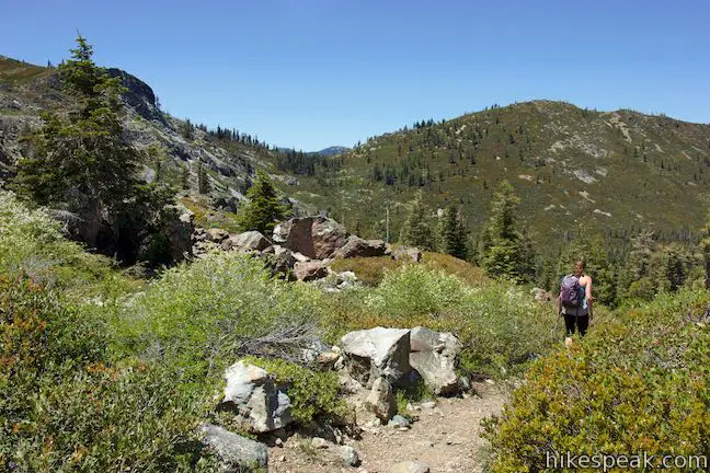
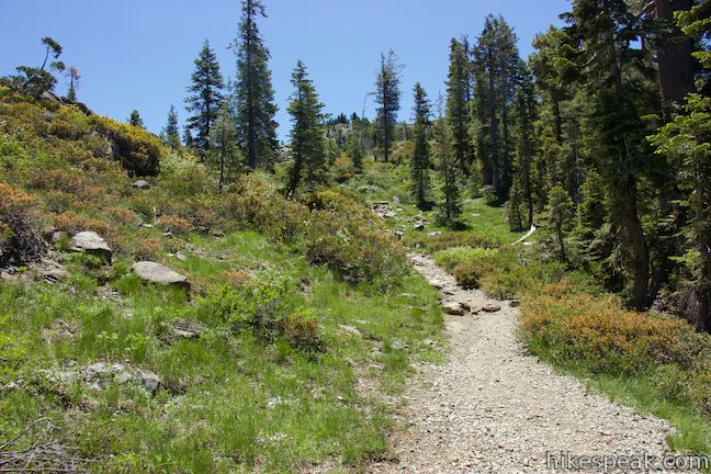
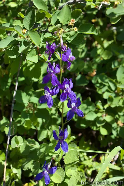
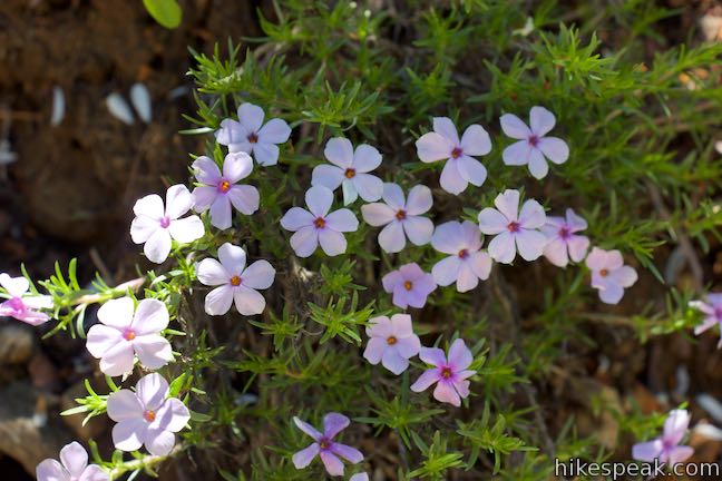
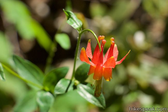
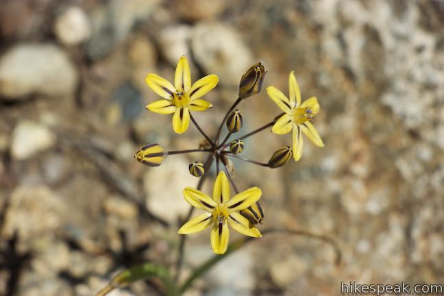
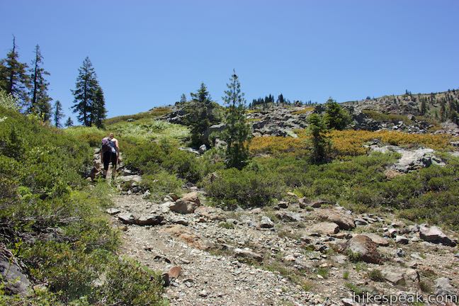
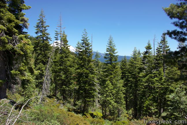
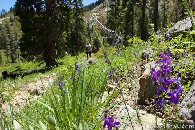
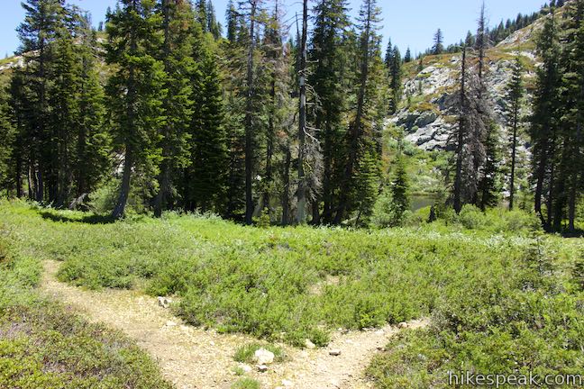
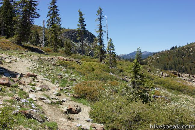
The single-track trail turns uphill and rises above the lake through brush and summer wildflowers like larkspur and phlox. After a third of a mile, the trail tilts up to a steep section. Use rock and roots for steps and make your way up through the forest. Pause to enjoy occasional views back over Castle Lake.
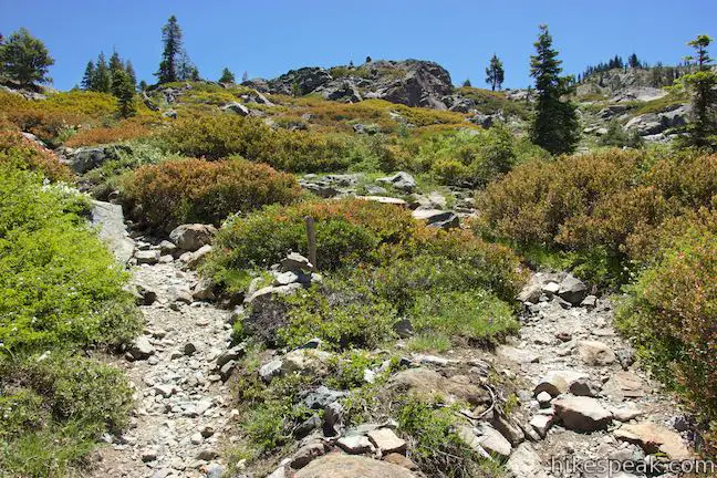
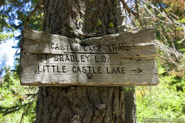
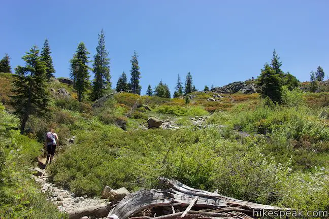
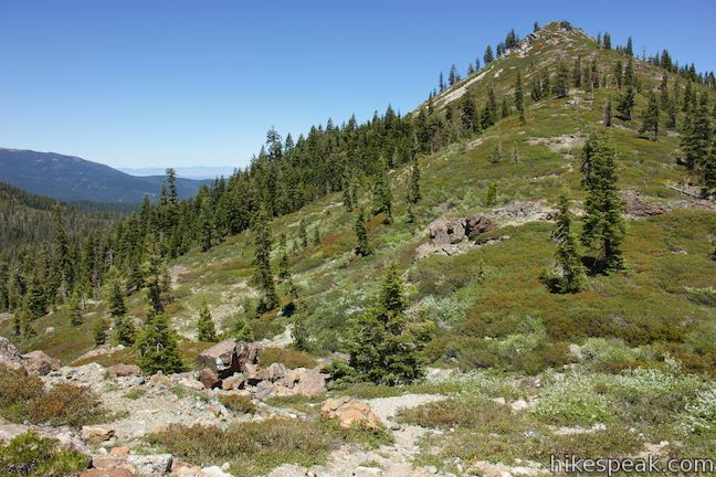
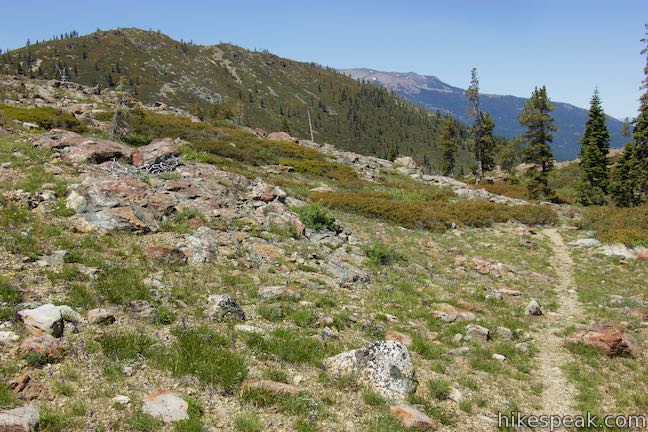
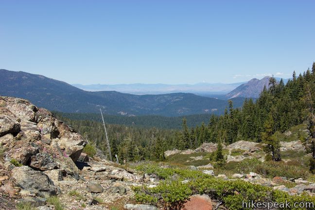
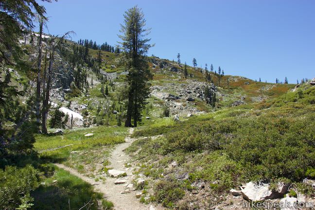
After half a mile of hiking, the trail exits the forest and continues uphill on a rocky course through low brush and occasional trees. As the rough trail rises to a mountain pass, it hits two junctions with trails leading to Heart Lake. The first comes 0.57 miles from the trailhead and the second is 0.05 miles farther up Castle Lake Trail. Neither junction is marked, except for cairn rock piles and unofficial wooden posts.
If you are hiking to Little Castle Lake Trail first, stay to the left through both junctions. Otherwise, you can turn right at either junction as the two trails merge 100 to 125 yards from Castle Lake Trail. The first right turn will deliver a shorter hike.
Hiking to Little Castle Lake
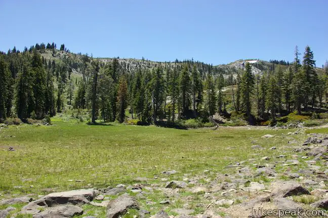
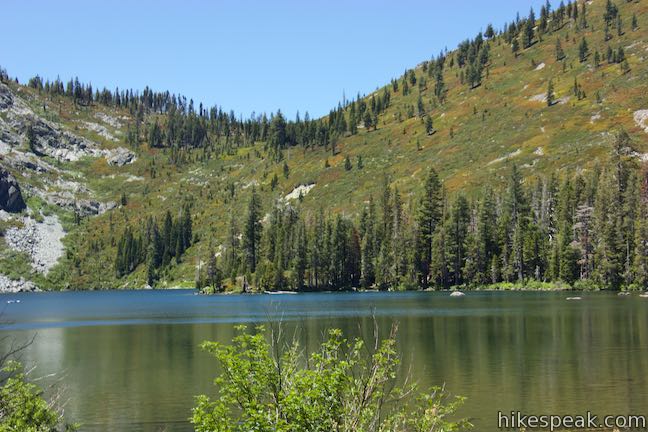
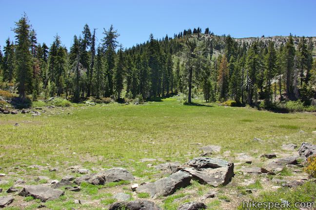
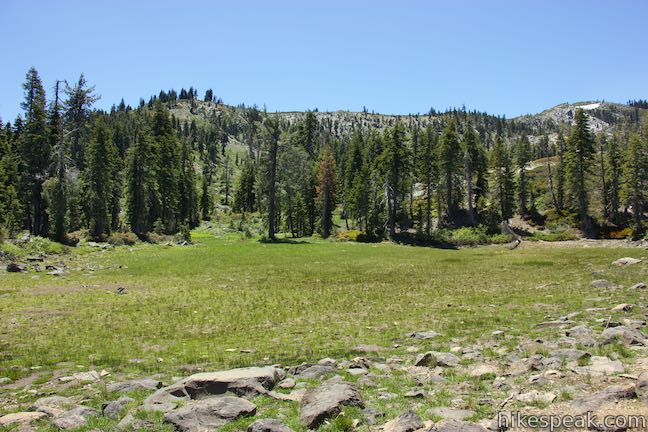
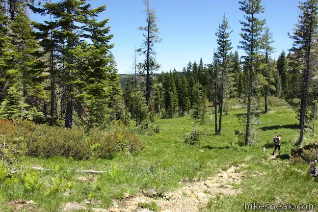
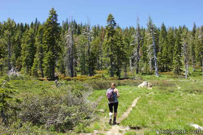
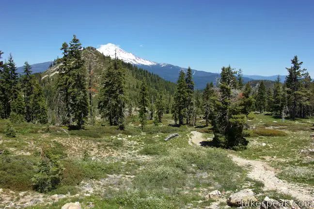
Proceed up Castle Lake Trail past the second junction with Heart Lake Trail where it crosses a mountain pass, 400 feet above Castle Lake. Look back down the trail for a final view of pine-framed Castle Lake and then hike gradually past a meadow and a dry pond that may be filled with water if you visit during the correct season.
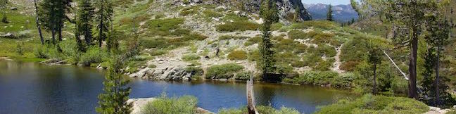
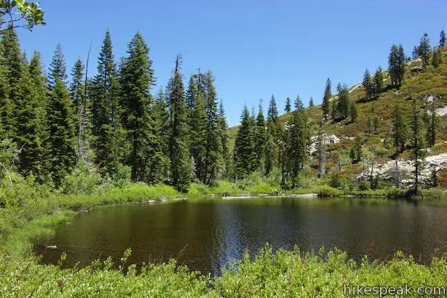
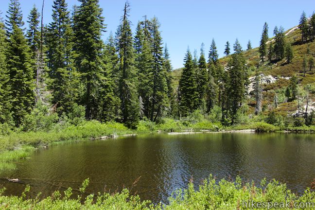
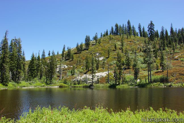
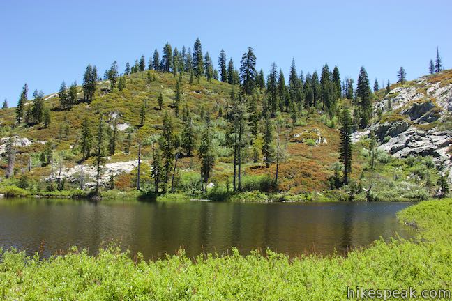
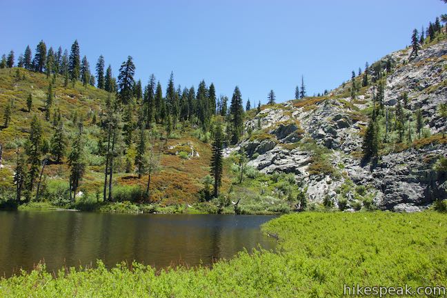
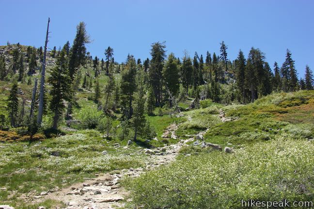
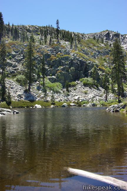
The trail turn left and goes along the side of the meadow. Your easy-going stroll is cut short when the trail tilts abruptly downhill through a pine forest. Catch glimpses of Mount Shasta as you descend a few steep, tight switchbacks. Near the bottom of the slope, you’ll spot the shimmering water of Little Castle Lake.
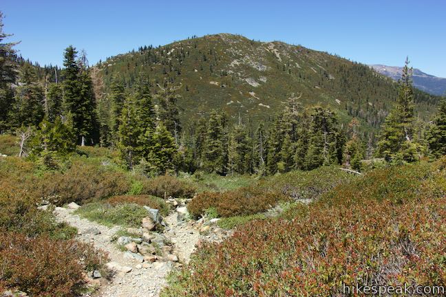
Below the forest, the trail levels out and enters a meadow. To your left, you’ll find an unobstructed view of Mount Shasta and the big snow-covered volcano looks mountainous from this perspective. Within this meadow, and a mile from the trailhead, you will come to an unmarked junction. Castle Lake Trail continues east to Mount Bradley Ridge. Turn right to find Little Castle Lake.
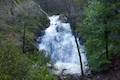
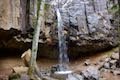
The short path leading to the lake comes to one more split just before the lake. Turning right seems like the easiest way to reach the shore. Above the lake on your right, you’ll see and hear a cascading stream. This is the start of Ney Springs Creek, which feeds Little Castle Lake. Down stream, this water will tumble over Faery Falls, another good hiking destination.
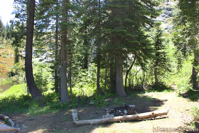
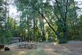
Arrive at the trees and brush along the side of Little Castle Lake. A campfire site sits next to the lake. There is no path around the lake and the shore is wrapped by brush and hard to access. The diminutive Little Castle Lake is pleasant, but not as much as Heart Lake. Given that you need to turn and ascend 260 feet over 0.4 miles to return to the mountain pass, some may wish to skip this addition and only hike to the more sought-after lake.
Leave Little Castle Lake, return to Castle Lake Trail, and turn left. Hike back across the meadow (hopefully enjoying a few wildflowers) and return to the forest for the short, steep ascent. Hike along the meadow will the dry pond and back to the mountain pass and the upper unmarked junction with Heart Lake Trail. Turn left (originally a right turn) to make your way to the next lake.
Hiking to Heart Lake
If you’re not hiking to Little Castle Lake, you probably want to turn right off Castle Lake Trail with the first path to Heart Lake (0.57 miles from the trailhead). In another 125 yards, you will come to a merger of the trails and turn right to proceed south toward the lake.
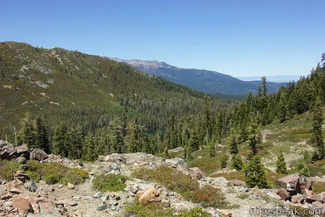
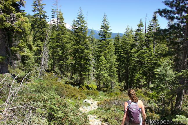
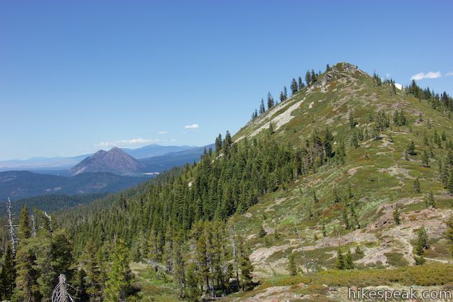
Coming from the upper junction (which is 0.62 miles from the trailhead or just under 1.5 miles from the start after visiting Little Castle Lake), the higher branch of Heart Lake Trail crosses an outcropping toward the trail merger to the south. On the way, you’ll get open views over Castle Lake and up toward Castle Peak on the ridge above Heart Lake.
Once the trails come together, pay some attention to stay on the correct path. Hike another 200 feet up Heart Lake Trail across a dip in the terrain to a potentially confusing split. Do not take the worn path to the left that goes along a line of trees. Instead, push straight up the slope in front of you.
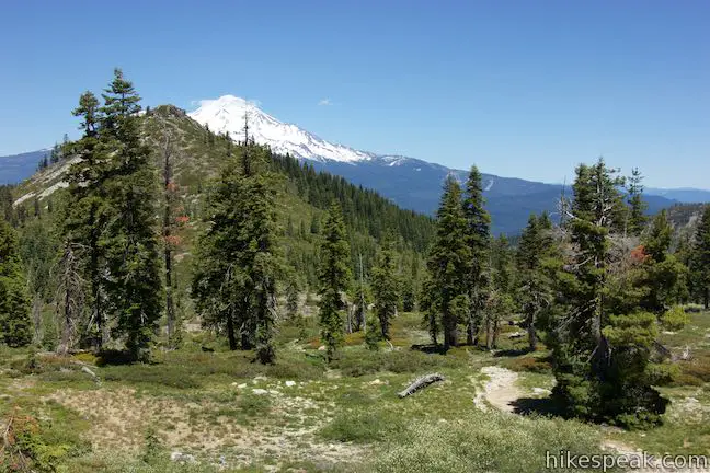
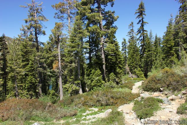
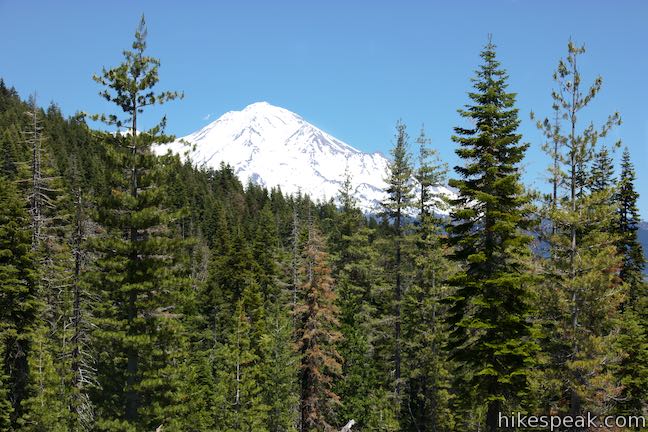
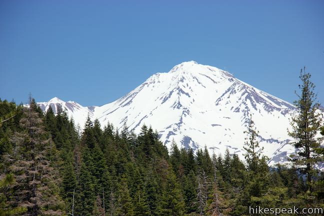
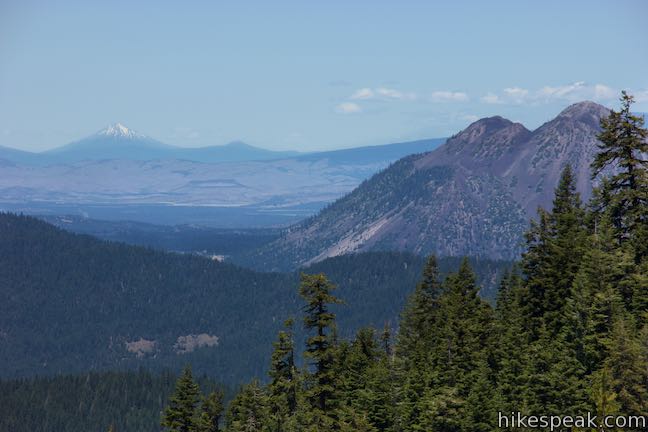
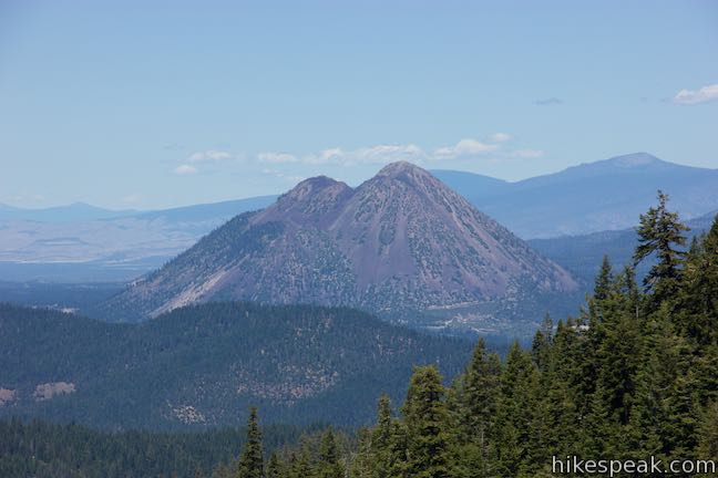
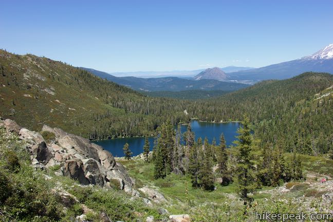
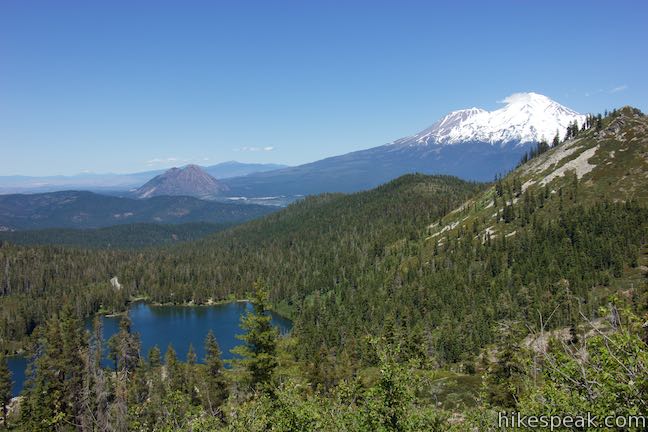
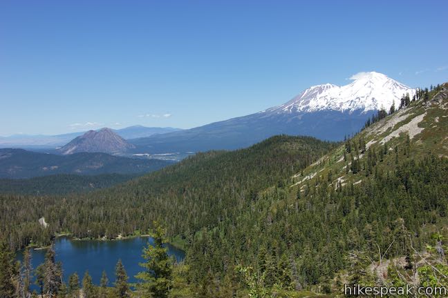
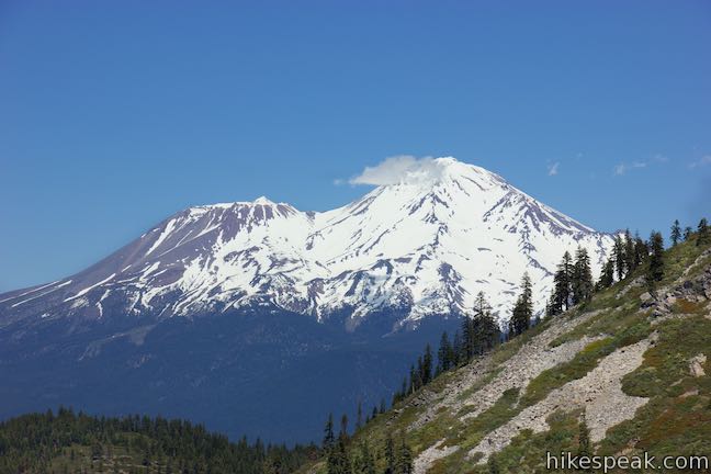
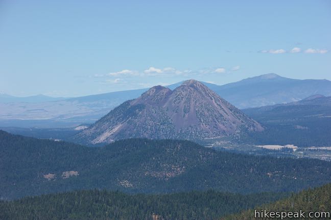
Heart Lake Trail curves to the right, heading up a lightly wooded slope. Look over your shoulder to see the top of Mount Shasta rising over a point on the ridge to the north. To the left of Mount Shasta is Black Butte, whose rocks actually have a red-purple color from this vantage. On clear days, the out-of-state summit of Mount McLoughlin can be seen rising to a snowy point far to the north.
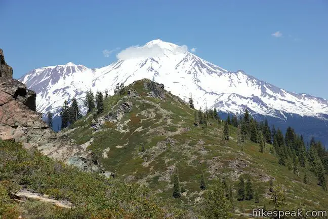
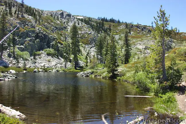
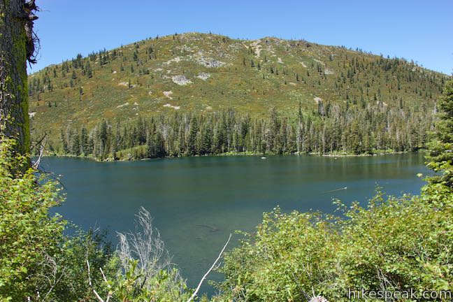
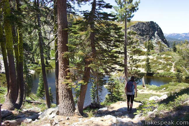
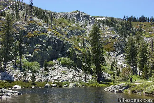
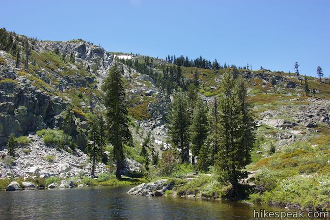
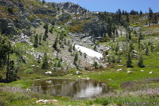
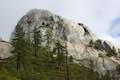
The trail goes uphill through brush, entering Castle Crags Wilderness as it reaches the base of a short, steep slope where the trail seems to split. The trail comes back together on the top of this pitch and tapers out to cross a notch in the terrain leading to Heart Lake. The inviting lake first appears through a cluster of pines, but you will quickly get an unobscured view.
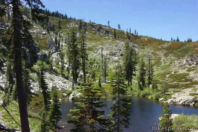
The trail comes down to the shore at a point between the two coves that make up the top of this heart-shaped lake. The trail proceeds around the north end of the lake to a fantastic viewpoint. Look out over a ledge and down over Castle Lake and a pine-covered valley. Black Butte and Mount Shasta rise prominently beyond (Mount Shasta is over 14,000 feet tall).
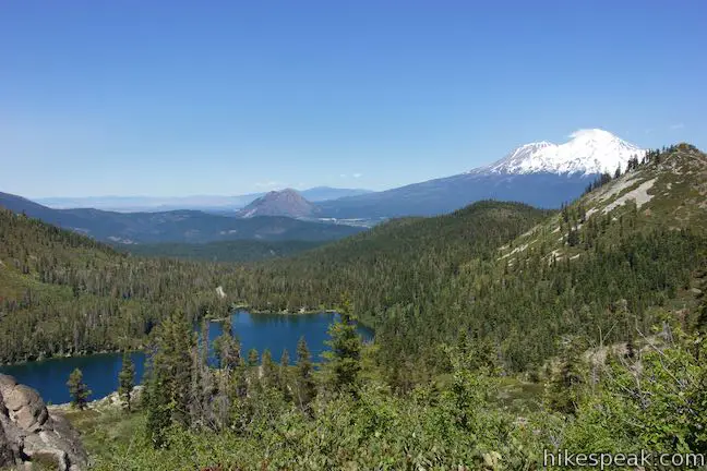
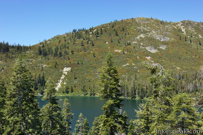
Step over the creek at the outlet of the lake to continue along the shore. If you walk farther around the lake, you can align yourself for a perspective of Mountain Shasta rising over the end of Heart Lake. Heart Lake is reached after 1 mile of hiking on its own or 1.9 miles of hiking with Little Castle Lake included.
A meadow behind Heart Lake can contain one or two small seasonal ponds. Paths proceed in this direction up a ridge to the summit known as Castle Peak. It is 585-foot climb over 0.7 miles to this summit, which has stunning views looking over Heart Lake and southeast toward a jumble of jagged peaks known as the Castle Crags. Much of the hike to Castle Peak is off trail, so consider hiking to Castle Peak if you are up for a bit more adventure. Otherwise, turn around at Heart Lake for a hike that is 2-3 miles round trip.
The basic directions to only Heart Lake are:
- Set out from the end of Castle Lake Road on Castle Lake Trail (0 miles)
- Cross Castle Lake Creek and turn right at the split (0.06 miles)
- Leave the forest and turn right at the first of two unmarked junction onto Heart Lake Trail (0.57 miles)
- Bear right as the trails to Heart Lake come together (0.64 miles)
- Stay to the right through an unclear junction (0.67 miles)
- React the outlet of Heart Lake (1 mile)
The basic directions to Little Castle Lake and Heart Lake are:
- Set out from the end of Castle Lake Road on Castle Lake Trail (0 miles)
- Cross Castle Lake Creek and turn right at the split (0.06 miles)
- After leaving the forest, stay to the left at the first unmarked junction with Heart Lake Trail (0.57 miles)
- Stay to the left through a second unmarked junction with Heart Lake Trail (0.62 miles)
- Cross over the pass and go along meadow and dry lake (0.67 miles)
- Turn right on a spur to Little Castle Lake (1 mile)
- Reach the lakeshore and turn around (1.05 miles)
- Return to Castle Lake Trail and turn left (1.1 miles)
- Hike back over the pass and turn left onto Heart Lake Trail (1.48 miles)
- Hike straight through a merger with the other branch of Heart Lake Trail (1.54 miles)
- Stay to the right through an unclear junction (1.57 miles)
- React the outlet of Heart Lake (1.9 miles)
- Explore the lake and turn around
- Bear left for the lower branch of Heart Lake Trail (2.26 miles)
- Turn left down Castle Lake Trail (2.33 miles)
- Return to the Castle Lake Trailhead (2.9 miles)
Whether you hike only to Heart Lake, visit Heart Lake and Little Castle Lake, or push on up to Castle Peak, you will have a lovely hike. No permit is required to day hike from Castle Lake and no fee is required for this hike. Dogs and bikes are permitted (although these trails seem ill-suited for mountain bikes). Camping is available just 0.3 miles down the road at Castle Lake Campground. Other nearby hikes include Lake Siskiyou Trail (South Shore Loop), Faery Falls, and Spring Hill.
To get to the trailhead: Take interstate 5 to exit 73B in Mount Shasta. At the end of the offramp, head west (away from the city) on Lake Street toward Hatchery Lane, following signs for Lake Siskiyou. Turn left on Old Stage Coach Road and drive south for 0.2 miles. Veer right onto Barr Road and drive another 2.3 miles to Ney Springs Road. The intersection comes after you cross the outlet of Lake Siskiyou. Turn left up Ney Springs Road and make the next right onto Castle Lake Road. Drive 7 miles up to the end of the road at a parking area by Castle Lake where the hike begins.
Trailhead address: Castle Lake, Castle Lake Road, Dunsmuir, CA 96025
Trailhead coordinates: 41.2303, -122.3816 (41° 13′ 49.07″N 122° 22′ 53.76″W)
View Castle Lake Area in a larger map
Or view a regional map of surrounding Northern California trails and campgrounds.


 | Castle Peak and Heart Lake This approximately 3.2-mile hike ventures off trail above Heart Lake to a summit with extraordinary views of the Castle Crags and Mount Shasta. |
 | Faery Falls and Ney Springs This short hike travels along a creek up to an impressive 50-foot waterfall, passing the ruins of an old resort along the way. |
 | Lake Siskiyou Trail (South Shore Loop) This short and easy lakefront loop offers great views across Lake Siskiyou toward Mount Shasta and the surrounding evergreen wilderness. |
 | Spring Hill This 2.9-mile hike hits a short summit near Mount Shasta with excellent views of Mount Shasta, Black Butte, and the surroundings. |
 | Crags Trail to Castle Dome This 5.6-mile round trip hike in Castle Crags State Park ascends 2,150-feet through a garden of granite crags to the base of Castle Dome. This hike can be extended to 6 miles round trip by taking a worthy side trail to Indian Springs. |
 | Root Creek Trail This 2.2-mile round trip hike in Castle Crags State Park takes a level and easy course to a tumbling creek in a mossy forest. |
 | Vista Point Trail This short hike reaches the principal viewpoint in Castle Crags State Park, which has a great perspective of granite peaks known as the Castle Crags, along with views of Mount Shasta and the surrounding wilderness. |
 | Hedge Creek Falls Trail This short hike leads to a forest-wrapped waterfall, passing behind the falls to arrive at a Sacramento River Overlook. |
 | Bailey Cove Trail This easy 3.1-mile loop circles a hill-covered peninsula on the McCloud Arm of Shasta Lake, providing both lake views and shade. |
 | More hikes in Northern California Explore more trails in Northern California, including redwood grove and oceanfront parks along the North Coast. |
 | Castle Crags State Park Campground There are 76 developed campsites within this state park that are nestled within a pine forest with access to nearby trails. |
 | Antlers Campground This well-shaded 59-site campground in Shasta-Trinity National Forest has level sites on a bluff next to Shasta Lake. |
 | Castle Lake Campground This six-site campground in Castle Lake is shaded by conifers in Shasta-Trinity National Forest. |
Go the extra miles...
Submit a rating of this hike to go with your comment. Contribute to the average trail rating.