Santa Ynez Canyon Trail to Eagle Rock
in the Santa Monica Mountains
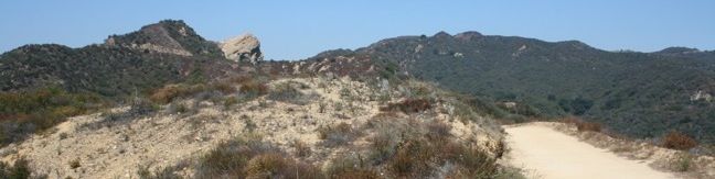
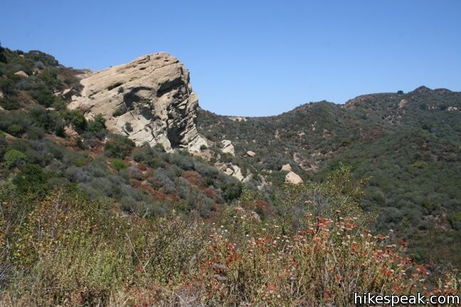
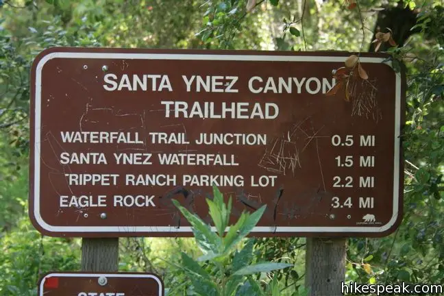
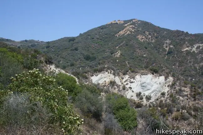
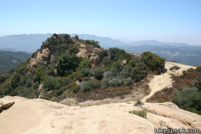
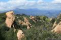
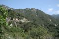
The craggy sandstone summit of Eagle Rock rises over Topanga State Park, delivering panoramic views of the Santa Monica Mountains. The shortest trail to awesome prominence is a four-mile hike from Trippet Ranch to Eagle Rock. For a more challenging trek, explore this 7.4-mile round trip hike ascending 1,400 feet from Santa Ynez Canyon to the 1,957-foot summit of Eagle Rock.
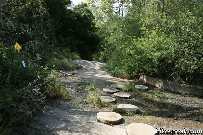
Begin by parking along Vereda de La Montura in the Pacific Palisades. This parking is free, while there is a $10 fee to park at Trippet Ranch in Topanga State Park. Descend through the gate and begin up Santa Ynez Canyon Trail. Use the concrete stepping stones to cross a runoff channel, and leave the urban world behind.
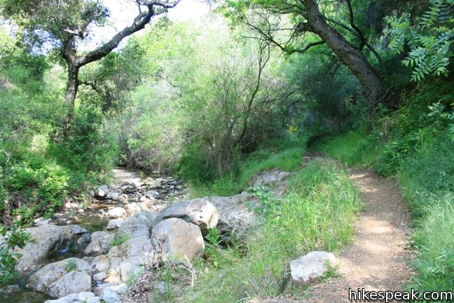
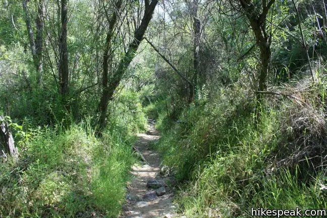
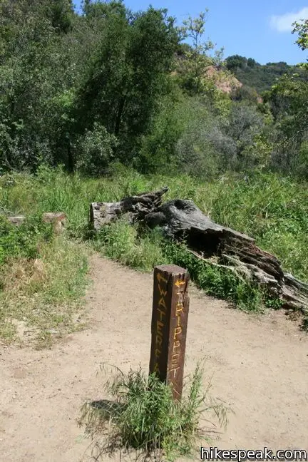
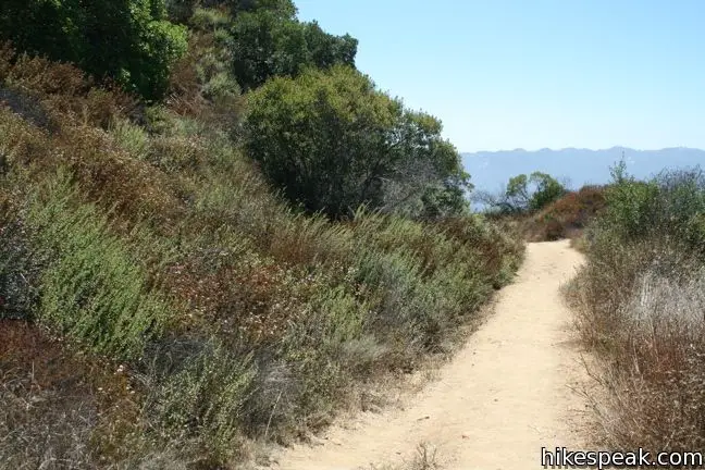
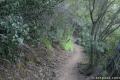
The pavement gives way to a dirt single track which plots a level course through a dense forest. The creek bed alongside the trail is dry in the summer and fall, but rock hopping is required in the spring. The trail comes to a junction 0.6 miles from the start. To the right, a spur trail leads to Santa Ynez Falls, a short seasonal waterfall that comes alive after it rains. To the left, Santa Ynez Canyon Trail continues toward Trippet Ranch and up to Eagle Rock.
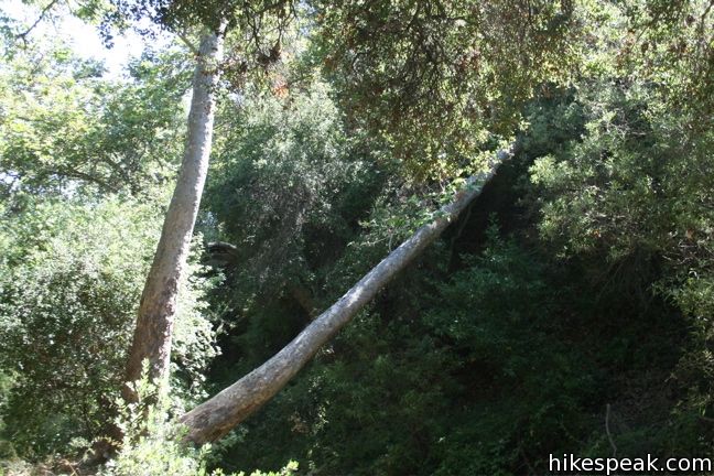
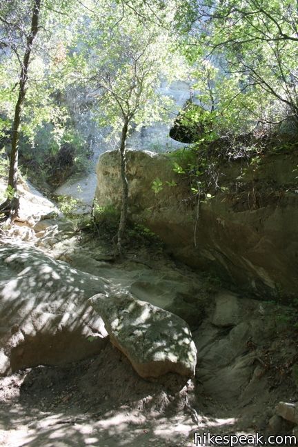
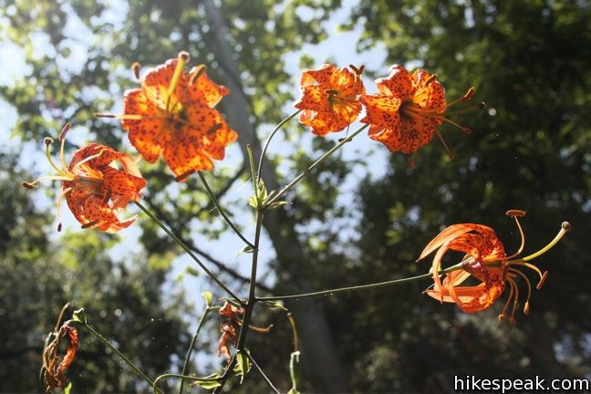
Less than a tenth of a mile past the junction, a subtle path heads up the canyon wall to the left, climbing a short distance to a small cave that can be explored by those interested. Beyond, the gradual trail progresses up canyon through a lust forest of oaks and bays.
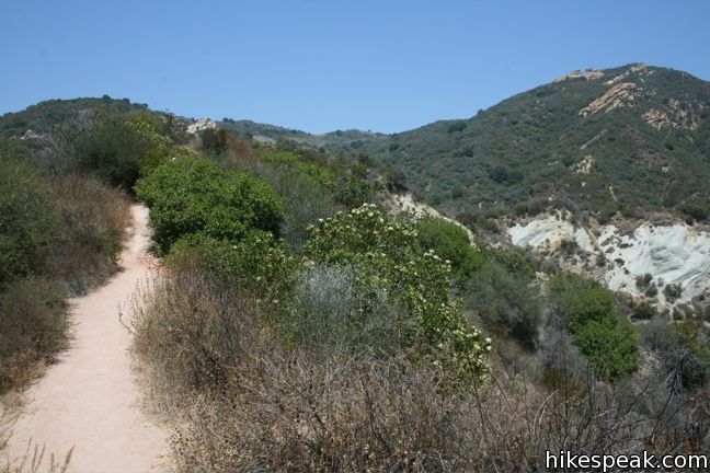
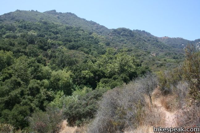
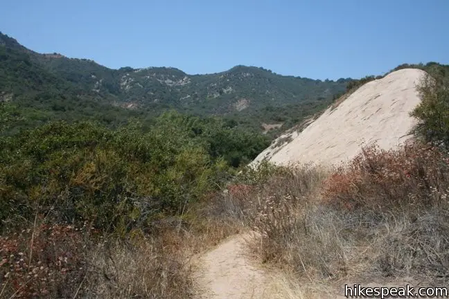
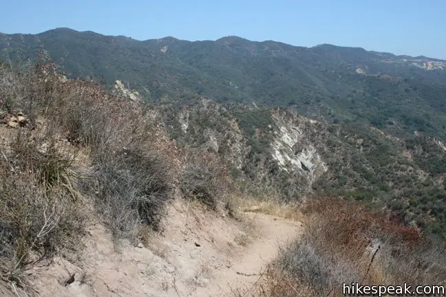
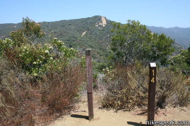
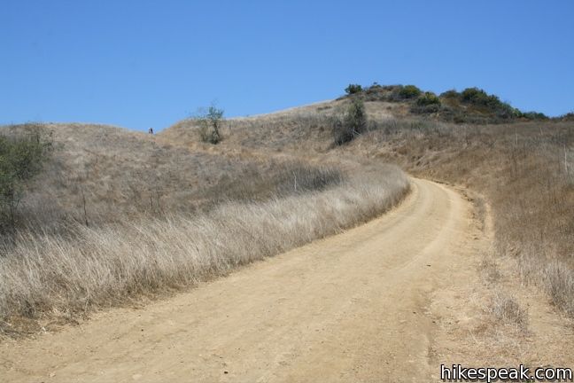
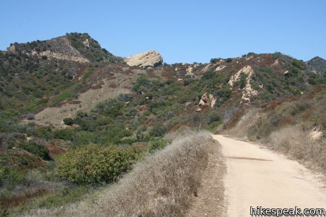
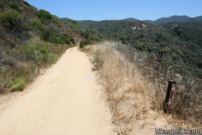
After a few creek crossings, and six-tenths of a mile past the junction, the trees break and launching a sun-exposed ascent up the side of the canyon. The trail crossed over sandstone slickrock, serving up broad views up and down canyon for the first time. The single-track climbs 450 feet over the next 2/3 of a mile before gaining the ridge. The trail finds shade again, but continues to climb, gaining another 200 feet over the next quarter-mile. The chaparral-lined switchbacks lead up to two junctions with unnamed paths that come in quick succession. Proceed to the right, following the trail markers through both junctions.
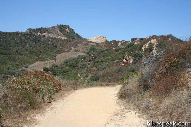
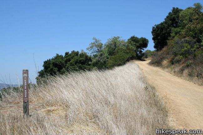
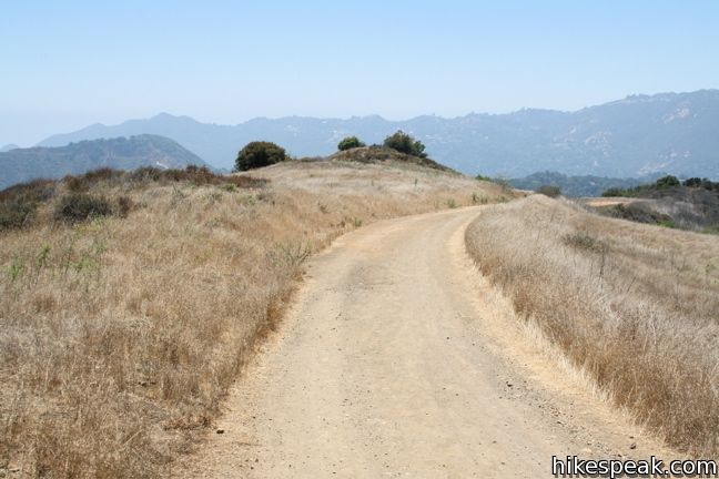
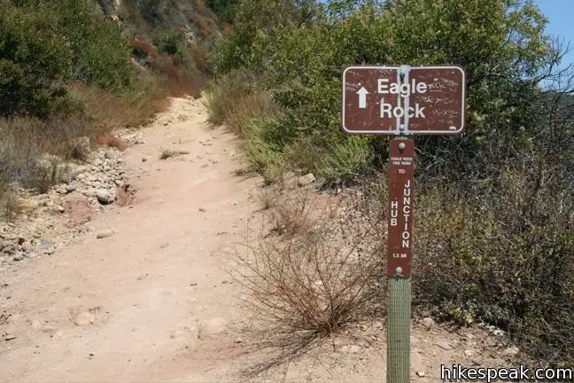
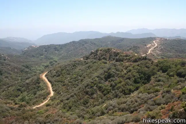
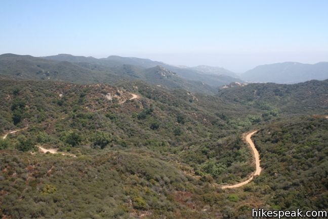
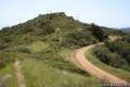
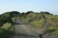
A tenth of a mile farther, Santa Ynez Canyon Trail comes to an end at a meeting with Eagle Springs Fire Road. To the left, the fire road descends 0.4 miles to Trippet Ranch. Eagle Rock is to the right, 1.6 miles and 550 vertical feet away. Turn right on Eagle Springs Fire Road and take this wide dirt track north through the Santa Monica Mountains.
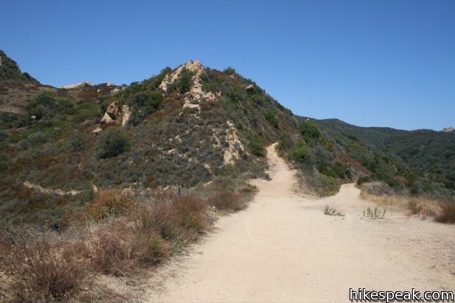
After just over a mile, you will arrive at a four-way intersection. Straight ahead Eagle Springs Fire Road, which is now also the Backbone Trail, continues northeast toward Temescal Ridge. To the left, a single-track named Musch Trail descends through Musch Trail Camp to the trailhead at Trippet Ranch. Most importantly, a second trail to the left heads uphill to Eagle Rock.
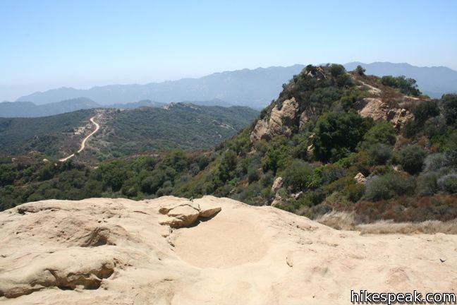
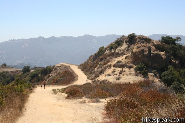
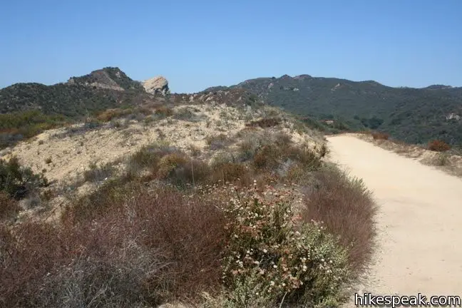
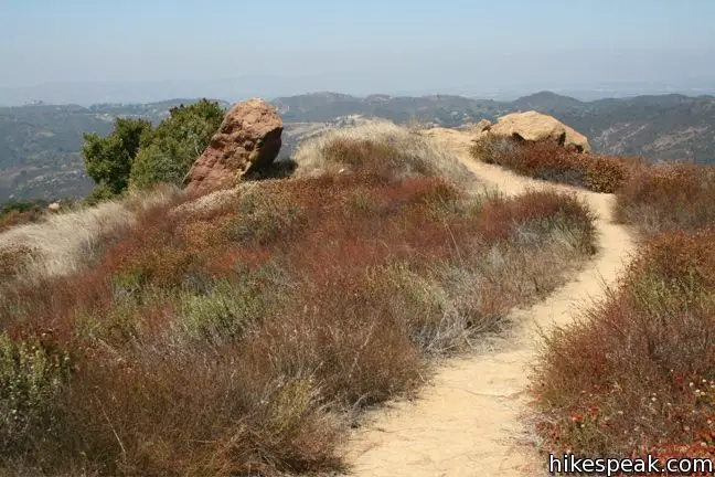
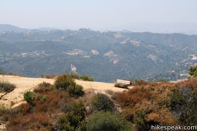
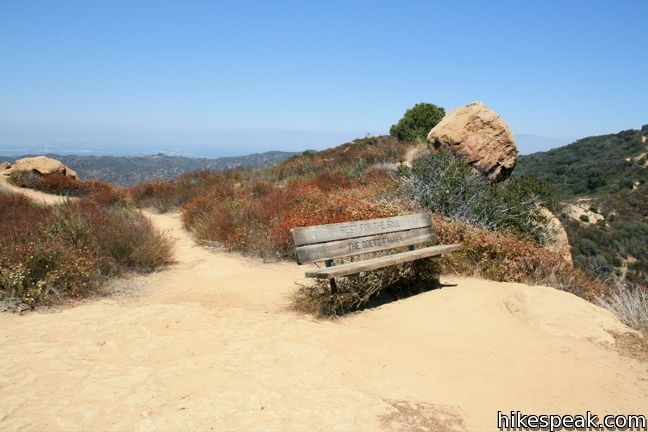
Take the fire road to the left, labeled Eagle Rock Fire Road and ascend another half mile up to Eagle Rock. The road continues past the summit, where you should take a footpath to the right past a wooden bench to the pothole-filled pinnacle.
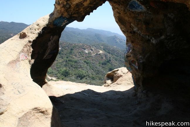
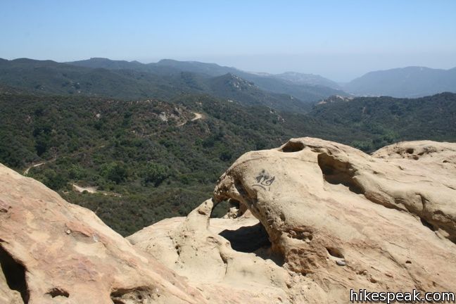
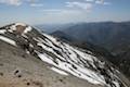
Panoramic views from the top overlook Topanga, Santa Monica Bay, the San Fernando Valley, and all the mountains in between. A partial ocean view is to the south (which was covered by overcast skies in the photos below). Relax and enjoy this lofty perch. Eagle Rock has a few arches and alcoves carved into the pocketed sandstone that are interesting to look at as well.
When you have had enough, simply return the way you came. It is downhill almost all the way. This 7.4-mile hike takes about three hours, and provides a good workout, varied vegetation, and fine scenery. Dogs are not allowed on this hike as it passes through Topanga State Park. No fee or permit is required to hike Santa Ynez Canyon Trail to Eagle Rock, so get out and enjoy!
The basic directions to Eagle Rock are:
- Park along Vereda de la Montura and begin up Santa Ynez Canyon Trail (0 miles)
- Turn left at junction with Santa Ynez Falls Trail (0.6 miles)
- Stay right through two small junctions (2.05 miles)
- Turn right on Eagle Springs Fire Road (2.15 miles)
- Reach Eagle Junction and turn left up Eagle Rock Fire Road (3.2 miles)
- Summit Eagle Rock (3.7 miles)
Want more? To extend the hike to another summit, continue east from Eagle Rock on Eagle Rock Fire Road for 0.7 to Hub Junction. Head south on Temescal Ridge Trail for half a mile, make a left up the Backbone Trail and another left up a single track to reach the 2,1,26-foot top of Temescal Peak, 1.4 miles from Eagle Rock. Return to Hub Junction and take Eagle Springs Fire Road west for 1.3 miles to reach Eagle Junction at the other end of Eagle Rock Fire Road. This 3.4-mile extension will add a second summit and a loop to your hike to Eagle Rock, bringing the total distance to 10.3 miles.
To get to the trailhead: From PCH, take Sunset Boulevard inland for half a mile. Turn left onto Palisades Drive and head north for 2.4 miles. Turn left onto Vereda de la Montura, and park on either side of the street in the permitted areas. The trail begins on the right side of the street at the bottom of the hill (before the private neighborhood gates).
Trailhead address: 17399 Vereda De La Montura, Pacific Palisades, CA 90272
Trailhead coordinates: 34.0782, -118.56745 (34° 04′ 41.52″N 118° 34′ 02.81″W)
View Santa Monica Mountains in a larger map
Or view a regional map of surrounding Los Angeles trails and campgrounds.


 | Santa Ynez Falls This 2.5-mile follows a shaded creek to a gorge containing a short waterfall. |
 | Eagle Rock from Trippet Ranch This 4.5-mile loop takes Musch Trail and Eagle Springs Fire Road to visit the exceptional sandstone summit. |
 | Temescal Peak This 5.8 to 7.6-mile hike ascends Temescal Ridge to a summit with sweeping views over Topanga State Park and the Santa Monica Mountains. |
 | Parker Mesa Overlook This steep out-and-back hike rewards the effort with excellent views of the Pacific Ocean. |
 | Temescal Canyon This 2.6-mile loop offers a variety of scenery and decent exercise, despite its relative brevity. |
 | Hondo Canyon This section of the Backbone Trail crosses fields of grains and forests of bays, climbing 1,550 feet over 3.8 miles to a small ocean view. Extend the hike to Topanga Lookout for an incredible perspective over the Santa Monica Mountains. |
 | More trails in the Santa Monica Mountains Explore other destinations in the range. |
 | Sandstone Peak This 6.25-mile loop summits the tallest peak in the Santa Monica Mountains. |
 | Westridge Trail to San Vicente Mountain This 7.4-mile hike travels a scenic ridge between a Brentwood neighborhood and a summit that was once used as a Nike Missile site. |
 | Stunt High Trail to Saddle Peak This 7.5-mile hike combines Stunt High Trail and a section of the Backbone Trail to visit the 6th tallest summit in the Santa Monica Mountains. |
 | Santa Anita Canyon Loop This 9.5-mile loop visits two peaceful creeks in sylvan canyons, passing a 60-foot waterfall and plenty of beautiful wilderness. |
 | Mount Baldy Loop This 11.3-mile hike incorporates Devil's Backbone and Baldy Bowl - Ski Hut Trail into one see-all loop. |
[…] On Monday, my buddy Taylor and I tackled a 7-mile hike in the Pacific Palisades. […]
I did this hike two weekends ago. It was a great hike and I believe it ended up being around 8.6 miles round trip. Great views and very diverse scenery from within the canyon all the way to the top of eagle rock. Only downside was once you are out of the canyon most of the trail is a fire road which doesn’t make for very exciting hiking (still good views though). I would recommend checking out the waterfall in the canyon even if it is dry because you can climb through a narrow canyon and over boulders to get to the very back where the falls would be. There was a small stick ladder someone made climbing out of the falls area but I was too hesitant to try to climb it and see where it went. Also, I believe I ran into some poison oak along the way, so watch out! Overall Great Hike!!!
A Great Website for Hikers!!! In addition to SummitPost.com
A great hike, physically challenging and provides a variety of different landscapes.
Beware of the sun and heat on the fire road portion, we went on a warm day in mid-day and we were wishing we would have gone earlier. We went through a lot of water and almost turned around before reaching Eagle Rock.
Best solution — go early in the day, bring plenty of water, and it’s a FANTASTIC hike. That is what we will do next time.
Oh, one more thing. In the canyon portion, there is abundant poison oak, to put it mildly. The trail is well maintained, but take caution if trail running, if you have small children, or a dog (if they are allowed, which I am not sure).
Not sure about the canyon portion of this route, but dogs are definitely not allowed on the fire road portion. I hiked here with a friend and she brought her dog, and rangers spotted us and wrote her up a ticket. No dogs in state parks.
Hey there!
I’m coming out next month for a conference in Northridge, and want to do a day hike here (maybe the 7 mile trip).
What is the risk of doing the hike alone? Is crime a concern? Wild animals (namely mountain lions)? Anything else I should know to be safe?
I have been hiking around Los Angeles for over a decade. I’ve never been robbed. I’ve never seen a mountain lion. Be mindful of your own safety (especially on top of Eagle Rock) and have a great hike!
[…] to do this hike on your own? Here is a link to Hikespeak that gives lots of details. Parking is free, and so is this […]