Devils Postpile
in Devils Postpile National Monument
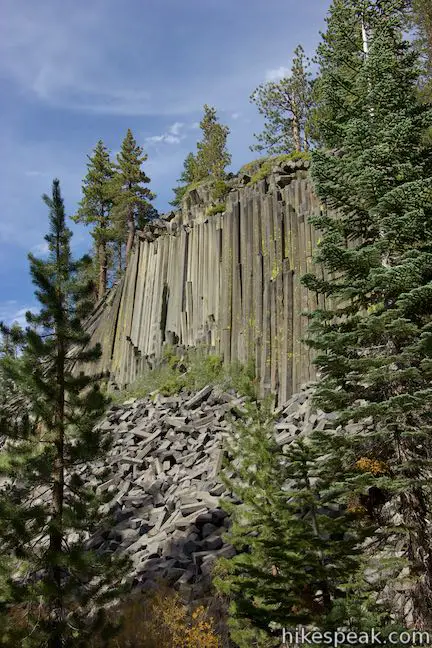
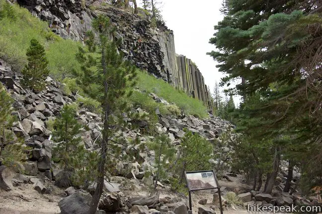
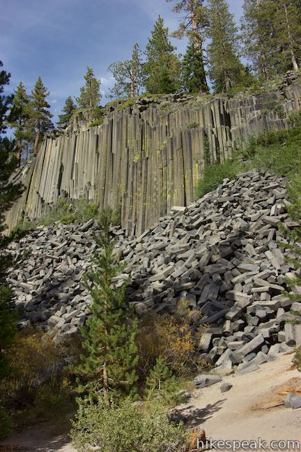
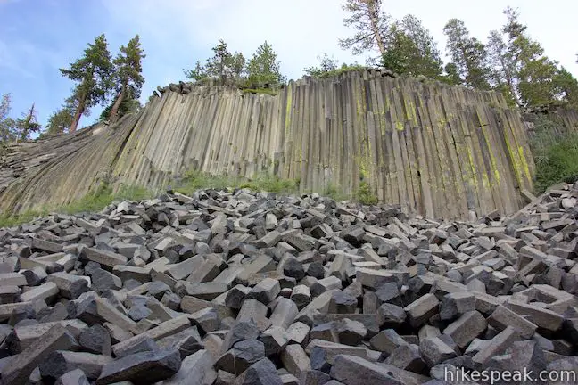
The main attraction in Devils Postpile National Monument is, of course, the Devils Postpile Formation, which has striking 60-foot tall cliffs of exposed columnar basalt. From the park’s main trailhead, it is a 1-mile round trip hike to the base of Devils Postpile on a wheelchair-friendly route with 40 feet of elevation change. A second trail crosses the top of Devils Postpile and allows hikers to stand atop the tile-like tops of the basalt columns. This trail can be used to create a 1.35-mile lollipop loop with 215 feet of elevation change. Those looking to hike farther can add the park’s second biggest attraction to the itinerary, Rainbow Falls, for a hike of 5.1 miles round trip or more.
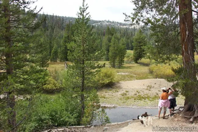
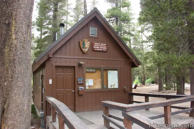
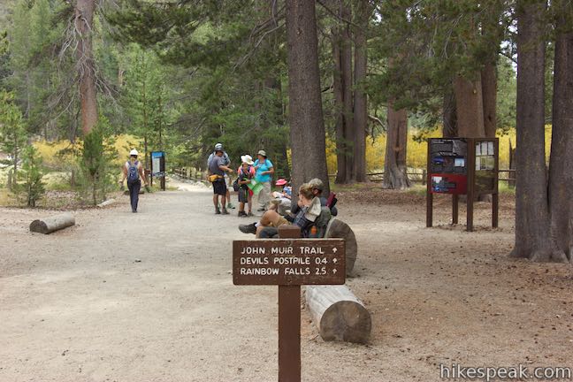
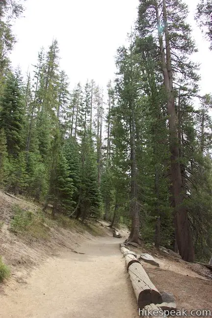
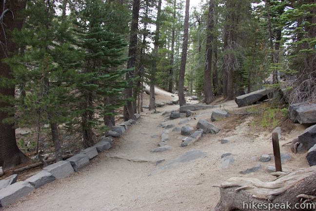
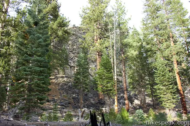
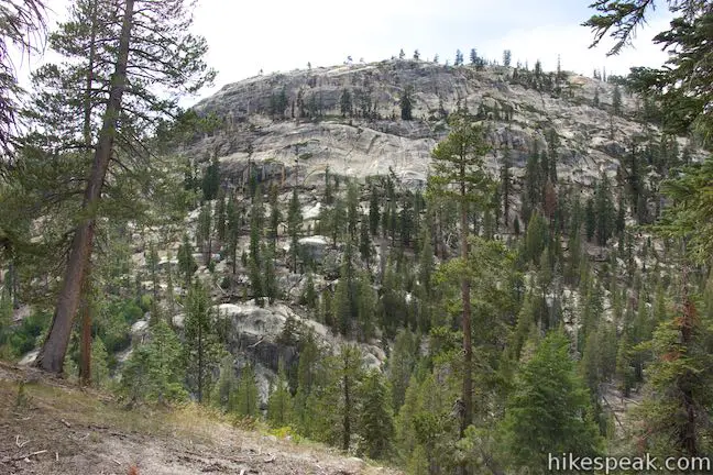
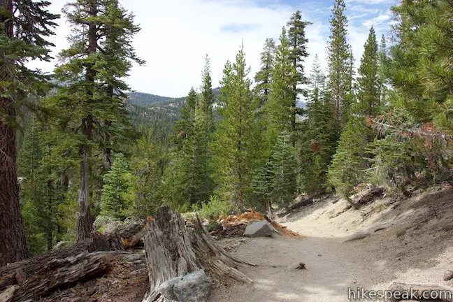
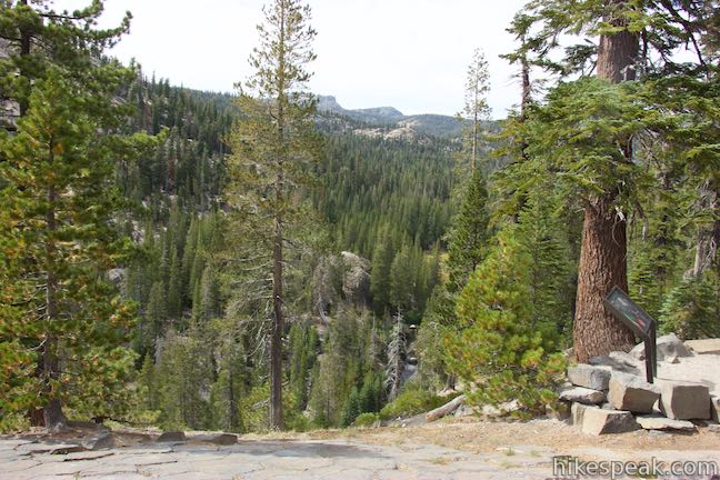
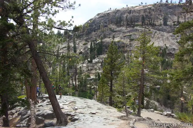
Devils Postpile National Monument is located near Mammoth Lakes in the Eastern Sierra Nevada Mountains and preserves 800 acres that are surrounded by national forest. Begin from the end of the road into the monument where you’ll find a ranger station, a campground, and a trailhead. Set out along the trail, which hugs the edge of a forest bordering Soda Springs Meadow, a grassy area along the winding waters of Middle Fork of San Joaquin River. The lovely meadow is backed by pine forests on all sides.
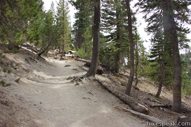
Come to a split after a quarter mile on the dirt trail. A trail to Minaret Falls parts to the right, crosses the river, and immediately passes a path to Soda Springs, where cold water bubbles to the surface along the river. Stay to the left at the junction with the trail to Minaret Falls and proceed toward Devils Postpile, which is quite near.
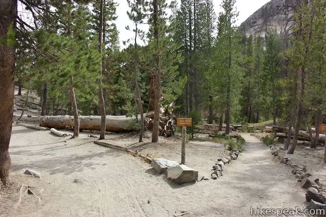
Walk along a bluff above the river. In another tenth of a mile, you’ll reach a junction with the Loop Trail to the Top of Devils Postpile, which ascends to the left. Straight ahead, enjoy the first view of Devils Postpile, a profile of the cliffs.
If you’re hiking the loop over and around Devils Postpile, you can turn left now and save the great head-on views of Devils Postpile for the second half of the hike. If you are skipping the loop, proceed to the right and descend stone steps (made with broken off basalt columns) or take a wheelchair-friendly ramp down to a viewing area below the postpile.
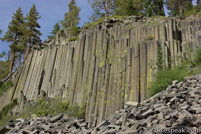
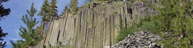
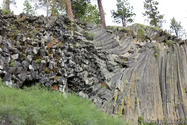
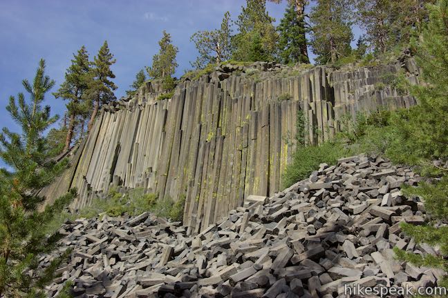
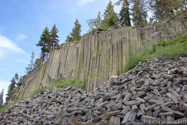
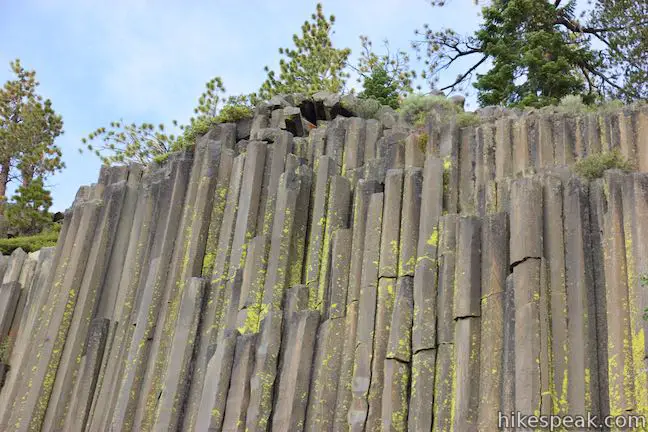
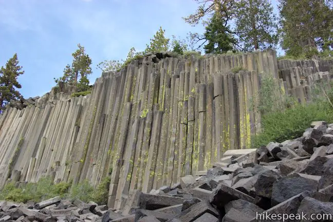
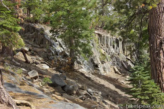
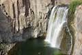
Devils Postpile has 60-foot tall cliffs made up of vertical basalt columns that appear to have been cut at precise angles. The creation of Devils Postpile is a song of ice and fire, as the park guide explains:
About 82,000 years ago, basalt lava flowed here from an unknown source. This particular lava flow was ideal for column formation. It was thick with consistent mineral composition, and it cooled slowly and evenly. As the lava cooled, it contracted and split into symmetrical, vertical, hexagonal columns that constitute Devils Postpile. Some 20,000 to 12,000 years ago, a glacier flowed down the Middle Fork of the San Joaquin River and overrode the fractured mass of lava. The moving ice carved away one side of the postpile, exposing a sheer wall of columns 60 feet tall.
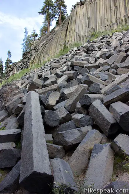
Hot lava oozed from the ground a couple miles upstream from Devils Postpile. The lava was blocked by a moraine from a past glacier, forming a lake of lava that was 400 feet deep. As the basalt lava slowly cooled, it contracted and formed cracks that extended from the top and bottom of the lava. The cracks met up to form vertical columns of homogeneous lava. The surface of the lava remained rough and uneven, hiding the columns from view. It took something as powerful as glaciers to expose Devils Postpile and its impressive columns. Several cycles of glaciers extended and retreated across the area. The glacial ice carried gravel and boulders that gouged and scraped the top of the basalt-filled valley. One major glacial event took the side right off the postpile, exposing the 60-foot sheer rock face of columnar basalt. Evidence of this glacial action is visible on the top of the postpile.
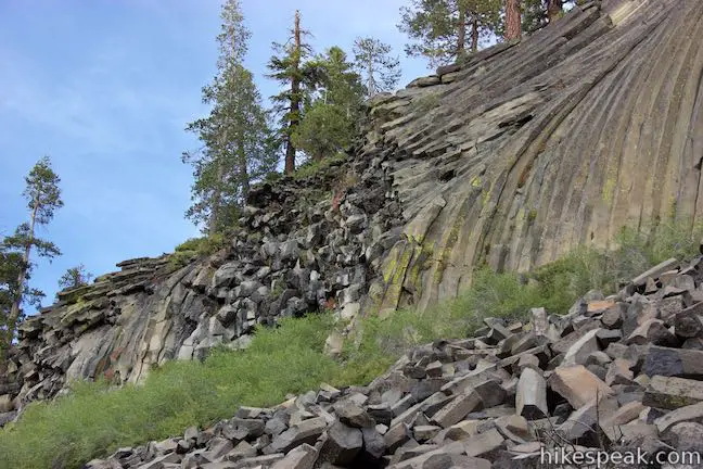
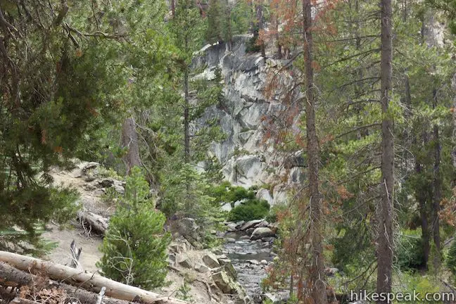
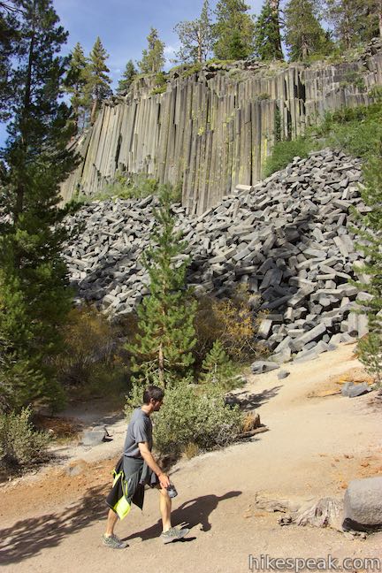
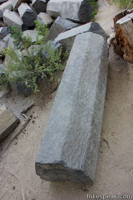
Stand below the postpile and admire the cliffs. In the center, the columns are straight up and down. At the north end of the postpile, the columns have been twisted and curved. Many columns have a perfect hexagonal shape with angles cut at 120 degrees. Below the cliffs, there is a steep slope of broken-off basalt columns that have fallen away from the cliffs over time.
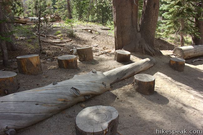
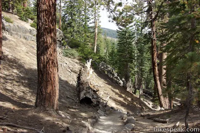
An amphitheater-like collection of stumps below Devils Postpile makes good seating for admiring the cliffs. Past the stumps, the trail turns sharply uphill and approaches the other end of the trail across the top of Devils Postpile. If you’re doing the out-and-back hike to the base of the postpile, turn around before the trail kicks uphill for a 1-mile round trip hike. Going over the top of the postpile increases the hike to 1.35 miles round trip and adds more elevation change.
Trail to the top of Devils Postpile
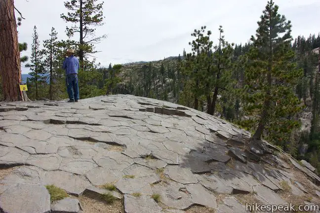
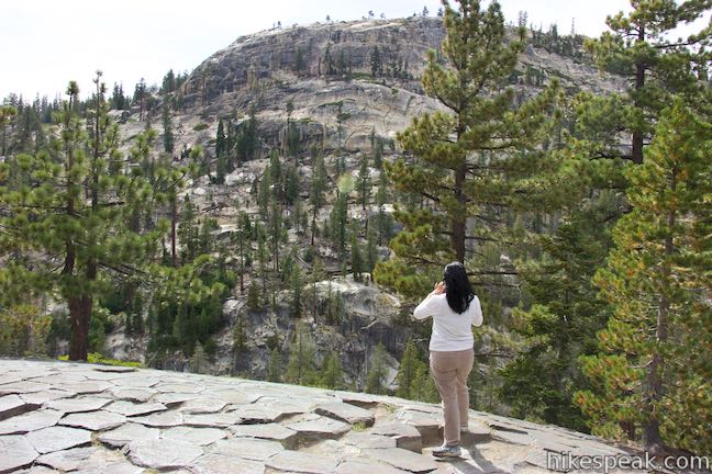
If you’re heading to the top of Devils Postpile, it seems preferable to turn left at the first junction with the loop trail, located at the north end of Devils Postpile (0.35 miles from the Devils Postpile National Monument Trailhead). From here, it is 0.15 miles to the top of the postpile, with a switchback in between. Ascend some steps in the side of the ridge and get views across the Middle Fork of the San Joaquin River toward a dome-shaped ridge on the other side.
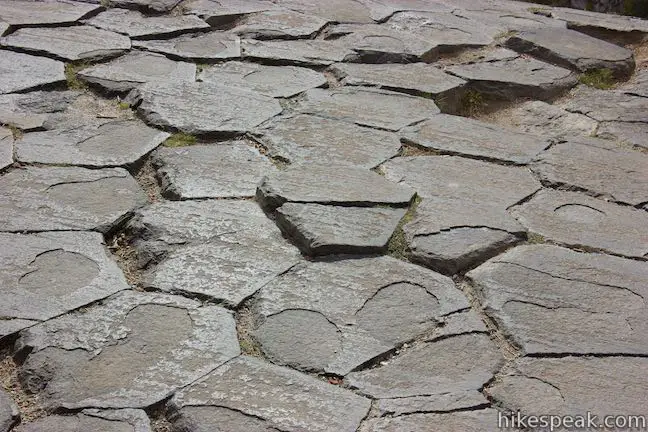
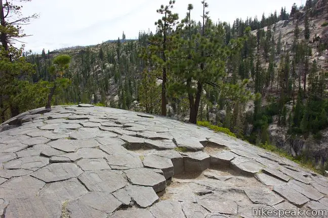
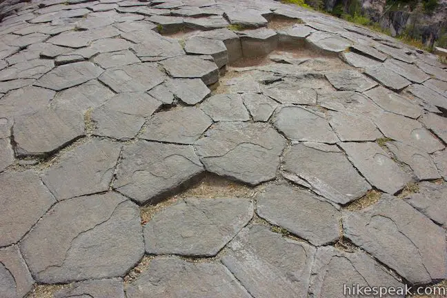
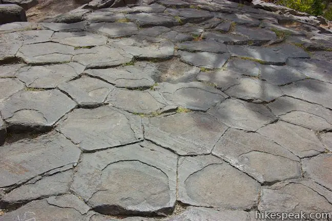
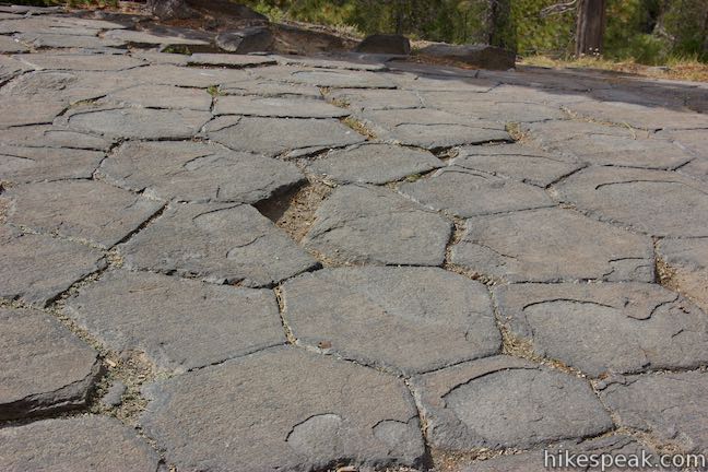
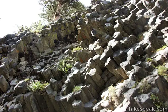
Soon you’ll be standing atop Devils Postpile. From above, the postpile looks like a fancy tile floor. The tiles have three to seven sided that fit together perfectly, often at 120-degree angles. The tops of the columns are smooth, having been polished down by glaciers. Lines scratched across the columns all point in the same direction and were cut by rock-carrying glacial ice. The glaciers exposed the columns in Devils Postpile and made them smooth and easy to stand on. A panel on top of Devils Postpile explains:
When gravel embedded in glacial ice scraped across the postpile, it carved parallel groves called glacial striations. The ice also carried finer silts that polished the exposed column tops.
Admire the hexagon-shaped tiling on the top of Devils Postpile, recognizing that these aren’t actually tiles, but the tops of very tall columns of hardened lava.
Leaving the postpile, you can continue up the trail, following a sign for Rainbow Falls. The trail ascends for a bit, before turning down into a draw on the south side of Devils Postpile. The trail passes below a cliff of basalt columns that have been turned on their sides. Shortly after that, the trail over the top of Devils Postpile comes to a T-junction with the park’s main trail. To the left, this trail heads south toward Rainbow Falls. Turning to the right, the trail descends to the viewing area below Devils Postpile on its way back to the trailhead.
Along this lower trail, it is a quarter mile between the south and north ends of the loop trail with viewing areas for Devils Postpile in between. In comparison, the loop trail over the top of the postpile is 0.4 miles long. Whether you hike to the base of Devils Postpile and back (one mile round trip with 40 feet of elevation change) or complete the loop to the top of the postpile (1.35 miles round trip with 215 feet of elevation change), you’ll be pleased by the postpile. Hiking beyond Devils Postpile to Rainbow Falls makes for an even better trek that’s 5.1 miles round trip without the trail to the top of Devils Postpile and 5.25 miles round trip if you include the loop trail.
No permit is required to day hike in Devils Postpile National Monument. However, there is a fee for a shuttle or a vehicle on the road into Devils Postpile National Monument. Dogs are allowed on this hike on leashes. Bikes are no allowed.
To get to the trailhead: Take Route 395 to Route 203 and drive 3.6 miles to Mammoth Lakes. Turn right onto Minaret Road toward Mammoth Mountain. Reach the ski resort after another 4 miles. Those who are visiting the park for the day (not staying overnight at the campground) should park here and take the shuttle to Devils Postpile National Monument (fees apply). If you choose to drive to the monument, go another 1.4 miles past the ski resort to Minaret Vista Entrance Station where a 10 dollar fee is charged for each vehicle entering in the valley below. Drive 6.7 miles toward Reds Meadow. Turn right, following signs for Devils Postpile National Monument and drive the final 0.3 miles to Devils Postpile. You will come to a loop with parking at the end of the road. The ranger station is straight ahead, the campground is on the right, and the trail into Devils Postpile is to the left. The shuttle will drop hikers off outside the ranger station next to the trailhead.
Trailhead address: Minaret Summit Road, Mammoth Lakes, CA 93546
Trailhead coordinates: 37.6299, -119.0847 (37° 37′ 47.63″N 119° 05′ 04.91″W)
You may also view a regional map of surrounding Sierra Nevada trails and campgrounds.


Loop Trail to Top of Devils Postpile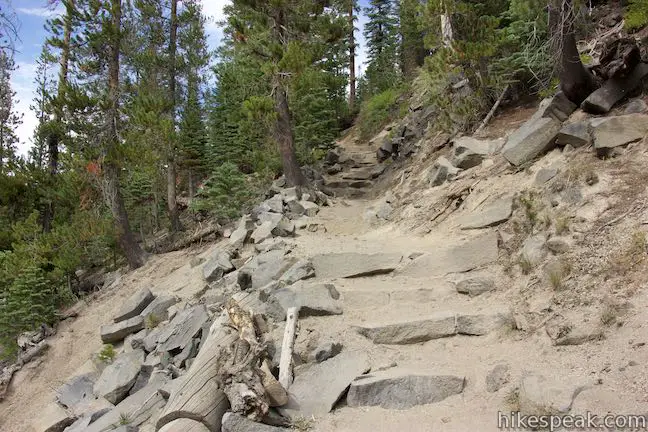


 | Rainbow Falls This hike of 5.1 miles or more passes the Devils Postpile Formation to reach an attractive 101-foot waterfall with rainbows in its mist. |
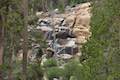 | Minaret Falls This 3-mile hike from Devils Postpile National Monument connects with Pacific Crest Trail to reach the base of a waterfall that tumbles and slides down a rocky slope. |
 | Shadow Lake This 8.5-mile hike crosses a picturesque canyon and passes a plunging cascade to visit a mountain lake in the Ansel Adams Wilderness of Inyo National Forest near Mammoth Lakes. |
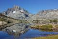
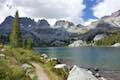 | Ediza Lake This hike of around 15 miles round trip ventures above Shadow Lake along a creek to a beautiful lake below Mount Ritter and Banner Peak in the Ansel Adams Wilderness of Inyo National Forest near Mammoth Lakes. Ediza Lake is an excellent destination for backpackers. |
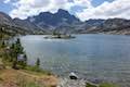 | Garnet Lake This beautiful lake along John Muir Trail is 8.55 miles from the trailhead at Agnew Meadows, making it an ideal lake to visit on a backpacking loop. |
 | Thousand Island Lake This exceptional lake is a true gem of the Sierra and is 8.75 miles from the trailhead at Agnew Meadows via High Trail, a section of Pacific Crest Trail, making it a great destination for an overnight trek. |
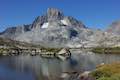 | Ediza Lake - Thousand Island Lake Loop This multi-day backpacking loop of around 25 miles incorporates sections of John Muir Trail and Pacific Crest Trail to visit a series of stunning Sierra lakes in the Ansel Adams Wilderness of Inyo National Forest. |
 | More trails in the Sierra Nevada Mountains Explore other destinations in Ansel Adams Wilderness and the rest of the range. |
 | Devils Postpile National Monument Campground This 21-site first-come first-serve campground provides camping in a pine forest next the Middle Fork San Joaquin River near the trailhead for Devils Postpile National Monument. |
Go the extra miles...
Submit a rating of this hike to go with your comment. Contribute to the average trail rating.