Crater Rim Drive to Keanakāko‘i Crater and Overlook Trail
in Hawai‘i Volcanoes National Park
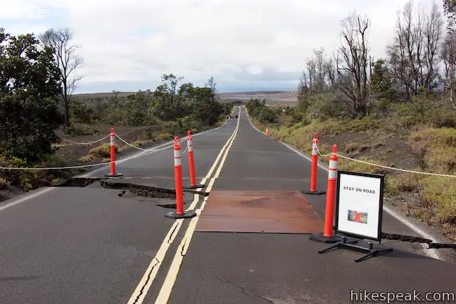
In the summer of 2018, Hawaiʻi Volcanoes National Park experienced the most dramatic volcanic activity in it’s more than century long history. Land considered stable was humbled and demolished. When the earth stopped exploding and when the shaking of 60,000 earthquakes ceased, Crater Rim Drive, the road that ringed Kīlauea, was ruined in many places.
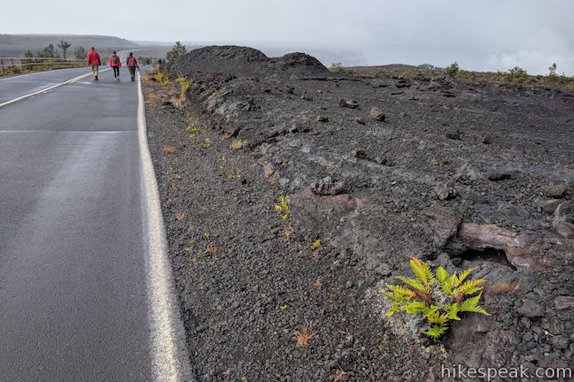
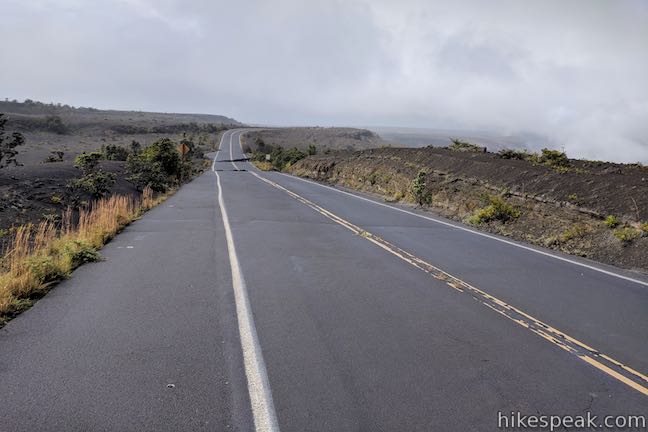
Although the north and east sides of Crater Rim Drive (near Kīlauea Visitor Center) remain open, other parts of the road may be closed forever. About a mile of Crater Rim Drive that is shut off to vehicles is open to cyclists and hikers. Walk down the somewhat damaged pavement to Keanakākoʻi Crater & Overlook Trail. Get a close look at a 600-year-old crater alongside the grander, evolving cliffs of Kīlauea. Absorb daunting volcano views on this 2.15-miles round trip hike (or more) with 100 feet of elevation change.
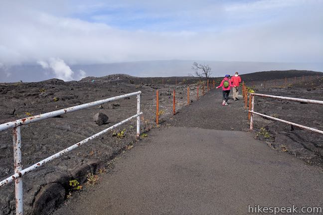
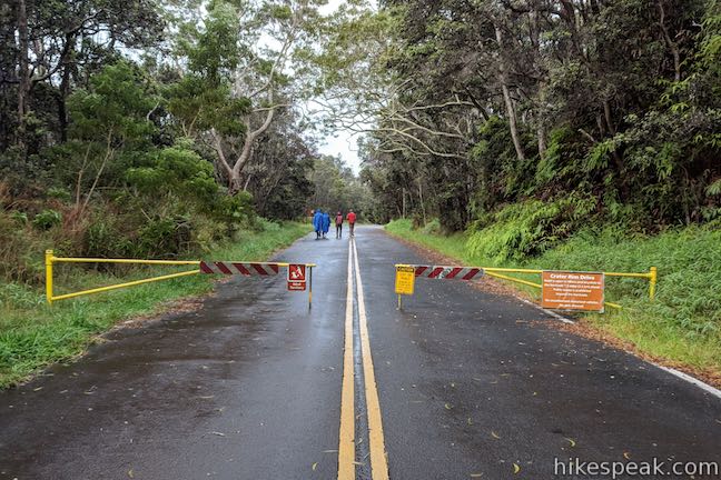
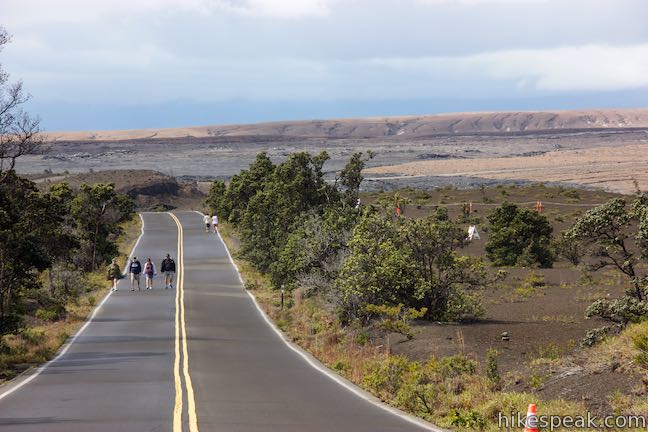
Start from the trailhead parking area for Devastation Trail, located at the intersection of Crater Rim Drive and Chain of Craters Road, the two major scenic drives in Hawaiʻi Volcanoes National Park. Leave the parking area, return to the intersection, and walk west on the section of Crater Rim Drive that is closed to traffic.
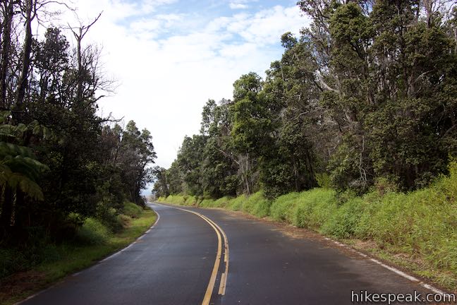
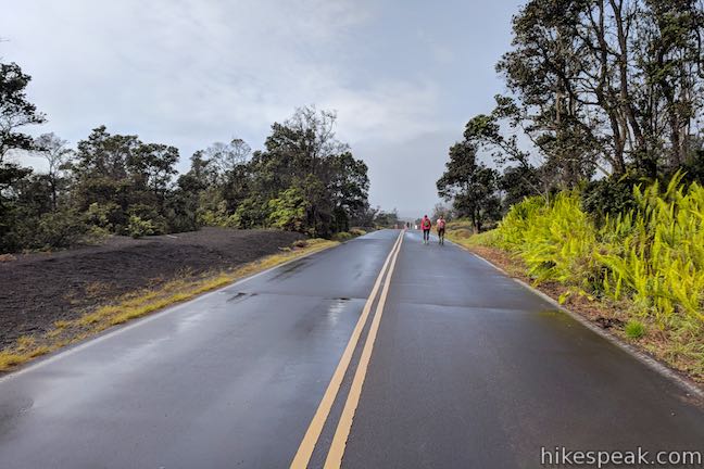
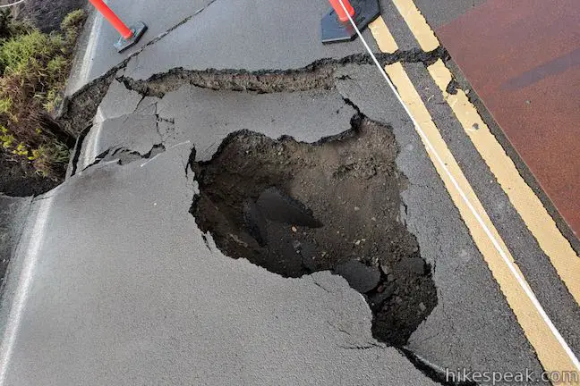
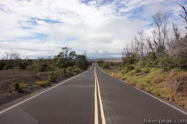
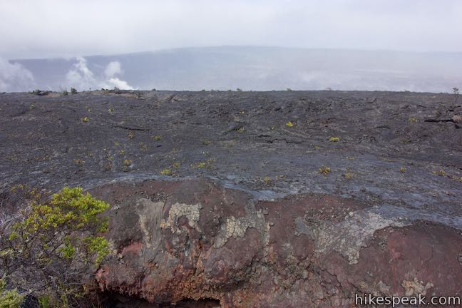
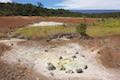
Walk through the gate, heading west through forest on Crater Rim Drive. After half a mile, the forest thins as the landscape starts looking more volcanic. Watch your footing as you weave around an area of the road that was ripped apart by earthquake damage.
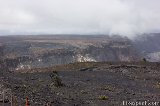
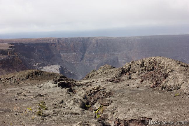
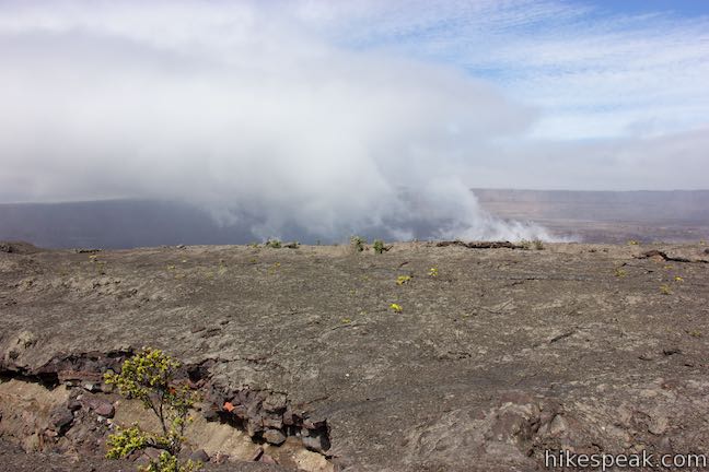
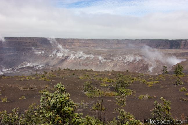
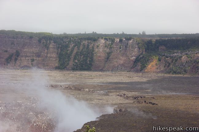
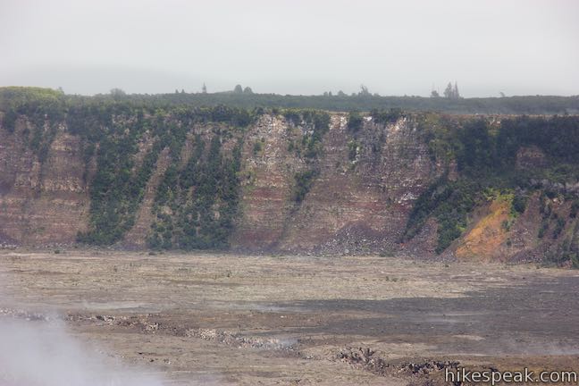
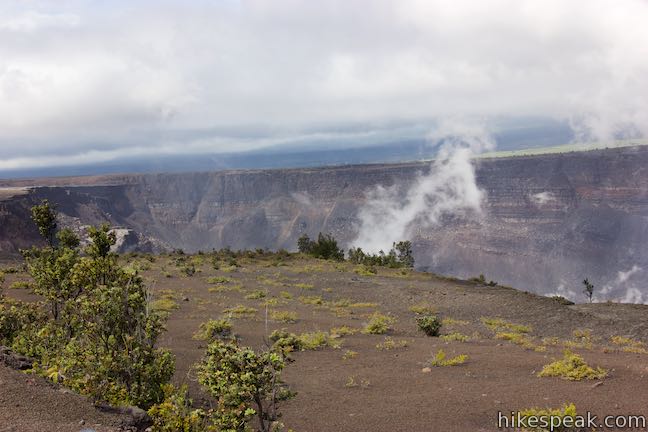
The road tilts downhill and reveals views of Kīlauea, a 2-mile wide crater filling the landscape in front of you. The summit of Kīlauea collapsed over 500 years ago. Magma stored below the summit was released during eruptions, causing the unsupported summit to fall. This created the large crater, or caldera, at the crown of Kīlauea. Further collapses within the crater have occurred, up to present times, as additional magma is released.
Possible side attractions: If the park offers extra viewpoints, take them!
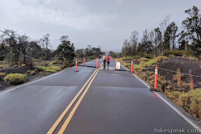
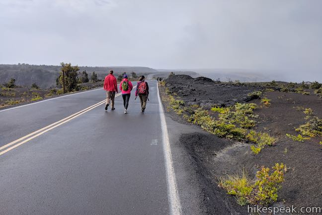
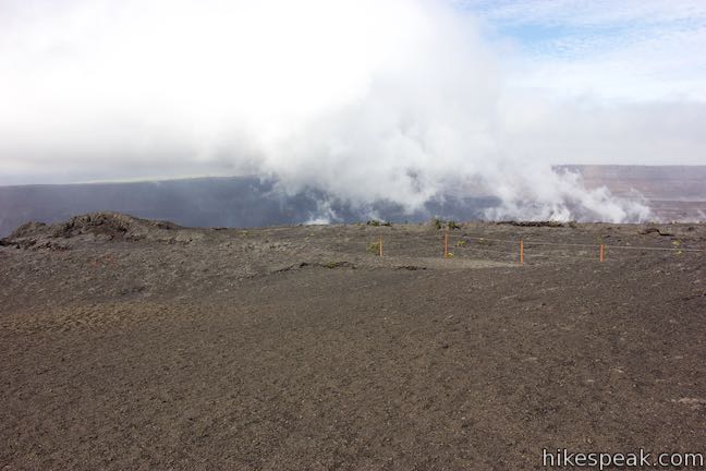
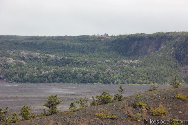
Before you come to Keanakāko‘i Crater and Overlook Trail (after 0.9 miles on the road), you may cross other overlook opportunities. In the fall of 2018, a path to a temporary viewpoint was installed by the NPS, 3/4 of a mile down the road. If you see traffic cones and temporarily railings (or more permanent features) marking an approved viewpoint, don’t skip the extra perspectives of Kīlauea Caldera. Even a short distance from Keanakāko‘i Overlook, the views into the crater can be quite different. Gaze across Kīlauea toward Steaming Bluff and the Volcano House.
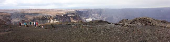
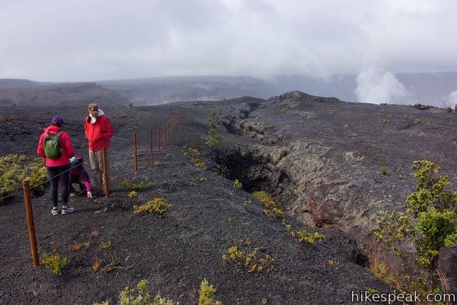
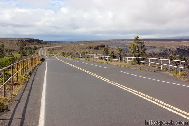
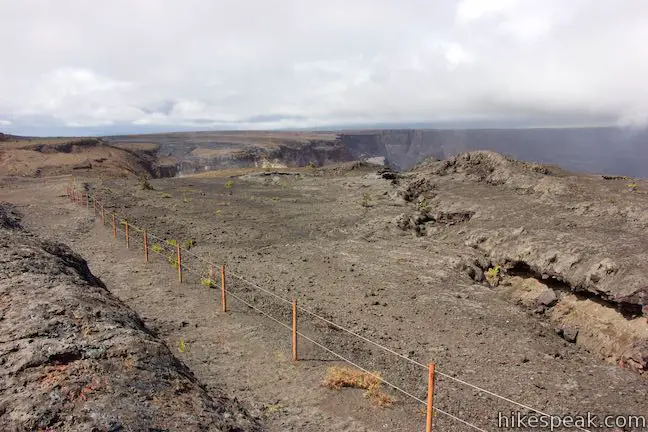
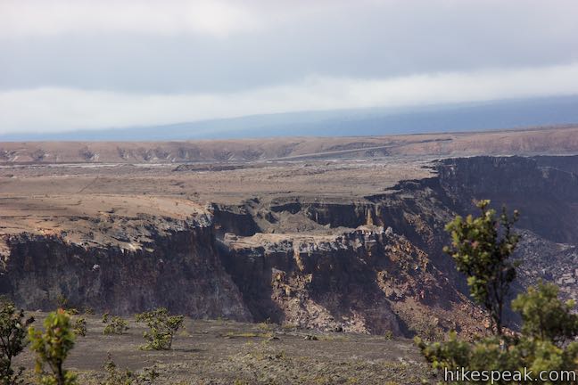
Make your way down Crater Rim Drive to a wide spot in the road with an overlook to the left and a trail departing to the right. Straight ahead, in another 100 yards, a barricade closes Crater Rim Drive to further exploration. Note: More of the road could open beyond this 2018 closure point. Walk down to the barrier to look at the earthquake damage in the road ahead, where the road once approached a viewpoint by Halemaʻumaʻu Crater, when the crater was significantly smaller.
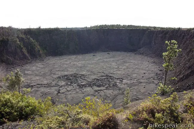
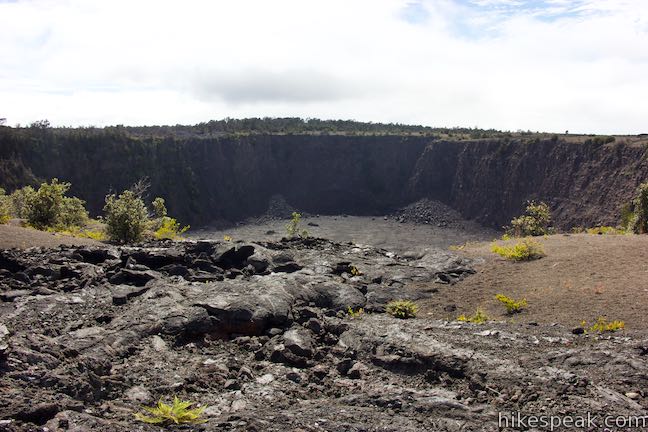
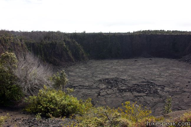
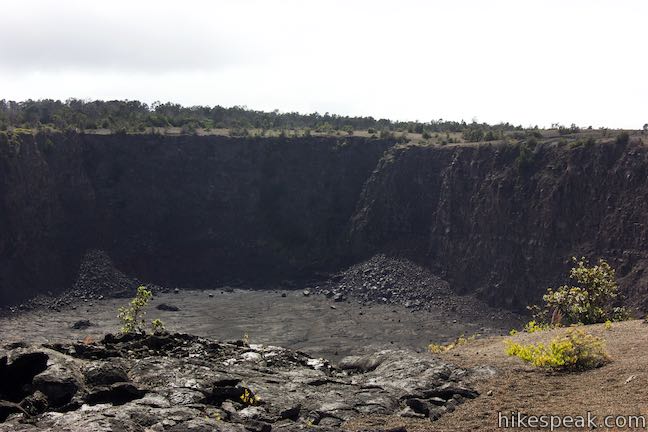
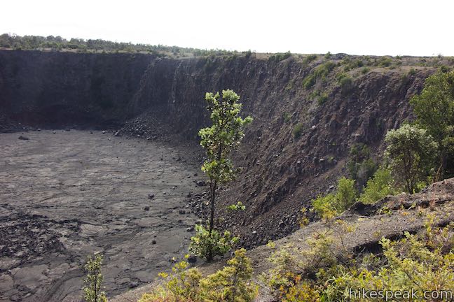
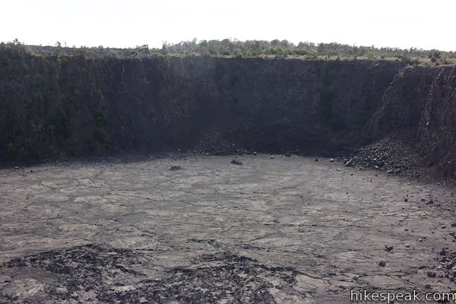
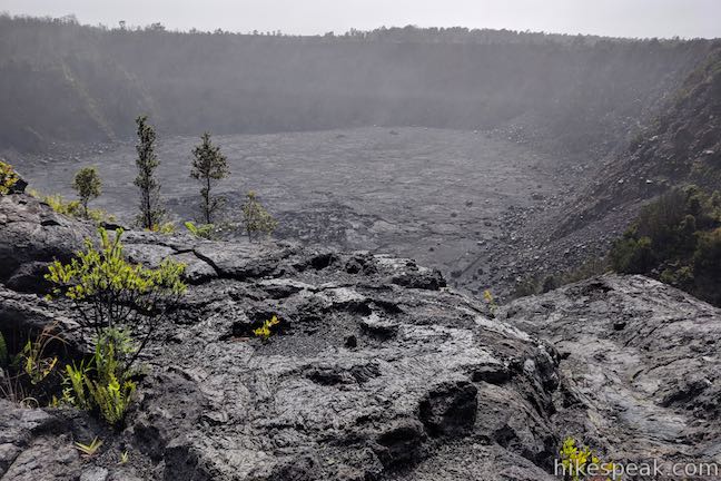
Keanakāko‘i Crater
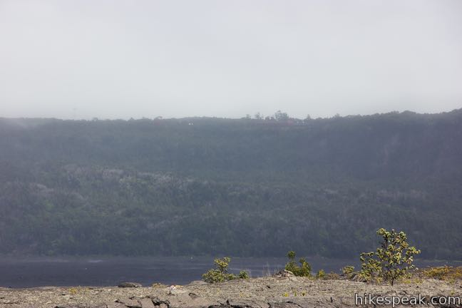
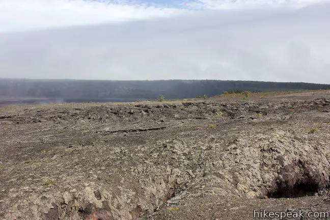
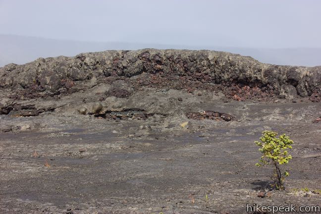
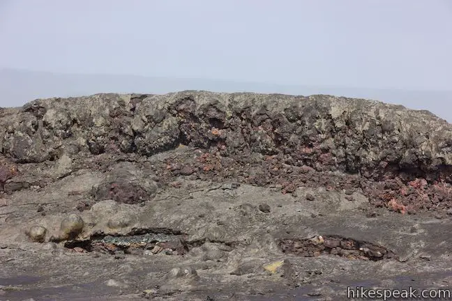
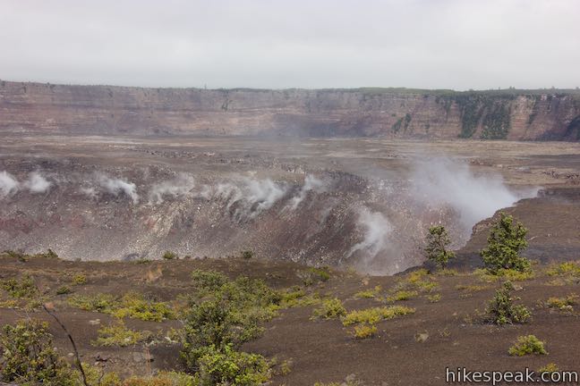
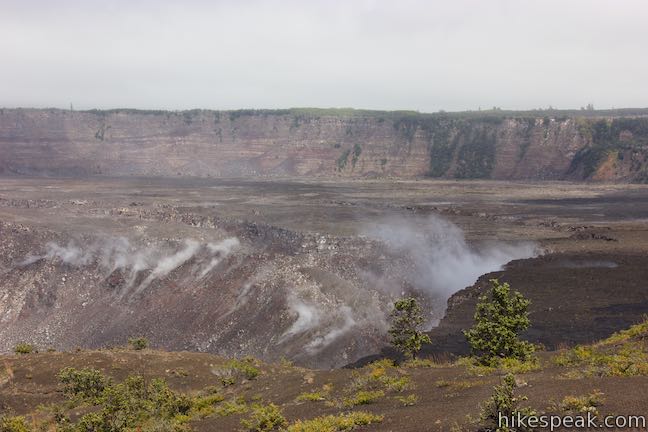
Off the south side of the road is Keanakākoʻi Crater. This pit crater lies at the edge of Kīlauea Caldera, but the crater is detached from the expansive opening to the north. Keanakākoʻi Crater is about 115 feet deep. From the overlook perspective, the crater is 250 yards across from left to right, but the far wall of the oval-shaped crater is 500 yards away from the viewpoint.
Keanakākoʻi translates to “cave of the adzes” (an ax-like tool). The crater formed during the 1400s when Kīlauea’s summit collapsed. Early Hawaiians put Keanakākoʻi’s strong and rare basalt into service for carving, forming the heads for their adzes (koʻi). A quarry of adze rock was buried by an eruption in 1877.
Keanakākoʻi Overlook Trail
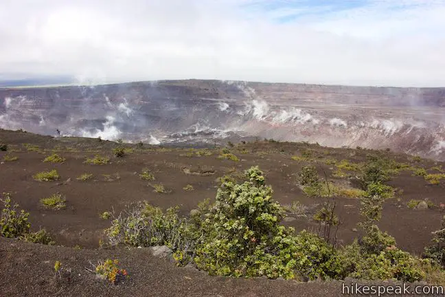
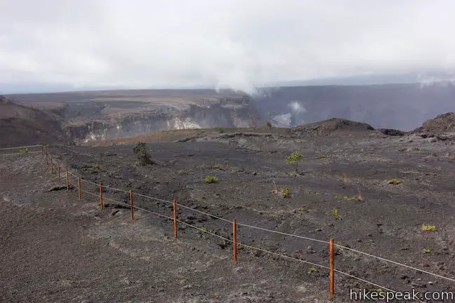
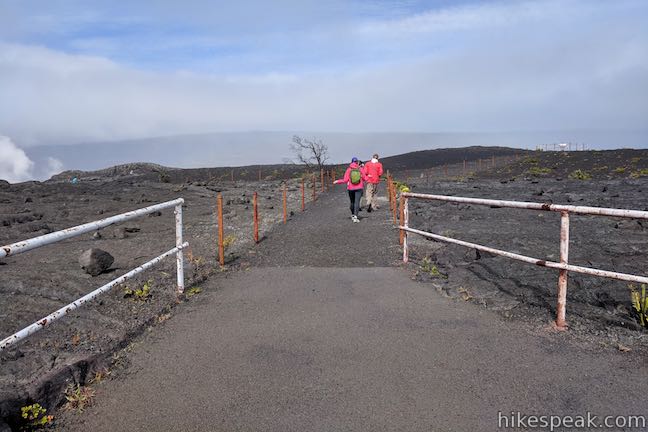
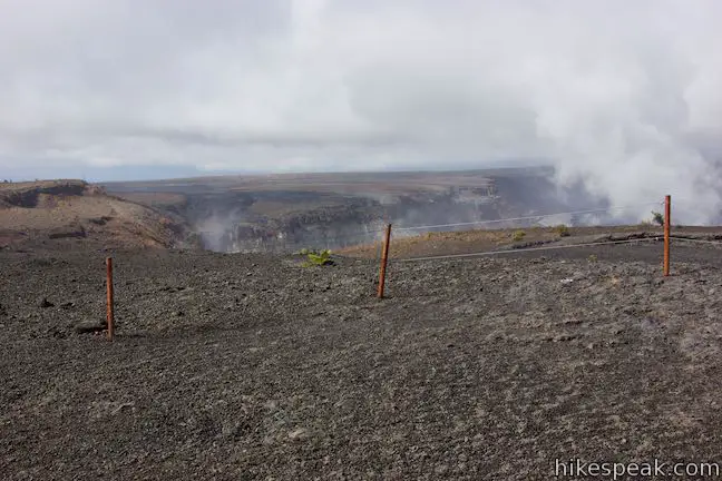
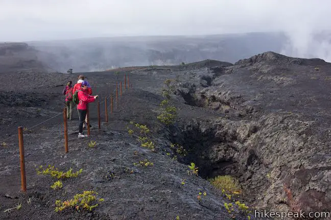
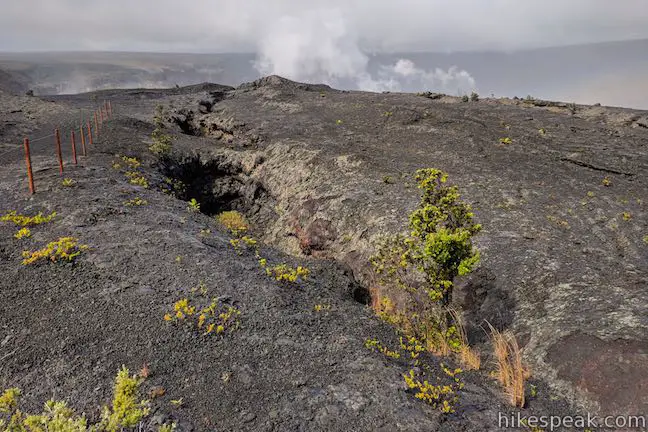
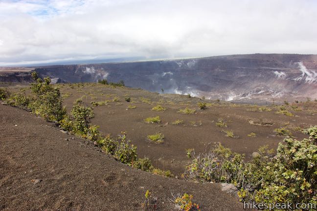
After gazing into Keanakākoʻi Crater, stray to the north side of the road where a quarter-mile round trip trail to viewpoints looking into Kīlauea gets underway. The trail also passes fascinating fissures extending from the crater’s edge. Hike north away from the road, staying within the boundary fences.
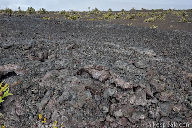
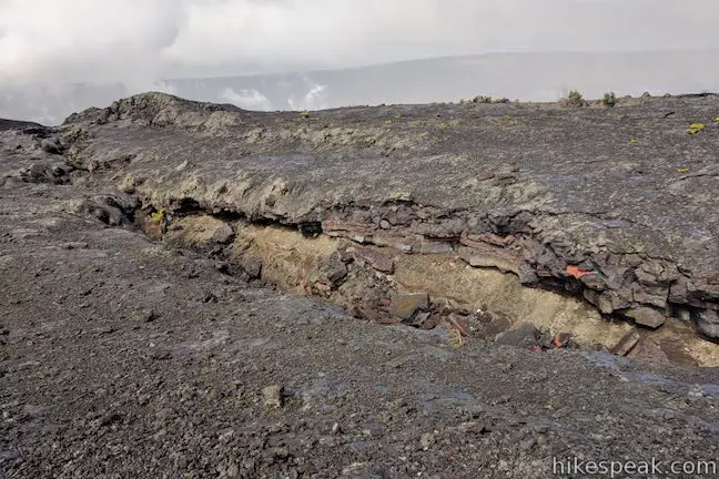
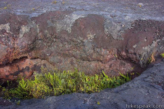
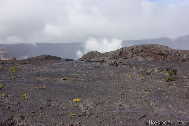
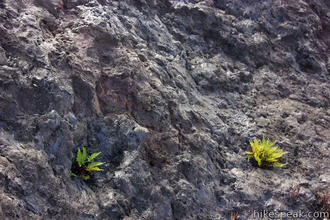
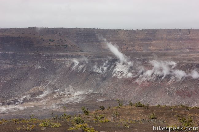
After fifty yards, come to a split in the trail – the start of a loop to overlook views. Stay to the right to approach a fissure running diagonally toward the edge of the crater. Watch steam and gasses escape from cracks in the surface. The sides of the fissure are not as dark as the surrounding surface, but are instead painted in reds, purples, and beiges. Ferns and other small vegetation manage to grow in the fissure too.
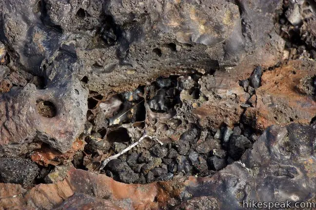
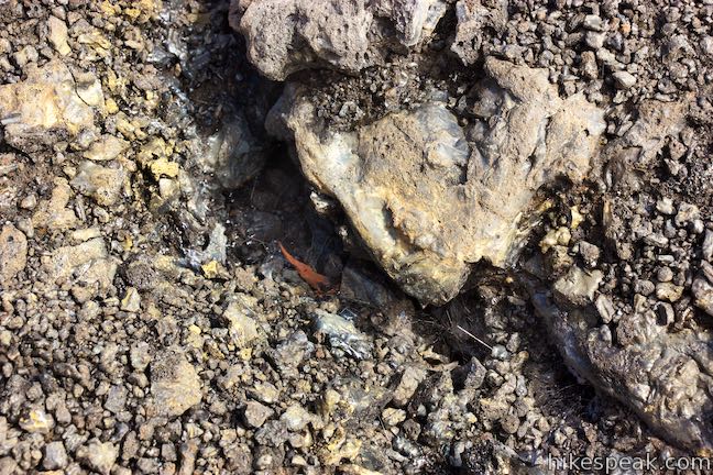
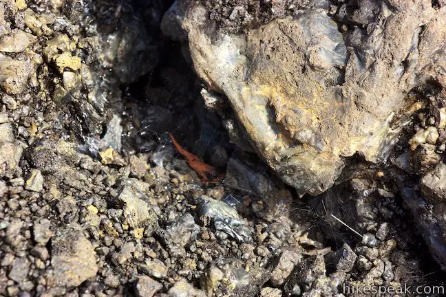
Within the smaller crevices potting the landscape, you may be lucky enough to spot “Pele’s hair.” This special form of lava appears after specific volcanic activity, and is named after the Hawaiian goddess Pele. These thin strands of volcanic glass look like hair or spider silk.
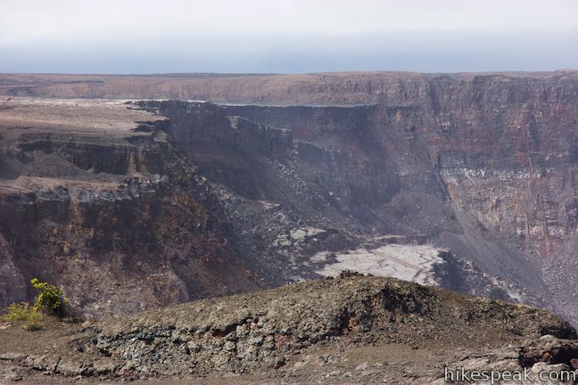
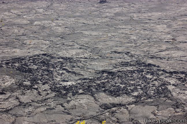
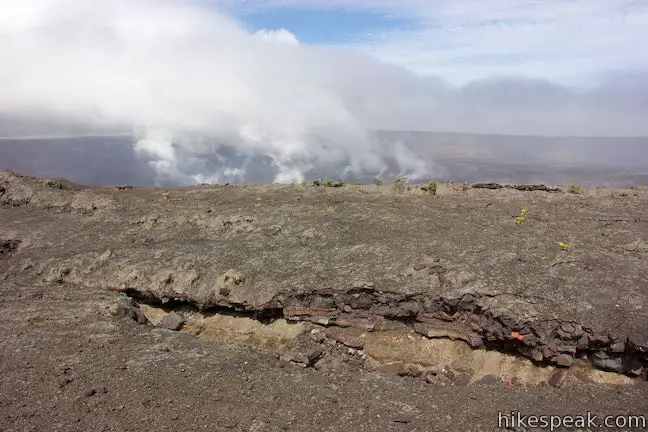
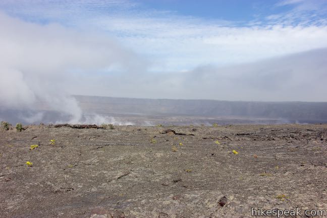
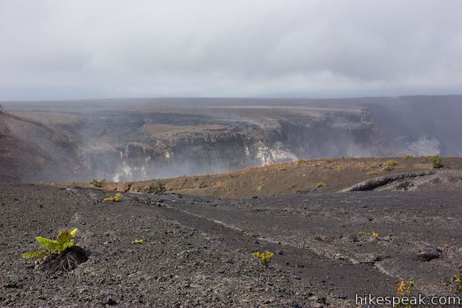
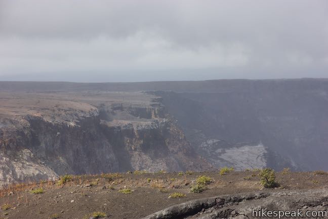
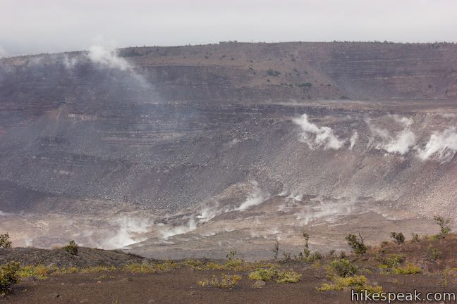
Follow the trail along the fissure toward the northwest side of the overlook, finding the biggest views across Kīlauea Caldera. Steam escapes from the sides of Kīlauea, a signal of the volcanoes simmering might. Halemaʻumaʻu Crater is the deepest part of Kīlauea and it grew even bigger during the eruptions in the summer of 2018. How much bigger? It is deeper by 1,600 feet and grew in volume from approximately 60 million cubic yards to 1.2 billion cubic yards.
Collapses along the rim of the crater west of the overlook trail show how the landscape surrendered to the advancing Halemaʻumaʻu Crater. The National Park Service has impressive before and after photos of Kīlauea’s transformation in 2018.
After taking it all in – and there’s a lot to take in – complete the circle back to the start of the trail. Return to Crater Rim Drive, turn left, and walk 0.9 miles back to the trailhead to complete this 2.15-mile hike with 100 feet of elevation change. Bikes are permitted on the road (but not the trail), but dogs are not allowed. No permit is required for this hike, but an entrance fee is charged to visit Hawai‘i Volcanoes National Park.
To get to the trailhead: Take Hawaii Belt Road (Route 11) to the entrance of Hawaii Volcanoes National Park (which is 30 miles south of Hilo). The park entrance is on the left when traveling from Hilo.
Drive past an entrance station to the first intersection. (Kīlauea Visitor Center is just to the right.) Turn left and drive 3 miles down Crater Rim Drive to an intersection with Chain of Craters Road and the Devastation Trail Parking Area. The hikeable road is straight ahead. Turn right into the Devastation Trail Parking Area and park. Walk back to the intersection to begin the trek.
Trailhead address: Crater Rim Drive, Hawaii Volcanoes National Park, HI 96778
Trailhead coordinates: 19.40531, -155.2531 (19° 24′ 19.1″N 155° 15′ 11.2″W)
View Hawai‘i Volcanoes National Park in a larger map
Or view a regional map of surrounding Hawaii trails and campgrounds.


Additional Viewpoint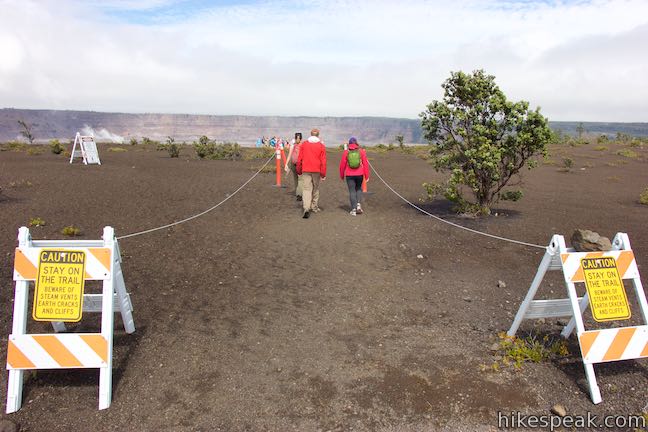
 | Sulphur Banks Trail - Crater Rim Trail Loop This 1.6-mile hike starting from Kīlauea Visitor Center tours a colorful hydrothermal area and looks into Kīlauea Caldera from Steaming Bluff. |
 | Pu‘u Loa Petroglyphs Trail This 1.4-mile hike in Hawai‘i Volcanoes National Park traverses an old lava flow to a boardwalk loop within a special area of preserved petroglyphs. |
 | Hōlei Sea Arch This brief hike in Hawai‘i Volcanoes National Park crosses a basalt bluff to a landmark sea arch extending into the ocean. |
 | Kīpukapuaulu Trail This 1.2-mile nature trail loop visits a forest oasis within the lava flows below Mauna Loa in Hawaii Volcanoes National Park. |
 | Rainbow Falls This 0.2-mile hike around Rainbow Falls Lookout explores a viewpoint facing a lovely waterfall and also ventures up to the top of the falls. |
 | Kaumana Caves This underground hike explores lava tubes on the edge of Hilo, created by an 1881 eruption of Mauna Loa. |
 | ‘Akaka Falls This short loop slips through a tropical valley to bold views of a 442-foot single-drop waterfall. |
 | Royal Grounds – Pu‘uhonua Loop This half-mile loop on the coast south of Kona explores Hawaiian royal grounds and a place of sanctuary in Pu‘uhonua O Hōnaunau National Historical Park. |
 | Trails in Hawaii Explore more hikes on the Big Island of Hawai‘i. |
Crater RIm Drive to Keanakāko‘i Crater on modernhiker.com
Crater Rim Drive to Keanakāko‘i Crater on outdoorproject.com/
Crater Rim Drive to Keanakāko‘i Crater on bigislandhikes.com
The official Hawaii National Parks Day Hikes webpage for Keanakāko‘i Crater
The official Hawaii National Parks Crater RIm Drive webpage for Keanakāko‘i Crater
Go the extra miles...
Submit a rating of this hike to go with your comment. Contribute to the average trail rating.