Coyote Wall
in Columbia River Gorge National Scenic Area
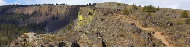
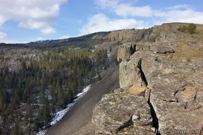
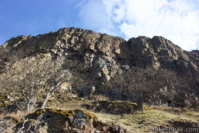
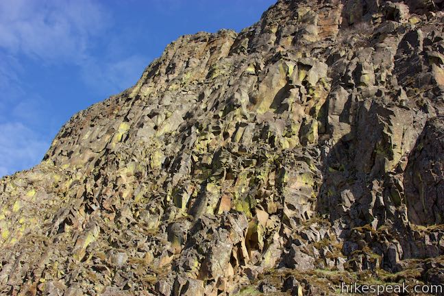
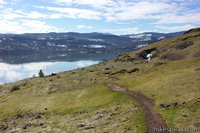
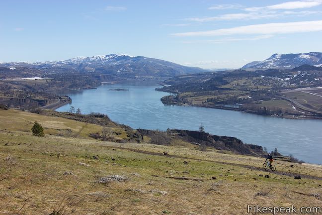
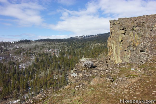
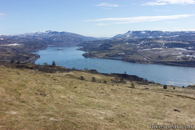
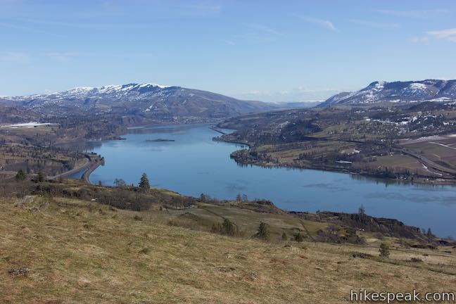
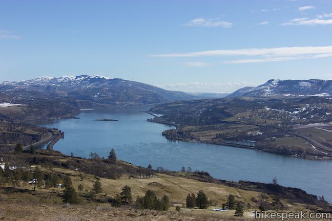
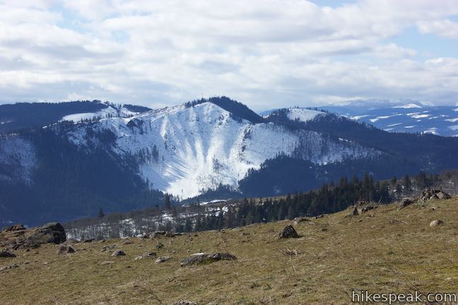
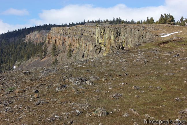
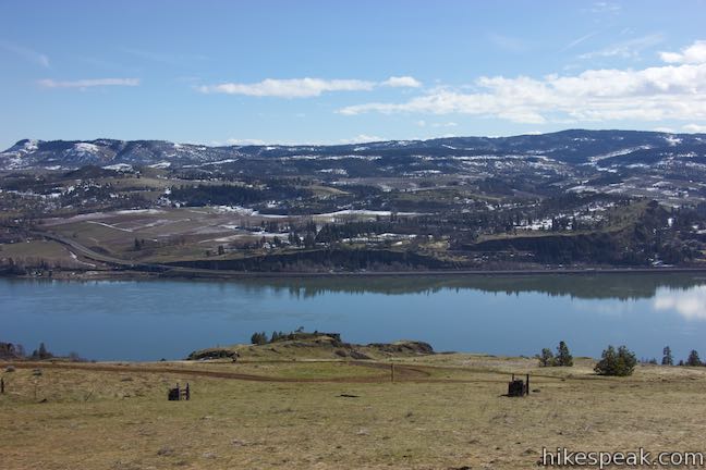
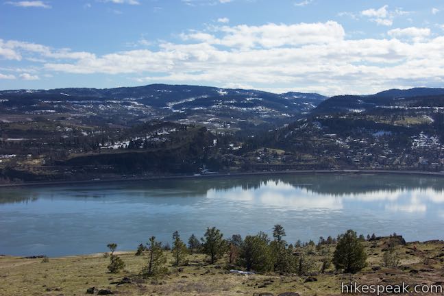
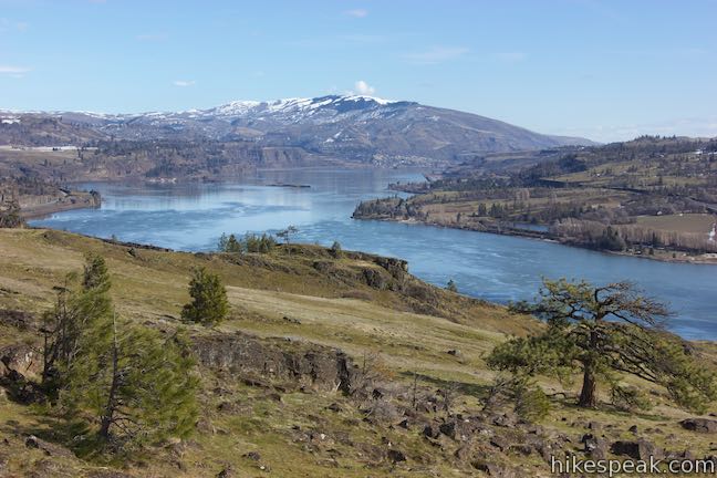
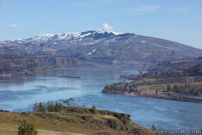
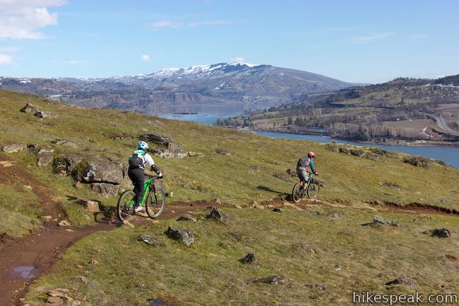
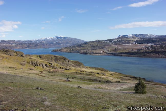
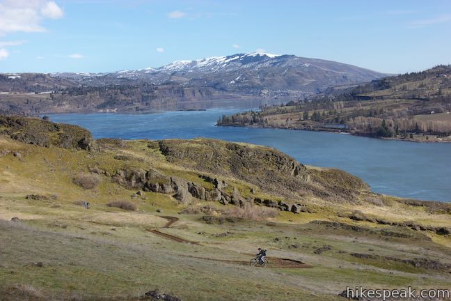
Take a drive through the Columbia River Gorge and you’re sure to be impressed by a diagonal band of cliffs on the Washington side of the gorge that rise from the river toward the mountains above. These grand and daunting cliffs are called Coyote Wall or the Syncline. A network of single-track trails and old jeep roads extend up alongside the columnar basalt ledge. Coyote Wall is quite popular with mountain bikes and is a howl for hikers too. One of the many possible routes (described here) ascends 1,575 feet on a 5.8-mile partial loop, using Little Maui Trail, Little Moab Trail, and Coyote Wall Trail to reach Coyote Wall Upper Viewpoint and excellent views of the wall and Columbia River Gorge.
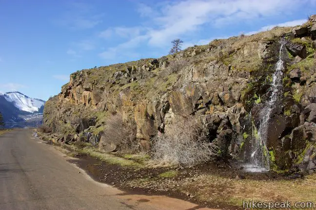
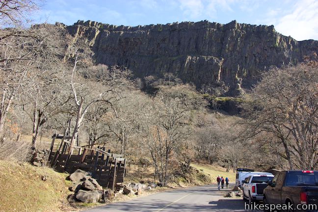
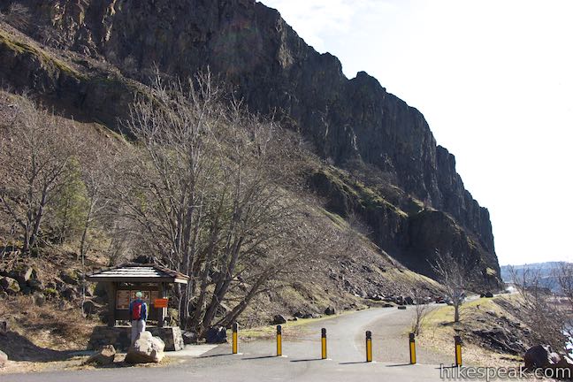
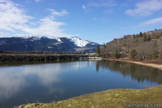
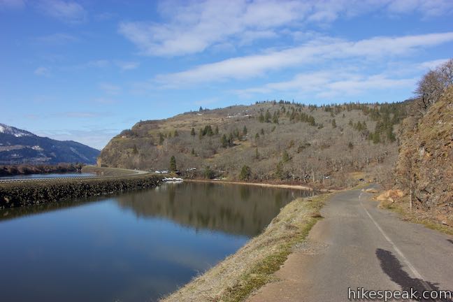
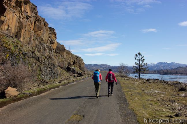
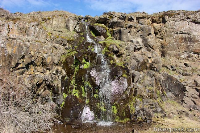
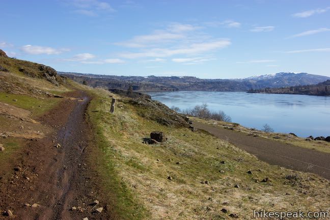
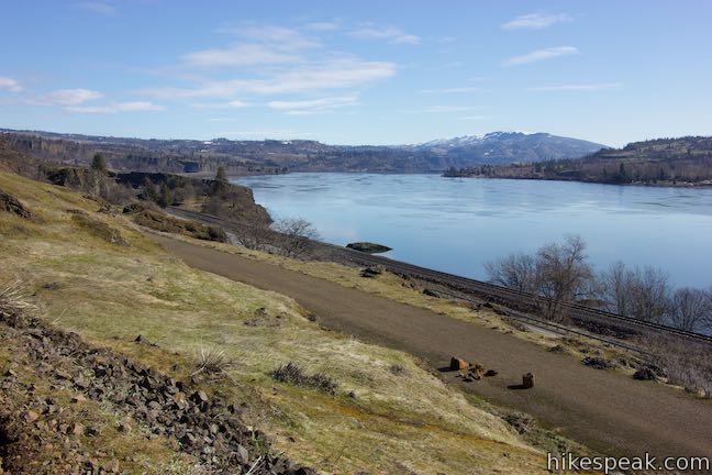
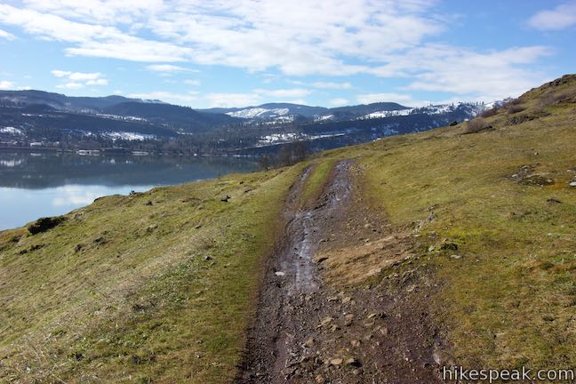
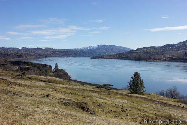
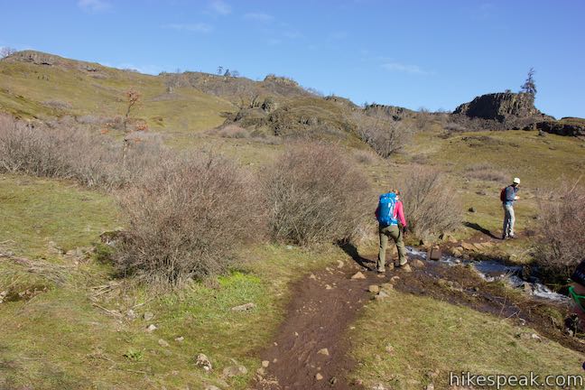
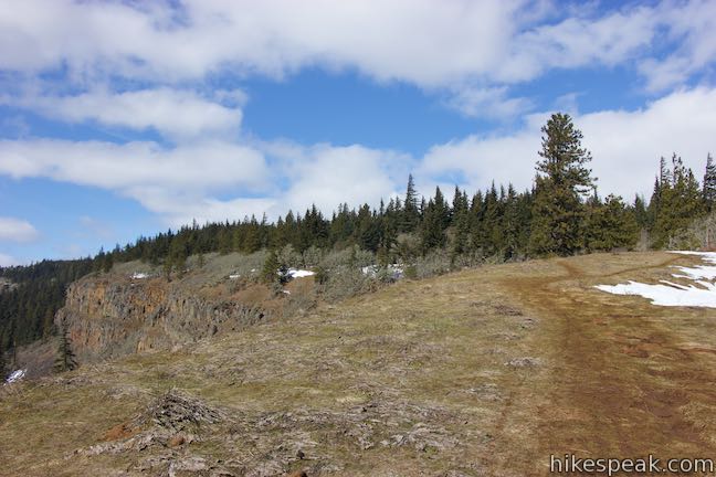
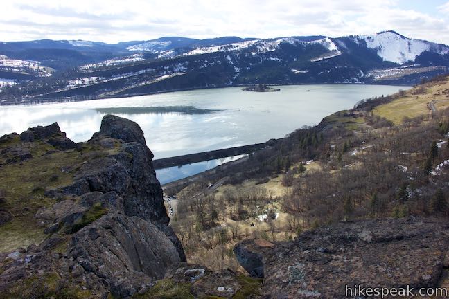
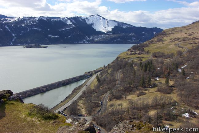
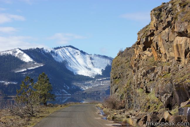
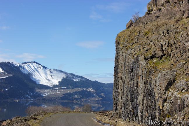
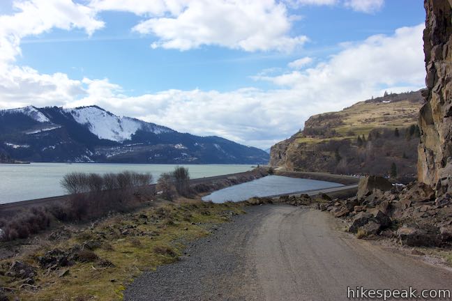
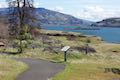
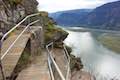
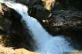
The trek begins from Coyote Wall Trailhead located, just off Highway 14 beneath the basalt cliffs. A United States Forest Service kiosk welcomes you to “Coyote Wall and Catherine Creek Trail System” and provides a map of all the trails you’ll be hiking (Little Moab Trail #4424, Little Maui Trail #4425, Old Ranch Road Trail #4426, and Coyote Wall Trail #4428). Have a look up Coyote Wall and take stock of your legs adversary for the day. Fortunately for your legs, you’ll walk around the bottom of the wall, rather than climb up it. The hike starts out with a quick easy walk, heading east along a paved surface. Follow Old Highway 8 for 0.45 miles. To the right, you can look out across the small body of Locke Lake toward Highway 14, a rail line, and the Columbia River. On your left, the road passes the bottom of Coyote Wall. Lichen-decorated rocks tower over the road. A few fallen boulders will put a swerve in your step. In the early months of the year, water can cascade over the side of the cliffs.
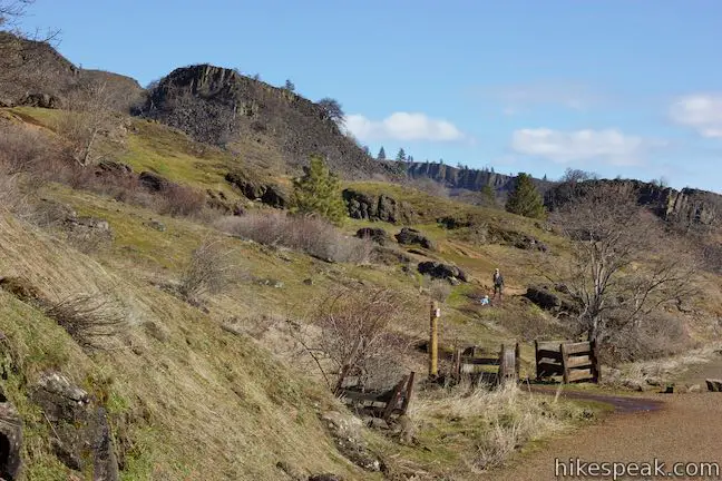
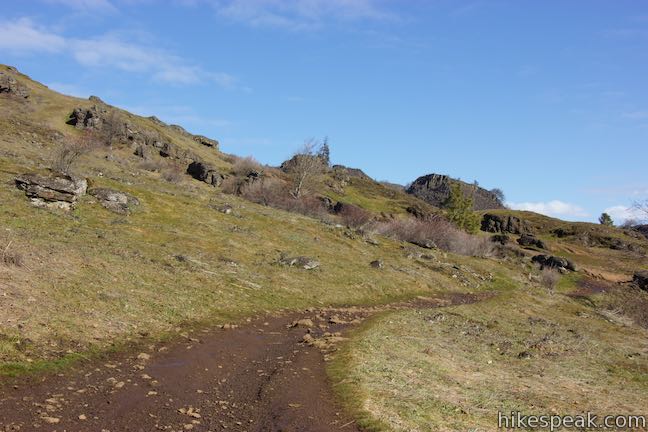
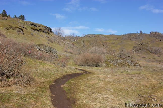
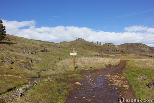
As you pass the end of Coyote Wall, come to the first junction, which is marked with a sign and old wooden fencing. Turn left up Old Ranch Road Trail, leaving the pavement. This trail, which grows wider, rises a long way up the slope east of the cliffs, passing both ends of Little Maui Trail and Little Moab Trail below Coyote Wall Trail.
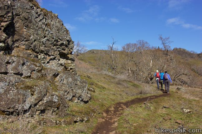
Though you could follow the Old Ranch Road for 1.82 miles, gaining 700 feet up to Coyote Wall Trail, hikers will probably prefer to check out the single tracks instead. Little Moab Trail goes along the edge of the wall and is more rocky and rough than the long switchbacks and easy curves of gradual Little Maui Trail. It is easier hike up Little Maui Trail and explore Little Moab Trail on the descent.
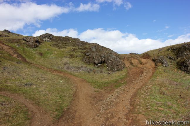
Hike a hundred yards up Old Ranch Road Trail to an unmarked split. To the left, a shortcut trail rises through outcroppings to the junction where Little Maui Trail leaves Old Ranch Road Trail. Taking the shortcut shaves about 0.15 miles off the hike, but is definitely steeper. Unless you’re punishing yourself, save the shortcut for the descent and continue to the right up Old Ranch Road Trail.
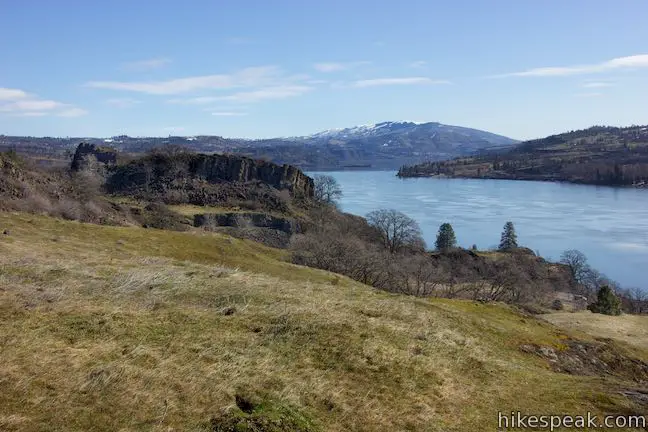
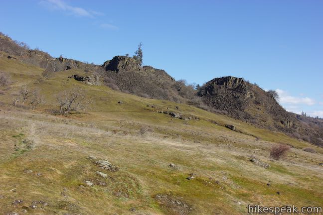
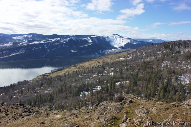
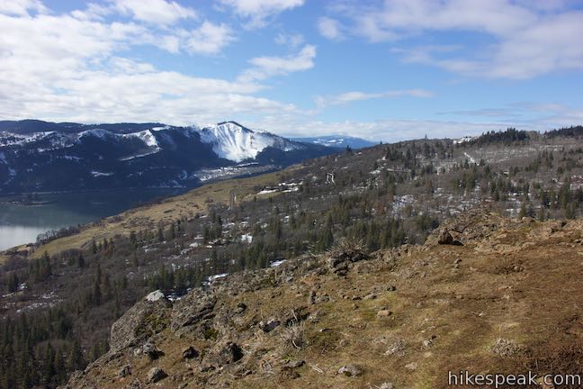
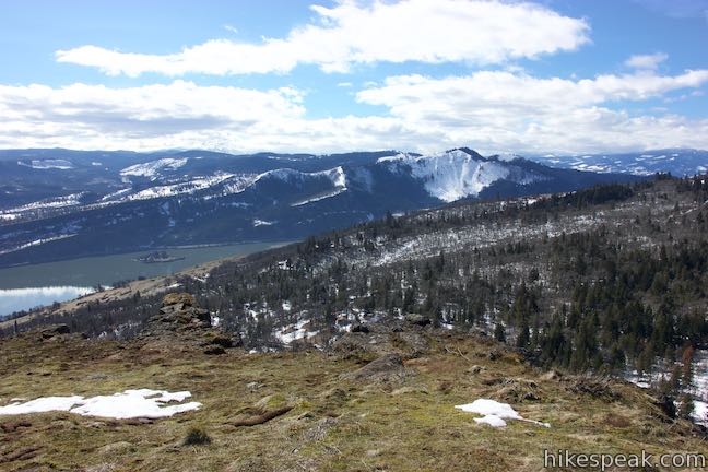
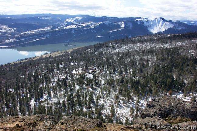
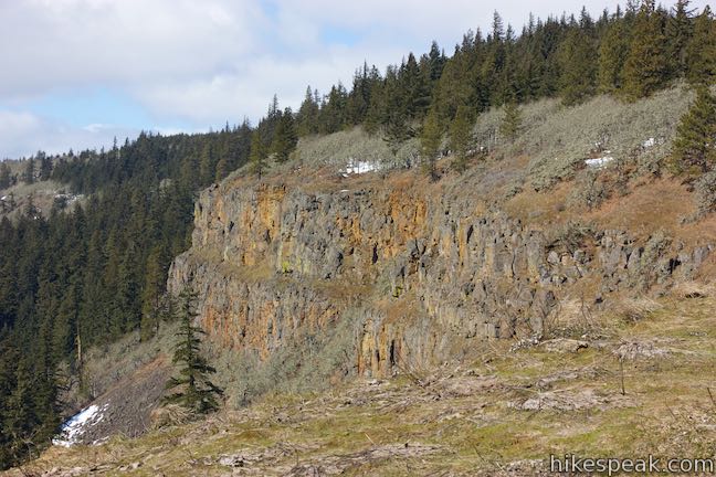
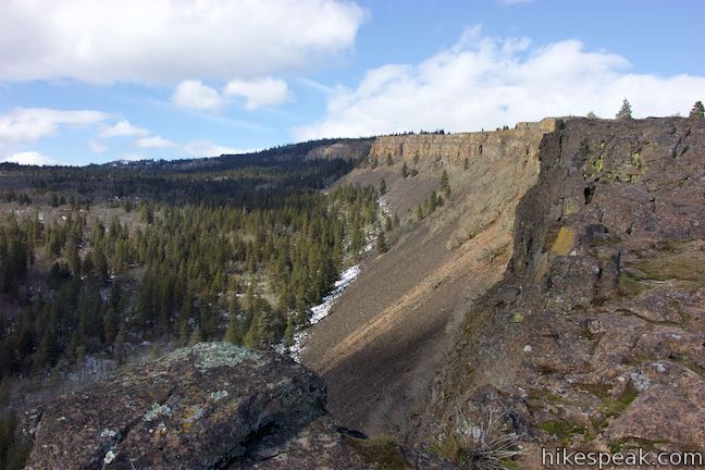
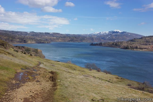
Old Ranch Road Trail rises above Old Highway 8 at a nearly parallel angle, offering nice early views across the Columbia River Gorge. Look east up the river toward Stacker Butte. As you go around a bend to the left, spot an alluring area of basalt formations just to the east. You’ll get a closer look at this area, known as the Labyrinth, from Little Maui Trail.
After a quarter mile on Old Ranch Road Trail, come to a marked junction with Little Maui Trail. Turn right to proceed up the Hawaiian side of Coyote Wall.
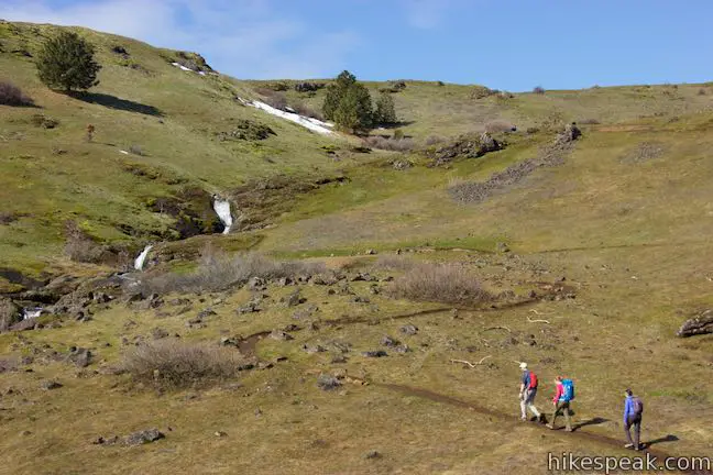
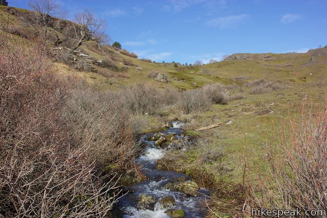
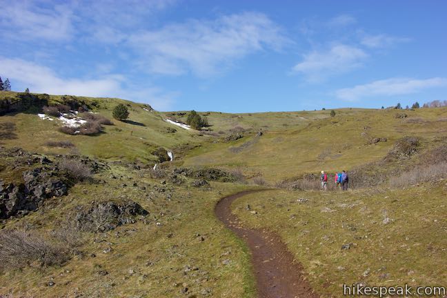
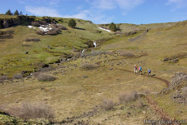
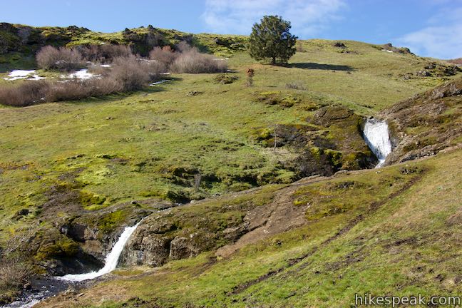
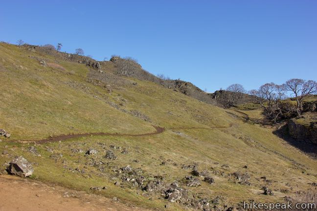
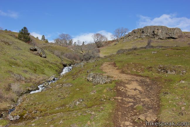
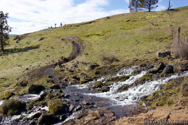
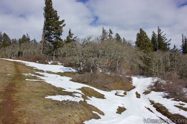
Little Maui Trail rises to the north, ascending a grassy bowl between volcanic formations. Cross a creek after 0.15 miles on this trail. Farther up, Little Maui Trail borders cascades along this creek and crosses the creek once again to return to Old Ranch Road Trail.
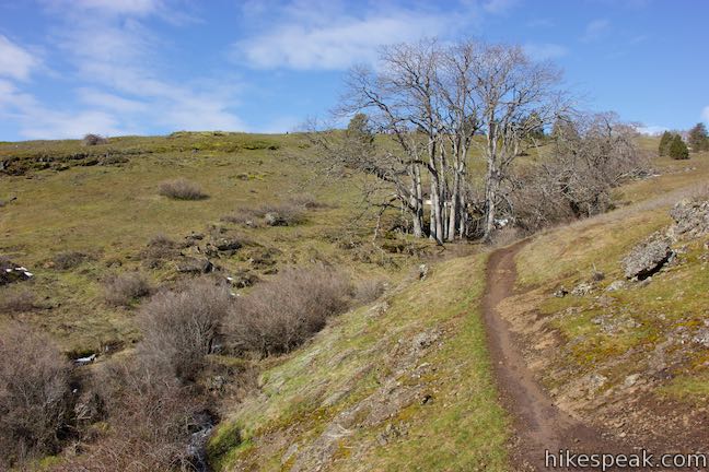
Head east from the first creek crossing and weave up switchbacks with picturesque views up the Columbia River. The volcanic playground of the Labyrinth draws wandering eyes to the east. Cross over a rise and return to the creek alongside a string of cascades. Proceed up the trail through a long switchback to the east before coming to the creek alongside more cascades. Again, a switchback to the east takes you away from the creek and then pulls you back. Duck under a low tree branch as you pass through a pocket of oaks by the creek.
Head east on one last switchback with views over the Labyrinth. At the end of this switchback, after 0.95 miles on Little Maui Trail, the trail splits. Take the highroad to the left or bear right to curve up the bottom of a depression. Either way, the paths soon come back together and head west to approach the creek for a final time. Cross the creek and proceed another 100 yards up a slope to the top of Little Maui Trail. After 1.2 miles on Little Maui Trail and 1.9 miles from the start of the hike, meet Old Ranch Road Trail and turn right to head uphill.
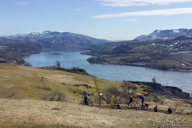
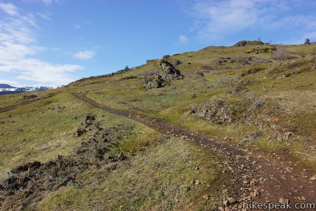
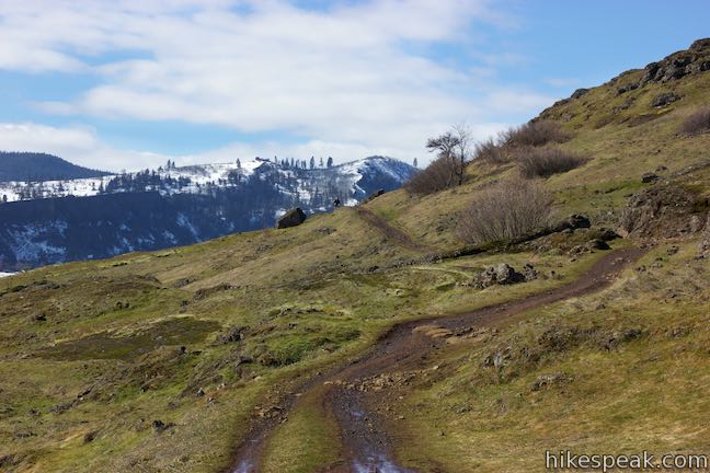
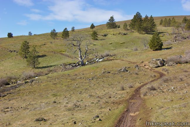
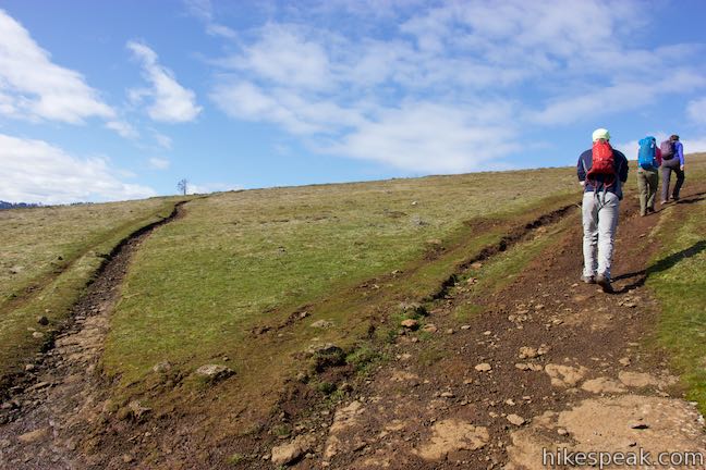
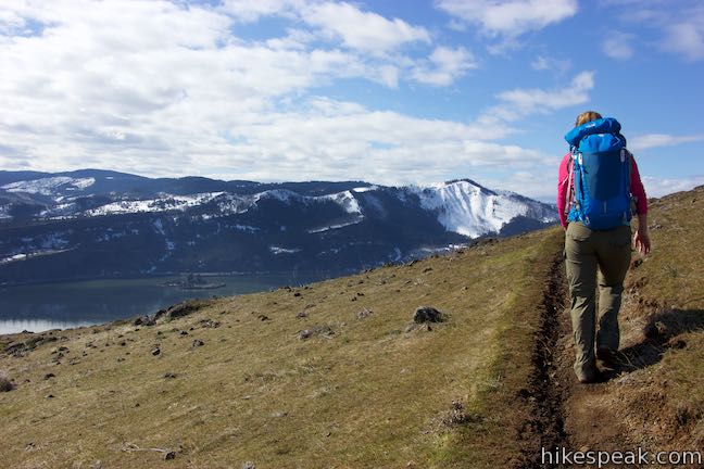
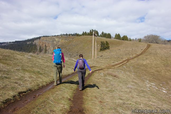
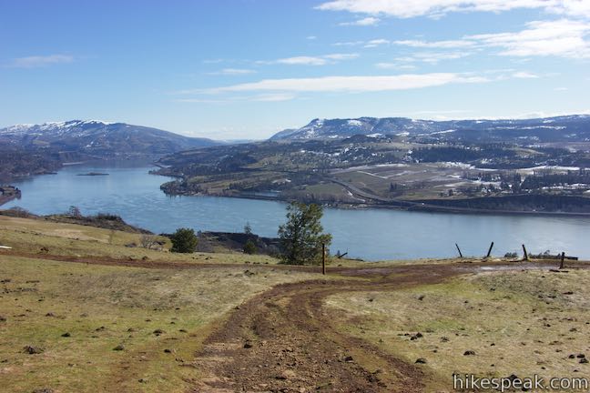
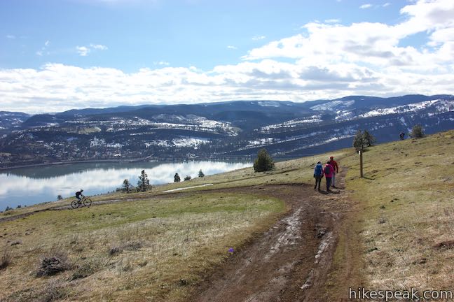
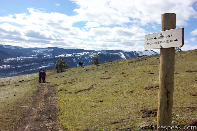
As soon as you get underway on Old Ranch Road Trail, it curves to the left and heads southwest up a grassy slope. Sun-drenching wildflowers show their colors on these slopes in the spring. Around the next bend to the right, pass the top of Little Moab Trail. If you turned left down this trail, that would result in a 3.6-mile hike. For now, keep curving to the right and in a few more steps you will come to another marked junction at the bottom of Coyote Wall Trail.
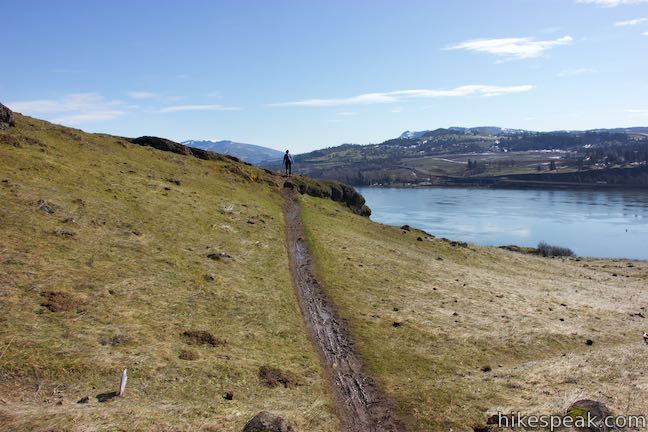
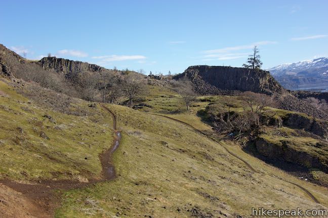
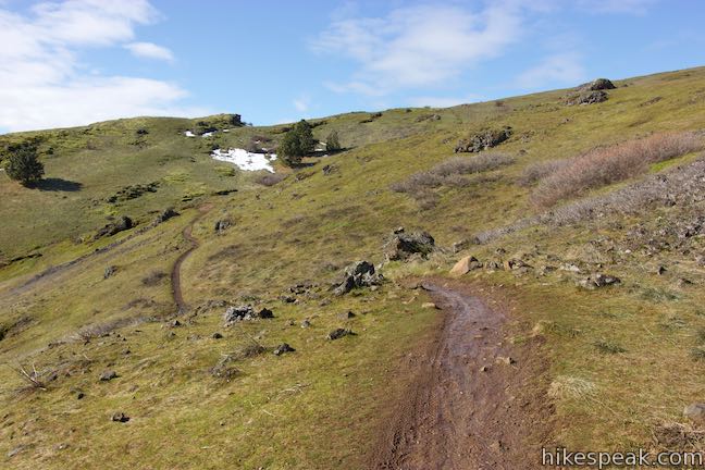
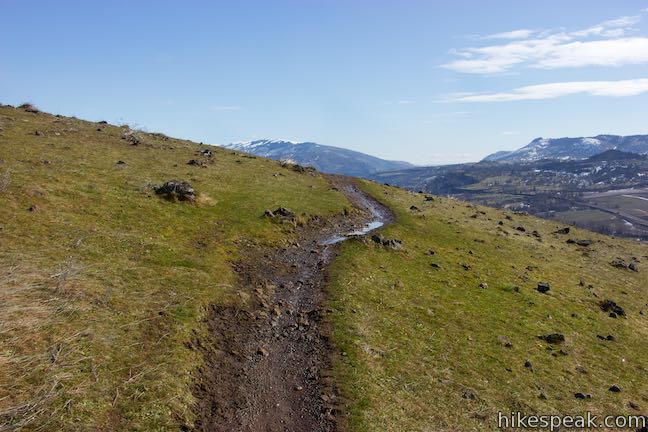
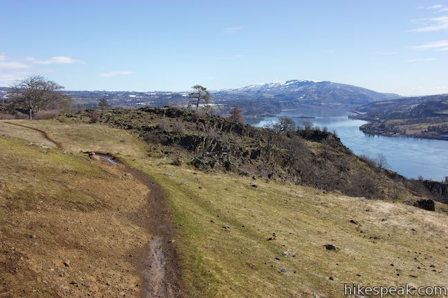
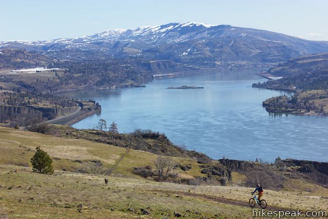
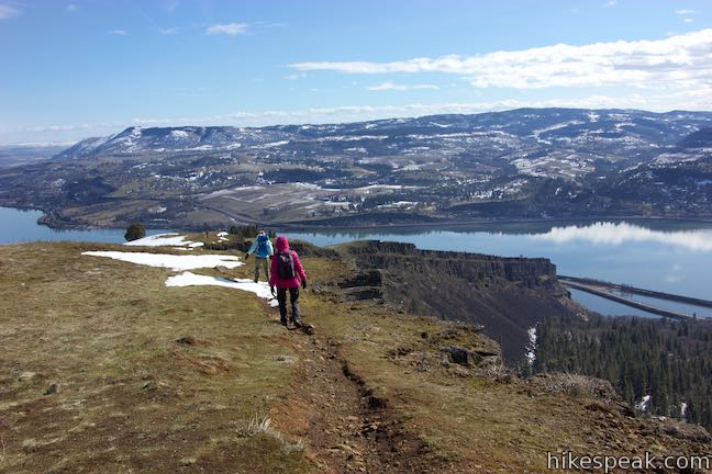
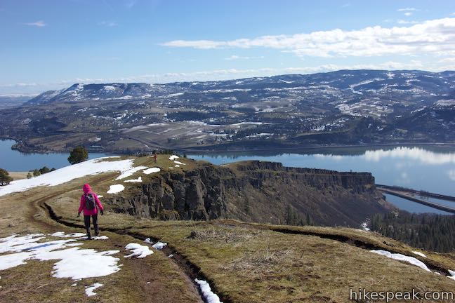
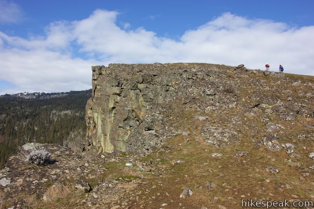
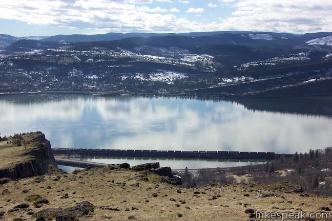
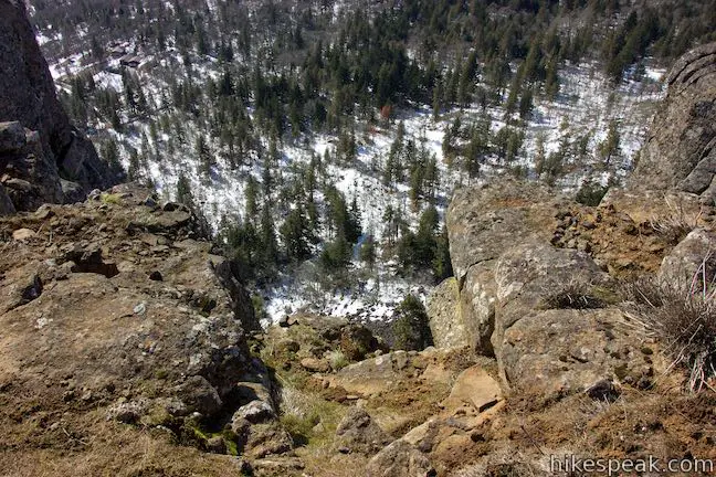
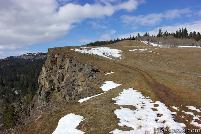
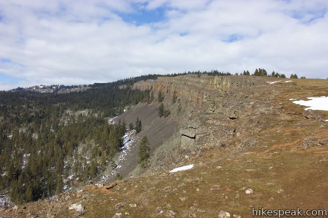
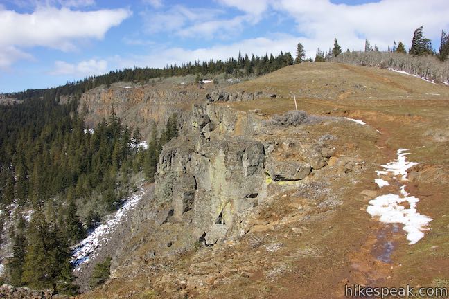
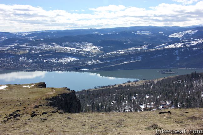
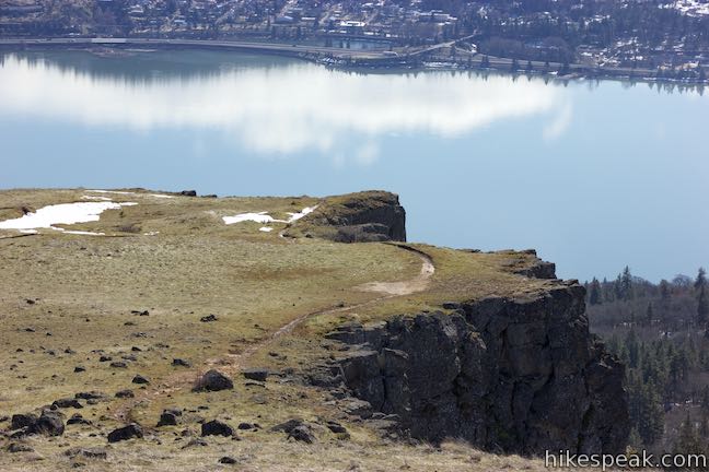
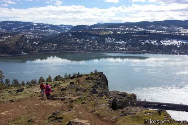
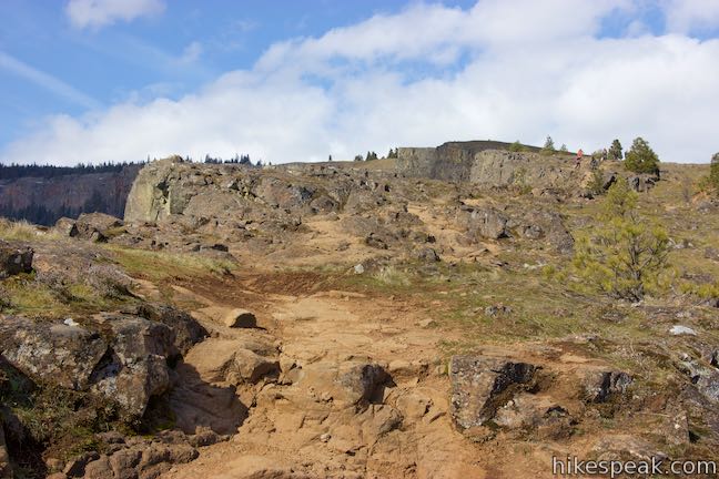
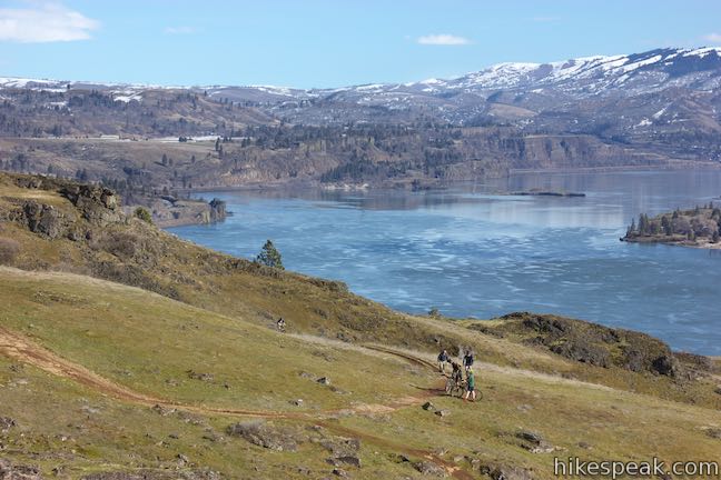
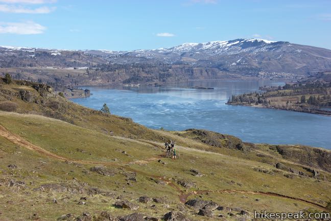
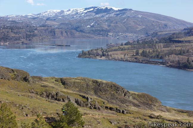
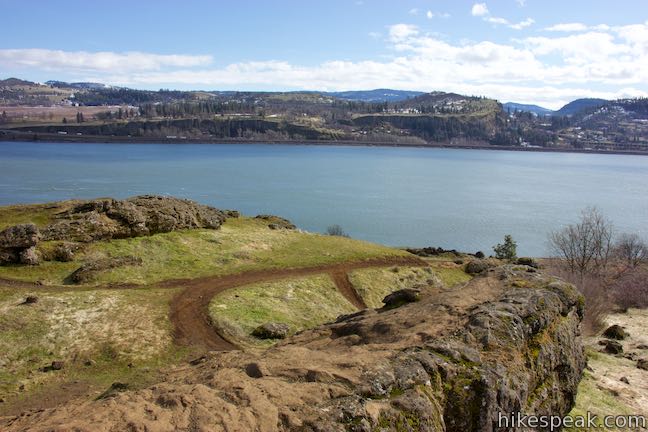
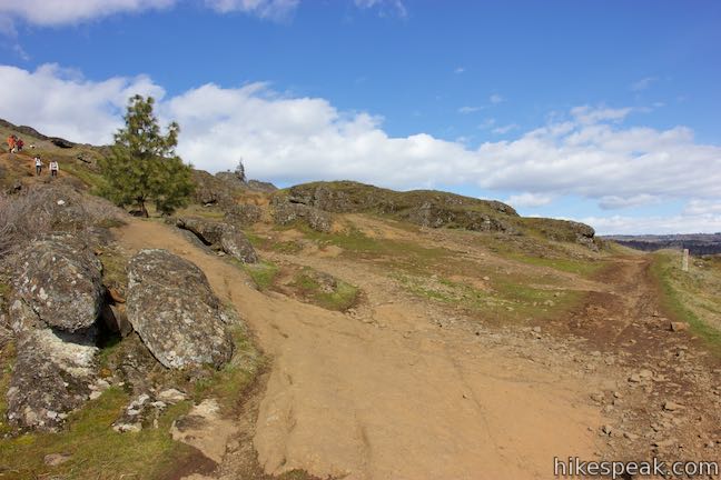
Turn left up Coyote Wall Trail. To this point, you will have ascended 750 feet over 2.13 miles. Approximately 825 feet remain in the ascent to Coyote Wall Upper Viewpoint and you can reach the vista in 0.85 miles, 1.2 miles, or somewhere in between. This is because Coyote Wall Trail is actually two trails. A double-track jeep trail heads basically straight up the grassy slope a short distance from the lip of Coyote Wall. An overlapping single track, also known as Crybaby Trail, passes closer to the edge of the cliff. Ascending the single track seems like the best option, giving your better views of the wall on a more gradual ascent, while saving views looking out across the gorge for the direct descent. You can also mix the two trails to form your own route. It would be hard to get lost and the views are spectacular.
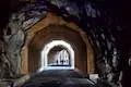
Just above Old Ranch Road Trail, come to the first split and bear left on the single track to approach the edge of Coyote Wall. The views looking over the lip of the wall will unnerve anyone afraid of heights, but the surroundings are as beautiful as they are daunting. The contour of Historic Columbia River Highway State Trail near the Mosier Twin Tunnels can be see across the river to the west.
The single track crosses the wider straight trail four times in the early goings. You can clip off the farther-from-the-cliffs curves if you prefer something a bit more direct. The single track then runs along the bluff for a stretch without intersections. When the singe track curves back to the wide trail again, there is no trail on the other side. Instead, join the wide trail and head up the slope.
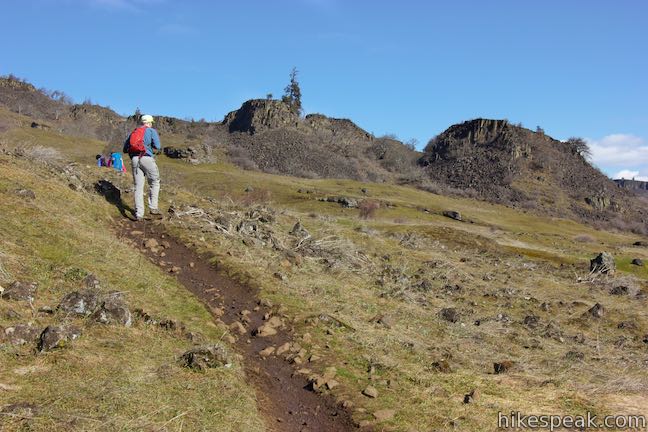
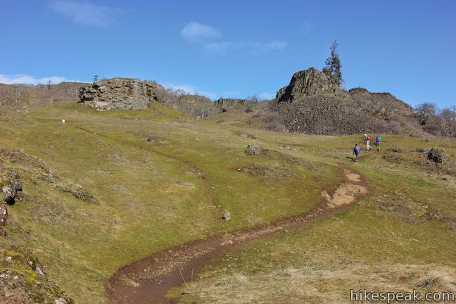
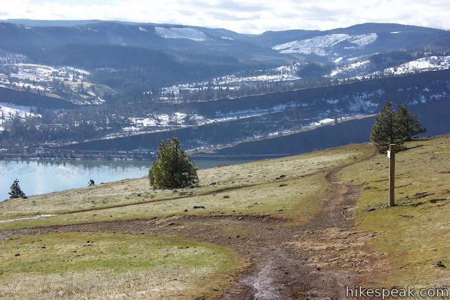
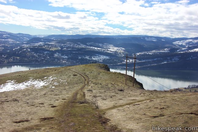
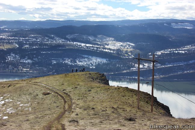
The trail runs just behind some rises along Coyote Wall. Cross under some large power lines, about 0.4 miles up Coyote Wall Trail. Afterward, you can branch off to the left on the single track again. Cross the wider trail twice and then rejoin it. After coming back together, pass a marker for the land survey grid, located just off the left side of the trail. The trails team up for about 0.2 miles. As you approach a steeper slope, bear left on the single track again to curve along the edge of the bluff.
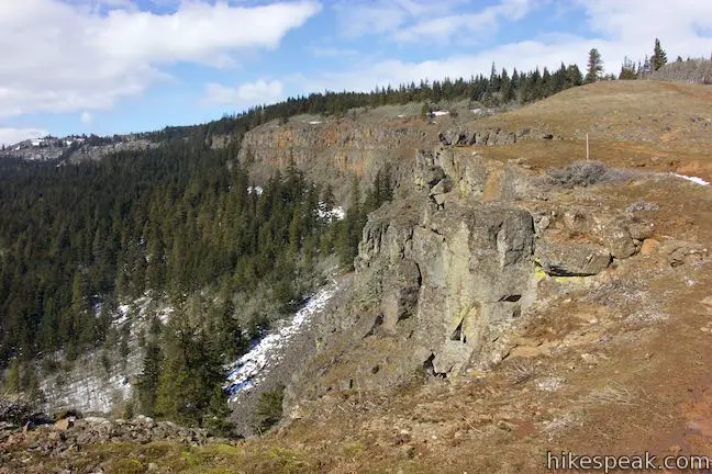
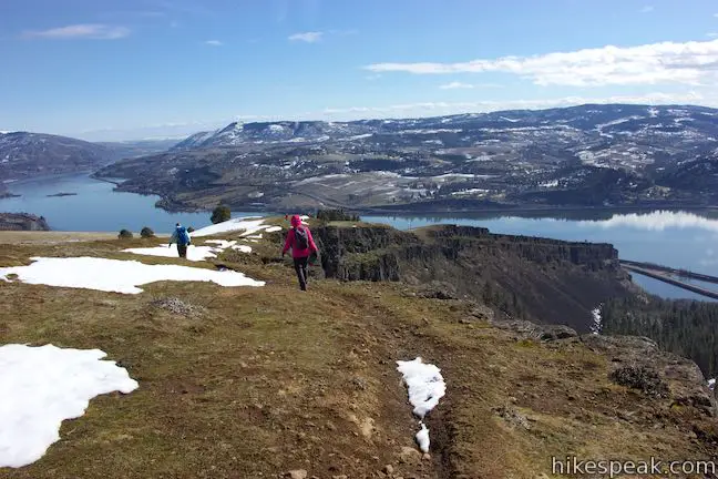
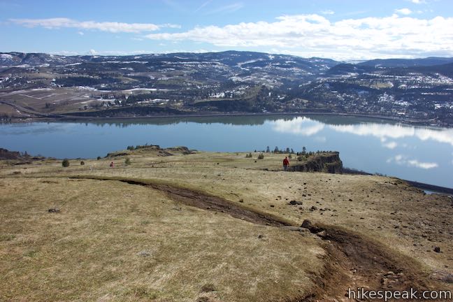
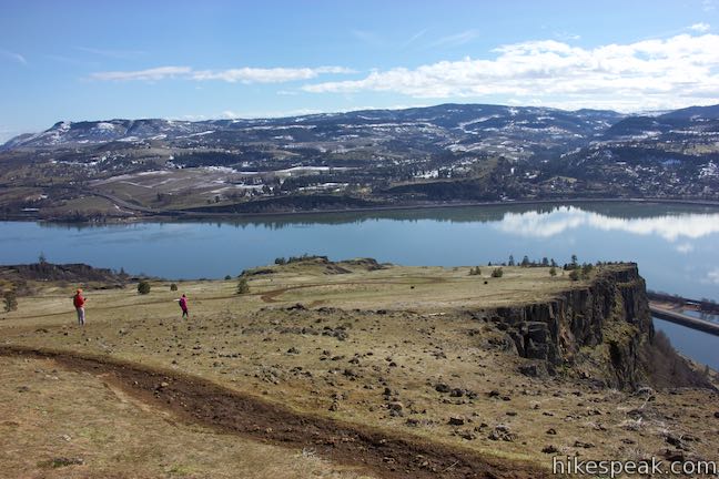
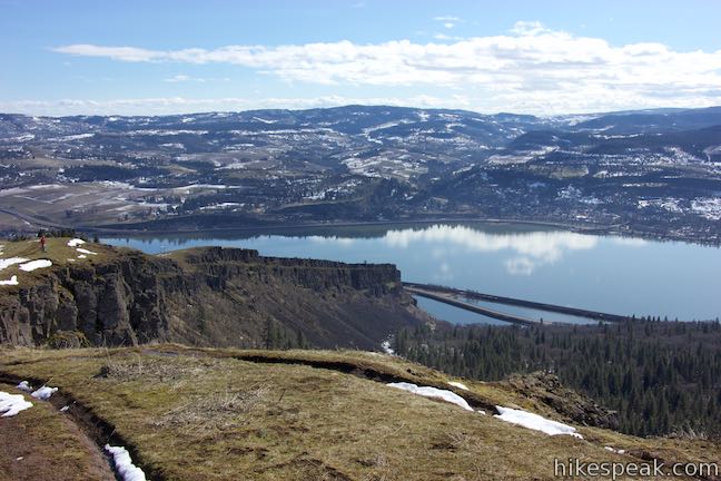
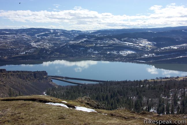
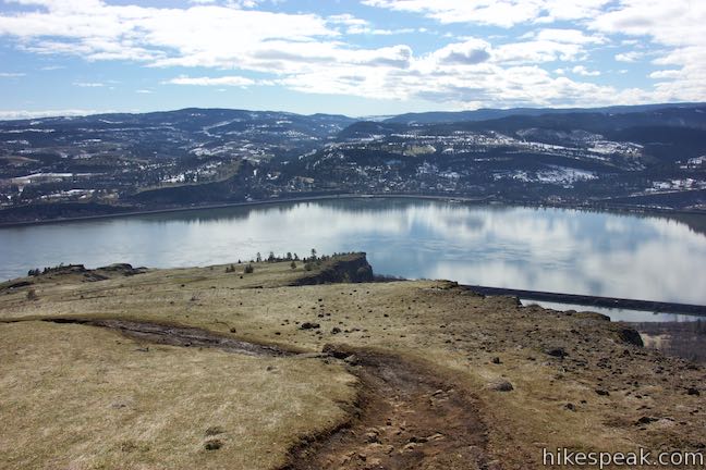
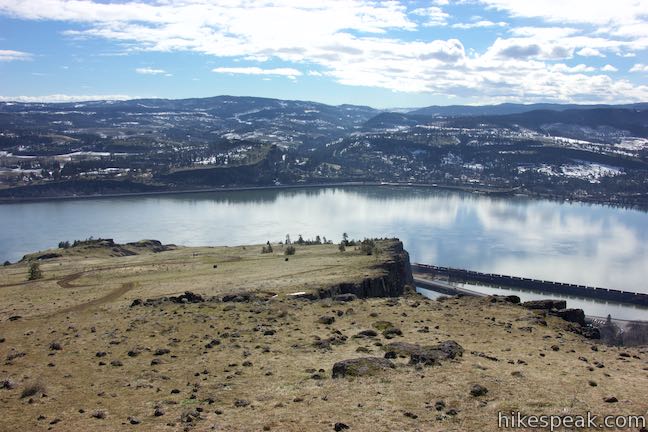
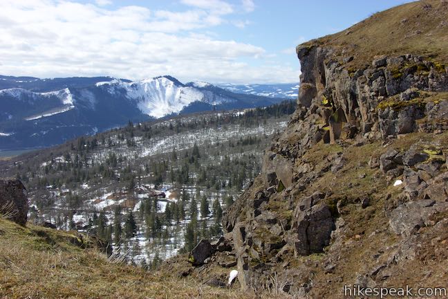
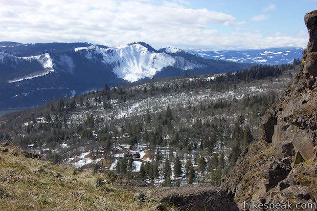
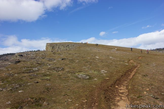
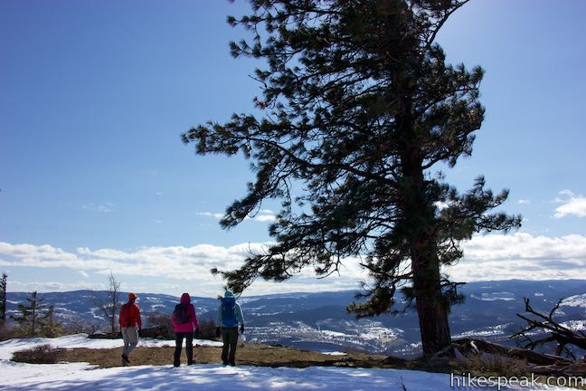
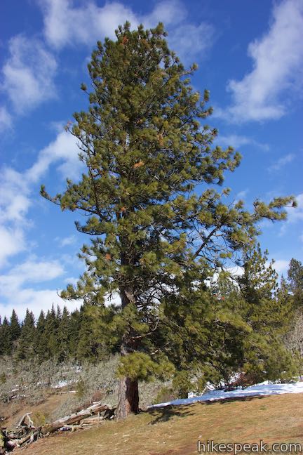
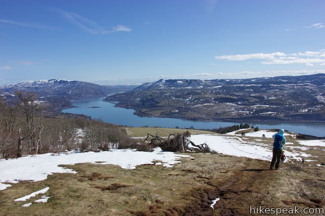
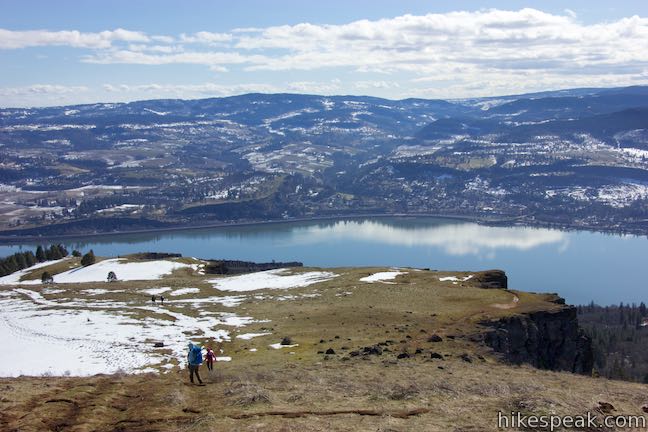
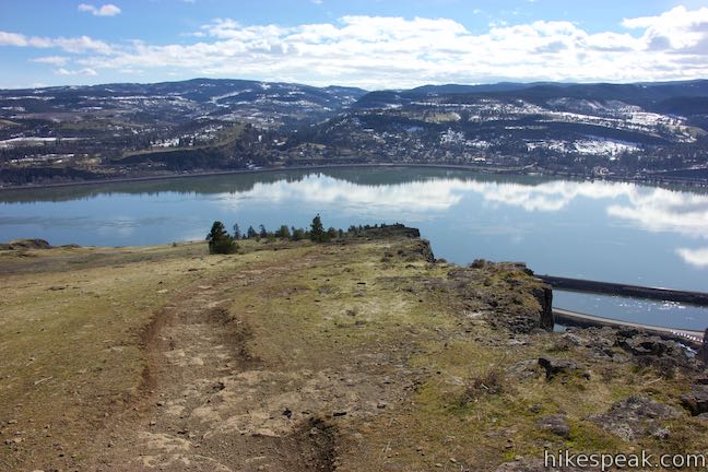
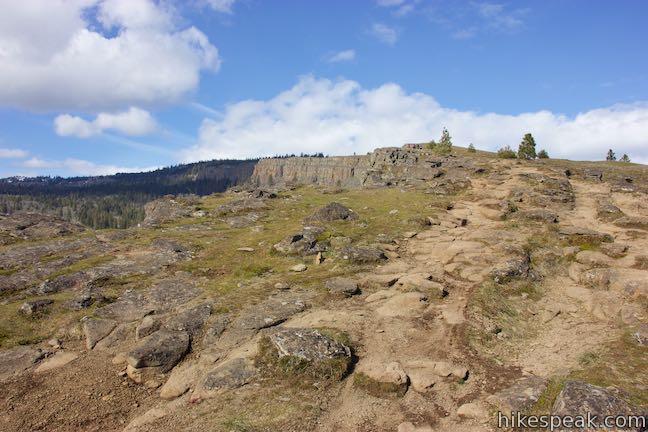
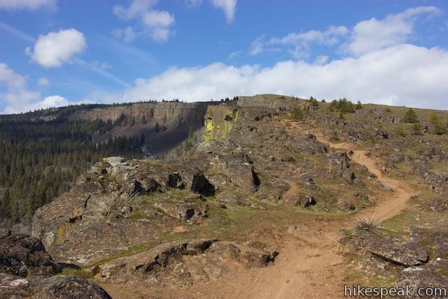
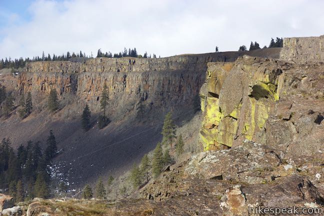
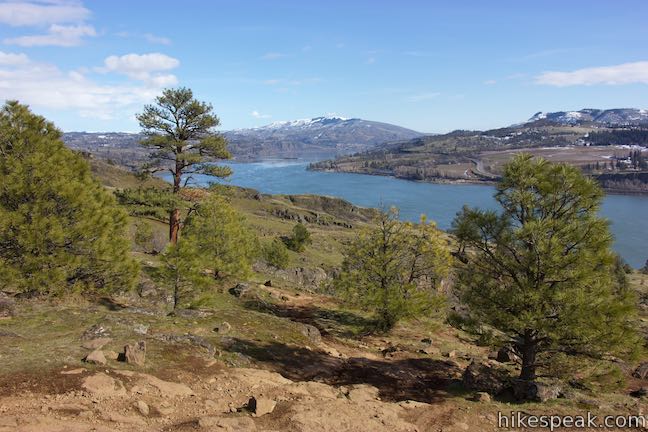
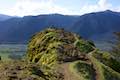
After saving you from the steepest pitch, the single-track trail delivers more off-the-wall views before it meets the edge of the forest on top of Coyote Wall. Unless you wish to hike farther up into the forest (loosing the open views), this is a good place to turn around. Angle toward a tall ponderosa pine standing apart from the others. This is the spot known as Coyote Wall Upper Viewpoint, labeled as McMahon on U.S. Forest Service maps.
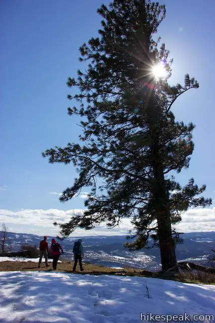
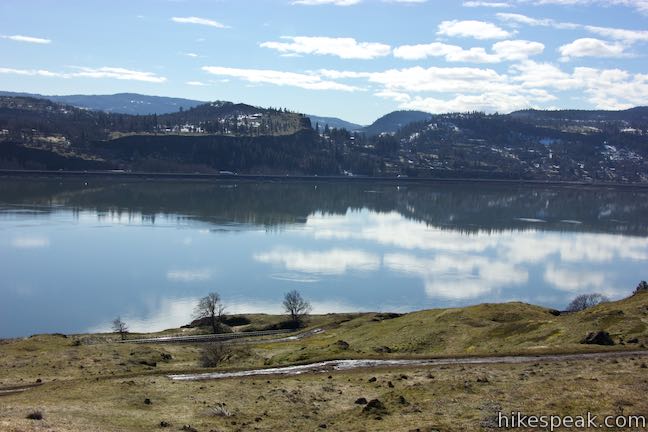
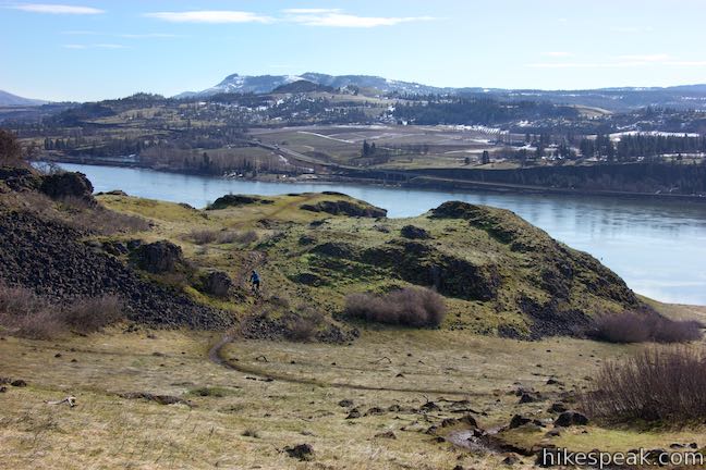
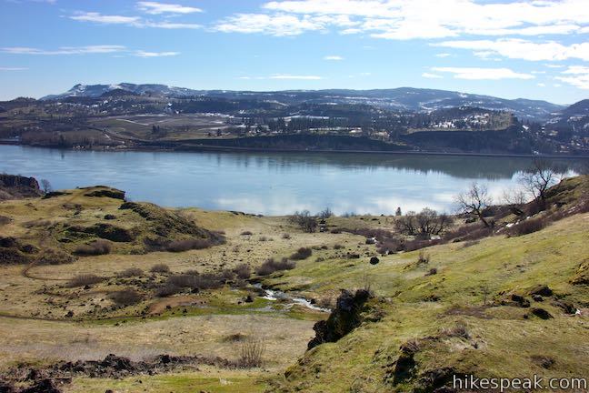
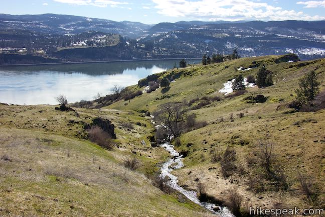
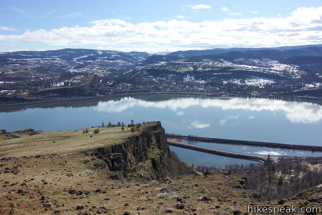
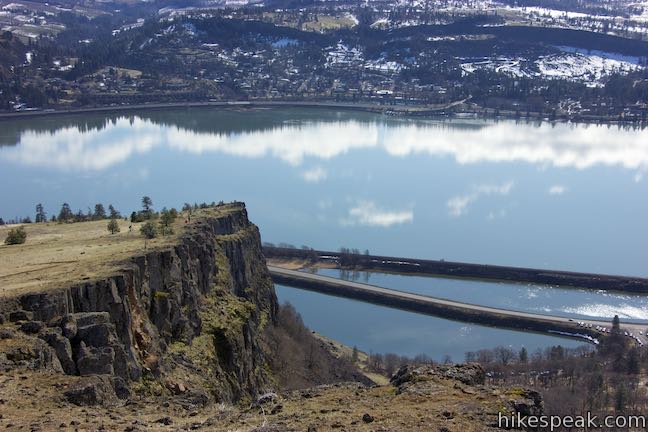
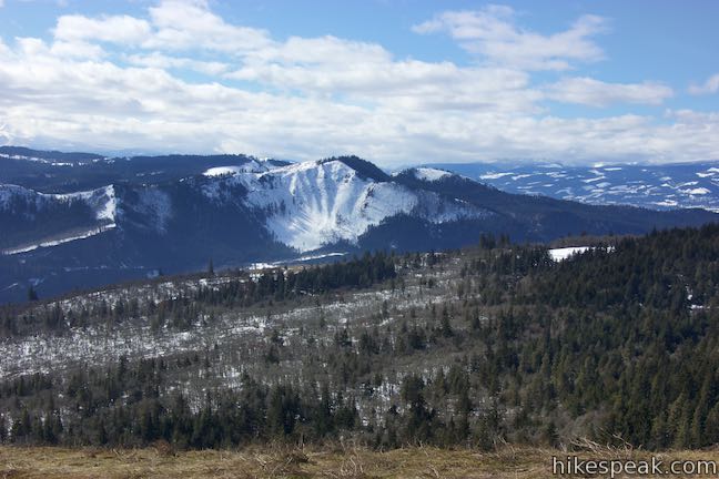
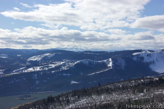
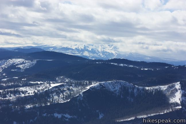
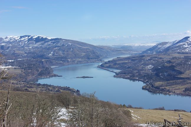
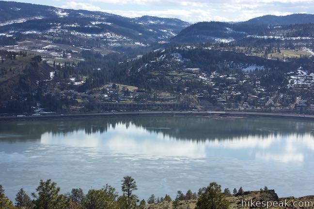
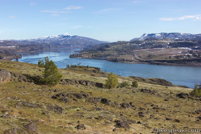
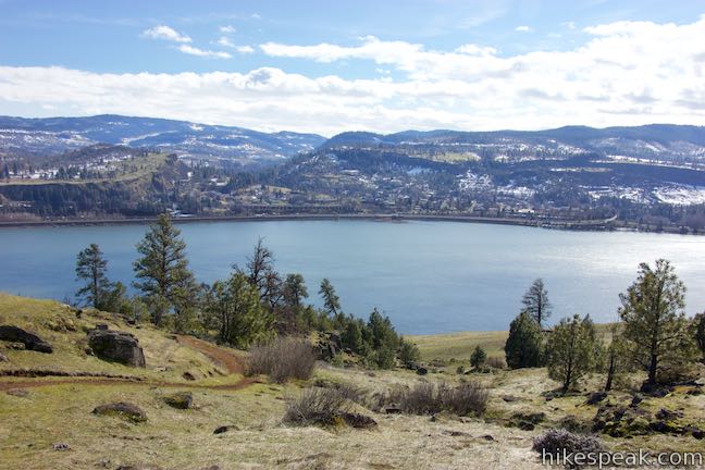
Take a break beside the tree near the edge of Coyote Wall. Having hiked 3 1/3 miles, you’ve earned a moment to relax and take in the views. Coyote Wall curves to the west, rising even higher. Below you, the wall descends to the southeast on an impressive run down to the Columbia River. Look across the gorge toward Oregon and landmarks like Mount Hood.
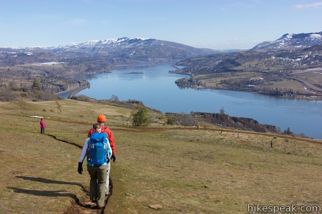
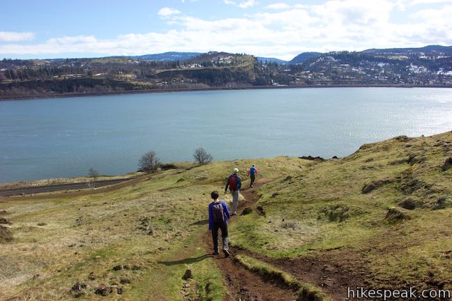
When its time to go, walk south from the summit. In 100 yards, you’ll pick up a wide jeep trail. The old road rises into the forest to the left. Stay to the right to proceed down the trail and over the steep slope. Descend Coyote Wall Trail through several junctions with the single trail. The wide trail is easy to follow on the descent, freeing hikers to enjoy panoramic views across the Columbia River.
When you return to the bottom of Coyote Wall Trail, turn right down Old Ranch Road Trail. Quickly reach the next junction and proceed straight onto Little Moab Trail while Old Ranch Road Trail curves to the left.
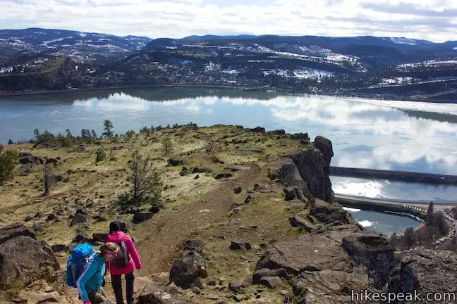
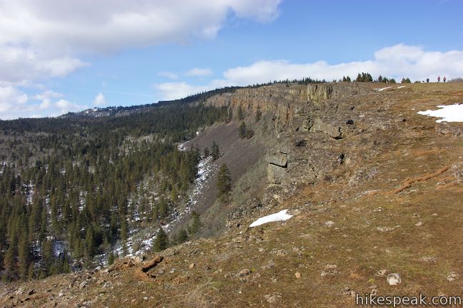
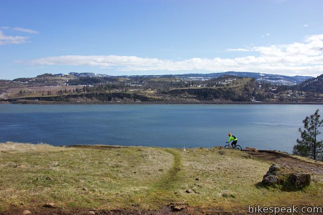
Enjoy 0.7 miles of awesome, rugged hiking along the edge of Coyote Wall as you descend Little Moab Trail. Are you romping through southeast Utah? No, but its easy to see how mountain bikers could draw that comparison. Little Moab Trail has excellent views up and down Coyote Wall. Look over the edge of the wall to see the trailhead far below.
When it runs out of wall, Little Moab Trail angles east and descends a draw with scattered trees and nice gorge views. Come to a junction with Old Ranch Road Trail at the 5-mile point of the hike. Bear right down Old Ranch Road. Descend around a switchback and head east toward the junction at the bottom of Little Maui Trail. Unless you feel compelled to linger on Old Ranch Road Trail, turn right at the intersection on the shortcut that dissects the lowest switchback on Old Ranch Road Trail.
Turn right at the bottom of the shortcut and walk a hundred yards down to Old Highway 8. Turn right to make your way back to the trailhead and complete this scenic 5.8-mile hike with 1,575 feet of elevation change.
Dogs and bikes are welcome. Dogs can be off leash from July to November, but must be on leashes the rest of the year. The grassy slopes on Coyote Wall may be wind swept and cooler than the trailhead, so pack layers. A toilet is located at the start of Old Highway 8. Although the trailhead has a decent amount of parking, the spaces do fill up on weekends. No permit or fee is required for this hike in Columbia River Gorge National Scenic Area. For easy nearby hikes, travel east and see spring wildflowers on Catherine Creek Interpretive Trail or witness the wonder of Catherine Creek Arch.
The basic directions for this hike are:
- Leave Coyote Wall Trailhead by heading east on Old Highway 8 (0 miles)
- Turn left up Old Ranch Road Trail (0.45 miles)
- Stay to the right past a shortcut path (0.5 miles)
- Turn right up Little Maui Trail (0.7 miles)
- Turn right onto Old Ranch Road Trail at the top of Little Maui Trail (1.9 miles)
- Stay to the right past the top of Little Moab Trail (2.1 miles)
- Turn left up Coyote Wall Trail (2.13 miles)
- Follow the single-track trail to Coyote Wall Upper Viewpoint (3.33 miles)
- Take the wider, more direct trail down to Old Ranch Road Trail and turn right (4.27 miles)
- Bear right onto Little Moab Trail (4.3 miles)
- At the bottom of the trail, turn right down Old Ranch Road Trail (5 miles)
- Meet the bottom of Little Maui Trail and turn right down a shortcut trail (5.25 miles)
- Rejoin to Old Ranch Road Trail and turn right (5.3 miles)
- Descend to Old Highway 8 and turn right (5.35 miles)
- Return to the trailhead (5.8 miles)
To get to the trailhead: From the intersection of Interstate 205 and Interstate 84 in Northeast Portland, take Interstate 84 east for 55.4 miles to exit 64 in Hood River, following signs for Mount Hood Highway toward White Salmon and Government Camp. At the end of the offramp, turn left to head north on Route 35. Pay a toll of a couple bucks to cross the Hood River Bridge. On the other side, turn right on Highway 14. Travel east for 4.6 miles and turn left onto Courtney Road. Make an immediate right into the Coyote Wall Trailhead Parking Area. Pass an old cattle chute on the left to find the start of the hike at the end of the lot.
Trailhead address: Coyote Wall, Old Highway 8, White Salmon, WA 98672
Trailhead coordinates: 45.7006, -121.4012 (45° 42′ 02.2″N 121° 24′ 04.3″W)
View Coyote Wall in a larger map
Or view a regional map of surrounding Washington trails and campgrounds.


 | Catherine Creek Arch This 1-mile round trip hike leads to the base of a curious natural arch in a basalt bluff. |
 | Catherine Creek Interpretive Trail This short, paved loop explores meadows that burst with seasonal wildflowers, passing an overlook for a small waterfall and plentiful gorge views. |
 | Dog Mountain This 6.65 to 7.4 hike explores forests, wildflower-covered slopes, and grand views from a mountain along the Columbia River Gorge. |
 | Mosier Twin Tunnels This 2 to 9.5-mile hike ventures up Historic Columbia River Highway State Trail to a pair of tunnels carved into basalt cliffs on the side of Columbia River Gorge. |
 | Eagle Creek Trail This 4.55-mile hike ventures up a beautiful and dramatic canyon to impressive waterfalls like Metlako Falls, Lower Punchbowl Falls, and Punchbowl Falls. |
 | Wahclella Falls This 2-mile hike visits a sublime waterfall in Oregon's Columbia River Gorge. |
 | Hamilton Mountain The beautiful 7.75-mile lollipop loop visits bombastic waterfalls and panoramic cliffs on the Washington side of the Columbia River Gorge in Beacon Rock State Park. |
 | Beacon Rock Trail This 1.6-mile hike follows an impressively engineered trail packed with switchbacks that scale a monolith along the Columbia River. |
 | Guler Ice Cave in Gifford Pinchot National Forest This short hike goes underground to explore an old lava tube with frozen stalactites and stalagmites, plus other interesting cave features. |
 | June Lake This 2.6-mile hike visits a small lake and a waterfall on the southern slopes of Mount Saint Helens. |
 | Lava Canyon Trail This 1.25-mile loop explores a colorful canyon re-carved by the 1980 eruption of Mount Saint Helens. |
 | Ape Cave This adventurous underground hike in Mount Saint Helens National Volcanic Monument travels through one of the longest lava tubes in the world. |
 | Trail of Two Forests This short nature trail in Mount Saint Helens National Volcanic Monument tours a landscaped that was transformed by a molten lava flow. For extra fun, crawl through a 50-foot long lava tube beneath the trail. |
 | More trails in Washington Explore other hikes in the Evergreen State, including Mount Rainier National Park and Mount Saint Helens National Volcanic Monument. |
Go the extra miles...
Submit a rating of this hike to go with your comment. Contribute to the average trail rating.