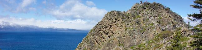
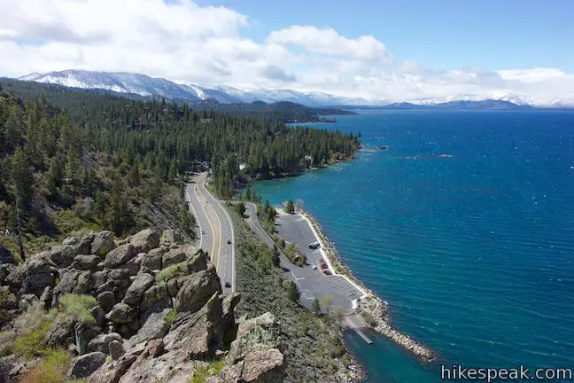
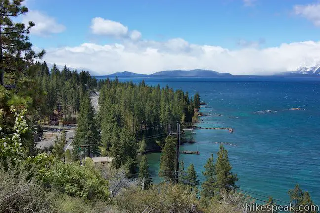
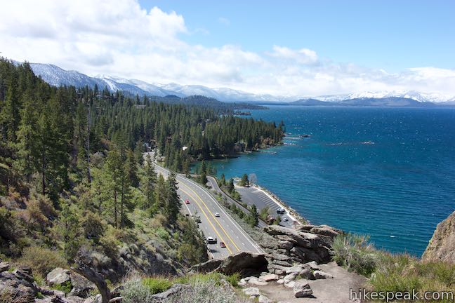
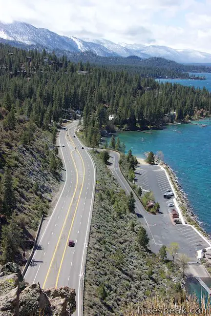
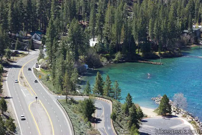
Gaze out from Route 50 as it travels along the southeast side of Lake Tahoe and you’ll find nice views of the lakeshore and its surrounding mountains. Seven miles up from the state border in South Lake Tahoe, Nevada Route 50 slips through a tunnel in a tall pointed ridge of volcanic rock. The road itself is scenic, but the sight of Cave Rock should have you speculating how superb things must look from the top.
The views from Cave Rock are, in fact, wonderful. Also, they don’t take long to reach because Cave Rock Trail is just 0.9 miles round trip!
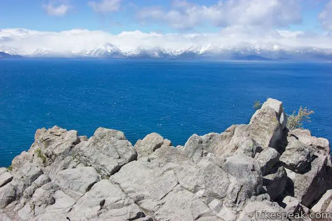
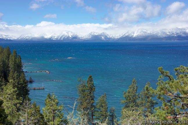
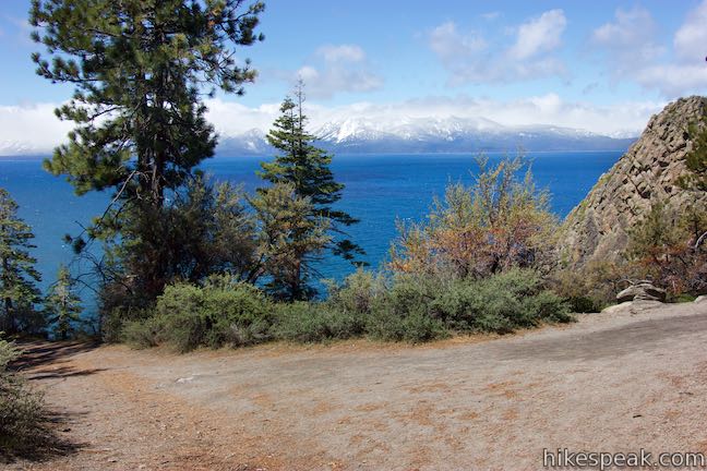
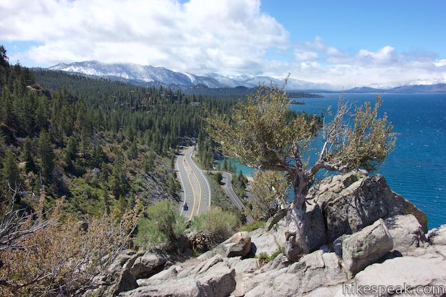
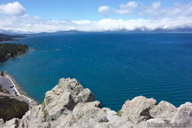
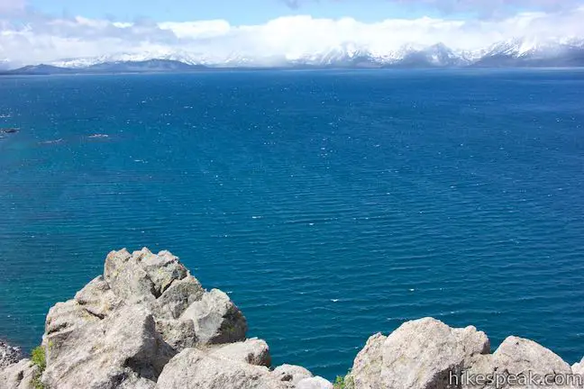
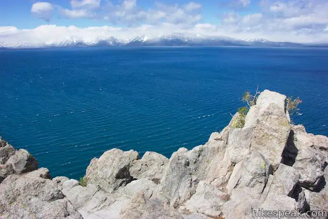
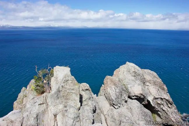
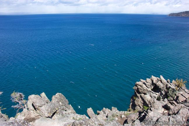
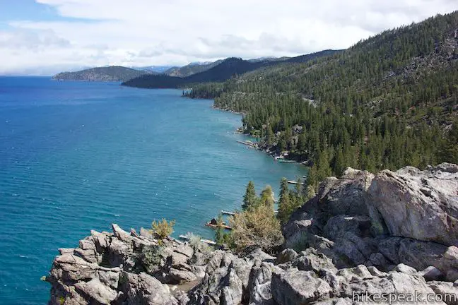
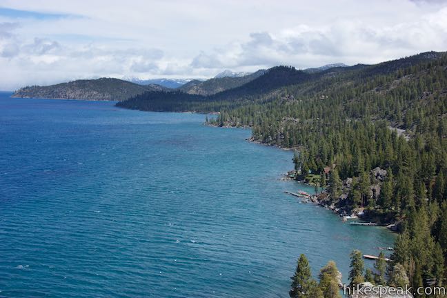
An easy, gradual trail approaches to the base of the rocky crown. From there, a short scramble leads up to the very top. Cave Rock has sweeping panoramic views over the striking blue waters of Lake Tahoe, the surrounding shoreline, and the snow-clad Sierra Nevada Mountains.
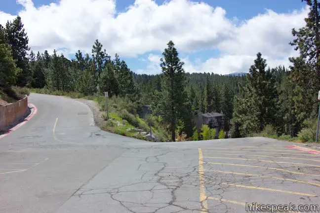
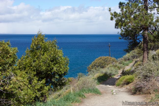
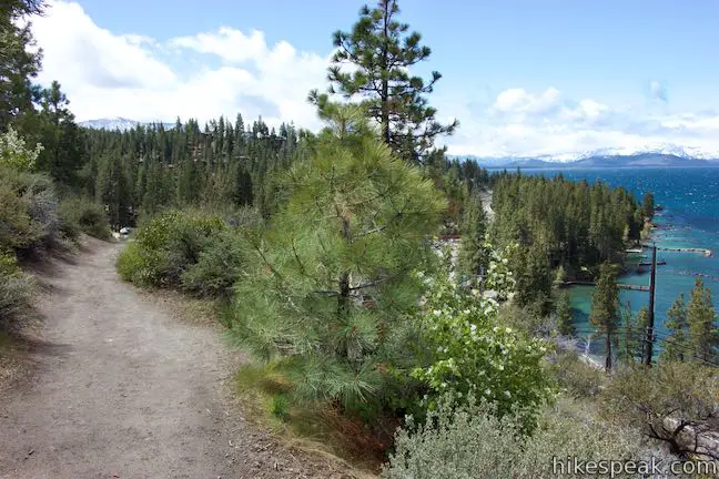
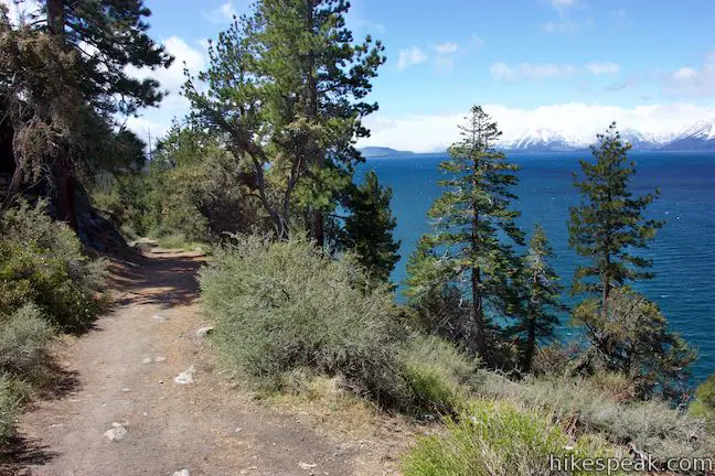
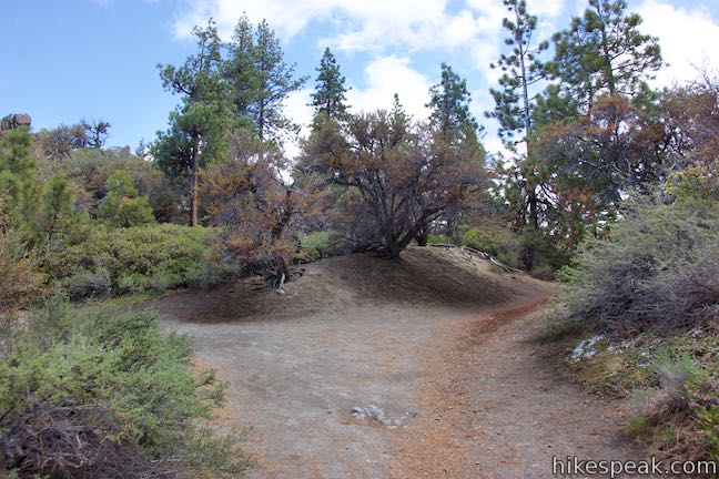
Cave Rock is located on the southeast side of Lake Tahoe. Begin hiking from a sharp bend in Cave Rock Drive, a quarter mile up from Route 50. The trailhead only has room for about six vehicles, so try to time your visit when crowds can be avoided. The start of the trail is framed by a pair of boulders but is not marked with a sign. Set out on the single-track Cave Rock Trail, which ventures north across a slope that drops to the left toward Route 50 and and the lake. Almost immediately, the trail offers rewarding views over the sweeping, bluer-than-blue water below.
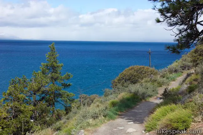
Progress up Cave Rock Trail, pausing occasionally to look out over the lake to your left – a segment of the big panorama available at the summit. Note: even if you don’t complete the final climb up Cave Rock, the trail still has plenty of fine views.
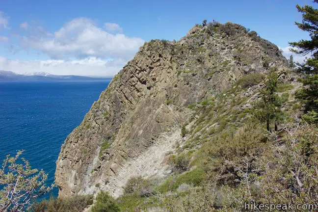
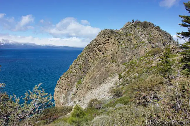
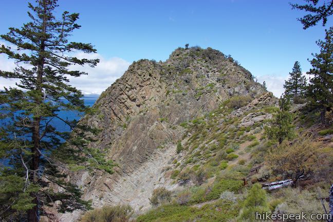
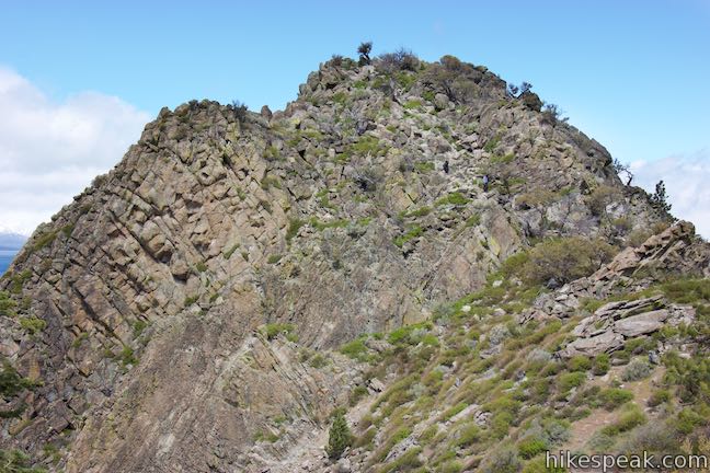
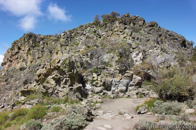
Not far from the trailhead, Cave Rock springs into view. This steep and dramatic formation of volcanic rock stands out from the broader mountain slope (that you are crossing). Continue up the trail to better views of the exposed rock crown that you’ll climb at hike’s end.
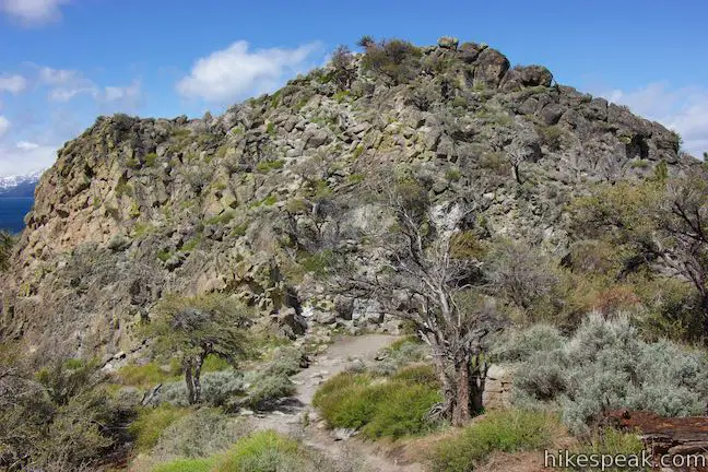
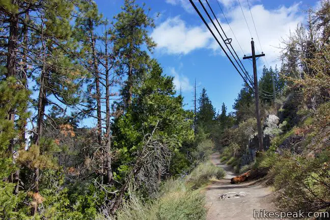
Come to an unmarked junction, 1/3 of a mile from the start. The trail to the right strays into a conifer forest. Turn left instead, in the direction of Cave Rock. Soon thereafter, the trail seems to split again. The path to the right is short, dead-ending at a partial view up the shoreline to the north. Bear left once again and drop across a saddle toward Cave Rock.
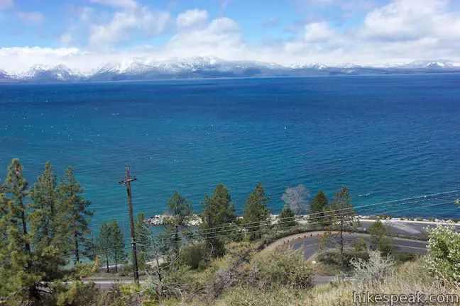
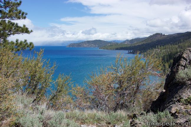
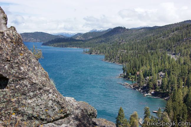
From the prone-to-be-wind-swept saddle, get views in two directions, up the shore to the north, as well as down the shore to the south. Both perspectives are slices of Lake Tahoe loveliness.
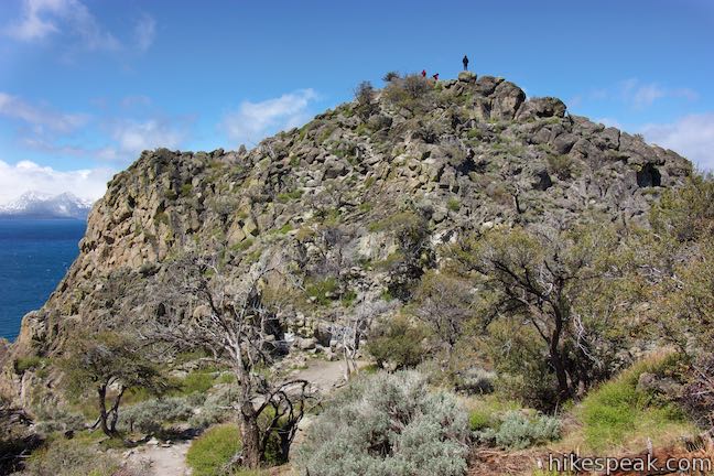
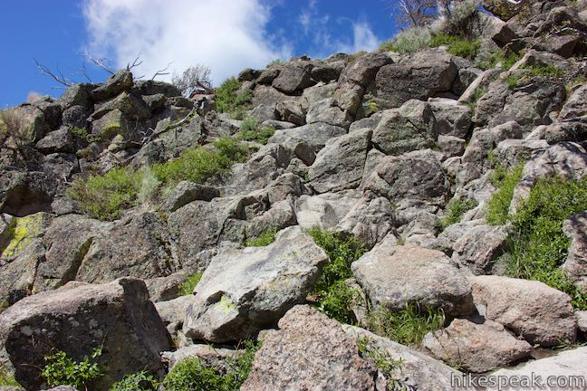
The established trail ends at the saddle. To get a fuller lake view, scramble about 50 vertical feet to the top of Cave Rock.
Make your way up, over, and around jumbled outcroppings on the side of Cave Rock. The climbing is not technical, but you will need to use your hands at times (the accent my not be appropriate for all hikers). Climb up the rocks on the southeast side of the peak, picking between the worn routes. It’s possible to take relatively normal steps up most of the boulders, but you’ll probably be required to hoist yourself up in a few places during the ascent.
The burst of effort is rewarded with 360-degree views from the crown of Cave Rock (and at least half of those degrees are filled by the beautiful blue water of Lake Tahoe). Gaze out across the expansive lake toward the mountains in the Northern Sierra. Ski slopes are visible above South Lake Tahoe to the south. While you’ll spend most of your time looking out over the lake to the west, the mountain views to the east aren’t terrible.
Take in the surroundings from Cave Rock and then return down the slope you came up. Be careful as you descend. Take the short trail from the saddle back to the parking area.
Cave Rock Trail can be a great place to hike at sunrise and sunset because of it’s convenient length and excellent views. Dogs are allowed. The limited parking at the trailhead is free and no permit is required to hike up Cave Rock, so get out and enjoy!
To get to the trailhead: From the California border in South Lake Tahoe, take Nevada Route 50 north along the lake. After 6.7 miles, and just before the road actually tunnels through Cave Rock, turn right up Cave Rock Drive. Go a quarter mile up to a sharp bend to the right lined with a small parking area. The trail begins near the parking spaces at the outside of the curve.
Trailhead address: Cave Rock Trailhead, 669 Cave Rock Drive, Glenbrook, NV 89413
Trailhead coordinates: 39.0420, -119.9465 (39° 02′ 31.2″N 119° 56′ 47.4″W)
View Lake Tahoe in a larger map
Or view a regional map of surrounding Nevada trails and campgrounds.


 | Chimney Beach Trail This 1.1-hike descends to a scenic and unique cove on the shore of Lake Tahoe that houses a stand-along chimney lingering from an old cabin. |
 | Moraine Trail To Fallen Leaf Lake This 1.1-mile loop sets out from Fallen Leaf Campground in South Lake Tahoe to visit a forest creek and a gorgeous mountain lake. |
 | Hikes in the Sierra Nevada Mountains Explore more trail in the range's great national parks, national forests, and other park lands. |
 | Hikes in Nevada Explore more trails in Nevada and the picturesque parks around Las Vegas. |
Go the extra miles...
Submit a rating of this hike to go with your comment. Contribute to the average trail rating.