Catherine Creek Arch
in Columbia River Gorge National Scenic Area
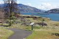
Catherine Creek Arch is a surprising creation – a bridge-like span of rock along a ledge of basalt. A 1-mile round trip hike leads to the foot of Catherine Creek Arch (and longer loops in the area are also possible). This short and sweet outing entertains hikers of all ages. Part of the Columbia River Gorge National Scenic Area, Catherine Creek is located on the Washington side of the west end of the gorge, where lovely views are easy to find.
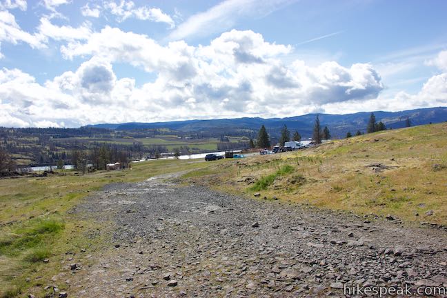
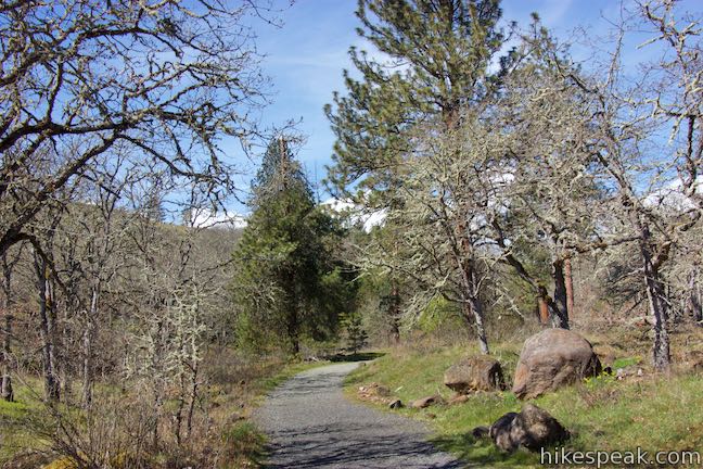
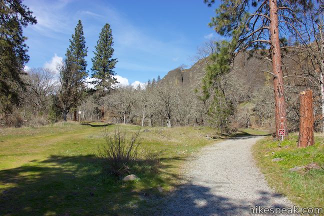
The hike begins from the north side of Old Highway 8, about 50 yards west of the trailhead for Catherine Creek Interpretive Trail (an easy loop for wildflower viewing). Find the trailhead kiosk beside a green gate. Step around the gate and come to a trail split. A trail to the left lures you north up the grassy hillside. Don’t go that way. Instead, bear right on a trail that is marked with the number 020.
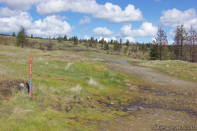
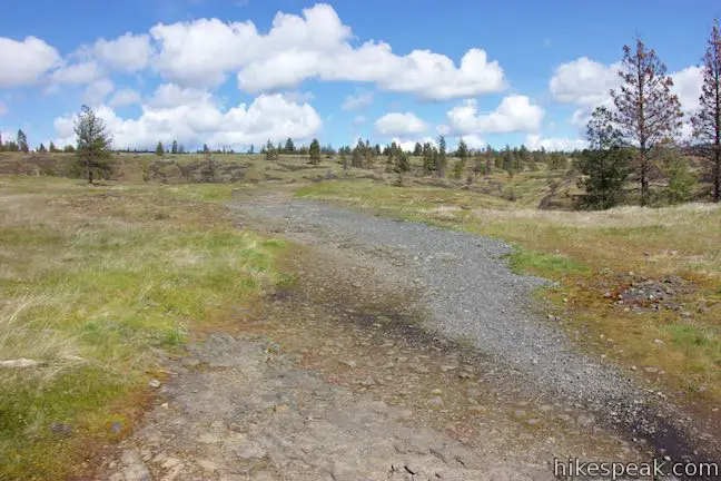
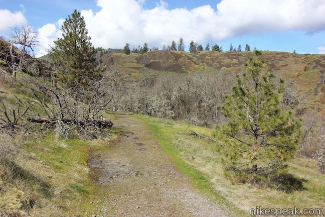
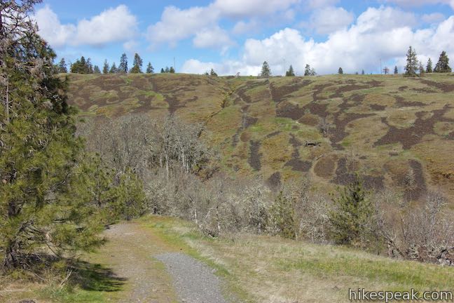
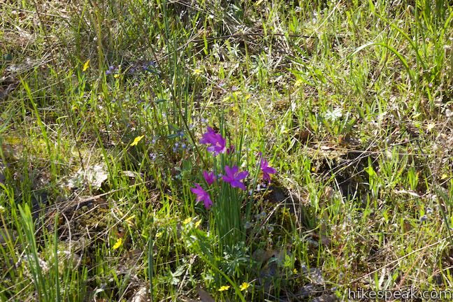
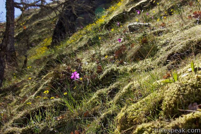
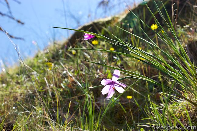
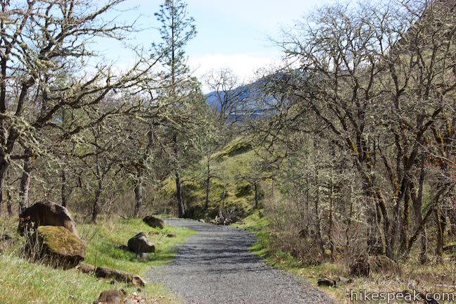
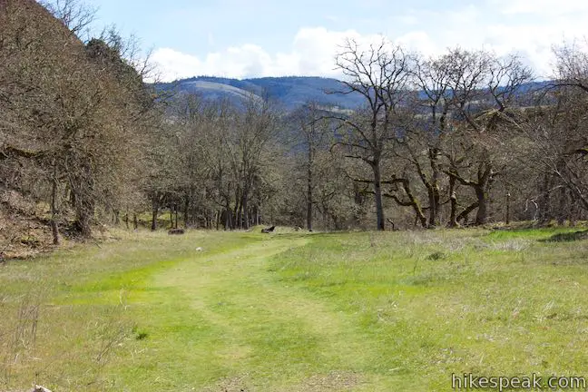
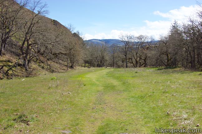
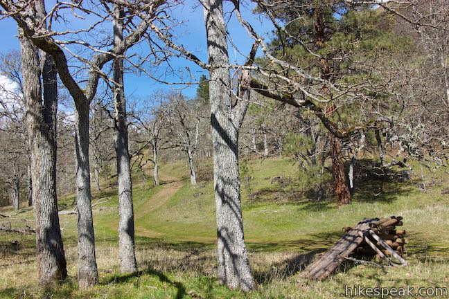
Hike east across basalt bedrock topped with just a think layer of soil where grasses and wildflowers manage to thrive. The trail tips over the rim of a shallow canyon and descends toward Catherine Creek. In the spring, expect to see wildflowers like Oregon sunshine and grass widows clinging to the cliffs to your left. The opposite side of the canyon has a unique look, with mounds of vegetation broken up by slopes of loose basalt.
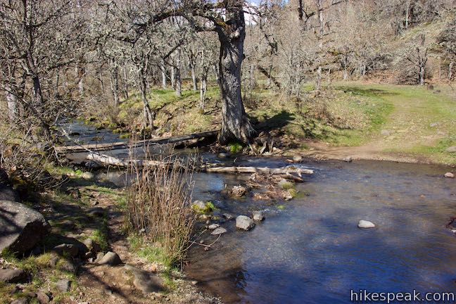
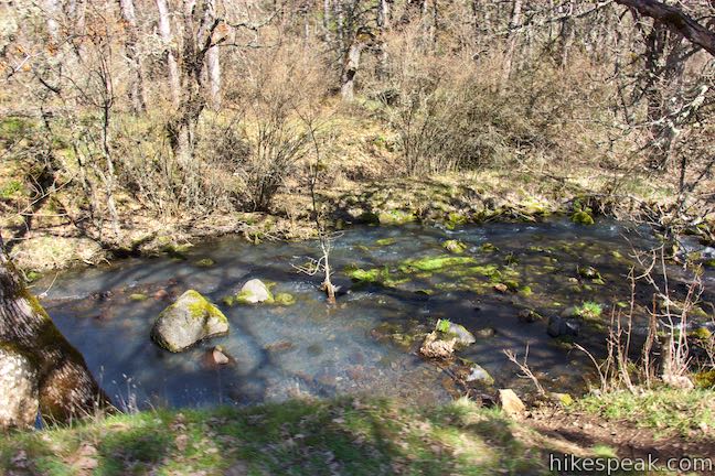
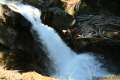
Descend into a riparian area along Catherine Creek. After 0.3 miles of hiking, come to a split in the trail. Take the branch to the right, which is made of gravel and not grass, by a marker with the number 021 (and a no mountain bikes sign). This trail immediately comes to a crossing of Catherine Creek. Things can dry out in the summer and fall, or ask for a bit of rock hopping in the spring. When the creek is really flowing, look upstream to the left, where a wooden footbridge has been positioned to lead you across.
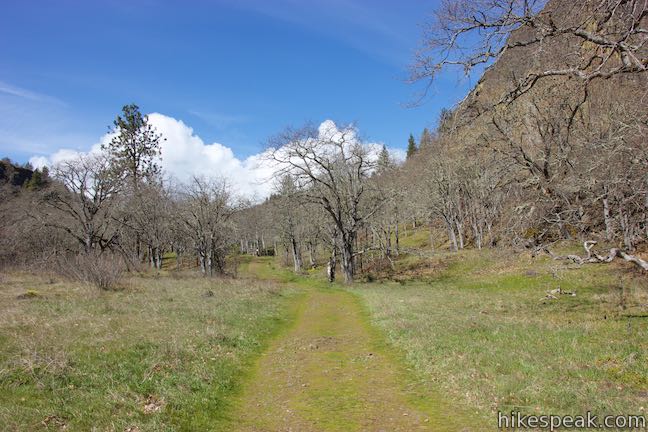
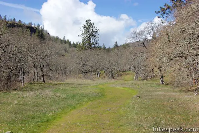
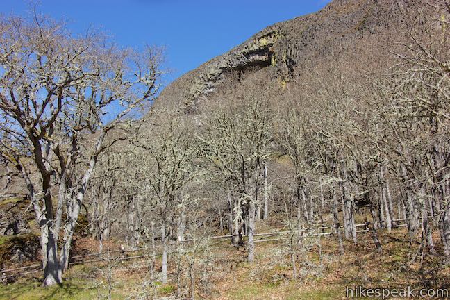
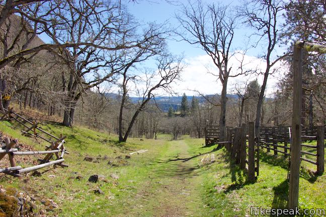
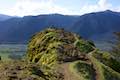
With its biggest obstacle now complete, the trail curves to the left and heads through forest and up into a meadow. As you rise, the view in the opposite direction, looking south toward Oregon, expands (which you can appreciate more on the hike down). Walk up the meadow, noticing the ledge of basalt rising to the right above a talus slop and tree tops. Keep an eye on this wall of rock to spot Catherine Creek Arch.
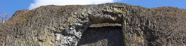
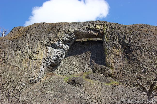
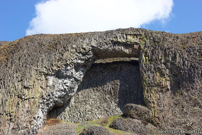
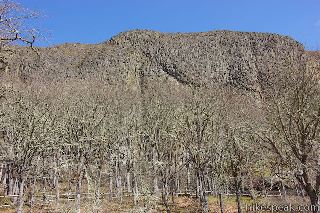
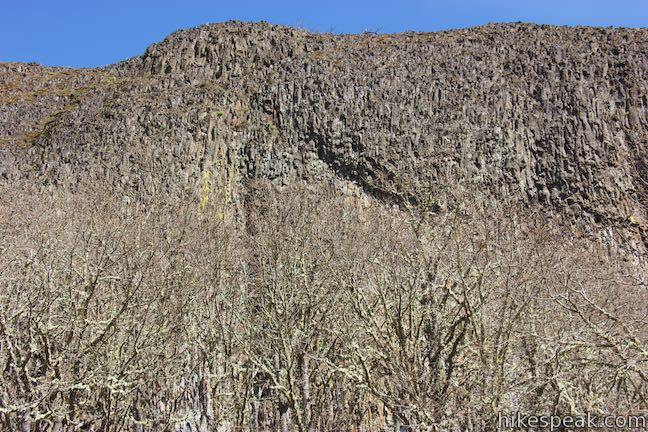
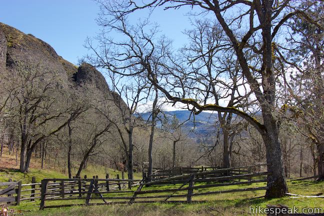
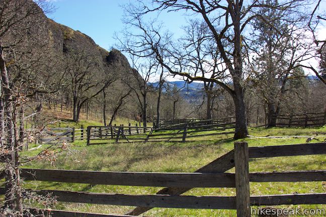
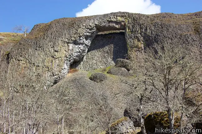
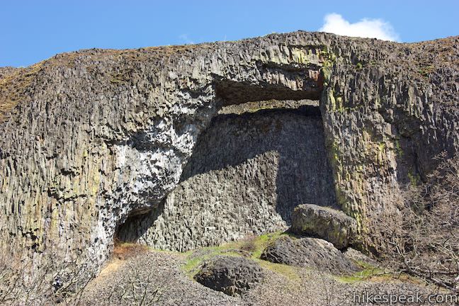
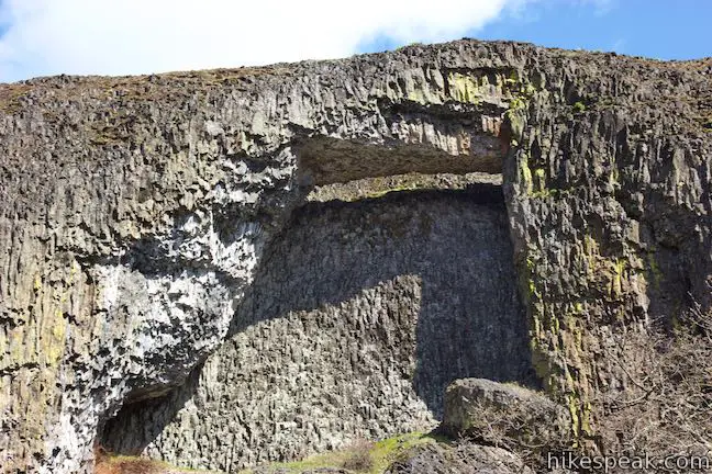
For the best view of the arch, walk through a cluster of view-blocking trees to the dilapidated fence of an old corral. This clear perspective straight up at Catherine Creek Arch is what you came for!
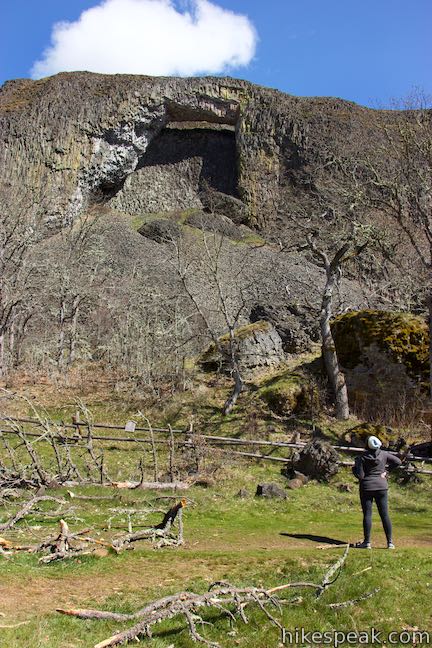
Through the layer of columnar basalt making up Catherine Creek Arch, sits a recessed wall of basalt with a window at the top. In geologic terms, William Sullivan describes the arch as a “splinter of rimrock.” You could imagine a fissure forming near the edge of the ledge that collaborated with some undercutting erosion at the base of the ledge to create Catherine Creek Arch. It is certainly a unique formation.
The arch and the slope below are fenced off and closed to the public, due to the location’s significance to Native Americans as well as the sensitivity of the area.
For those eager to keep hiking, a trail continues up the hill to the north. By following this trail and later doubling back to the right, hikers can return to Old Highway 8 along the bluff above Catherine Creek Arch for a two-mile loop. To stick with the simple 1-mile out and back hike, simply turn around beneath the arch and return the way your came. Another way to create a 2-mile hike is to combine Catherine Creek Arch with Catherine Creek Interpretive Trail, an easy paved loop on the opposite side of Old Highway 8 with lots of gorge views and wildflower potential.
No fee or permit is required to hike to Catherine Creek Arch. Dogs are welcome on leashes. Horses are allowed from May through November. Bikes are not allowed. For a longer hike along bigger cliffs, check out nearby Coyote Wall.
To get to the trailhead: From the intersection of Interstate 205 and Interstate 84 in Northeast Portland, take Interstate 84 east for 55.4 miles to exit 64 in Hood River, following signs for Mount Hood Highway toward White Salmon and Government Camp. At the end of the offramp, turn left to head north on Route 35. Pay a toll of a couple bucks to cross the Hood River Bridge. On the other side, turn right on Highway 14. Travel east for 5.8 miles and bear left up Old Highway 8. Drive 1.4 miles and park in the spaces off the left side of the road. This hike begins from the left side of the road. Catherine Creek Interpretive Trail is on the right side of the road.
Trailhead address: Catherine Creek Day Use Area, Old Highway 8, Lyle, WA 98635
Trailhead coordinates: 45.7105, -121.3621 (45° 42′ 37.8″N 121° 21′ 43.6″W)
View Coyote Wall & Catherine Creek in a larger map
Or view a regional map of surrounding Washington trails and campgrounds.


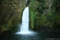
 | Catherine Creek Interpretive Trail This short, paved loop explores meadows that burst with seasonal wildflowers, passing an overlook for a small waterfall and plentiful gorge views. |
 | Coyote Wall This partial loop covers 5.8 miles as it ascends Coyote Wall to great views of its basalt cliffs and across Columbia River Gorge. |
 | Dog Mountain This 6.65 to 7.4 hike explores forests, wildflower-covered slopes, and grand views from a mountain along the Columbia River Gorge. |
 | Hamilton Mountain The beautiful 7.75-mile lollipop loop visits bombastic waterfalls and panoramic cliffs on the Washington side of the Columbia River Gorge in Beacon Rock State Park. |
 | Beacon Rock Trail This 1.6-mile hike follows an impressively engineered trail packed with switchbacks that scale a monolith along the Columbia River. |
 | Mosier Twin Tunnels This 2 to 9.5-mile hike ventures up Historic Columbia River Highway State Trail to a pair of tunnels carved into basalt cliffs on the side of Columbia River Gorge. |
 | Eagle Creek Trail This 4.55-mile hike ventures up a beautiful and dramatic canyon to impressive waterfalls like Metlako Falls, Lower Punchbowl Falls, and Punchbowl Falls. |
 | Wahclella Falls This 2-mile hike visits a sublime waterfall in Oregon's Columbia River Gorge. |
 | Guler Ice Cave in Gifford Pinchot National Forest This short hike goes underground to explore an old lava tube with frozen stalactites and stalagmites, plus other interesting cave features. |
 | More trails in Washington Explore other hikes in the Evergreen State, including Mount Rainier National Park and Mount Saint Helens National Volcanic Monument. |
Go the extra miles...
Submit a rating of this hike to go with your comment. Contribute to the average trail rating.