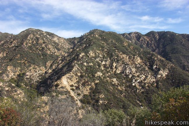
Mount Lowe Road and Sunset Ridge Trail to Cape of Good Hope and Echo Mountain in the San Gabriel Mountains
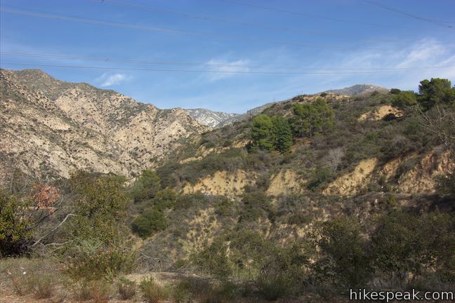
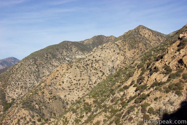
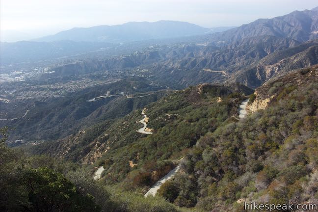
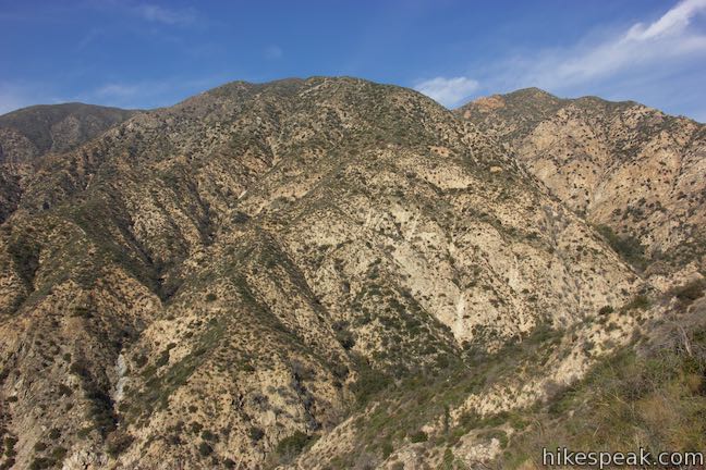
Starting near the base of the San Gabriel Mountains in Altadena, Mount Lowe Road is an 8.9-mile long partially paved trail rising up the range to an intersection with Mount Wilson Red Box Road near the summit of Mount Wilson. Of course, you don’t have to go that full distance on a hike up Mount Lowe Road. Sunset Ridge Trail intersects and parallels the bottom of Mount Lowe Road and is even more enjoyable to hike on, providing both an alternative to Mount Lowe Road and the possibility to form a loop.
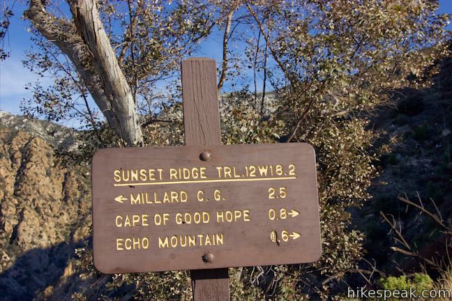
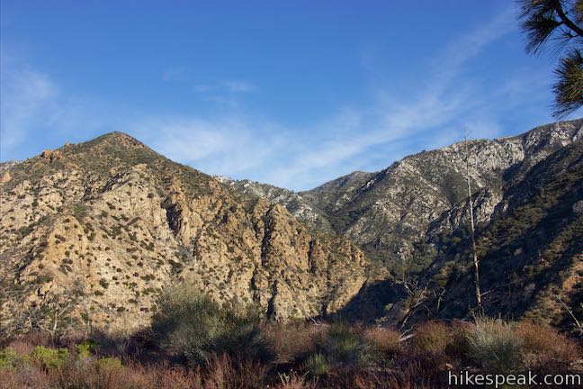
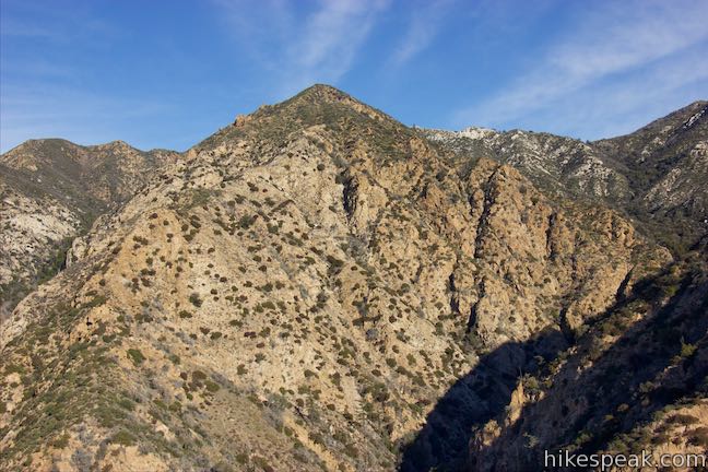
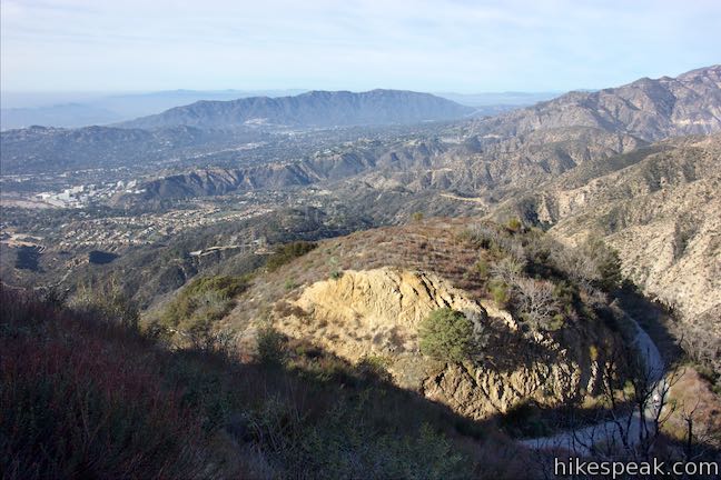
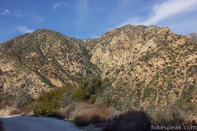
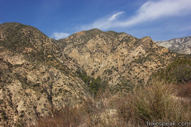
The trails merge below Cape of Good Hope, a landmark left behind from Mount Lowe Railway, which was constructed around the turn of the 19th century. Cape of Good Hope is where the railway transitioned from southward views over Las Flores Canyon to westward views over Millard Canyon as it traveled from a resort on Echo Mountain to lodging higher up in the San Gabriel Mountains. While the railway is gone, Cape of Good Hope remains view-packed and is a desirable destination for hikers. Via Sunset Ridge Trail, it is 2.75 miles one way to Cape of Good Hope, ascending 1,425 feet. Mount Lowe Road is 0.3 miles shorter. Combine the dirt trail and the paved road for a 5.2-mile loop.
From Cape of Good Hope, this hike can be extended to visit Mount Lowe Trail Camp, Inspiration Point, the ruins on Echo Mountain, and other points in Angeles National Forest. The ruins of the White City Resort on Echo Mountain are one mile from the top of Sunset Ridge Trail, following the old railway route. Taking Sunset Ridge Trail to Echo Mountain is 0.8 miles longer each way than the more widely used Sam Merrill Trail.
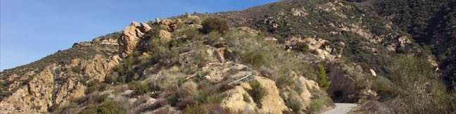
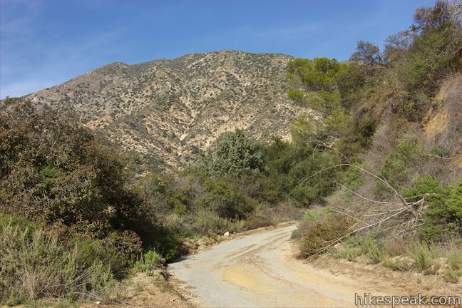
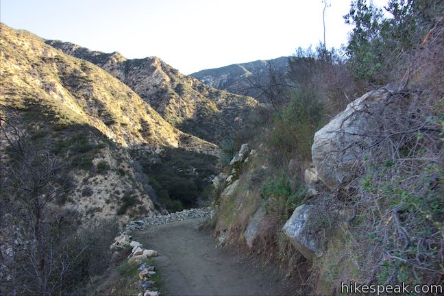
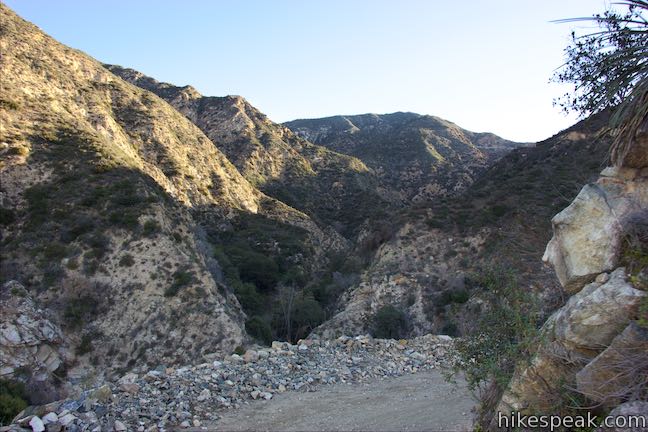
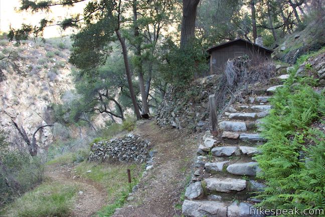
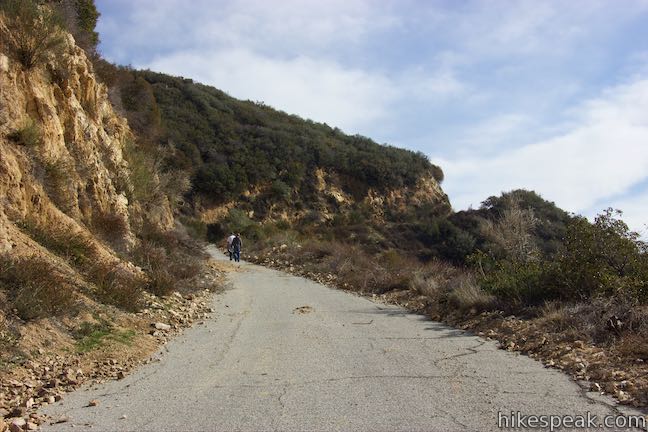
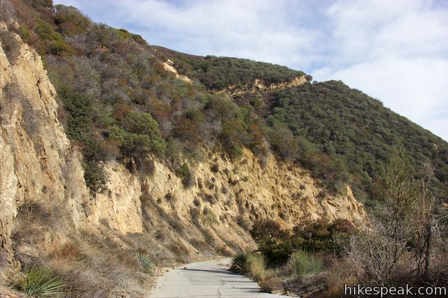
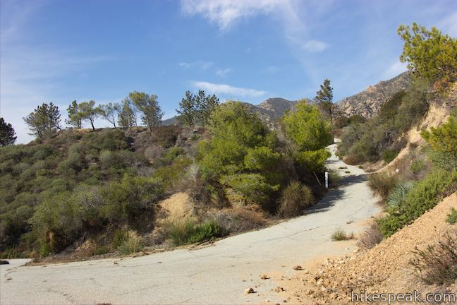
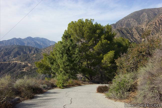
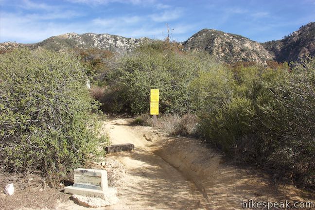
Set out hiking up Mount Lowe Road from Chaney Trail (a paved and drivable road that leads to Millard Campground and the trail to Millard Falls). Mount Lowe Road begins from a crest, 0.5 miles from the end of the road. Step around a white gate labeled 2N50, following signs for Echo Mountain and Mount Lowe. The paved road heads east, coming to a marked junction after 1/8 of a mile. To the left, a lower section of Sunset Ridge Trail descends to Millard Campground. If you park at the campground instead, you can hike 0.8 miles up this trail to join Mount Lowe Road.

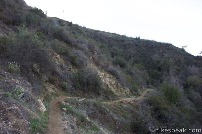
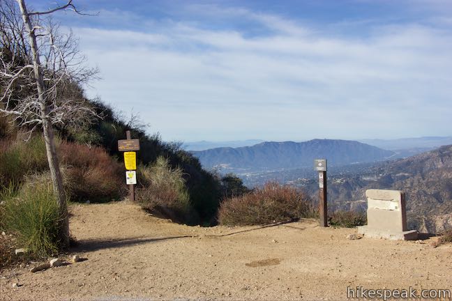
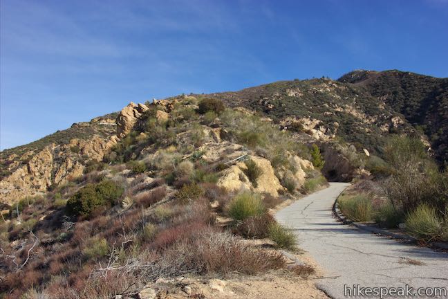
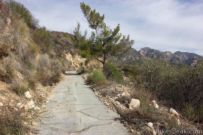
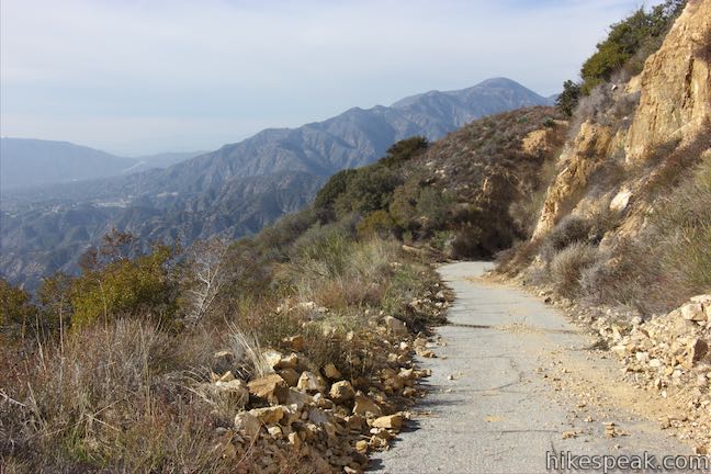
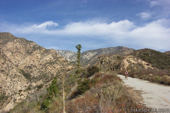
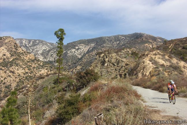
Proceed up Mount Lowe Road for another quarter mile to find the next section of Sunset Ridge Trail. You can now either continue up Mount Lowe Road, which is paved all the way up to just past Cape of Good Hope, or turn left on Sunset Ridge Trail, which is an unpaved dirt single track.

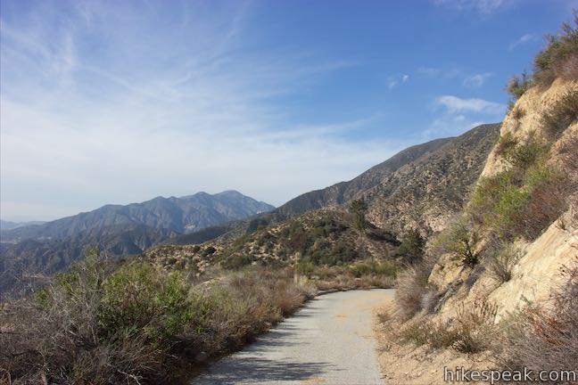
Mount Lowe Road
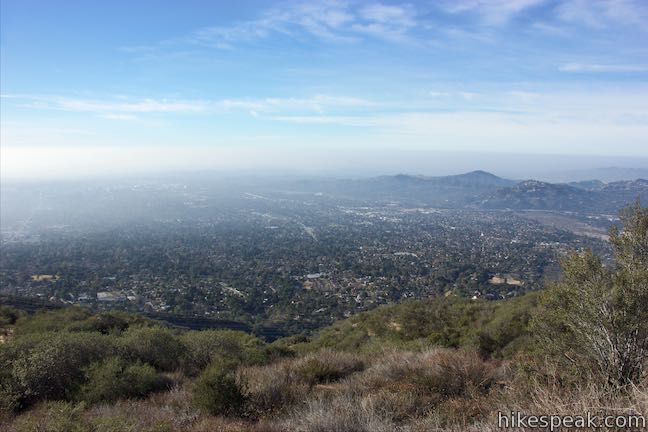
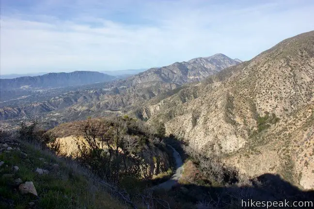
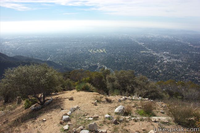
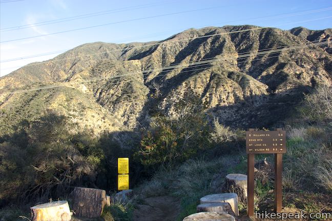
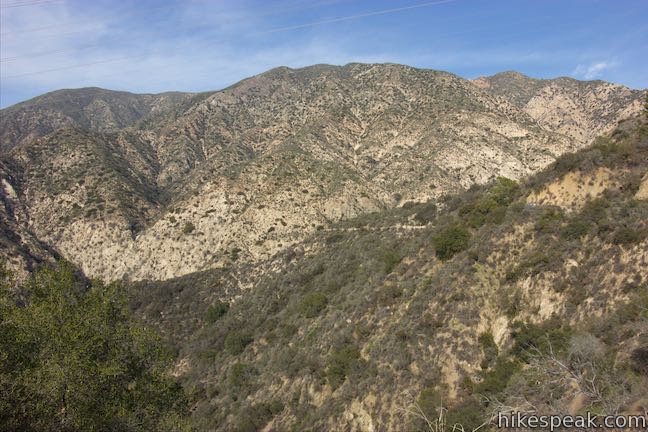
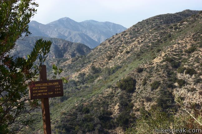
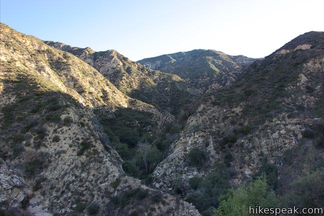
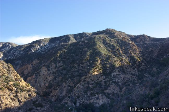
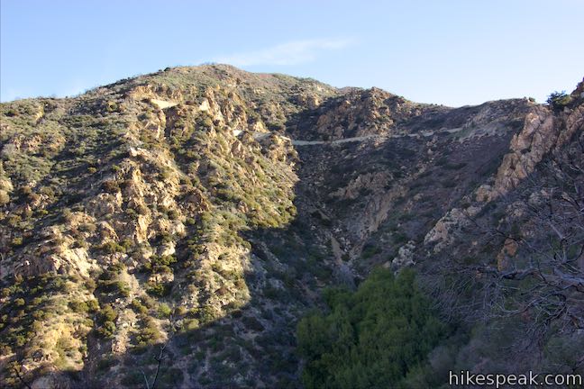
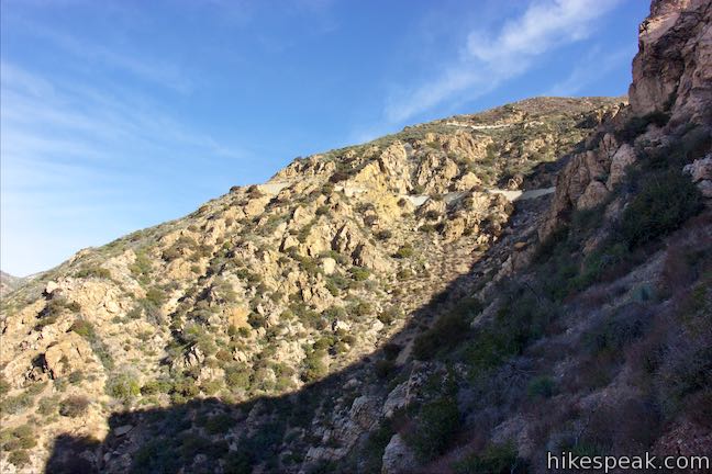
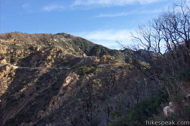
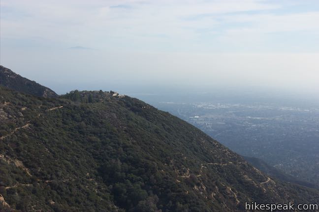
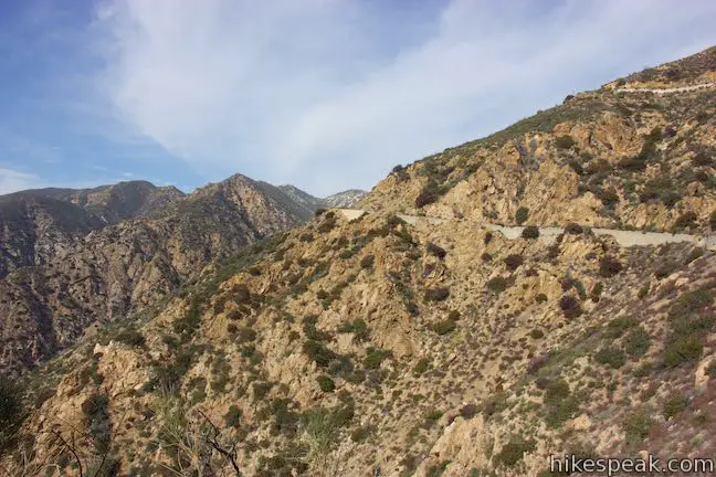
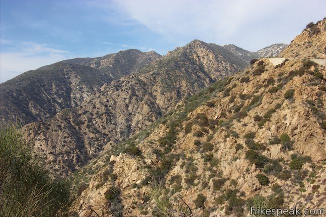
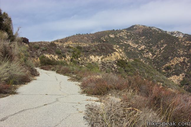
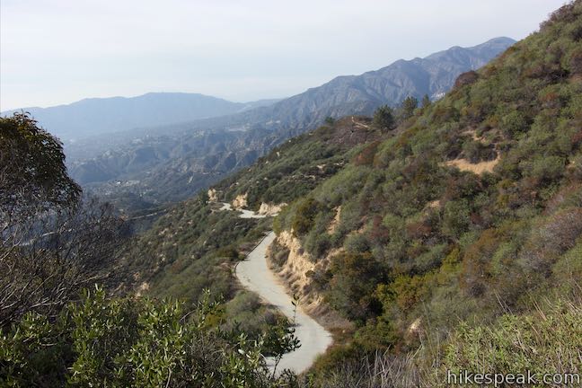
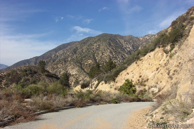
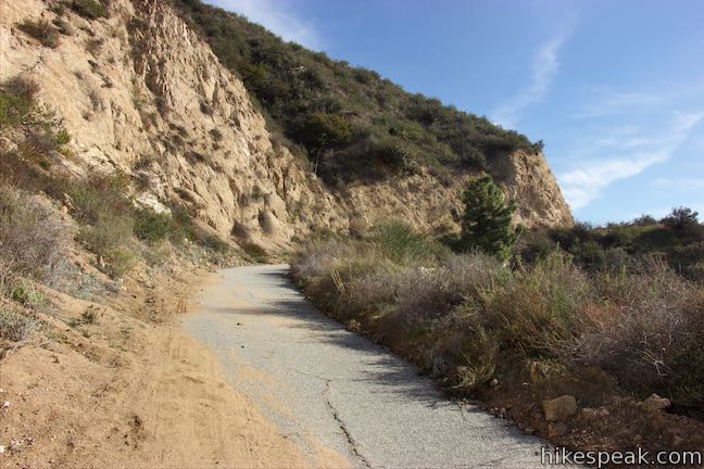
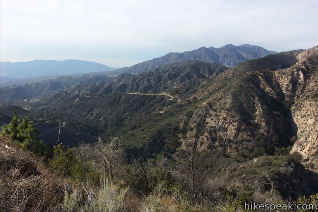
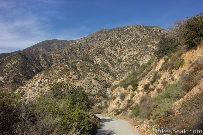
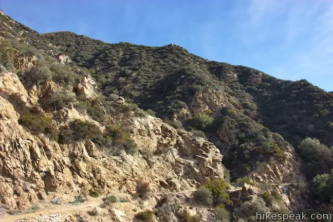
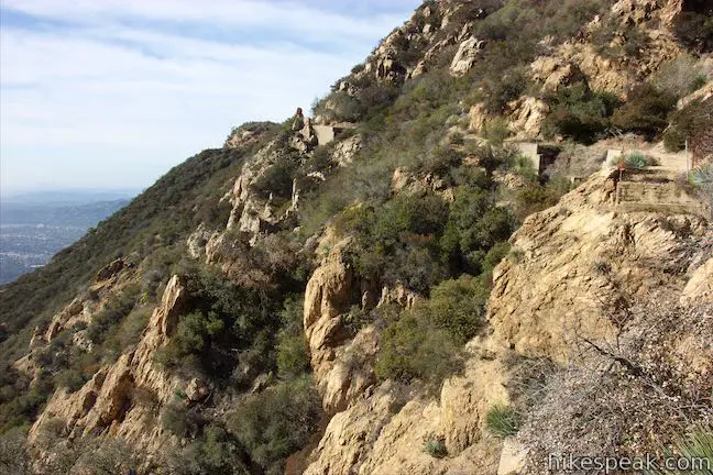
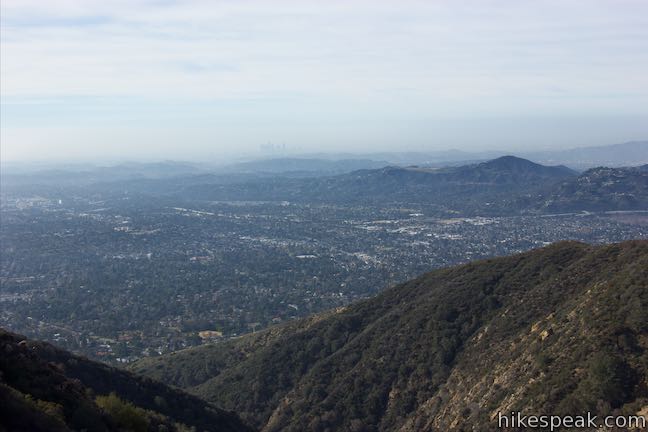
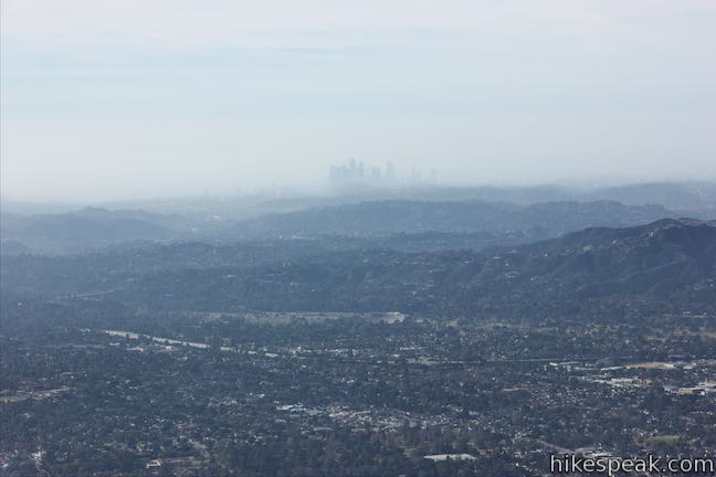
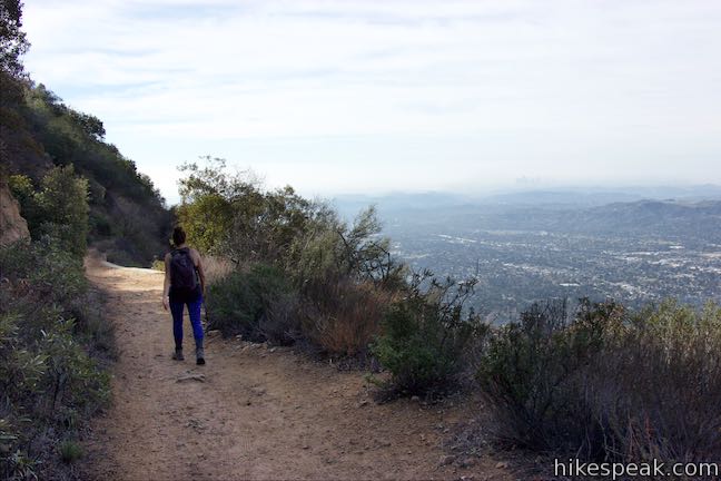
Mount Lowe Road offers more views over cities to the south than it does of the mountains and canyons to the north (unlike Sunset Ridge Trail). If you hike up this way, there are only a couple things to note. At 1.55 miles from the bottom of Mount Lowe Road (and 0.85 miles below the final junction with Sunset Ridge Trail), you’ll pass a short spur up to Sierra Saddle, where a picnic area sits on a landing by a meeting with Sunset Ridge Trail. Mount Lowe Road weaves up the mountain from there and comes to a junction with the top of Sunset Ridge Trail, 2.4 miles from the start. Across from the junction, which is on the left, enjoy views of Echo Mountain on the rise to the east.
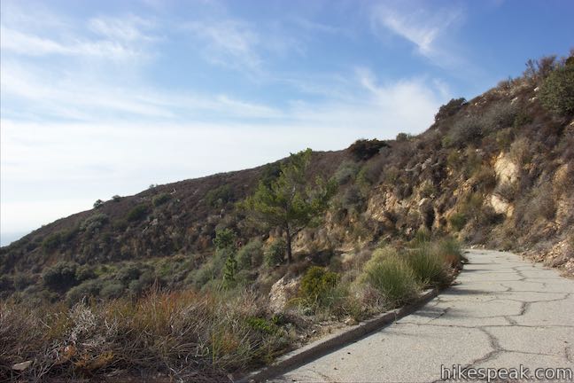
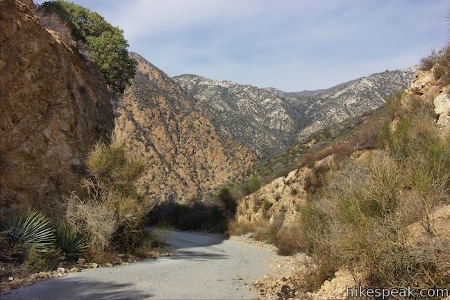
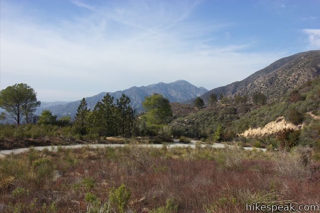
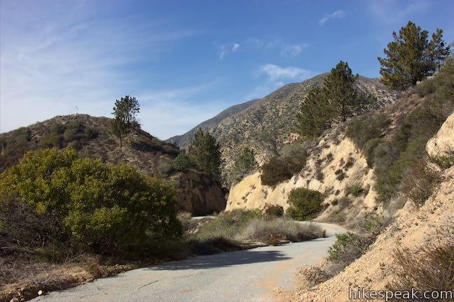
A short distance farther up Mount Lowe Road, Echo Mountain Trail parts to the right, following the old railway route down to Echo Mountain. Across from that is Cape of Good Hope. Just past that, and 2.5 miles from Chaney Trail, the pavement ends on Mount Lowe Road. It is unpaved for the duration, passing more attractions on the old route of Mount Lowe Railway as it ascends another 2.8 miles to Mount Lowe Trail Camp, followed by a spur to Inspiration Point. It is a full 6.45 miles from Cape of Good Hope to the very top of Mount Lowe Road.
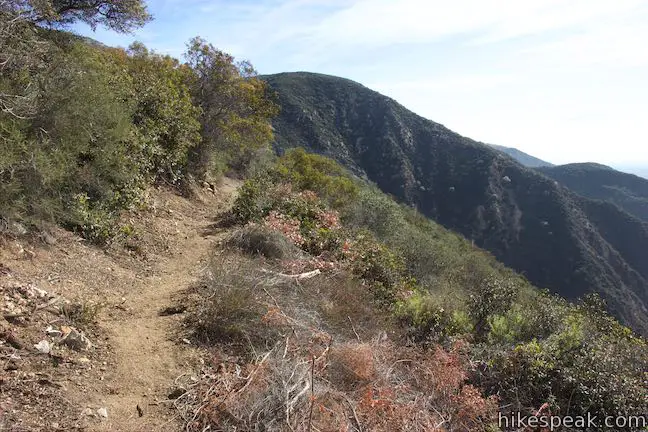
Sunset Ridge Trail
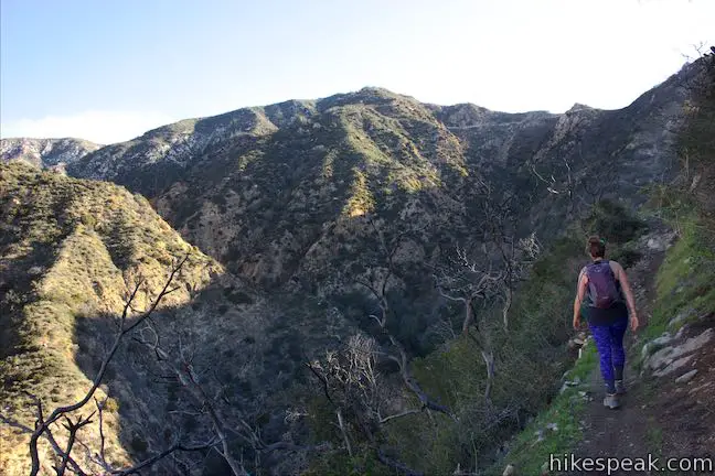
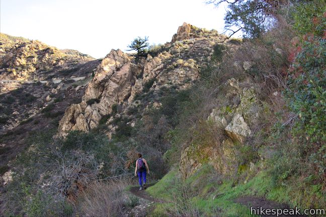
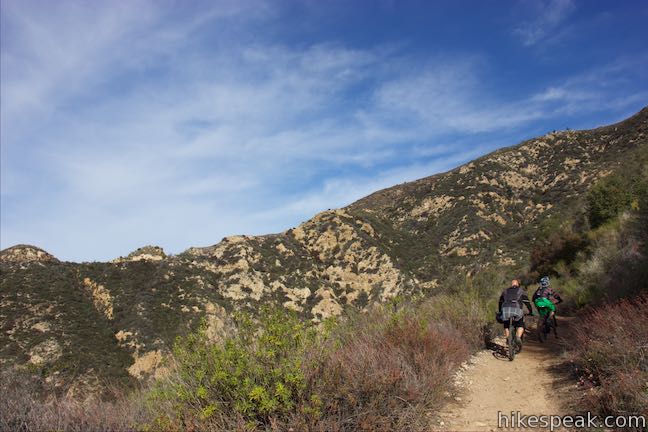
Unless you’re hiking in a large group or just don’t like narrow trails, you will probably want to hike at least one direction on Sunset Ridge Trail (and maybe both ways, since that will limit your contact with pavement). Take the left turn onto Sunset Ridge Trail, 0.37 miles from the bottom of Mount Lowe Road. The dirt track is level at first, angling north toward Millard Canyon as the road rises away to the right.
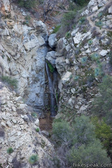
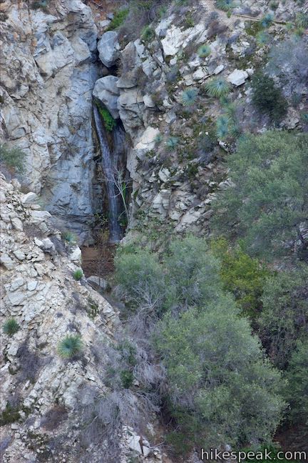
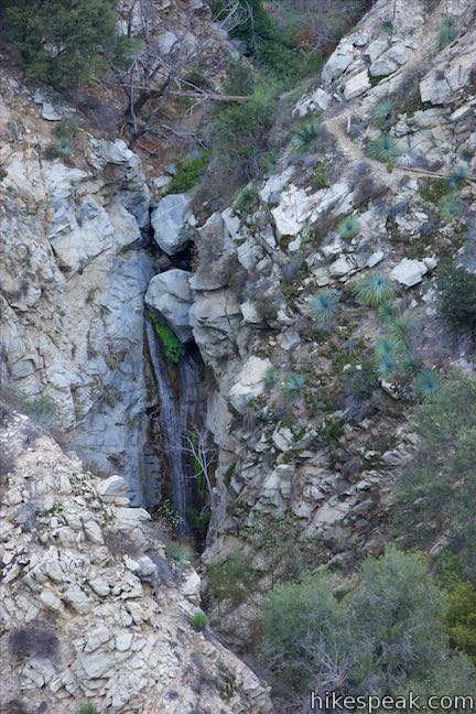
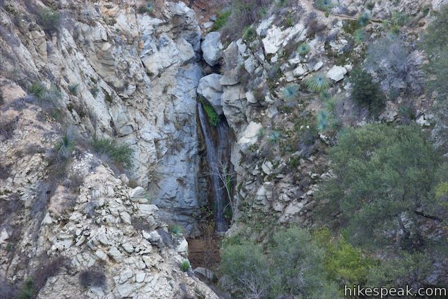
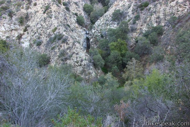
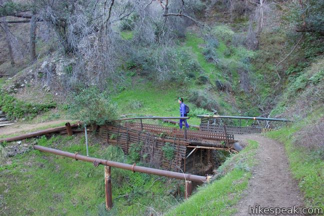
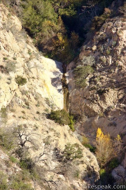
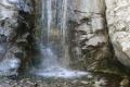
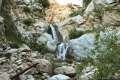
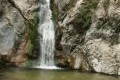
Look down on Millard Campground, cradled by ridges to the west, and come around a curve to the right to enter a narrow section of Millard Canyon. The trail crosses the steep side of the ridge opposite Millard Falls. You will get a good view of the waterfall after a quarter mile on Sunset Ridge Trail. A column of water passes below a choke stone at the top of the falls and drops fifty feet to the canyon floor. Enjoy the sound of the falling water as you continue up the trail.
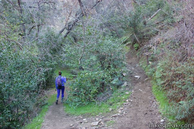
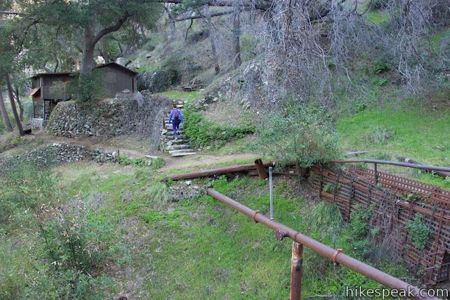
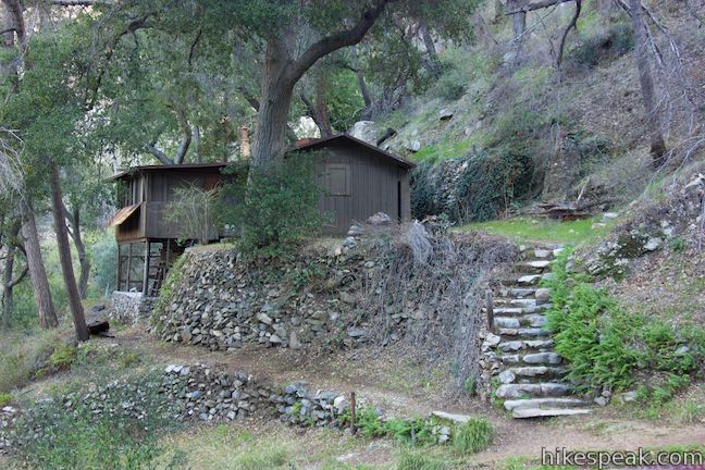
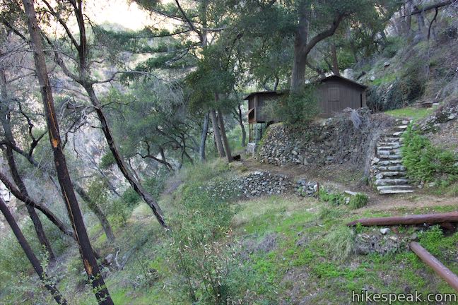
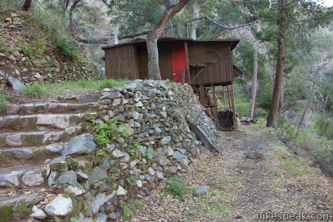
Following the contours of the canyon, Sunset Ridge Trail curves to the left and comes up along the side of the canyon above Millard Falls. After less than half a mile on Sunset Ridge Trail (and 0.85 miles from the start of the hike) you will come to a split. A trail to the left continues up Millard Canyon, quickly passing a cabin owned by Altadena Mountain Rescue Team. Beyond that, a path drops into the canyon that can be used to hike farther up to places like Dawn Mine.
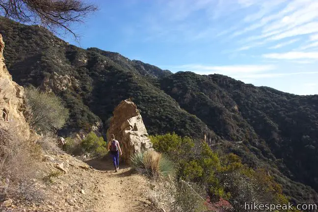
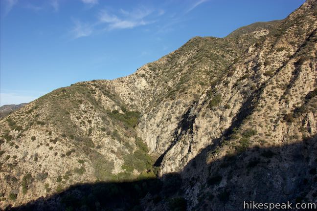
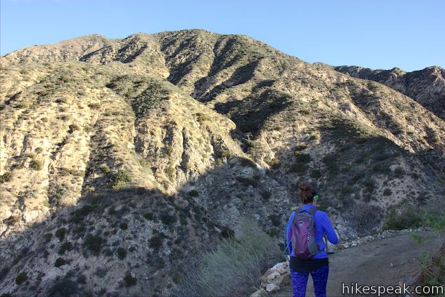
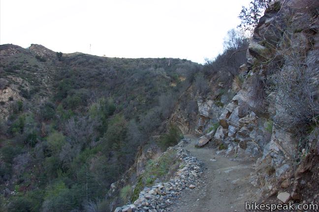
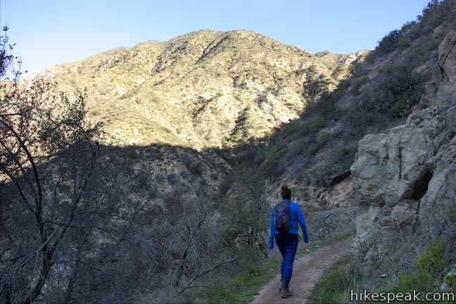
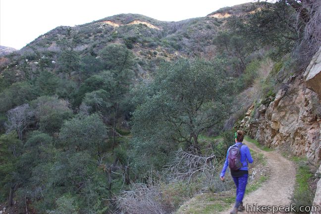
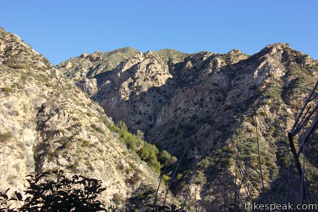
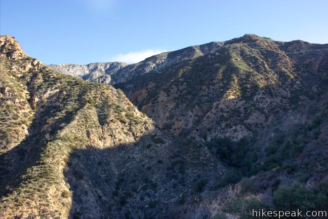
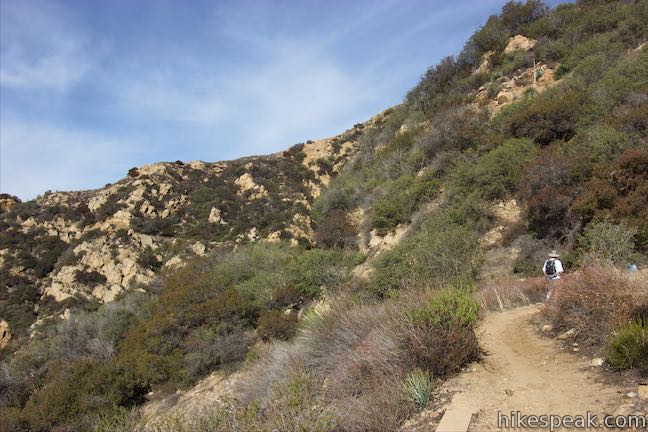
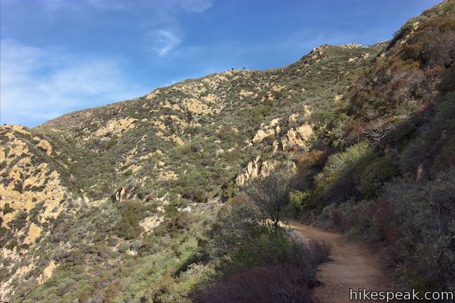
Stay to the right at the junction, following the sign for Sunset Ridge Trail to continue the ascent toward Cape of Good Hope. The trail makes a sharp turn to the right, followed by a quick turn to the left, forecasting numerous switchbacks in the trail to come. Ascend to the east, gaining broader views up and across Millard Canyon.
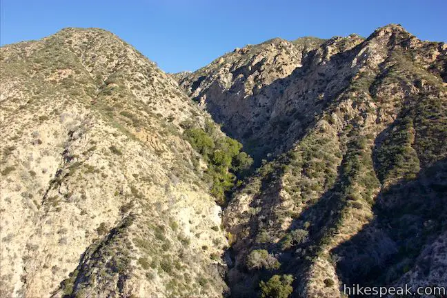
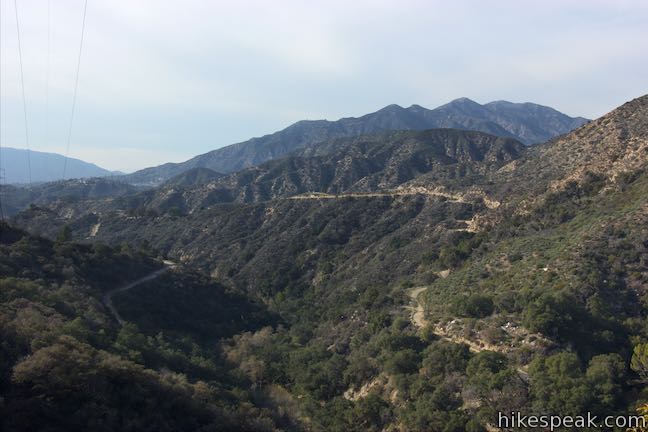
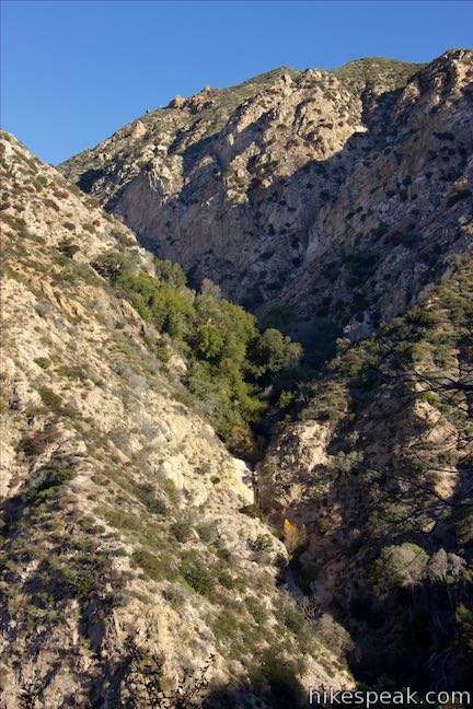
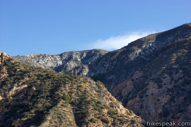
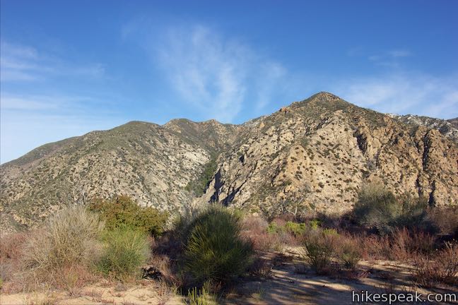
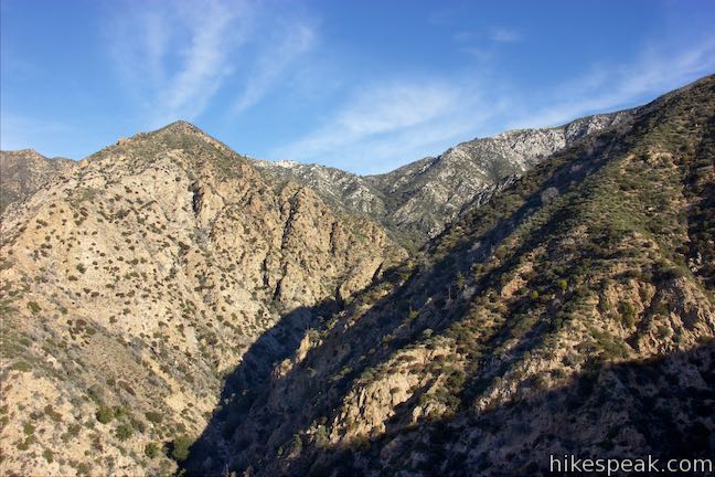
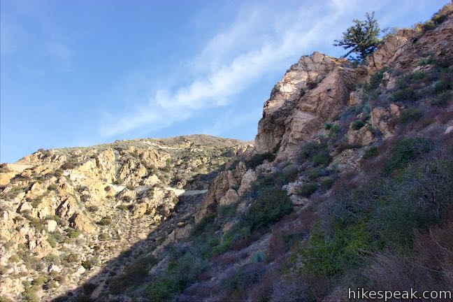
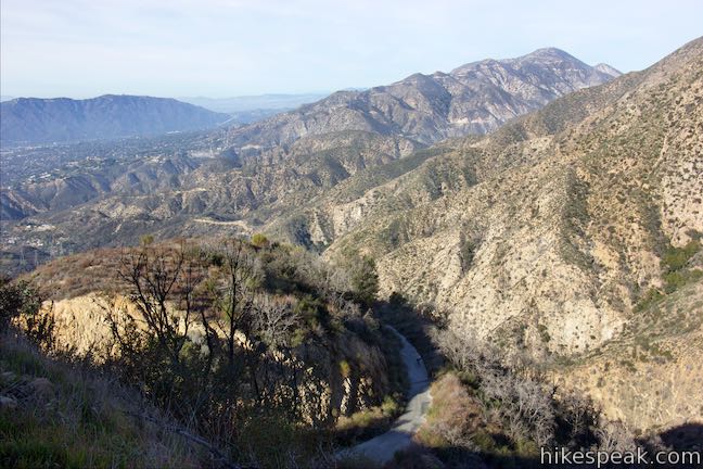
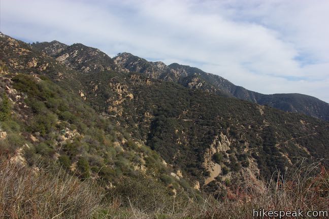
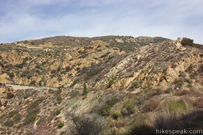
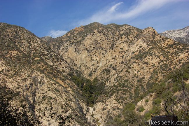
Three tenths of a mile above the junction, you will hit a string of longer switchbacks. Look northwest up the Saucer Branch of Millard Canyon and see if you can spot a narrow waterfall sliding down a short rock face. Tan-colored rock formations jut out from the mountains above the steep side canyon. After a trio of switchbacks, the trail turns east and continues to ascend the ridge. Pass through a bend just below Mount Lowe Road and go up a few more switchbacks to come close to being alongside the road. Stick with Sunset Ridge Trail, which goes up the spine of the ridge before dropping off the left side.
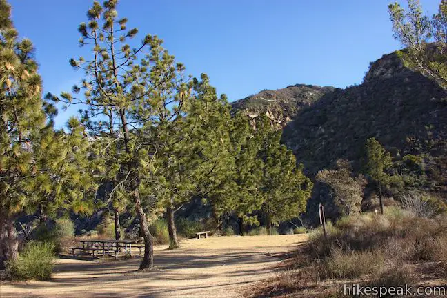
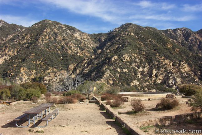
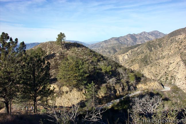
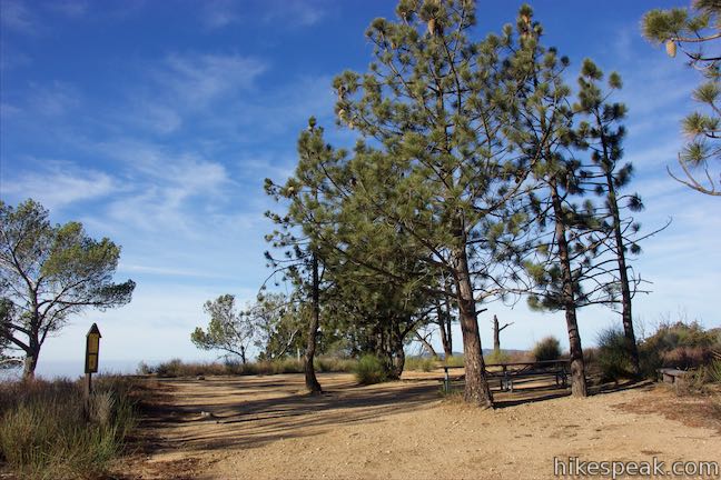
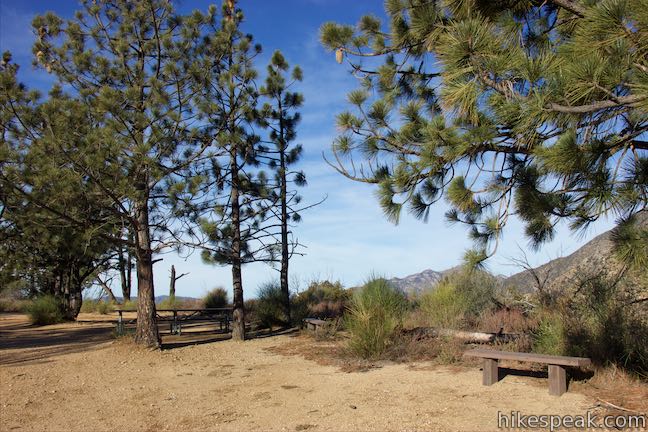
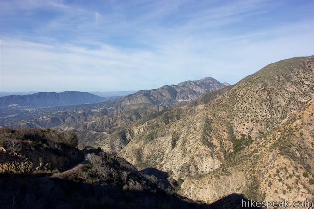
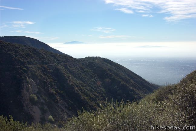
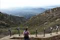
Make your way along the side of Sunset Ridge up to Sierra Saddle, a picnic area by the trail, 1.9 miles from the start of the hike (after 1.53 miles on Sunset Ridge Trail). Sunset Ridge Trail continues to the left. Straight ahead, a paved road descends to Mount Lowe Road. To the right, pines offer shade on a scenic landing. Picnic tables and benches on Sierra Saddle are appointed with views south over Pasadena and north into the San Gabriel Mountains.
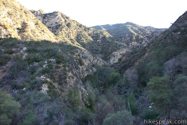
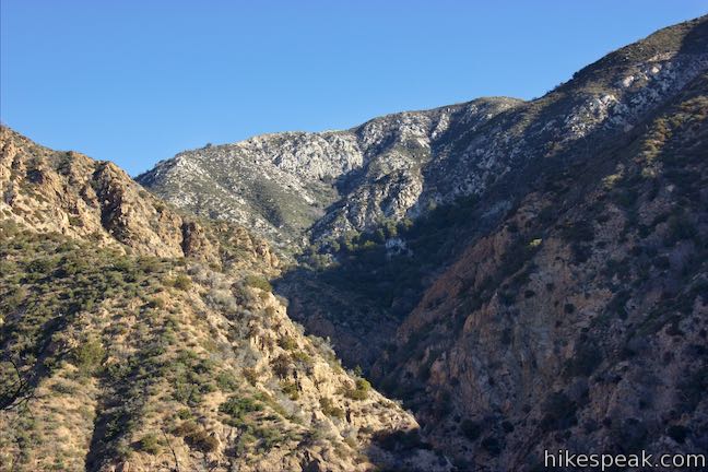
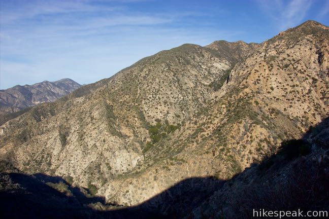
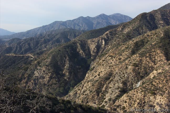
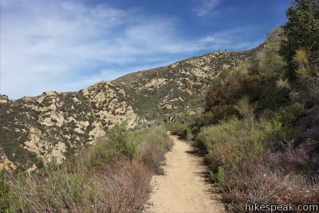
Sunset Ridge Trail continues for another 0.8 miles. Over this stretch, you’ll find views north across Millard Canyon toward Brown Mountain and Tom Sloan Saddle. The trail passes through chaparral and charred branches that were damaged by the 2009 Station Fire.
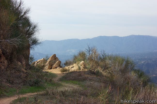
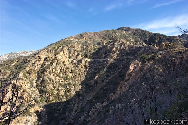
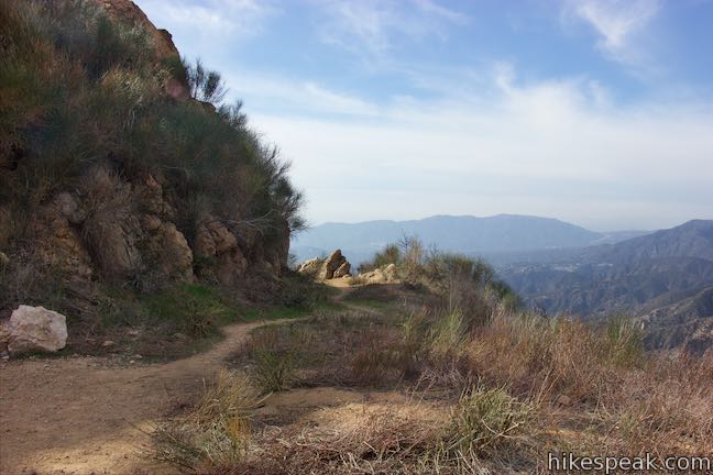
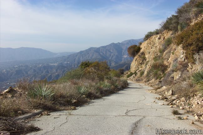
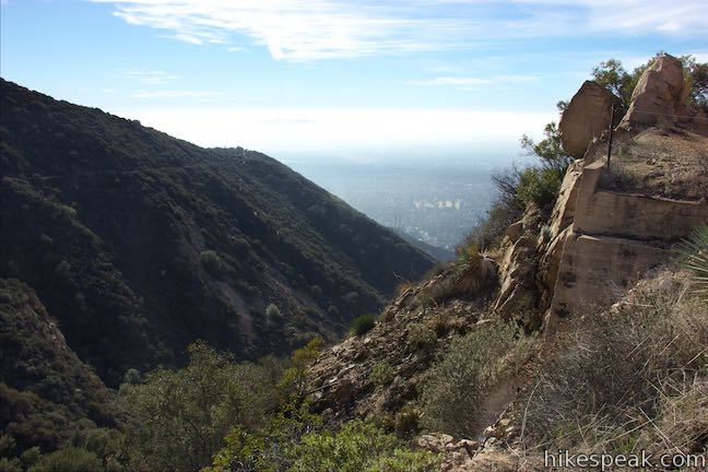
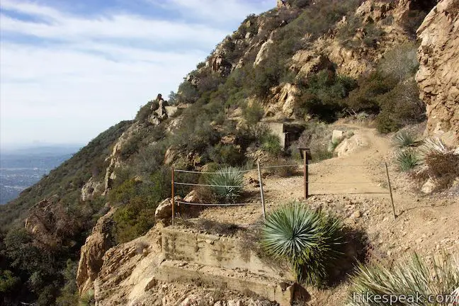
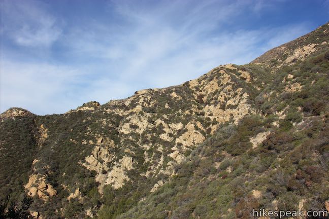
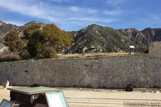
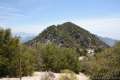
On the final switchbacks, look up at Cape of Good Hope, a rocky point on the ridge above. Spot a stone wall that supported the old railway as it wrapped around the cape. To the left of Cape of Good Hope, Mount Lowe Road cuts across the mountainside past a jumble of small cliffs.

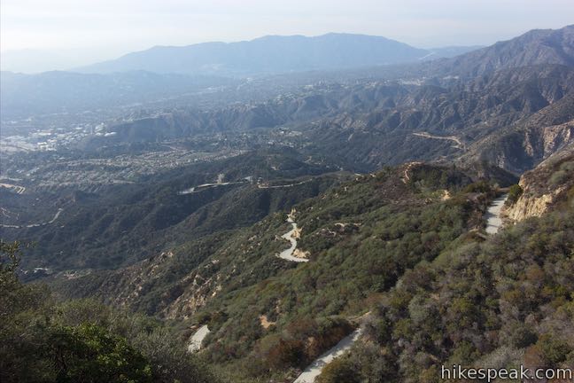
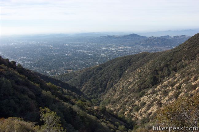
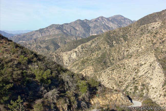
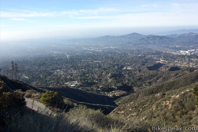
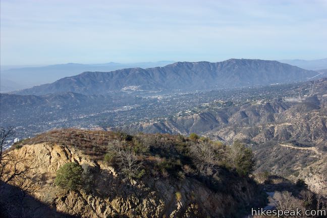
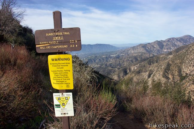
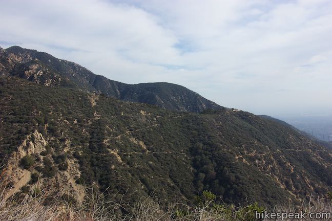
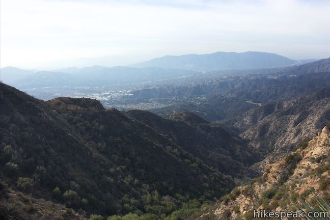
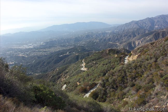
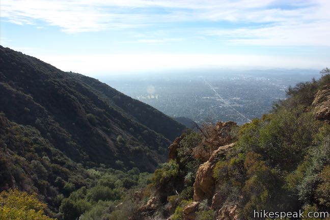
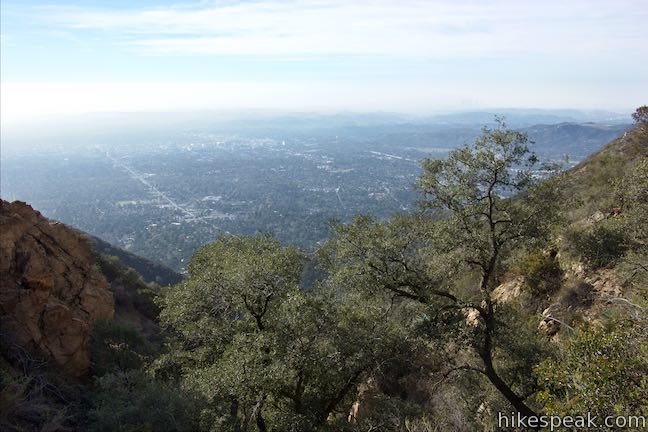
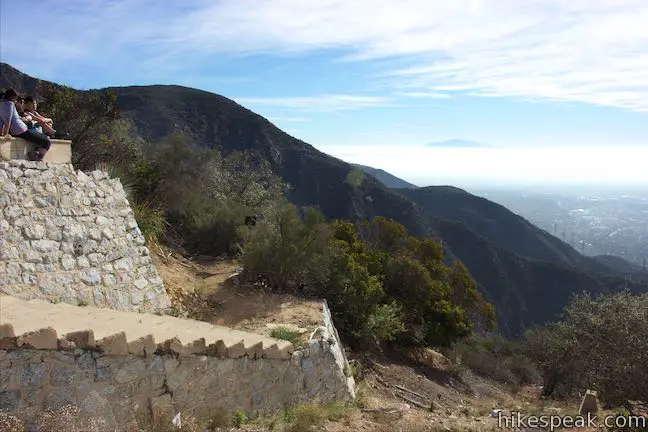
Sunset Ridge Trail comes to an end at a T-junction with Mount Lowe Road. Having hiked 2 1/3 miles up Sunset Ridge Trail (and 2.7 miles from the trailhead), the first thing you should do is walk to the opposite side of the road and take in the perspective off the east side of the ridge toward Echo Mountain. You’ll see the zigzagging switchbacks of Sam Merrill Trail as it ascends from Altadena. Echo Mountain Trail wraps around the back of Las Flores Canyon, which is between your vantage and Echo Mountain, joining Sam Merrill Trail on its course to the Echo Mountain ruins.
To the right, Mount Lowe Road descends 2.4 miles back to Chaney Trail (the road where the hike started). Even if you don’t plan to hike too much farther, you should at least turn left to hike a short distance up Mount Lowe Road to Cape of Good Hope.

Cape of Good Hope
On the left side of Mount Lowe Road next to Sunset Ridge Trail, an unmarked single track breaks off the road and wraps around the west side of Cape of Good Hope. You can hike up this path or stick with the road. At 150 feet from Sunset Ridge Trail, Echo Mountain Trail parts from the right side of Mount Lowe Road. This is the route to Echo Mountain, one mile away.
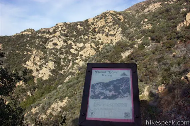
Ahead, Mount Lowe Road cuts through the ridge alongside Cape of Good Hope. In the days of the railway, the road was not here and the ridge connected directly to the cape. Walk to the other side of the cut-through part of the ridge and you’ll find a panel on the left next to a path around the cape. The panel offers a bit of history about Mount Lowe Railway. It reads:
The railway from Echo Mountain to the Alpine Tavern covered 3 1/2 miles with 127 curves and 114 straight segments. You are looking at the longest straight segment on that route—a mere 225 feet long (less than 1/20 of a mile)!
The short, straight section is just above Cape of Good Hope and the rest of the route was much tougher to design, with 18 bridges and so many curves. Mount Lowe Railway was in operation from 1893 to 1936 when it was abandoned due to lack of funding and natural damage like fires. The railway was used by trolleys with an overhead electric line.
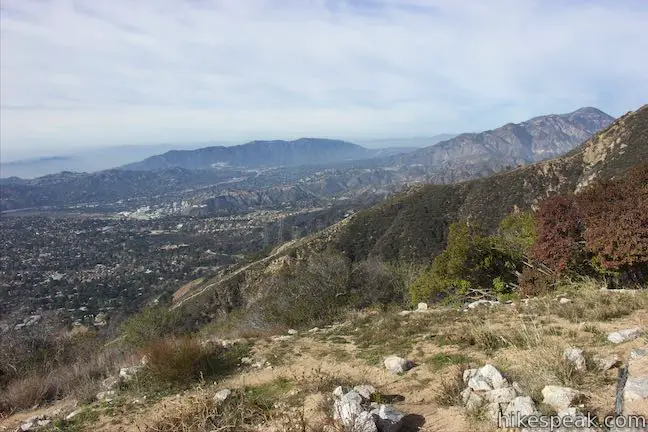
At the Cape of Good Hope, the railway made a panoramic 200-degree turn around the rocky point. Between Echo Mountain and the cape, the railway presented views south down Las Flores Canyon. After that, passengers were treated to views west down Millard Canyon. Looking out from Cape of Good Hope, it’s easy to understand why Mount Lowe Railway was such an attraction, marketed as “the grandest scenic trip on Earth” and “the 8th wonder of the world.”
Take the path around Cape of Good Hope to return to Mount Lowe Road near Sunset Ridge Trail. If you are ready to head back, Cape of Good Hope makes a satisfying high point for a hike that is 5.5 miles round trip (up and back on Sunset Ridge Trail), 4.9 miles round trip (up and back on Mount Lowe Road, or 5.2 miles round trip (up one trail and down the other).
Want to hike farther? Echo Mountain Trail meets Mount Lowe Road next to the Cape of Good Hope, following the old railway route down to the ruins of a resort built on Echo Mountain. Extend the hike by 2 miles round trip to visit Echo Mountain.
Want to hike even farther? Go beyond Echo Mountain and hike two miles up Castle Canyon Trail to Inspiration Point. Return the same way or take Mount Lowe Road back to Cape of Good Hope to form another loop that adds 6.35 miles to the hike.
Echo Mountain Trail to Echo Mountain
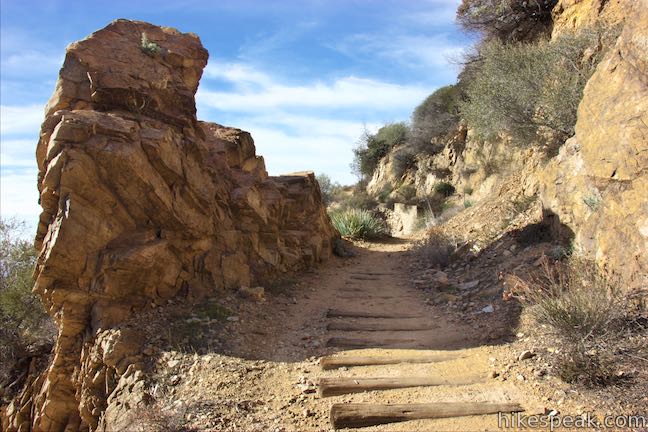
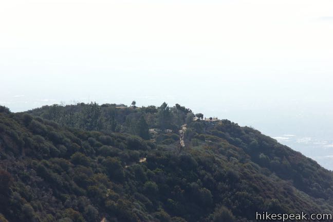
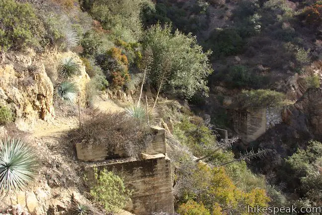
Cape of Good Hope was a fine attraction on Mount Lowe Railway, but guests couldn’t get there without first reaching the grand resort on Echo Mountain. Echo Mountain Trail follows the path of the old railway from Cape of Good Hope to the ruins of Echo Mountain. Hike east on Echo Mountain Trail from a junction on Mount Lowe Road that is well marked, just across from Cape of Good Hope. You will only need to hike 120 yards down this trail to reach another landmark on the old railway route. The trail slips past a pointed rock on the right called Sentinel Rock. Look on the ground next to the rock and you’ll see railroad ties left over from the old railway.
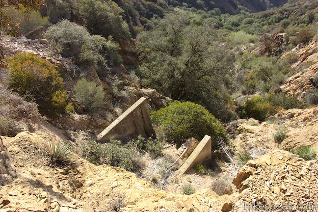
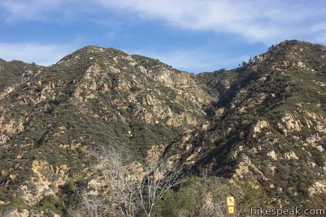
Sentinel Rock was just after the 9th and final bridge on the railway between Echo Mountain and Cape of Good Hope. Above the cape, there were nine more bridges on the way to Alpine Tavern (now Mount Lowe Trail Camp). Continue along Echo Mountain Trail past the remnants of High Bridge. The concrete feet that supported this trestle bridge can be seen along the trail. Panels by the trail explain that the bridge was 113 feet long and 35 feet high, allowing the railway to take a straight course around the steep, uneven, and curved side of the canyon. Walk along the trail between the ends of the bridge, looking down Las Flores Canyon toward Pasadena and the other cities below. Imagine what it must have been like to ride Mount Lowe Railway at the start of the 20th century.
Echo Mountain Trail continues down around the back of the canyon past a panel that instructs you to look up the ridge above the trail to see the site of Circular Bridge, a famed bend on Mount Lowe Railway. Circular Bridge is part of the railway above Cape of Good Hope and it took 1 1/4 miles of track to reach the rounded 400-foot bridge from the location of the panel. If you were traveling directly, it would be just 1/5 of a mile and 700 vertical feet from this spot to Circular Bridge.
Continue down the trail past more pieces from the railway. After 0.77 miles, Echo Mountain Trail comes to a junction. To the right, Sam Merrill Trail descends to a trailhead in Altadena. To reach the Echo Mountain ruins, bear left to hike the last 0.2 miles.
Before reaching the ruins, you’ll pass through junctions on the left with Upper Sam Merrill Trail and Castle Canyon Trail. Both trails allow hikers to explore higher in the mountains. Taking Castle Canyon Trail up to Inspiration Point is a fine extension.
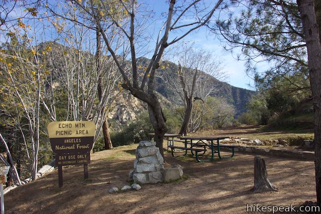
After the two junctions, pass Echo Mountain Picnic Area, which was established by the old tennis grounds on the northwest side of the ruins. The picnic area is in a peaceful pine grove and is a nice spot to take a break after visiting the ruins.
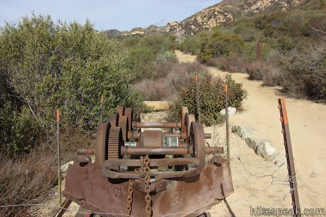
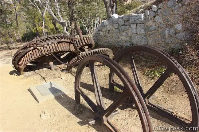
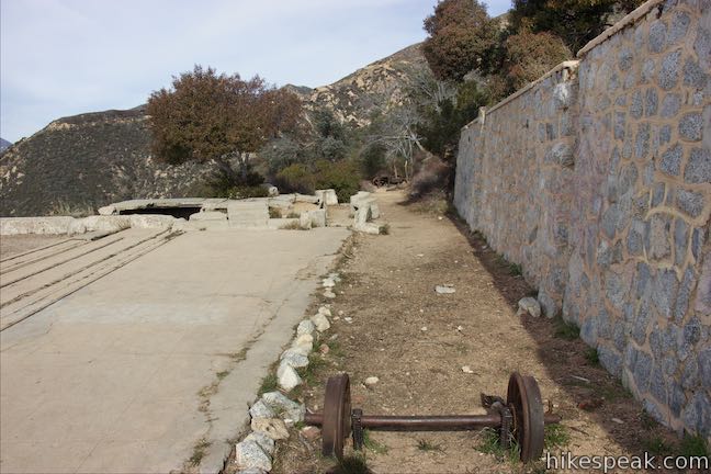
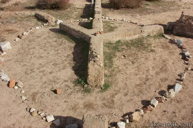
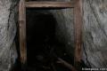
Large rusting gears and an old train car line the trail as you approach what is left of the resort complex known as the White City. Steps lead up to a level area where short stone walls outline the layout of the large buildings. Below these steps is a landing where guests arrived on “White Chariots,” the tramcars that brought guests from Rubio Canyon to Echo Mountain. The impressive incline tramline has long disappeared, but the old route is visible below.
Numerous park-provided plaques add history and scope to the setting. The resort and railway built by Thaddeus S. C. Lowe attracted over 3 million guests in its 40 years of operation, making it one of the most popular destinations in Southern California. A panel alongside the foundation offers this description of the resort:
The world famous Echo Mountain House was completed in 1894. It was a beautiful “L-shaped” building, four stories high with a 400-foot wing offering a southern exposure. A massive metal dome crowned the structure. The entire interior of the hotel was furnished in natural wood and had, in addition to 70 sleeping rooms, office space, social and recreation halls, a dining room, curio shop, Western Union office, bowling alley, billiard room, barber shop, shoeshine stand, and other facilities for the comfort of guests. The hotel cost $65,000, a vast sum at the time.
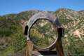
From the footprint of the resort, walk northeast across the clearing to a strange looking relic, the Echo Phone. In an era before cell phones and walkie-talkies, the Echo Phone could be used to shout messages across the mountains. A series of these metal megaphones were used to communicate back and forth to the resort. Step up and give the Echo Phone a try. The messages still resonate across Castle Canyon to the north.
Professor Lowe chose a fine spot for his resort. The sprawling vista that drew guests from around the world can now be enjoyed by hikers at no charge. Linger, explore, and take in all that the Echo Mountain ruins have to offer. When you are done, you can hike back up Echo Mountain Trail and then hike down Mount Lowe Road or Sunset Ridge Trail to the trailhead at the bottom of Mount Lowe Road along Chaney Trail. The hike to Cape of Good Hope and Echo Mountain is 7.5 miles round trip (up and back on Sunset Ridge Trail), 6.9 miles round trip (up and back on Mount Lowe Road), or 7.2 miles round trip (up one trail and down the other).
If you want to keep hiking, consider taking Castle Canyon Trail from Echo Mountain to Inspiration Point. This trail is 2 miles long, leading to a historic vista point with timeless views. Hikers taking Castle Canyon to Inspiration Point from Echo Mountain can return by the same route or make a loop by hiking down Mount Lowe Road past Mount Lowe Trail Camp to Cape of Good Hope. This loop would extend a hike to Cape of Good Hope by 6.35 miles, adding 1,015 feet of elevation for a total of 4,440 feet of elevation change. This lengthy hike is 11.85 miles round trip for those hiking up and back on Sunset Ridge Trail, 11.25 miles round trip for those hiking up and back on Mount Lowe Road, or 11.55 round trip for those hiking up one trail and down the other. For more information about this extension, review the write-up of Castle Canyon Trail to Inspiration Point.
To get to the trailhead: Take the 210 Freeway to Pasadena. Exit Lake Avenue and head north. Reach a T-intersection after 3.5 miles and turn left onto Loma Alta Drive. Drive one mile and make a right on Chaney Trail. Drive up this steep winding road for 1 mile to a crest on Sunset Ridge where Mount Lowe Road begins on the right. Limited parking is located in front of the gate at the bottom of Mount Lowe Road and along Chaney Trail. Additional parking can be found at the end of Chaney Trail, 0.5 miles ahead, next to Millard Campground.
Trailhead address: Chaney Trail & Mount Lowe Road, Angeles National Forest, Altadena, CA 91001
Trailhead coordinates: 34.2148, -118.1476 (34° 12′ 53.27″N 118° 08′ 51.35″W)
View Cape of Good Hope & Echo Mountain in a larger map
Or view a regional map of surrounding Los Angeles trails and campgrounds.
Sunset Ridge Trail & Mount Lowe Road to Cape of Good Hope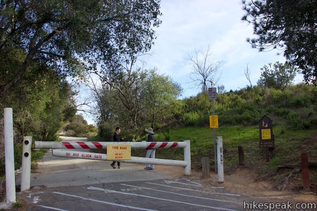


Echo Mountain Trail to Echo Mountain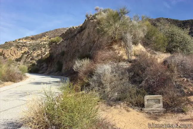


 | Millard Falls This one mile hike visits a 50-foot waterfall up one of the most scenic canyons in the range. |
 | Dawn Mine This 6-mile hike from Millard Campground leads past Millard Falls to an old gold mine. |
 | Echo Mountain via Sam Merrill Trail This 5.8-mile hike visits a historic railway and ruins from a century old resort overlooking Pasadena. |
 | Castle Canyon Trail to Inspiration Point (and beyond) This 2-mile long trail ascends from the ruins on Echo Mountain to a historic viewpoint that still offers hike-worthy panoramas. Form a loop back to Echo Mountain to visit Mount Lowe Trail Camp, Cape of Good Hope, and other landmarks on Mount Lowe Railway. |
 | Rubio Canyon Trail This 1.3-mile round trip hike ventures into a rustic canyon to a double waterfall. |
 | Inspiration Point & Mount Lowe Trail Camp This 7.25-mile round trip hike descends Mount Lowe Road into the San Gabriel Mountains to a historic scenic overlook and a trail camp built on interesting ruins. |
 | San Gabriel Peak from Mount Lowe Road This 6,161 foot peak is also reachable via a 3.2-mile round trip hike from Eaton Saddle. |
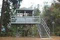 | Henninger Flats via Mount Wilson Toll Road This 6-mile round trip hike ascends 1,325 feet to a trail camp, tree nursery, lookout tower, and visitor center on a landing in the San Gabriel Mountains operated by the Los Angeles County Fire Department. The hike can easily be extended to 8.7 miles by exploring a loop above Henninger Flats. |
 | Eaton Canyon Falls This 3.5-mile hike goes up Eaton Wash to a narrow stretch of Eaton Canyon containing a pleasant 40-foot waterfall. |
 | More trails in the San Gabriel Mountains Explore other destinations in the range. |
 | Millard Campground This is a convenient place to camp at the base of the San Gabriel Mountains at the start of a trail to Millard Falls. |
 | Gabrielino Trail to Gould Mesa Trail Camp This 5-site trail camp in Angeles National Forest can be reached by venturing 5.1 mile round trip up a canyon surrounding the Arroyo Seco. |
Go the extra miles...
Submit a rating of this hike to go with your comment. Contribute to the average trail rating.