Cape Meares Lighthouse & Octopus Tree
in Cape Meares State Park
A two-for-one special is going on at Cape Meares State Park. Here’s the deal – two short hikes for the price of one (which is free). Take one trail to a well preserved more-than-a-century-old lighthouse on the Oregon coast, followed immediately by another short trail to a sprawling spruce worthy of its name, the Octopus Tree. Combine Cape Meares Lighthouse Trail and Octopus Tree Trail for hike that’s less than a mile round trip with 180 feet of elevation change and oodles of ocean views.
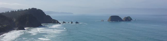
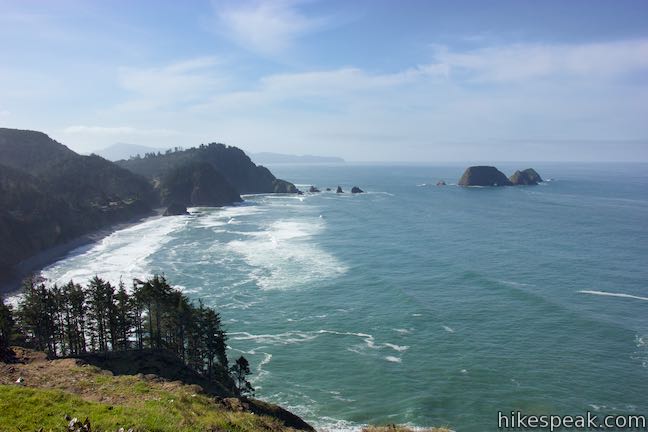
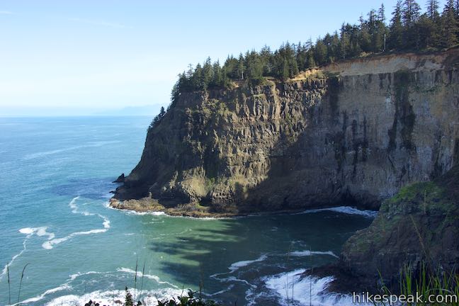
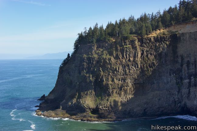
Cape Meares is the northernmost of the three headlands on Three Capes Scenic Route on the coast near Tillamook, Oregon. The next cape to the south, Cape Lookout, is visible from Cape Meares. Cape Meares is the only cape of the three with a lighthouse, which is perched atop 200-foot cliffs at the end of the headland. Cape Meares also sports a rare old growth forest and great views of a nearby string of rock islands called Three Arch Rocks.
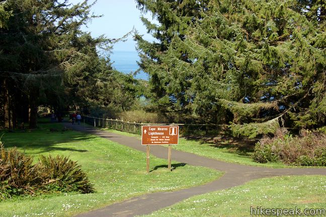
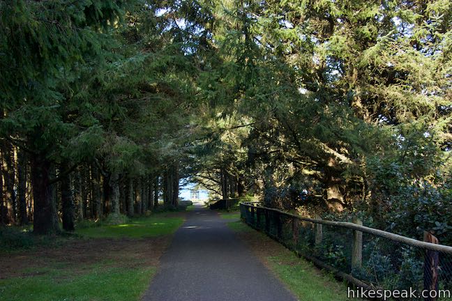
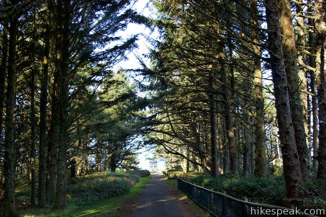
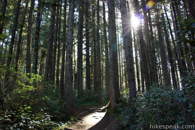
Cape Meares State Park is 11 miles from Tillamook, just north of the small town of Oceanside and south of Bayocean Spit. Drive into the park’s main parking area, which has viewpoints to the south and north. Octopus Tree Trail goes east, entering a forest. An information kiosk is on the west side of the parking area, along with trails to Cape Meares Lighthouse.
Cape Meares Lighthouse Trail
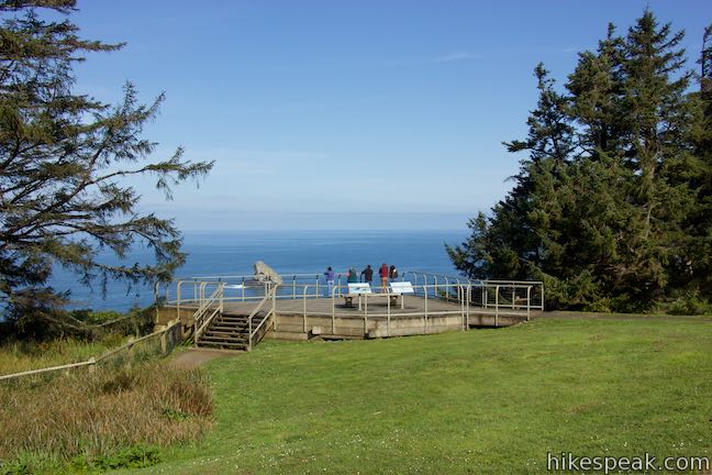
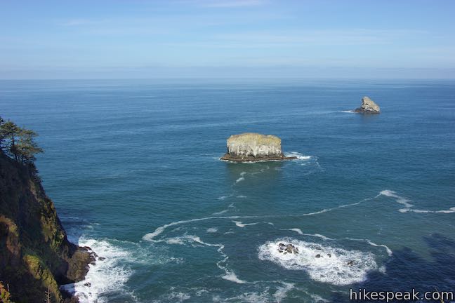
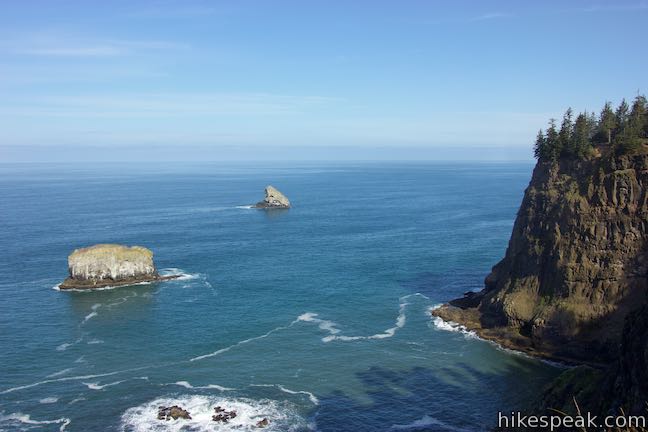
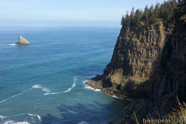
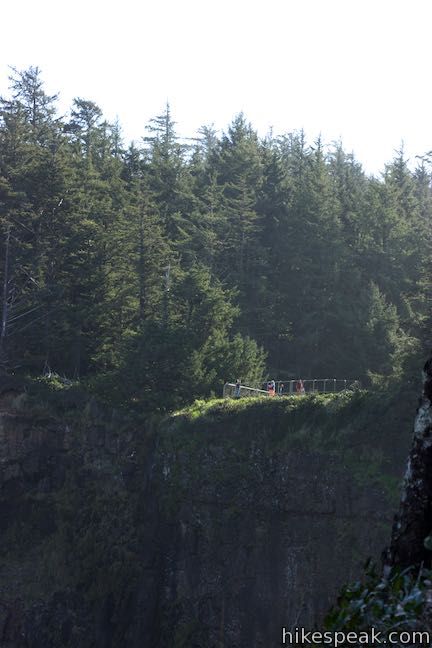
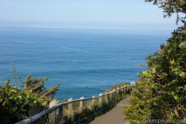
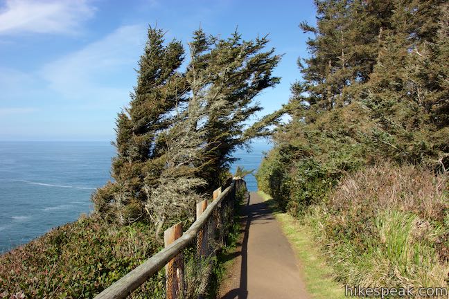
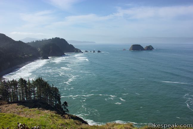
The lighthouse can be reached by walking 0.2 miles on a paved trail with a gradual downhill grade. Before doing that, head for the overlook at the northwest end of the parking area. Step out on a wooden platform and look over the edge of a 325-foot ledge. A cove lies below, on the north side of Cape Meares, surrounded by a horseshoe of sheer cliffs. A couple rock islands lie just off shore.
Panels at this viewpoint describe the area’s shorebirds, including the black oystercatcher, which can be identified from its black feathers and long, thin, orange beak. According to the panel, this bird doesn’t eat oysters, but instead eats mussels and other mollusks along the shoreline. This makes you wonder what other animals are misnamed, like do praying mantis even pray?
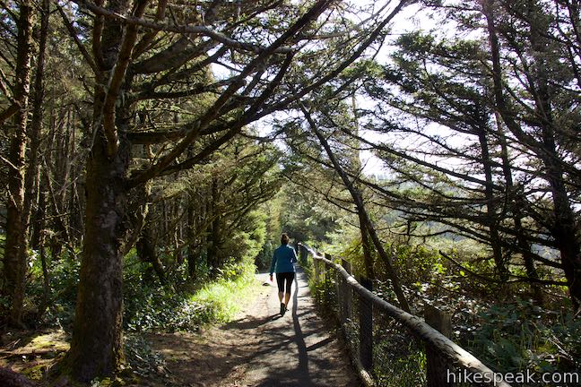
Leave the first overlook and take the path to the left, which connects to the main trail from the parking area down to Cape Meares Lighthouse. Hiking toward the end of the cape, you’ll pass spurs to two overlooks on the right with more views over the cove and up the coast to the north. These overlooks are accompanied by more panels with information about the area’s birds.
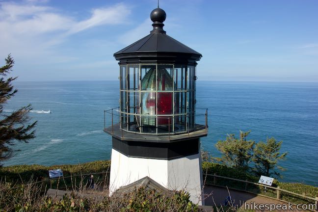
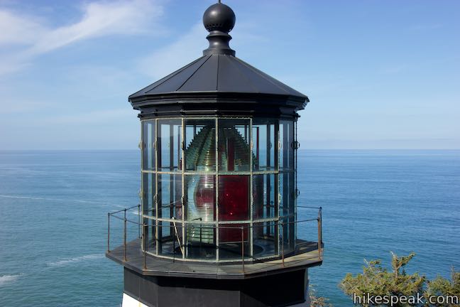
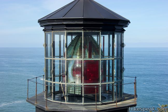
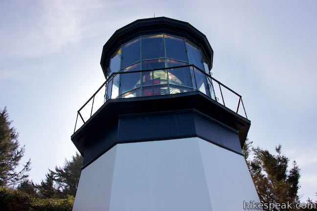
Proceed down the trail, heading directly toward the lighthouse’s large Fresnel lens. After about a quarter mile of hiking, you’ll come to a railing perched behind the lighthouse where you are at the same height as the massive lens. Stop to admire this beautiful creation with eight sides interchanging between clear and red glass. Cape Meares has the only lens of this kind in the contiguous United States (Hawaii has a second). A panel offers this description of the 1-ton crystal lens:
Shaped like a giant beehive, the outer surface of the lens is made of prisms that bend the light into a narrow beam. The bean then passes through a magnifying glass, or bull’s-eye as the center of each side that intensifies it, producing a brilliant sheet of light visible for 21 miles. The original light was a heavy bronze five-wick kerosene lantern that was turned by weights and pulleys. Four sides of this 8-sided lens were covered with red glass, which produced an alternating red and white beam as the light turned. The Cape Meares lighthouse is the “first order,” the largest of seven lens sizes.
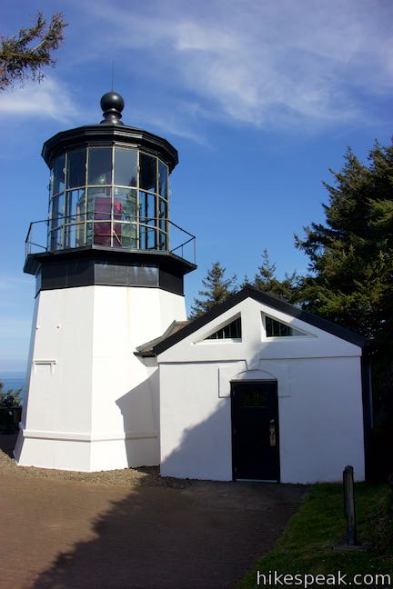
Follow the trail to the left, coming to a junction by a sign that reads, “both trails return to parking area.” You can take the trail to the left when it is time to head back. First, turn right and descend to Cape Meares Lighthouse. Walk up to the base of the white building housing the big, beautiful lens.
Cape Meares Lighthouse was built was built in 1889 and its upkeep has been first rate. Eight other lighthouses were built on Oregon’s coast during this time period. The next lighthouse to the north, Tillamook Rock Light, can be seen from Ecola State Park. Each light had a unique look and could be identified by mariners traveling along the coast, who would keep one light it sight at all times. Cape Meares Lighthouse may be open for tours during the summer season (as well as a gift shop).

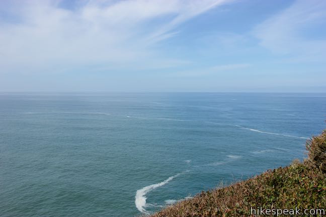
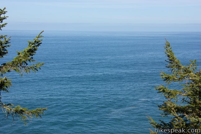
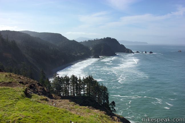
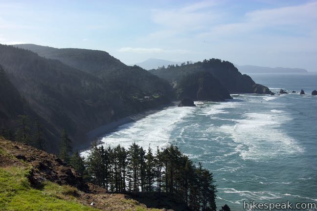
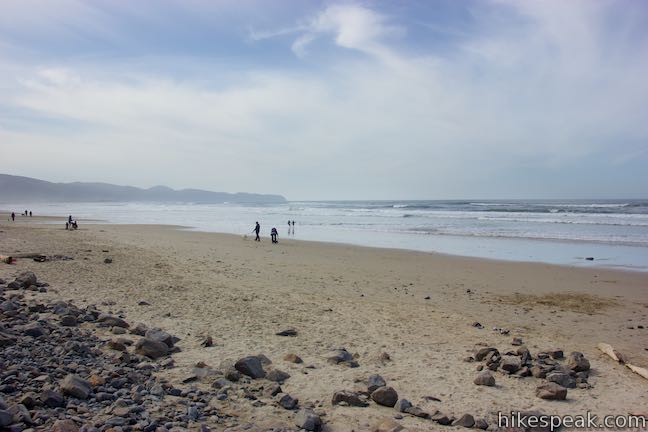
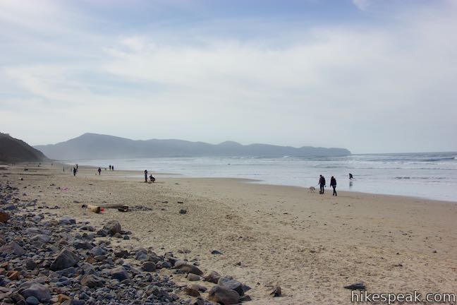
The lighthouse is at the end of Cape Meares and has a panoramic perch over the Pacific Ocean. The migration lanes for gray whales are directly in front of the cape. If you make this hike from December to January or March to April, you should be able to spot breaching whales in the ocean below.
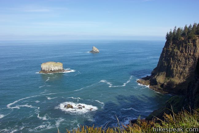
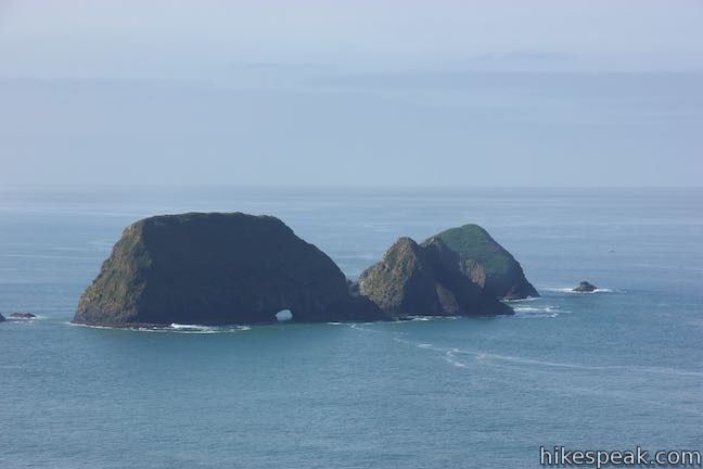
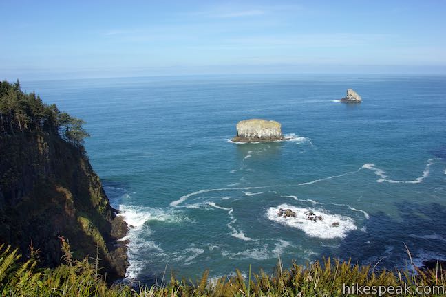
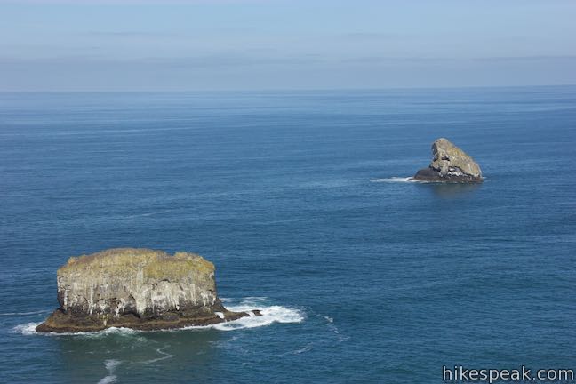
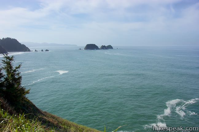
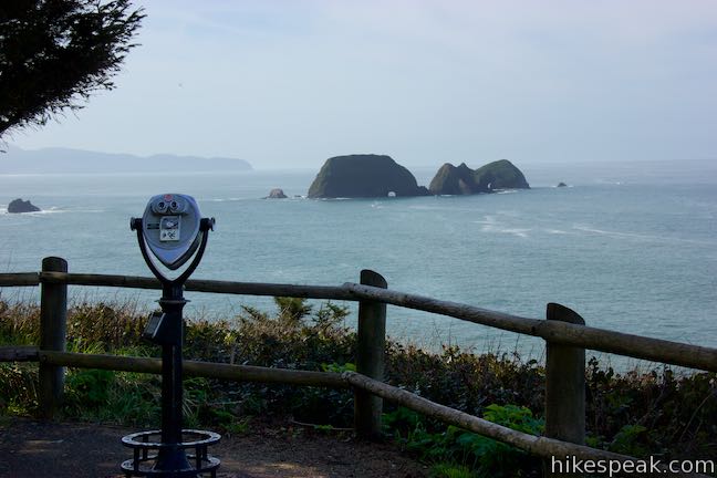
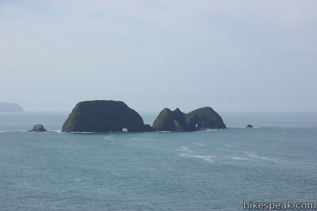
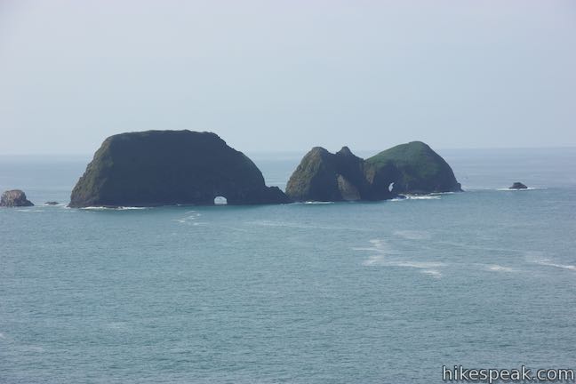
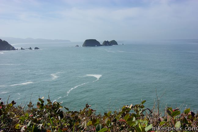
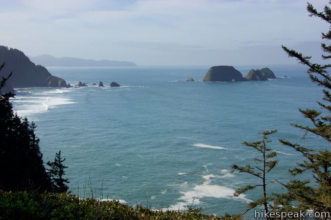
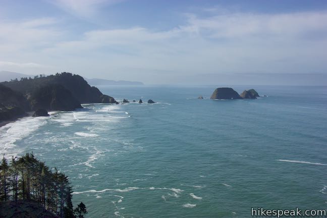
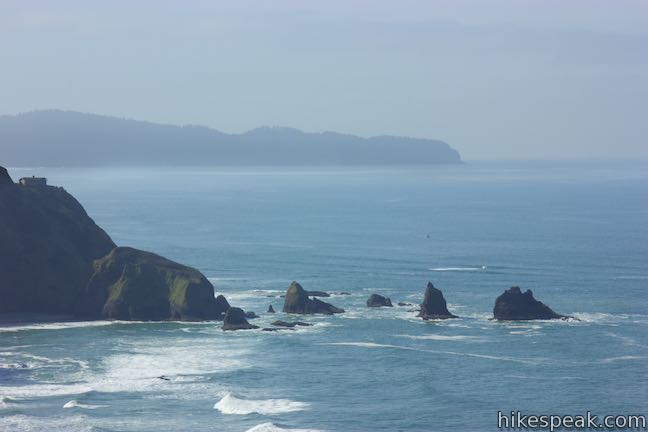
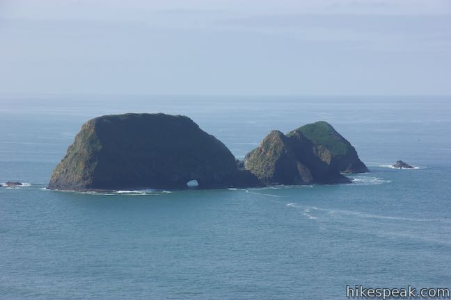
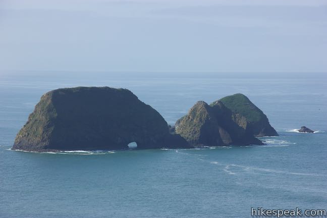
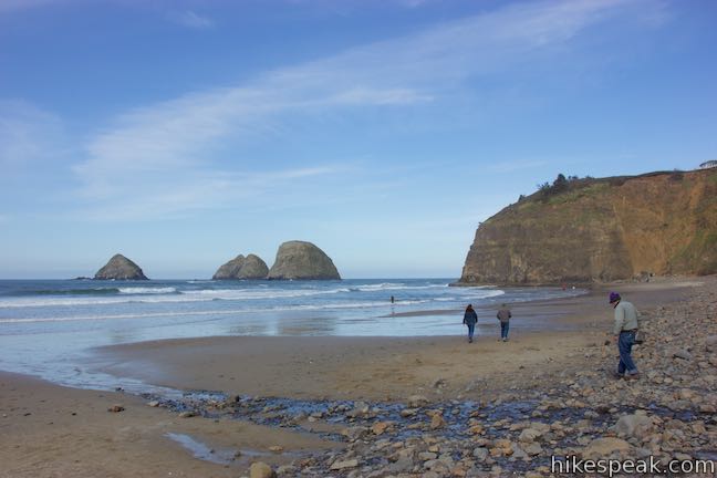
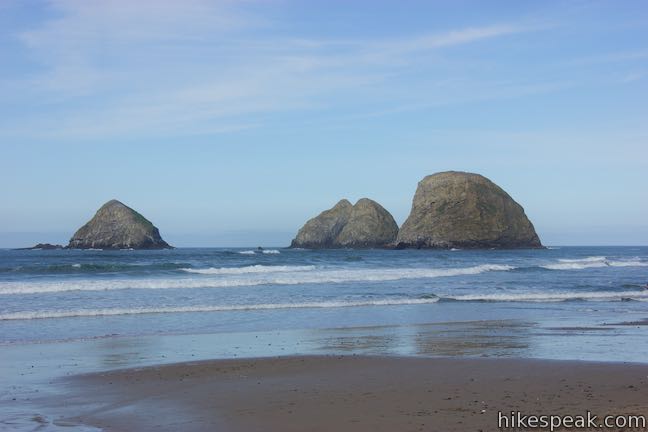
Leave the lighthouse, return to the junction, and stay to the right to take the other trail back toward the parking area, exploring the south side of the cape. This cliff top trail presents great views of Three Arch Rocks, a cluster of rock islands with natural tunnels carved through them. Depending on where you stand, you can get an angle looking through one or two tunnels at a time.
The wild and beautiful Three Arch Rocks are a significant animal habitat. Sea lions breed on the rocks while many more sea birds nest nearby. Three Arch Rocks are home to a few thousand tufted puffins and the largest nesting colony of murres south of Alaska (nearly a quarter million).
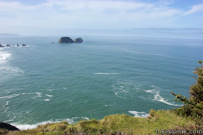
Gaze at the Three Arch Rocks to the southwest or look farther south toward Cape Lookout, which extends a couple miles into the ocean. Hike gradually uphill to the parking area, coming up alongside a viewpoint facing south down the beautiful coastline. If you don’t choose to continue on, the out and back hike to Cape Meares Lighthouse is half a mile roundtrip.
- For more views of the Three Arch Rocks explore nearby Tunnel Beach in Oceanside.
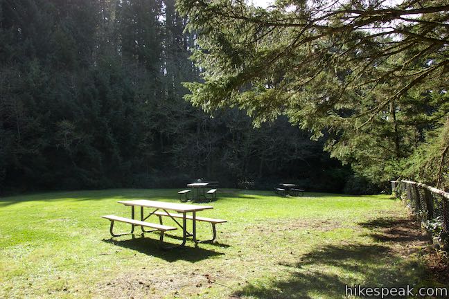
To your right at the end of the trail, you’ll find a path leaving the parking area that goes a couple hundred feet into the forest to a picnic area in a grass clearing. While this picnic spot is close to the sea cliffs, the surrounding trees block out the ocean views. Return to the parking area to continue onto Octopus Tree Trail.
Octopus Tree Trail
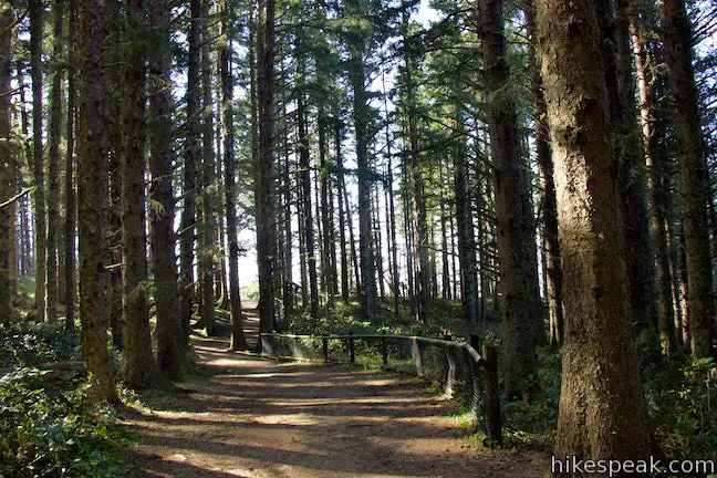
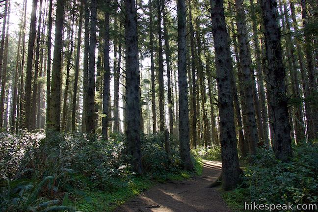
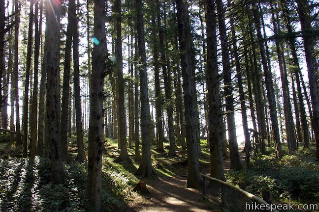
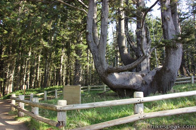
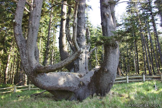
From the parking area in Cape Meares State Park, head east up Octopus Tree Trail. This dirt trail enters a spruce forest and passes bathrooms. Walk a tenth of a mile through a lovely, dense forest to find the Octopus Tree. These are special surroundings because Cape Meares has one of the only old growth forests remaining along the Oregon coast. Most other old growth forest have been logged or developed, eliminating animal habitats. The survival of some animals, like marbled murrelets, is linked to the preservation of old growth forests. Though most sea birds nest in rocks, marbled murrelets nest high up in the trees of old growth forests and cannot adapt to different environments.
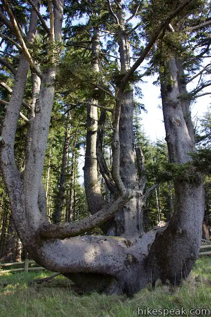
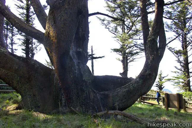
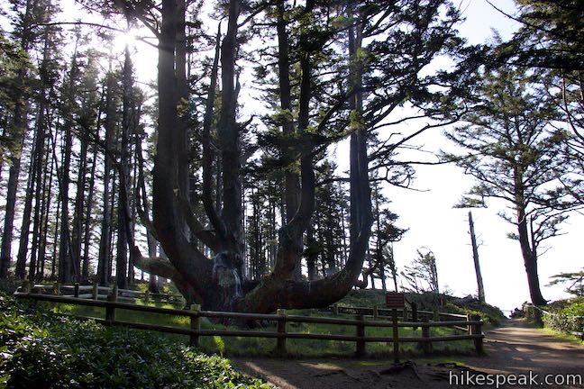
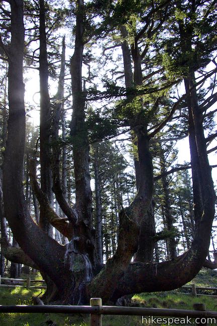
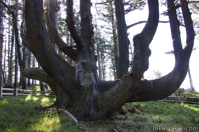
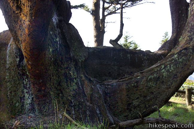
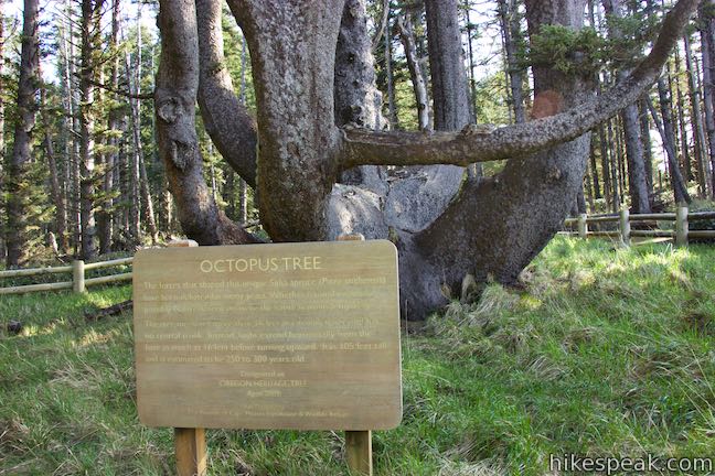
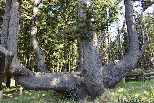
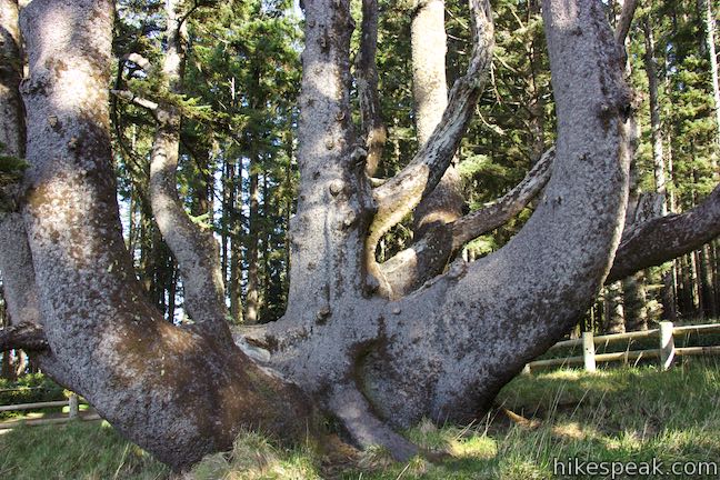
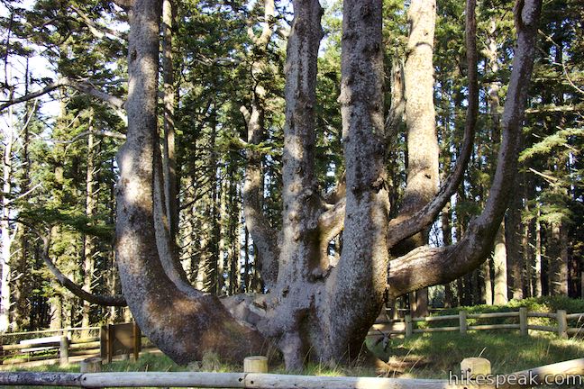
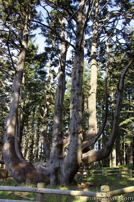
Stroll up through a forest of spruce trees to come to one tree that is larger and stranger than all the rest. From its base, Octopus Tree spreads horizontally with several think branches the eventually angle upward. Each branch of Octopus tree is bigger than the trunks of the surrounding spruce, making it appear even more massive.
Walk a circle around Octopus tree behind a wooden fence, stopping to look at a sign that reads:
The forces that shaped this unique sitka spruce have been debated for many years. Whether natural events or possibly Native Americas were the cause remains a mystery. The tree measures more than 46 feet in circumference and has no central trunk. Instead, the limbs extend horizontally from the base as much as 16 feet before turning upward. It is 105 feet tall and estimated to be 250 to 300 years old.
Some theorize that Native Americans bent the Octopus Tree’s branches when it was a young tree to create its unique shape. Native Americas used the Octopus Tree for burial ceremonies, placing their deceased in canoes that were set between the tree’s limbs.
Octopus Tree is a beautiful mystery, and you can find more natural splendor just ahead. Continue south for a couple hundred feet to an overlook on the top of the cliffs next to Octopus Tree. This spot offers a great perspective down the coast over a short rocky point backed by spruce forests. Cape Lookout extend from the shoreline in the distance and the Tree Arch Rocks break up the open ocean in a captivating way to the southwest.
After visiting the Octopus Tree and the adjacent overlook, simply hike back the way you came. Octopus Tree Trail is 0.3 miles long round trip, bringing the total distance for the hike to Cape Meares Lighthouse and the Octopus Tree to about 0.8 miles total (or slightly longer if you check out the picnic area and viewpoints along Cape Meares Lighthouse Trail). When you finish with this hike, you can drive south down the coast for hikes at Cape Lookout and Cape Kiwanda, the other two capes on Three Capes Scenic Route.
No fee is required to enter Cape Meares State Park and use the parking area at the trailhead. Dogs can come along on this hike if they are leashed. No permit is required to visit Cape Meares Lighthouse or the Octopus Tree Trail, so get out and enjoy!
To get to the trailhead: From the intersection of Highway 101 and Route 6 in Tillamook, head west on Netarts Highway (Route 131), which is straight across Highway 101 from Route 6 for those traveling from Portland. Take Route 131 southwest for 5 miles and pass Whiskey Creek Road, the route to Cape Lookout. Drive another 3.8 miles, bearing northwest up the coast. Reach Oceanside and bear right on Cape Meares Loop / Bayshore Drive, following signs for Cape Meares State Park and Three Capes Scenic Route. (If you stray to the left, you would come to Oceanside Beach and the coastal walk to Tunnel Beach.)
From the Oceanside intersection, it is another 2.5 miles to the park entrance on the left (the road continuing north has been closed due to storm damage as of May 2016). Turn left into the park and drive half a mile up Cape Meares Lighthouse Drive to the trailhead parking area.
Trailhead address: Cape Meares Lighthouse Drive, Tillamook, OR 97141
Trailhead coordinates: 45.4856, -123.97443 (45° 29′ 08.15″N 123° 58′ 27.94″W)
You may also view a regional map of surrounding Oregon trails and campgrounds.

 | Oceanside Beach to Tunnel Beach This 0.8-mile beach walk comes with an adventurous twist, a man-made tunnel through a cliff that leads from one beautiful beach to a second, more secluded beach in Oceanside. |
 | Cape Lookout Trail This 5-mile round trip hike ventures down a promontory on the Oregon Coast with beautiful ocean views. |
 | Cape Kiwanda This short beach hike explores tide pools and sand dunes at a rugged headland on Oregon's coast near Pacific City. |
 | Ecola Point to Indian Beach This 2 2/3-mile round trip hike explores a wild and beautiful section of Oregon Coast Trail between Ecola Point and Indian Beach in Ecola State Park. |
 | Whalen Island Loop Trail This 1.5-mile hike explores a lovely island-like park in Sand Lake Estuary with ocean and wetland views. |
 | Munson Creek Falls Trail This short hike near Tillamook travels up a forest canyon to the tallest waterfall in Coastal Oregon. |
 | Saddle Mountain Trail This 5-mile round trip hike rises through fir forests and wildflower-filled slopes up to a summit with panoramic coastal views. |
 | Beaver Falls This short hike slips down through forest to a beautiful waterfall plunging over a basalt wall. |
 | Trails in Oregon Explore more hikes throughout the state of Oregon. |
 | Whalen Island County Campground This 33-site campground is a nice camping option on Whalen Island with easy access to estuary beaches and a loop hike. |
 | Cape Lookout State Park Campground This grand, oceanfront campground has over 200 sites right behind a big, beautiful beach. |
Cape Meares on oregonhikers.org
Cape Meares Lighthouse and trails on maliasmiles.com
The official website for the Friends of Cape Meares Lighthouse & Wildlife Refuge Web Site
Octopus Tree on amusingplanet.com
History of Oregon's Shortest Lighthouse And The Legend of The Octopus Tree on salem-news.com
Go the extra miles...
Submit a rating of this hike to go with your comment. Contribute to the average trail rating.