Calico I & Calico II in the Calico Hills
in Red Rock Canyon National Conservation Area
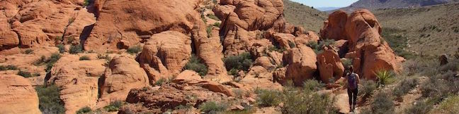
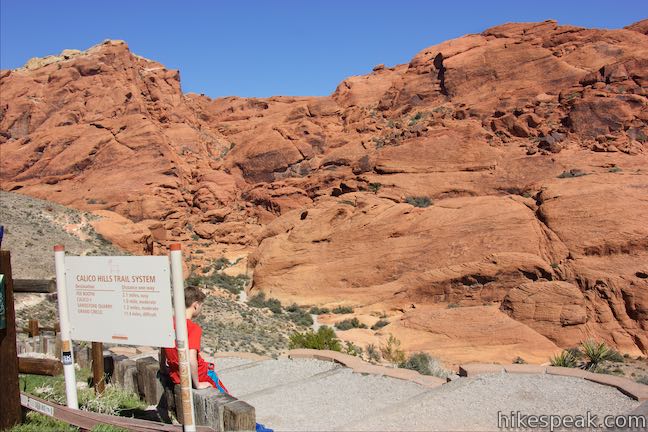
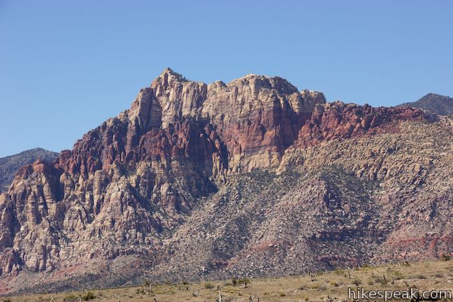
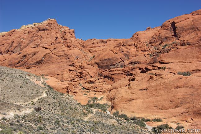
The whimsically concocted concentration of vibrant red-orange Aztec sandstone known as the Calico Hills is a must-see destination in Red Rock Canyon National Conservation Area. After leaving the visitor center, the Scenic Drive heads straight to the Calico Hills, passing three overlooks and trailheads, Calico I, Calico II, and Sandstone Quarry (the start of Calico Tanks Trail). You could spend all day exploring the Calico Hills, but what should you do if you have less time?
- For a brief but thrilling 0.8-mile hike with 225 feet of elevation change, explore a stretch of trail descending southeast from Calico I toward the visitor center and the park entry booth.
- You can also hike in the other direction and explore a roughly 2-mile long trail between Calico I and the Sandstone Quarry Trailhead.
- If someone can pick you up, you could hike 0.85 miles one way from Calico I to Calico II (the next overlook on Scenic Drive) with 190 feet of elevation change.
- If you are starting from Calico I and need to finish at Calico I, consider a 2.1-mile out and back hike (with 200 feet of elevation change) that goes up past Calico II to explore a rock amphitheater and then turns around at a rock column well before the Sandstone Quarry Trailhead.
- Combining that last option with the first option, which went down the canyon to the southeast, creates a 2.75-mile outing. This trek from Calico I goes down the canyon to southeast for distance and then explores the area above Calico I toward the Sandstone Quarry Trailhead.
Calico I
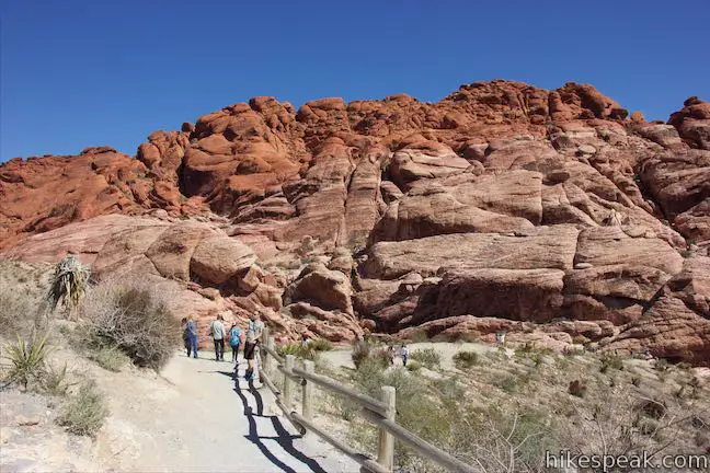
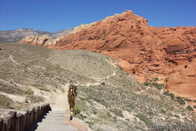
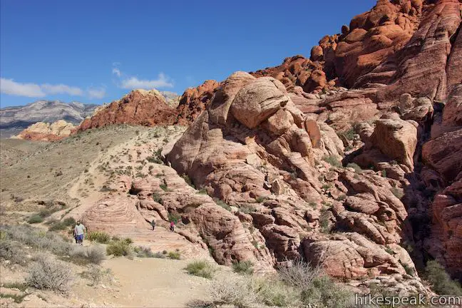
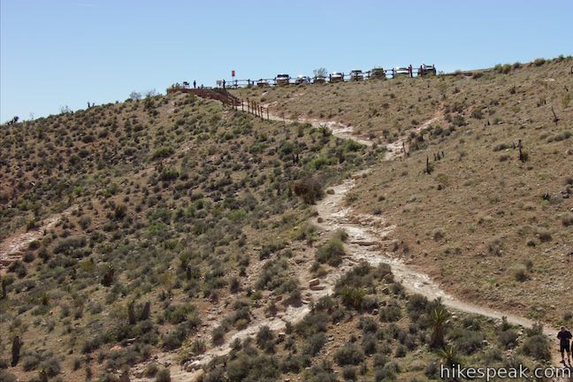
Calico I is the first overlook along the 13-mile Scenic Drive through Red Rock Canyon National Conservation Area. Scenic Drive is a one-way road, so Calico I should be your first stop. If you skip the Calico Hills and decide you want to see them later, you’ll need to drive all the way around the scenic loop, exit the park, re-enter (paying another entrance fee unless you have an annual pass), and drive back to Calico I.
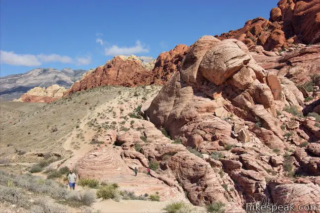
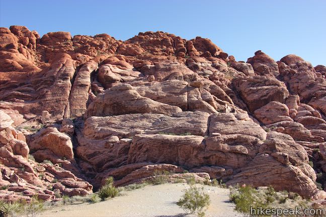
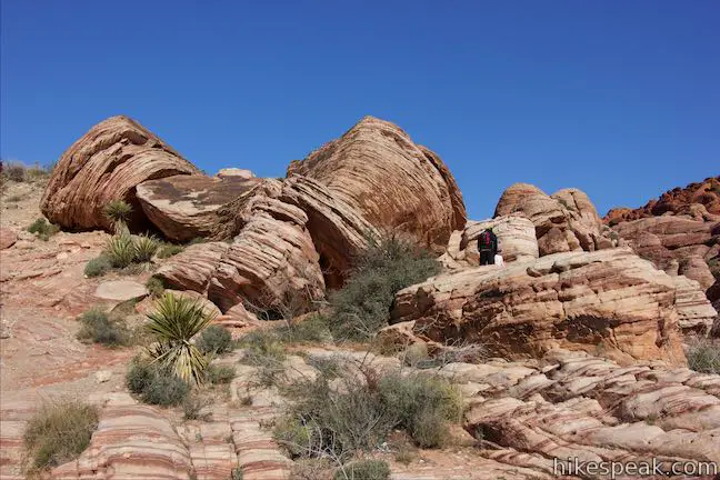
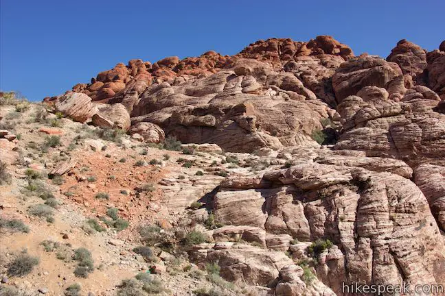
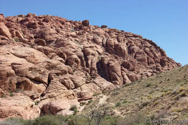
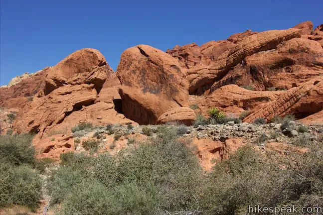
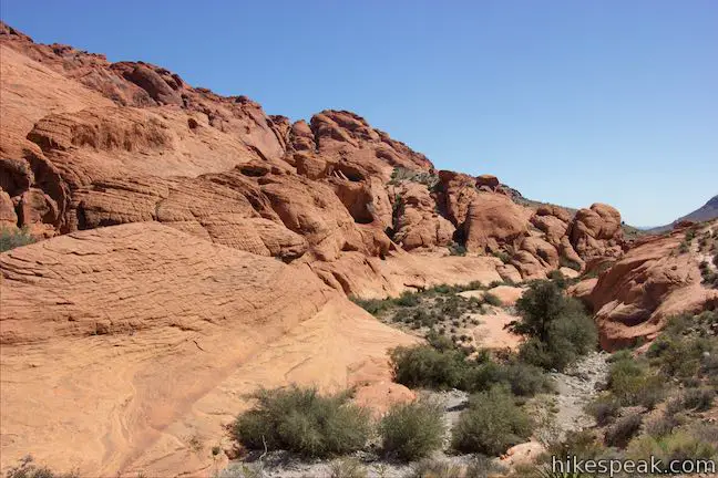
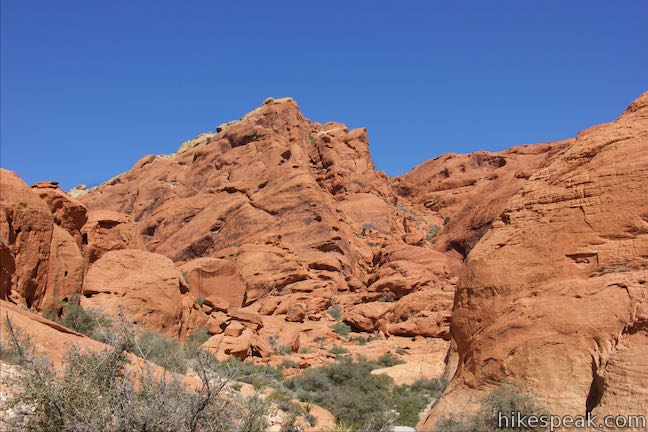
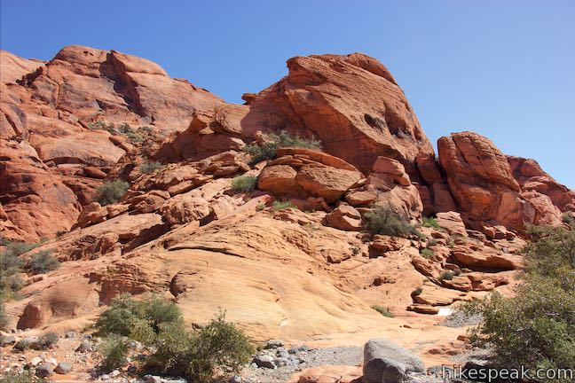
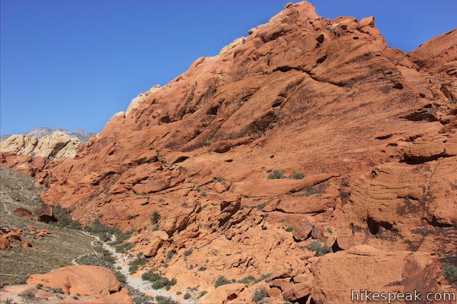
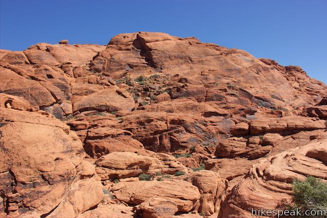
When you do stop, you’ll get an enticing view of the Calico Hills right from the parking area. A ravine separates the trailhead from an awesome jumble of red-orange rocks towering over paler pink-colored rock that actually has red stripes. To get a closer look, hike down a dirt trail to the north to a landing above a ravine bordering the hills of sandstone. At 0.7 miles from the trailhead, you will come to a junction. The trail to the left heads toward Calico II and Sandstone Quarry Trailhead. Straight ahead, you’ll find boulders to climb on and have a look around. Discover a trail to the right going down the ravine to the east. Admire the rocks in front of Calico I, which an info panel compares to frozen sand dunes:
If you could travel back in time, about 180 million years, you wound find yourself standing in a vast field of towering red sand dunes that stretched across much of the southwest. This immense dune field was one of the largest that has even existed on earth. The region was very arid and looked similar to the dune fields of the modern-day Sahara Desert in Africa. Over time, underground water moving through the dunes carried away much of the red color and left behind calcium carbonate. This process cemented the sand into rock. This rock forms the colorful sandstone cliffs and hills of Red Rock Canyon National Conservation Area.
East of Calico I
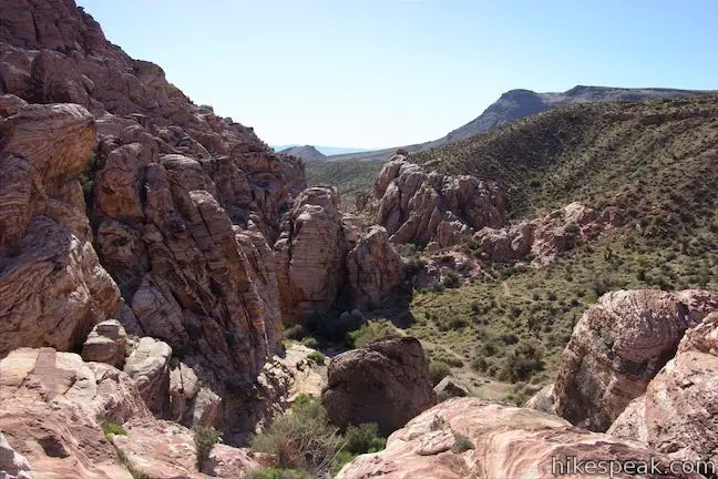
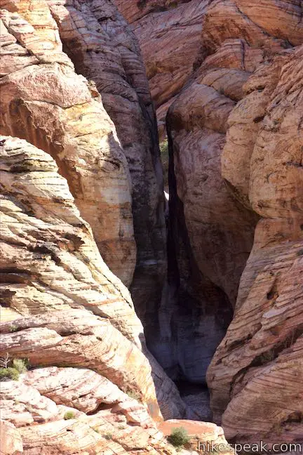
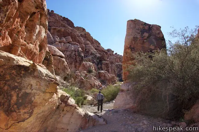
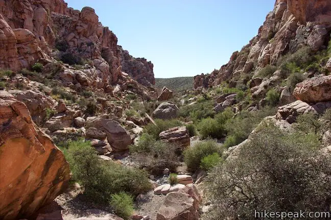
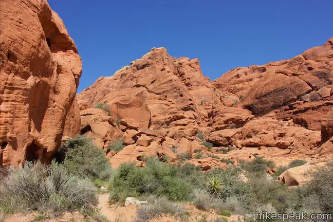
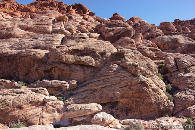
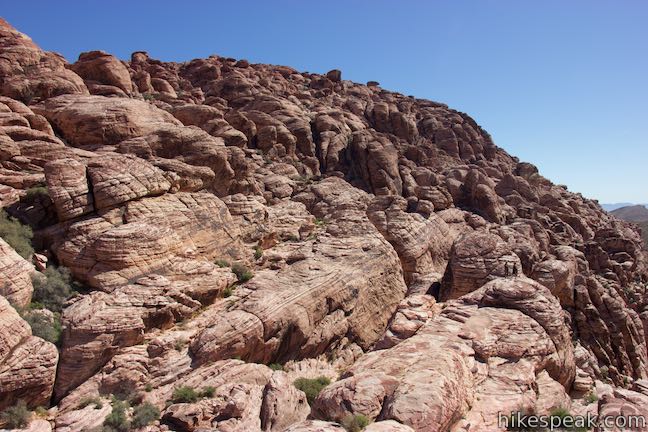
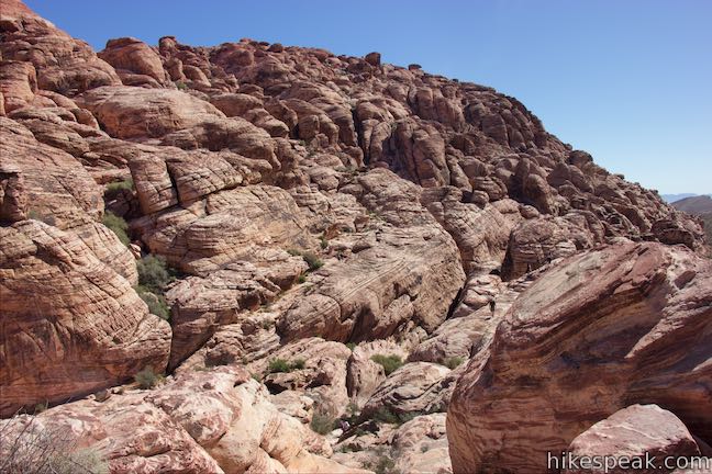
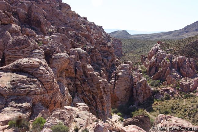
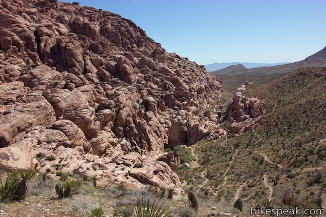
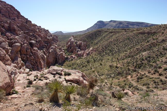
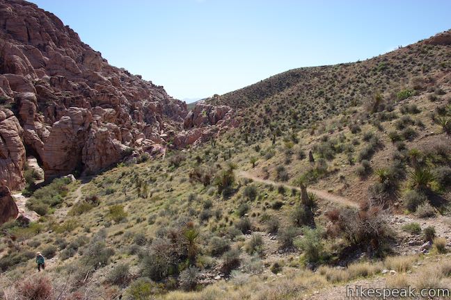
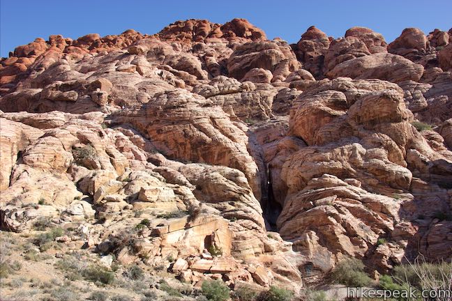
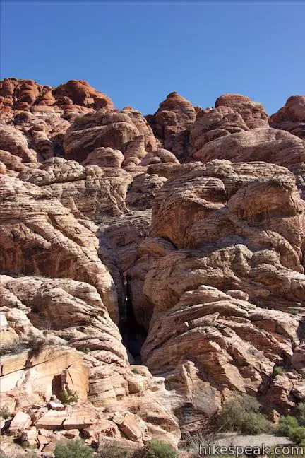
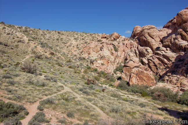
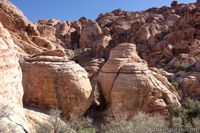
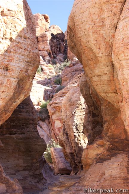
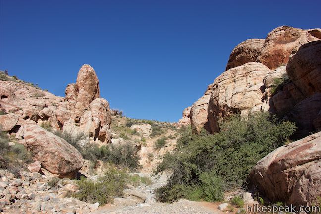
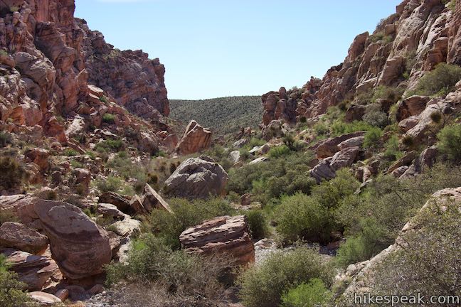
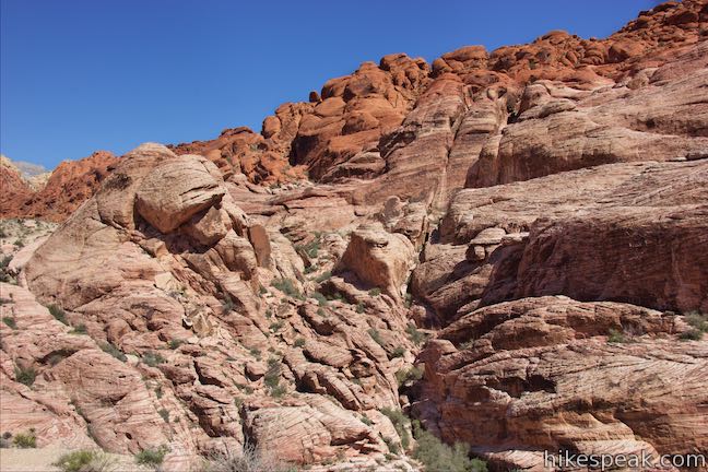
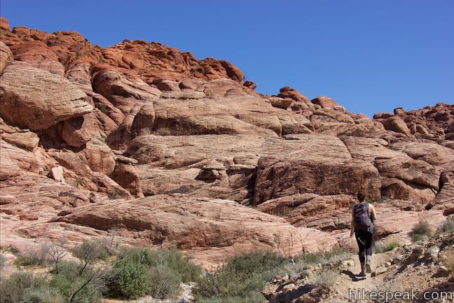
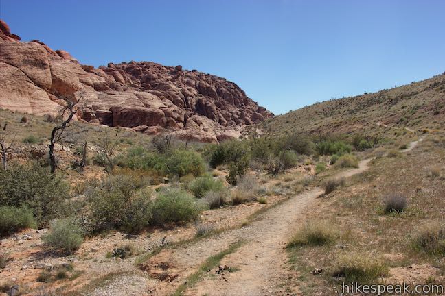
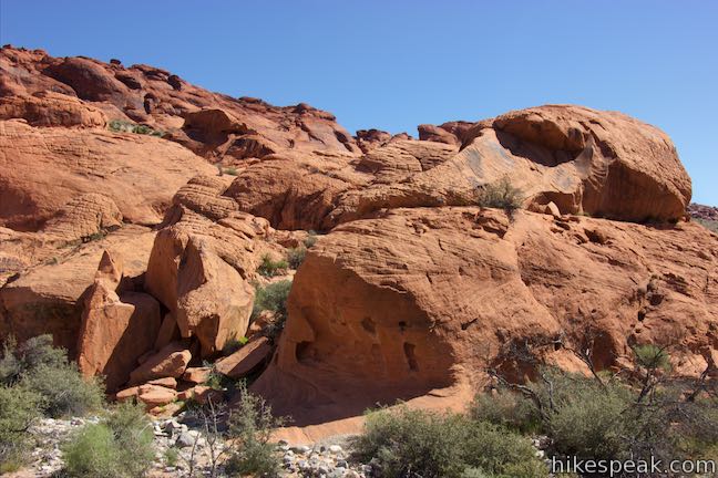
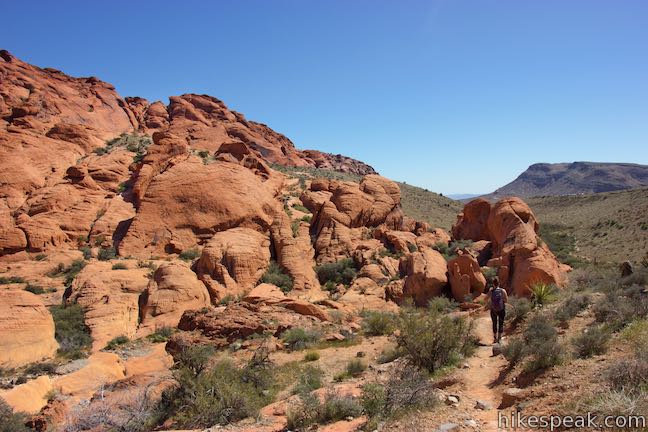
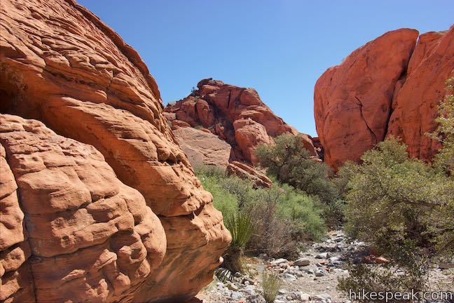
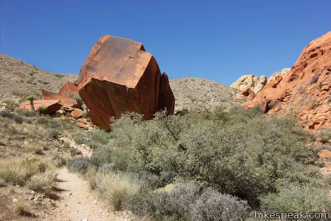
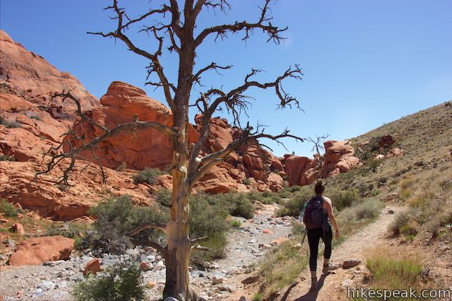
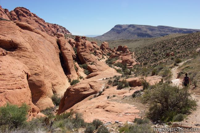
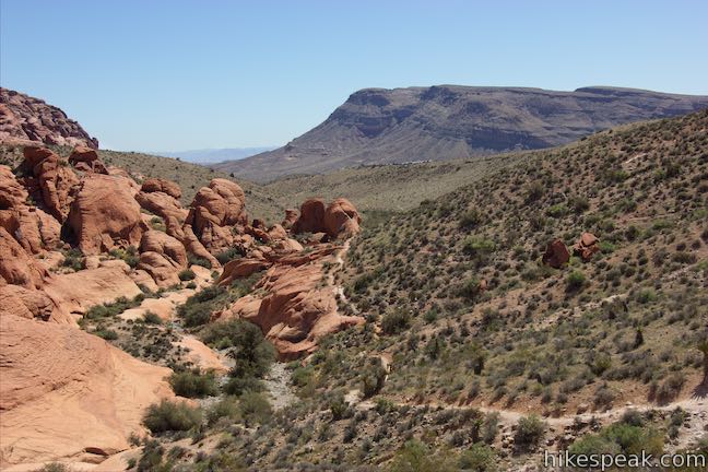
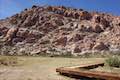
After walking down to a point less than a tenth of a mile below the Calico I Parking Area, bear right and drop into the ravine to the east. Pick your favorite from a few paths that go down the slope to merge alongside a gravel wash in the depression below. Steep rocks rise to your left, while a slope of desert vegetation abutting the Calico Hills is on the right (hosting the paths down). As you get into the ravine and gain a lower perspective, the rock formations become even wilder looking. Peer up a dark, tall, narrow gap between sandstone formations to discover a recess illuminated by morning sunlight.

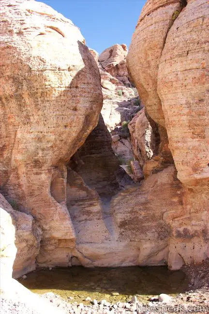
A trail offering a longer hike around the Calico Hills goes up across a ridge of sandstone on the right side of the ravine. Skip this trail and proceed downhill toward an interesting collection of boulders in the bottom of the ravine. Reach the floor of the ravine after a quarter mile and hike down the gravel wash between sandstone formations. To your left, you’ll pass another interesting gap between boulders that has a basin at the bottom. This is a tank that provides a rare source of water for desert plants and animals. A park sign explains that:
Tinajas or tanks are natural depressions in the rocks that hold water. These stone basins fill with runoff from scarce desert rains. This “captured” water may remain in the tinajas many months and provides vital water for wildlife.

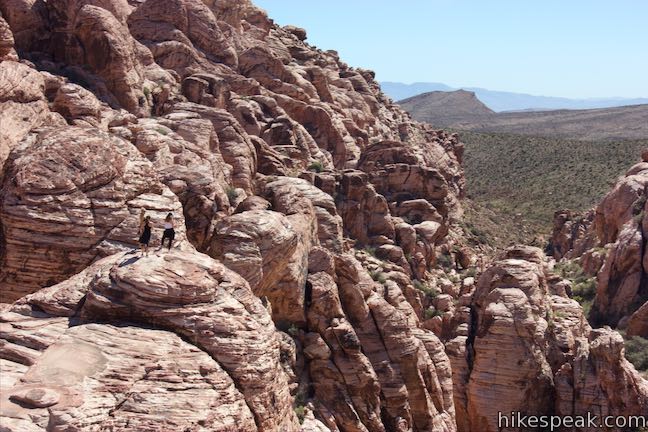
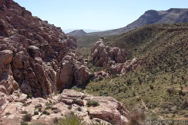
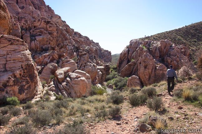
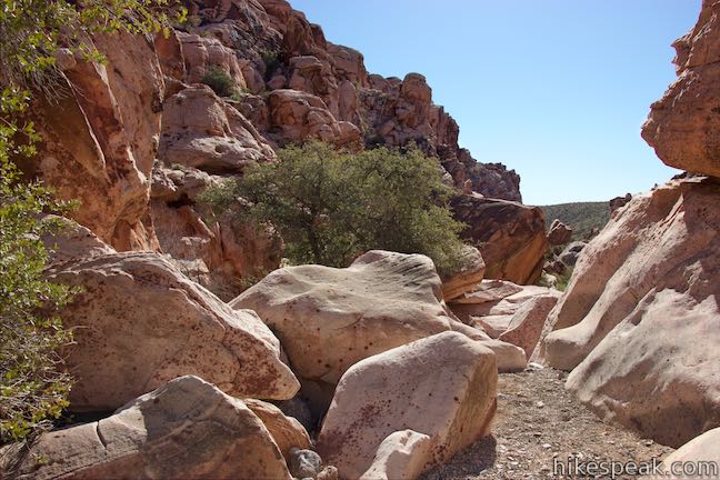
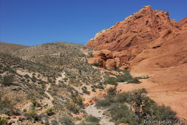
Make your way down the ravine through misshapen boulders of Aztec sandstone. At 0.4 miles from the trailhead, you will come to a rock ledge with no easy way to proceed. You could definitely scramble down the boulders to keep going down the ravine, but this is also a good spot to turn back. The ravine below gets wider and has fewer massive boulders, appearing to be less appealing than the area you’ve been through already.
Unless you’re going all the way around Calico Hills to Red Spring or hiking down to the entry booth, this is a logical place to turn back. Enjoy the perspective down the ravine from the perch on the ledge and then hike back the way your came. This eastbound descent from Calico I is 0.8 miles round trip. It can also be paired with a hike west from Calico I toward Calico II.
West of Calico I
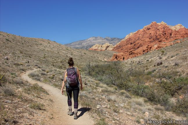
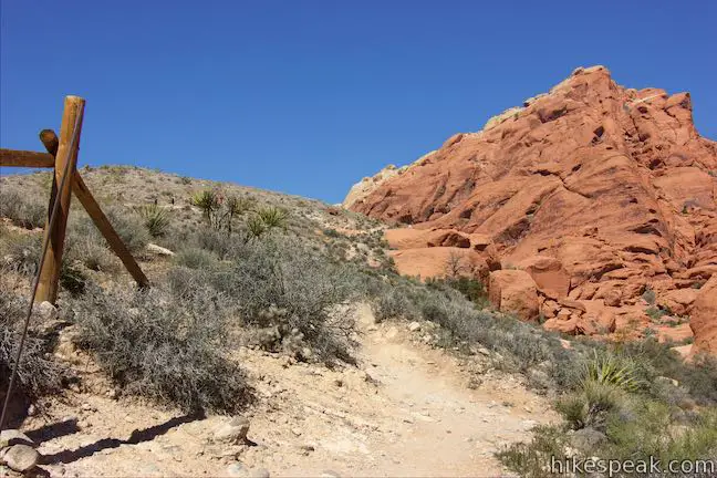
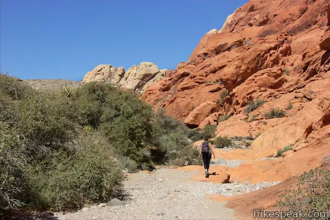
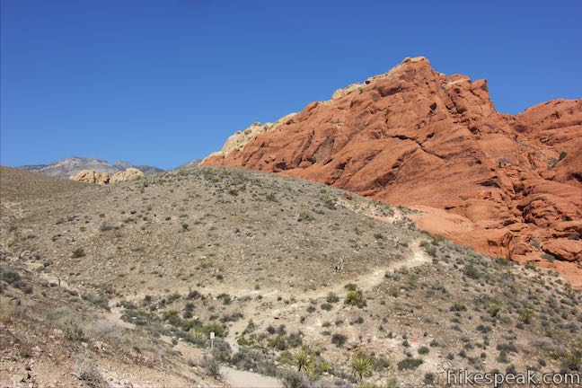
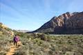
To hike from Calico I toward Calico II and Sandstone Quarry Trailhead, descend 0.07 miles from the parking area to the junction and turn left, following a sign for Calico II. Take this dirt single track down into a ravine below the viewpoint. To your right, a rock formation resembling a troll stands out from the rest (or do you see a different shape?).
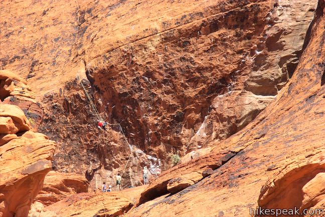
Not far below the junction, you will come to a split. Bear left to take the trail along the side of the ravine, just above the brush-covered thicket at the bottom. Paths to the right ascend into the Calico Hills that are used by those who want to scramble around. The Calico Hills are a popular climbing destination and you will probably see rock climbers as you hike. A panel at Calico I explains:
The area’s great weather and superb sandstone provides excellent climbing that attracts climbers from all over the world and tests their skills on the demanding routes. Red Rock Canyon National Conservation Area has an estimated 1,700 climbing routes of varying lengths and difficulties.
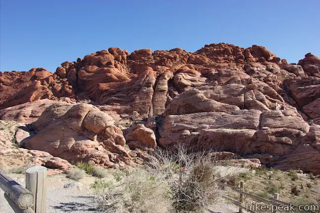
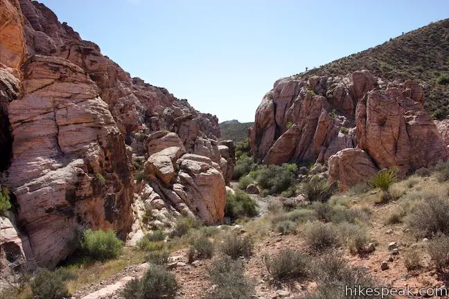
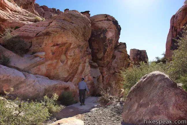
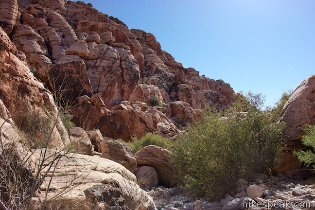
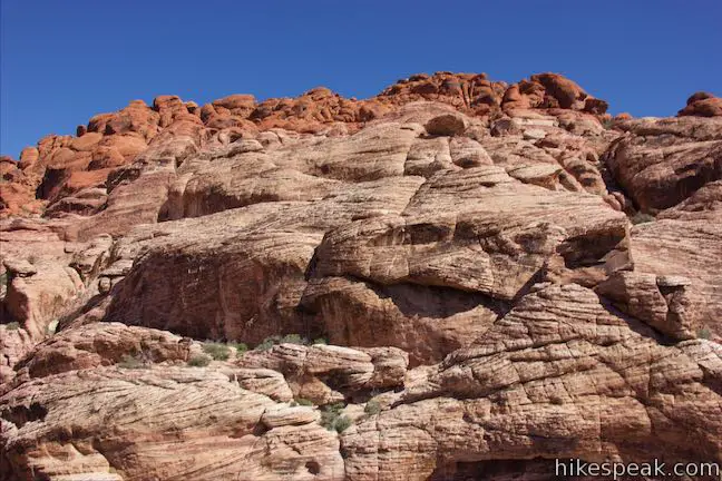
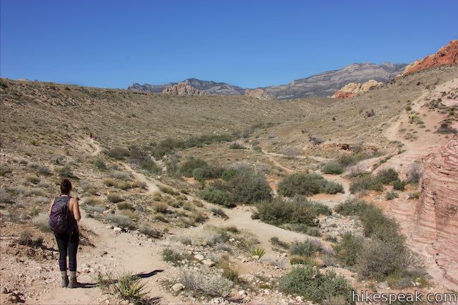
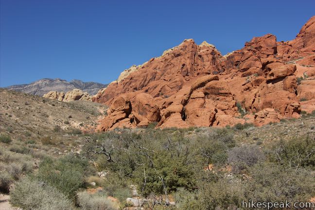
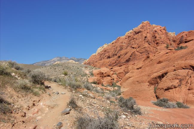
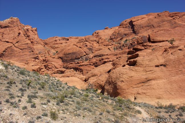
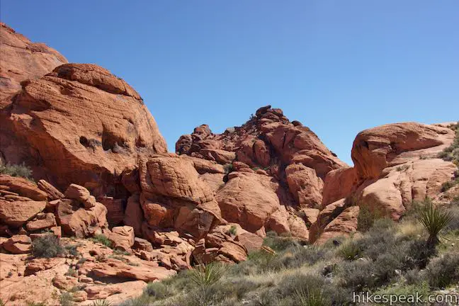
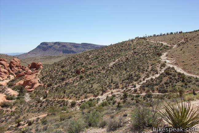
The trail goes gradually uphill along the side of the ravine across from a wall of misshaped sandstone. There aren’t any formations right next to the trail, so this stretch of the hike isn’t as interesting as the trail east of Calico I (one reason that section may be better for those with limited time). Don’t fret though; the terrain along the trail becomes more interesting ahead.
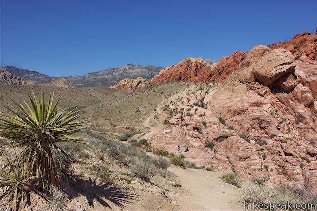
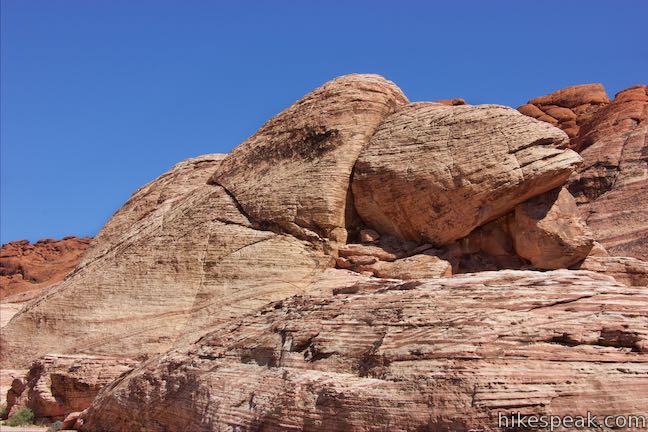
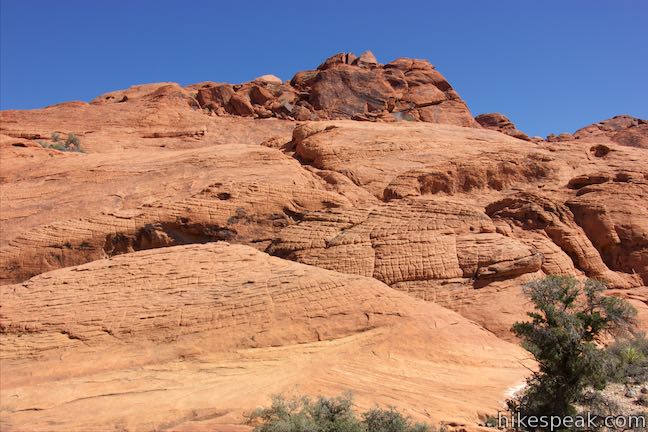
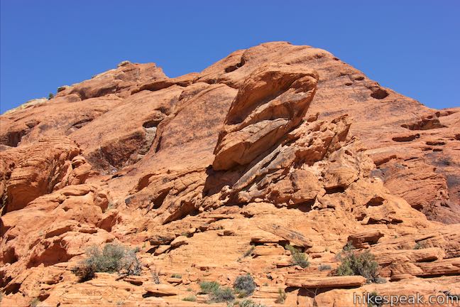
At 0.6 miles from the trailhead, ascend out of the wash onto an outcropping with views of the surrounding rocks. With just a little imagination you can spot faces, hands, and other shapes in the formations. Do you see sandstone that looks like it was woven together in different layers? This is called cross bedding. A panel at Calico I explains that cross beds are created by the migration of wind-carried grains of sand, splitting the process into three steps:
1) In a vast field of sand dunes, the migration of a dune partially erodes the dune in front of it. As this occurs, sand is deposited in curving layers and the dune “climbs the back” of the dune in front of it.
2) This new series of curving layers is oriented at angles to those in the remnants of the dune below it and are know as cross beds. The continued forward climbing movement of dune after dune resulted in the stacking of layer upon layer of cross-bedded sands.
3) Underground water moving through these deep poles of sand left behind calcium carbonate that cemented the sand grains together and turned the sand to stone.
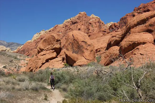
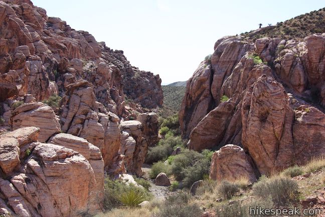
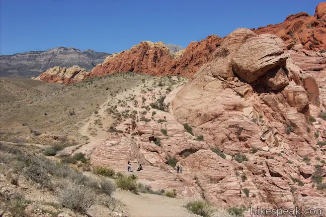
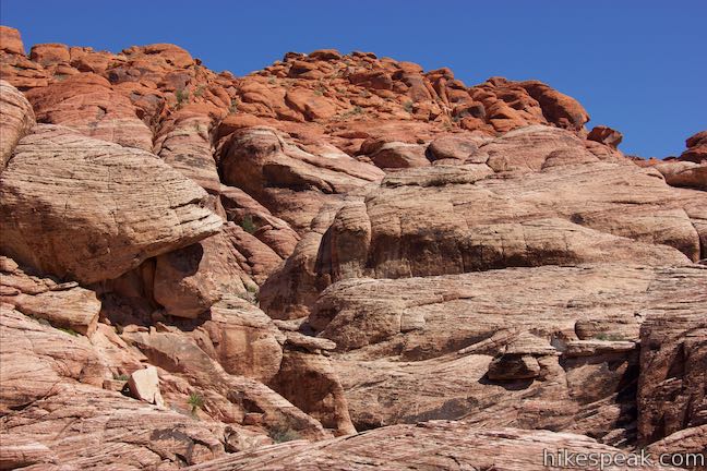
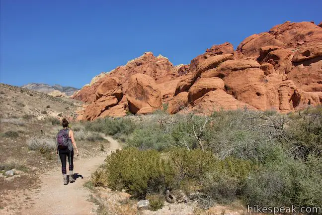
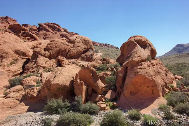
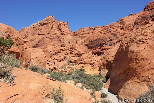
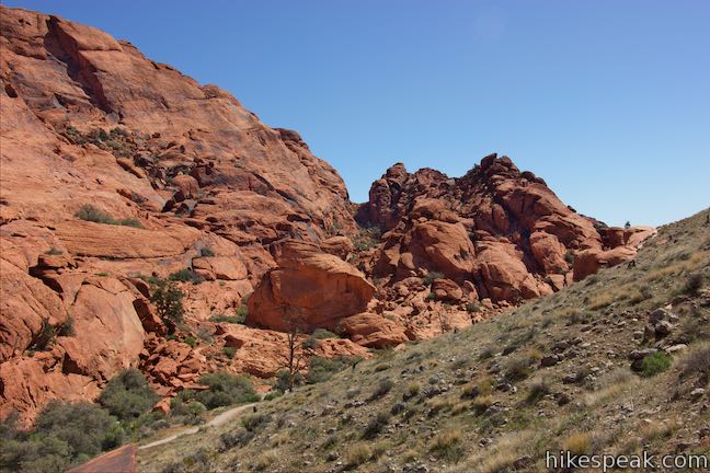
Avoid the gravel bottom of a side ravine (unless you’re keen to explore) and proceed up the trail. Pass a bit of wooden fence and come to an unmarked split, 0.7 miles from the start. The trail to the right goes down to the bottom of the ravine and passes through an amphitheater of red-orange boulders. The trail to the left is the ‘high road’ and passes above this area. Along the way, the upper trail passes a junction with a trail up to Calico II. Which way should you go?
- For hikers with someone to pick them up at Calico II, turn left at the split, hike 0.05 miles, turn left again and ascend 0.1 miles to the parking area to complete a 0.85-mile hike from Calico I
- To venture beyond Calico II, bear right at the split. The next section of the trail is quite interesting
Make your way down to the ravine floor and bear left along the gravel bottom, passing between tall boulders and short brush. You will find yourself surround by alluring sandstone creations. Head up the gravel creek bed through the sandstone enclave and out the other side. The trail ahead isn’t as exciting, but is still scenic.
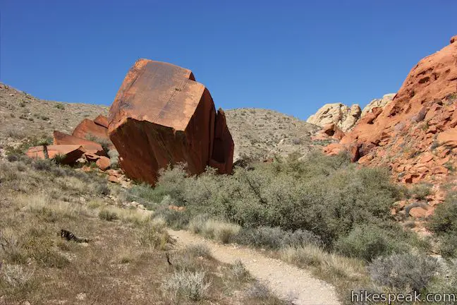
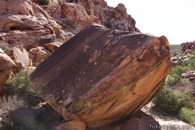
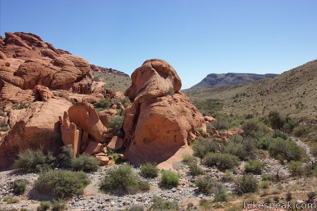
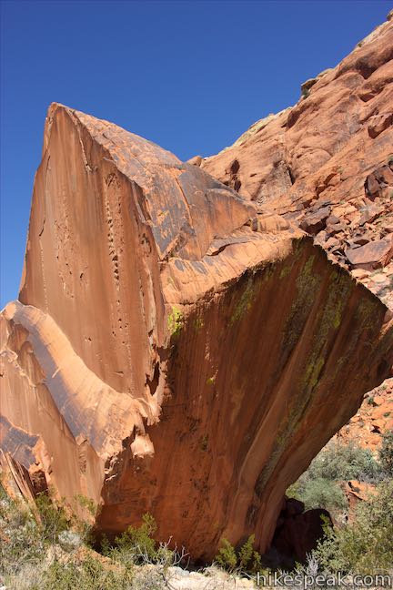
Merge with the high road and hike another 0.2 miles up a trail along the bottom of the ravine. You will come to a column of rock that has an angled square top and looks like something designed by a cubist artist. Ahead, the trail continues another 0.8 miles to Sandstone Quarry Trailhead. Unless you’ve got someone there to pick you up, this column of rock makes a good landmark for turning around, 1.05 miles from Calico I. Observant hikers may even spot petroglyphs on this rock formations.
Hiking back, you can go the same way or take the ‘high road’ over the ridge of rock on the south side of the amphitheater-like area. At the top, you’ll find broader views over the sandstone formations in the Calico Hills to the north. Descend the other side and come to a junction with the trail down from Calico II. This trail to the right ascends 60 feet in a tenth of a mile to meet the Scenic Drive at its second stop. To return to Calico I, bear left and proceed 0.05 miles to the initial split. Proceed down the ravine to hike the final 0.7 miles back to Calico I.
Calico II
The directions above assume that you start from Calico I, but what if you begin from Calico II? Hike 0.1 miles down from the trailhead to a split. If you turn right, you can hike 0.75 miles to Calico I. Turn left to hike west toward Sandstone Quarry Trailhead, arriving at the ‘cubist column’ after 0.35 miles. Coming back toward Calico II, you can proceed down the wash through the rock amphitheater and up the other side to make a hard right turn and return to the junction below Calico II. Ascend back to the trailhead and you’ll have a 0.95-mile lollipop loop with 100 feet of elevation change.
Dogs are welcome on leashes on all trails in Red Rock Canyon National Conservation Area. No permit is required to hike in the Calico Hills. An entrance fee is charged at the beginning of the Scenic Drive used to access the trailhead. Toilets area located Calico I and at various points along Scenic Drive.
To get to Calico I: From Las Vegas, take Interstate 15 to exit 42 and follow Route 95 west for 5 miles (heading toward Reno). Take exit 81A for Summerlin Parkway and drive 6.5 miles, using a ramp on the right to get on Clack County Route 215 South. Drive 2.2 miles, taking exit 26 to reach an intersection with Route 159 (Charleston Boulevard). Turn right and drive 5.2 miles to the start of Scenic Drive in Red Rock Canyon. Turn right, pay the entrance fee, and drive 1.2 miles up the road (passing the visitor center) to the first turnoff on the right.
Trailhead address: Calico 1, Scenic Drive, Red Rock Canyon National Conservation Area, Las Vegas, NV 89161
Trailhead coordinates: 36.1461, -115.430725 (36° 08′ 45.95″N 115° 25′ 50.6″W)
To get to Calico II: Follow the directions above to the start of Scenic Drive in Red Rock Canyon and drive 1.6 miles up the road (passing the visitor center and Calico I) to the second overlook, which is on the right.
Trailhead address: Calico II, Scenic Drive, Red Rock Canyon National Conservation Area, Las Vegas, NV 89161
Trailhead coordinates: 36.151835, -115.43728 (36° 09′ 06.6″N 115° 26′ 14.2″W)
You may also view a regional map of surrounding Nevada trails and campgrounds.


Calico I to Calico II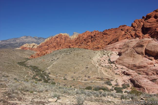


 | Calico Tanks This 2.5-mile hike ventures up a colorful canyon to a pond in a sandstone-framed basin alongside a grand view of Las Vegas. |
 | Red Spring Boardwalk This easy 0.55-mile nature trail circles a meadow at the base of the Calico Hills and visits a small but relied upon spring. |
 | Lost Creek Canyon This short hike visits Lost Creek Waterfall, a seasonal waterfall in a steep canyon above Red Rock Wash. |
 | Willow Springs Loop This 1 to 1 1/3-mile circuit travels along Red Rock Wash, exploring desert landscapes, Native American rock art, and potentially a seasonal waterfall. |
 | Hikes in Nevada Explore more trails in Nevada and the picturesque parks around Las Vegas. |
 | Red Rock Canyon Campground Red Rock Canyon National Conservation Area has one developed campground with 72 sites that have shade ramadas, picnic tables, fire rings, barbecue grills, drinking water spigots, and vault toilets. |
 | Atlatl Rock Campground and Arch Rock Campground Valley of Fire State Park has great places to camp surrounded by formations of red sandstone. |
Calico Hills Trail on redrockcanyonlv.org
Calico Hills Trail on birdandhike.com
Calico Hills Trail on myown100hikes.blogspot.com
Calico Hills Trail on lastadventurer.com
Red Rock Canyon National Conservation Area on wikipedia.org
The official website for Red Rock Canyon Interpretive Association
The official website for Red Rock Canyon National Conservation Area
Go the extra miles...
Submit a rating of this hike to go with your comment. Contribute to the average trail rating.