Calabasas Peak via Calabasas – Cold Creek Trail
in the Santa Monica Mountains
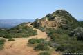
Before it was called Calabasas – Cold Creek Trail, this single track on the northwest side of Calabasas Peak was called the Secret Trail. Well the secret is out and this 4.5-mile round trip trek is a pleasure that all hikers should discover! Tackle 750 feet of elevation change as you cross ridges and ravines topped by sandstone minarets, eventually reaching a 2,163-foot summit with 360 degree views over the Santa Monica Mountains.

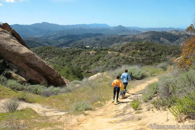
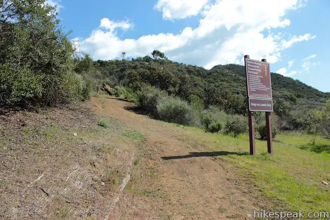
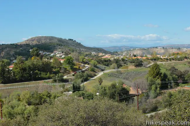
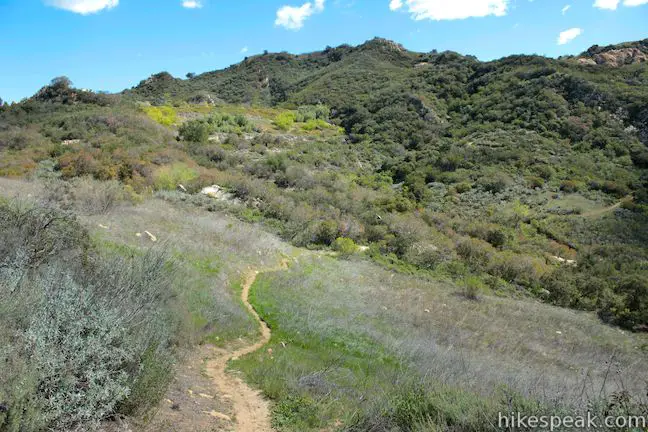
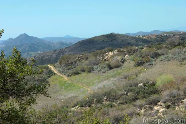
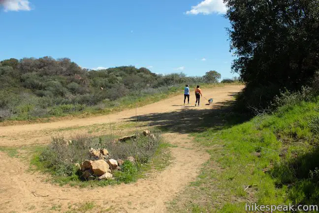
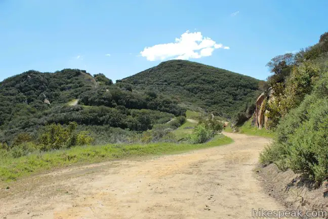
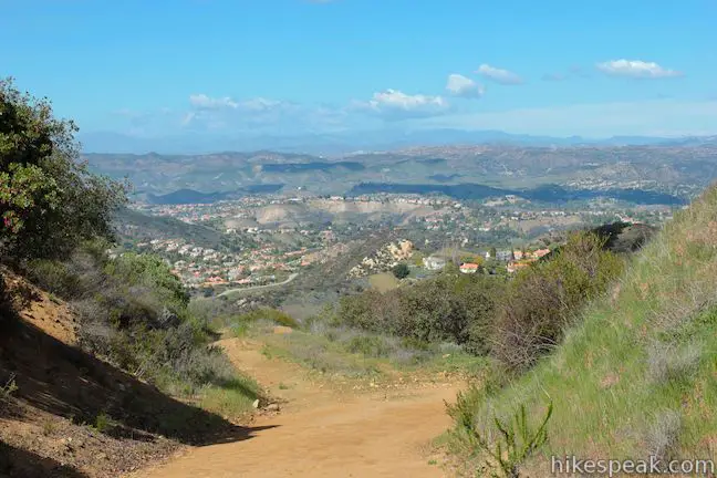
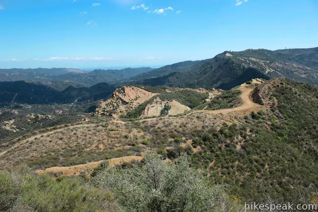
Starting from a turnout along Mulholland Highway in Calabasas, begin hiking east up a dirt track that weaves up a hillside of chaparral and oaks. Cross a seasonal stream and climb to views southwest toward Castro Peak and the summits that tower over Malibu Creek State Park. Once you get high enough, Ladyface Peak will come into view to the west, along with a ridge to the northwest skirted by a Calabasas neighborhood.

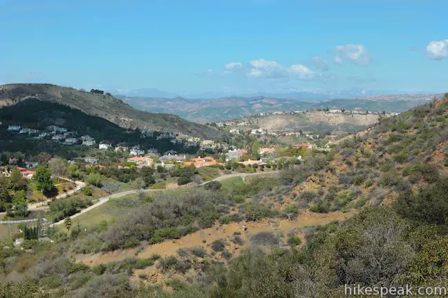
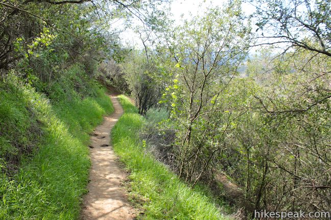
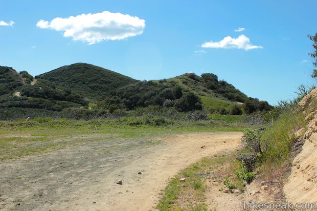
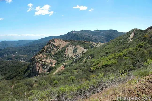
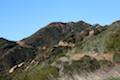
After 3/4 of a mile on the ascent, cross a ridge and drop across a shallow canyon on the side of the Calabasas Peak. Orange sandstone masses protrude from the top of the mountain slope. Cross the canyon and begin to climb again. Switchbacks lead to even broader views over the green valley to the southwest, cradled within the Santa Monica Mountains.
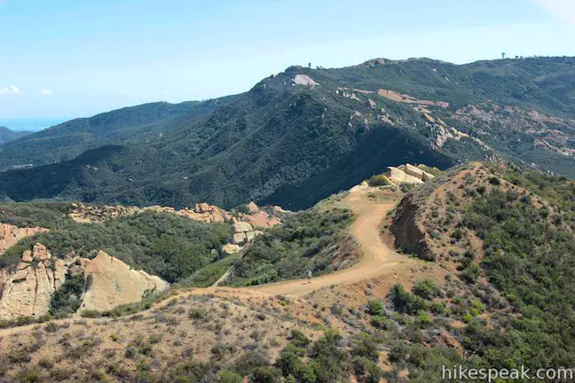
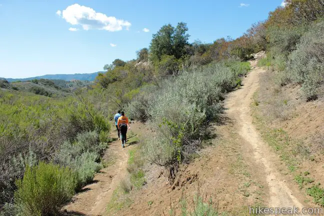
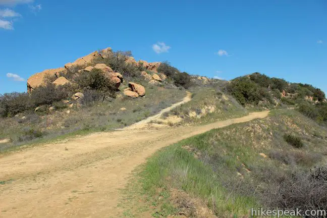
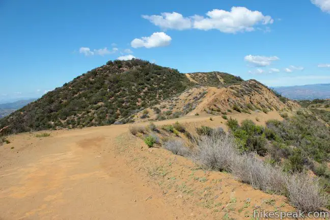
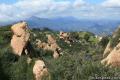
After 1.45 miles, you will pass through tall boulders that guard the top of Calabasas – Cold Creek Trail. Stay to the left (past a footpath that breaks off to explore some of the rock formations) and come over a crest to reach a T-junction with Calabasas Peak Motorway. Turn right to set out for the summit up the wide dirt road. To the left, Calabasas Peak Motorway goes over a rise and down to Old Topanga Canyon Road, which can be used as a starting point for a 4.2-mile round trip hike up Calabasas Peak Motorway to Calabasas Peak.
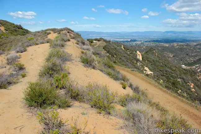
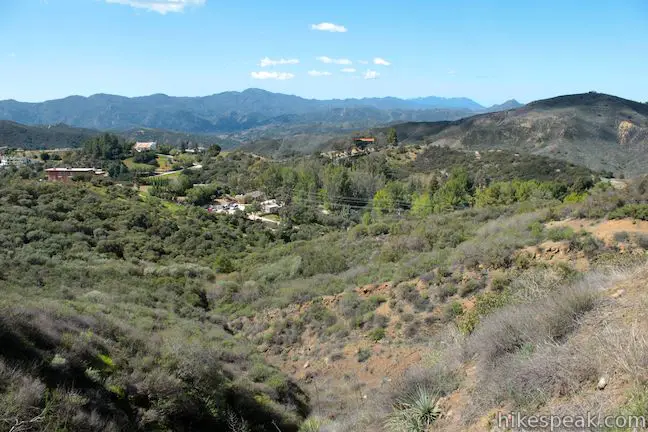
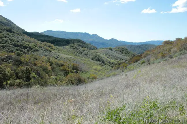
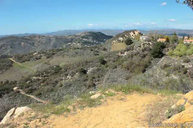
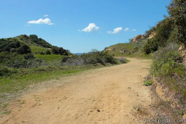
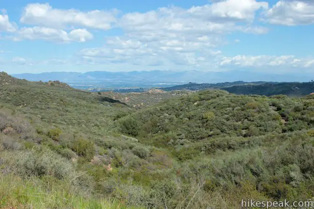
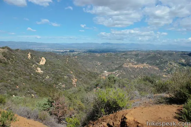
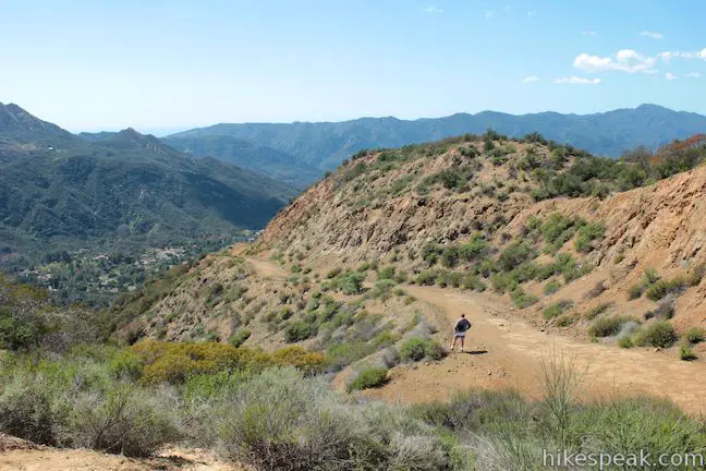
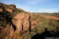
Calabasas Peak Motorway rolls south, offering views east and west off the ridge. The new view east looks down over Topanga and Red Rock Canyon Park.
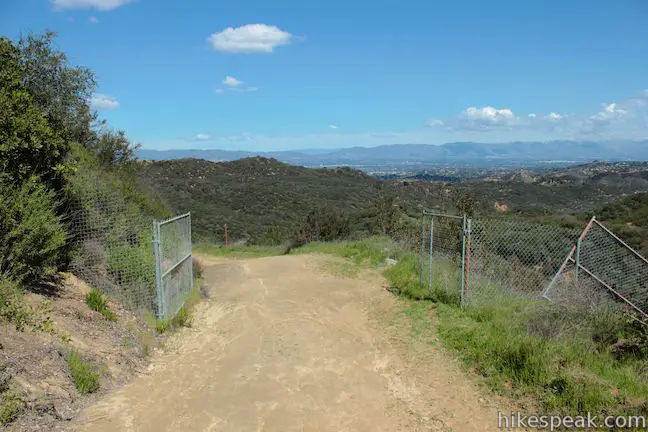
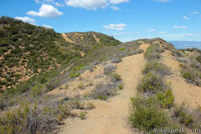
After 0.4 miles on Calabasas Peak Motorway, pass through an open gate in a chain-link fence. Continuing another 0.15 miles up the road and pass a path on the right that jumps up the ridge toward the summit of Calabasas Peak. The road continues below the summit and eventually descends the southern slope. If you leave Calabasas Peak Motorway here and take the path to the summit, you are in for a steep climb. It is easier to continue a little farther up the road and approach the summit from the other side.
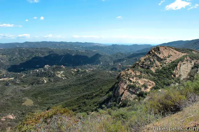
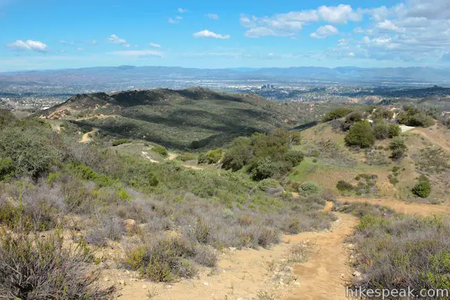
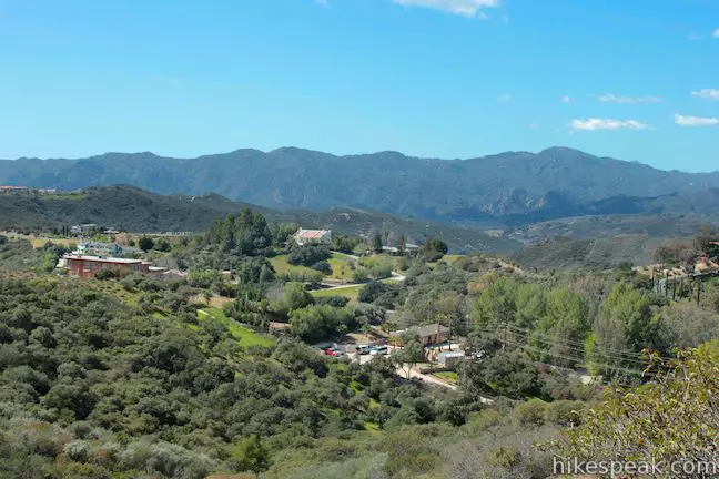
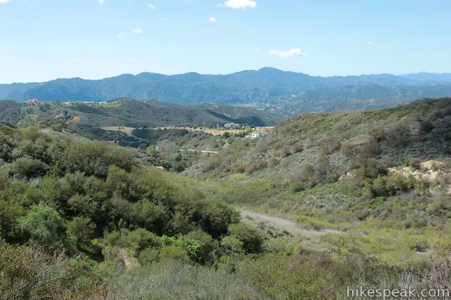
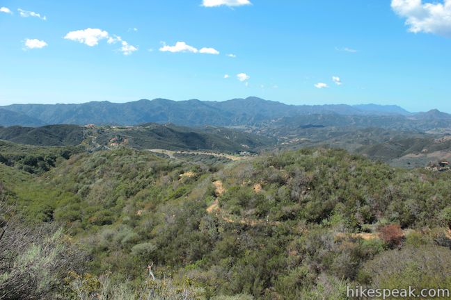
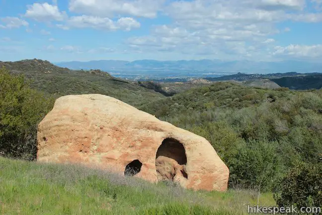
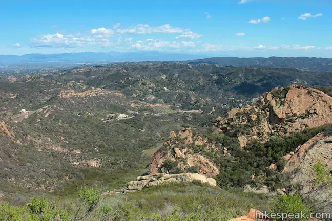
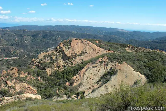
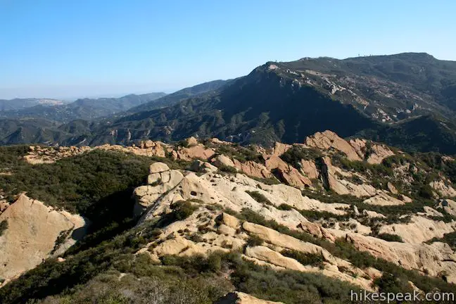
After another 0.25 miles on Calabasas Peak Motorway, for a total of 0.8 miles on the road and 2.25 miles from the start, you will arrive at an outcropping of rocks on the left side of the road. Step off Calabasas Peak Motorway here or you will start to descend off the mountain (toward another trailhead along Stunt Road). Have a seat on a boulder and enjoy one of the prime views on Calabasas Peak. Look east over Red Rock Canyon Park, defined by pink sandstone formations. Topanga Lookout and Saddle Peak rise to the south, and a sliver of the Pacific Ocean is visible to the southeast. The pointed and pocketed rock formations below are quite interesting and not as visible from the actual summit, so check them out here.
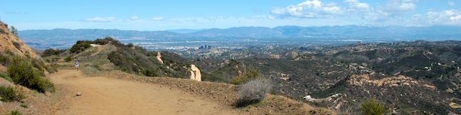
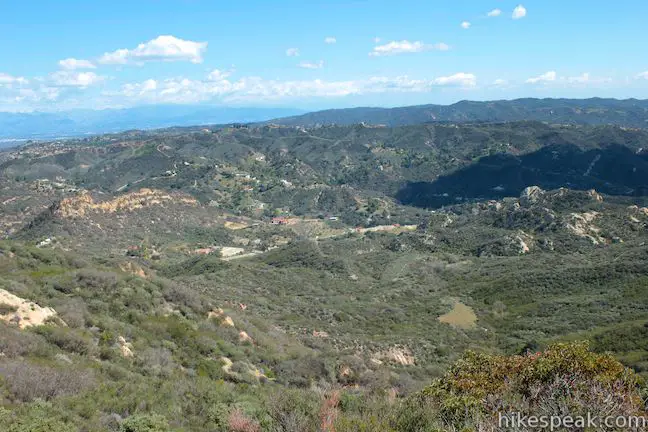
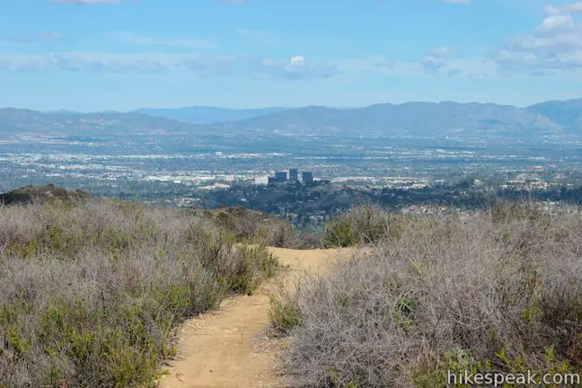
To reach the top of Calabasas Peak, backtrack north up Calabasas Peak Motorway for under a tenth of a mile until you see a path on the left (west) heading up the ridge to the mountaintop. The path will come to a T after another tenth of a mile. The path to the right descends back to Calabasas Peak Motorway (this is the steep route back). Turn left and hike the last 50 yards to the summit of Calabasas Peak. There is a register at the top of the small summit. Waist-high brush allows for open panoramic views. Look east toward Topanga, south toward Saddle Peak, west toward Castro Peak, and north over the San Fernando Valley where downtown Calabasas is marked by a cluster of tall dark buildings. The sometimes-snowcapped San Gabriel Mountains are visible across the valley.
After enjoying the view, hike north down to the ridge. Just past the junction, the single track shoots down a steep slope and reconnects with Calabasas Peak Motorway. Hike down the dirt road to Calabasas – Cold Creek Trail. Turn left and hike back down to Mulholland Highway to complete the hike.
This 4.5-mile round trip hike explores interesting terrain on the way to a sweeping summit. Calabasas Peak can also be reached by hiking up the south end of Calabasas Peak Motorway from Stunt Road or Red Rock Canyon Park. To see more of the north side of Calabasas Peak Motorway, try the hike from Old Topanga Canyon Road to Calabasas Peak. Dogs and mountain bikes are allowed on Calabasas – Cold Creek Trail and Calabasas Peak Motorway. No fee or permit is required for this hike, so get out and enjoy!
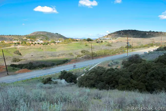
To get to the trailhead: From the 101 Freeway, take exit 29 for Valley Circle Boulevard/Mulholland Drive. At the end of the ramp, turn south on Mulholland Drive (which is called Valley Circle Boulevard north of the freeway). Drive south for 0.6 miles and turn right on Valmar Road. Valmar Road becomes Old Topanga Canyon Road after 0.4 miles. Stay on Old Topanga Canyon Road for an additional 0.8 miles and turn right at an intersection with Mulholland Highway. Drive 2.1 miles and find the dirt turnout for the trailhead on the left (east) side of Mulholland Highway.
Trailhead address: Mulholland Highway, Calabasas, CA 91302
Trailhead coordinates: 34.12637, -118.657407 (34° 07′ 34.93″N 118° 39′ 26.66″W)
View Santa Monica Mountains in a larger map
Or view a regional map of surrounding Los Angeles trails and campgrounds.


 | Calabasas Peak from Old Topanga Canyon Road This 4.2-mile hike on Calabasas Peak Motorway approaches Calabasas Peak from the northeast, providing big views over Topanga and other parts of the Santa Monica Mountains. |
 | Calabasas Peak from Stunt Road This 3.6-mile hike on Calabasas Peak Motorway approaches Calabasas Peak from the south, ascending through sandstone formations to panoramic views of the Santa Monica Mountains and San Fernando Valley. |
 | Red Rock Canyon The trails in the beautifully sculpted Red Rock Canyon are 2.5 and 5.2 miles in length. |
 | Stunt High Trail to Saddle Peak This 7.5-mile hike combines Stunt High Trail and a section of the Backbone Trail to visit the 6th tallest summit in the Santa Monica Mountains. |
 | Backbone Trail to Saddle Peak This 2-mile hike approaches Saddle Peak from the east. |
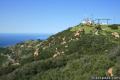
 | Topanga Lookout This 2-mile visits the site of an old fire tower that still offers great views of the surrounding mountains. |
 | More trails in the Santa Monica Mountains Explore other destinations in the range. |
[…] This is a beautiful, moderate trail, with partial shade and amazing views. Thereare multiple caches on this trail. The first one can be found within the first 1/4mile of the trail. The next one can be found about 1 mile in.101N Exit West Valley Circle/Mulholland DriveHead West on Mulholland (approx 1.5 miles)R on Mulholland Hwy (approx 3 miles)Trailhead and small pull off parking area will be on Left hand side of roadGet more information about Secret Trail […]
I hiked this trail today and enjoyed it quite a bit. Although it is not an overly difficult hike, there are short stretches that will get the blood pumping. In addition there is sufficient shade to give you places to rest. I suspect it is quite pretty in the spring, when there may even be water in the creeks. But regardless, I may have found a new after work workout trail that meets all of my needs for fitness, scenery, distance, and elevation gain. I also can’t wait to bring my friends back who like to climb on rocks!
I’ll be leading a hike (its free) on the Secret Trail to Calabasas Peak Sunday Feb 17. We’ll be doing it a little differently by staying off the Calabasas Peak Motorway dirt road and following a path along the contours of the ridge line. You can view the hike here: https://www.hikingwithdean.com/event/pre-game-hike-calabasas-peak-without-the-fireroads-dogs-ok/