Tasman Glacier View & Blue Lakes
in Aoraki Mount Cook National Park
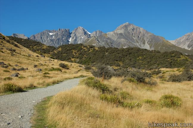
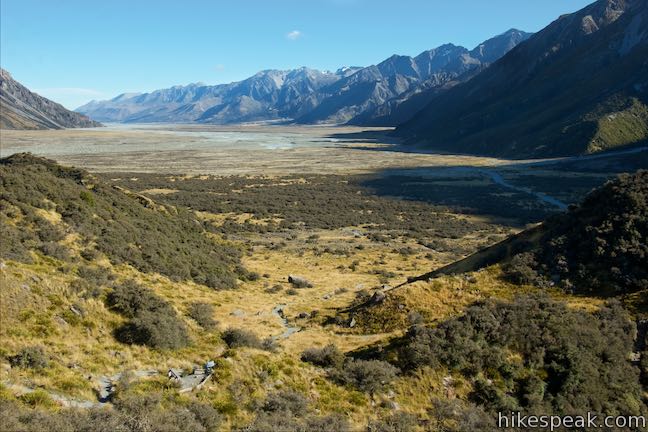
Two tracks are combined in Blue Lakes and Tasman Glacier View Walk for a 1.85-kilometer (1.15 mile) round trip outing, netting views of small pools and a big lake below New Zealand’s largest glacier. This Tasman Valley hike ascends rocky moraine to a viewpoint that looks down on a long, milky-colored lake below Tasman Glacier and several peaks in the Southern Alps. Downhill from the viewpoint, visit the Blue Lakes, which are actually small green ponds that have transitioned since their naming.

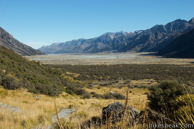
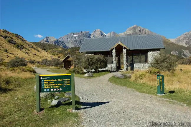
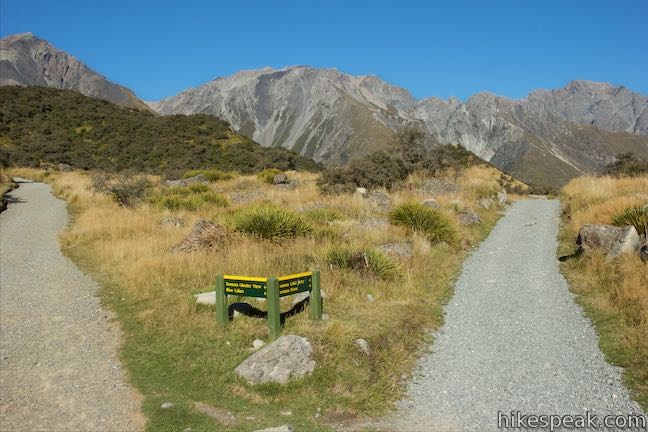
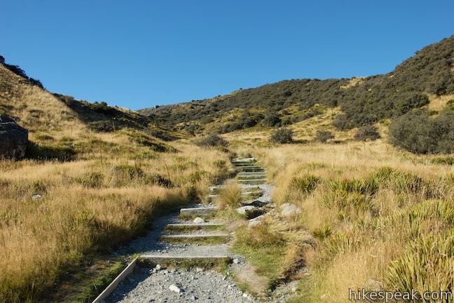
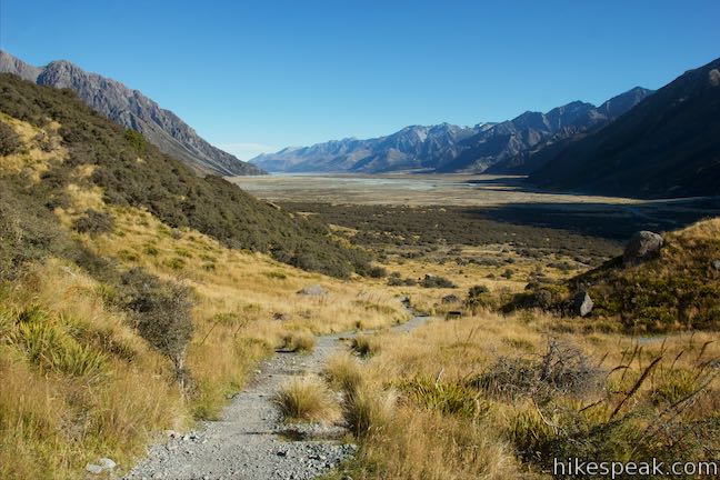
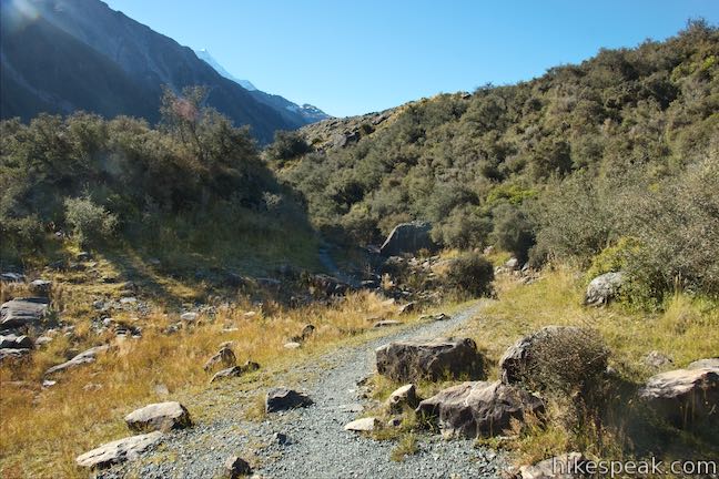
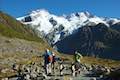
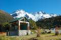
Start from the Blue Lakes Car Park at the end of Tasman Valley Road, about eight kilometers east of Mount Cook Village. A sign at the car park lists the distance to Tasman Glacier View as 15 minutes and to Blue Lakes as 10 minutes. Hike up the gravel track next to a day-use shelter and toilets to come to the first of two junctions, 150 meters into the outing. To the right, a track heads to Tasman Lake Jetty and Tasman River. The jetty is used for boat tours on the lake and this track takes about 25 minutes to walk. Turn left to continue toward Tasman Glacier View and the Blue Lakes.
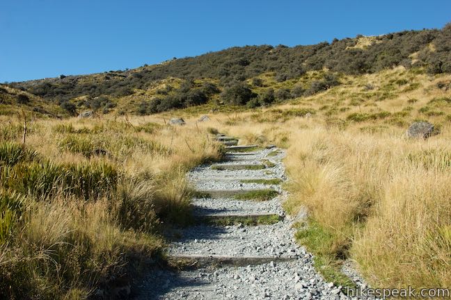
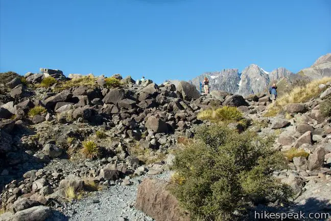
Go up wooden steps on a grassy slope, heading toward a boulder-strewn hill. This is a moraine alongside Tasman Lake, created by Tasman Glacier when it was significantly larger. Over your shoulder, you’ll find long views down Tasman Valley in the direction you came.
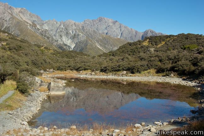
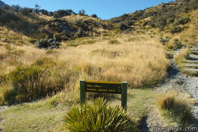
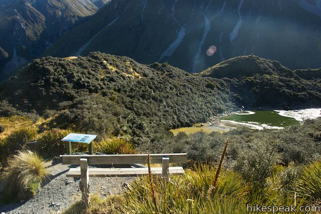
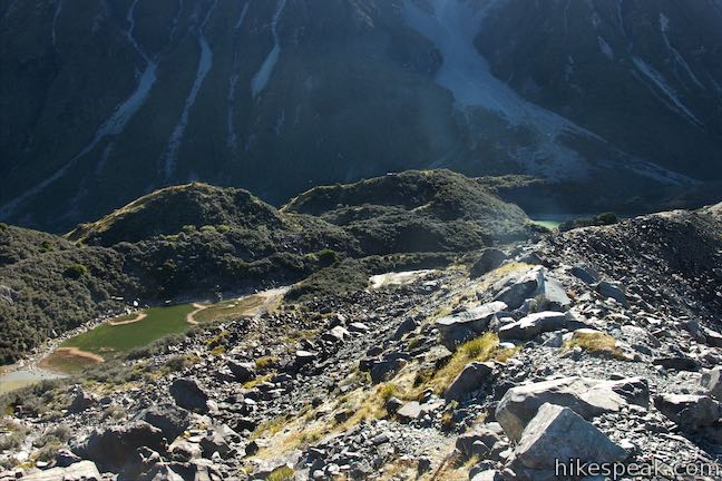
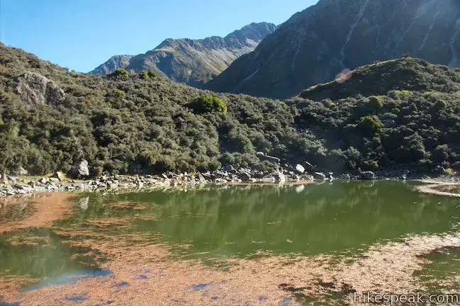
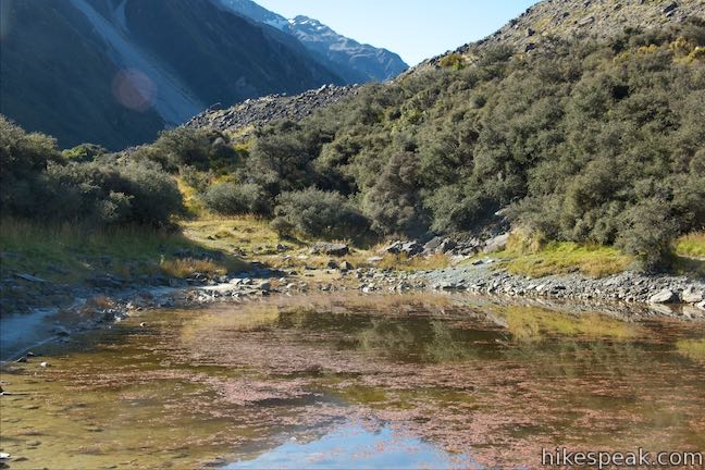
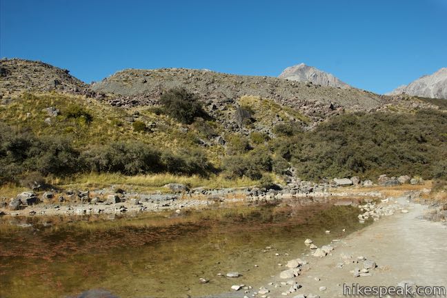
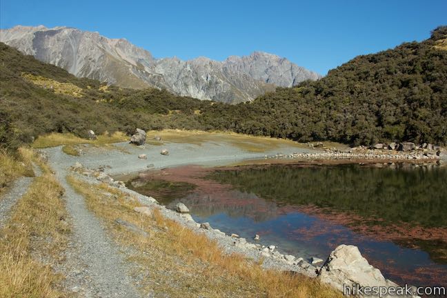
After putting in 370 meters of hiking, you’ll hit another marked junction. The Blue Lakes are to the left and the track to the viewpoint stays to the right. Continue to the right to proceed toward Tasman Glacier View. You will be able to look down on the Blue Lakes just ahead. Hike up more steps for another sixty meters to a bench that overlooks the Blue Lakes and a panel that explains why the pools are now green:
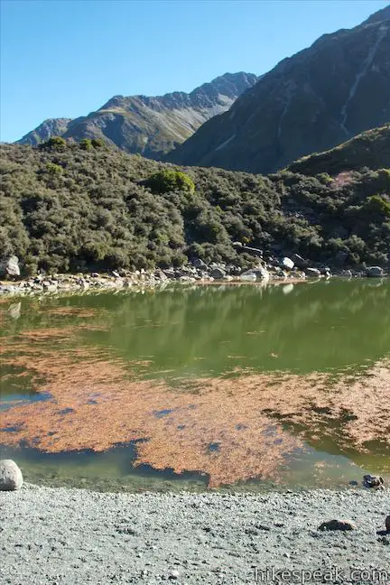
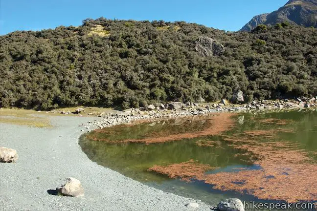
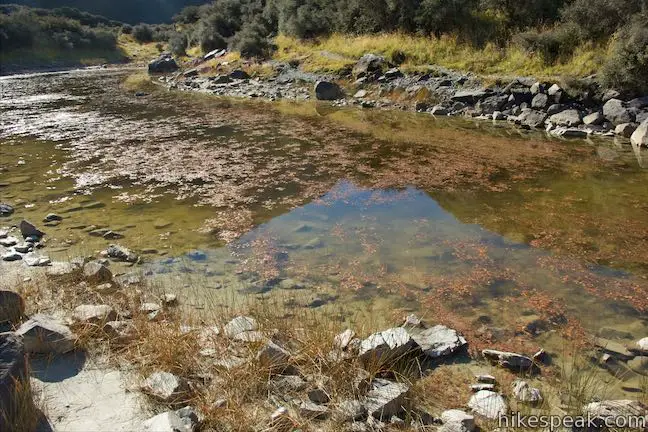
In the mid-1800s when the Blue Lakes were named, they were fed by turquoise glacial melt water filtering through the moraine. The icy blue water was a popular swimming spot in summer and skating rink in winter. Today, the Tasman Glacier has shrunk in length and height, and water no longer flows from the glacier into the Blue Lakes. The warmer rainwater that now feeds the lake supports green algae, making the Blue Lakes green.
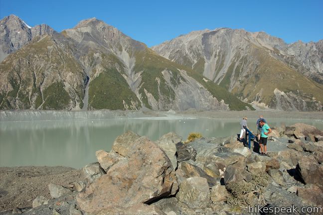
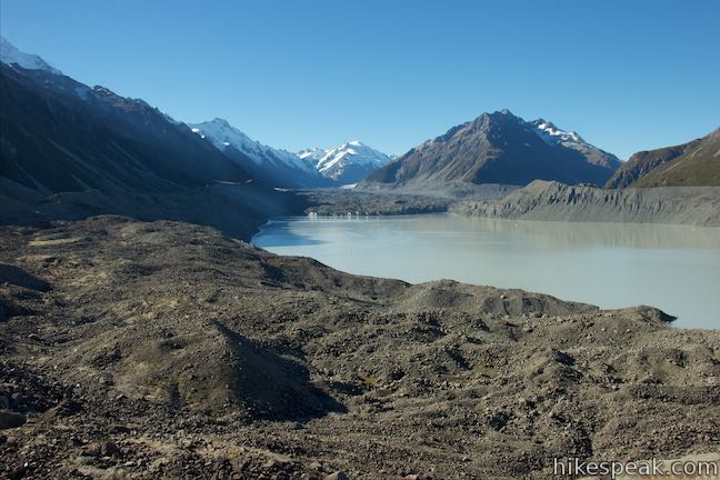
Tasman Lake is a milky brown color, signifying that it is filled with lots of particles from glacial melt. Turquoise blue water is found in pools where more glacial particles have settled to the bottom. Rock particles still suspended in the water contribute the blue color. Green water is generally rainwater, indicating that Tasman Glacier no longer feeds the Blue Lakes.
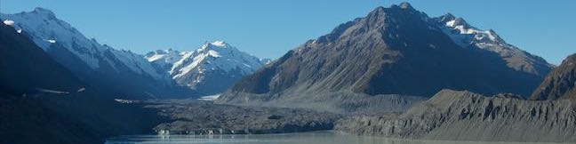
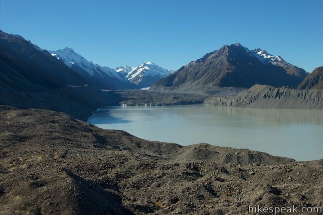
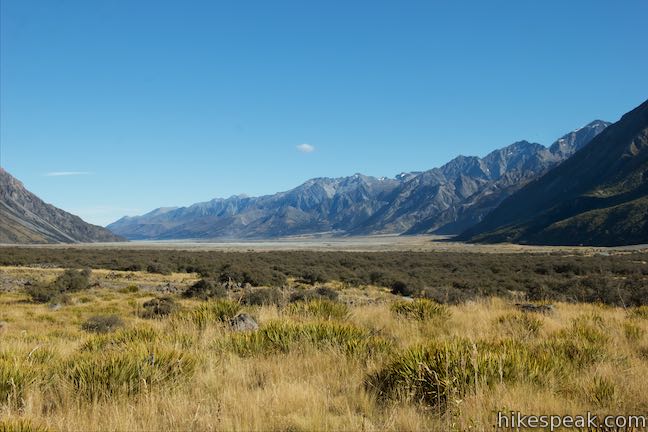
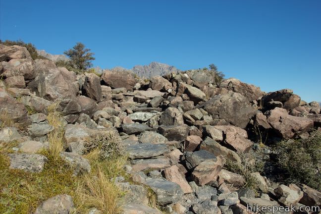
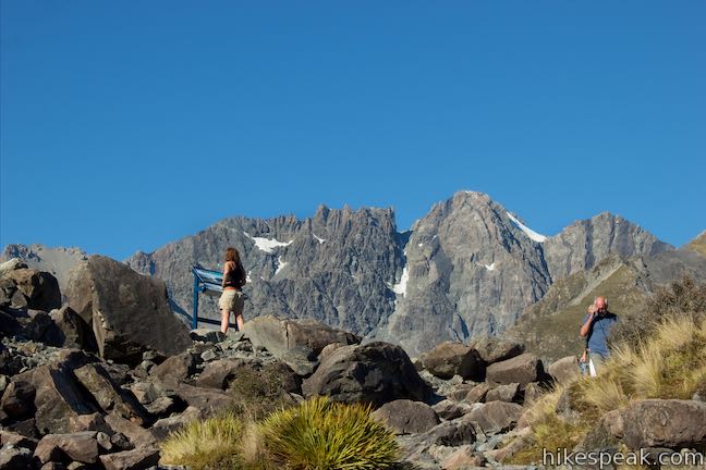
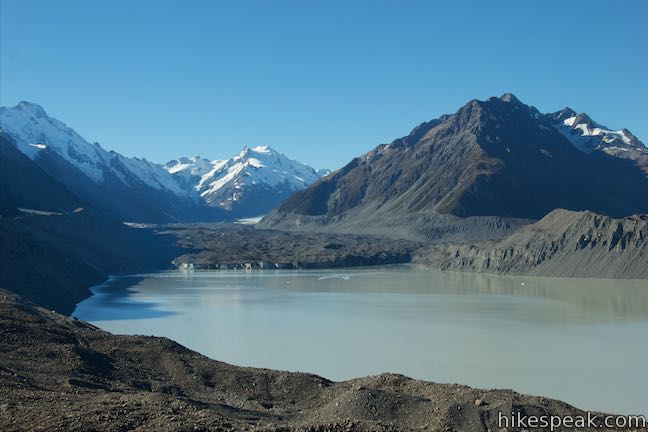
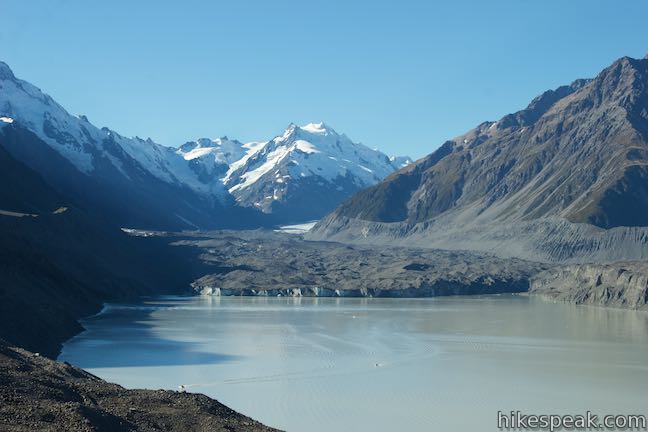
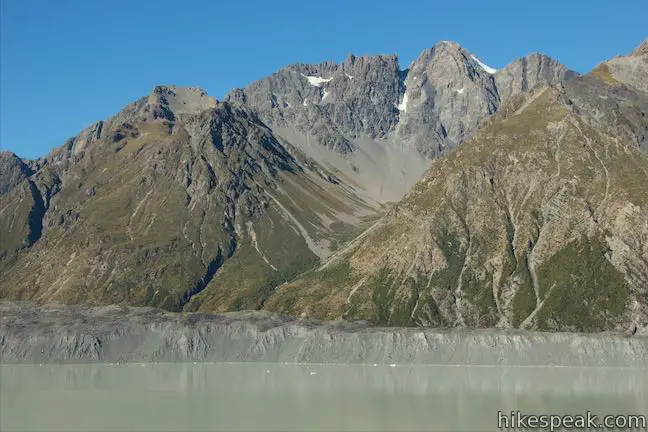
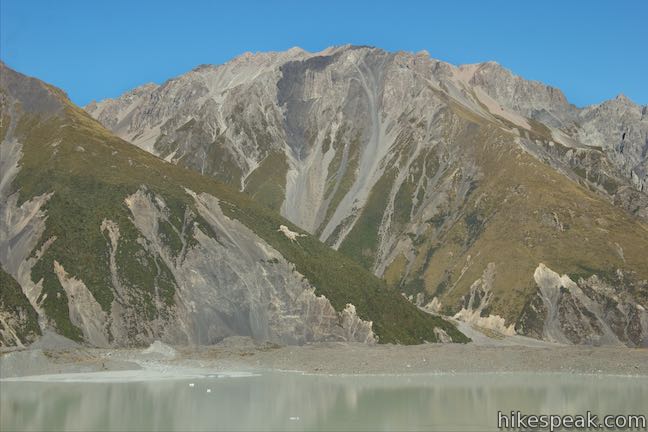
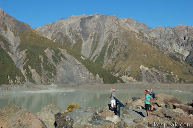
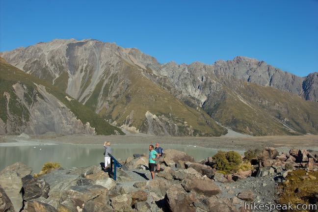
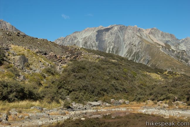
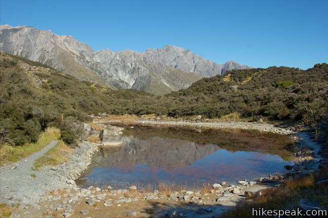
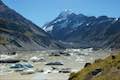
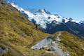
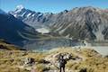
The terrain gets more rugged toward the top of the steepening slope of boulders. You will arrive at the viewpoint in under 600 meters of effort. Below you stretches a terminal lake, occupying a long valley between tall mountains. A handful of icebergs may be floating down the lake from the glacier to the north. Tasman Glacier is the largest and longest glacier in New Zealand with a surface area of around 100 square kilometers. The ice is thick too, as the deepest section of the glacier is around 600 meters tall.
A panel at Tasman Glacier View explains that the massive glacier is shrinking. Around 14,500 years ago, Tasman Glacier was 85 kilometers long with 1,500-meter deep ice at the location of Tasman Glacier View (picture ice halfway up the mountains on the opposite side of the valley). By 1890, the glacier was 29 kilometers long, with 880-meter deep ice where you’re standing now. In 1990, the glacier was 26 kilometers long. It measured 24 kilometers long in 2011 and is shrinking rapidly. The glacier is retreating by 480 to 820 meters per year and is expected to be 20 kilometers long by 2027. It’s a tough time to be a glacier…
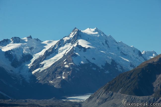
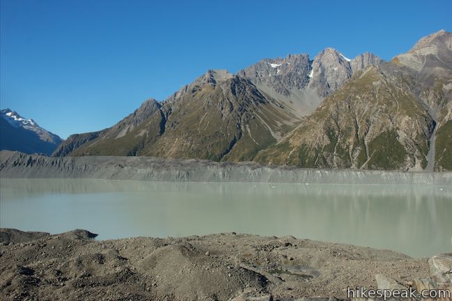
Looking up the lake, you will see a cliff of ice at the end of Tasman Glacier. On the far left, the top of Mount Cook pokes out above the ridge. Behind the glacier is Mount Haidinger and Mount De La Beche. Mount Johnson and Novara Peak rise above the right side of the glacier. Looking across Tasman Lake, the Liebig Range rises to the east, including summits like the Armchair, Mount Biretta, the Nuns Veil, the Acolyte, and Mount Blackburn. Isn’t it nice to get such a big view after putting in a limited effort?
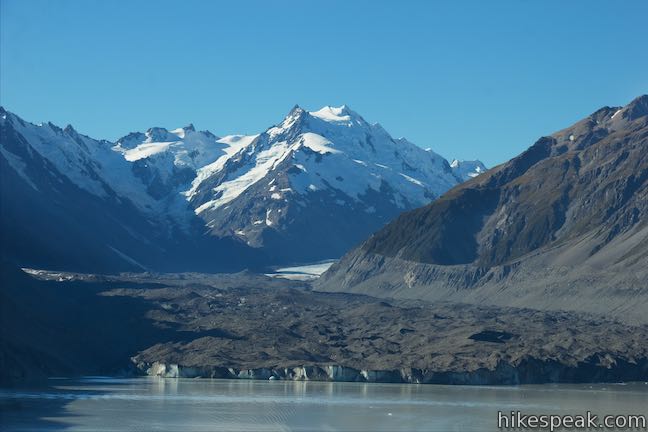
As you look out over the large lake below the glacier, you may spot a couple boats zipping around the water. Floating icebergs may be scarce from this vantage (Check out nearby Hooker Valley Track to see a glacier lake with more icebergs).
Backtrack down the stone steps to the junction with Blue Lakes Track. Make a right turn (originally a left) to begin the second portion of the hike. Go through brush for about 125 meters to reach the edge of the first pond. The water is green with lots of reddish algae near the surface. If the water is still, it should provide pleasant reflections of the surrounding peaks, so stroll around the pond to catch the best angles. The track goes down the right side of the pool and crosses through another strip of brush to reach a second member of the Blue Lakes, which is smaller than the first. The track splits to go around both sides of the pond.
If you’ve seen enough, you could circle this pool and head back up the track. Otherwise, you could push farther. The track narrows to a rarely used route and pushes through brush to pass a few more lakes (which you saw from above). The final pool is the largest. Past that, the path ends at Ball Hut Road, an extension of Tasman Valley Road.
The hike to Tasman Glacier View is 1.15 kilometers (0.7 miles) round trip with 85 meters (280 feet) of elevation change. Adding the side track to the Blue Lakes brings that distance to 1.85 kilometers to visit the first two lakes or 2.75 kilometers round trip going all the way to Ball Hut Road. Dogs are not allowed on tracks in Aoraki Mount Cook National Park. Bikes are also forbidden on this outing. No permit is required to visit Tasman Glacier View and Blue Lake. The national park has no entry fee, so get out and enjoy!
Directions: Take State Highway 8 to State Highway 80 (Mount Cook Road), at the south end of Lake Pukaki. Drive north on SH 80 for 53.0 kilometers. A few kilometers before Mount Cook Village, turn right on Tasman Valley Road. After 7 kilometers, the road ends at car park where the track begins.
Trailhead address: Tasman Valley Road, Aoraki Mount Cook National Park, Canterbury, 7999, New Zealand
Trailhead coordinates: -43.698, 170.16325 (43° 41′ 52.80″S 170° 09′ 47.70″E)
You may also view a regional map of surrounding New Zealand tracks, campgrounds, and lodging.


 | Hooker Valley Track This superb 11-kilometer round trip hike heads up Hooker Valley to an iceberg-filled lake at the end of an impressive glacier below Mount Cook. |
 | Kea Point Track This easier 3-kilometer round trip walk goes to landing above Mueller Lake with views of Mount Sefton and Mount Cook. |
 | Sealy Tarns Track This incredibly steep and incredibly scenic 5.8-kilometer round trip hike uses a series of staircases to ascend a mountainside to pools that reflect views of Mount Sefton and Mount Cook. |
 | Mueller Hut Route Ascend past Sealy Tarns on a rough route to a famed hut for a 10.5-kilometer round trip hike with spectacular views. |
 | Mount Ollivier This 1,933-meter tall summit can be reached by ascending above Mueller Hut for even grander views. |
 | More trails in New Zealand Explore other destinations for walking and hiking (as well camping and lodging) in New Zealand. |
 | White Horse Hill Campground This 60-site campground is surrounded by great hiking tracks and just a few kilometers from Mount Cook Village, making it an ideal place to stay during a visit to Aoraki Mount Cook National Park. |
The Department of Conservation webpage for Tasman Valley Walking Tracks
The Department of Conservation brochure for walking and cycling in Aoraki Mount Cook National Park
Tasman Glacier View & Blue Lakes on rankers.co.nz
The Department of Conservation webpage for Aoraki Mount Cook National Park
Hi,
At which point we can see the best view of glacier during winter time at this area?