Hazard Peak via Bloody Nose Trail, Hiedra Trail, and Hazard Peak Trail in Montaña de Oro State Park

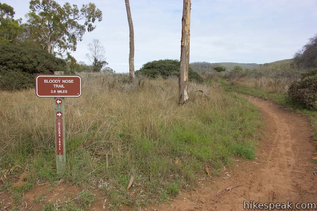
The panoramic summit of Hazard Peak in Montaña de Oro State Park has excellent coastal views. Hazard Peak Trail is the most obvious route to the top and a great choice, rising to the 1,076-foot summit over 3 miles. A junction partway up Hazard Peak Trail makes it possible to add a couple other trails to the approach. Bloody Nose Trail and Hiedra Trail are a combined 0.85 miles long, meeting Hazard Peak Trail 1.93 miles below the summit. Use these two trails to change-up the hike to Hazard Peak, effectively shortening the hike up the mountain to 5.55 miles round trip while maintaining 950 feet of elevation change. Bloody Nose Trail passes through an interesting eucalyptus grove and Hiedra Trail has awesome views of Morro Rock, Hazard Canyon, and Hazard Peak.
South Dune Trail bridges the trailheads for Hazard Peak Trail and Bloody Nose Trail, presenting the possibility of a loop hike that can be combined with the ascent to Hazard Peak for an outing of just over 6.5 miles round trip.
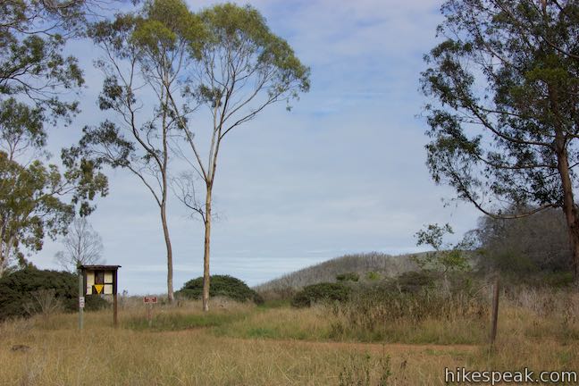
Space for a couple cars to park is available beside the posted trailhead for Bloody Nose Trail along Pecho Valley Road, on the inland side of the road, almost directly across from and Hazard Canyon Parking Day Use Area (and hikes along the Dune Trail).
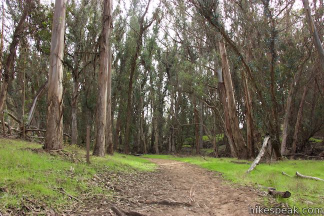
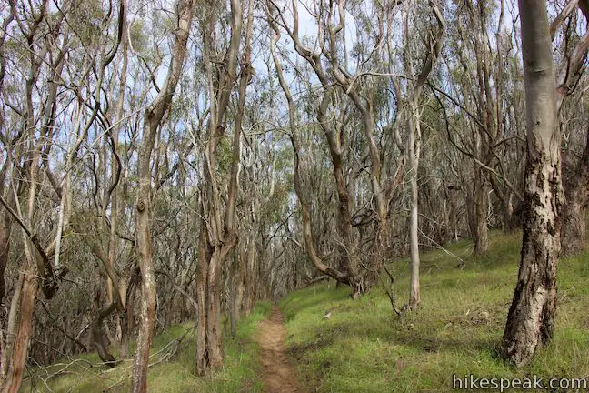
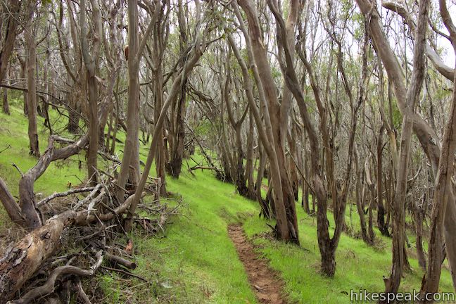
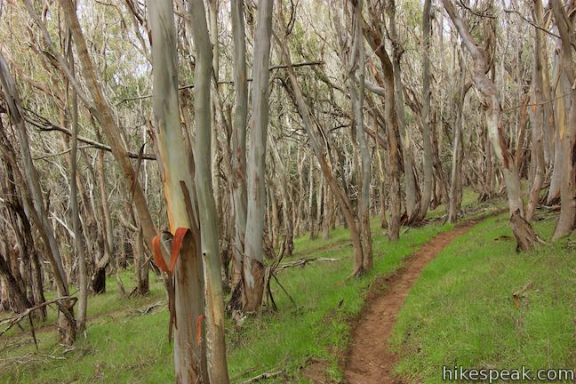
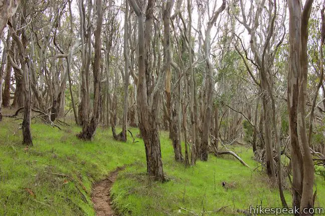
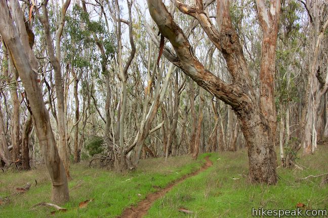
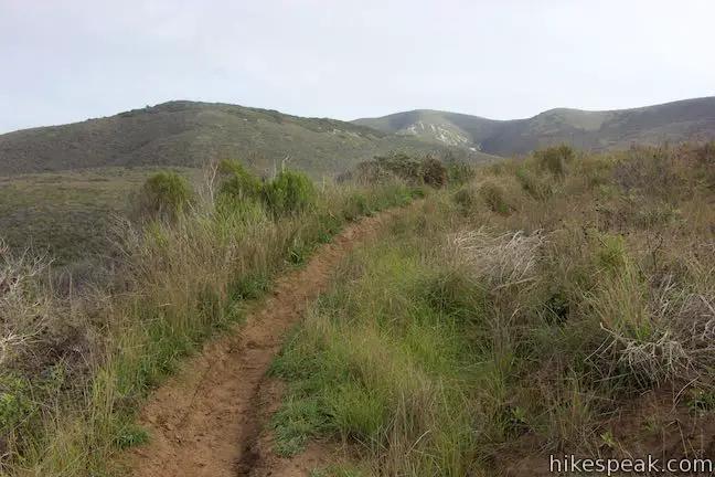
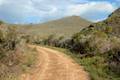
Set out up Bloody Nose Trail and come to an ambiguous U-shaped turn after 100 yards. Bypass the path straight ahead and curve to the left to continue up the trail. (For those in a rush, the path going straight off the curve probably gets to the next junction in a shorter distance.) After the bend, Bloody Nose Trail narrows to a single track that rises gradually through thin, tightly packed eucalyptus trees. Enjoy the weaving course up through this interesting single-species forest.

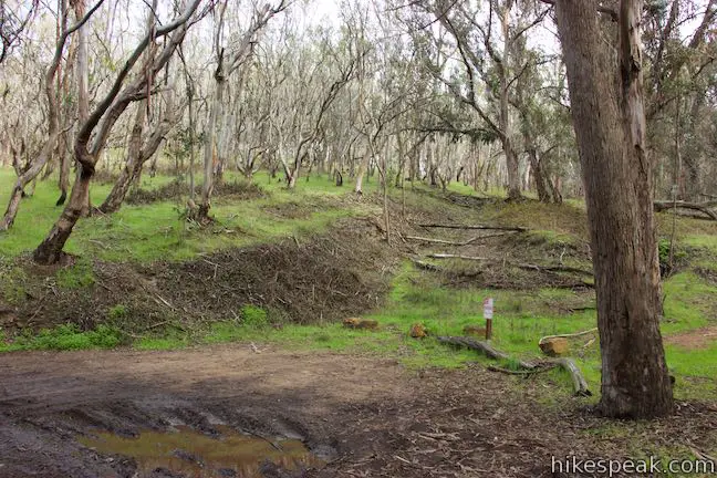
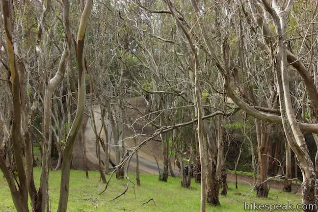
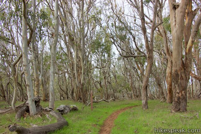
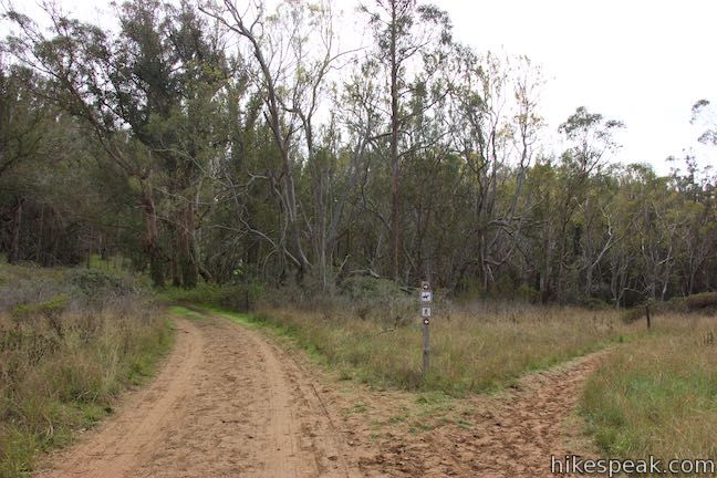
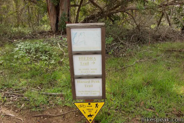
After about a third of a mile of hiking, Bloody Nose Trail exits the forest into a field where the trail curves to the left and meets a wide dirt road by a trail kiosk. Heading south (a hard right turn) is a wide dirt road that offers an alternative route back down to Pecho Coast Road. Bloody Nose Trail continues up the wide road to the left, going north. Hiedra Trail begins to the right of the kiosk and is marked with a trail sign. Make the turn up Hiedra Trail to continue ascending to Hazard Peak Trail.
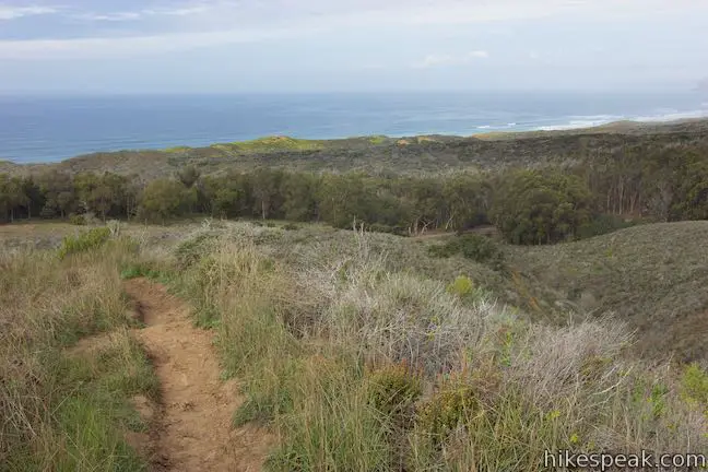
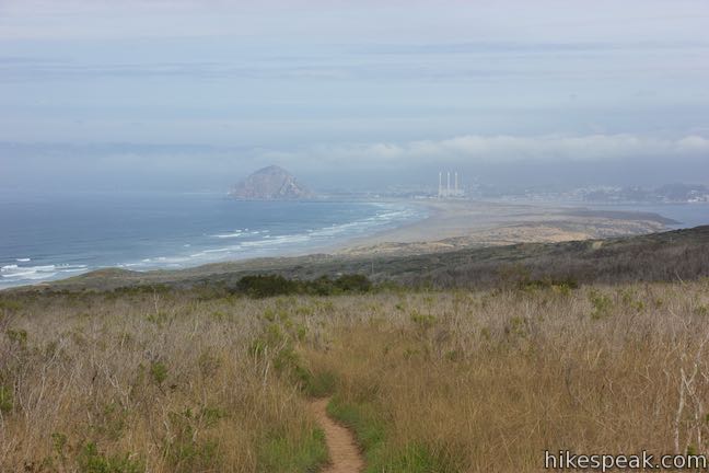
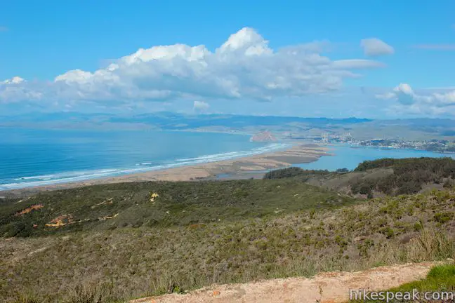
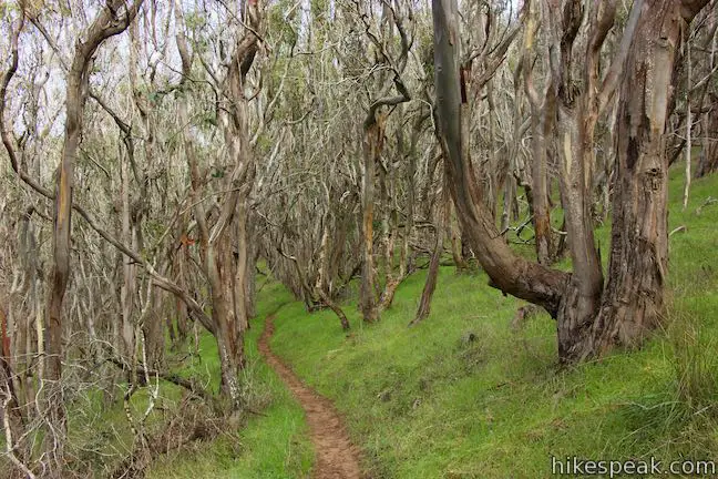
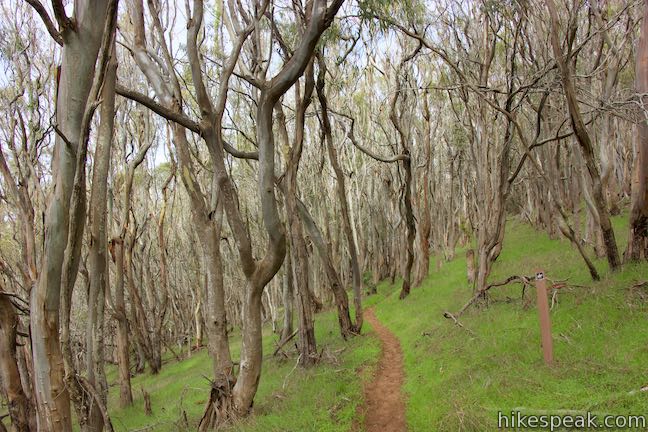
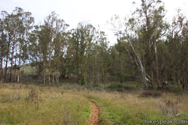
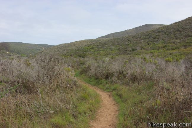
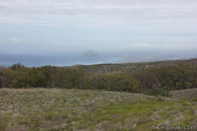
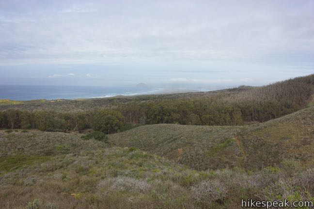
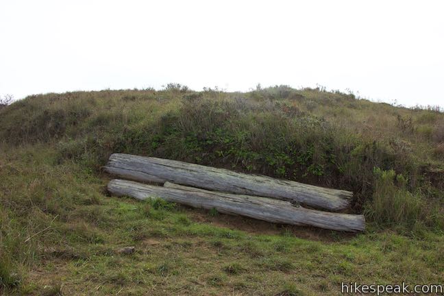
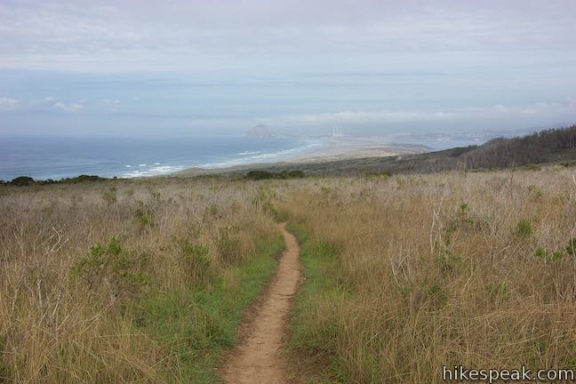
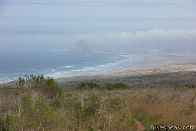
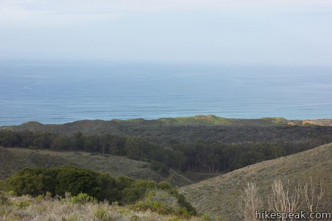
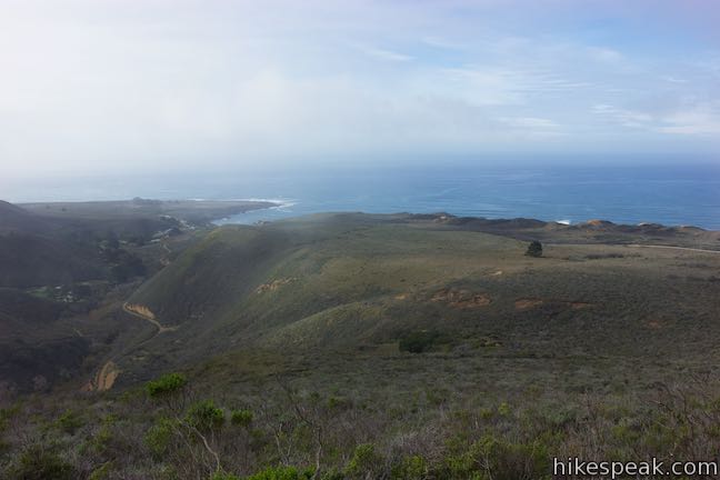
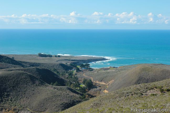
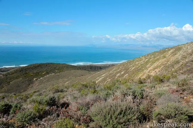
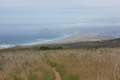
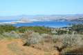
Hiedra Trail rises gradually and curves up around the round edge of a ridge on the south side of Hazard Canyon. Short vegetation offers open views. Pass some logs on the right that form a natural bench as you look to the left out over the ocean. As you gaze up the coast, the large mass of Morro Rock jumps out from the surroundings. Three smoke stacks and the coastal city of Morro Bay lie just inland from the rock.
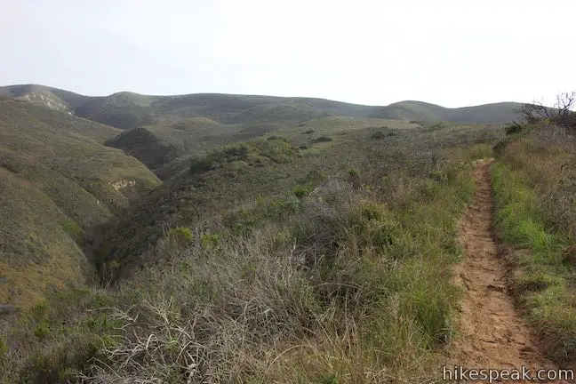
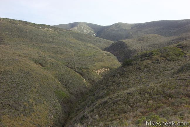
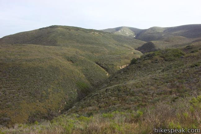
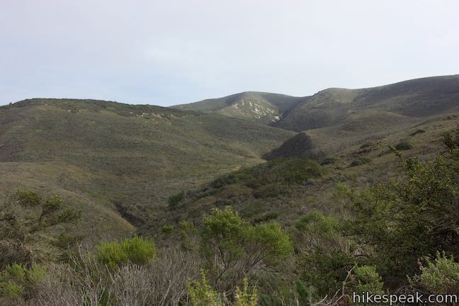
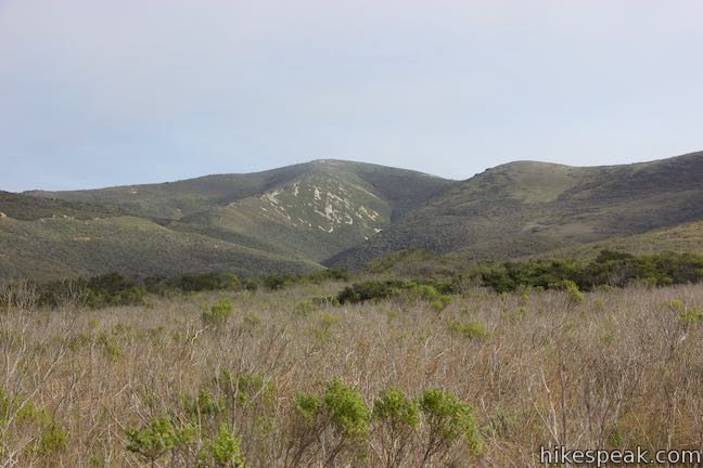
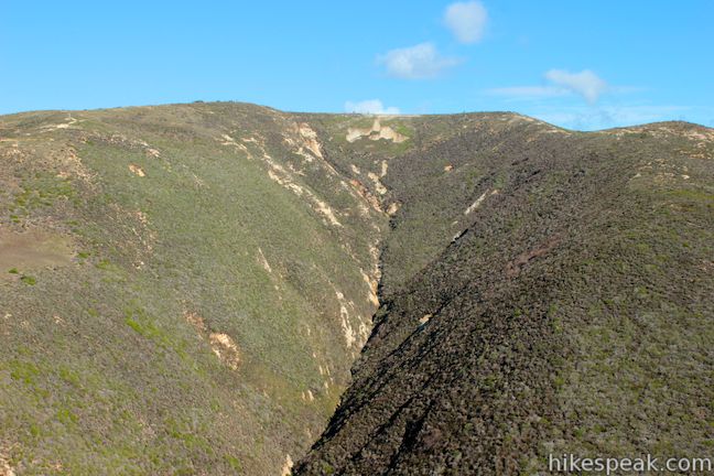
As Hiedra Trail rounds the bend, you’ll get a new perspective up Hazard Canyon toward Hazard Peak. The summit a long way up the canyon. At the end of the curve, Hiedra Trail heads south through short brush atop the ridge. Over your shoulder, the views of Morro Bay continue to wow.
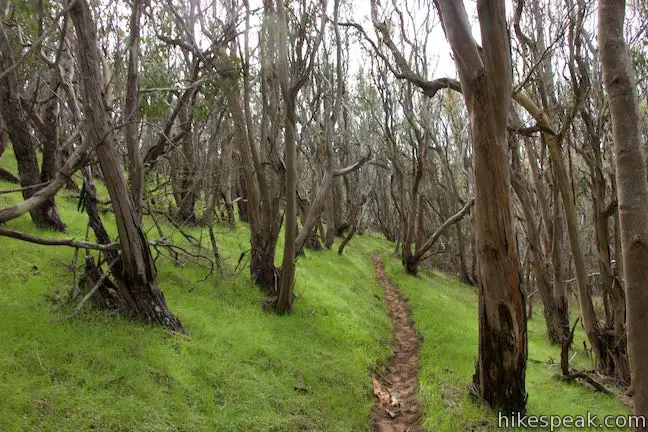
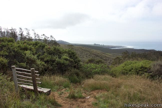
Reach a small wooded area at the top of the trail where the single track curves left and passes a bench. Pause here to gaze south over Montaña de Oro State Park. Spooner’s Cove and the area along the Bluff Trail lie down the coast below you.
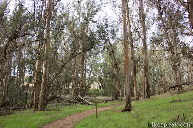
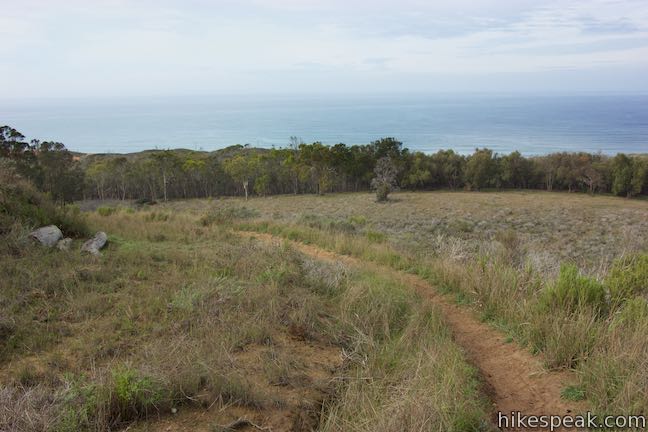
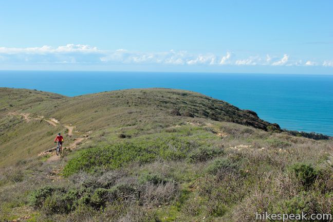
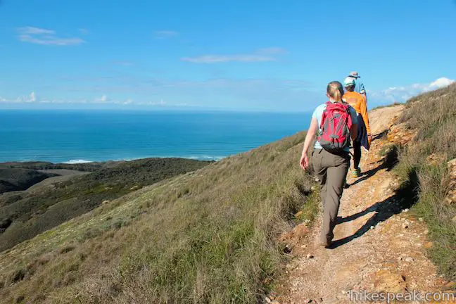
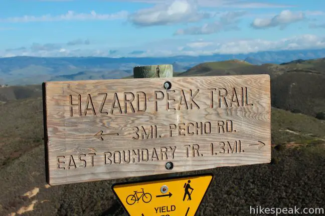
Walk another 150 feet to the end of Hiedra Trail and a T-junction with Hazard Peak Trail. After 0.85 miles of hiking, join the main trail up to Hazard Peak. Turn left to ascend the next 650 feet in just under two miles to the summit.
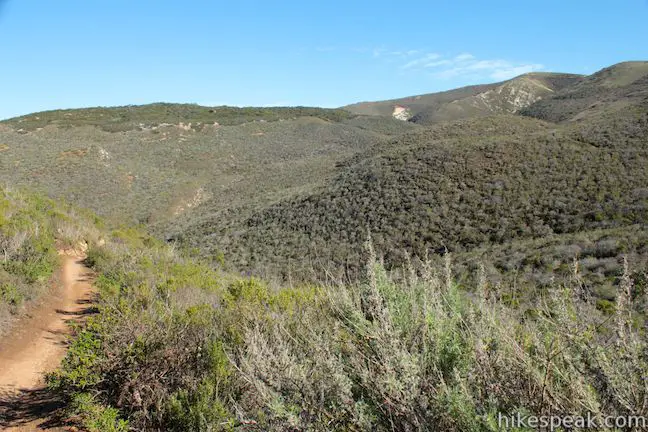
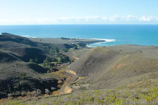
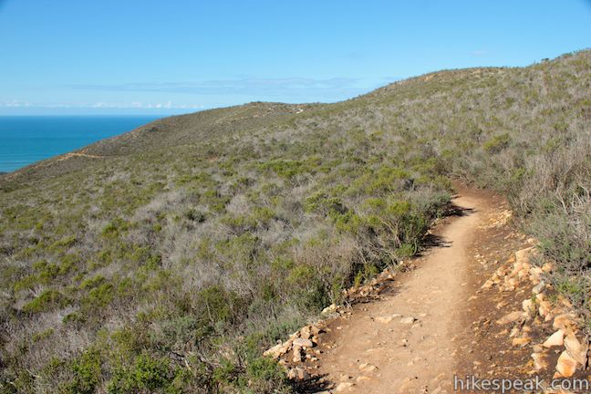
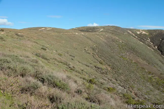
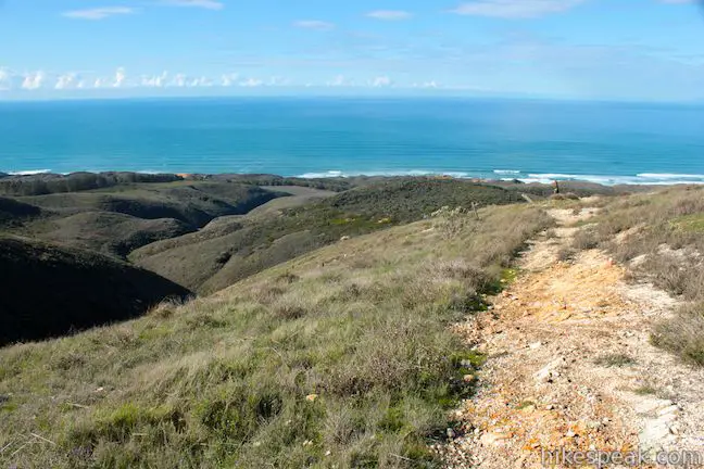
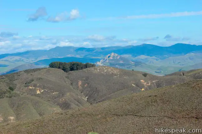
Hazard Peak Trail curls northeast, offering another view of Morro Rock beyond the line of sand dunes at the north end of Montaña de Oro State Park. The trail goes inland up the mountainside next to a small canyon. Weaving to the south, the trail attains higher views looking out over the coast and into Islay Creek Canyon, just to the south. Oats Peak and Valencia Peak rise over the far side of the canyon.
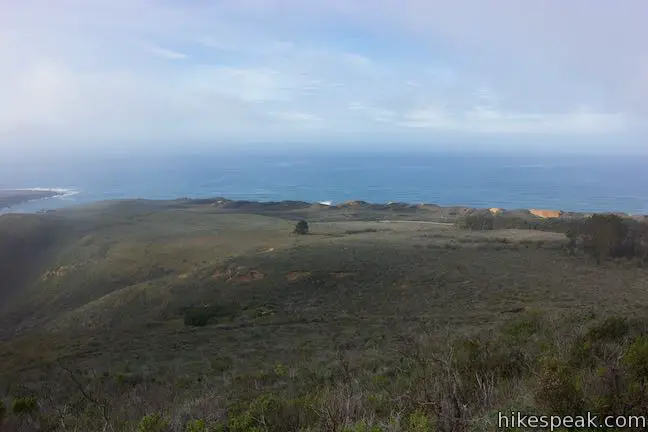
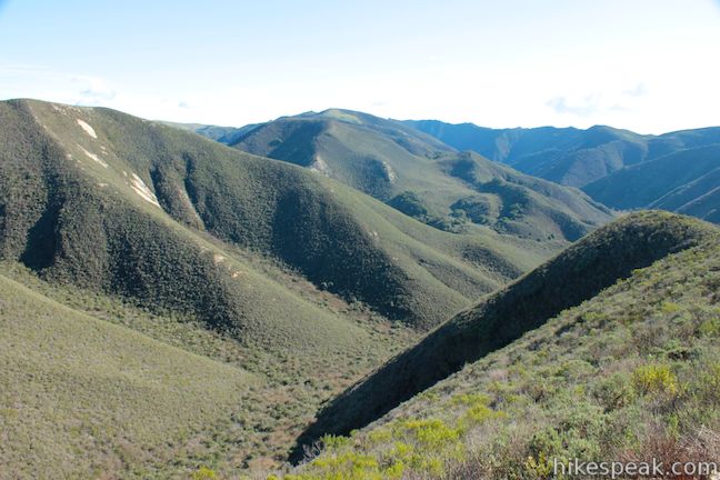
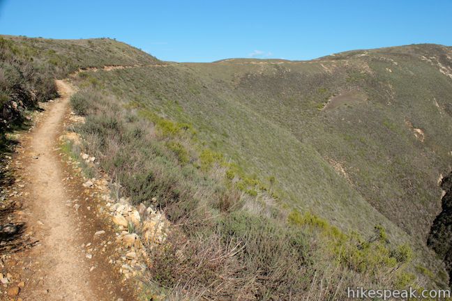
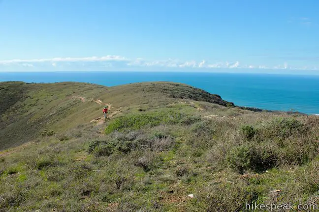
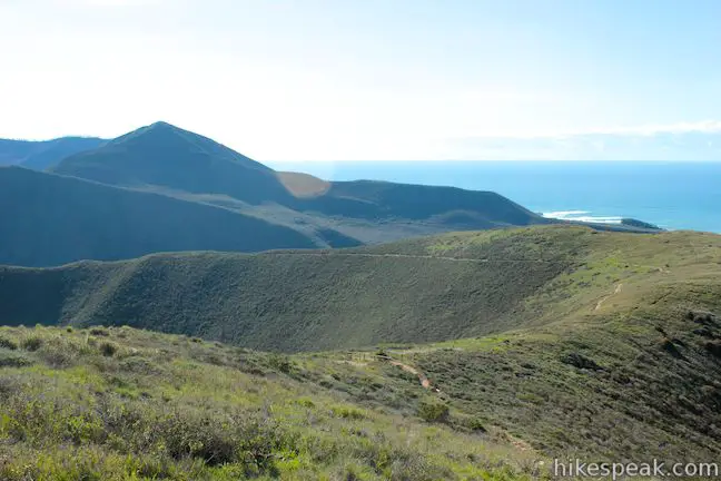
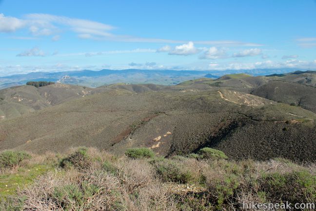
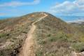
The coastal views expand as you continue up the trail across an ocean-facing slope. The single track makes its way to the north side of Islay Creek Canyon. Come to a landing, 3/4 of a mile from the top and look across a side-canyon off Islay Creek Canyon toward Hazard Peak. The route to the round summit is visible from here. The trail makes a long gradual curve across the top of steep slopes toward the summit of Hazard Peak.
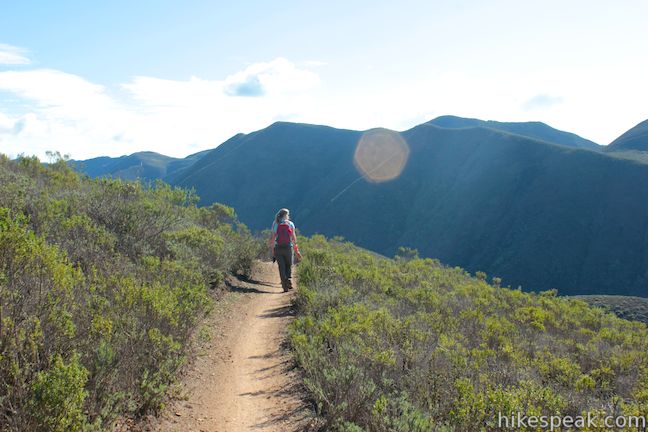
Follow the steady trail north and eventually northeast just below the top of the ridge that angles toward the summit. After another half mile, reach a bench on the western face of Hazard Peak. Take a seat and enjoy fantastic views north over Morro Bay.
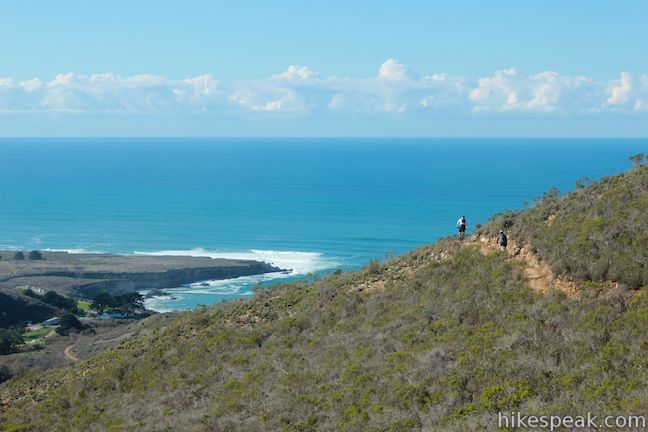
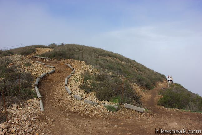
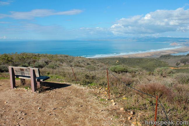
The trail wraps around the north side of the peak for more views of Morro Bay. Come to a junction on the east side of the summit. Turn right, taking a short spur to the top. Railings line the trail, so you cannot get off course. At the top, you will find a bench and sweeping summit views.
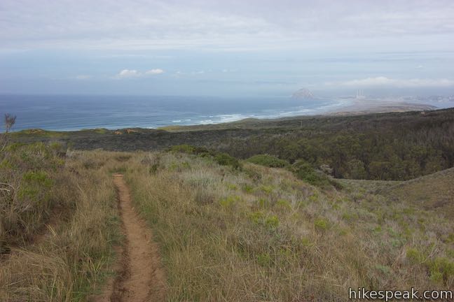
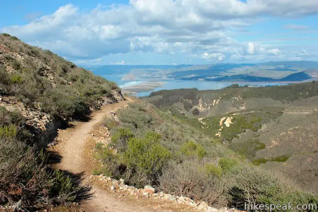
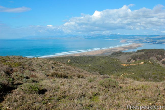
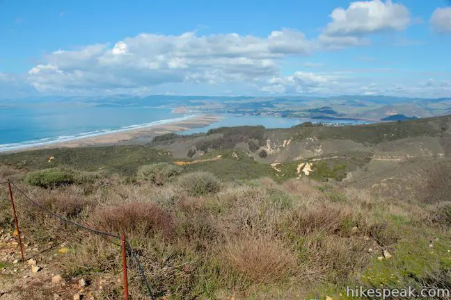
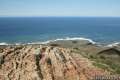
Hazard Peak is named after a previous landowner, Alexander Hazard, and not for some grand danger. The peak has 360-degree views that extend west over the Pacific, north up the coast, and east and south over the Irish Hills. Look north from the 1,076-foot summit and you won’t see anything half as tall as Hazard Peak for about 15 miles, giving you a full view of the dune-lined coast backed by the iconic Morro Rock. The postcard perspective north is mesmerizing, but the views don’t end there. Gaze inland over Los Osos Valley and the easy-to-spot chain of volcanic plugs crossing San Luis Obispo County called the Morros.
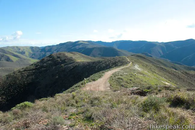
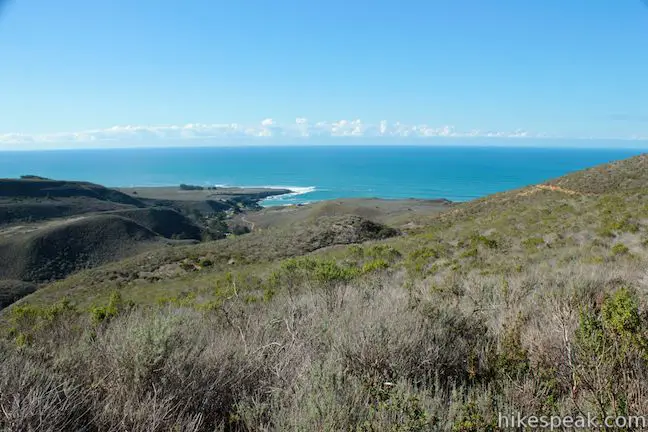
To the east, the next section of Hazard Peak Trail can be seen continuing down a green ridge deeper into Montaña de Oro State Park toward picturesque green peaks and valleys (that can be explored on the 9.2-mile Hazard Peak – Islay Creek Loop). The second highest point in the park, Oats Peak, along with Valencia Peak, are visible to the south beyond Islay Creek Canyon. To the west is a coast of verdant headlands, blue bays, and rolling sand dunes.
The hike back down Hazard Peak Trail faces the Pacific Ocean and has great on-the-way-down views. If you miss the turnoff for Hiedra Trail (you shouldn’t – it’s well marked) and hike all the way to the bottom of Hazard Peak Trail, cross Pecho Valley Road and take South Dune Trail north toward Hazard Canyon Parking Day Use Area and the bottom of Bloody Nose Trail.
Dogs are not allowed on these trails. Bikes are allowed on Hazard Peak Trail and Hiedra Trail (and may use a variation on Bloody Nose Trail). No permit is needed for this hike and no fee is required to park at the trailhead, so get out and enjoy!
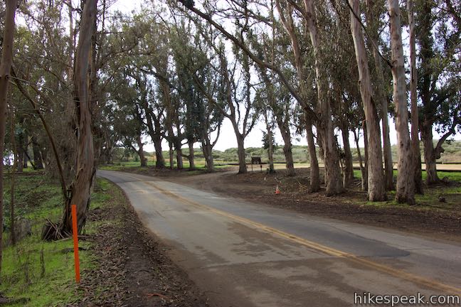
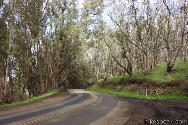
To get to the trailhead: From Highway 101 south of San Luis Obispo, take exit 200 onto Los Osos Valley Road. Drive a total of fifteen miles northwest toward Montaña de Oro State Park. After 11.2 miles, Los Osos Valley Road becomes Pecho Valley Road and turns sharply to the south. Continue 2.7 miles, entering Montaña de Oro State Park and a eucalyptus grove. Park on the left at the bottom of Bloody Nose Trail or park in the larger Hazard Canyon Parking Day Use Area on the right.
Trailhead address: Pecho Valley Road, Montaña de Oro State Park, Los Osos, CA 93402
Trailhead coordinates: 35.2854, -120.8801 (35° 17′ 07.44″N 120° 52′ 48.35″W)
View Montaña de Oro State Park in a larger map
Or view a regional map of surrounding Central Coast trails and campgrounds.


 | South Dune Trail – Bloody Nose Trail – Hiedra Trail – Hazard Peak Trail Loop This 2 2/3-mile loop combines four trails through dunes and eucalyptus trees to lovely coastal views. |
 | Hazard Peak Trail This 6-mile out and back hike ascends coastal ridges to a 1,076-foot summit with panoramic views that include a dynamic perspective of Morro Bay. |
 | Islay Creek Trail This easy 6-mile round trip hike follows a wide trail up a coastal canyon flanked by thousand-foot peaks, passing a small waterfall to reach an abandoned barn. |
 | Hazard Peak - Islay Creek Loop This 9.2 mile loop continues beyond Hazard Peak deeper into Montana de Oro before circling back on Islay Creek Trail. |
 | Reservoir Flats Trail This 2-mile loop delivers fine ocean and canyon views as it explores the bottom of Islay Creek Canyon in Montaña de Oro State Park. |
 | Oats Peak Trail This scenic 10.8-mile hike ventures into Montaña de Oro State Park to a panoramic summit. |
 | Valencia Peak Trail This 4.5-mile hike summits a 1,347-foot peak with stunning views over Montaña de Oro. |
 | Bluff Trail This hike of around three miles tours tide pools, beaches, and impressive cliffs along the picturesque coast of Montaña de Oro State Park. |
 | Rattlesnake Flats Trail – Badger Trail – Bluff Trail Loop This 1 2/3-mile hike offers a twist on the Bluff Trail, going along and just above the coast of Montaña de Oro State Park. |
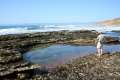 | Dune Trail to Hazard Canyon Reef This one-mile hike in Montaña de Oro State Park descends an oceanfront ravine to a rocky shoreline graced with engaging tide pools. |
 | Coon Creek Trail This 5-mile out and back hike ventures up a coastal canyon at the south end of Montaña de Oro State Park. |
 | Point Buchon Trail This 1 1/3 to 6.8-mile hike explores the beautiful coastline south of Montaña de Oro State Park. |
 | Morro Dunes Ecological Reserve This 2.6-mile loop serves up panoramic views over Morro Bay as it ascends 800 feet from Los Osos to Montaña de Oro State Park. |
 | More hikes in San Luis Obispo Explore other trails around San Luis Obispo including Morro Bay State Park and the Morros. |
 | Islay Creek Campground This 50-site campground is located at the heart of Montaña de Oro State Park in Islay Creek Canyon, and is a great base camp for treks in the park. |
Go the extra miles...
Submit a rating of this hike to go with your comment. Contribute to the average trail rating.