Pond Trail and Marsh Trail
in Binghamton University Nature Preserve
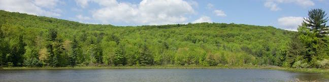
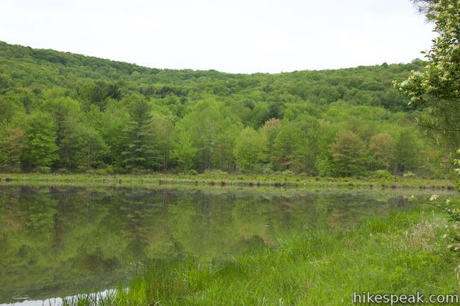
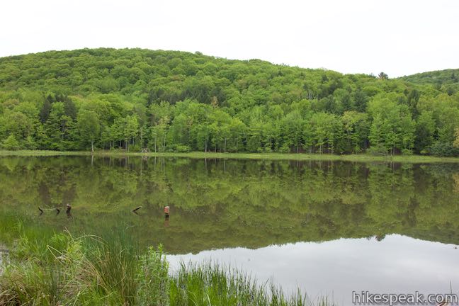
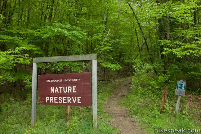
Some centers of higher learning probably overlook nature’s value in education, but not Binghamton University. This SUNY Institution in Vestal, New York set aside 182 acres for the benefit of students, faculty, and the community. Several intersecting trails explore Binghamton University Nature Preserve, creating numerous hiking options, like this one — a figure-eight loop on the easiest and most scenic trails around the wetlands in the middle of the preserve.
This hike features two major trails, Marsh Trail and Pond Trail, that shouldn’t be missed, as well as shorter sections of Pipeline Trail, Redwing Trail, Connector Trail, and Oak Trail to form the double loop. The 2.6-mile hike gathers views of ponds, wetlands, and woods and can be altered and expanded to include other trails in the preserve. Along the belt of the figure-eight loop, the hike crosses the center of the wetlands twice, but you probably won’t mind this short repeat of the preserve’s main attraction. If you could only do one hike in Binghamton University Nature Preserve, this would be a good choice.
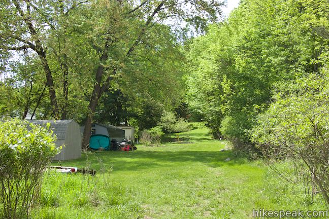
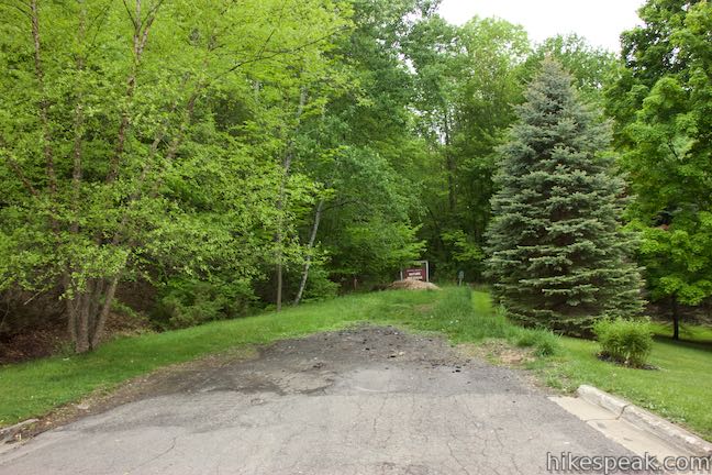
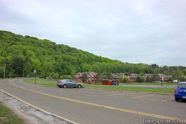
Where to begin? This loop can be picked up from two locations on campus and one off-campus trailhead. The main on-campus starting point is Lot M, a parking area right next to the preserve that offers visitor parking. If you’re a student staying in the College-in-the-Woods Residence Halls, you can set out from your doorstep. Pond Trail begins at College-in-the-Woods and ventures a quarter mile to an intersection with Marsh Trail that is pivotal to this loop. At the other end of Pond Trail on the eastern edge of the preserve, there is access from Lehigh Avenue, which has on-street parking. Stair Park is adjacent to the trailhead on Lehigh Avenue and presents a brief walk to a short waterfall. The hiking directions below begin from Lot M, with additional instructions from the other trailheads. Driving directions to all three are provided as well.
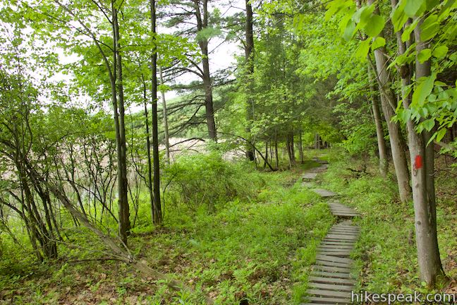
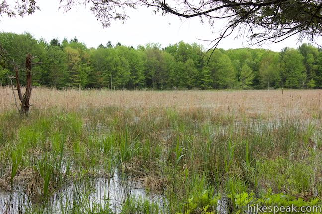
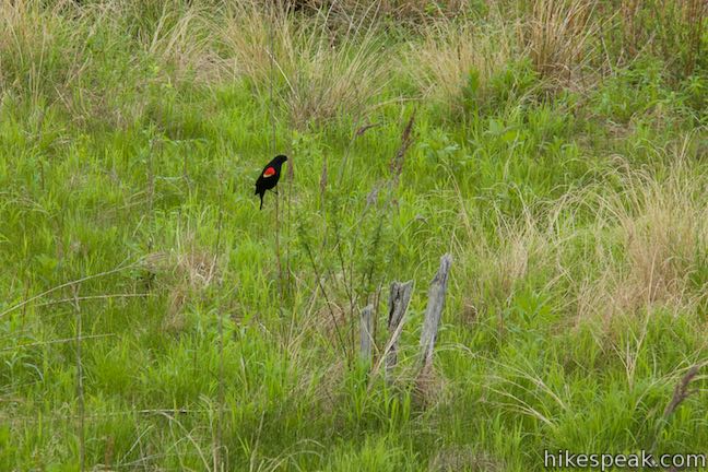
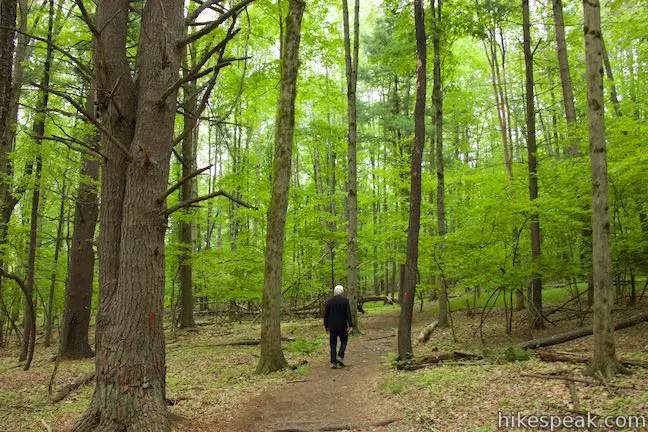
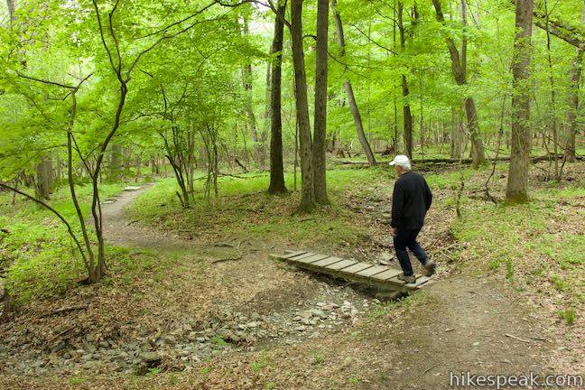
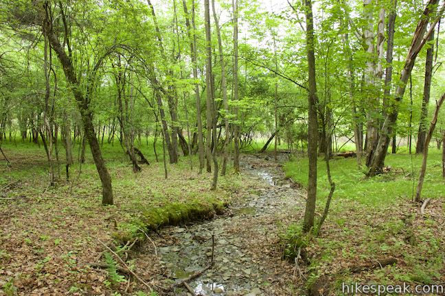
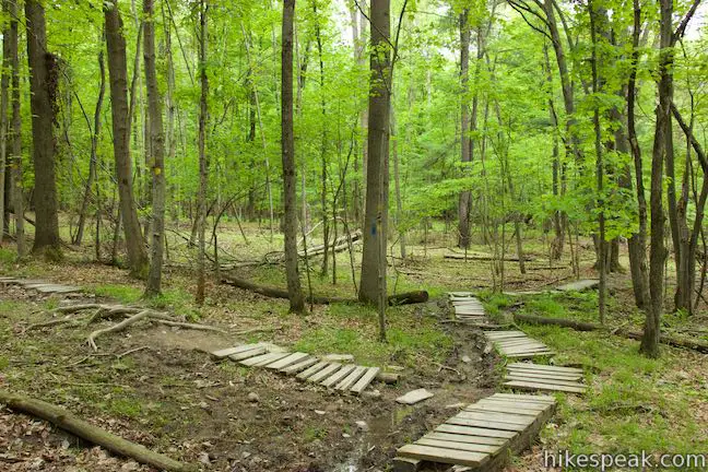
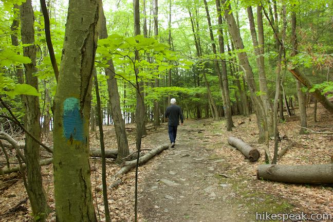
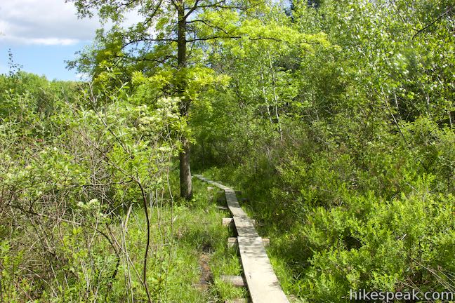
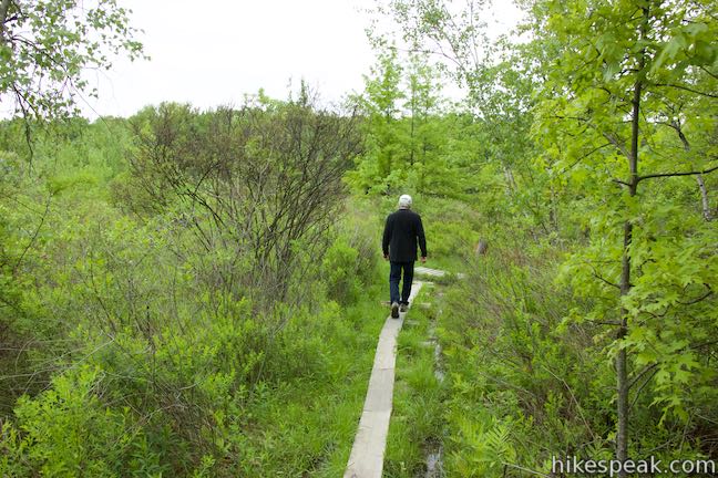
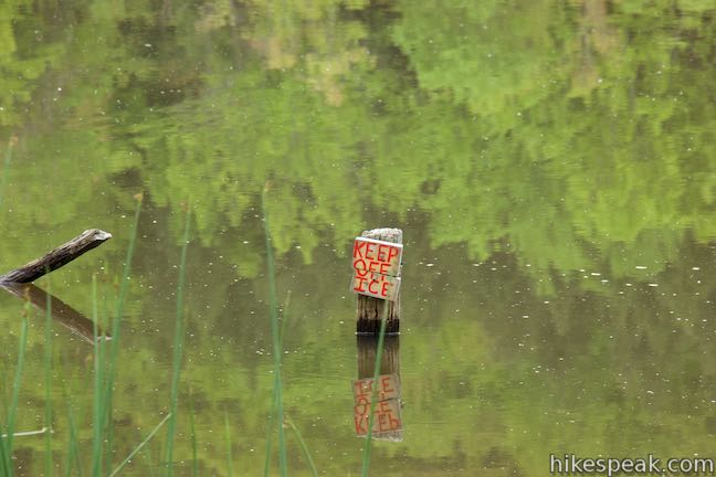
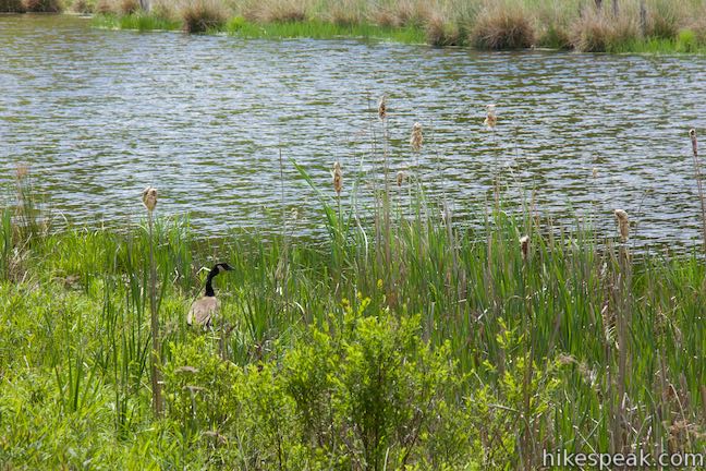
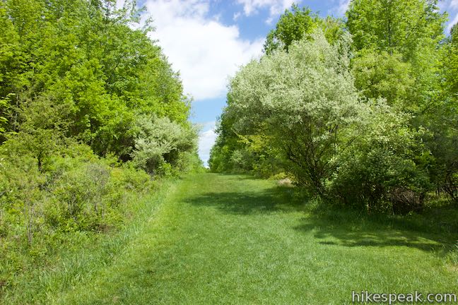
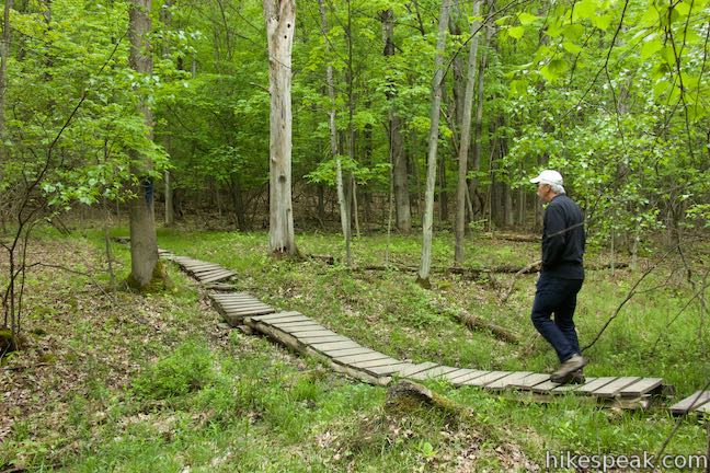
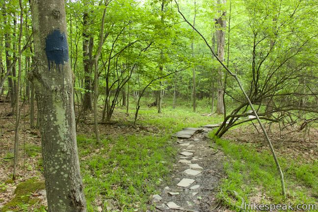
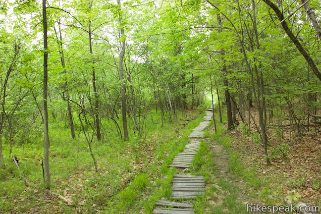
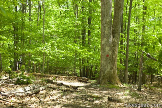
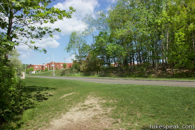
Leaving Lot M, you’ve got two obvious trail options leading into the preserve. Marsh Trail is on the east side of the lot (to the left as you face the preserve) next to a panel with a trail map. Redwing Trail is to the right next to a pavilion perched along West Access Road. Lets start there. Walk 0.05 miles to the pavilion and look out over the wetlands. Just past it, you’ll see steps down the bank and a sign for Redwing Trail. The trail’s name isn’t hockey related. Instead, it’s a tribute to the red-winged blackbirds that sing lovely melodies throughout the wetlands. Descend the staircase into the forest below and follow the trail along the west side of the marsh, using short sections of boardwalk to keep your feet dry. Redwing Trail is marked with red signs and red spots painted on trees that border the trail. All the trails in Binghamton University Nature Preserve are color coded red, yellow, or blue, with no two trails of the same color intersecting (with one exception).
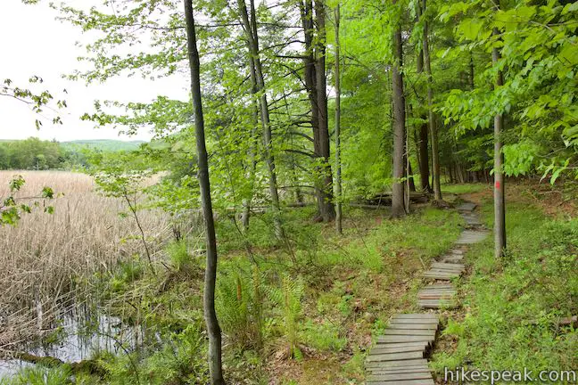
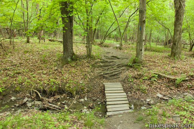
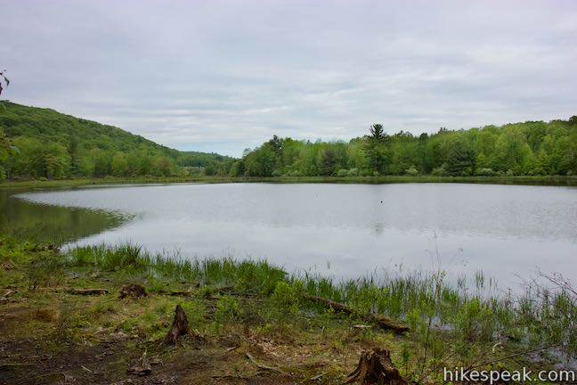
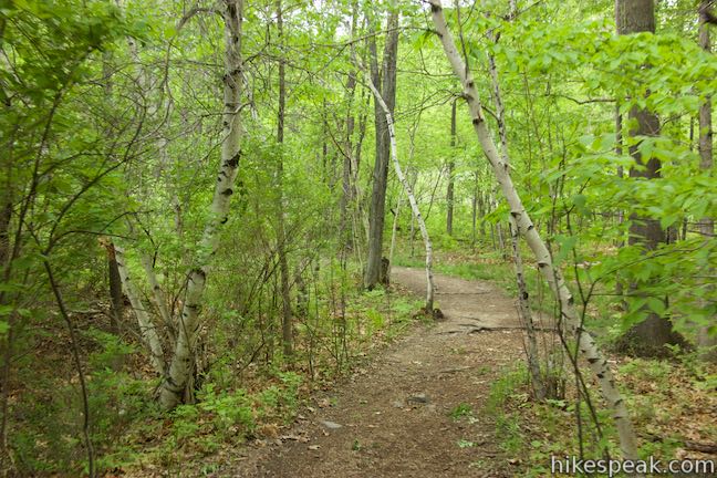
Look to your left through reeds and cattails across the marsh that you saw from the pavilion. Redwing Trail ends after 0.3 miles, coming to a T-junction with Connector Trail. To the right, this trail ascends to Forest Loop Trail, but turn left and hike toward Oak Trail. Bearing left onto Connector Trail, you’ll cross through a forest of deciduous trees set back from the marsh’s edge. Like the last trail, Connector Trail ends after 0.3 miles, reaching a T-junction with Oak Trail. Marked in yellow, Oak Trail ascends a ridge to the right. But why climb? Turn left to take a level 0.1-mile long stretch of Oak Trail leading to Pond Trail along the east side of the marsh. Right after you turn left on Oak Trail, look for a path on the left that goes down to the edge of Harpur Pond. This is a quiet place to look out over the wetland’s main pond.
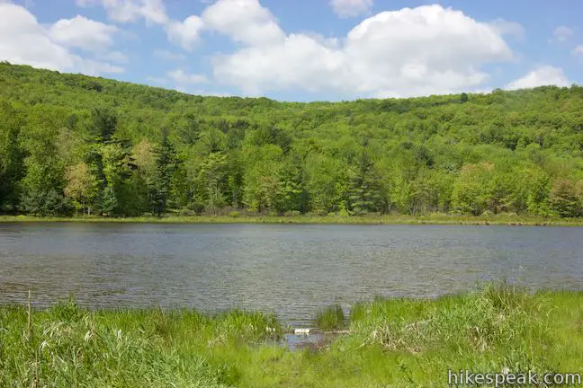
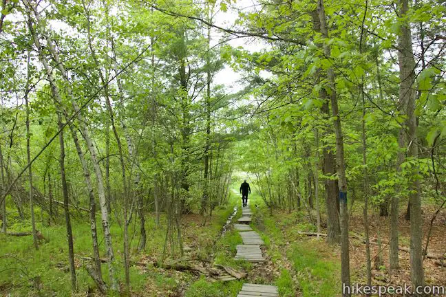
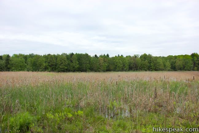
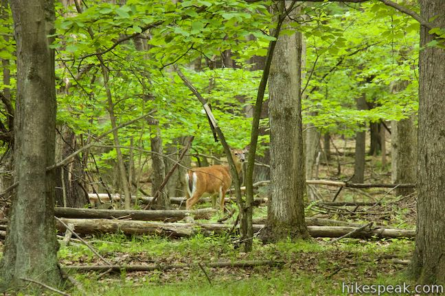
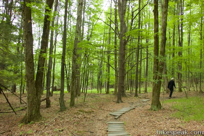
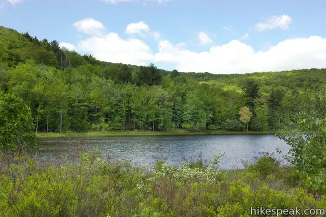
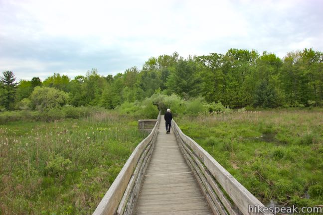
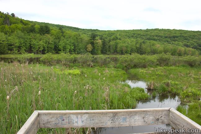
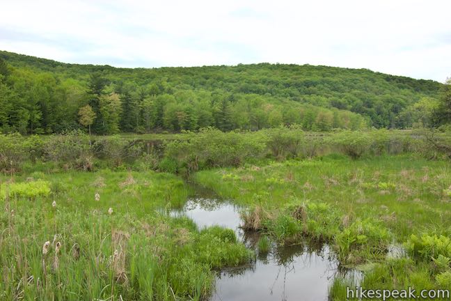
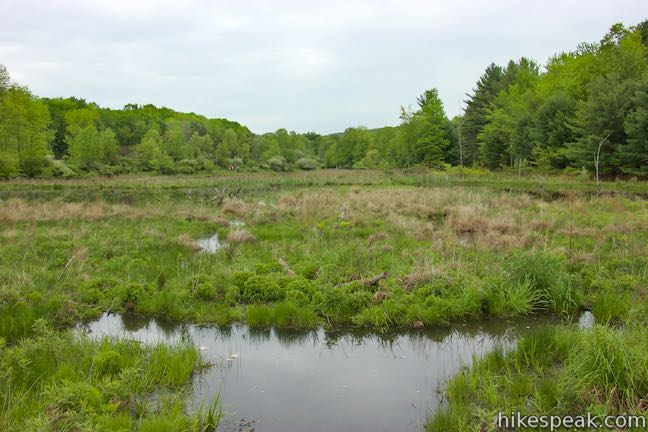
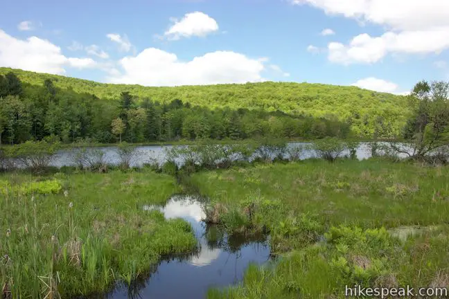
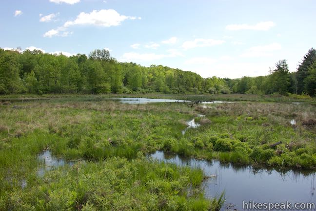
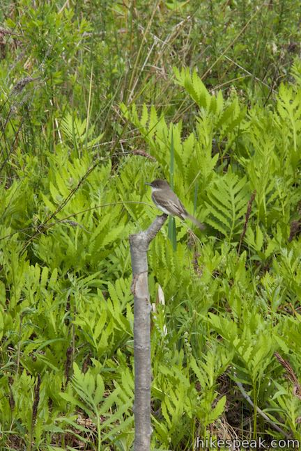
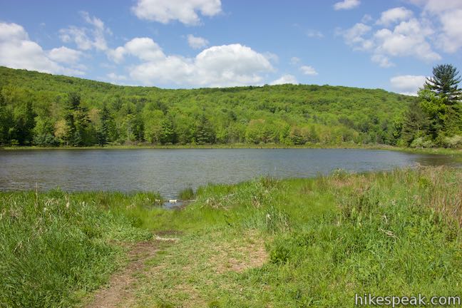
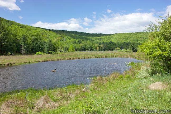
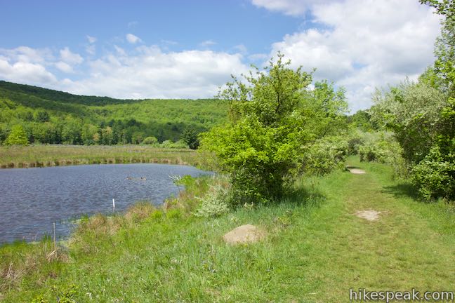
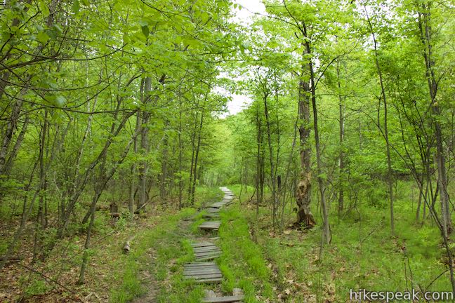
Cross a narrow boardwalk on Oak Trail to reach Pond Trail, a central trail in Binghamton University Nature Preserve. Turn left to walk through the heart of the preserve on a raised boardwalk over the wetlands near Harpur Pond. From this trail, you’ll feel like you’re smack dab in the middle of the wetlands, with forest-lined marshes on all sides. This is definitely a park highlight, reached 0.85 miles from the start. Cross the boardwalk to a bench and find a path on the left to the edge of Harpur Pond. This is an ideal spot for taking in views across the water. Look for geese and smaller birds like eastern phoebe around the shore.

Take Pond Trail to a junction with Marsh Trail, 0.95 miles from the start. If you turn left, you could follow Marsh Trail for 0.3 miles back to Lot M for a shorter loop. Straight ahead, Pond Trail ventures into campus to College-in-the-Woods. BU Bearcats slinking into the preserve from College-in-the-Woods can hike to this junction and follow the directions from here.
To continue exploring Binghamton University Nature Preserve, turn right down Marsh Trail and witness more wetlands, including another pond. It is worth noting that a couple paths shortcut the junction between Pond Trail and Marsh Trail. To skip the main junction and trim the corner off this part of the loop, you can take one of these paths that break off the right side of Pond Trail to join eastbound Marsh Trail.
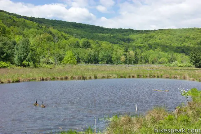
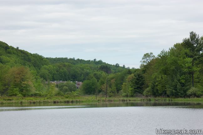
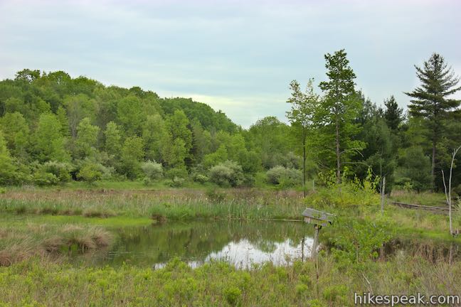
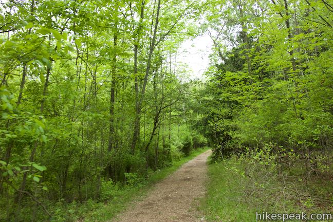
Walk along a wide, grassy path on Marsh Trail. A long cattail-lined pool borders the trail on the right, where you might spot turtles. On the right, a pond alongside the trail is fed by a stream flowing out of Harpur Pond. In late spring, look for geese shuttling young ones across the water.

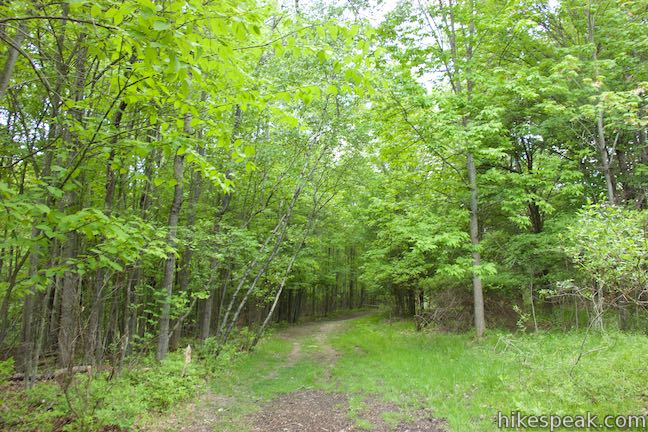
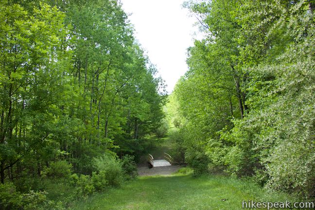
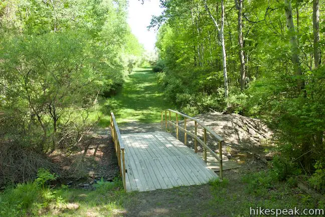
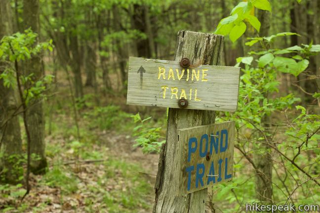
Past the pond, Marsh Trail slips though forest and comes to an end at a T-junction with another wide grassy Trail, Pipeline Trail. This trail goes along the edge of the preserve near a neighborhood that borders Binghamton University. It is the least scenic stretch of this hike, but Pipeline Trail offers a convenient connection back to Pond Trail. Turn right on Pipeline Trail. Walk downhill, across a bridge, and up to a junction with Ravine Trail, which is on the right.
Ravine Trail passes through forest to connect to Pond Trail and you may find it to be a more pleasant alternative to Pipeline Trail. Near its start, Ravine Trail meets Vernal Pool Trail, which can also be used to reach Pond Trail, passing through the forest and a rainwater-filled pool.
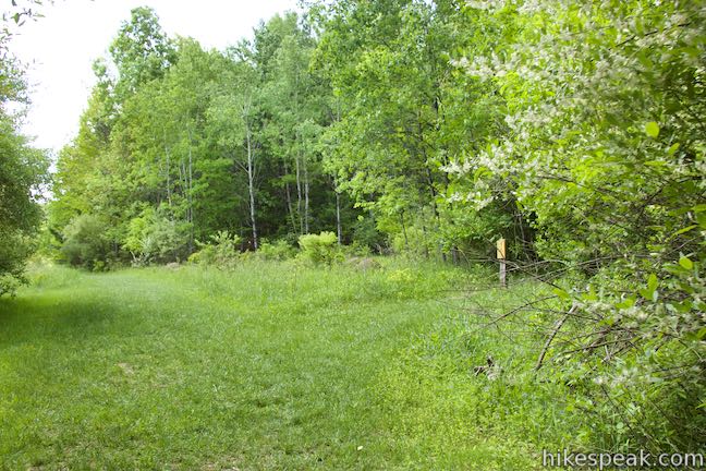
As you proceed on Pipeline Trail, it becomes a bit different. Houses replace the greenery on the left. Pipeline Trail passes right behind these properties and it can feel you are walking through people’s backyards. You are on a trail though. Pipeline Trail comes to an end when it reaches Pond Trail, a quarter mile from Marsh Trail and 1.65 miles from the start.
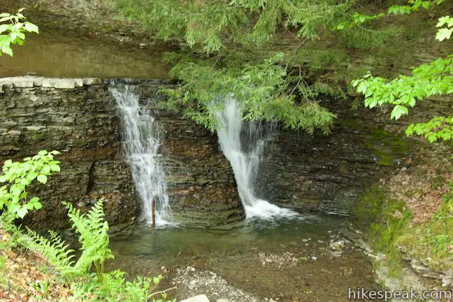
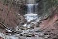
This intersection coincides with the trailhead on Lehigh Avenue. The end of Lehigh Avenue is visible the left, while Pond Trail heads to the right. If you leave Binghamton University Nature Preserve and walk across Lehigh Avenue, you’ll find a bridge entering Stair Park, a Town of Vestal Park. Just over the bridge, stay to the right along Fuller Hollow Creek across from a picnic area and playground. You’ll soon spot a short waterfall in the stream. This off-campus excursion to the falls adds about 0.15 miles round trip to the hike.
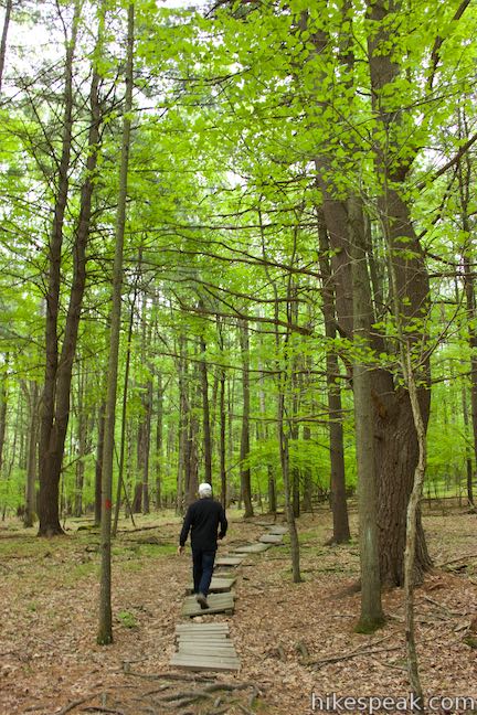
Those starting from Lehigh Avenue can follow the directions from here. Hike west up Pond Trail into the preserve. This dirt single track has numerous sections of short boardwalks and wooden planks covering wet areas along the route. You’ll pass through four junctions on the way to Harpur Pond. First comes Ravine Trail on the right, taking a wooded 0.2-mile route back to Pipeline Trail. Next comes the east end of Oak Trail on the left. This trail is 0.45 miles long, going up a wooded hillside before returning to Pond Trail. Stay on Pond Trail, which weaves through forest, straightens out, and heads gradually downhill. Pass Vernal Pool Trail on the right, which is a 0.25-mile long single track and meets Ravine Trail near Pipeline Trail.
Just past the junction with Vernal Pool Trail, and 0.45 miles from the trail’s east end, Pond Trail meets the west end of Oak Trail. If you began from Lot M and took Redwing Trail to Connector Trail to Oak Trail, this junction will look familiar. It is where you initially turned left on Pond Trail. Stay to the right now, having put in 2.1 miles to this point. Repeat the next section of Pond Trail that crosses the marsh on a raised boardwalk toward a junction with Marsh Trail. You may see some different animals this time around and shouldn’t mind this second dose of the preserve’s center.
At the crossroads of Pond Trail and Marsh Trail, turn left and hike 0.3 miles up to Lot M on a wide easy trail to complete this 2.6-mile double loop. If you started somewhere other than Lot M, turn left at the end of Marsh Trail, walk along West Access Road to the pavilion, and turn left down Redwing Trail. To go the extra mile, walk a little farther up West Access Road to Forest Loop Trail and add that wooded walk to your itinerary.
Another way to see more of Binghamton University Nature Preserve is to explore the other trails along this loop. Ravine Trail, Vernal Pool Trail, and Oak Trail can all be added to this hike or explored on their own 1.15-mile venture. As Tolkien wrote, “Not all who wander are lost,” so take any trail that calls to you. Binghamton University Nature Preserve is the type of place that you can visit and just get lost for a couple hours (in a good way). The double loop described here, taking Redwing Trail to Connector Trail to Oak Trail to Pond Trail to Marsh Trail to Pipeline Trail and back to Pond Trail and Marsh Trail is 2.6 miles long with 90 feet of elevation change. That distance applies when starting from Lehigh Avenue or Lot M. Add half a mile round trip if you start from College-in-the Woods. The side trip to the short waterfall in Stair Park adds about 0.15 miles to the hike too.
The basic directions for this loop are:
- Walk up West Access Road from Lot M toward Redwing Trail (0 miles)
- Turn left down Redwing Trail (0.05 miles)
- Turn left on Connector Trail (0.35 miles)
- Turn left on Oak Trail (0.65 miles)
- Turn left on Pond Trail (0.75 miles)
- Turn right on Marsh Trail, joining hikers from College-in-the-Woods (0.95 miles)
- Turn right on Pipeline Trail (1.4 miles)
- Turn right on Pond Trail, joining hikers from Lehigh Avenue (1.65 miles)
- Turn left on Marsh Trail (2.3 miles)
- Return to Lot M (2.6 miles)
Dogs are allowed on leashes in Binghamton University Nature Preserve but are not allowed in Stair Park. Bikes are not allowed in either park. No permit is needed to hike in Binghamton University Nature Preserve. Parking is free along Lehigh Avenue. Visitors can park in Lot M with a day pass costing $5. After 5 p.m., the cost of a permit goes down to $1. During the summer, permits during the day drop to $1 with free parking on weekends from 4 p.m. on Friday until Monday morning (all prices as of 2015).
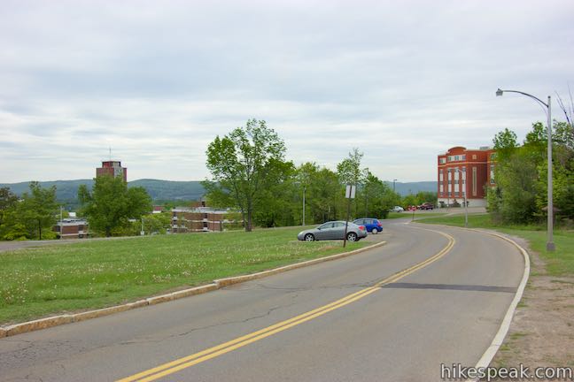
To get to the Lot M trailhead: From Route 17, take exit 70 for Route 201 and Johnson City. Drive south on Route 201 for 1.5 miles, taking the flyover to a bridge over Susquehanna River toward Vestal. Drive to the end of Route 201 and go around a loop in the offramp to head east on Route 434. Make the first right at the trafic light and enter Binghamton University on Bartle Drive. Pass a visitor check-in station and stay to the right through a traffic circle onto West Drive. In 0.4 miles, turn right up Connector Road (toward Susquehanna Community). Drive 0.3 miles and turn right on West Access Road. Park in a row of spots that come immediately on the right. If these parking spaces are full, turn right and drop into a larger section of Lot M.
Lot M address: West Access Road, Binghamton University, Vestal, NY 13850
Lot M coordinates: 42.0848, -75.9728 (42° 05′ 05.28″N 075° 58′ 22.08″W)
To get to the College-in-the-Woods trailhead: Residents of College-in-the-Woods will find the start of Pond Trail on the north side of Oneida Residence Hall. To approach this trailhead by car, enter Binghamton University on Bartle Drive. Pass a visitor check-in station and go around a traffic circle past West Drive to stay on Bartle Drive. In 0.2 miles, turn left on East Drive. Drive 0.4 miles and turn left up East Access Road. Make the first right into Lot O for College-in-the-Woods (parking restrictions apply). Walk southwest through College-in-the-Woods to Oneida Residence Hall and the start of Pond Trail.
College-in-the-Woods trailhead address: Oneida Residence Hall, Binghamton University, Vestal, NY 13850
College-in-the-Woods trailhead coordinates: 42.08535,-75.96767 (42° 05′ 07.25″N 075° 58′ 03.61″W)
To get to the Lehigh Avenue trailhead: From Route 17, take exit 70 for Route 201 and Johnson City. Drive south on Route 201 for 1.5 miles, taking the flyover to a bridge over Susquehanna River toward Vestal. Drive to the end of Route 201 and go around a loop in the offramp to head east on Route 434. Drive 0.5 miles to the second traffic light and turn right up Murray Hill Road. In 0.9 miles, turn right onto Washington Drive and make the next left on Lehigh Avenue. Drive 0.3 miles and park near the paved ‘T’ at the end of the road. The entrance to Binghamton University Nature Preserve is up the short strip of pavement to the right and Stair Park is to the left.
Lehigh Avenue trailhead address: 1000 Lehigh Avenue, Vestal, NY 13850
Lehigh Avenue trailhead coordinates: 42.0781, -75.9592 (42° 04′ 41.15″N 075° 57′ 33.11″W)
View Binghamton University Nature Preserve in a larger map
Or view a regional map of surrounding New York trails and campgrounds.


Pond Trail from College-in-the-Woods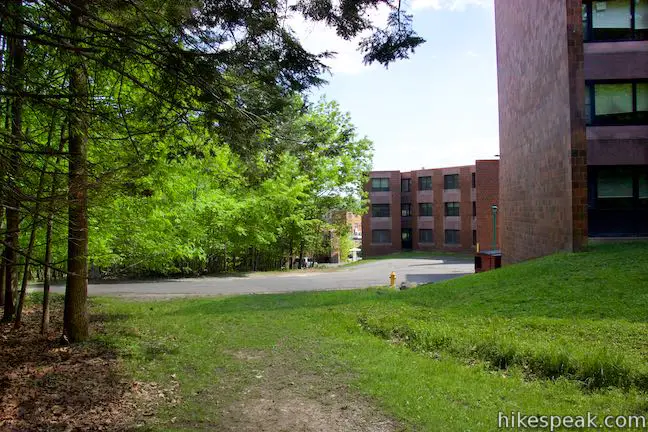


 | Forest Loop Trail This 1.15-mile hike in Binghamton University Nature Preserve goes up a wooded hillside, slipping between oaks and pines. |
 | Ravine Trail, Vernal Pool Trail, and Oak Trail Loop This 1.15-mile hike in Binghamton University Nature Preserve links three trails that branch off Pond Trail to form a loop through less-visited parts of the preserve. |
 | Green Lake & Round Lake This easy 3.25-mile loop explores a pair of aquamarine glacial lakes in Green Lakes State Park in Central New York. |
 | Cliff Trail – Long Trail – Mildred Faust Trail Loop This 1.95 miles loop crosses limestone cliffs above a glacial lake and combines several trails to explore Clark Reservation State Park. |
 | Tinker Falls This gradual 0.5-mile hike follows Tinker Falls Creek to the base of a lovely 50-foot waterfall. A trail to the top of Tinker Falls can be added to create a 1.3-mile trek in Labrador Hollow Unique Area. |
 | High Line Trail This elevated stroll of up to 3 miles round trip explores a one-of-a-kind park built on a historic rail line with gardens, artwork, seating, and great views of New York City. |
 | More trails in New York Explore other hikes in the Empire State, including Central New York and the Adirondack Mountains. |
Go the extra miles...
Submit a rating of this hike to go with your comment. Contribute to the average trail rating.