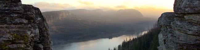
Angel’s Rest Lookout boast soaring views across Columbia River Gorge. Things get particularly heavenly at sunrise when the first rays of light grace the gorge. Angel’s Rest Trail starts from Historic Columbia River Highway, just off Interstate 84, and rises 1,500 feet over a 4.8-mile round trip hike. In addition to superb sights at the top, the trail seals its Columbia River Gorge status by passing waterfalls on Coopey Creek. Being one of the quickest-to-reach trailheads in the gorge from Portland makes this beautiful hike even more popular.
Angel’s Rest Trailhead has a parking area on Historic Columbia River Highway by exit 28 of Interstate 84 (approximately 25 miles from Portland). If the parking lot is full, travel west on Historic Columbia River Highway and make the first left up to an overflow parking area. A connector trail from this parking area unites with the main trail.
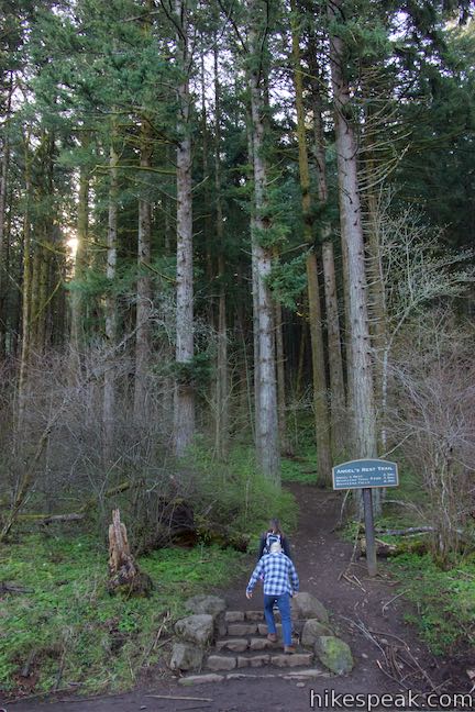
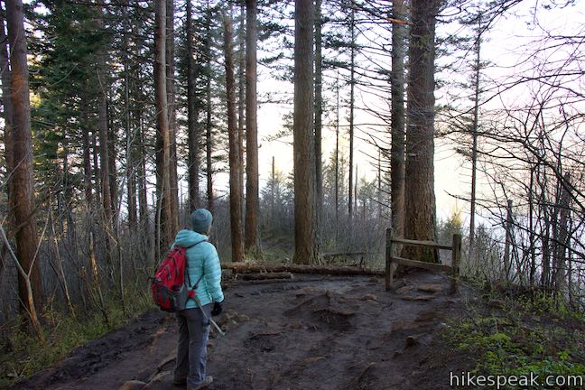
Starting from the main trailhead, walk to the west side of the lot by a kiosk and safely cross to the south side of Historic Columbia River Highway where a sign and staircase mark the start of Angel’s Rest Trail.
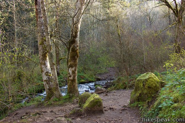
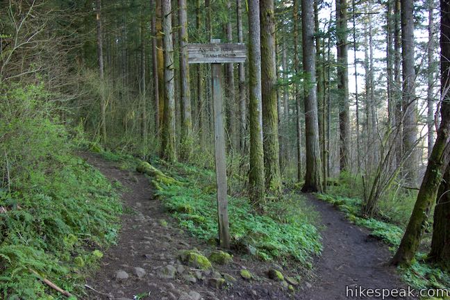
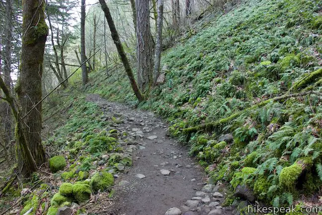
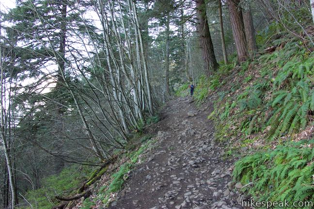
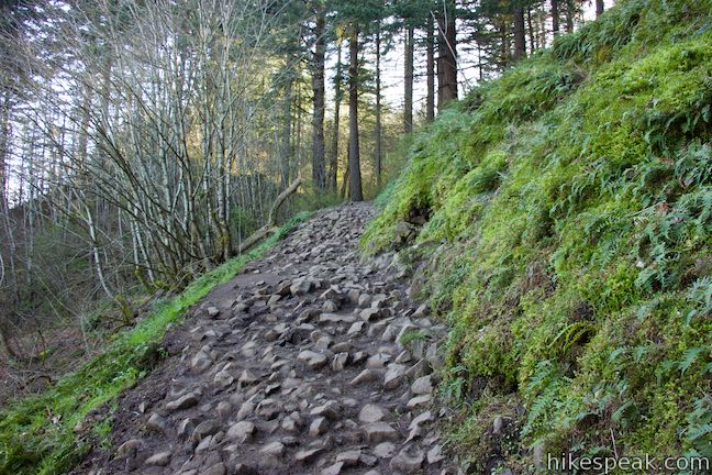
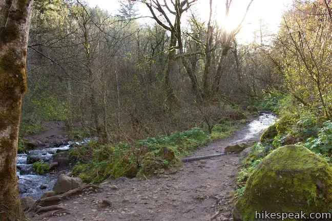
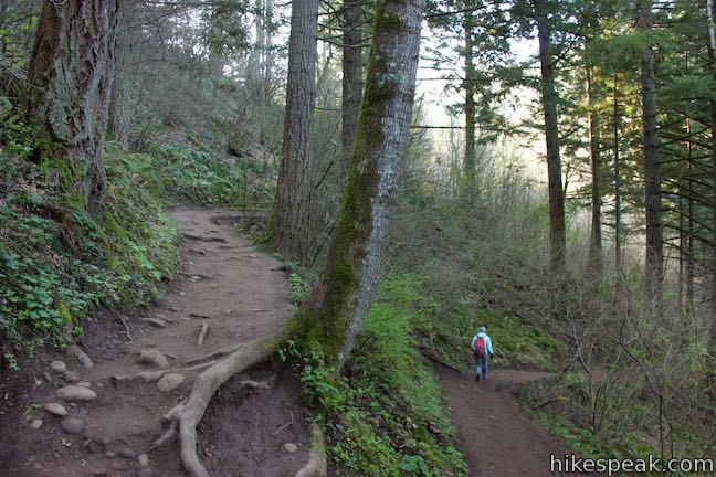
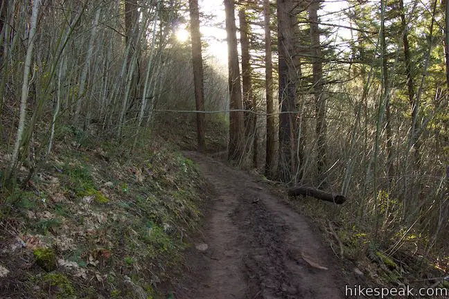
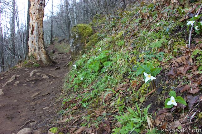
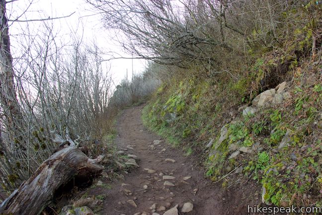
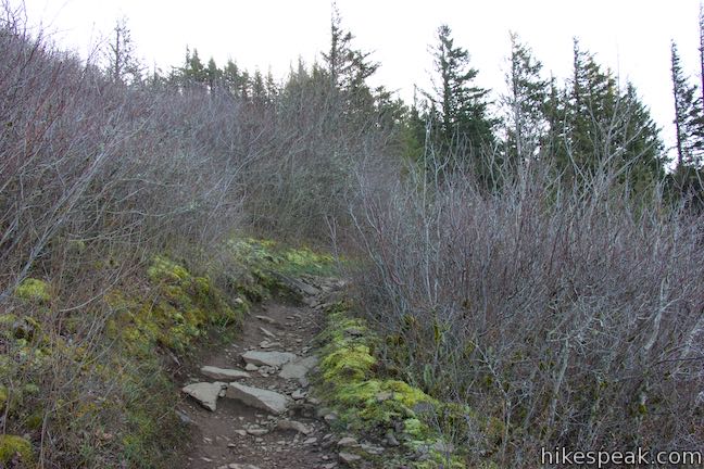
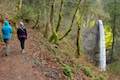
As the hike gets underway, you’ll come to a merger with the trail from the overflow lot. Make the obvious left turn to continue toward Angel’s Rest, rising gradually through a forest of broadleaf maples. Moss clings to tree trunks, downed logs, and a few boulders. Ferns thrive in the shadows. The trail rises across slopes of basalt rock that present windows out of the forest and across the Columbia River toward Washington.
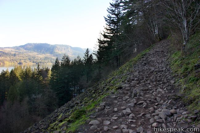
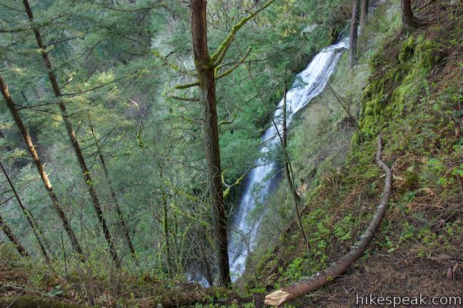
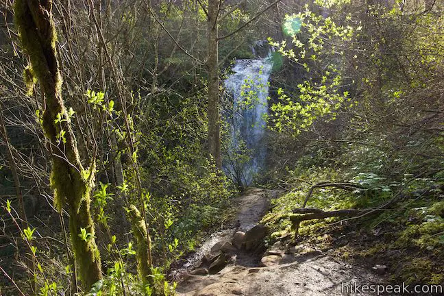
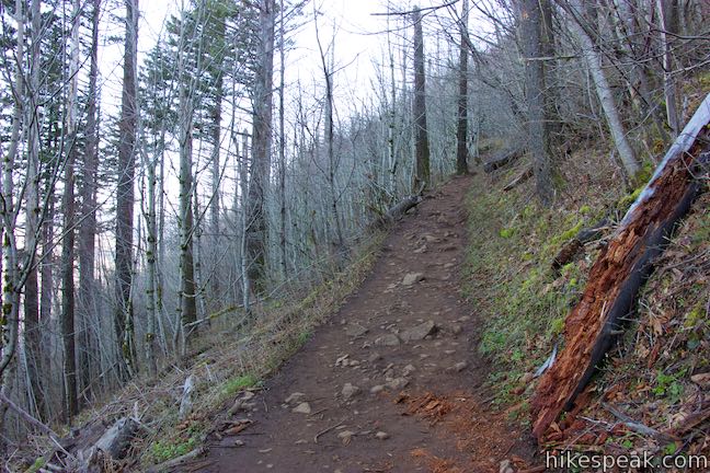
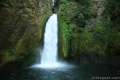
Push up the rocky, uneven trail past a draw in the side of the gorge. Here the trail turns to dirt once again. Around the next bend, pass a worn-out landing where the trail has been widened by hikers who shuffle to the left to gaze off the ledge toward Coopey Falls. The waterfall slides a hundred feet from your level down to the forest below.
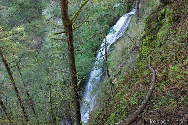
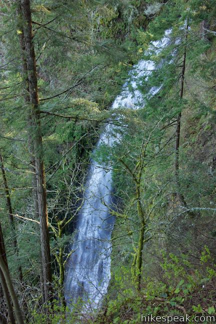
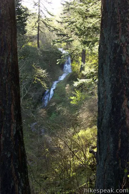
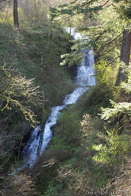
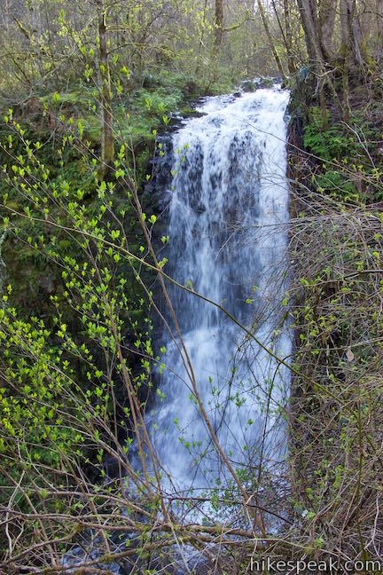
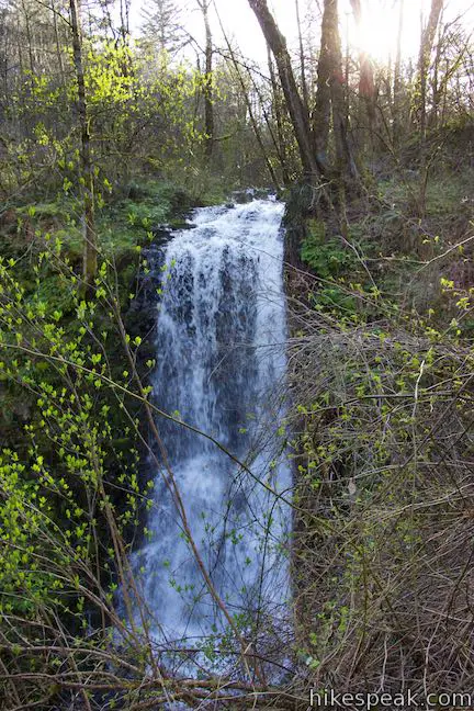
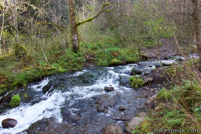
Just ahead, and half a mile from the start, Angel’s Rest Trail comes to a T-junction. To the left, a short spur runs down to a viewpoint alongside Coopey Creek. The top of Coopey Falls is just downstream, but is difficult to see. Looking upstream, Coopey Creek offers another waterfall that’s easier to distinguish. Upper Coopey Falls has one main drop of about thirty feet, followed by a series of energetic cascades.
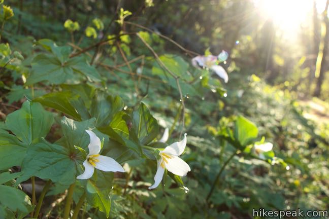
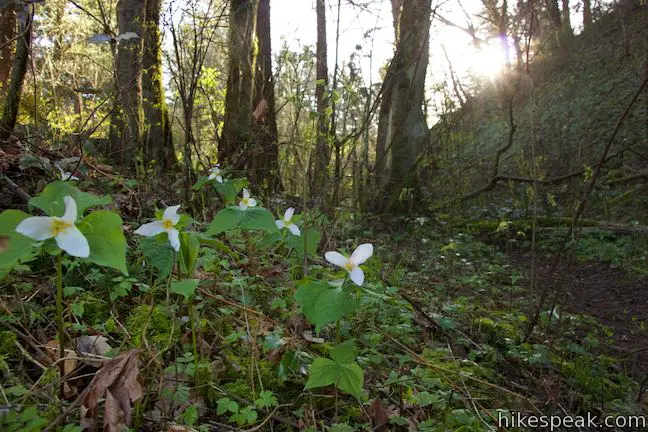
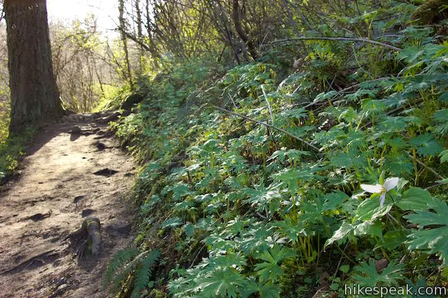
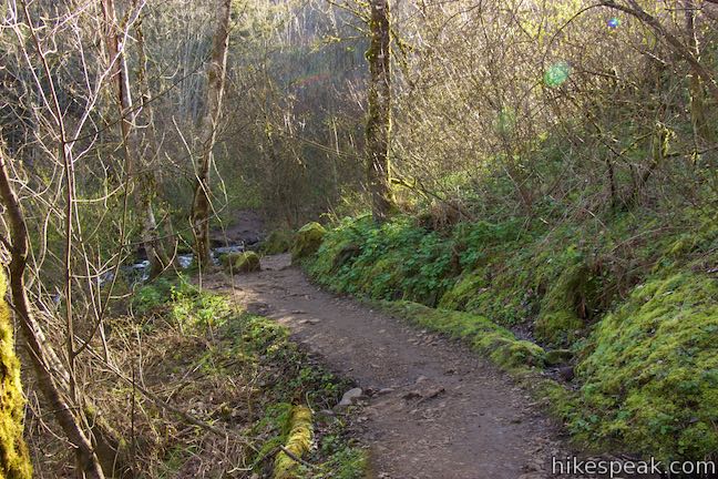
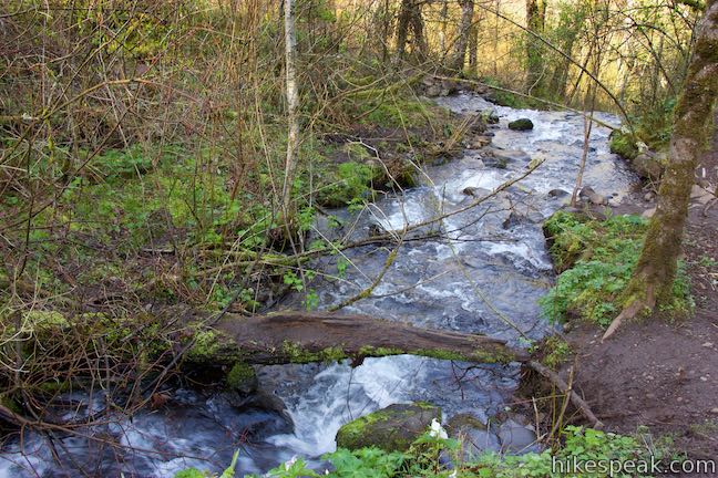
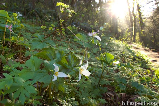
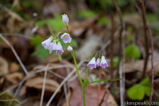
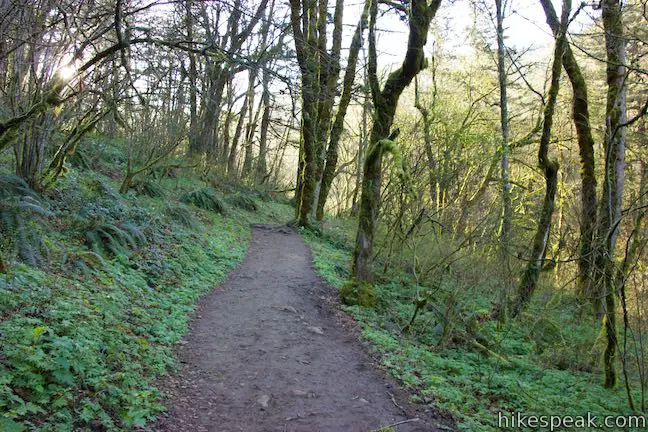
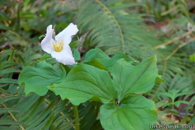
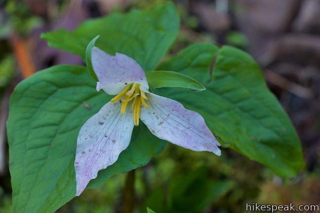
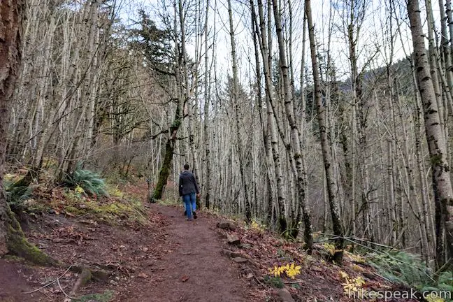
Return to the unmarked T-junction and continue up Angel’s Rest Trail (originally a right turn). The trail leads you through lush forest along Coopey Creek. Trillium bloom along your path in early spring, joined by more wildflowers later in the season.
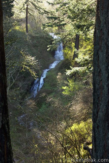
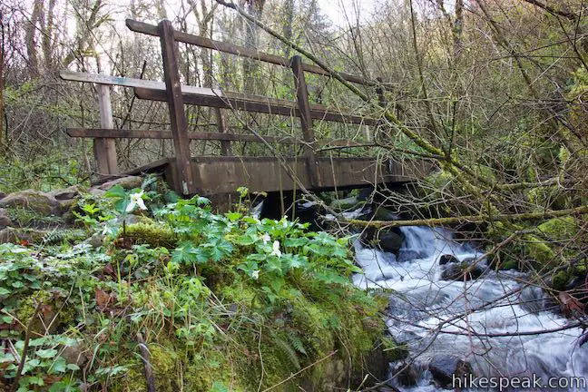
A spur on the left leads down to the top drop on Upper Coopey Falls. Past that you’ll walk along the creek up to a bridge to the other side. Pause to enjoy the sights and sounds of the creek.
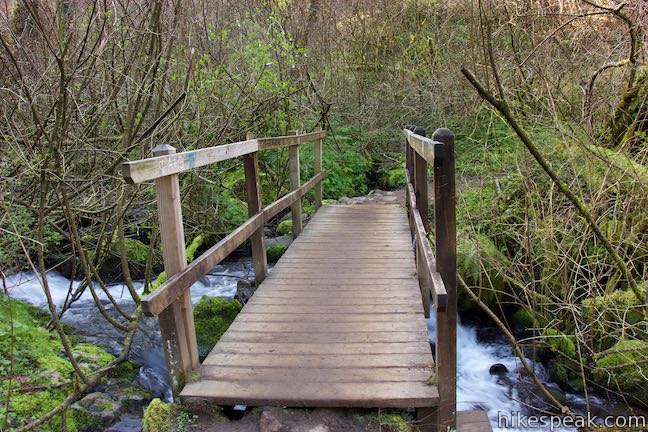
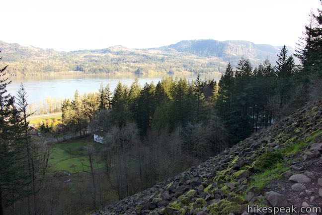
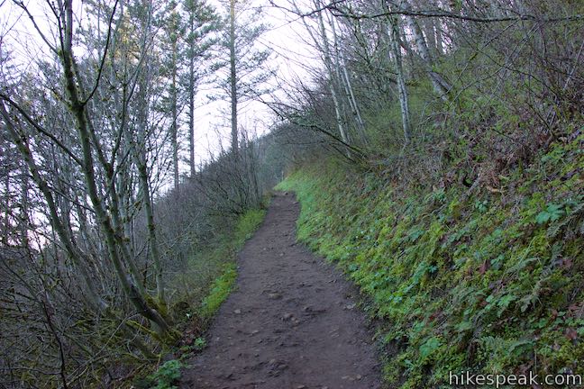
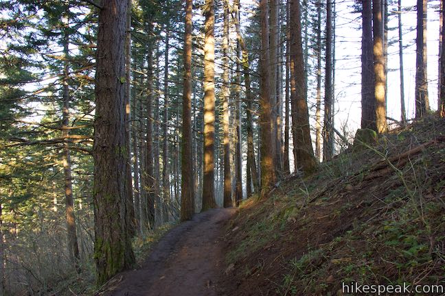
After crossing the bridge, 2/3 of a mile from the start, the ascent gets more serious. The trail stays closer to the creek for a stretch until a sharp left turn sets you on a course out of the canyon and up to a ridge, 1.2 miles from the trailhead, where the Columbia River can be seen through the trees. Views of the river get even better higher up the trail.
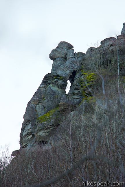
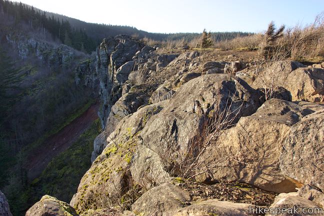
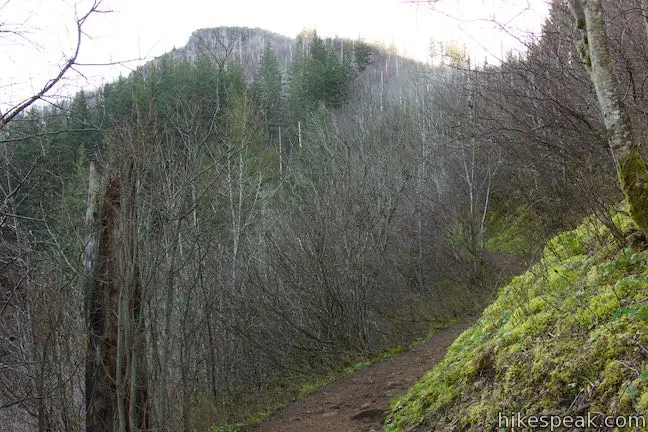
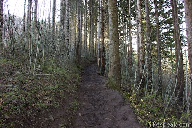
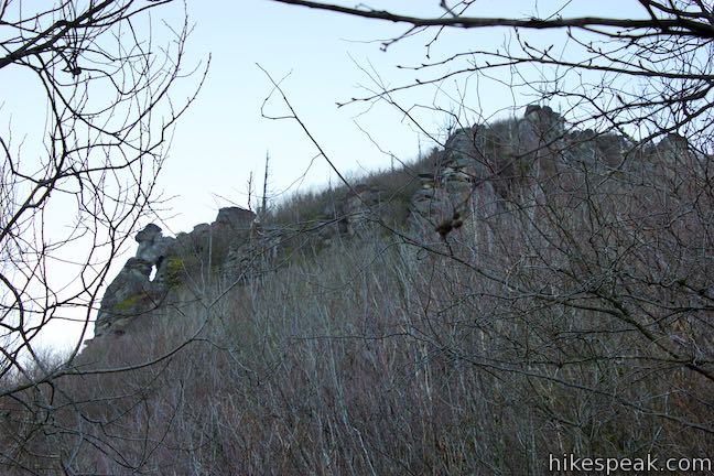
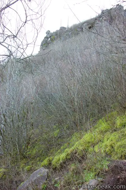
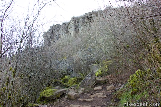
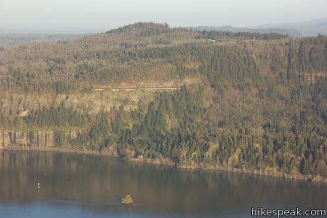
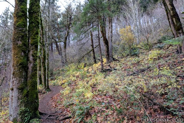
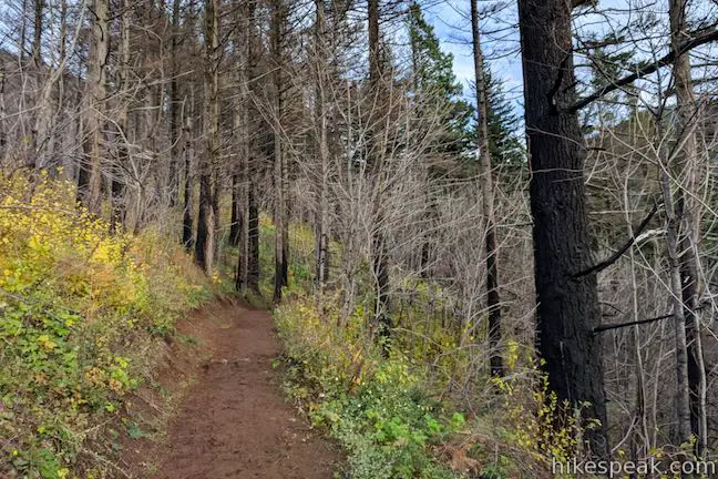
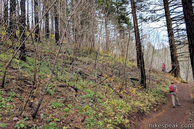
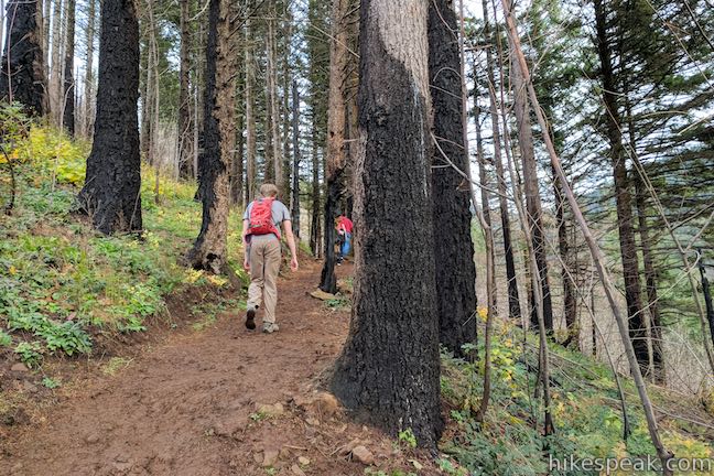
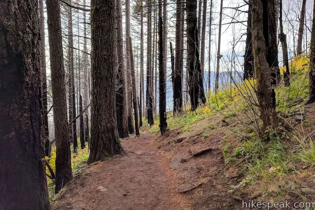
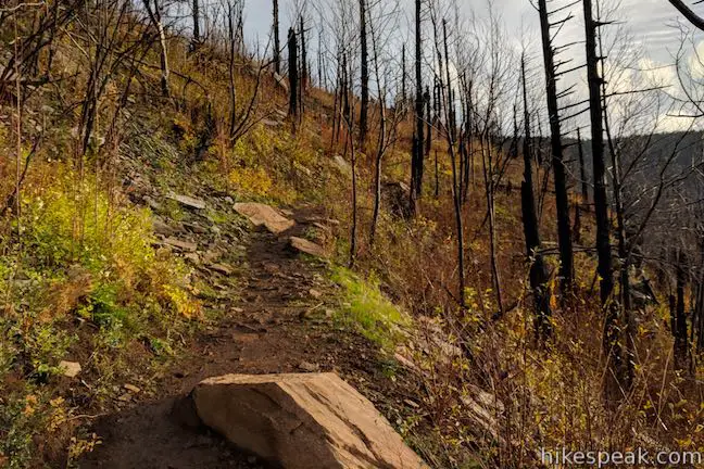
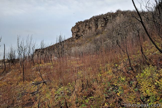
Angel’s Rest Trail twists and turns as it rises higher through the forest and heads east toward Angel’s Rest. After 1.75 miles of hiking, come to a compact series of 6 switchbacks that take you up though the forest below an outcropping at the base of Angel’s Rest. Look up to see silhouette shaped rocks in front of a silhouette shaped hole in the basalt bluff.
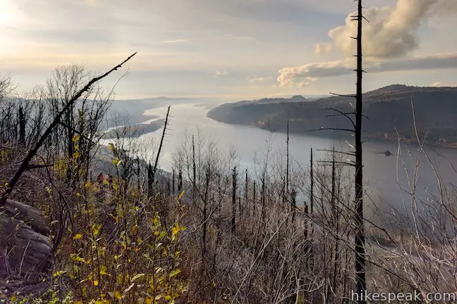
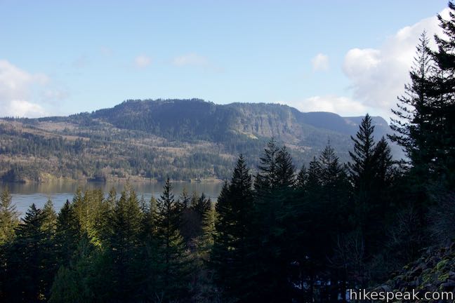
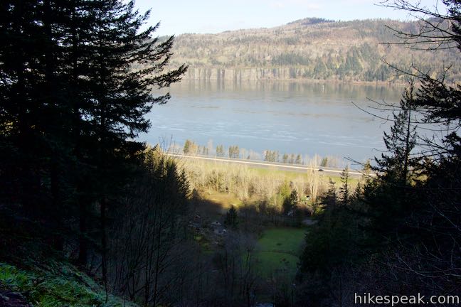
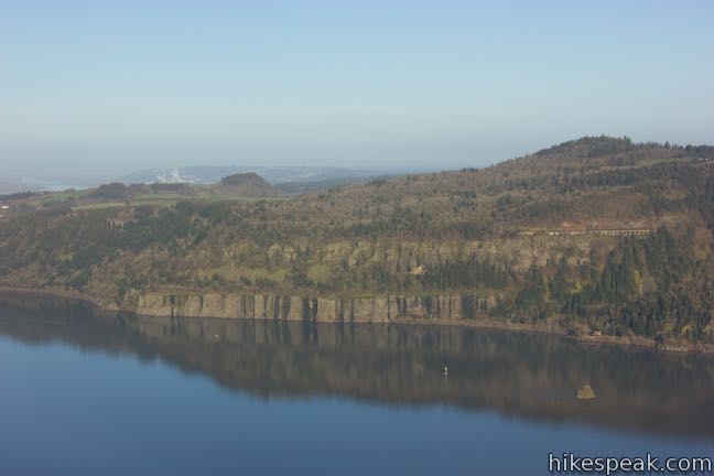
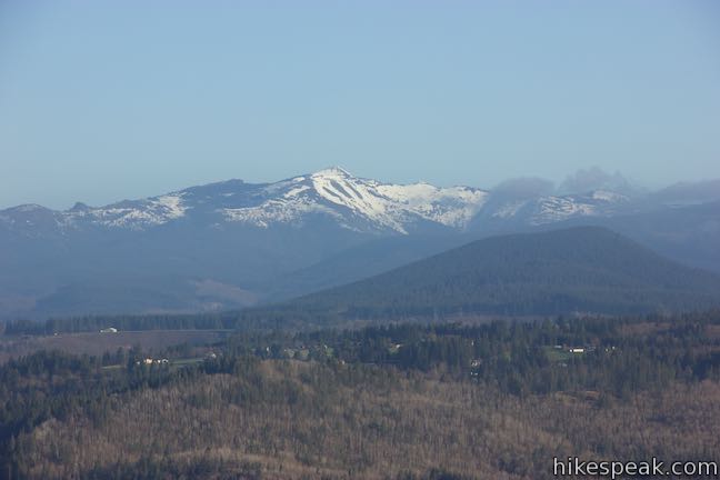
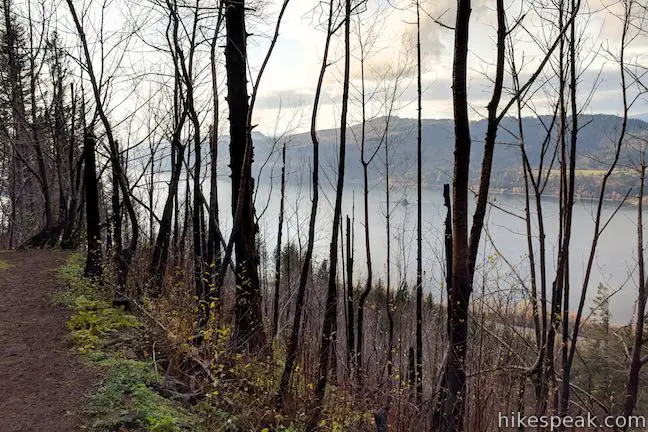
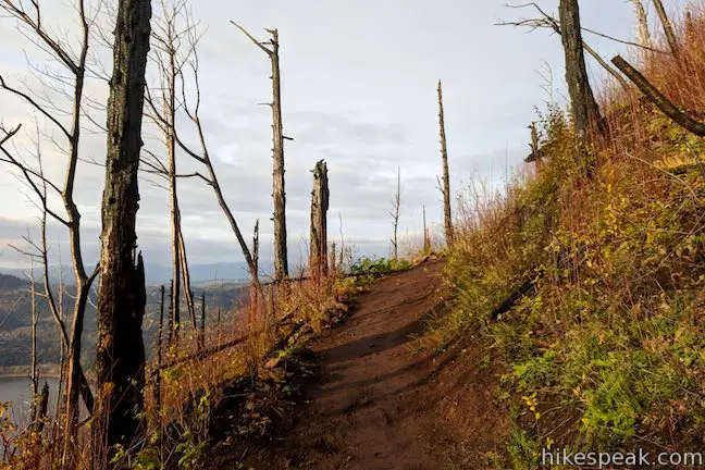
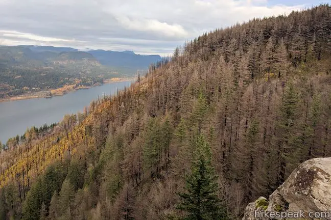
Above the switchbacks, the trail straightens out and delivers views out over trees burned by a 1991 wildfire. Look down the Columbia River toward Portland and across the river toward Silver Star Mountain.
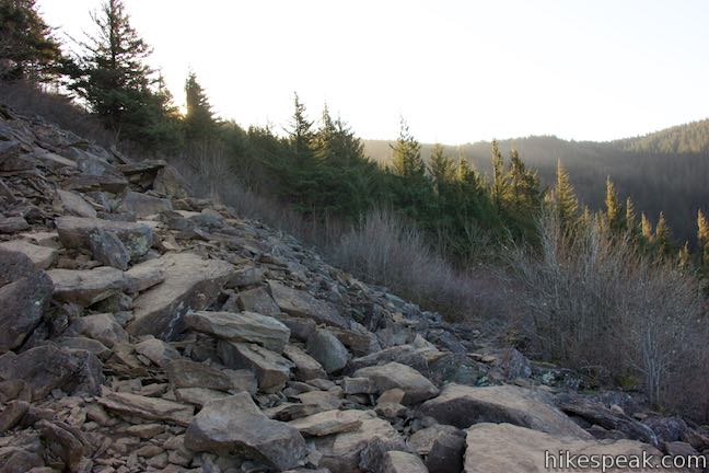
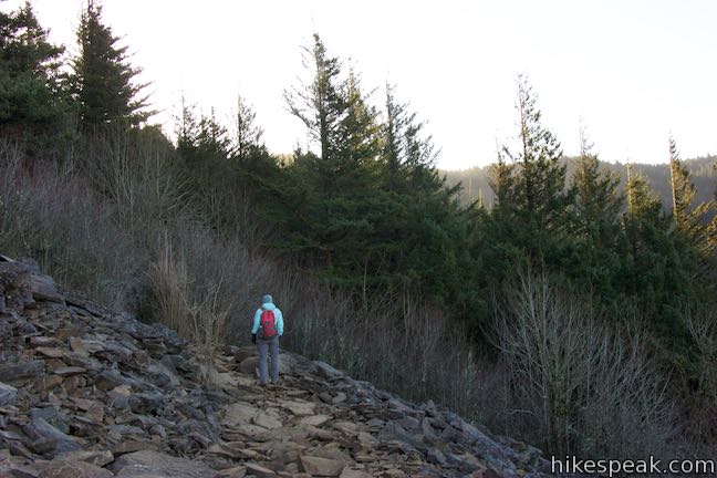
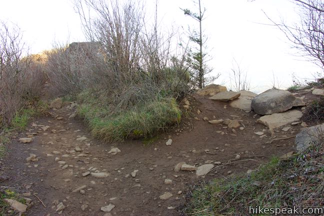
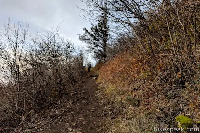
Tackle a smaller bundle of switchbacks to arrive at an open area of loose boulders, just over two miles from the start. While this isn’t Angel’s Rest, the westward views down the Columbia River make it a nice place to stop for a short rest. If you take out any snacks, watch your food – pika may be hiding behind any rock.
Cross the boulder field, and return to the forest for one last stretch of trail. Trek southeast until a switchback to the left points you up toward Angel’s Rest.
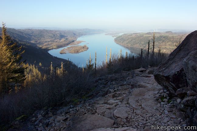
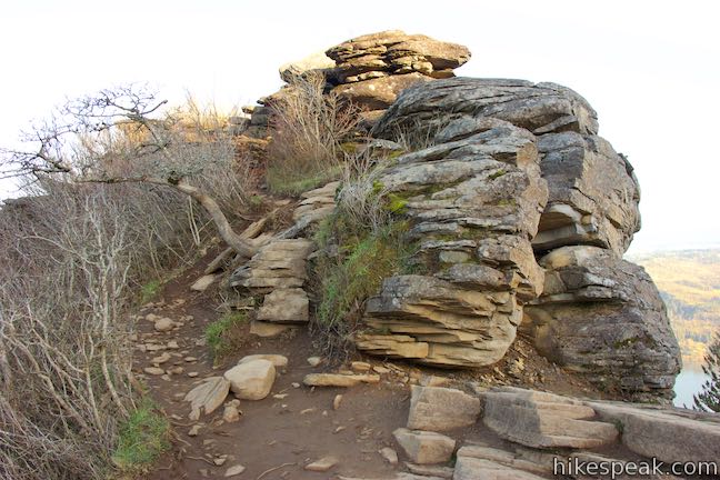
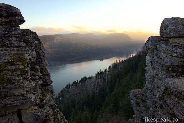
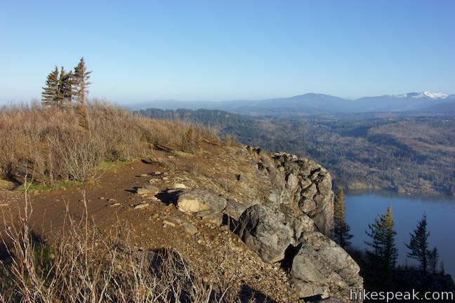
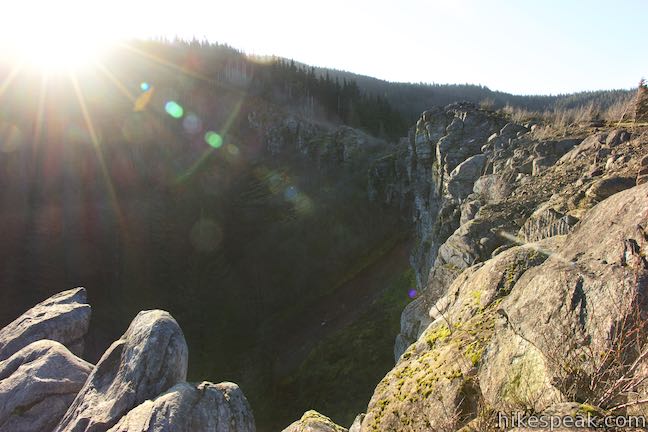
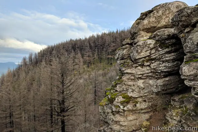
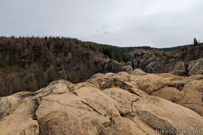
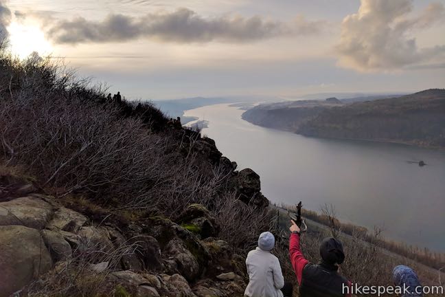
Arrive at an unmarked T-junction along a rocky spine, 2.4 miles from the start. To the right, a trail proceeds higher up the side of the gorge and connects to Wahkeena Trail after about 2.5 miles. Turn left to reach Angel’s Rest Lookout. You’ll immediately hit an outcropping of rock that you must climb up and over to proceed down the ridge. While doing so, you’ll find motivational views east up Columbia River Gorge.
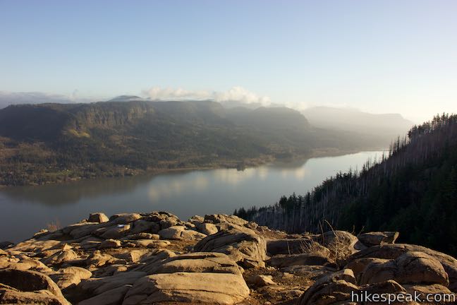
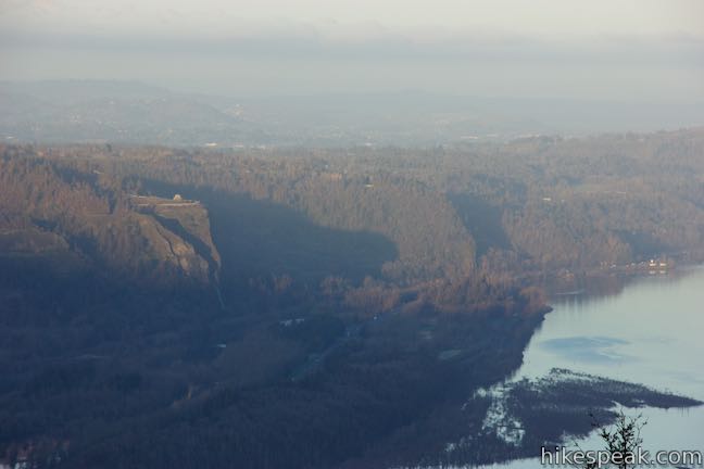
Make your way across the ridge of basalt rocks that extends into the Columbia River Gorge. Don’t get too close to the cliffs to your right, but do enjoy the sweeping views in front of you. The cliffs you stand on were eroded from the Columbia Lava Flows, and signs of the gorge’s dramatic creation are all around you.
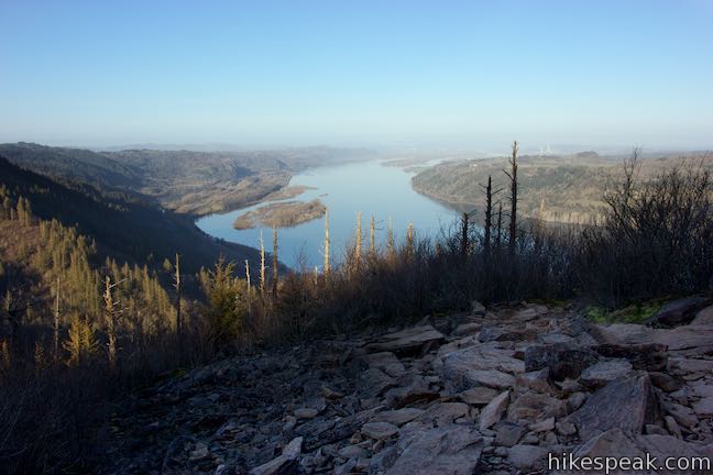
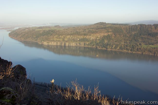
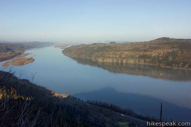
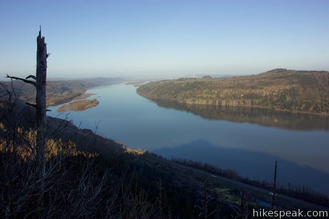
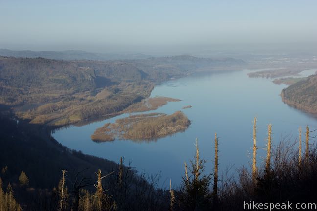
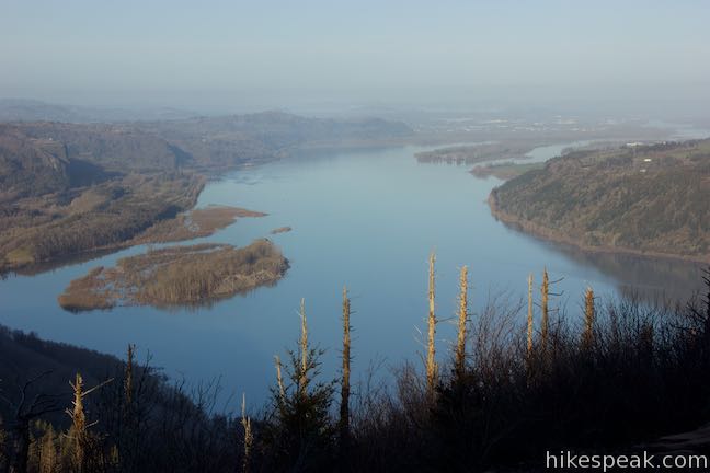
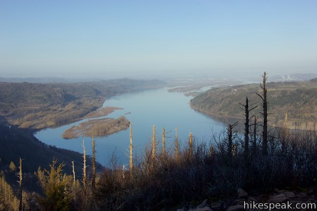
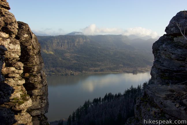
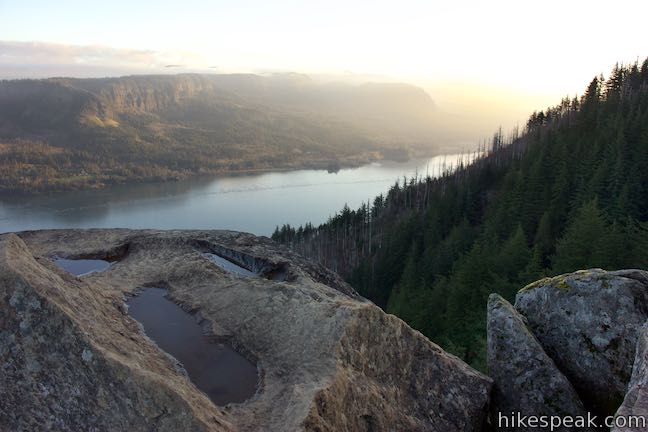
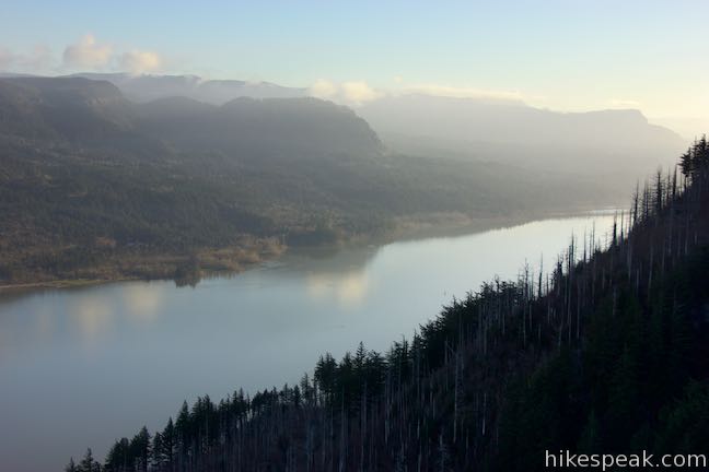
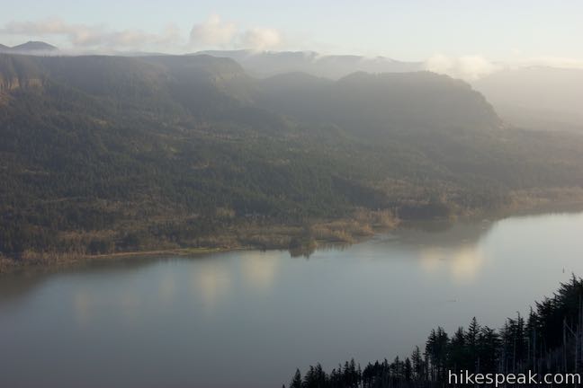
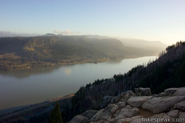
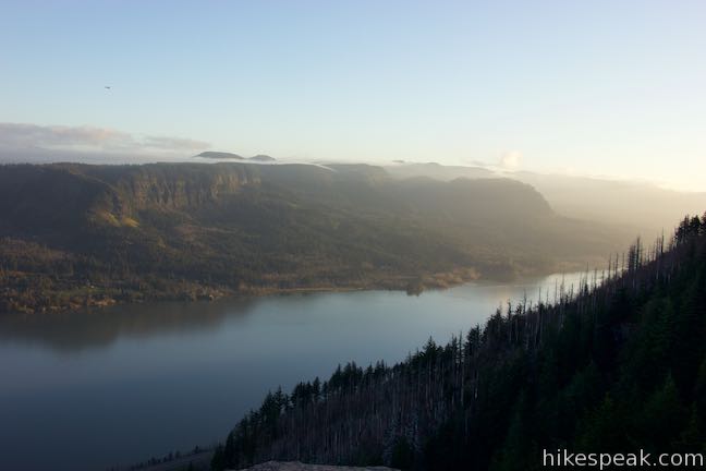
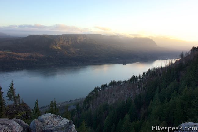
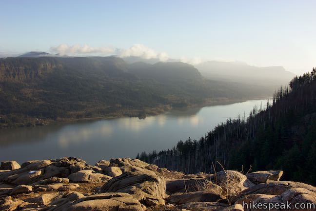
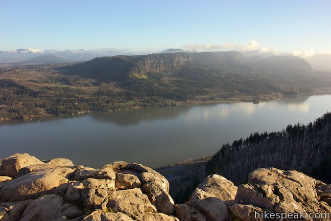
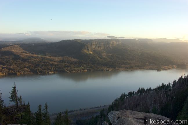
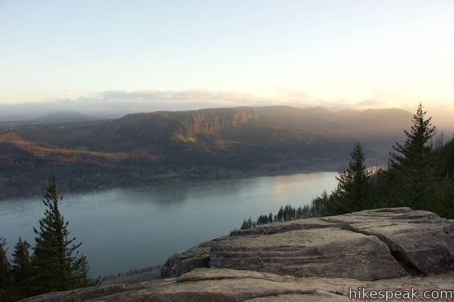
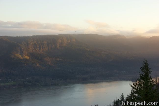
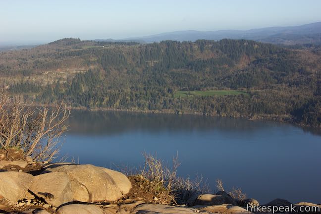
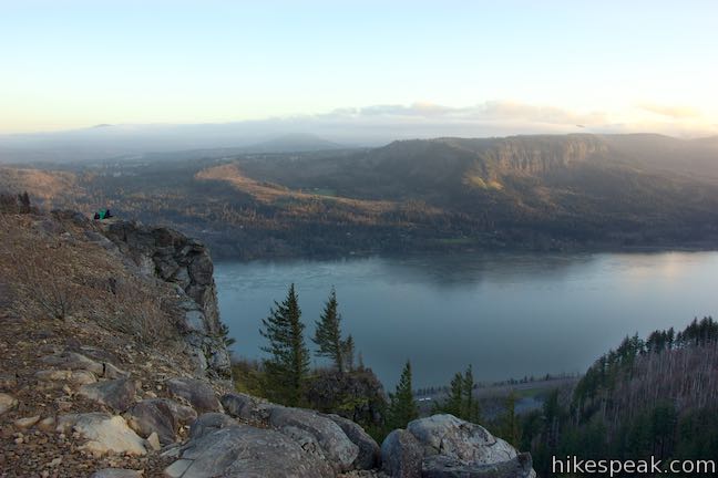
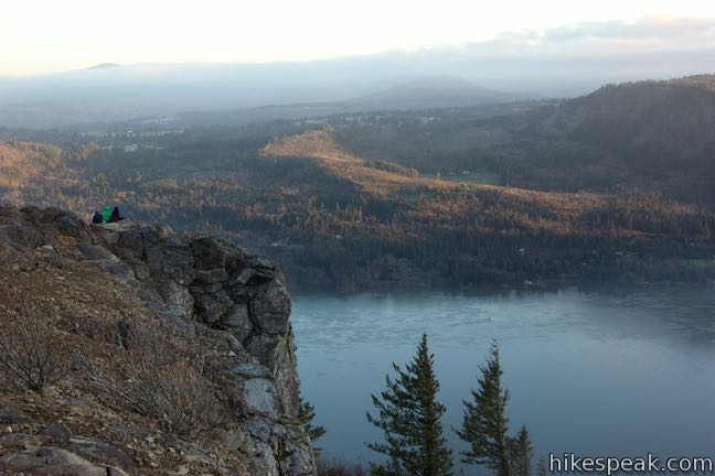
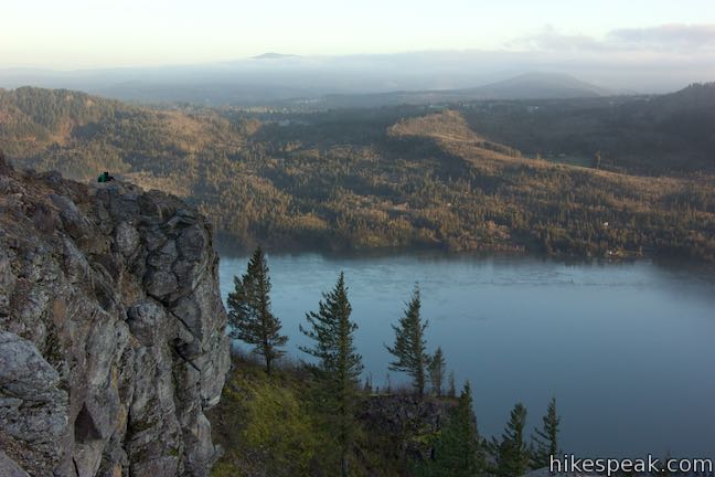
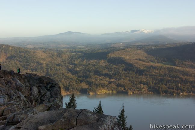
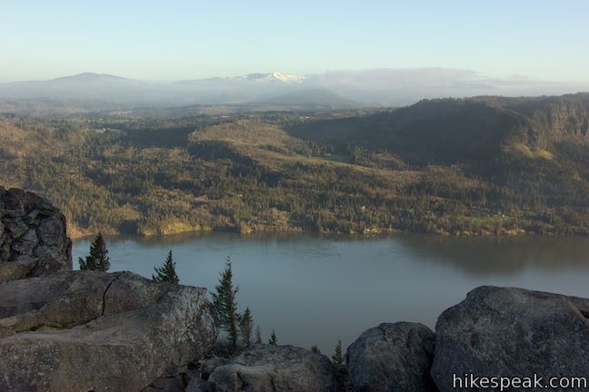
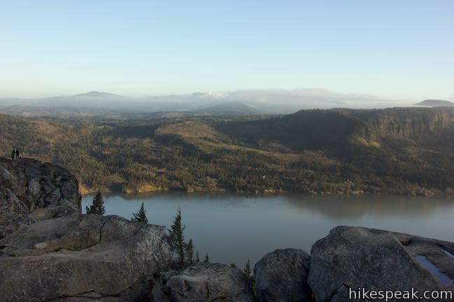
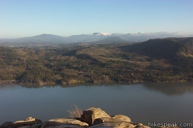
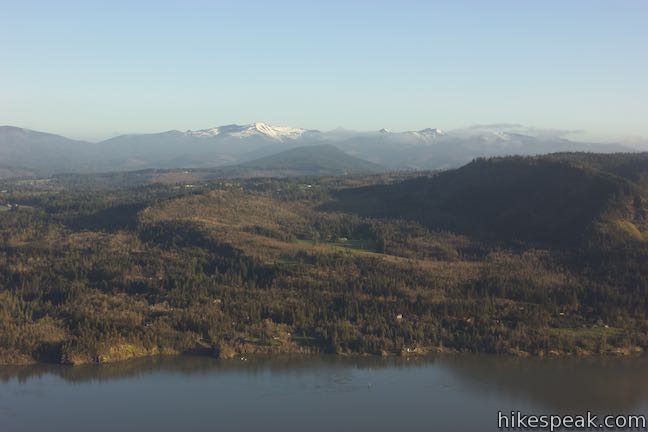
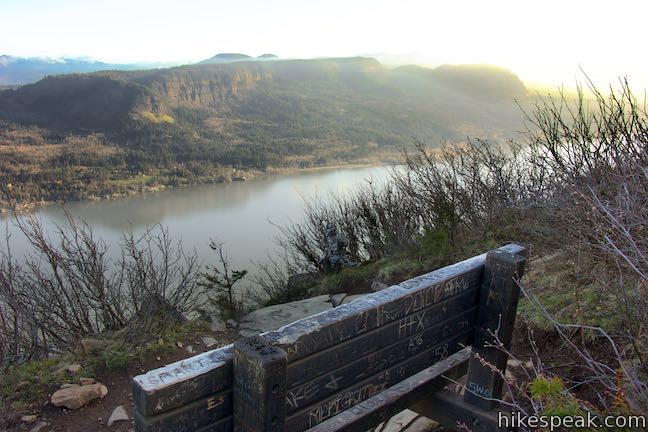
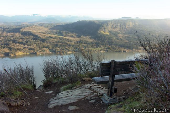
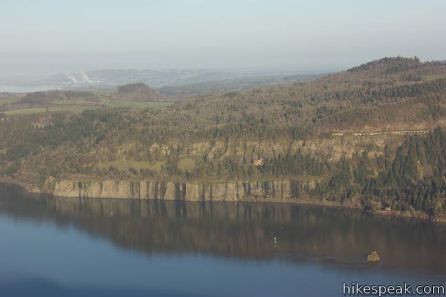
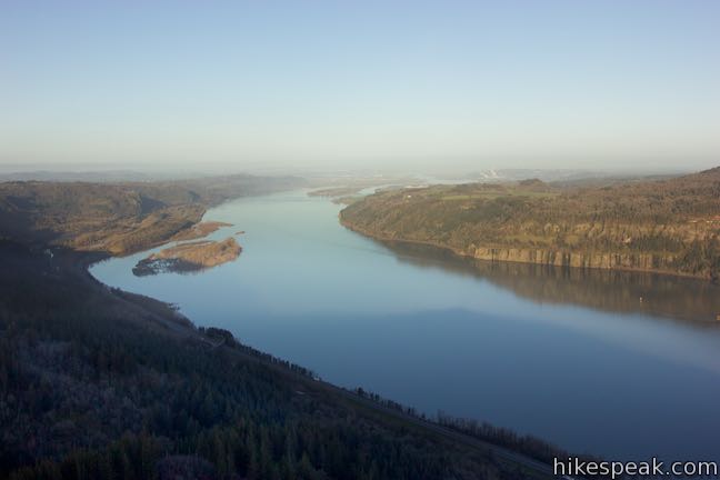
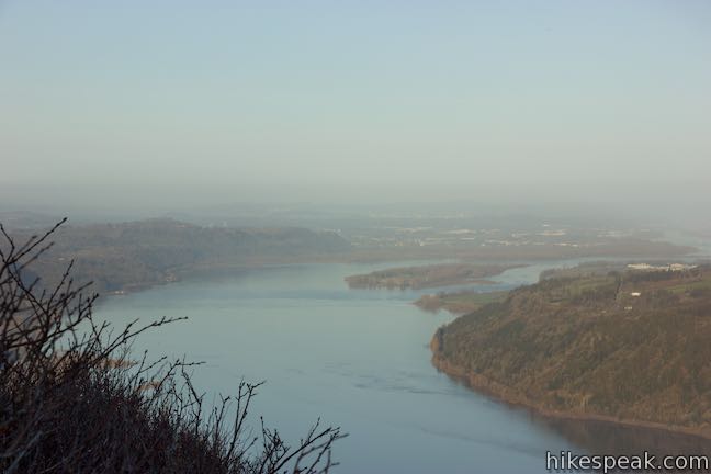
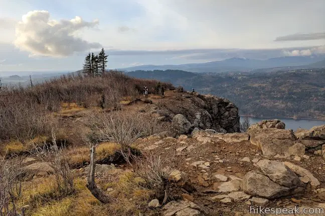
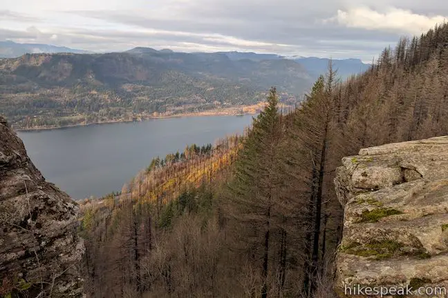
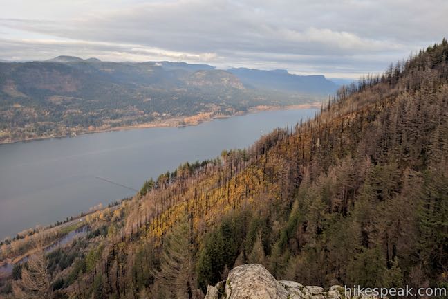
Walk a tenth of a mile from the junction out to the rocky point of Angel’s Rest Lookout. Gaze north across the Columbia River toward Silver Star Mountain and other ridges in the state of Washington. Look east up the Columbia River, which takes a beautiful path down the gorge and is flanked on the north side by cliffs around Archer Mountain. Mount Adams rises in the distance to the northeast. Angel’s Rest Lookout presents a truly beautiful perspective of Columbia River Gorge.
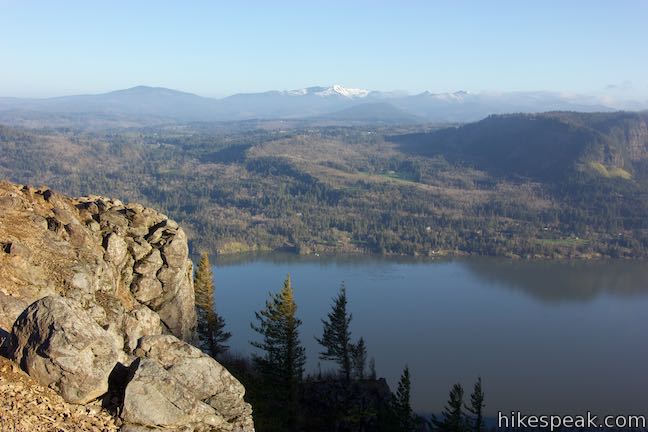
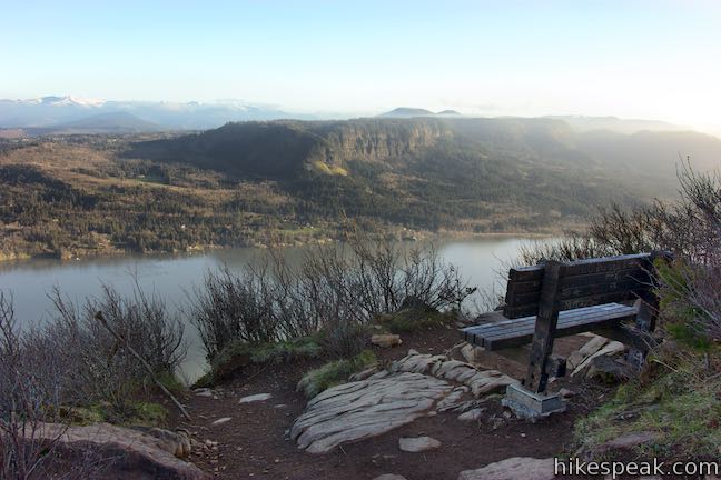
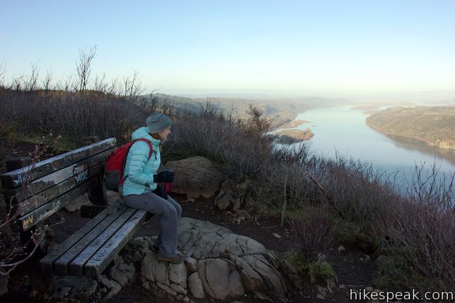
If you leave the main area on the landing of Angel’s Rest and follow a path to the west around the end of the point, you’ll find a well-positioned bench. Have a seat and look out across the gorge or gaze west down the Columbia River toward Portland. Angel’s Rest offers a 3-direction view and you should spend time enjoying everything there is to see.
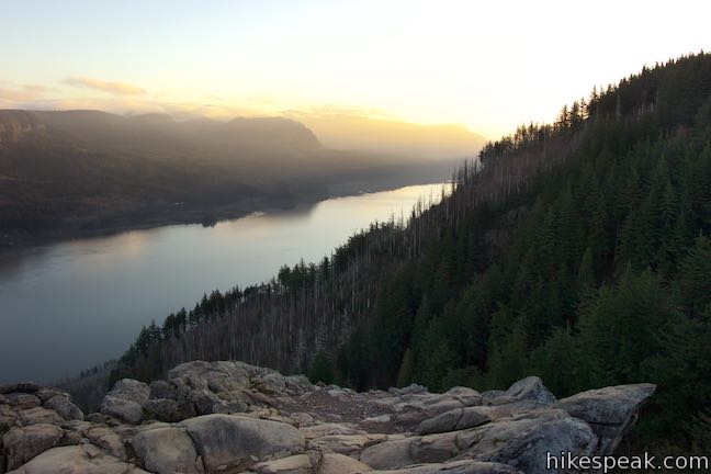
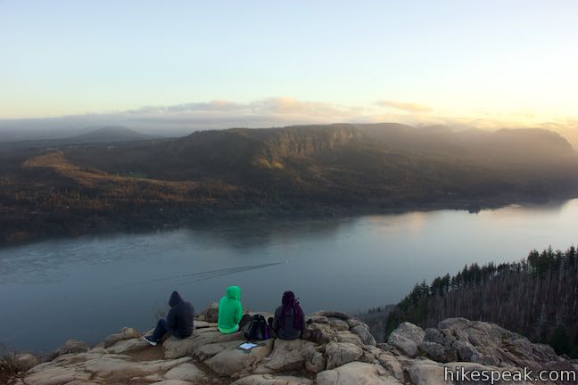
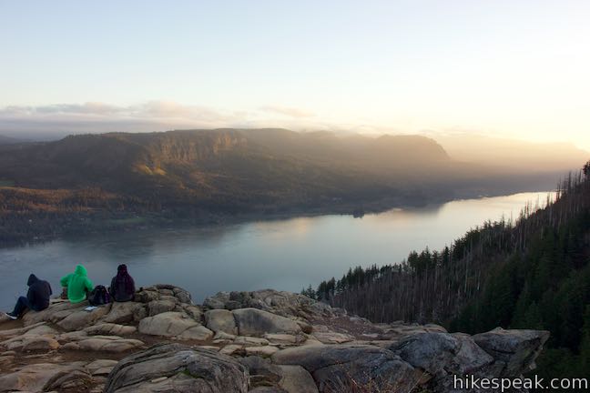
Are you an early riser? Make it up to Angel’s Rest at sunrise and you’re in for a great show.
Angel’s Rest provides balcony seating for the theater of the gorge. Watch a performance of nature unfold as sunlight dances down the alley of the Columbia River, tangoing with shadows in the cliffs on the Washington side while the landscape becomes illuminated.
When the time comes to leave Angel’s Rest Lookout, return the way your came to complete the 4.8-mile hike on Angel’s Rest Trail (descending the 1,500 feet is a lot easier). Leashed dogs are welcome on Angel’s Rest Trail, but bikes are not allowed. Parking at the trailhead is free and no permit is required to take this hike in Columbia River Gorge, so get out and enjoy!
If you like cliff-top viewpoints, check out the Vista House, 5 miles west of the trailhead on Historic Columbia River Highway. Driving that direction will take you past Latourell Falls. If you travel east on Historic Columbia River Highway, you’ll pass Wahkeena Falls, Multnomah Falls, and eventually Oneonta Falls and Horsetail Falls.
Trail Conditions Update – November 24, 2018
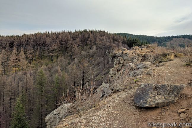
Angel’s Rest Trail reopened on November 23, 2018 after a 15 month closure from the Eagle Creek Fire. The route of the trail is unchanged. Both the Coopey Creek Bridge and the bench at the top Angel’s Rest were undamaged by the fire. The first third of the hike is very similar to its pre-fire appearance, with lots of green moss and ferns to enjoy, and only small patches of partially burned trees.
Fire damage is more evident along the upper two-thirds of the trail. The series of switchbacks around half a mile before the open boulder field appears to have been hit the hardest. To put a positive spin on the changes, the switchbacks now have more open views of the Columbia River Gorge. Fire damage is patchy along the trail. Expect minimal shade on hot sunny days.
Angel’s Rest Trail remains a beautiful hike, despite the area’s prominent fire damage. For more information about remaining wildfire closures, visit the US Forest Service’s Columbia River Gorge National Scenic Area: Alerts and Notices webpage.
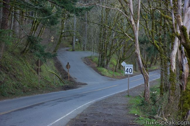
To get to the trailhead: From the intersection of Interstate 205 and Interstate 84 in Northeast Portland, take Interstate 84 east for less than 20 miles to Exit 28, which has signs for Bridal Veil and Historic Columbia River Highway. The offramp puts you on to Bridal Veil Road, which quickly comes to an intersection with Historic Columbia River Highway. Turn right and you will see a parking area on your right. This is Angel’s Rest Trailhead, so make another right turn to enter the parking area. If you can’t find space to park, drive west on Historic Columbia River Highway and make the first left turn up Palmer Mill Road to the overflow parking area.
Coming from the west, take Interstate 84 east of Hood River for 28 miles to exit 35. Proceed east on Historic Columbia River Highway for 7.3 miles, finding the trailhead parking on the right just past the intersection with Bridal Veil Road.
Trailhead address: Historic Columbia River Highway, Corbett, OR 97019
Trailhead coordinates: 45.5605, -122.17245 (45° 33′ 37.8″N 122° 10′ 20.8″W)
View Columbia River Gorge in a larger map
Or view a regional map of surrounding Oregon trails and campgrounds.
Before the Eagle Creek Fire (2017)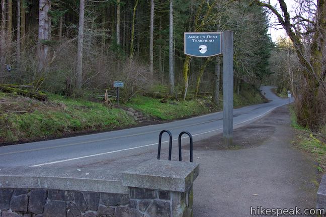


After the Eagle Creek Fire (2018)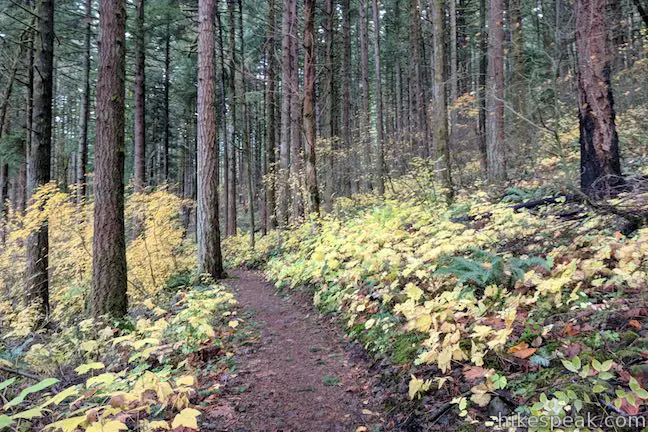


 | Latourell Falls Trail This 2.3-mile loop explores a canyon with two beautiful waterfalls, attaining great views of both. |
 | Multnomah Falls This 0.4 to 2.6-mile hike visits Oregon's tallest (and probably most visited) waterfall, offering something to hikers of all abilities. |
 | Multnomah-Wahkeena Loop This 6.05-mile loop uses Wahkeena Trail and Larch Mountain Trail to visit six glorious waterfalls (Wahkeena Falls, Fairy Falls, Ecola Falls, Weisendanger Falls, Dutchman Falls, and Multnomah Falls) as well as many fine cascades along Wahkeena Creek and Multnomah Creek in two beautiful canyons off Columbia River Gorge. |
 | Oneonta Gorge to Lower Oneonta Falls This 0.8-mile trek follows Oneonta Creek between the tall, mossy cliffs of a wild and beautiful gorge to the base of an enchanting 100-foot waterfall. |
 | Horsetail Falls Trail - Oneonta Trail Loop This 2.85-mile loop starts at Horsetail Falls, passes beneath an overhang behind Ponytail Falls, and crosses a bridge by Middle Oneonta Falls to hit three waterfalls and viewpoints looking out over the Columbia River Gorge. |
 | Wahclella Falls This 2-mile hike visits a sublime waterfall in a canyon within the Columbia River Gorge. |
 | Eagle Creek Trail This 4.55-mile hike ventures up a beautiful and dramatic canyon to impressive waterfalls like Metlako Falls, Lower Punchbowl Falls, and Punchbowl Falls. |
 | Mosier Twin Tunnels This 2 to 9.5-mile hike ventures up Historic Columbia River Highway State Trail to a pair of tunnels carved into basalt cliffs on the side of Columbia River Gorge. |
 | More trails in Oregon Explore other hikes in Oregon outside the Columbia River Gorge. |
[…] I headed slightly farther east to Angel’s Rest trailhead for my first taste of many hikes to come on this road trip. Angel’s Rest is a 4.8 […]