Hikes in Sequoia National Forest
Sequoia National Forest preserves 1.2 million acres of the Sierra. Within the national forest there are 328,000 acres and 33 giant sequoia groves that receive extra protection as part of Giant Sequoia National Monument.
Highlights of Sequoia National Forest


Sequoia National Forest and Giant Sequoia National Monument
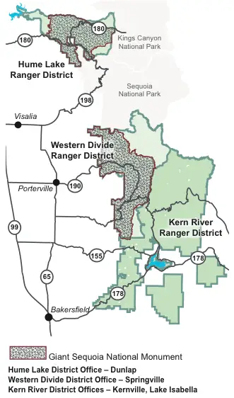 Sequoia National Forest is split into three ranger districts. The southernmost district is the Kern River District, followed by the Western Divide Ranger District, which borders Sequoia National Park to the north and is the largest piece of the Giant Sequoia National Monument. The third ranger district, Hume Lake Ranger District, is located north of Sequoia National Park on the west side of Kings Canyon National Park. Kings Canyon is actual split into two pieces and to drive between them you have to pass through this very scenic park of Sequoia National Forest (also protected as part of Giant Sequoia National Monument).
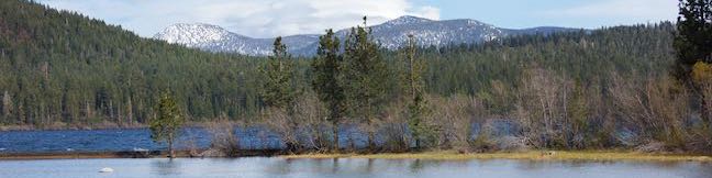
The Western Divide Ranger District of Sequoia National Forest is a great place to visit. It is located on the west side of the Sierra Nevada Mountains south of Sequoia National Park. On holiday weekends, when the national parks fill, you can escape the crowds and come to Sequoia National Forest, sacrificing a bit of notoriety for Sierra serenity. Western Divide Ranger District offers visitors access to striking mountains, meadows, and sequoia groves. car camping is available along Western Divide Highway. With the exception of Trail of 100 Giants, hiking in this area of Sequoia National Forest is free.
Sequoia National Forest Hiking
This collection of trails in Sequoia National Forest and Giant Sequoia National Monument lists the hikes from north to south. The table may also be sorted alphabetically or by distance to help you select your next trek. Each trail links to its own report complete with photos, GPS maps, directions, and all the other information needed to locate and enjoy these trails. Below the table is an interactive map showing the location of each hike.
Trail | Description | Distance | Location |
|---|---|---|---|
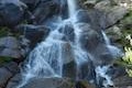 260 260 | Grizzly Falls This stroll at Grizzly Falls Picnic Area reaches the base of an 80-foot waterfall along the Generals Highway near the Cedar Grove Area of Kings Canyon National Park. | 0.1 miles 10 feet | 36.802979, -118.743561 |
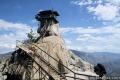 800 800 | Needles Lookout This out and back hike visits a fire tower with unbeatable views of the region. | 5 miles 500 feet | 36.1198, -118.5084 |
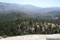 830 830 | Dome Rock This short out and back hike just off Western Divide Highway provides a great view of the valley below. | 0.5 miles 75 feet | 36.068, -118.532 |
 860 860 | Natural Water Slide This out and back hike visits a refreshing natural water slide on the eastern side of the Great Western Divide. | 1.5 mile 150 feet | 36.02745, -118.5153 |
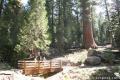 900 900 | Trail of 100 Giants This paved loop explores a grove of giant sequoias alongside Western Divide Highway. | 1.3 miles 80 feet | 35.97733, -118.59399 |
Or explore hikes around Sequoia National Forest on the Hike Finder Map