Forest Park Loop Hike Wild Cherry Trail Alder Trail Portland Oregon
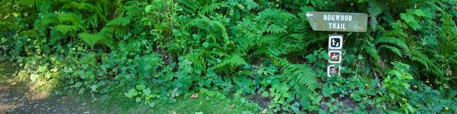
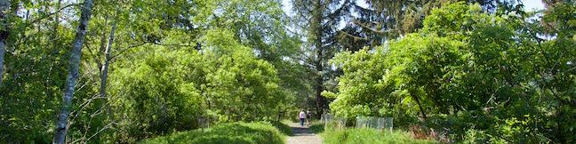
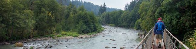
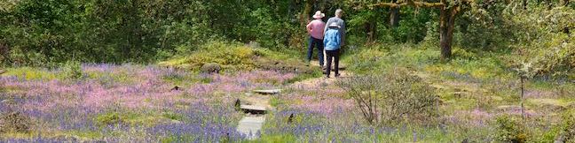
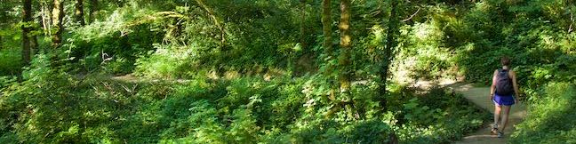
What will you find under the canopy of Forest Park? Dirt single tracks weave through verdant woodlands, passing Douglas firs and bigleaf maples bedecked with licorice ferns. Explore some of Forest Park's charmingly ridges and ravines on this 3.5-mile loop with 510 feet of elevation change. Although Wild Cherry Trail and Alder Trail are the most notable members of this hike, this circuit actually comes together with the use of a few other trail: Leif Erikson Trail, Wildwood Trail, Keil Trail, and a sliver of Dogwood Trail. ...Read more.
My Hikes: Completed hikeA green icon of shows a picture of a landscape with a check mark in the upper right corner, signifying that this is a hike you would like to put on your completed list.OK! Add to trails I've hiked
My Hikes: Want to hikeA green icon of shows a picture of a landscape with a heart in the upper right corner, signifying that this is a hike you would like to put on your to-do list.OK! Add to trails I want to hike
TagsA green icon depicting a tags represents a list of words and phrases that this content is tagged with Tagged with · Forest Park · Free Trails · Northwest Portland · Tualatin Mountains · West Hills of Portland
Hike DistanceA green icon of a hiker used to label information about the length of the hike Distance: 3.5 miles · Elevation change: 510 feet
By: Published: Last updated: December 5, 2025
Wild Cherry Trail Dogwood Trail Leif Erikson Drive Loop Hike Forest Park Portland Oregon
Looking for a Forest Park hike that can be completed in about an hour? Delve into the woods on this 2.5-mile loop that explores a soothing swath of Forest Park. The loop has 515 feet of elevation change, traveling downhill from Northwest 53rd Drive on Wild Cherry Trail before rising back up Dogwood Trail. Wild Cherry Trail – Dogwood Trail Loop starts from one of the roadside parking area along NW 53rd Drive, 0. ...Read more.
My Hikes: Completed hikeA green icon of shows a picture of a landscape with a check mark in the upper right corner, signifying that this is a hike you would like to put on your completed list.OK! Add to trails I've hiked
My Hikes: Want to hikeA green icon of shows a picture of a landscape with a heart in the upper right corner, signifying that this is a hike you would like to put on your to-do list.OK! Add to trails I want to hike
TagsA green icon depicting a tags represents a list of words and phrases that this content is tagged with Tagged with · Forest Park · Free Trails · Northwest Portland · Tualatin Mountains · West Hills of Portland
Hike DistanceA green icon of a hiker used to label information about the length of the hike Distance: 2.5 miles · Elevation change: 515 feet
By: Published: Last updated: December 5, 2025
Alder Island Nature Trail Siletz Bay National Wildlife Refuge Hike Lincoln City Oregon Coast Trail
Just south of Lincoln City on the Oregon coast, Highway 101 crosses the Siletz River as it flows into Siletz Bay and the Pacific Ocean. It is at this location that you will find Alder Island Nature Trail, which opened in 2017 and offers a level 0.85-mile loop hike around an island between the river and its marshes. While it might lack the ocean views of surrounding coastal hikes, Alder Island Nature Trail is a tranquil spot for a short, easy outing with wildlife-viewing opportunities. ...Read more.
My Hikes: Completed hikeA green icon of shows a picture of a landscape with a check mark in the upper right corner, signifying that this is a hike you would like to put on your completed list.OK! Add to trails I've hiked
My Hikes: Want to hikeA green icon of shows a picture of a landscape with a heart in the upper right corner, signifying that this is a hike you would like to put on your to-do list.OK! Add to trails I want to hike
TagsA green icon depicting a tags represents a list of words and phrases that this content is tagged with Tagged with · Depoe Bay · Free Trails · Lincoln City · Siletz Bay National Wildlife Refuge
Hike DistanceA green icon of a hiker used to label information about the length of the hike Distance: 0.85 miles · Elevation change: 5 feet
By: Published: Last updated: December 5, 2025
Pipeline Trail Hood River Oregon Penstock Flume Hike Columbia River Gorge Powerdale Corridor
Most of the trails in Columbia River Gorge lead to big waterfalls or big views, but one of these trails is not like the others. The Pipeline Trail near downtown Hood River has a hiking experience that could very well be a one-of-a-kind. This route exchanges the average dirt trail for a catwalk built on top of a penstock pipeline. That catwalk stands a dozen feet off the ground and whisks visitors through tree branches to raised views of Hood River. ...Read more.
My Hikes: Completed hikeA green icon of shows a picture of a landscape with a check mark in the upper right corner, signifying that this is a hike you would like to put on your completed list.OK! Add to trails I've hiked
My Hikes: Want to hikeA green icon of shows a picture of a landscape with a heart in the upper right corner, signifying that this is a hike you would like to put on your to-do list.OK! Add to trails I want to hike
TagsA green icon depicting a tags represents a list of words and phrases that this content is tagged with Tagged with · Free Trails · Hood River · Ruins
Hike DistanceA green icon of a hiker used to label information about the length of the hike Distance: 2.8 miles · Elevation change: 100 feet
By: Published: Last updated: December 5, 2025
Camassia Natural Area Loop Trail West Linn Wildflower Hike Camas Lilies Portland Oregon
Camassia Natural Area contains something special – one of the best wildflower displays in the greater Portland area. From April to May, the grassy plateaus in this 27-acre preserve boasts beautiful purples, blues, pinks and yellows created by Camas lilies, blue-eyed Mary, rosy plectritis, and buttercups (as well as other flowers). Explore this West Linn jewel on an easy 0. ...Read more.
My Hikes: Completed hikeA green icon of shows a picture of a landscape with a check mark in the upper right corner, signifying that this is a hike you would like to put on your completed list.OK! Add to trails I've hiked
My Hikes: Want to hikeA green icon of shows a picture of a landscape with a heart in the upper right corner, signifying that this is a hike you would like to put on your to-do list.OK! Add to trails I want to hike
TagsA green icon depicting a tags represents a list of words and phrases that this content is tagged with Tagged with · Camassia Natural Area · Free Trails · The Nature Conservancy · West Linn · Wildflowers
Hike DistanceA green icon of a hiker used to label information about the length of the hike Distance: 0.8 miles · Elevation change: 70 feet
By: Published: Last updated: December 6, 2025
Scouters Mountain Nature Park Hike Portland Mount Hood View Happy Valley Boomer Trail Scouters Mountain Shelter
Searching for a short hike in the Portland area? Scouters Mountain Nature Park in Happy Valley makes a worthwhile destination for a 1.2-mile hike. Explore a forested cinder cone east of Portland, plotting your way through tall firs to a summit clearing with a direct sight of Mount Hood. If you work up an appetite, picnic under a pavilion at the top of Scouters Mountain. ...Read more.
My Hikes: Completed hikeA green icon of shows a picture of a landscape with a check mark in the upper right corner, signifying that this is a hike you would like to put on your completed list.OK! Add to trails I've hiked
My Hikes: Want to hikeA green icon of shows a picture of a landscape with a heart in the upper right corner, signifying that this is a hike you would like to put on your to-do list.OK! Add to trails I want to hike
TagsA green icon depicting a tags represents a list of words and phrases that this content is tagged with Tagged with · Cinder Cones · Free Trails · Happy Valley
Hike DistanceA green icon of a hiker used to label information about the length of the hike Distance: 1.2 miles · Elevation change: 180 feet
By: Published: Last updated: December 5, 2025
Canemah Bluff Nature Park Oregon City Hike Camas Springs Trail Canemah Bluff Hike Willamette Falls Portland Oregon
What's so appealing about Canemah Bluff Nature Park in Oregon City? Start with fields of spring wildflowers and views of Willamette Falls. Then add ferny forests and a historical cemetery to give visitors plenty of reasons to take this 1.7-mile hike. In April and early May, Camas lilies steal the show at Canemah Bluff Nature Park, providing pops of purple to a meadow on a landing above the Willamette River. ...Read more.
My Hikes: Completed hikeA green icon of shows a picture of a landscape with a check mark in the upper right corner, signifying that this is a hike you would like to put on your completed list.OK! Add to trails I've hiked
My Hikes: Want to hikeA green icon of shows a picture of a landscape with a heart in the upper right corner, signifying that this is a hike you would like to put on your to-do list.OK! Add to trails I want to hike
TagsA green icon depicting a tags represents a list of words and phrases that this content is tagged with Tagged with · Free Trails · Oregon City · Willamette River
Hike DistanceA green icon of a hiker used to label information about the length of the hike Distance: 1.7 miles · Elevation change: 165 feet
By: Published: Last updated: December 5, 2025
Camping Deschutes River State Recreation Area Campground Columbia River Tent RV camp Oregon
Deschutes River State Recreation Area is located east of The Dalles, Oregon (where spring arrives earlier than it does in areas west of the Columbia River Gorge). Bordering the Deschutes River beside its meeting with the Columbia River, the park's grassy and shaded campground is a relaxing place to stay. This 63-site campground (with 34 sites with electrical hookups, 25 more primitive sites, and 4 group sites) has river views, ample amenities, and hiking along the Deschutes River. ...Read more.
TagsA green icon depicting a tags represents a list of words and phrases that this content is tagged with Tagged with · Deschutes River · Deschutes River State Recreation Area · Oregon State Parks · Tent Camping · Wasco
By: Published: Last updated: September 2, 2025
River Trail Loop Deschutes River State Recreation Area Atiyeh Deschutes River Trail Loop Oregon Blackberry Trail Riverview Trail Loop
Right before spilling into the Columbia River, the Deschutes River flows down a canyon between grass and sagebrush-covered ridges with basalt outcroppings. Alongside the river, a pair of parallel trails allow hikers to enjoy a 3.1-mile loop with a variety of fine views. The level River Trail (also known as Blackberry Trail) hugs the riverbank, while the rolling Upper Trail (also known as Riverview Trail) crosses a grassy terrace with broader vistas up and down the Deschutes. ...Read more.
My Hikes: Completed hikeA green icon of shows a picture of a landscape with a check mark in the upper right corner, signifying that this is a hike you would like to put on your completed list.OK! Add to trails I've hiked
My Hikes: Want to hikeA green icon of shows a picture of a landscape with a heart in the upper right corner, signifying that this is a hike you would like to put on your to-do list.OK! Add to trails I want to hike
TagsA green icon depicting a tags represents a list of words and phrases that this content is tagged with Tagged with · Deschutes River · Deschutes River State Recreation Area · Free Trails · Oregon State Parks · Wasco
Hike DistanceA green icon of a hiker used to label information about the length of the hike Distance: 3.1 miles · Elevation change: 115 feet
By: Published: Last updated: December 5, 2025
Catherine Creek Arch Columbia River Gorge National Scenic Area Hike Washington
Catherine Creek Arch is a surprising creation - a bridge-like span of rock along a ledge of basalt. A 1-mile round trip hike leads to the foot of Catherine Creek Arch (and longer loops in the area are also possible). This short and sweet outing entertains hikers of all ages. Part of the Columbia River Gorge National Scenic Area, Catherine Creek is located on the Washington side of the west end of the gorge, where lovely views are easy to find. ...Read more.
My Hikes: Completed hikeA green icon of shows a picture of a landscape with a check mark in the upper right corner, signifying that this is a hike you would like to put on your completed list.OK! Add to trails I've hiked
My Hikes: Want to hikeA green icon of shows a picture of a landscape with a heart in the upper right corner, signifying that this is a hike you would like to put on your to-do list.OK! Add to trails I want to hike
TagsA green icon depicting a tags represents a list of words and phrases that this content is tagged with Tagged with · Arches · Columbia River Gorge National Scenic Area · Free Trails · Lyle
Hike DistanceA green icon of a hiker used to label information about the length of the hike Distance: 1 mile · Elevation change: 100 feet
By: Published: Last updated: December 6, 2025