Fire Wave Trail Valley of Fire State Park Nevada Valley of Fire Wave Hike
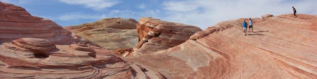
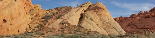
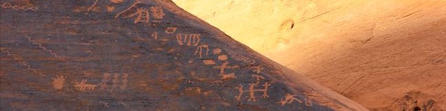
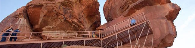
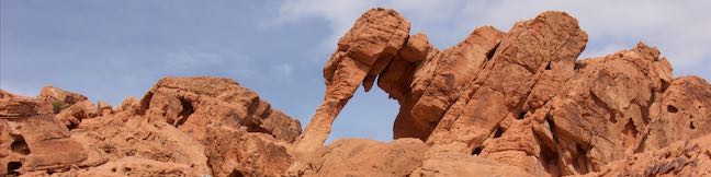
Stripes are something you don't see too often in nature (unless you live near a bunch of zebras), and the stripes at Fire Wave really stand out. In this isolated area of Valley of Fire State Park in Nevada, the slickrock has interchanging streaks of beige and red-orange colored sandstone. Fire Wave has a bowl-shaped depression with a couple rising points covered with wavy lines. ...Read more.
My Hikes: Completed hikeA green icon of shows a picture of a landscape with a check mark in the upper right corner, signifying that this is a hike you would like to put on your completed list.OK! Add to trails I've hiked
My Hikes: Want to hikeA green icon of shows a picture of a landscape with a heart in the upper right corner, signifying that this is a hike you would like to put on your to-do list.OK! Add to trails I want to hike
TagsA green icon depicting a tags represents a list of words and phrases that this content is tagged with Tagged with · Nevada State Parks · Overton
Hike DistanceA green icon of a hiker used to label information about the length of the hike Distance: 1.5 miles · Elevation change: 175 feet
By: Published: Last updated: December 5, 2025
Rainbow Vista Trail Valley of Fire State Park Nevada Rainbow Vista Hike
You have to use some pretty colorful language when describing Rainbow Vista Trail, like vibrant, fiery, and effing extraordinary. The good news about Rainbow Vista Trail is that you get big views right from the start and any hiking you do will be picturesque. The bad news is that Rainbow Vista Trail is not as well marked as it could be and crosses sandy terrain with lots of spurious footpaths. ...Read more.
My Hikes: Completed hikeA green icon of shows a picture of a landscape with a check mark in the upper right corner, signifying that this is a hike you would like to put on your completed list.OK! Add to trails I've hiked
My Hikes: Want to hikeA green icon of shows a picture of a landscape with a heart in the upper right corner, signifying that this is a hike you would like to put on your to-do list.OK! Add to trails I want to hike
TagsA green icon depicting a tags represents a list of words and phrases that this content is tagged with Tagged with · Nevada State Parks · Overton
Hike DistanceA green icon of a hiker used to label information about the length of the hike Distance: 1.5 miles · Elevation change: 150 feet
By: Published: Last updated: December 5, 2025
Mouse's Tank Trail Petroglyphs Canyon Trail Hike to Mouses Tank Valley of Fire State Park Nevada
The best outing for seeing petroglyphs in Valley of Fire State Park is Petroglyph Canyon Trail. This 0.75-mile round trip hike passes rock faces that are covered in Native American rock art. The abundance of prehistoric petroglyphs on this trail is amazing. To cap things off, the trail ends at Mouse's Tank, a natural basin (or tinaja) of water suspended in sandstone. ...Read more.
My Hikes: Completed hikeA green icon of shows a picture of a landscape with a check mark in the upper right corner, signifying that this is a hike you would like to put on your completed list.OK! Add to trails I've hiked
My Hikes: Want to hikeA green icon of shows a picture of a landscape with a heart in the upper right corner, signifying that this is a hike you would like to put on your to-do list.OK! Add to trails I want to hike
TagsA green icon depicting a tags represents a list of words and phrases that this content is tagged with Tagged with · Desert Canyons · Nevada State Parks · Petroglyphs · Tanks
Hike DistanceA green icon of a hiker used to label information about the length of the hike Distance: 0.75 miles · Elevation change: 25 feet
By: Published: Last updated: December 5, 2025
Scenic Roads Valley of Fire State Park Nevada Picturesque Drives White Domes Road Valley of Fire Highway Scenic Loop Road
Every road through Valley of Fire State Park is scenic. The biggest wows come on White Domes Road, an official state and national scenic byway. The main road through the park, Valley of Fire Highway, is honored for its surrounding beauty as well. Scenic Loop Road branches off Valley of Fire Highway and can be used to bike or drive a 3-mile circuit past numerous natural attractions. ...Read more.
TagsA green icon depicting a tags represents a list of words and phrases that this content is tagged with Tagged with · Arches · Nevada State Parks · Overton
By: Published: Last updated: May 13, 2025
Valley of Fire State Park Campgrounds Camping Atlatl Rock Campground and Arch Rock Campground Valley of Fire Nevada
Camping in Valley of Fire State Park is a real pleasure with nicely established campsites wrapped by bold formations of red sandstone. Atlatl Rock Campground and nearby Arch Rock Campground, both located on the west side of the park offer great camping experiences for visitors to Valley of Fire State Park. General Camping Information Spring and fall are the ideal seasons to camp in Valley of Fire State Park. ...Read more.
TagsA green icon depicting a tags represents a list of words and phrases that this content is tagged with Tagged with · Nevada State Parks · Tent Camping
By: Published: Last updated: May 13, 2025
Atlatl Rock Trail Petroglyphs Hike Valley of Fire State Park Nevada
Valley of Fire State Park is an excellent place to see Native American rock art up close. Atlatl Rock sports a collection of petroglyphs on a boulder about fifty feet off the ground. A metal staircase has been installed on the side of the red sandstone formation to take visitors right up to a viewing area in front of the petroglyphs. Atlatl Rock is on a Scenic Loop Road on the west side of the park next to Atlatl Rock Campground and is a great, quick attraction in Valley of Fire State Park. ...Read more.
My Hikes: Completed hikeA green icon of shows a picture of a landscape with a check mark in the upper right corner, signifying that this is a hike you would like to put on your completed list.OK! Add to trails I've hiked
My Hikes: Want to hikeA green icon of shows a picture of a landscape with a heart in the upper right corner, signifying that this is a hike you would like to put on your to-do list.OK! Add to trails I want to hike
TagsA green icon depicting a tags represents a list of words and phrases that this content is tagged with Tagged with · Nevada State Parks · Overton · Petroglyphs
Hike DistanceA green icon of a hiker used to label information about the length of the hike Distance: 0.1 miles · Elevation change: 50 feet
By: Published: Last updated: December 5, 2025
Petrified Logs Loop Petrified Wood Trail Valley of Fire State Park Hike Nevada
Petrified wood is the fossil of a tree that has been turned to stone. Find out how this happens and see partially buried petrified logs in Valley of Fire State Park in Nevada. An easy 0.3-mile loop goes past several good examples of petrified logs, as well as informative panels detailing how the park's petrified logs came to be. Petrified Logs Loop is located on the southwest side of Valley of Fire State Park up a short gravel road from Valley of Fire Highway. ...Read more.
My Hikes: Completed hikeA green icon of shows a picture of a landscape with a check mark in the upper right corner, signifying that this is a hike you would like to put on your completed list.OK! Add to trails I've hiked
My Hikes: Want to hikeA green icon of shows a picture of a landscape with a heart in the upper right corner, signifying that this is a hike you would like to put on your to-do list.OK! Add to trails I want to hike
TagsA green icon depicting a tags represents a list of words and phrases that this content is tagged with Tagged with · Nevada State Parks · Overton · Petrified Logs
Hike DistanceA green icon of a hiker used to label information about the length of the hike Distance: 0.3 miles · Elevation change: 45 feet
By: Published: Last updated: December 5, 2025
Balancing Rock Trail Valley of Fire State Park Balancing Rock Hike Nevada Valley of Fire State Park Visitor Center Balanced Rock
This short hike begins next to the visitor center for Valley of Fire State Park. Hike just a quarter mile round trip to stand below a formation of red sandstone that seems to be standing quite precariously. The short trail is located near the start of White Domes Road and is an easy and convenient addition to any park visit. Facing the visitor center, turn to the left to spot the start of the trail. ...Read more.
My Hikes: Completed hikeA green icon of shows a picture of a landscape with a check mark in the upper right corner, signifying that this is a hike you would like to put on your completed list.OK! Add to trails I've hiked
My Hikes: Want to hikeA green icon of shows a picture of a landscape with a heart in the upper right corner, signifying that this is a hike you would like to put on your to-do list.OK! Add to trails I want to hike
TagsA green icon depicting a tags represents a list of words and phrases that this content is tagged with Tagged with · Nevada State Parks · Overton
Hike DistanceA green icon of a hiker used to label information about the length of the hike Distance: 0.25 miles · Elevation change: 10 feet
By: Published: Last updated: December 5, 2025
Elephant Rock Trail Valley of Fire State Park Elephant Rock Hike Nevada Valley of Fire State Park
Elephant Rock is a unique rock formation just off Valley of Fire Highway, next to the east entrance of Valley of Fire State Park. This is the sort of sandstone formation that can't be believed by people who haven't seen it. Is Elephant Rock an oddly shaped natural arch or perhaps a stone encased mastodon trunk? Get a close look at Elephant Rock on an easy 0. ...Read more.
My Hikes: Completed hikeA green icon of shows a picture of a landscape with a check mark in the upper right corner, signifying that this is a hike you would like to put on your completed list.OK! Add to trails I've hiked
My Hikes: Want to hikeA green icon of shows a picture of a landscape with a heart in the upper right corner, signifying that this is a hike you would like to put on your to-do list.OK! Add to trails I want to hike
TagsA green icon depicting a tags represents a list of words and phrases that this content is tagged with Tagged with · Arches · Nevada State Parks · Overton
Hike DistanceA green icon of a hiker used to label information about the length of the hike Distance: 0.3 miles · Elevation change: 50 feet
By: Published: Last updated: December 5, 2025