Heaton Flats Trail in the San Gabriel Mountains
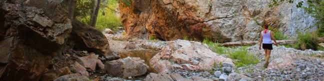
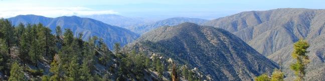
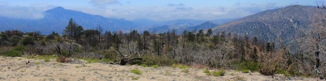
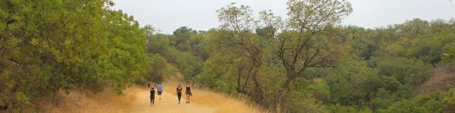
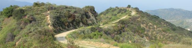
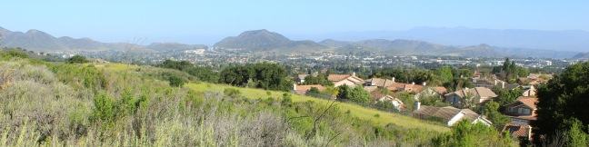
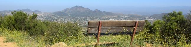
Half a mile from the start of the crowded trail to the Bridge to Nowhere, you'll find a junction with Heaton Flats Trail, which rises above the canyon carved by the East Fork of the San Gabriel River to offer big views and plenty of solitude. Enjoy panoramic perspectives of some of the most notable peaks in the San Gabriel Mountains (including Mount Baldy, Mount Baden-Powell, and Iron Mountain) along the trail to a 4,000-foot high clearing on the ridge. ...Read more.
Distance: 6 miles · Elevation change: 2000 feet
By: Published: September 27, 2012 Last updated: December 5, 2025
Fish Canyon Narrows in the Sierra Pelona Mountains
Not to be confused with Fish Canyon Falls on the east end of the Angeles National Forest, the Fish Canyon Narrows reside on the far west end of the Angeles in the Sierra Pelona Mountains north of Santa Clarita. Here a mountain stream passes through hundred-foot cliffs that are at time only twenty feet apart. The red rock walls mimic those you might find hiking in Zion National Park or other Utah canyons. ...Read more.
Distance: 10.5 miles · Elevation change: 650 feet
By: Published: July 22, 2012 Last updated: April 8, 2026
Winston Ridge and Winston Peak in the San Gabriel Mountains
Winston Ridge and Winston Peak are name-sharing neighbors in the high San Gabriel Mountains near the Mount Waterman Ski Area. While Winston Peak is the high point of the hike at 7,502 feet, the summit is covered with pines that leave little room for panoramic views. The best vistas come from the shorter 7,003-foot Winston Ridge, which has fewer pines and broader views. ...Read more.
Distance: 4.85 miles · Elevation change: 875 feet
By: Published: July 19, 2012 Last updated: April 9, 2026
Mount Hillyer in the San Gabriel Mountains
Rising to just over 6,200 feet, Mount Hillyer is actually one of the easier summits to reach in the high country of the San Gabriel Mountains. Beyond its boulder piles and pine forests, the stretched-out summit offers several sweeping views of nearby peaks and canyons. The shortest route to the summit involves hiking 1.33 miles up Mount Hillyer Trail from Horse Flats Campground, gaining 575 feet. ...Read more.
Distance: 6.25 miles · Elevation change: 1000 feet
By: Published: July 18, 2012 Last updated: April 8, 2026
Horse Flats Campground in the San Gabriel Mountains
Horse Flats Campground is a 25-site camping spot operated by the Angeles National Forest in San Gabriel Mountains National Monument, located in the high elevation of the San Gabriel Mountains. At 5,650 feet above sea level, or a mile higher than Los Angeles, the campground feels far from home, even through it is only about 30 miles from the city at the base of the mountains. ...Read more.
By: Published: July 17, 2012 Last updated: October 8, 2024
Fryman Canyon Loop in the Santa Monica Mountains
What to go for a hike but don't have time to leave Los Angeles? If you live near the Hollywood Hills or Studio City, Fryman Canyon may be the perfect place to get an hour of outdoor exercise. The 3-mile loop on Betty B. Dearing Trail passes through Wilacre Park in Lower Fryman Canyon and Coldwater Canyon Park, dishing out just 450 feet of elevation gain. ...Read more.
Distance: 3 miles · Elevation change: 450 feet
By: Published: July 9, 2012 Last updated: April 20, 2026
Beaudry Motorway Loop to Tongva Peak in the Verdugo Mountains
On the east end of the Verdugo Mountains between Glendale and Burbank, there is a scenic 6.15-mile loop on wide dirt service roads. North and South Beaudry Motorways circle past Tongva Peak and Mount Thom, which rise above the micro-range's eastern ridges. The high point of the loop, and a highlight of the hike, is a scenic overlook on the 2,656-foot summit of Tongva Peak. ...Read more.
Distance: 6.15 miles · Elevation change: 1475 feet
By: Published: June 18, 2012 Last updated: December 6, 2025
Angel Vista via Rosewood Trail in the Santa Monica Mountains
The boldly named Angel Vista is one of the top viewpoints in the Santa Monica Mountains, a coastal range running between Los Angeles and Ventura. Angel Vista soars over Thousand Oaks, presenting panoramic views of the west end of the range, which includes the Boney Mountains, the rocky crown of Santa Monicas. A few trails lead to the vista point, including the 7. ...Read more.
Distance: 4 miles · Elevation change: 850 feet
By: Published: June 2, 2012 Last updated: April 17, 2026
Angel Vista via West Los Robles Trail in the Santa Monica Mountains
Los Robles Trail in Thousand Oaks crosses a chaparral-covered mountainside leading to Angel Vista, one of the premier overlooks on the north side of the Santa Monica Mountains. There are a few routes to the viewpoint, including this 7.6-mile round trip hike up the east end of West Los Robles Trail. The hike charts a steady course along a mountain slope, gaining 800 feet to reach the vista above the Conejo Valley. ...Read more.
Distance: 7.6 miles · Elevation change: 800 feet
By: Published: June 1, 2012 Last updated: April 17, 2026
Charmlee Wilderness Park in Malibu
Charmlee Wilderness Park is perched on a bluff overlooking Malibu's alluring coast. Operated by the Mountains Recreation and Conservation Authority (previously the city of Malibu), this 590-acre park has eight miles of interwoven trails, making it easy to build your own hike between two to four miles, easy to moderate. In spring, Charmlee puts on a champion's display of wildflowers. ...Read more.
Distance: 3.25 miles · Elevation change: 260 feet
By: Published: May 4, 2012 Last updated: December 5, 2025