Tuna Canyon Park in the Santa Monica Mountains
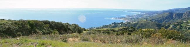
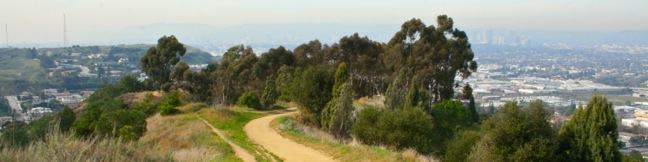
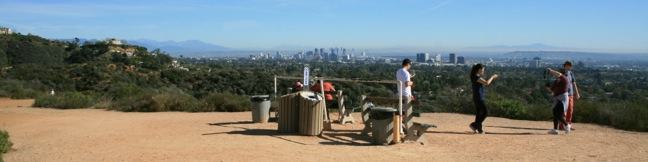
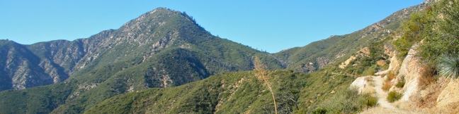
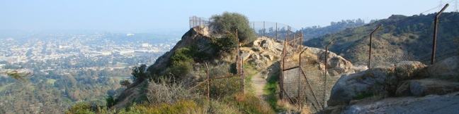
Tuna Canyon Park preserves 1,255 beautiful acres in the mountains between Topanga and Malibu. Despite being relatively unknown and under-visited, the park delivers some of the grandest ocean views to be found anywhere in the Santa Monica Mountains. From ridges 1,500 feet above a silken Pacific Ocean, Tuna Canyon Park looks east toward Santa Monica Bay and west up the coast of Malibu. ...Read more.
Distance: 5.1 miles · Elevation change: 900 feet
By: Published: February 1, 2012 Last updated: December 5, 2025
Community Trail in Kenneth Hahn State Recreation Area
Hahn Park's Community Trail is quite well named. It isn't the type of hike you would travel a long distance to visit, but if you live nearby, you are lucky to have it. The highlight of this 2.5-mile hike in the Baldwin Hills is a string of ridge-top viewpoints that looks north over Los Angeles. The 319-acre park is bordered by oil fields that limit the natural charm. ...Read more.
Distance: 2.5 miles · Elevation change: 200 feet
By: Published: January 23, 2012 Last updated: December 6, 2025
Rustic Canyon’s Murphy Ranch from Will Rogers State Historic Park
Next to Will Rogers State Historic Park is a shady canyon with a shady past. The ruins of Murphy Ranch, a compound built by Nazi sympathizers in the 1930s have been left behind to decay in Rustic Canyon. For adventuresome hikers, a trail enters Rustic Canyon from the east side of Will Rogers SHP. Beyond the end of the trail is a long unmaintained path up an overgrown canyon to the ruins. ...Read more.
Distance: 4 miles · Elevation change: 225 feet
By: Published: January 12, 2012 Last updated: December 5, 2025
Inspiration Point in Will Rogers State Historic Park
In addition to a rare polo field, renown ranch house, and a lawn that begs to be picnicked on, Will Rogers State Historic Park has plenty to offer to hikers. This is the eastern end of the 65-mile long Backbone Trail, which crosses the Santa Monica Mountains all the way to Point Mugu, and Will Rogers SHP is also home to a delightful short hike to a popular overlook. ...Read more.
Distance: 2.25 miles · Elevation change: 325 feet
By: Published: January 11, 2012 Last updated: April 9, 2026
Beacon Hill in Griffith Park
Located in the southeast corner of Griffith Park, Beacon Hill is the easternmost summit in the Santa Monica Mountain Range. The 1,001-foot hill towers over the Los Angeles River and provides panoramic views from Burbank to Santa Monica Bay. On a clear day, Beacon Hill issues a stunning panorama. The summit can be reached via a 2.75-mile out and back hike, or a 3. ...Read more.
Distance: 3.9 miles · Elevation change: 500 feet
By: Published: December 7, 2011 Last updated: December 5, 2025
Crystal Lake in the San Gabriel Mountains
Diminished by drought and tarnished by wildfire, Crystal Lake is not the glistening destination it once was. Crystal Lake is the only naturally occurring lake in the San Gabriel Mountains, cradled by granite summits north of the San Gabriel River Valley above the city of Azusa at 5,500 feet. It is a 1 1/3-mile round trip paved hike to Crystal Lake with 150 feet of elevation gain. ...Read more.
Distance: 1.33 miles · Elevation change: 150 feet
By: Published: December 6, 2011 Last updated: April 8, 2026
Smith Mountain via Upper Bear Creek Trail in the San Gabriel Mountains
If someone wrote a book about hiking Smith Mountain, it would be called A Tale of Two Trails. It was the most gradual of times, it was the steepest of climbs... This classic hike in the San Gabriel Mountains begins with three miles of single track that easily gain a thousand feet to Smith Saddle. What follows is an 800-foot scramble to the summit in less than half a mile. ...Read more.
Distance: 7 miles · Elevation change: 1800 feet
By: Published: November 26, 2011 Last updated: April 18, 2026
Coldbrook Campground in the San Gabriel Mountains
Coldbrook Campground is a small 20-site campground on Coldbrook Creek, which feeds into the North Fork of San Gabriel River. From Azusa, it is an 18-mile, roughly half hour drive up Route 39 to the campground in Angeles National Forest in San Gabriel Mountains National Monument. At Coldbrook Campground, all sites are first-come first-serve for $12 per night (price as of 2018). ...Read more.
By: Published: November 25, 2011 Last updated: October 8, 2024
Old Zoo Picnic Area in Griffith Park
The old zoo in Griffith Park is one of the strangest ruins in Los Angeles (putting it in the running for strangest ruins worldwide). When the Los Angeles Zoo opened at its current location in the 1960s, the former zoo, a few miles away was not torn down or destroyed. Instead, the zoo was abandoned and converted into a picnic area. Explore one of LA's best off-the-beaten-path attractions on a half mile hike (or more) through the picnic area past old animal cages and exhibits. ...Read more.
Distance: 0.5 miles · Elevation change: 50 feet
By: Published: November 18, 2011 Last updated: April 20, 2026
Bee Rock in Griffith Park
Bee Rock is a unique hive-shaped outcropping towering over the east side of Griffith Park. From the top of the rock, you have a commanding view over the park and the city beyond. The observation area atop Bee Rock is surrounded by a tall chain-link fence, protecting visitors from the steep drop-offs on all sides, while meshing up the panoramic views. ...Read more.
Distance: 2.6 miles · Elevation change: 600 feet
By: Published: November 17, 2011 Last updated: December 5, 2025