Old Cottonwood Creek Trail to South Fork Lakes in the John Muir Wilderness
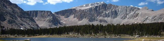
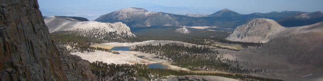
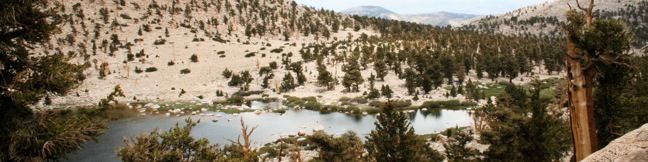
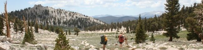
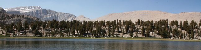
Old Cottonwood Creek Trail breaks from the popular Cottonwood Lakes Trail for a more secluded hike into Cottonwood Basin, visiting pristine meadows, alpine lakes, flowing creeks, and amber forests. The trail provides a lovely 8-mile day hike to South Fork Lake, with several options to extend to nearby lakes and peaks. Take Cottonwood Lakes Trail from Horseshoe Meadow as it runs downhill heading north through the Golden Trout Wilderness. ...Read more.
Distance: 9 miles · Elevation change: 1150 feet
By: Published: September 24, 2010 Last updated: April 9, 2026
Mount Langley in Sequoia National Park
Rising to 14,042 feet, Mount Langley is less than five hundred feet shorter than Mount Whitney but receives far fewer visitors. While the lottery to get a permit for Mount Whitney can be challenging and competitive, Mount Langley's hikers can easily get a free permit on the day of their hike. The summit provides expansive views, solitude, and a deep feeling of accomplishment. ...Read more.
Distance: 22 miles · Elevation change: 4000 feet
By: Published: September 21, 2010 Last updated: December 9, 2025
Cottonwood Lakes Trail to New Army Pass in the John Muir Wilderness
Cottonwood Lakes Trail provides a scenic romp through the Southeastern Sierra with alpine lakes and mountain views. Located south of Mount Whitney and west of the city of Lone Pine, the trail travels through the Golden Trout Wilderness and the John Muir Wilderness to end at the border of Sequoia National Park. This is a superb trail for day hikers and backpackers alike. ...Read more.
Distance: 15 miles · Elevation change: 2350 feet
By: Published: September 21, 2010 Last updated: April 9, 2026
Chicken Spring Lake in the Golden Trout Wilderness
This mountain lake is 0.6 miles from Cottonwood Pass, making it an easy 8.2-mile round trip hike from Horseshoe Meadow. With just 1,330 feet of elevation gain en route to the lake, this is a desirable destination for day-hikers and a good first camp for backpackers. Follow Cottonwood Pass Trail to a junction at the pass with Pacific Crest Trail. Turn right and continue through a rocky forest of Foxtail Pines. ...Read more.
Distance: 8.2 miles · Elevation change: 1330 feet
By: Published: September 17, 2010 Last updated: April 9, 2026
Horseshoe Meadow Campgrounds in the Golden Trout Wilderness
Cottonwood Pass Trail and Cottonwood Lakes Trail provide great portals into Inyo National Forest and Sequoia National Park. Hiking begins at an elevation of 10,000 feet, providing a launch pad into the high sierra. Because you start so high up, acclimating is a key to avoiding altitude sickness. For this reason, a pair of first-come first-serve campgrounds offer a valuable resource for hikers. ...Read more.
By: Published: September 16, 2010 Last updated: April 13, 2026
Cottonwood Pass in the Golden Trout Wilderness
At an elevation of 11,200 feet, Cottonwood Pass serves as a gateway to the Golden Trout Wilderness and Sequoia National Park. The pass is reached via a 3.5-mile one way trail from Horseshoe Meadow, which has an elevation of 10,000 feet, making this is one of the easiest passes for hikers to reach in the Eastern Sierra. A view of Trail Peak from Horseshoe Meadow Pick up the trail at Horsehoe Meadow Campground and begin hiking east over packed sand along the northern edge of Horseshoe Meadow. ...Read more.
Distance: 7 miles · Elevation change: 1200 feet
By: Published: September 16, 2010 Last updated: April 9, 2026