Talepop Loop in Malibu Creek State Park
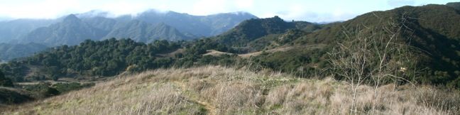
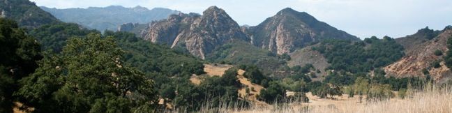
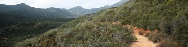
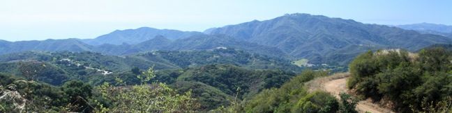
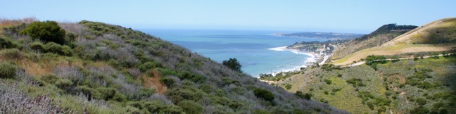
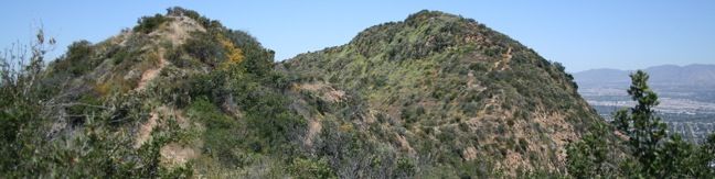
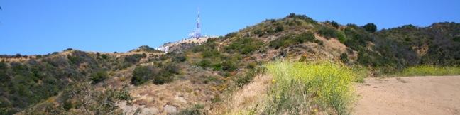
Talepop Loop explores the north end of Malibu Creek State Park through a region long inhabited by Chumash Indians who had a village here named Talepop. Hikers today are exposed to signs of modern humanity like ranches and electric lines, but despite being suspiciously close to two major roadways, Talepop Trail escapes the man-made world to explore a beautiful patch of the Santa Monica Mountains. ...Read more.
Distance: 4.75 miles · Elevation change: 500 feet
By: Published: December 28, 2010 Last updated: December 5, 2025
Grassland Trail to Crags Road and Rock Pool in Malibu Creek State Park
South Grassland Trail enters Malibu Creek State Park from Mulholland Highway, providing a scenic stroll over rolling hills. The trail ends at Crags Road, the major hiking artery through the park. If you are familiar with hiking out of the main parking lot, starting on the Grassland Trail adds about 0.9 miles to those hikes. By entering on Grassland Trail, visitors also avoid driving into the park and paying the vehicle entry fee. ...Read more.
Distance: 3 miles · Elevation change: 125 feet
By: Published: December 26, 2010 Last updated: April 10, 2026
Santa Ynez Canyon Trail to Eagle Rock in the Santa Monica Mountains
The craggy sandstone summit of Eagle Rock rises over Topanga State Park, delivering panoramic views of the Santa Monica Mountains. The shortest trail to awesome prominence is a four-mile hike from Trippet Ranch to Eagle Rock. For a more challenging trek, explore this 7.4-mile round trip hike ascending 1,400 feet from Santa Ynez Canyon to the 1,957-foot summit of Eagle Rock. ...Read more.
Distance: 7.4 miles · Elevation change: 1400 feet
By: Published: November 14, 2010 Last updated: April 18, 2026
Castro Crest from Corral Canyon Road through Upper Solstice Canyon in the Santa Monica Mountains
Between Corral Canyon Road and Castro Crest, the Backbone Trail passes though a remote segment of the Santa Monica Mountains know as Upper Solstice Canyon. While it is possible to feel quite removed at the bottom of this trail, the high ridges on both ends provide such sweeping views as to immediately restore your sense of place. From Corral Canyon Road to Castro Crest is 5. ...Read more.
Distance: 5.5 miles · Elevation change: 540 feet
By: Published: November 12, 2010 Last updated: December 7, 2025
Castro Crest from Latigo Canyon Road in the Santa Monica Mountains
Castro Crest is located 1.4 miles from Latigo Canyon Road up a pleasant section of the Backbone Trail. The crest offers excellent views over Malibu's Santa Monica Mountains, with the option to continue another half-mile up Castro Peak. The summit may not be reached however, as it is privately owned and extremely closed to the public. Another popular extension is to continue on the Backbone Trail for another 2. ...Read more.
Distance: 3.8 miles · Elevation change: 650 feet
By: Published: November 11, 2010 Last updated: December 9, 2025
Corral Canyon Loop in the Santa Monica Mountains
The 1,000-acre Corral Canyon Park protects a span of the Santa Monica Mountains between Dan Blocker Beach and Malibu Creek State Park. This is the only canyon on the Los Angeles County side of the range that remains undeveloped from the ridge top down to PCH, allowing the 2.5-mile loop through the park to plunge hikers in to a world of natural scenery and vegetation. ...Read more.
Distance: 2.5 miles · Elevation change: 525 feet
By: Published: November 6, 2010 Last updated: December 5, 2025
Runyon Canyon Loops in Runyon Canyon Park
Runyon Canyon Park is one of the most popular hiking destinations in Los Angeles and often shows up on publishers' lists of best hikes in LA. This 130-acre dog park is located in Hollywood on the east end of the Santa Monica Mountains, providing hikers with a few overlapping loops and great views over Hollywood. For a quick Runyon Canyon hike, try a 1. ...Read more.
Distance: 2.65 miles · Elevation change: 700 feet
By: Published: November 2, 2010 Last updated: April 13, 2026
Cahuenga Peak and Mount Lee via Burbank Peak Trail and Aileen Getty Ridge Trail in Griffith Park
Cahuenga Peak is the highest summit in Griffith Park with excellent views of Los Angeles, Burbank, and that iconic landmark - the Hollywood Sign. Visit the Cahuenga Peak, Burbank Peak, and Mount Lee on a rugged two-trail outing. Burbank Peak Trail (formerly Wonder View Trail) climbs from the west, passing a mini-summit viewpoint on the ridge of Cahuenga Peak known as Burbank Peak (home of the Wisdom Tree) Aileen Getty Ridge Trail goes from Burbank Peak up over the top of Cahuenga Peak and along a ridge to the Hollywood Sign at the top of Mount Lee Combine Burbank Peak Trail and Aileen Getty Ridge Trail for a hike to three summits that is 3 miles round trip with 875 feet of elevation change. ...Read more.
Distance: 3 miles · Elevation change: 875 feet
By: Published: November 1, 2010 Last updated: April 19, 2026
Brush Canyon Trail to Mount Lee and the Hollywood Sign in Griffith Park
Want to hike to the Hollywood Sign? One way to get there is a 6.4-mile hike through Griffith Park that summits Mount Lee directly behind the iconic lettering. Beyond just gazing up at the sign, the hike offers the opposite perspective, a chance to look down at the city below. The moderate day hike gains 1,050 feet of elevation over wide fire roads, and the last mile is actually paved. ...Read more.
Distance: 6.4 miles · Elevation change: 1050 feet
By: Published: October 30, 2010 Last updated: April 8, 2026
Santa Ynez Falls in the Santa Monica Mountains
Santa Ynez Falls Trail follows a shaded creek to a gorge containing a short waterfall. This 2.5-mile hike is a popular family outing because it is fairly level (just 250 feet of elevation change) and interesting enough to hold a child's attention for the duration. Santa Ynez Falls is one of the Los Angeles waterfall hikes. The hike begins from a free trailhead into Topanga State Park in the Pacific Palisades. ...Read more.
Distance: 2.5 miles · Elevation change: 250 feet
By: Published: April 29, 2010 Last updated: April 7, 2026