Hidden Valley in Joshua Tree National Park
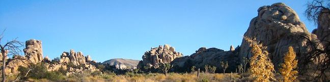
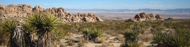
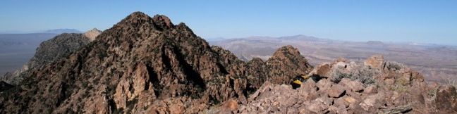
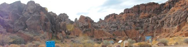
For an introduction to plant and wildlife in Joshua Tree National Park, visit Hidden Valley. This one-mile loop circles a small valley that is surrounded by tall boulders. Hidden Valley Trail shows off Joshua Tree's rocky landscapes and is a great place to climb around. Hidden Valley Nature Trail Take the path from the parking lot between rock walls into Hidden Valley. ...Read more.
Tagged with · Bouldering · National Parks · Off Trail
Distance: 1 mile · Elevation change: 75 feet
By: Published: February 18, 2010 Last updated: December 5, 2025
Camping in Joshua Tree National Park
Joshua Tree National Park boasts nine campgrounds with 500 a combined individual sites, so this park is ready to accommodate your visit! On Thanksgiving weekend and New Years weekend (the Memorial day and Labor day of the desert) the park will be packed and finding a campsite can be a challenge. On these weekend, consider visiting the less popular Mojave National Preserve to the north. ...Read more.
Tagged with · National Parks · Tent Camping
By: Published: February 17, 2010 Last updated: April 7, 2026
Indian Cove in Joshua Tree National Park
Beyond its 101-site campground, Indian Cove offers a 0.6-mile long interpretive trail, a picnic area, and plenty of rocks for climbers. The picnic area serves as the starting point for an unmaintained trail up Rattlesnake Canyon. The rock formations around Indian Cove are perfect for bouldering, rock hopping, and more serious climbing. Have some fun in the sun and burn some calories leaping and climbing up the mountain of sandstone boulders. ...Read more.
Distance: 0.6 miles · Elevation change: 25 feet
By: Published: February 17, 2010 Last updated: April 8, 2026
Fortynine Palms Oasis in Joshua Tree National Park
A secluded palm tree oasis is tucked away on the north end of Joshua Tree National Park. To reach the awesome oasis, you'll hike 3 miles round trip with 350 feet of elevation gain, passing through a variety of desert scenery and panoramic views. The trail leads to a collection of palm trees wrapped around a rare spring, an out-of-place desert destination that's a perfect target for hikers. ...Read more.
Distance: 3 miles · Elevation change: 350 feet
By: Published: February 16, 2010 Last updated: January 9, 2026
New York Peak in Mojave National Preserve
The New York Mountains are a micro-range in the northeast corner of Mojave National Preserve. The highest peak in the range (7,533 feet) offers a sprawling desert vista, and is considerably easier to reach than other peaks in Mojave, which require slower hiking around cacti and other obstacles. Those driving a low clearance vehicle will not be able to make it all the way up the dirt road leading to the Keystone Canyon Trail. ...Read more.
Distance: 7 miles · Elevation change: 2400 feet
By: Published: February 12, 2010 Last updated: December 5, 2025
Teutonia Peak in Mojave National Preserve
Teutonia Peak is a rocky 5,755-foot mountain on the edge of Cima Dome in Mojave National Preserve. The dome, which is 1,500 feet tall and covers seventy square miles, is the most symmetrical dome of its type in the United States. If that geological geometrical fact doesn't strike your fancy, the hike to the panoramic rocky summit will. It is 3.4 to 4 miles round trip with 700 feet of elevation gain, passing an abandoned silver mine and a thriving forest of Joshua trees along the way to the summit of Teutonia Peak. ...Read more.
Tagged with · Free Trails · Summits
Distance: 3.4 miles · Elevation change: 700 feet
By: Published: February 12, 2010 Last updated: December 9, 2025
Fountain Peak in Mojave National Preserve
Beyond the trails maintained by the park, numerous peaks in Mojave National Preserve can be reached with off-trail hiking and scrambling. One worthy candidate is Fountain Peak. Fountain Peak is located near Mitchell Caverns whose parking lot in the Providence Mountains State Recreation Area provides a serviceable base camp. Before setting out, download the USGS topographical map of Fountain Peak. ...Read more.
Tagged with · Free Trails · Summits
Distance: 5 miles · Elevation change: 2700 feet
By: Published: February 12, 2010 Last updated: December 5, 2025
Hole-in-the-Wall Rings Trail in Mojave National Preserve
Off Black Canyon Road in Mojave National Preserve, the Hole-in-the-Wall Rings Trail is a must see! The namesake Ringbolts serve as hand holds and steps, granting passage through a couple steep and narrow sections on this 1.5-mile loop (or 0.5-mile out and back hike for those preferring to repeat the most exciting stretch of the hike). The Hole-in-the-Wall Rings Trail delivers a short fun hiking experience for park visitors. ...Read more.
Tagged with · Desert Canyons · Free Trails
Distance: 1.5 miles · Elevation change: 150 feet
By: Published: February 12, 2010 Last updated: December 5, 2025
Camping in Mojave National Preserve
Being a preserve, Mojave National Preserve lacks a few of the facilities you would find in Joshua Tree or Death Valley, but this absence creates the opportunity for a more intimate visit with the desert. For the traditionalists (those who like camping near a bathroom), Mojave National Preserve has a couple standard campgrounds. For more adventurous campers, Mojave offers a unique experience akin to wilderness car camping. ...Read more.
Tagged with · Tent Camping
By: Published: February 12, 2010 Last updated: April 9, 2026
Kelso Dunes in Mojave National Preserve
The Kelso Dunes cover 45 square miles and rise 650 feet above the desert floor. What do you do with such a big pile of sand? Climb it! Even if you have hiked other dunes before, Kelso will be an interesting experience. The 3-mile round trip hike to the top features fantastic views of the surrounding dunes and peaks in Mojave National Preserve. The start of Kelso Dunes Trail A concentrated trail leaves from the parking area, but dissolves away the farther you go. ...Read more.
Tagged with · Free Trails · Off Trail · Sand Dunes
Distance: 3 miles · Elevation change: 470 feet
By: Published: February 11, 2010 Last updated: December 5, 2025