Moonstone Beach Boardwalk in Hearst San Simeon State Park
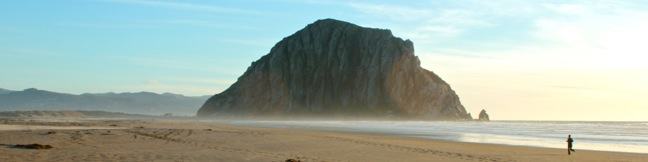
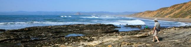
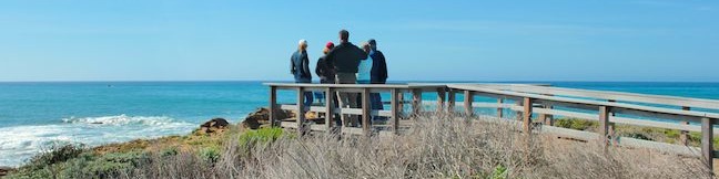
The city of Cambria is located on Highway One at the north end of San Luis Obispo County, and has earned the nickname "Gateway to the Big Sur Coast." Like that stunning area to the north, Cambria has its own beautiful waterfront. Explore sandy beaches and rocky tide pools on a 2.85-mile round trip hike down Moonstone Beach Boardwalk, crossing a pristine beach that is preserved by Hearst San Simeon State Park. ...Read more.
Distance: 2.85 miles · Elevation change: 40 feet
By: Published: March 1, 2013 Last updated: December 5, 2025
Hazard Peak – Islay Creek Loop in Montaña de Oro State Park
The hike up and down Hazard Peak Trail delivers a heavy dose of ocean views. While it could be argued that this 6-mile round trip hike is the finest trek to the summit of Hazard Peak, you may wish to consider elongating that hike to a 9.2-mile loop that returns to the coast via Islay Creek Trail in the adjacent Islay Creek Canyon. Sacrificing a second helping of ocean views, the loop explores the secluded interior of Montaña de Oro State Park and finishes with a cool down on a wide, gradual trail in a canyon flanked by thousand foot peaks (including the 1,076-foot Hazard Peak). ...Read more.
Distance: 9.2 miles · Elevation change: 1000 feet
By: Published: January 9, 2013 Last updated: April 8, 2026
Hazard Peak in Montaña de Oro State Park
Montaña de Oro State Park is packed with so many picturesque places that it can be difficult to settle on just one day hike. However, if you are looking for broad, unobstructed view over Morro Bay, you should feel compelled to set out for the top of Hazard Peak. Looking north from this coastal 1,076-foot summit, you won't see anything even half as tall as Hazard Peak for about 15 miles, giving you a full view of the dune-lined coast backed by the iconic Morro Rock. ...Read more.
Distance: 6 miles · Elevation change: 950 feet
By: Published: January 8, 2013 Last updated: December 5, 2025
Islay Creek in Montaña de Oro State Park
Montaña de Oro State Park has a couple lengthy level hikes. If you desire ocean views, you can't do any better than the Bluff Trail. If you would rather hike up a canyon flanked by thousand foot peaks along a creek that even has a small waterfall, the fitting trail is Islay Creek Trail. The rolling 3-mile long dirt road has 300-feet of easy elevation change. ...Read more.
Distance: 6 miles · Elevation change: 300 feet
By: Published: January 7, 2013 Last updated: April 8, 2026
Valencia Peak in Montaña de Oro State Park
At 1,347 feet, Valencia Peak is one of the highest summit in Montaña de Oro State Park and may provide the best panorama of the park's stunning shoreline and inviting inland peaks. The views are epic and the hike is 4.5-miles round trip with 1,275 feet of elevation. An older version of Valencia Peak Trail was 0.4 miles shorter each way, and the new route uses more switchbacks to ease the ascent. ...Read more.
Distance: 4.5 miles · Elevation change: 1275 feet
By: Published: December 31, 2012 Last updated: December 5, 2025
Morro Strand Trail to Morro Strand State Beach and Morro Rock from Cloisters Park
Morro Rock is an iconic landmark on California's Central Coast. Located north of San Luis Obispo, the 578-foot tall mass of volcanic rock rises above of the Pacific Ocean, separating the inviting sands of Morro Strand State Beach from the blue waters of Morro Bay Harbor. Starting from a protected coastal wetland along Highway One in Morro Bay, this easy beach hike crosses sand dunes into Morro Strand State Beach, where you can walk along the ocean to the wave-battered mini-mountain guarding the entrance of Morro Bay. ...Read more.
Tagged with · Free Trails · Morro Bay · Morros · Ocean Views
Distance: 3.5 miles · Elevation change: 25 feet
By: Published: December 26, 2012 Last updated: April 9, 2026
Bob Jones City to the Sea Bike Trail in Avila Beach and Avila Valley
Are you jonesing for an easy trail that leads to a beach town brimming with oceanfront fun? Take a relaxing trip down Bob Jones Bike Trail to Avila Beach, a small bayside hamlet that can bustle with beachgoers on weekends. The level 5-mile round trip trail is suitable for hikers, joggers, walkers, and bikers. You will enjoy refreshing shade from oaks as you follow San Luis Obispo Creek down Avila Valley to its pacifying ending in Avila Beach. ...Read more.
Distance: 5 miles · Elevation change: 50 feet
By: Published: September 15, 2012 Last updated: April 10, 2026
Johnson Ranch Open Space in San Luis Obispo
Johnson Ranch Open Space preserves 242 acres of old ranch land just south of San Luis Obispo. The 3.7-mile Johnson Ranch Loop explores the municipal open space, which is dominated by rolling grassy hills accented by serpentine rocks. A shortcut can be used to trim the hike to 2.5 miles. There is 200 feet of total elevation between the high and low points of the hike, a distance that is repeated several times over the meandering loop. ...Read more.
Tagged with · Free Trails
Distance: 3.7 miles · Elevation change: 200 feet
By: Published: April 25, 2012 Last updated: December 5, 2025
Dune Trail to Hazard Canyon Reef in Montaña de Oro State Park
For a quick one-mile jaunt in Montaña de Oro State Park, hike down Dune Trail to Hazard Canyon Reef. At the bottom of this oceanfront ravine is a rocky shoreline graced with engaging tide pools. Explore up or down the coast to extend your stay, or settle in for a picnic on the sandy beach. The postcard views of Morro Rock are a good reason to stick around. ...Read more.
Distance: 1 mile · Elevation change: 100 feet
By: Published: April 24, 2012 Last updated: April 8, 2026
Los Osos Oaks State Natural Reserve in San Luis Obispo
The 90-acre Los Osos Oaks State Natural Reserve protects a pocket of 800-year-old oaks near San Luis Obispo, California. Los Osos Creek Trail, Chumash Trail, and Oak View Trail loop through the park presenting easy hikes between 0.75 and 1.5 miles. The trails pass beneath (and sometimes between) the gangly branches of pygmy oaks, offering quiet hikes through a shady grove. ...Read more.
Distance: 1.5 miles · Elevation change: 25 feet
By: Published: April 23, 2012 Last updated: April 9, 2026