Lizards Mouth Santa Barbara hike trail Camino Cielo Los Padres National Forest California
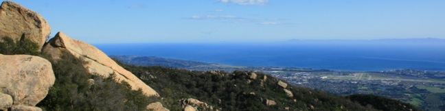
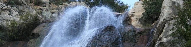
Lizard's Mouth is a mountain top rock formation overlooking Santa Barbara. Wind-carved pockets on the underside of this sandstone outcropping give the rock a resemblance to a frog or lizard's mouth. The short hike to Lizard's Mouth offers sensational views and is a quick excursion for anyone traveling the 154 between Santa Barbara and Lake Cachuma or Los Olivos. ...Read more.
My Hikes: Completed hikeA green icon of shows a picture of a landscape with a check mark in the upper right corner, signifying that this is a hike you would like to put on your completed list.OK! Add to trails I've hiked
My Hikes: Want to hikeA green icon of shows a picture of a landscape with a heart in the upper right corner, signifying that this is a hike you would like to put on your to-do list.OK! Add to trails I want to hike
TagsA green icon depicting a tags represents a list of words and phrases that this content is tagged with Tagged with · Free Trails · Los Padres National Forest · Ocean Views · Santa Ynez Mountains
Hike DistanceA green icon of a hiker used to label information about the length of the hike Distance: 0.5 miles · Elevation change: 25 feet
By: Published: Last updated: December 6, 2025
Tangerine Falls Santa Cold Springs Trail Waterfall Hike Los Padres National Forest Montecito California
After a spring rain, the 100-foot Tangerine Falls blooms into the most beautiful waterfall in Santa Barbara. The seasonal waterfall dries out for much of the year, but is spectacular at the peak of the rainy season. The 2.5-mile excursion to Tangerine Falls has 875 feet of elevation gain and everything a hiker could want — a soothing creek, plenty of shade, ocean views, and even a bit of off-trail rock hopping and scrambling (not to mention an exceptional waterfall). ...Read more.
My Hikes: Completed hikeA green icon of shows a picture of a landscape with a check mark in the upper right corner, signifying that this is a hike you would like to put on your completed list.OK! Add to trails I've hiked
My Hikes: Want to hikeA green icon of shows a picture of a landscape with a heart in the upper right corner, signifying that this is a hike you would like to put on your to-do list.OK! Add to trails I want to hike
TagsA green icon depicting a tags represents a list of words and phrases that this content is tagged with Tagged with · Creeks · Free Trails · Los Padres National Forest · Montecito · Ocean Views · Santa Ynez Mountains · Waterfalls
Hike DistanceA green icon of a hiker used to label information about the length of the hike Distance: 2.5 miles · Elevation change: 875 feet
By: Published: Last updated: December 5, 2025