Andrew Molera State Park Trail Camp
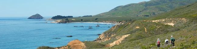
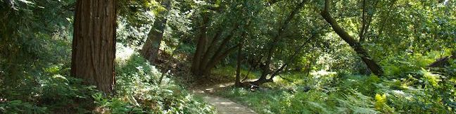
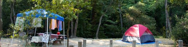
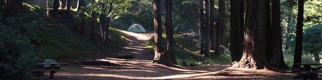
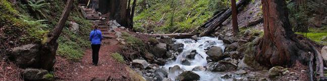
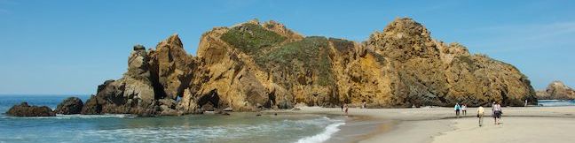
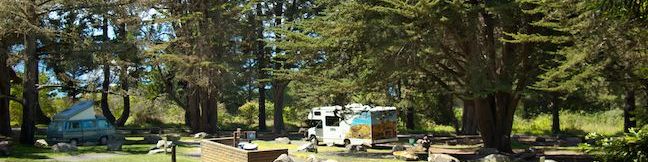
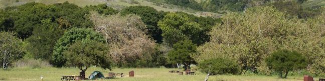
Andrew Molera State Park preserves nearly 5,000 acres of beautiful parkland at the north end of Big Sur. Hikers can explore the park on over twenty miles of trails, including the Ridge Trail - Panorama Trail - Bluff Trail Loop hike. Campers can enjoy Andrew Molera State Park Trail Camp, which has a 24 first-come first-serve campsites in a grassy meadow near the Big Sur River and Molera Beach. ...Read more.
By: Published: July 25, 2014 Last updated: April 9, 2026
Ridge Trail – Panorama Trail – Bluff Trail Loop in Andrew Molera State Park
Andrew Molera State Park's big loop trek centered over Ridge Trail, Panorama Trail, and Bluff Trail has about everything you could want in a Big Sur hike, including a redwood grove, an unspoiled beach, and lots of ocean views over a wild coastline. This is a hike for those who want to lose themselves in the majestic beautify of Big Sur. Ok, don't get lost, bring along these directions and immerse yourself in the area's natural beauty, enjoying spectacular seaside views and solitude in Andrew Molera State Park. ...Read more.
Distance: 8.7 miles · Elevation change: 1100 feet
By: Published: July 25, 2014 Last updated: April 10, 2026
Nature Trail – River Path Loop in Pfeiffer Big Sur State Park
You don't have to travel far beyond the entrance booth at Pfeiffer Big Sur State Park to get an introduction to the area's plants and animals. That's because the easy-walk providing Nature Trail starts from a day use lot just inside the park. Two additional trails along the Big Sur River in this area can be combined with the Nature Trail to form short easy loops. ...Read more.
Distance: 0.55 miles · Elevation change: 15 feet
By: Published: July 21, 2014 Last updated: December 9, 2025
Pfeiffer Falls and Valley View in Pfeiffer Big Sur State Park
The trails to Pfeiffer Falls and Valley View are a perfect fit for hikers who like to multi-task. The versatile hike in Pfeiffer Big Sur State Park has a bit of everything. See impressive redwood trees in a shaded canyon, examine colorful wildflowers on a sunny ridge, admire a charming waterfall, and gaze out from a vista point that looks all the way down the Big Sur River Valley to the Pacific Ocean. ...Read more.
Distance: 2.4 miles · Elevation change: 550 feet
By: Published: July 20, 2014 Last updated: December 9, 2025
Big Sur River Gorge in Pfeiffer Big Sur State Park
Big Sur River Gorge is one of the big draws at Pfeiffer Big Sur State Park, facilitating a romp to a swimming hole in the wilds of Big Sur. An unmaintained trail connects the park's campground to a inviting pool of clear river water in a granite-walled gorge. Multiple river crossings along the way make for a rock-hopping hike of half a mile round trip. ...Read more.
Distance: 0.5 miles · Elevation change: 75 feet
By: Published: July 19, 2014 Last updated: December 9, 2025
Camping in Pfeiffer Big Sur State Park
For one of the quintessential camping experiences in Big Sur, pack your tent and head to Pfeiffer Big Sur State Park. The park is nestled in a verdant valley with campsites laid out beneath oak and redwood trees and along the banks of the charming Big Sur River. Pfeiffer Big Sur State Park resides in the heart of Big Sur and the campground is surrounded by outdoor fun, both inside and outside the park. ...Read more.
By: Published: July 19, 2014 Last updated: April 19, 2026
Camping in Limekiln State Park
Limekiln State Park is located in Big Sur about halfway between Monterey and Morro Bay. The 716-acre park has one entrance along Highway One where you will find a 29-site campground. Some sites are nestled in a shaded redwood grove along Limekiln Creek while others are exposed to more sun and ocean views at the bottom of Limekiln Canyon. Campers have access to a small beach and nice short hiking trails up Limekiln Canyon to Hare Creek, Limekiln Falls, and historic lime kilns. ...Read more.
By: Published: July 18, 2014 Last updated: April 19, 2026
Hare Creek Trail, Limekiln Trail, and Falls Trail in Limekiln State Park
For pleasant hiking along creeks in canyons shaded by coast redwoods, you can't do much better than Limekiln State Park in Big Sur. A trio of short trails in the park provide variety and great scenery on a 2.65-mile round trip hike with 250 feet of elevation gain. Hare Creek Trail is a supremely peaceful creekside stroll, as is Limekiln Trail, which heads to historic lime kilns that the park has preserved, and Falls Trail ascends another fork of Limekiln Creek to a hundred-foot tall waterfall. ...Read more.
Distance: 2.65 miles · Elevation change: 250 feet
By: Published: July 18, 2014 Last updated: December 9, 2025
Pfeiffer Beach in Los Padres National Forest (Big Sur)
Most of Big Sur's beautify is obvious – tall green mountains, a ragged coastline, and lots of ocean blue, but some attractive features are practically hidden, and Pfeiffer Beach is one such gem. Pfeiffer Beach has great sand and iconic rock formations, but you won't see this beach from Highway One (or its begging-to-be-photographed wave-tunneled rocks). ...Read more.
Distance: 0.2 miles · Elevation change: 10 feet
By: Published: July 10, 2014 Last updated: December 7, 2025
Plaskett Creek Campground in Los Padres National Forest (Big Sur)
Plaskett Creek Campground is a convenient place for tent or RV camping in Big Sur. The campground is close enough to the coast for visitors to smell the ocean, and there are several short hikes nearby. Trails to Sand Dollar Beach, Jade Cove and Plaskett Rock Point are just across Highway One from the campground and Pacific Valley Bluff Trail is only a mile to the north. ...Read more.
By: Published: July 9, 2014 Last updated: April 13, 2026