Oak Creek Canyon Loop Trail in Los Robles Open Space
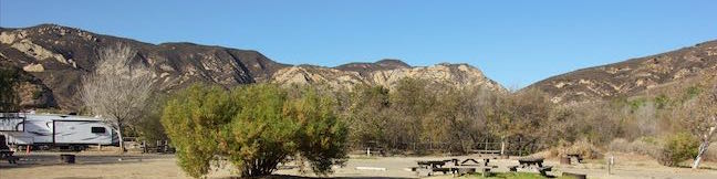
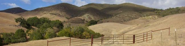
Oak Creek Canyon Trail is a rather special trail in Los Robles Open Space that is designed for the blind as well as the sighted. The all-access nature trail has a dozen and a half signs in English and Braille. While blind hikers will probably want to turn around at the end of the guide fence, for a 0.55 mile hike with 50 feet of elevation change, others may continue on to a loop trail for a 0. ...Read more.
Distance: 0.8 miles · Elevation change: 100 feet
By: Published: March 10, 2017 Last updated: December 5, 2025
Oso Flaco Lake Trail in Oceano Dunes State Vehicular Recreation Area
Oso Flaco Lake Trail in Oceano Dunes SVRA offers a hike with easy-going appeal. The nearly level trail takes a boardwalk over a 75-acre birdlife-boasting lake and across sand dunes to a tucked-away beach and a viewpoint overlooking the Guadalupe-Nipomo Dunes. These are the largest dunes on the coast of Southern California, but Oso Flaco Lake Trail is a short hike at just 2-miles round trip. ...Read more.
Distance: 2 miles · Elevation change: 25 feet
By: Published: September 21, 2016 Last updated: April 9, 2026
Chumash Trail – Crespi Trail – Hutash Trail Loop in Morro Bay State Park
While it is one of the more inland hikes in Morro Bay State Park, the loop formed by connecting Chumash Trail, Crespi Trail, and Hutash Trail delivers ample coastal views as it leads to a lovely grove of coast live oaks. This lollipop loop covers 2.9 miles with 420 feet of elevation change. Hutash Trail can be trimmed from the circuit to lower the round trip distance to 2. ...Read more.
Distance: 2.9 miles · Elevation change: 420 feet
By: Published: August 8, 2016 Last updated: April 9, 2026
Terrace Hill Open Space in San Luis Obispo
An interesting chain of conical volcanoes, or volcanic plugs called the Morros, graces San Luis Obispo County. Terrace Hill is one of the smaller and harder to identify Morros within the city of San Luis Obispo County. Unlike the other Morros, Terrace Hill has a broad flat summit. The top of the hill was removed for use as construction material in the 1920s, leaving behind a flat mesa-like mountaintop. ...Read more.
Tagged with · Free Trails · Morros
Distance: 0.55 miles · Elevation change: 110 feet
By: Published: August 5, 2016 Last updated: December 6, 2025
Rattlesnake Flats Trail – Badger Trail – Bluff Trail Loop in Montaña de Oro State Park
Completely resurfaced to be wheelchair-friendly, the Bluff Trail in Montaña de Oro State Park is one of the most pleasant coastal trails in California. Once you have hiked the Bluff Trail, you will probably want to see it again (and again and again). Revisit the Bluff Trail and get just a bit more elevation by creating a loop with Bluff Trail, Badger Trail, and Rattlesnake Flats Trail. ...Read more.
Distance: 1.65 miles · Elevation change: 150 feet
By: Published: March 16, 2016 Last updated: December 5, 2025
China Flat and Simi Peak in the Simi Hills
Looking up at the orange sandstone outcroppings on the rugged slopes of the Simi Hills, you would hardly expect the terrain above to host a peaceful oak savanna. Walk through this grassy area shade by tall oaks to ascend to Simi Peak, the highest point in a mountain range that spans the boundary between Ventura County and Los Angeles County just north of the 101 Freeway. ...Read more.
Distance: 6.2 miles · Elevation change: 1090 feet
By: Published: February 22, 2016 Last updated: December 5, 2025
Gaviota State Park Campground
Pack the tent and your flip-flops when you visit the campground at Gaviota State Park. Each site is ambling distance from a sandy beach along the scenic coast west of Santa Barbara. A railroad trestle, pier, and hiking trails are close to the campground, which is just off Highway 101, making it a convenient place to camp near the ocean. Gaviota State Park is about 30 miles west of Santa Barbara in the area around the Gaviota Tunnel. ...Read more.
By: Published: January 6, 2016 Last updated: April 19, 2026
East Cuesta Ridge in San Luis Obispo
East Cuesta Ridge Road, also known as Mount Lowe Road, is a dirt road that crosses the dominant ridgeline in the Santa Lucia Mountains northeast of San Luis Obispo. Views from the trail extend over San Luis Obispo and its surrounding peaks toward the ocean to the west at Morro Bay and to the south by Oceano Dunes. The hike starts just off Highway 101 at the top of Cuesta Grade. ...Read more.
Distance: 8.4 miles · Elevation change: 1075 feet
By: Published: October 31, 2015 Last updated: December 5, 2025
Stenner Creek Trail – Red Dog Trail – Poly Canyon Road Loop in San Luis Obispo
Above Stenner Creek Road near the Cal Poly Campus, a freestyle bike course is hidden within a eucalyptus grove. The easiest route to The Eucs is to head up and back on Stenner Creek Trail. For a longer hike that explores neighboring grassland on slopes below the Santa Lucia Mountains, consider this 4.25-mile loop with 550 feet of elevation change. This hike takes Stenner Creek Trail up to the Eucs and then continues on Red Dog Trail, which sets out across grassy ridges and descends to Poly Canyon Road, a dirt road back to the beginning of Stenner Creek Trail. ...Read more.
Distance: 4.25 miles · Elevation change: 550 feet
By: Published: October 20, 2015 Last updated: April 10, 2026
“M” Trail on Cerro San Luis in San Luis Obispo
From downtown San Luis Obispo, it's easy to spot the large white “M” on the side of nearest mountain, Cerro San Luis. If you've looked up at the “M,” you may have wondered what it's like to look down from that big white letter, find out! The “M” is interesting to see up close and its perch provides a panoramic view over San Luis Obispo. ...Read more.
Tagged with · Free Trails · Morros
Distance: 1.9 miles · Elevation change: 560 feet
By: Published: June 8, 2015 Last updated: December 5, 2025