Willow Springs Loop
in Red Rock Canyon National Conservation Area
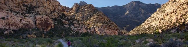
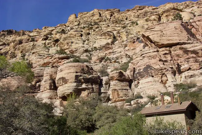
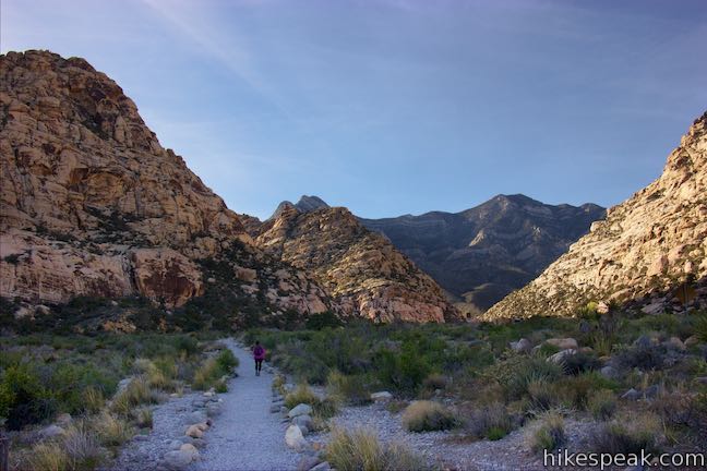
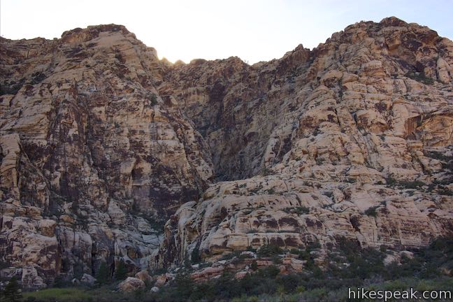
Willow Springs Loop explores an area off the northwest side of the Scenic Drive through Red Rock Canyon National Conservation Area. While it is bordered by steep mountains, the loop actually crosses easy terrain along Red Rock Wash. Visit pictographs left behind by Native American’s near Willow Springs Picnic Area and meander through desert landscapes. A spur to Lost Creek Waterfall, a seasonal gusher, can be added to this hike as well. Willow Springs Loop ranges in length from one mile round trip using a segment of Lost Creek Children’s Discovery Trail to 1 1/3 miles round trip using Lost Creek Canyon Trail to visit Lost Creek Waterfall. The elevation change between the low and high points of the longer hike is 165 feet. The shorter loop has 140 feet of elevation change, which can be trimmed down to 110 feet for an even easier variation.
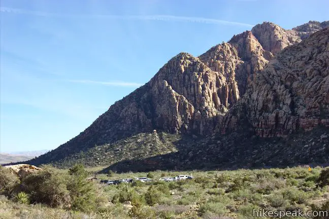
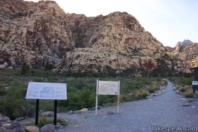
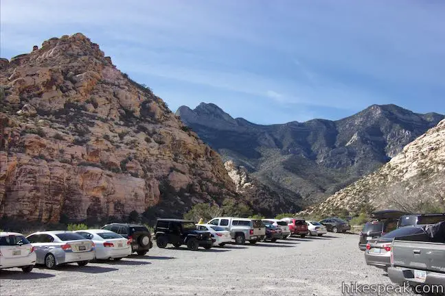
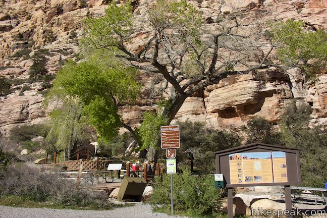
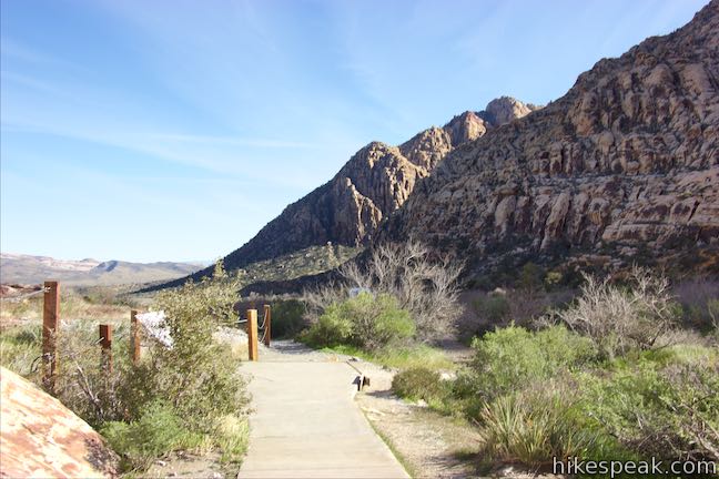
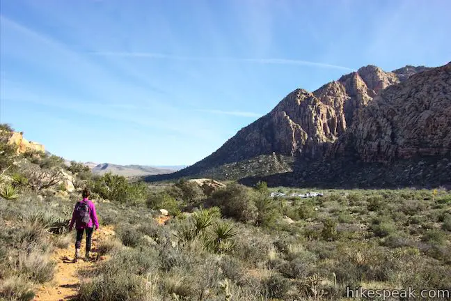
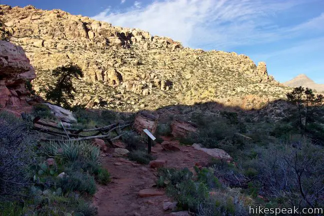
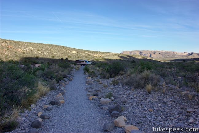
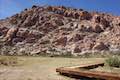
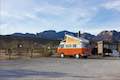
Willow Springs Loop crosses Rocky Gap Road at two points, Lost Creek Canyon Trailhead and Willow Springs Picnic Area. The picnic area has a large parking lot, making it an easy place to start.
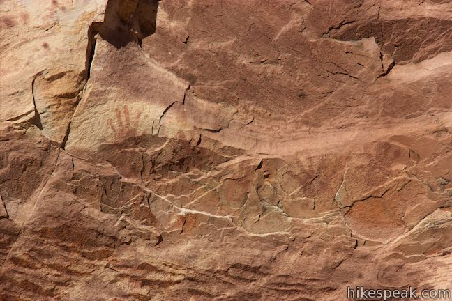
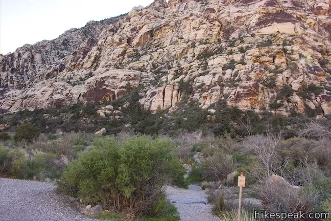
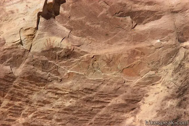
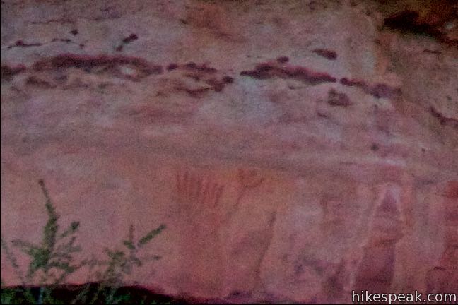
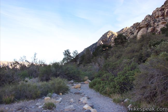
Have a seat below shade-casting cottonwoods in the picnic area to enjoy a break before or after the hike. Take the trail heading southeast from Willow Springs Picnic Area, parallel to the road you drove up. The gravel trail quickly meets a concrete handicap-accessible path from Rocky Gap Road to the pictographs site. Bear left on the concrete trail and come to an info panel below a large boulder with five hands painted on it. To find the pictographs, look on the right side of a crack between two boulders. About halfway up this rock, you’ll discover faint paintings left behind by Native Americans.
A panel in front of the pictographs explains that:
Rock art is one of the earliest forms of human expression and provides an insight into how prehistoric and historic Indian cultures saw their world. Rock art images include representations of humans, animals, and plants as well as abstract designs like spirals, circles, stars, and dots. Although we do not know the reasons for creating rock art, these images may be related to hunting rituals, water sources, migrations, astronomical evens, and religious practices.
The red hands prints at this site are pictographs. The native people may have created them by coating their hands in paint and then pressing them on the surface of the rock to make the prints. Paints were made by mixing powdered minerals, clays, or charcoal with liquid binder such as plant juices, saliva, or egg whites. The red pigment on these hand prints cam from hematite (iron oxide). Paint could be applied with fingers, hands, or fiber brushes.
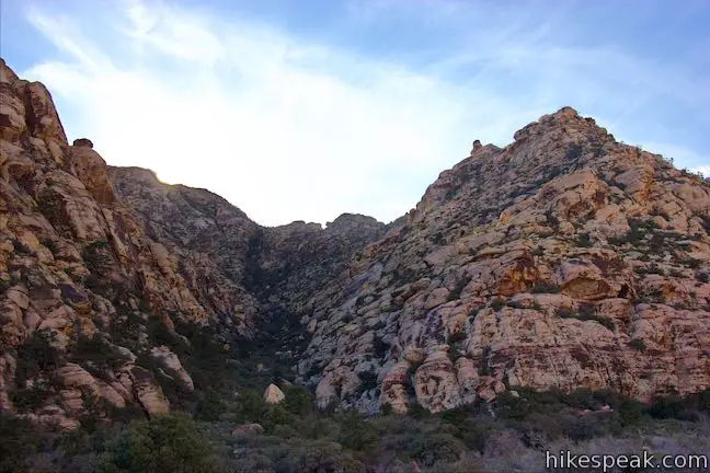
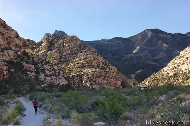
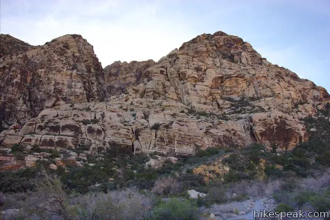
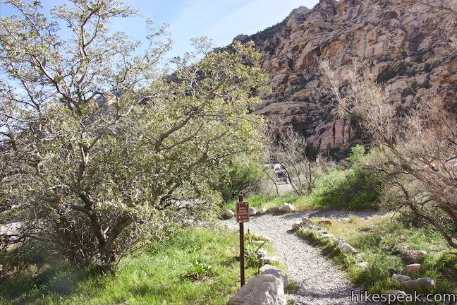
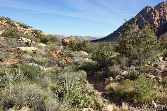
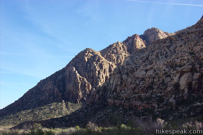
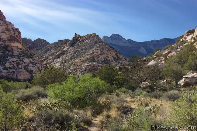
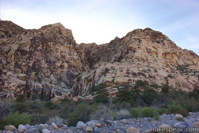
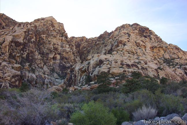
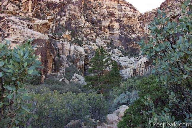
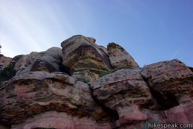
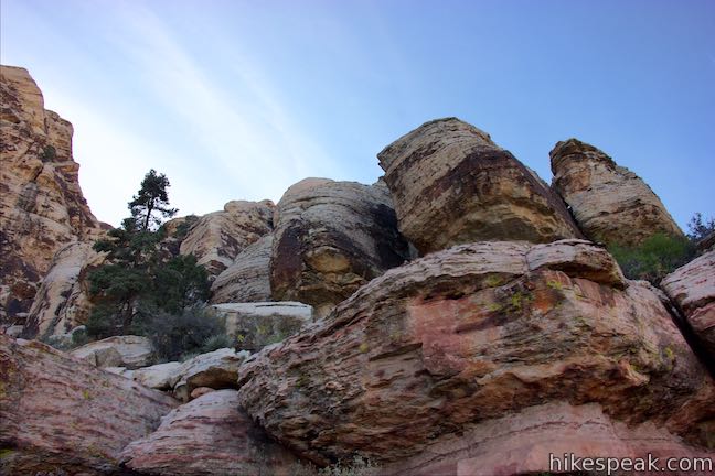
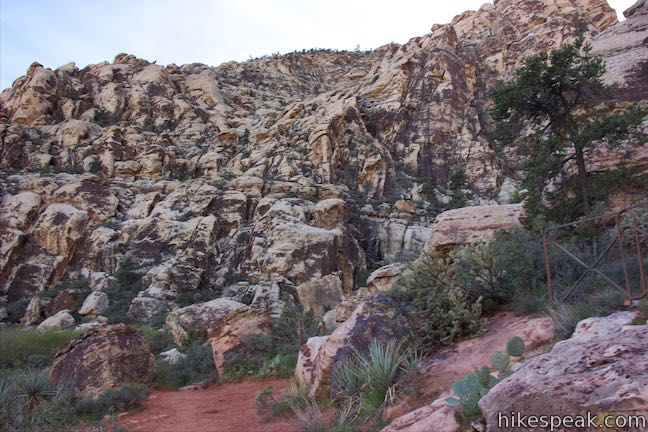
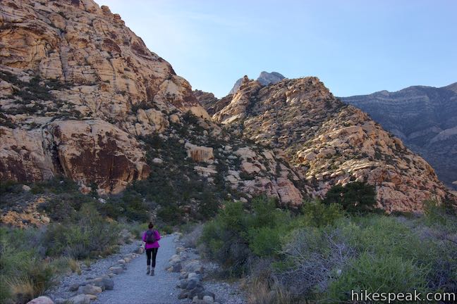
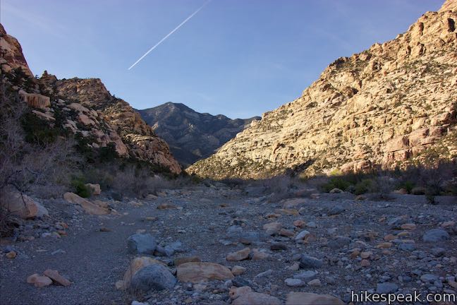
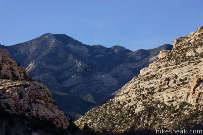
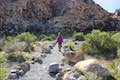
The pictograph feels like a handshake with the people who lived here centuries ago. Continue down the concrete trail and approach an agave roasting pit, also used by Native Americans. Now the trail switches back to gravel, 1/8 of a mile from the start, and sets out across a desert landscape. Hike gradually downhill past cactus, yucca, and other Mojave Desert Plants. Enjoy views down Red Rock Wash toward steep cliffs in the Spring Mountains to the southeast. Lost Creek Canyon and Icebox Canyon cut into the massive rock wall.
Come to a junction, 0.4 miles from the start where White Rock Trail parts to the left. Bear right, following an arrow for Lost Creek. Continue down the trail toward Rocky Gap Road. Cross the road carefully at a crosswalk, being mindful of the 2-way traffic.
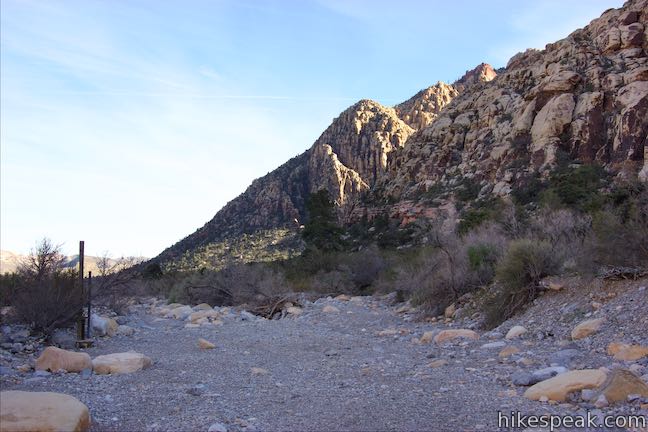
Lost Creek Canyon Trailhead is on the opposite side of the road, with a parking area and two trails. Lost Creek Children’s Discovery Loop Trail goes west from the right side of the parking area. Take this trail for the shorter version of Willow Springs Loop. To the left of this trail is Lost Creek Canyon Trail, which goes southwest toward the narrow canyon slicing into the cliffs in front of you.
Which way should you go? To see Lost Creek Waterfall, or at least a pictograph and a boardwalk over a spring, pick Lost Creek Canyon Trail. For a shorter hike back to Willow Springs Picnic Area, bear right on Children’s Discovery Loop Trail.
Option 1: Lost Creek Canyon Trail
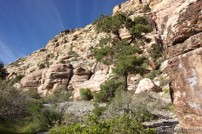
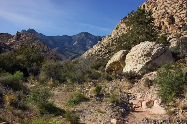
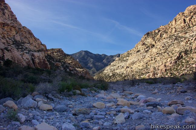
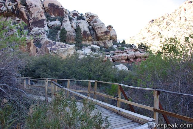
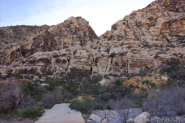
Take Lost Creek Canyon Trail southwest, following a gravel track lined by larger rocks. Bear right at a junction with SMYC Trail and slip through desert brush to Red Rock Wash, 0.15 miles from the Lost Creek Trailhead.
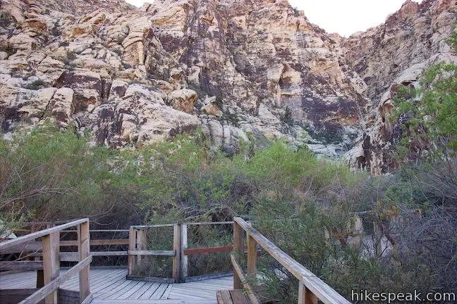
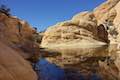
Cross the wash and continue into trees that grow around water at the bottom of Lost Creek Canyon. The trail comes to a boardwalk, lifting you above the ground to protect the fragile grasses in this riparian area. A panel explains how this place has been restored:
The Lost creek area has been a popular place for people to visit for years, but it is more than a visit to the many plants and animals that live here. Lost Creek is their home. Heavy visitor use of this area has compacted soils, trampled plants, and destroyed much of the fragile riparian habitat (habitat associated with water). Concerned about the loss of habitat, the Bureau of Land Management developed a restoration plan. Trampled areas were replanted and an elevated boardwalk was constructed by volunteers. The boardwalk provides visitors with a way to continue enjoying this special place and helps protect the fragile spring habitat.
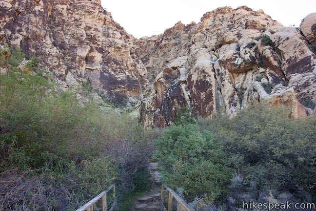
On the left side of the boardwalk, you can watch the spring flow through the thicket below. At the end of the short boardwalk, a rocky dirt trail resumes. Cross a boundary to Rainbow Mountain Wilderness Area and come to an unmarked junction, a quarter mile from the Lost Creek Trailhead and 0.7 miles from the start of the hike at Willow Springs Picnic Area. Stay to the left to venture another tenth of a mile up the canyon to the waterfall or bear right to hike back to Willow Springs.
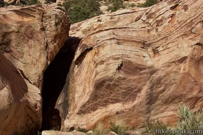
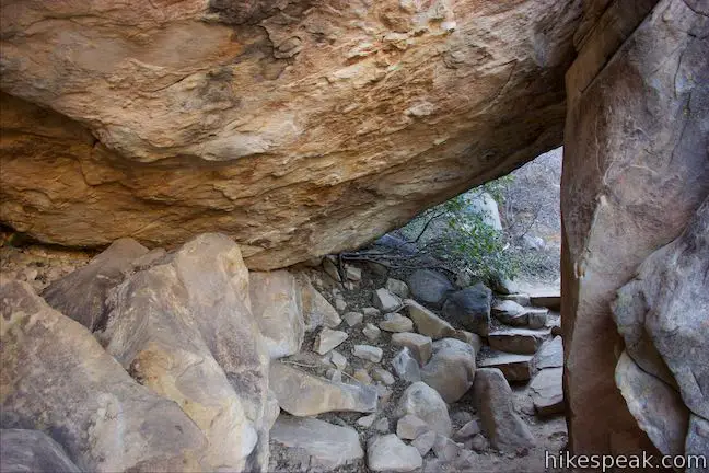
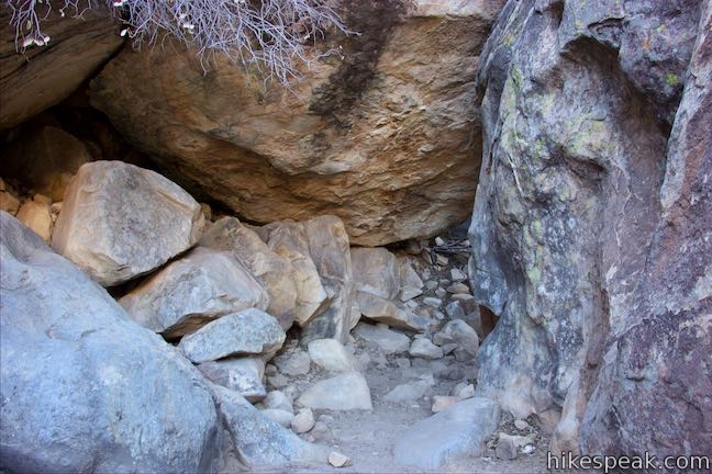
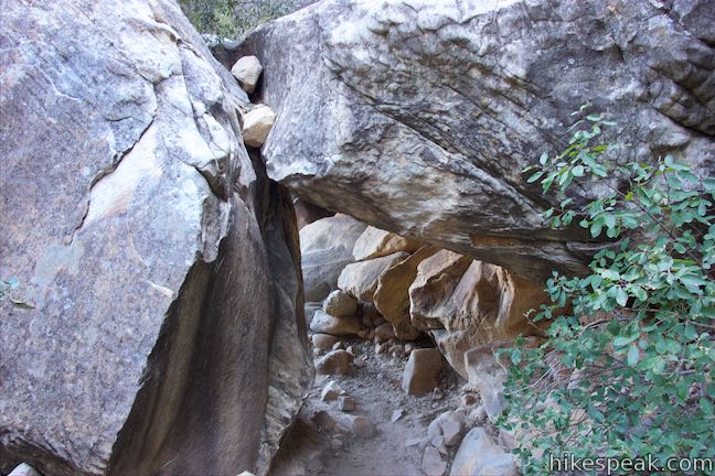
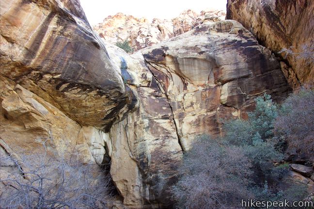
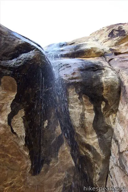
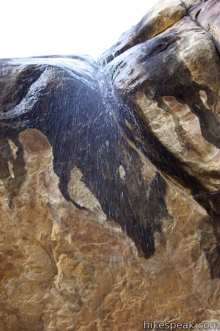
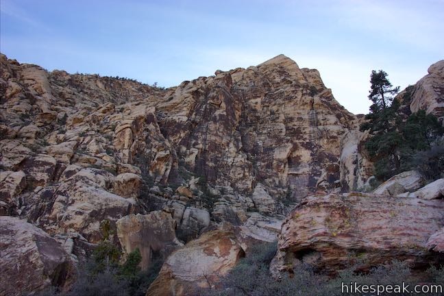
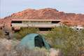
Moving toward the waterfall, Lost Creek Canyon Trail drops across a creek bed. Any water here means the waterfall is flowing strong! Take steps up the other side and make your way through a tunnel formed by a pair of boulders. Just ahead, you will arrive at the base of the waterfall.
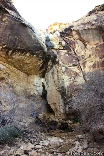
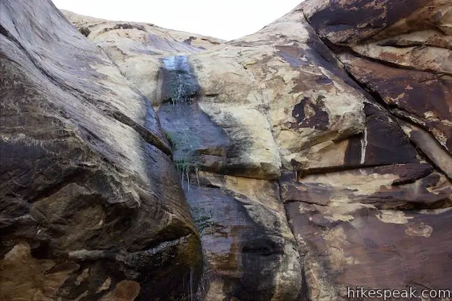
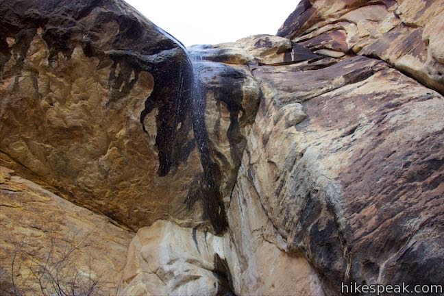
Lost Creek Falls is a seasonal waterfall flushed by rain and snowmelt that flows in the winter and spring. The waterfall pours from an overhang at the back of the box canyon and can run strong or run dry. If the waterfall isn’t gushing, but rather dripping like a shower (as shown), walk right up under the waterfall for some natural refreshment.
After soaking up Lost Creek Waterfall, head back down the trail. When you return to the unmarked junction, turn left to proceed with the loop. Pass a large boulder and come to a wooden fence on the left side of the trail. Look up at the rocks above the fence and see if you can spot a pictograph, resembling a person with their hand raised. What message was the Native American sending who created this rock art?
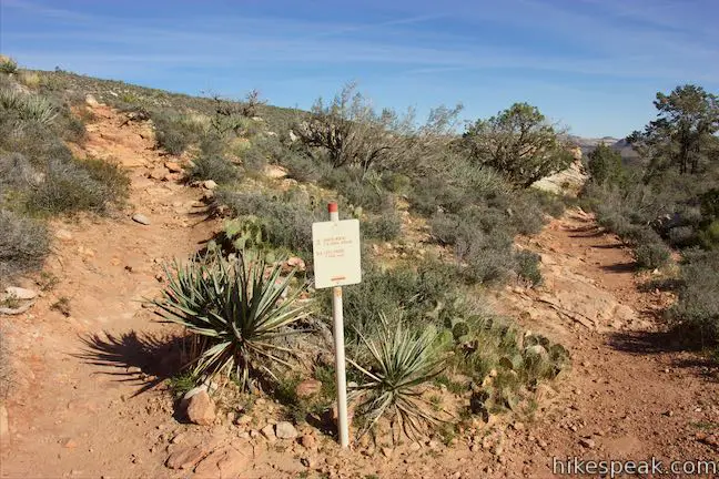
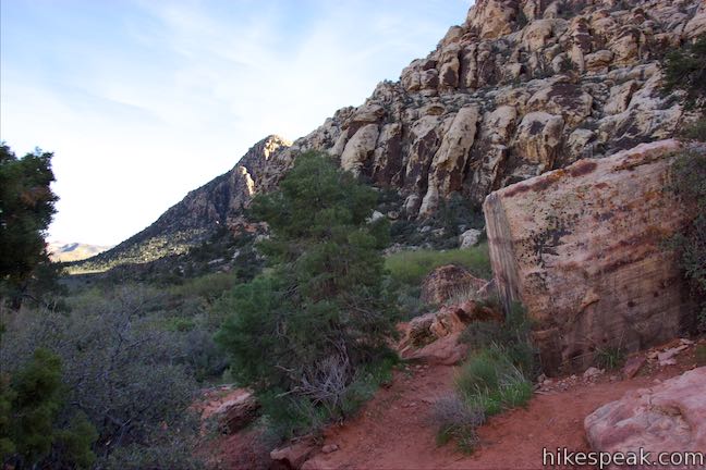
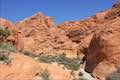
Continue along Children’s Discovery Loop Trail beneath the cliffs that border Lost Creek Canyon. Enjoy views out and across the wash below. Pass a sign for Willow Springs Loop next to a faint trail that heads up a slope toward a gap between boulders. (The junction is next to trail marker number three and you will have walked past it if you reach marker two.) Turn left to pick up the last 0.3 miles of Willow Springs Loop Trail.
Willow Springs Loop Trail goes along the base of steep cliffs. Stay to the right past Upper Lost Creek Falls Trail, a use-trail forging a route across the cliffs into the canyon above Lost Creek Waterfall. The trail proceeds across a rise below the cliffs above Red Rock Wash. Pass an unofficial overlook with views down the wash toward Las Vegas before the trail descends to the wash itself. Cross the gravel wash and take the last piece of the trail back to Rocky Gap Road. Turn left when you reach the road to walk a few steps back to the parking area where the hike began, completing a 1-1/3 mile loop.
Option 2: Children’s Discovery Loop Trail
The other way to continue Willow Springs Loop from Lost Creek Canyon Trailhead is to bear right when you cross the road onto Lost Creek Children’s Discovery Loop Trail. Hike up this trail across the desert, enjoying views of the steep ridges ahead of you.
After 0.15 miles, the trail comes to a Red Rock Wash, a gravel channel running west to east down the valley. Paths break off to the right here, heading up the wash and back to Willow Springs Picnic Area. On the other side of the wash, Children’s Discovery Loop Trail goes up a slope below the cliffs to a junction with the next part of Willow Springs Loop. If you’d like to avoid that elevation gain, you could walk up alongside the wash (as many visitors seem to do) and take one of the paths parting to the right to return to Rock Gap Road near the picnic area.
Sticking with Children’s Discovery Loop Trail, once you cross the wash, the trail curves to the left away from Willow Springs Picnic Area. Make a sharp turn to the right to begin ascending from the wash up a slope below steep sandstone cliffs. Pass an info panel labeled “A Prehistoric Kitchen” that describes how Native Americas baked food in mounds called agave roasting pits like the one you saw next to the pictographs of the hands.
Walk up the trail for another 90 seconds. As it curves to the left, find marker three next to a sign for Willow Springs Loop. Turn right up this trail, ascending through a gap between boulders to hike the final 0.3 miles back to the trailhead.
The trail goes along the base of steep cliffs. Stay to the right past Upper Lost Creek Falls Trail, a use trail that forges a route up and across the cliffs into the canyon above Lost Creek Waterfall. Proceed across an area perched above Red Rock Wash. Pass an unofficial overlook with views down the wash toward Las Vegas. The trail then descends back to Red Rock Wash. Cross the wash to find the last piece of the trail back to Rock Gap Road. Turn left when you reach the road to walk a few steps back to the parking area where the hike began, completing a 1-mile loop.
Summation
Willow Springs Loop is a nice easy hike in Red Rock Canyon National Conservation Area. With pictographs, a seasonal waterfall, and nice views of tall colorful cliffs in the Spring Mountains (where you might spot bighorn sheep), this short loop offers a lot. If Lost Creek Waterfall is flowing and you combine the hike with a picnic at Willow Springs, you’ll have a fine outing in Red Rock Canyon.
Dogs are allowed on trails in Red Rock Canyon National Conservation Area. This hike begins from a picnic area off the park’s scenic loop drive, requiring that you pay a park entrance fee to reach the trailhead. No permit is required for Willow Springs Loop, so get out and enjoy!
To get to the trailhead: From Las Vegas, take Interstate 15 to exit 42 and follow Route 95 west for 5 miles (heading toward Reno). Take exit 81A for Summerlin Parkway and drive 6.5 miles, using a ramp on the right to get on Clack County Route 215 South. Drive 2.2 miles, taking exit 26 to reach an intersection with Route 159 (Charleston Boulevard). Turn right and drive 5.2 miles to the start of Scenic Drive in Red Rock Canyon. Turn right, pay the entrance fee, and drive 7.2 miles up the road, passing several trailheads and viewpoints. Turn right onto Rocky Gap Road, following a sign for Willow Springs Picnic Area and Lost Creek Trail. Drive 0.6 miles and park in front of Willow Springs Picnic Area, which will be on the right. A high clearance vehicle is required to drive much farther up Rocky Gap Road beyond Willow Springs.
Trailhead address: Rocky Gap Road, Red Rock Canyon National Conservation Area, Las Vegas, NV 89161
Trailhead coordinates: 36.1609, -115.4985 (36° 09′ 39.23″N 115° 29′ 54.6″W)
You may also view a regional map of surrounding Nevada trails and campgrounds.


Lost Creek Canyon Trail (option 1)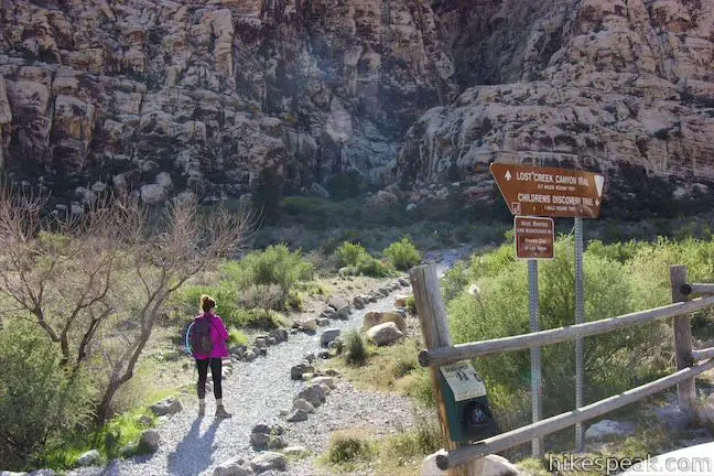


Children's Discovery Loop Trail (option 2)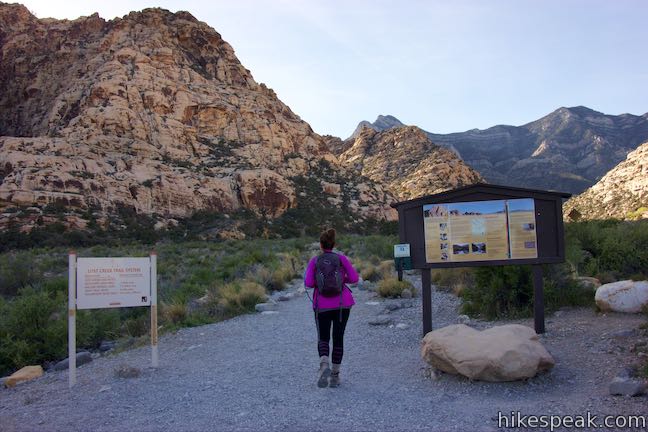


 | Lost Creek Canyon This 0.7 to 0.8-mile hike visits a seasonal waterfall in a steep canyon above Red Rock Wash and can be made into a loop that passes a pictograph. |
 | Calico Tanks This 2.5-mile hike ventures up a colorful canyon to a pond in a sandstone-framed basin alongside a grand view of Las Vegas. |
 | Calico I and Calico II This hike of 0.8 to 2.75 miles or more explores dramatically shaped and colored sandstone formations in the Calico Hills near the start of Scenic Drive. |
 | Red Spring Boardwalk This easy 0.55-mile nature trail circles a meadow at the base of the Calico Hills and visits a small but relied upon spring. |
 | Hikes in Nevada Explore more trails in Nevada and the picturesque parks around Las Vegas. |
 | Red Rock Canyon Campground Red Rock Canyon National Conservation Area has one developed campground with 72 sites that have shade ramadas, picnic tables, fire rings, barbecue grills, drinking water spigots, and vault toilets. |
 | Atlatl Rock Campground and Arch Rock Campground Valley of Fire State Park has great places to camp surrounded by formations of red sandstone. |
Go the extra miles...
Submit a rating of this hike to go with your comment. Contribute to the average trail rating.