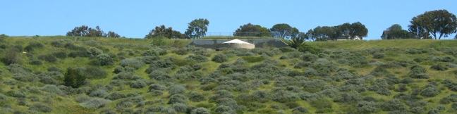
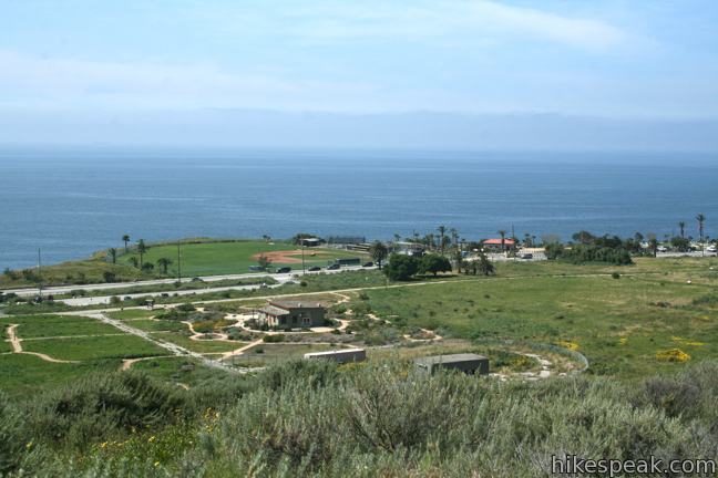
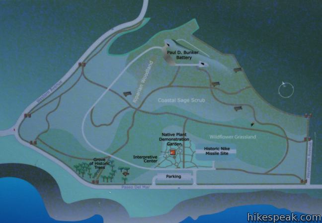
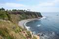
White Point Nature Preserve is located at the southern end of Palos Verdes Peninsula, offering a unique window into the regions past. Rings of trails connect the visitor center with the park’s main attraction, a retired military bunker with everlasting ocean views. This 102-acre history-packed park provides a one to 2.5-mile loop with 150 feet of elevation gain.
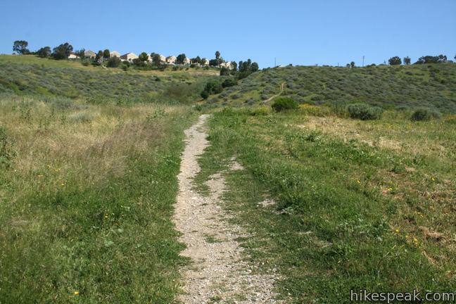
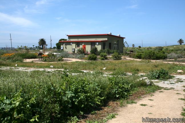
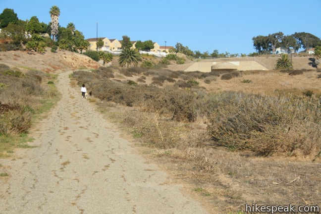
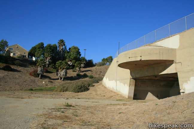
Beginning from the botanical gardens outside the information center, head west-northwest up a wide dirt road parallel to Paseo del Mar. After a short distance, a single track breaks off to the right toward the bunker, which can be seen up on the hill to the northeast.
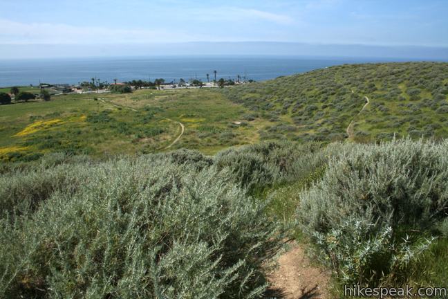
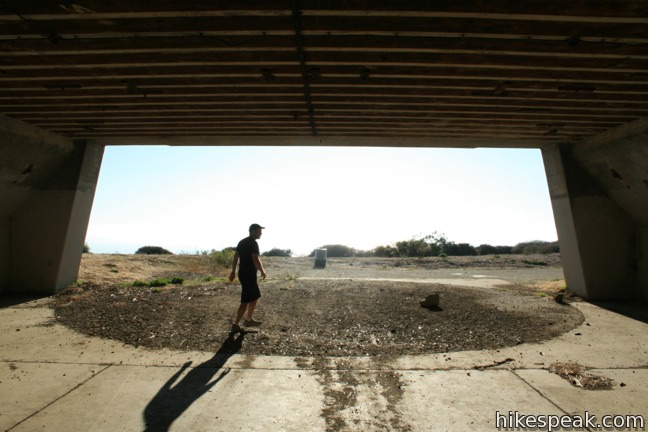
The road continues straight, becoming paved and curving gradually up to the northern battery. The single track traces the edge of the field before climbing a sagebrush slope to the southern battery of the old military stronghold. Both routes reach Battery Bunker after just half a mile.
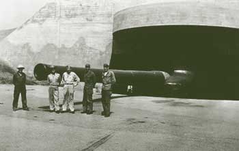
(courtesy of the Fort MacArthur Museum)
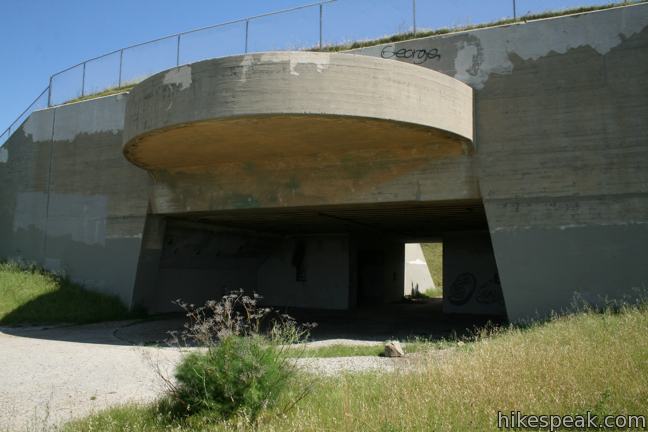
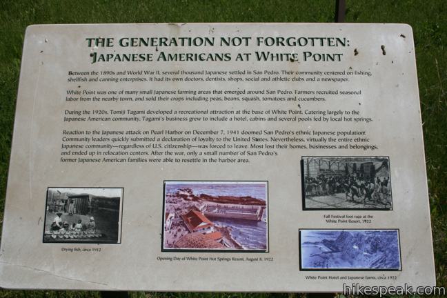
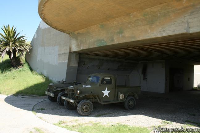
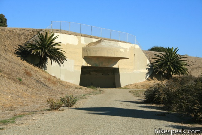
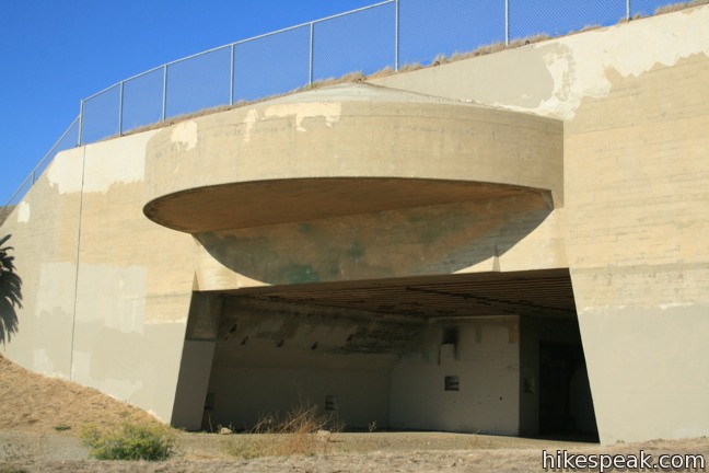
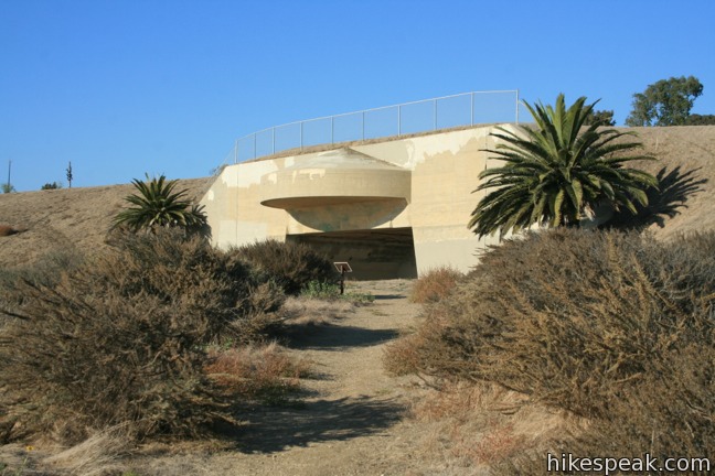
The bunker at White Point was built as a coastal defense site in World War II, and was in service from 1942 to 1978, though it never fired on the enemy. A panel along the trail describes the weaponry at White Point:
During World War II, Battery Bunker housed two 16-inch guns, each capable of hurling 2,000-pound shells up to 26 miles. Every time the great guns were test-fired, the booms broke hundreds of windows in San Pedro!
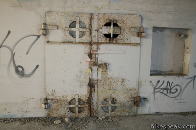
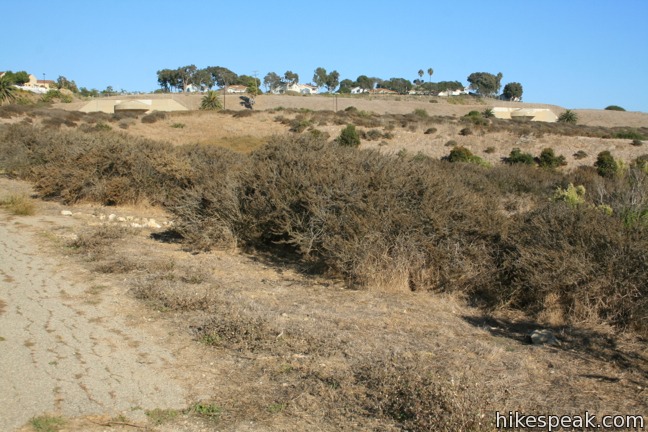
The bunker is now abandoned, allowing visitors to walk around the grounds and imagine the peninsula in a militarized state. The 17-foot thick, steel-reinforced concrete ceiling over the 4,000 square foot facility creates an artificial hill that will be standing for quite some time. Another thing that won’t change is the pacifying ocean view, which you will have the opportunity to enjoy as you hike back to the trailhead.
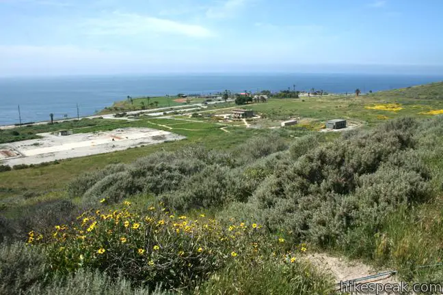
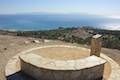
Follow the track south to loop back to the visitor center. Make a right at two minor trail junctions for the most direct path, or angle to the left around the contours of a grass field to the south. There is a noticeably vacant concrete platform in the center of the field. This area housed surface-to-air missiles during another US military campaign. At the start of the cold war, White Point was used as a Nike Missile site, part of an early system designed to protect Los Angeles from soviet missile attacks. San Vicente Mountain in the Santa Monica Mountains and Mount Disappointment in the San Gabriel Mountains were also part of this defense network.
While not the most picturesque parcel of the peninsula, White Point Nature Preserve is an excellent place to learn about the history of the headland. The city owned park was dedicated as an open space in 1999, and the Palos Verdes Peninsula Land Conservancy, which manages the area, has ensued that your visit will be an informative one. Panels along the trail describe the area’s vegetation and human history, providing some good learnin’ on a short hike. Dogs are allowed, but bicycles are prohibited. No fee or permit is required to visit White Point Nature Preserve, so get out and enjoy.
To get to the trailhead: From Los Angeles take the 405 or 110 Freeway south to the 405-110 interchange near Carson. Continue south on the 110 Freeway for 8 miles to the end of the freeway. Turn left on Gaffey Street, and make the third right on First Street. After one mile, turn left on Western Avenue (Route 213) and drive 2.3 miles until it becomes Paseo Del Mar. Turn to the left to stay on Paseo Del Mar. Turn left again into the parking area for White Point Nature Preserve after 1/3 of a mile.
Trailhead address: 1600 West Paseo Del Mar, San Pedro, CA 90731
Trailhead coordinates: 33.716086, -118.31516 (33° 42′ 57.90″N 118° 18′ 54.57″W)
You may also view a regional map of surrounding Los Angeles trails and campgrounds.
 | Deane Dana Friendship Park This 1.1-mile loop circles a park with panoramic ocean views over the south end of the Palos Verdes Peninsula. |
 | Quarry Loop This short loop in Forrestal Nature Reserve delivers lots of ocean views as it circles an old bowl-shaped quarry. |
 | Portuguese Bend Reserve This 5.15-mile double loop explores the scenic coastal hillsides and canyons in Portuguese Bend Reserve on the Palos Verdes Peninsula and can easily be shortened to 3 miles round trip by omitting the lower loop. |
 | Seascape Trail This level family-friendly 1.5-mile hike explores scenic coastal bluffs north of the historic Point Vicente Lighthouse. |
 | Lunada Canyon Trail This short trail explores an overgrown canyon between two residential ridges inland of Lunada Bay. |
 | More trails in the Los Angeles Explore other destinations in the Santa Monica Mountains, San Gabriel Mountains, and elsewhere. |
I love this hike, especially in the spring. Although part of Paso Del Mar has slid into the ocean, White Point Nature Preserve is still opened, accessible via 25th Street to Western. Many other great hikes in the area too, some of the best rocky shoreline scenery in SoCal in my opinion. Great write up on the area Hikespeak! Thanks!
Great hike, but does anyone know for sure what the U.S.E.D. stands for?
It stands for United States Engineering Department (part of the Army)
I’ve never been to White Point, but a PVPLC volunteer recently told me there is a hard to find miltary service animal cemetery on site. Does anyone who where this is? Looking forward to exploring this trail.
There’s a K9 cemetery at the nearby Fort MacArthur Museum site. It’s maybe .5 mile from White Point.