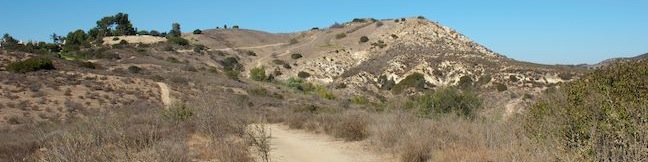
Where can you go for a loop hike in a wilderness area in Orange County? Why, Weir Canyon of course. Weir Canyon Trail provides a 3.8-mile loop over undulating terrain on the side of Weir Canyon in the Anaheim Hills below the Santa Ana Mountains. There is 350 feet of elevation between the high and low points of the loop, but all the ups and downs along the trail make it feel more like a hike with a thousand feet of elevation gain. The sun-exposed hike passes interesting sandstone formations and rises to views over Anaheim as it explores Weir Canyon Wilderness Park, which is a less-visited part of Santiago Oaks Regional Park.
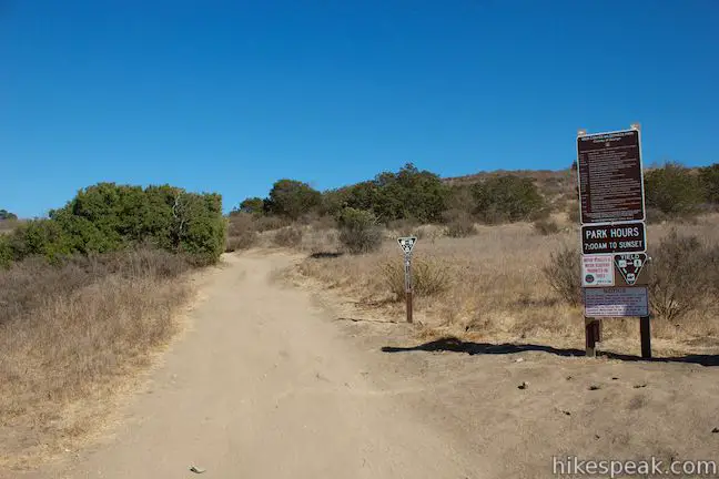
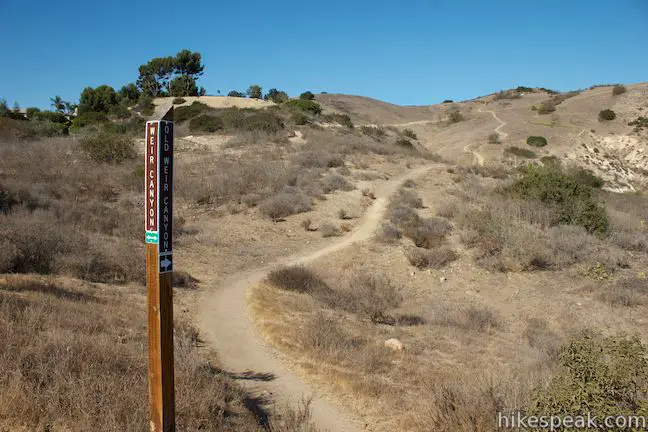
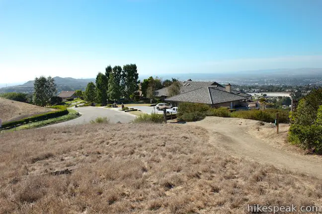
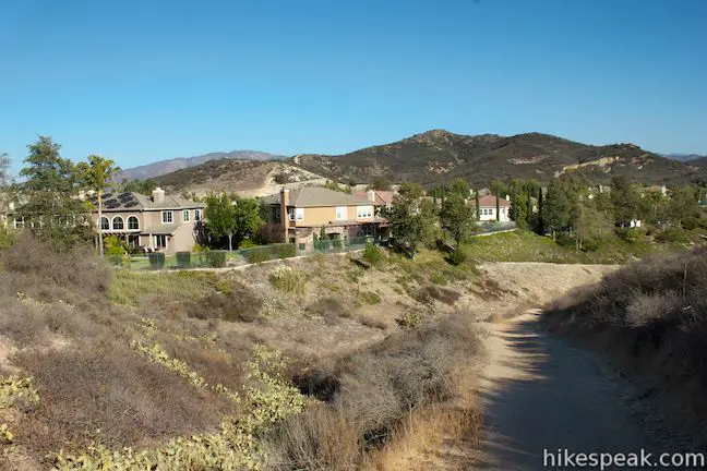
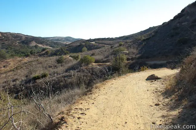
Get started from a trailhead at the corner of Hidden Canyon Road and Overlook Terrace in a residential area on northeast side of Santiago Oaks Regional Park. Spot the trail regulations sign with for the Weir Canyon Wilderness Park and begin walking east up Weir Canyon Trail. You will reach a junction after a tenth of a mile where the loop begins.
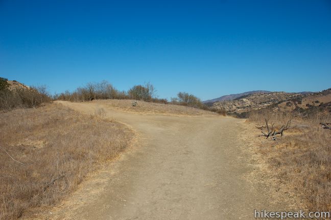
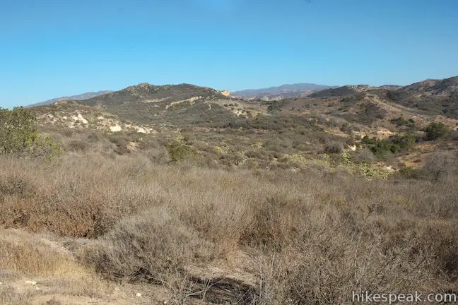
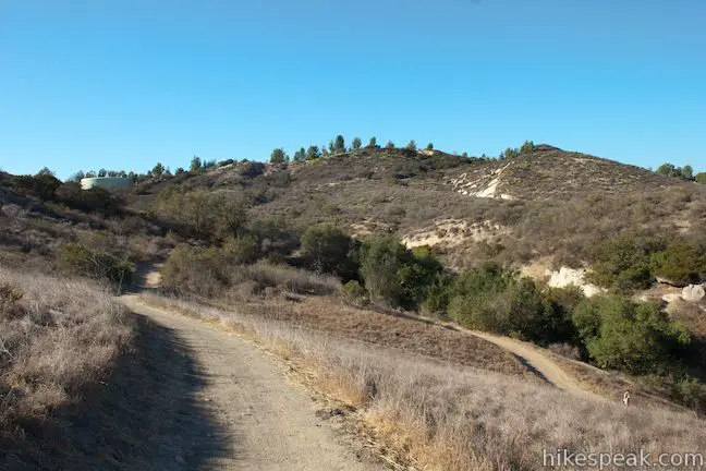
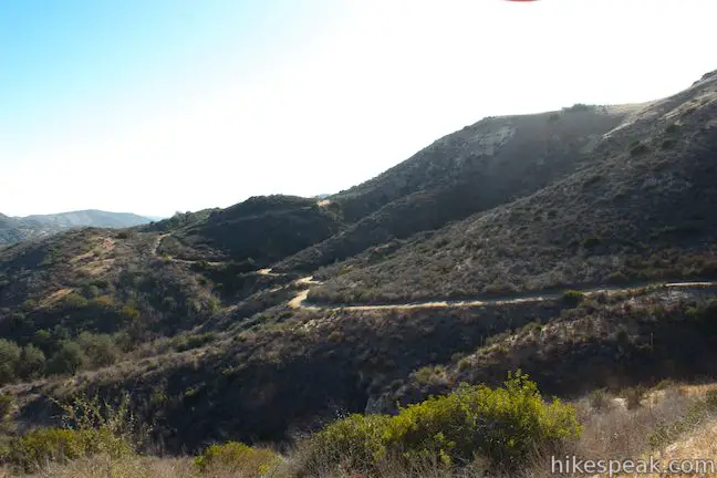
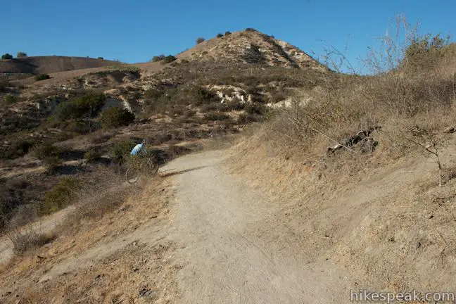
The Weir Canyon Trail Loop is shaped roughly like a stretched out northeast-southwest running oval, with a higher side to the west and a lower side to the east. To hike the higher side of the loop first, turn left, tackling Weir Canyon Trail in a clockwise direction. The loop trail is made up of both single track and wide dirt road, and this first stretch of the hike is on a single track. Weir Canyon Trail never actually visits the bottom of Weir Canyon and instead crosses higher and lower points on the northwest side of the canyon.
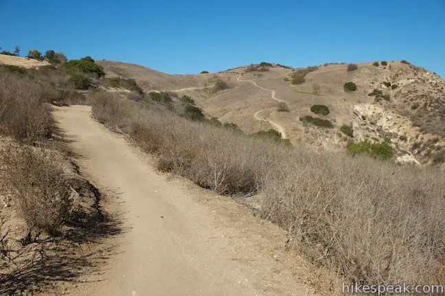
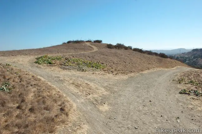
In a short distance, a quarter mile from the start, you will reach another trail junction. Old Weir Canyon Trail splits off to the right, while the new trail stays to the left. New Weir Canyon Trail is more gradual and avoids a big dip and climb that is crossed by the old trail.
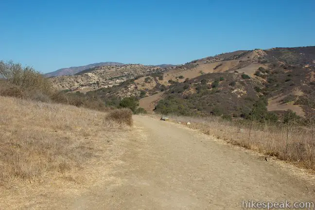
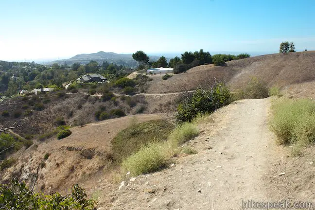
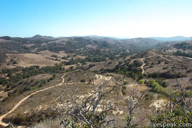
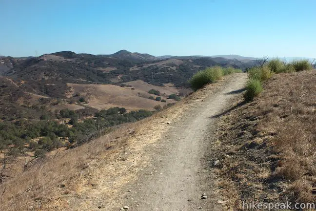
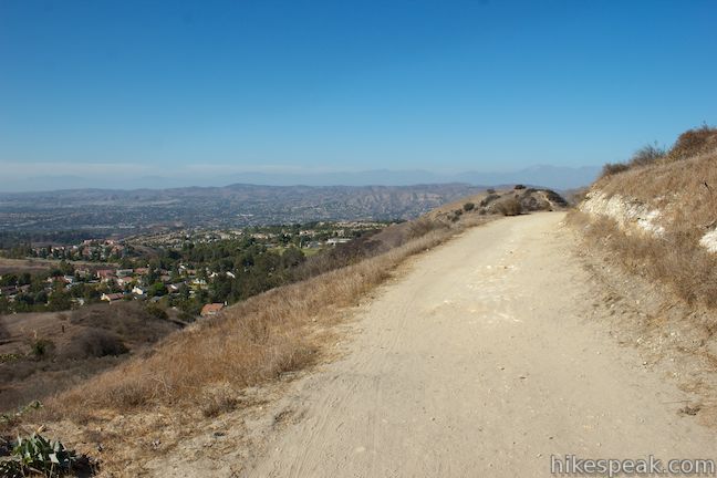
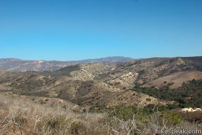
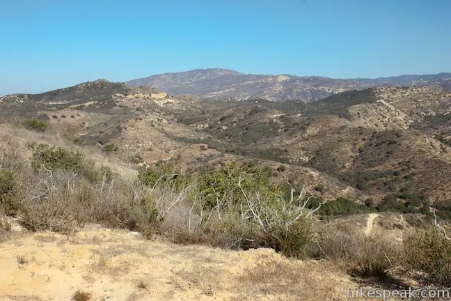
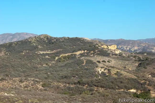
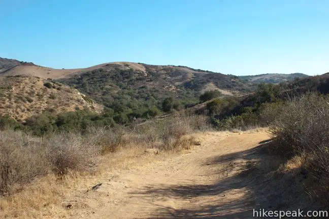
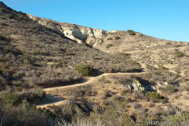
Take New Weir Canyon Trail for a gradual ascent through thin brush alongside a few homes. After another quarter mile, the new trail will crisscross the old trail. Continue straight on the new trail to reach an overlook with some of the hike’s best views. As the trail makes a slow curve along a bluff near the high point of the hike, you’ll gain excellent views over the Weir Canyon Wilderness, looking east and south toward the Santa Ana Mountains.
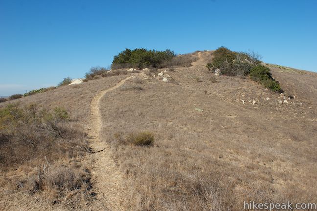
Past this de facto scenic overlook, the trail continues to curve to the left. You will pass a path on the right that ascends to a summit above Weir Canyon Trail before coming to one last junction with Old Weir Canyon Trail, where the two trails reunite. Continue up the unified trail to another junction, located alongside a trailhead at the end of Avenue de Santiago. This is an alternate starting point for hikers on Weir Canyon Trail. When you reach the wide dirt trail by this trailhead, turn right and continue north up Weir Canyon Trail.
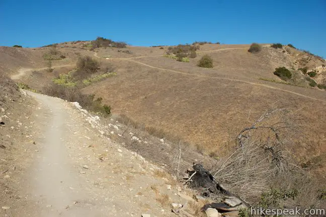
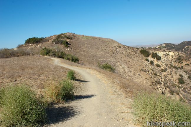
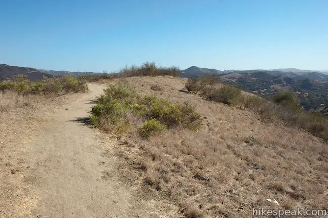
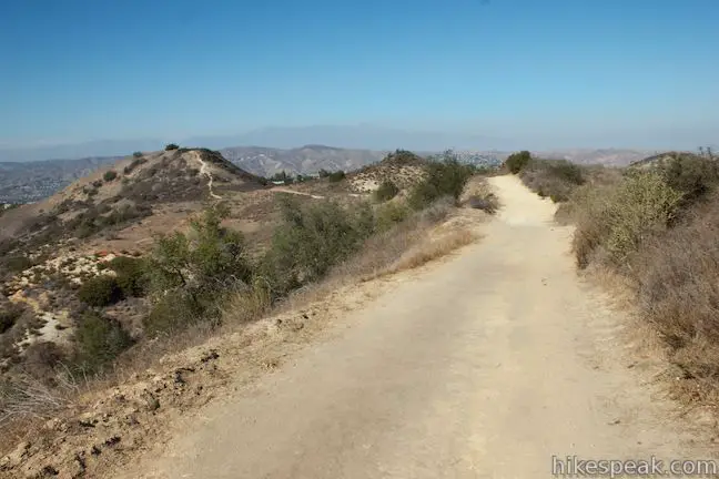
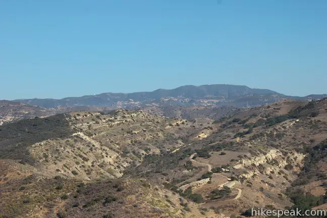
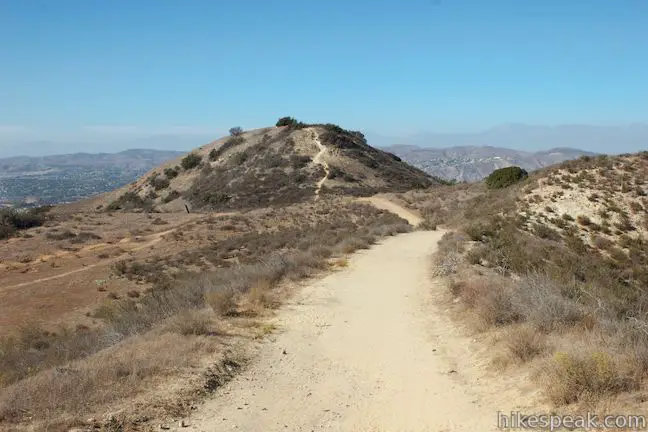
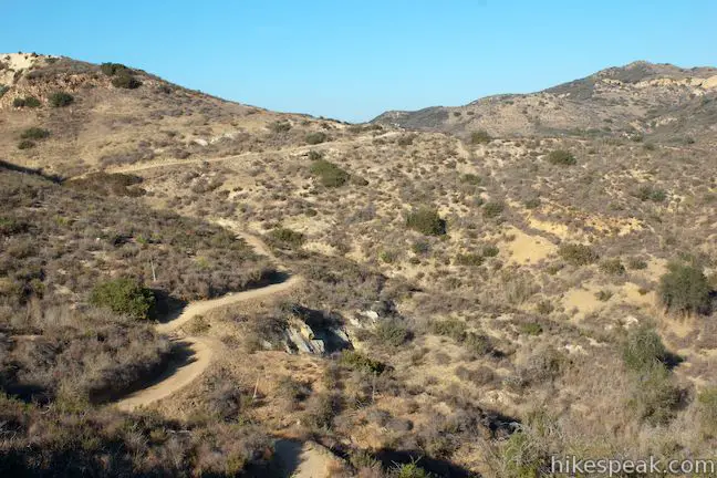
In a short distance, you will pass the other end of the path that goes over the summit above the trail. To the left, there are views over nearby Walnut Creek Reservoir, backed by the valley that cradles Anaheim and Yorba Linda. Cross the tapered 1,250-foot high point of the loop and begin to hike downhill along a ridge toward a pronounced bump.
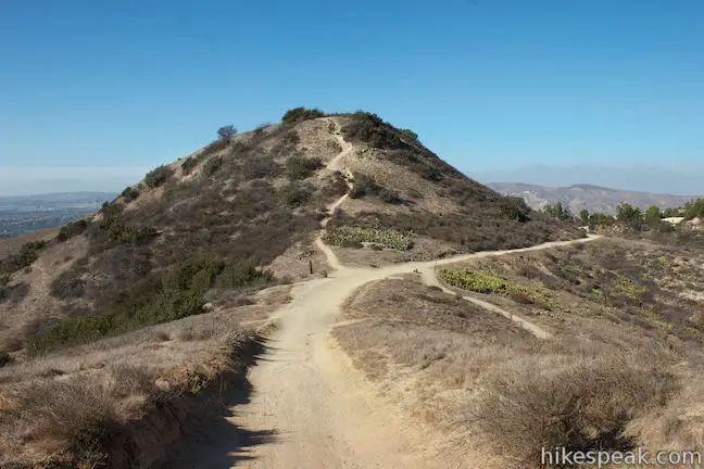
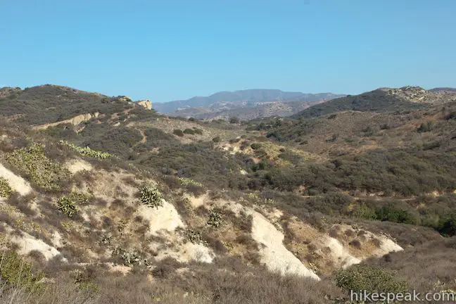
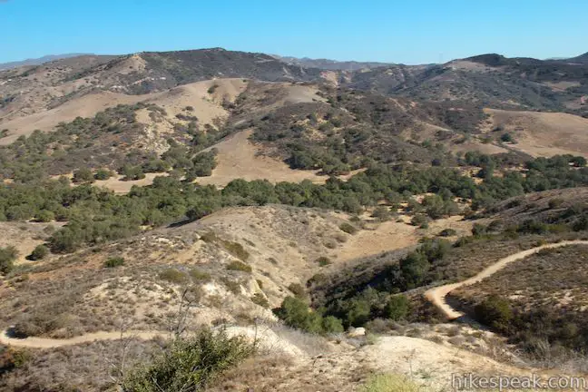
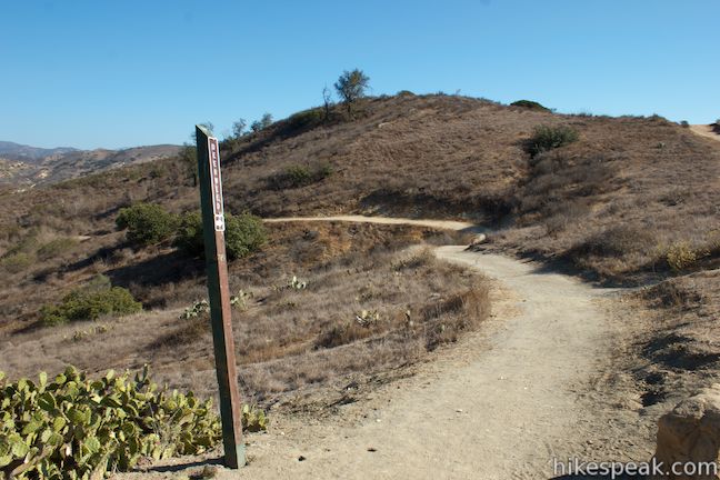
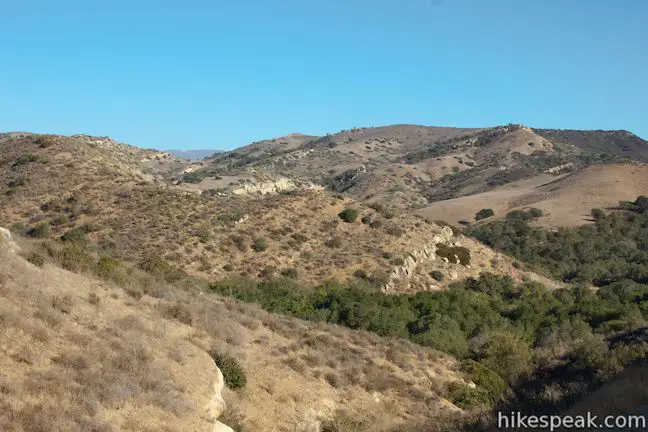
As the trail passes just below the pimple-like bump on the ridge, you will come to a junction with Deerweed Trail on the right, 1.05 miles from the start. Deerweed Trail travels a quarter mile between the high and low sides of Weir Canyon Trail and could be used to cut this loop from 3.8 miles down to 2.7 miles, or to transform the loop into a figure-8. Across from Deerweed Trail, there is a spur trail that ascends the small cone-shaped summit, which Weir Canyon Trail bypasses.
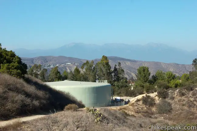
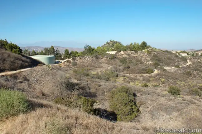
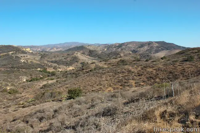
Continue past the Deerweed Trail junction on Weir Canyon Trail, gradually descending toward a holding tank, which you will pass 1.25 miles from the start. As you near the holding tank, you will have excellent views into the wild mountain range to the east, the Santa Ana Mountains. Above and beyond the holding tank, there are views north toward Mount Baldy and the San Gabriel Mountains.
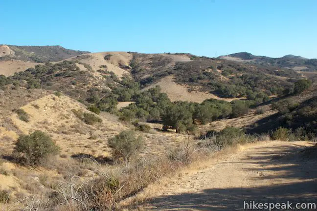
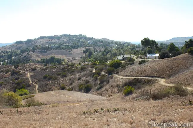
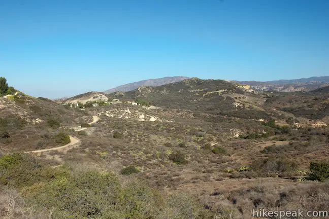
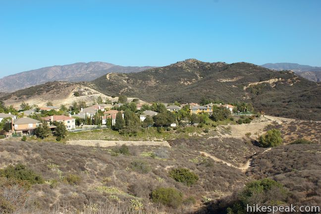
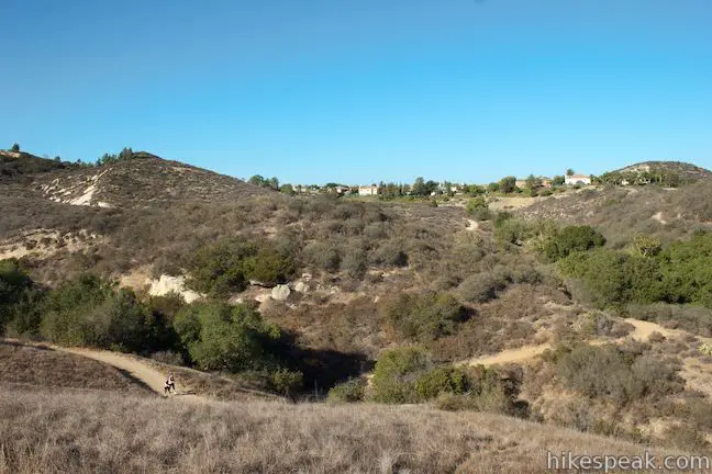
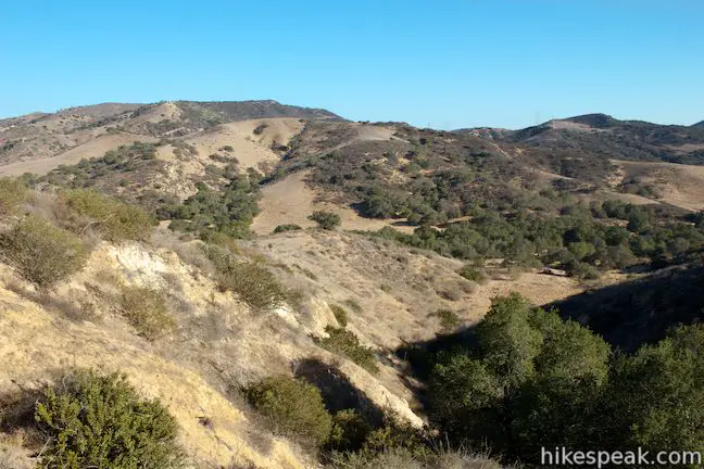
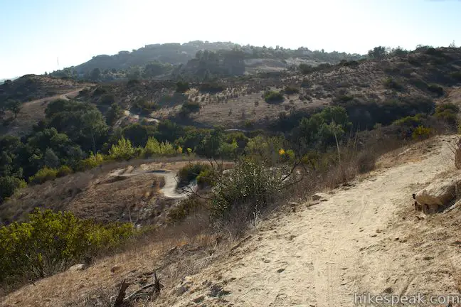
At the northeast end of the Weir Canyon Trail Loop, hike downhill toward a housing development that borders the trail. The trail passes below the houses and curls south, eventually dropping into a cluster of oaks huddled within a draw on the side of Weir Canyon.
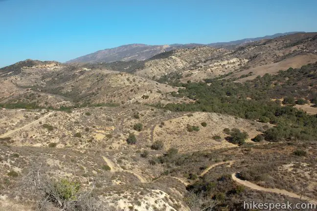
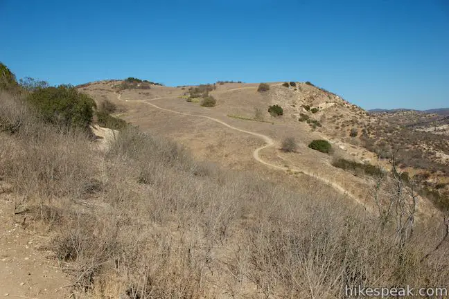
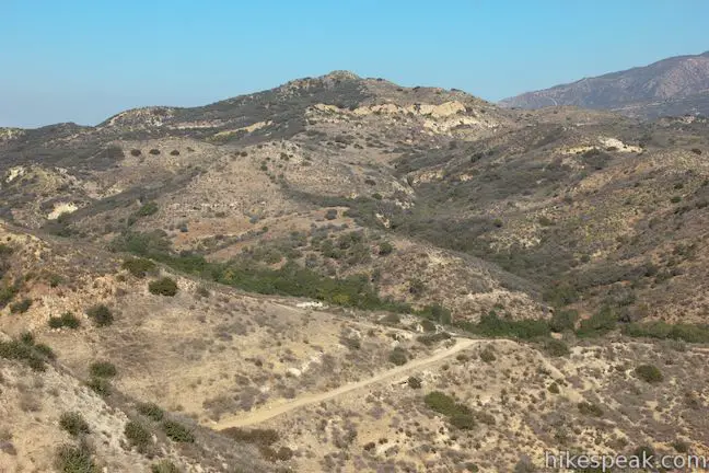
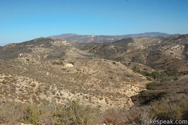
If you look up the draw, you’ll spot the holding tank along the higher side of Weir Canyon Trail. Round a horseshoe bend and ascend toward broader views over Weir Canyon and the surrounding terrain. This pattern of dropping in and out of creases on the side of the canyon is repeated several times on the lower, eastern side of Weir Canyon Trail.
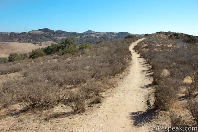
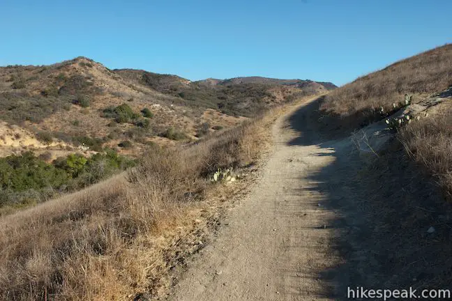
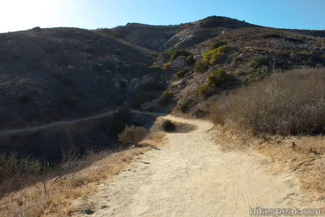
At the next major draw, you pass the other end of Deerweed Trail, 2.4 miles from the start. Stay to the left to continue on Weir Canyon Trail. The wide dirt trail crosses the rippled landscape past interesting sandstone formations with small socket-like caves. Below the trail, there are nice views of the bucolic oak-dotted landscape at the bottom of Weir Canyon.
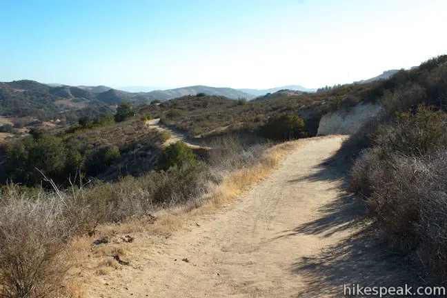
The trail continues to descend and climb in and out of draws on the side of Weir Canyon. Pass below the bluff that boasts the nice overlook on the higher side of the loop, and descend a short series of switchbacks into one final dip in the terrain. There are two junctions right at the end of the hike. Stay to the right past an unmarked trail on the left that heads toward Santiago Oaks Regional Park. Then, in another hundred feet, stay to the left through the junction with the other end of Weir Canyon Trail (completing the loop). After the junctions, simply retrace your steps for the final tenth of a mile back to the trailhead.
Dogs and bikes are permitted. No fee or permit is required to hike Weir Canyon Trail, so get out and enjoy!
To get to the trailhead: Take the 91 Freeway east of Anaheim to exit 36 for Route 90 (Imperial Highway). Drive south on Route 90 for a third of a mile and turn left on Nohl Ranch Road. Dive 2.4 miles east and turn left on Serrano Avenue. Drive another mile and turn right onto Hidden Canyon Road. Take this road south for half a mile until you come to a sharp turn to the right at the start of Overlook Terrace. The trailhead parking area is straight ahead at the end of Hidden Canyon Road.
Note: Another trail, Anaheim Hills Trail, heads south from this trailhead toward Santiago Oaks Regional Park. This trail can be used to link Weir Canyon Trail with other hikes in the park. To find Weir Canyon Trail, be sure to take the trail on the left as you face the trailhead, heading east away from the neighborhood. Weir Canyon Wilderness Park has signage as an independent park, but it’s 210 acres were incorporated into Santiago Oaks Regional Park in 2008.
Trailhead address: South Hidden Canyon Road & East Overlook Terrace, Anaheim, CA 92807
Trailhead coordinates: 33.830446, -117.744129 (33° 49′ 49.60″N 117° 44′ 38.86″W)
You may also view a regional map of surrounding Southern California trails and campgrounds.


 | Lake View Loop & East Ridge Overlook This 3.65-mile loop expands on the 2.7-mile Lake View Loop with a small loop to the high point of Peters Canyon Regional Park. |
 | Lake Huntington This level and easy 3/4-mile loop circles a small lake in Huntington Beach Central Park. |
 | West Bluff Trail Loop This 2.5-mile loop combines trails above and below the West Bluff in Upper Newport Bay Nature Preserve to provide a variety of views across Upper Newport Bay. |
 | Geology Discovery Trail This 9-mile loop in Crystal Cove State Park follows guide markers exploring geology in the beautiful backcountry of this Orange County wilderness. |
 | Moro Beach This 2-mile round trip hike ventures down Moro Canyon to a picturesque beach in Crystal Cove State Park. |
 | Little Sycamore Canyon - Serrano Ridge - Camarillo Canyon - Stagecoach South Trails Loop This 5-mile loop uses four trails to explore two canyons and a ridge in Laguna Coast Wilderness Park. |
 | Redwood Grove in Carbon Canyon Regional Park This level 2.5-mile round trip hike visits a small grove of small coastal redwoods that is the largest grove of these large trees in Southern California. |
 | More hikes in Southern California Explore more trails in Orange, Riverside, San Bernardino, and San Diego counties. |
Took the entire loop. Good exercise with the elevation gains posing good challenge! Make sure to check out the creek and green marshland at the lower half. Will go again.
I took this loop a week ago (so mid April) and everything looked just like the photos. If you go late February to mid March about a week after the last rains, everything will be green.
I usually do this loop as part of a longer hike beginning in Irvine Regional Park, ascending through Santiago Oaks and finally over into Weir. That hike is about 11-12 miles.
This trail is popular but not crowded during the week. On the weekends however, there will be a lot of mountain bikers so if you do bring a dog, keep them on a short leash.
Does anyone know How much it will cost to horseback through weir canyon trail? I’m thinking of bringing my boyfriend and need to know how much to save for the whole trip?
This is an excellent write up of the trail. I would add that when you get very close to the houses on E Hayden Ct, the trail forks (stay to the right). If you go to the left, the trail turns into the concrete water drainage. It appears to be a trail that the residents made and it’s tempting to think it’s part of the main trail.