Warren Peak
in Joshua Tree National Park
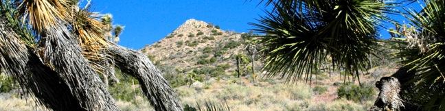
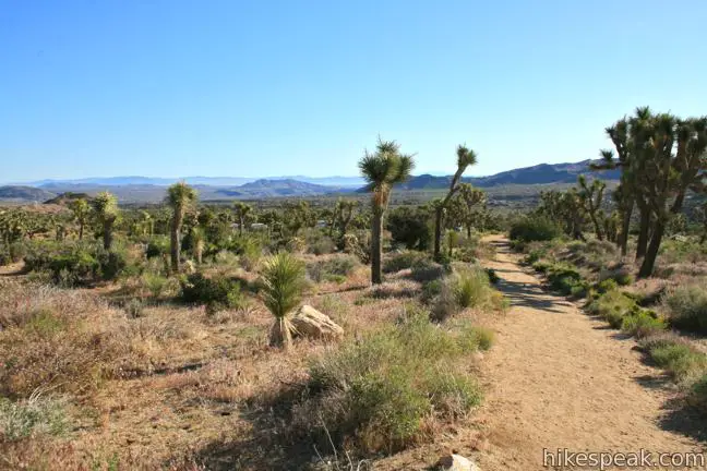
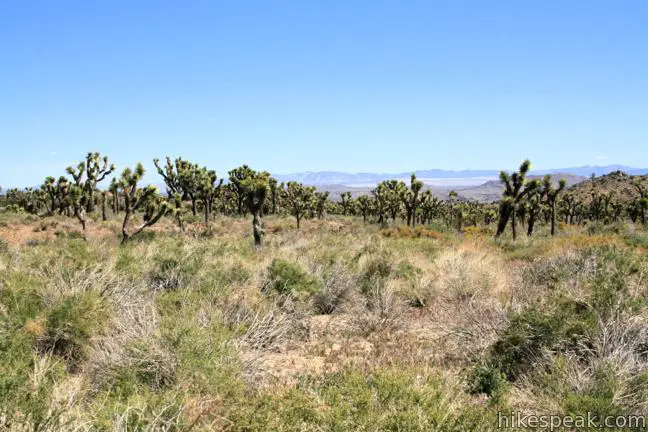
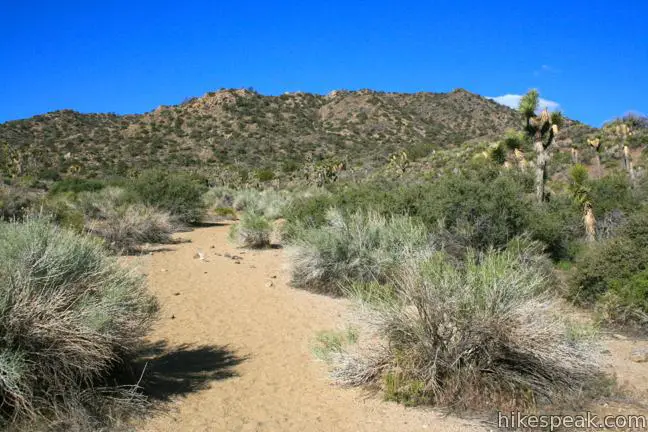
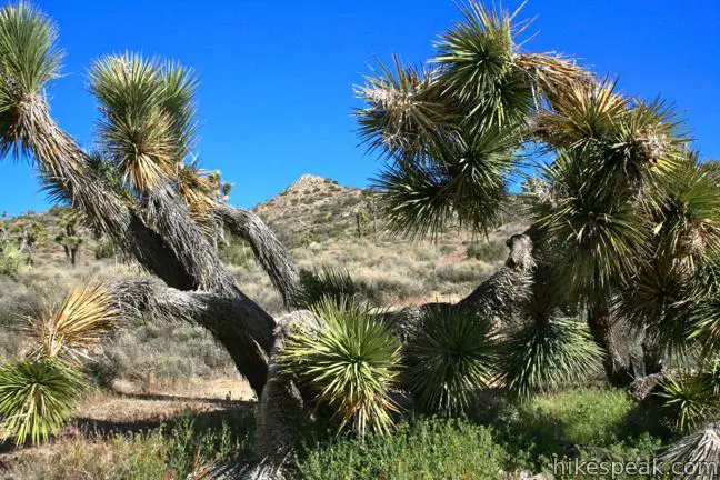
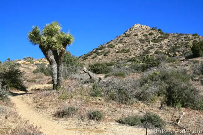
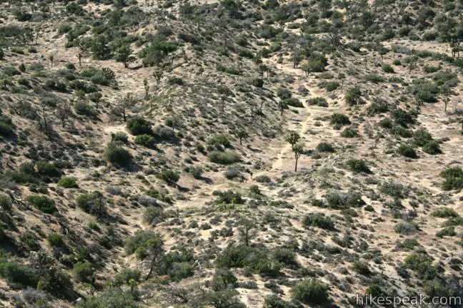
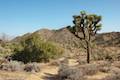
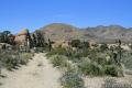
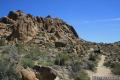
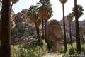
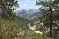
Warren Peak is a high point on the western edge of the Little San Bernardino Mountains in Joshua Tree National Park. Located away from Park Boulevard, Warren Peak offers private peace of mind and near endless views. A 5.5-mile round trip hike to the 5,103-foot summit begins from Black Rock Campground, the only campground in the park where visitors can sleep surrounded by Joshua trees. Joshua trees are plentiful along the start of the trail to Warren Peak. Higher up, you’ll find Pinyon pines and panoramic views.
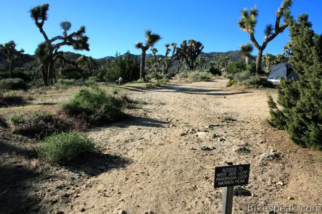
Park at the campground visitor center, and walk to the trailhead to the left of campsite 30. The trail has several junctions, so follow these directions:
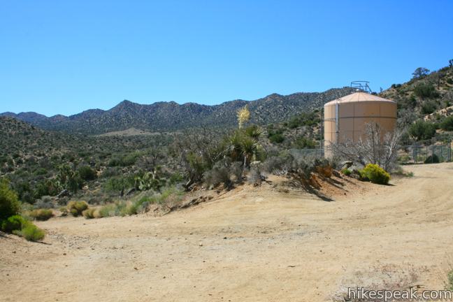
- When you reach the water tank 0.2 miles from the trailhead, turn left and make an immediate right on the single-track trail continuing east across undulating desert.
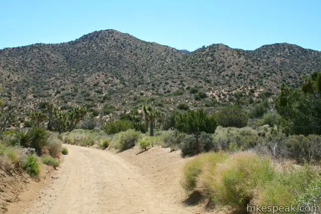
- After another 0.4 miles, turn right up the wash in the center of Black Rock Canyon (and get ready for your pace to slow in the sand). From this point on, you will make a right at each forthcoming junction, following signs labeled WP for Warren Peak.
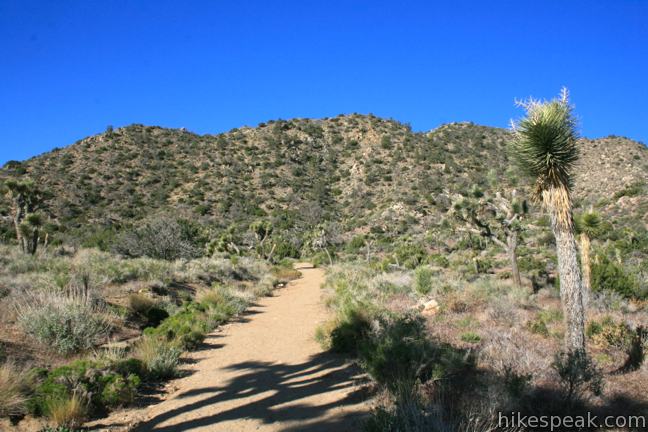
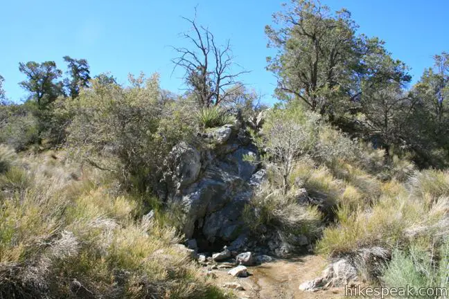
- After 0.8 miles up the wash, the trail passes through the diminutive Black Rock Spring before continuing another 0.2 miles to a fork where the Panorama Loop breaks off to the left. Turn right here.
- Make another right at a second fork, 0.4 miles later, where Panorama Loop rejoins the trail.
- After another 1/3 of a mile, the trail reaches a Y labeled WV-WP. To the left is the spur to Warren View. Take the right fork toward Warren Peak, which is now just 0.4 miles and 400 feet away.

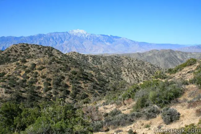
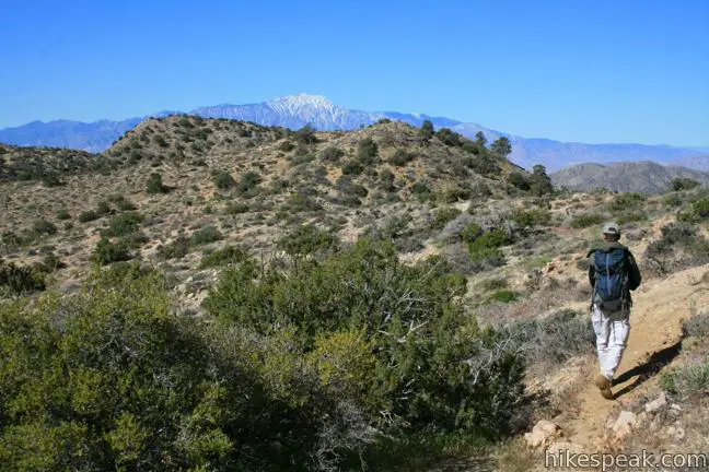
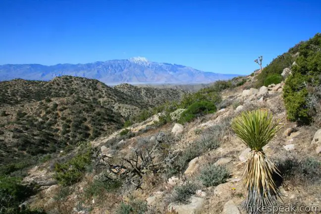
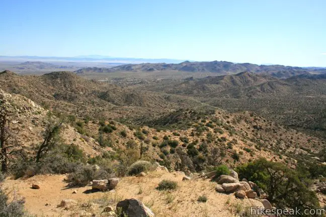
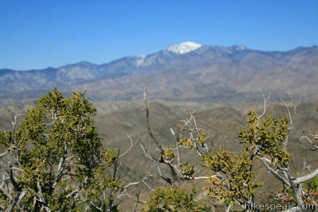
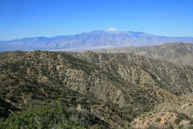
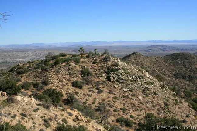
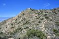
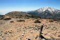
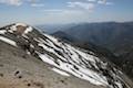
The trail ascends the ridgeline east of the peak and takes a somewhat steep and rugged climb to the summit. Warren Peak offers a great view of the Mojave Desert to the north and the Coachella Valley to the south. Also to the south is Mount San Jacinto, the prominent 10,834-foot peak that rises above Palm Springs. To the west is Mount San Gorgonio, a 11,499-foot peak that is the highest point in Southern California. To the east is Eureka Peak and lower summits in the Little San Bernardino Mountains in Joshua Tree National Park. Warren Peak offers quite a view of these impressive Mountains.
Enjoy a moment of solitude on this less-visited summit, before returning the way you came. On the way back, you’ll be happy to find a sign at the junction where the wash meets the trail heading back to the water tank. The sign points to the left toward West Side Loop (Upper Campground). Turn left here. Everything else is self-explanatory – and downhill – so get out and enjoy the hike to Warren Peak!

Directions to the Trailhead
- From Route 62 in the city of Yucca Valley, turn south on Joshua Lane (5.8 miles west of the intersection with Park Boulevard).
- Drive 4.6 miles to the end of the road and turn right onto San Marino Drive, which curves to the left and becomes Black Rock Road.
- Go up this pothole-filled road for a mile to reach Black Rock Campground.
- Park at the visitor center and find the start of the trail next to campsite 30.
Trailhead Location
Trailhead address: 9800 Black Rock Canyon Road, Joshua Tree National Park, Yucca Valley, CA 92284
Trailhead coordinates: 34.07155, -116.3909 (34° 04′ 17.6″N 116° 23′ 27.2″W)
View Joshua Tree National Park in a larger map
Or view a regional map of surrounding California Desert trails and campgrounds.


 | High View Nature Trail This 1 1/3-mile loop climbs a ridge on the west side of the park that offers views of San Gorgonio Mountain and Yucca Valley, along with an introduction to desert plants. |
 | Desert Queen Mine This 1.6-mile hike follows a level trail to an overlook before crossing a canyon to visits the ruins of one the most profitable gold mines in the California desert. |
 | Barker Dam This level 1.5-mile loop visits a small foreign-looking reservoir within the Wonderland of Rocks. |
 | Hidden Valley This one mile loop circles the interior of a small valley surrounded by tall rocks that serves as an excellent bouldering arena. |
 | Ryan Mountain This 3-mile hike offers summit views from the center of Joshua Tree National Park. |
 | Lucky Boy Vista This level 2.5-mile hike visits a modest overlook at the site of an old mine. |
 | Inspiration Peak This 1.2-mile hike leaves the crowds at Keys View for even grander views at a 5,550-foot summit that looks out on the Coachella Valley, the Salton Sea, Mount San Jacinto, and much of Joshua Tree National Park. |
 | Lost Horse Mine This 4-mile hike visits a well-preserved mine and mill. |
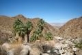 | Fortynine Palms Oasis The 3-mile round trip hike visits a cool desert oasis. |
 | Indian Cove The 101-site campground is home to a 0.6-mile interpretive trail and endless bouldering and rock climbing opportunities. |
 | Mastodon Peak This 2.6-mile loop visits a 3,400-foot summit with panoramic views of southeastern Joshua Tree. |
 | Lost Palms Oasis This 7.2-mile hike visits a desert oasis nestled between mountains in the southeast corner of the park. |
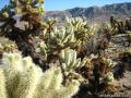 | Cholla Cactus Garden This quarter-mile loop allows visitors to stroll through an intense concentration of cholla cacti. |
 | Hikes in the California Desert Explore more trails in Death Valley National Park, Joshua Tree National Park, Anza-Borrego Desert State Park, and Mojave National Preserve. |
 | Silver Peak in Mojave National Preserve This 8.5-mile hike summits a 6,365-foot peak in the Granite Mountains. |
 | New York Peak in Mojave National Preserve This 7 to 9-mile round trip hike summits the highest point of the New York Range in the northeast corner of the preserve. |
 | Wildrose Peak in Death Valley National Park This 8.4-mile hike summits a 9,064-foot peak in the Panamint Mountains north of Telescope Peak. |
 | Mount Waterman The 5.5 to 6 miler can be completed as an out and back hike or a loop, traveling through a pine forest to a round summit. Add six miles to the hike by dropping across a saddle and climbing to the summit of Twin Peaks. |
 | Mount Baldy in the Angeles National Forest This 11.3-mile hike incorporates Devil's Backbone and Baldy Bowl - Ski Hut Trail into one see-all loop. |
 | Joshua Tree Campgrounds Nine campgrounds with 500 total sites are spread throughout the park to facilitate your visit. |
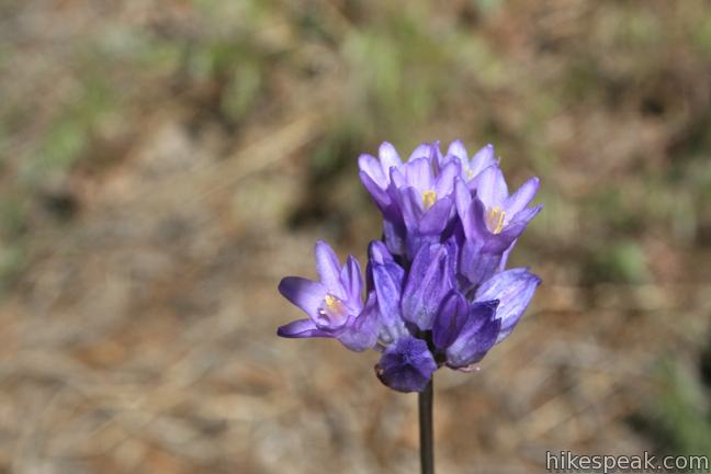
 | Joshua Tree Wildflowers The desert in bloom is something any outdoor enthusiast in California should see. |
Common Questions about Warren Peak in Joshua Tree National Park
- Is the trail open?
- Yes. You should expect to find that Warren Peak Trail is open. There are no recent reports of trail closures. If you discover that the trail is closed, please help your fellow hikers by reporting a closure.
- Do I need a permit for this hike?
- Yes. National Park Entrance Fee.
- How much time does this hike take?
- It takes approximately 3 hours to hike Warren Peak Trail. Individual hiking times vary. Add extra time for breaks and taking in the views.
- How long is this hike?
- The hike to Warren Peak Trail is a 5.5 mile out and back with 1000 feet of elevation change.
- Are dogs allowed on this trail?
- No, dogs are likely not allowed on Warren Peak Trail. The trail is primarily open to hikers.
- Does this trail go to a summit?
- Yes, Warren Peak Trail reaches a summit with panoramic views.
- Where is the trailhead located?
- The trailhead for Warren Peak Trail is located in Yucca Valley, CA.
Trailhead Address:
9800 Black Rock Canyon Road
Yucca Valley, CA 92284
Trailhead Coordinates:
34.07155, -116.3909 - What are the driving directions to the start of the hike?
To get to the trailhead: From Route 62 in the city of Yucca Valley, turn south on Joshua Lane (5.8 miles west of the intersection with Park Boulevard). Drive 4.6 miles to the end of the road and turn right onto San Marino Drive, which curves to the left and becomes Black Rock Road. Go up this pothole-filled road for a mile to reach Black Rock Campground. Park at the visitor center and find the start of the trail next to campsite 30.
View custom Google Maps directions from your current location.
- Are there other trails near Warren Peak Trail?
- Yes, you can find other nearby hikes using the Hikespeak Hike Finder Map.

9 Comments on Warren Peak in Joshua Tree National Park
What hikers are saying:
✨ Generated summary of user commentsHikers find this trail to be a rewarding challenge with spectacular summit views that make the effort worthwhile. The path primarily follows a sandy wash, providing a strenuous workout for those navigating the soft terrain. Pete warns that official maps can be misleading because some marked trails do not exist while other unmarked paths crisscross the area. Visitors should tread lightly to protect the fragile habitat while enjoying the scenic ridges.
“The view from the summit is spectacular.” Jump to comment ↓
“I didn't realize the entire hike was in a sandy wash but it turned out to be a great workout” Jump to comment ↓
Thanks so much for this! I did the hike today and followed your step-by-step instructions which were great. You can see my photos here: https://www.avoidingregret.com/2012/08/photo-essay-warren-peak-black-rock.html
Great hike. I didn’t realize the entire hike was in a sandy wash but it turned out to be a great workout and the views from the peak were awesome!
[…] For a more adventurous and strenuous hike, we recommend the Warren Peak hike accessible from Blackrock Campground […]
This has become one of my favorite hikes, ever since I bought a fixer upper shack in the area, so I can spend winters in a warm place away from Alaska. Because it has become something like a work-out routine, additional features got noticed. Among them trails not shown on any map. Here it should be noted, that not all trails shown on the map above actually exist, while others are not marked, which can be misleading.
For instance, the trail indicated to drop from Warren summit down the its western slope, connecting with the Little Long Canyon trail below, is an illusion. On the other hand, a large part of what is officially known as the West Loop Trail is not on this map. The missing part veers pretty much straight West near the halfway point on the red trail indicated, and eventually meets the trail mistakenly shown as a loop off Warren Peak.
To incorporate the Warren Peak excursion into what could be termed a “little grand hike”, one can begin with the Panorama Loop, then continue up Warren Peak and instead of returning the official way, continue from the summit along its northern ridge (there is a small but definite trail). Paying attention, you’ll find where that one meets the West Loop Trail at its highest point (a pass). Cross the WL trail and continue along another faint and soon improving trail up to a distinct ridge, prominently shown on the map, snaking W to E. The trail follows that ridge over a distinct high point, a little peak in its own right. Continue E along the ridge to another high point. On the map you’ll note a short ridge dropping off to the N. Follow that, it’s steep, but manageable. Next you’ll meet the little scenic loop trail, which you can follow counter-clockwise and connect back to the campground. Or you can do a short-cut to the campground, going E right where these trails meet. Because all this is fragile habitat, one must be cautious to tread lightly to preserve Nature the way we like her.
This could possibly be considered a rather strenuous loop, covering about 8 or so miles, but offers plenty of great scenic views from higher ridges and rewarding summits and just as many excuses to break for a snack. Enjoy:-)
(Send me a note, if you’d like a map with all those trails marked in detail).
Hello Pete,
This is John Bauman and I did not get any contact information from you when you called so if you get this, please call or email us again. Thanks J.B.
Hi Pete,
Spent 25 years in Alaska, we have a mutual friend in Nick Parker…living in Big Bear now…Yes, I would like a map with details for this weekend if possible.
Cheers,
Nat
Hi Nat,
Sorry for the very late response. I only looked at this site by accident, while looking for something else. Indeed do I know Nic Parker. How do we proceed from here to get you a map?
Really nice hike, especially in mid-80s weather like it was yesterday. The area is full of unmarked horse trails, and the park markings are getting a bit hard to read, but you have to work at it to get lost. The view from the summit is spectacular. Black Rock Campground is a great base for a number of interesting hikes including another summit, Eureka Peak with similar views.
[…] Warren Peak Trail has an elevation gain of 1,105 feet and can be accessed from Black Rock Canyon Road. The trailhead coordinates are 34.07155, -116.3909, as mentioned by Hikespeak. […]