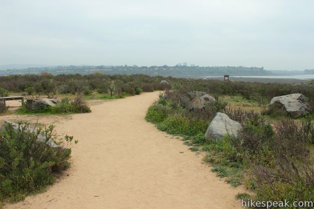
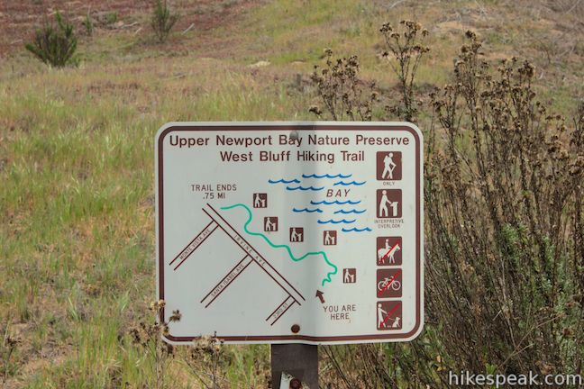
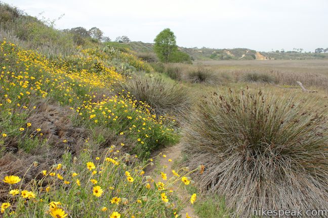
Newport Bay is a vital stopover for birds migrating across Southern California. Hikers can explore the estuary too, on trails in Upper Newport Bay Nature Preserve, a 142-acre coastal habitat managed by the Orange County Parks Department. The preserve’s West Bluff has a few trails (some open to equestrians and bikers) that provide easy hikes of a mile or more, including the 2.5-mile loop described here, which combines trails above and below the bluff for a variety of views across Upper Newport Bay and just 75 feet of elevation change.
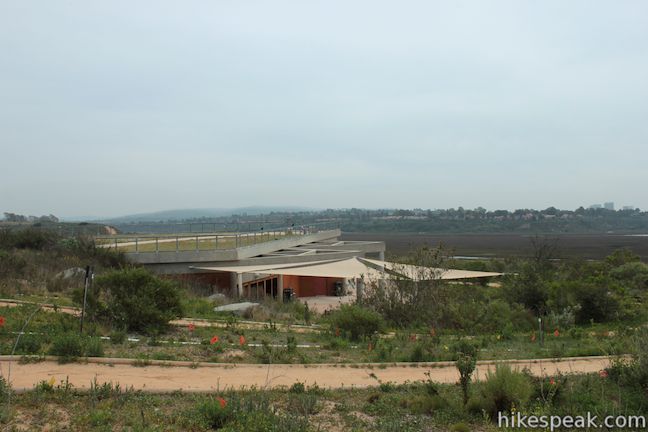
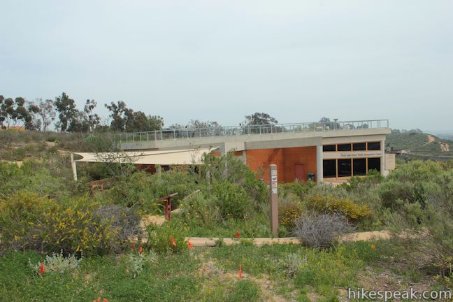
Your first stop in Upper Newport Bay Nature Preserve should be Peter and the Mary Muth Interpretive Center. Even through the center is just a tenth of a mile from the parking lot, you won’t be able to spot it at the start because the Muth Interpretive Center is built nearly seamlessly into the side of West Bluff in architectural harmony with the surroundings.
To get to Mary Muth Interpretive Center, simply follow the trail heading southeast from the parking area. Three trails leave from the parking lot. The trail to the interpretive center is the one that is closest to the entrance.
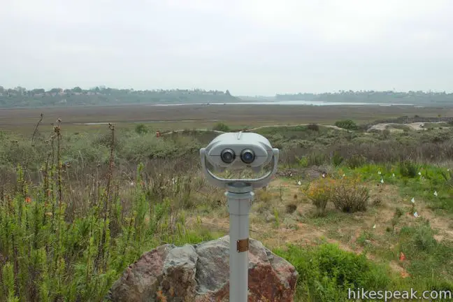
The trail quickly winds down alongside the Muth Interpretive Center. Step inside to learn about the plants and animals in Upper Newport Bay Nature Preserve (and pick up a field guide if you would like one). The large center is like a classroom for learning about the nature preserve. Outside, there is a viewing scope that allows you to closely examine the islands and waterways in Upper Newport Bay.

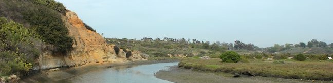
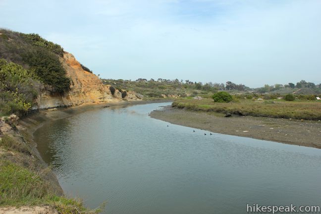
Continue south past the center on a path down to Delphi Channel, a waterway flowing into Upper Newport Bay. The trail turns right, running parallel to the channel up to a split. The path continuing along the channel is closed to the public for restoration, so angle to the right, ascending to West Bluff Trail, the main hiking trail through the park.
To the right, West Bluff Trail goes 0.15 miles back to the parking lot. This can be used as your return route at the end of the hike (or as an alternative for those who don’t want to visit the Muth Interpretive Center and Delphi Channel). For now, turn left and follow the trail as it curves to the right up a draw in the bluff.
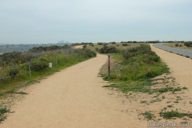
After 0.15 miles, you will come to a junction with a connector to the nearby Bayview Trail, which allows bikers and equestrians to circle around the perimeter of the park along Irvine Avenue. Stay to the left as the trail heads southwest toward one of the fine scenic overlook along the trail.
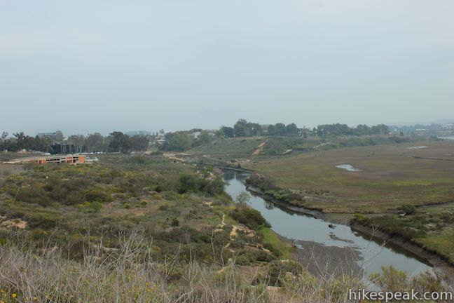
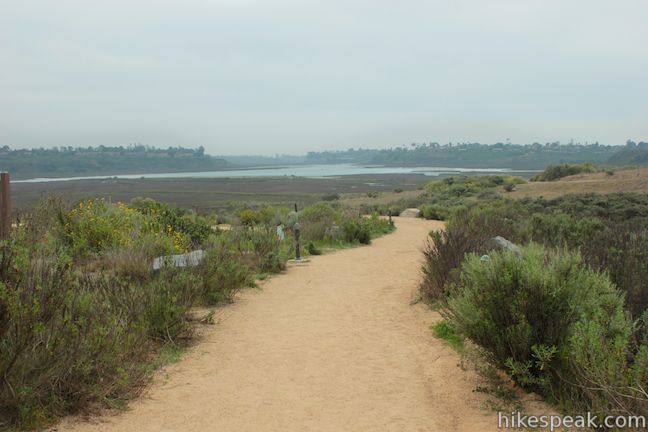
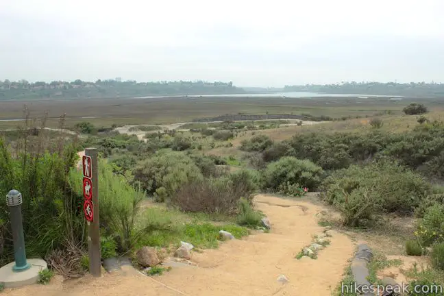
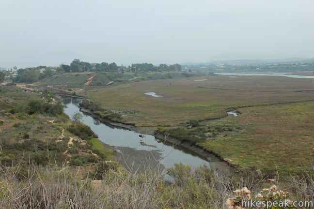
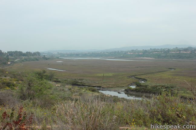
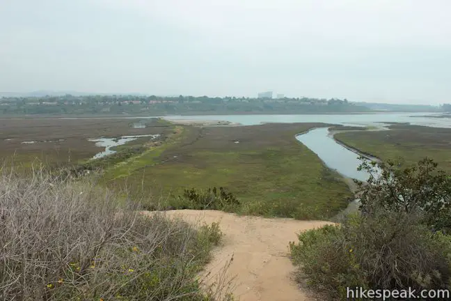
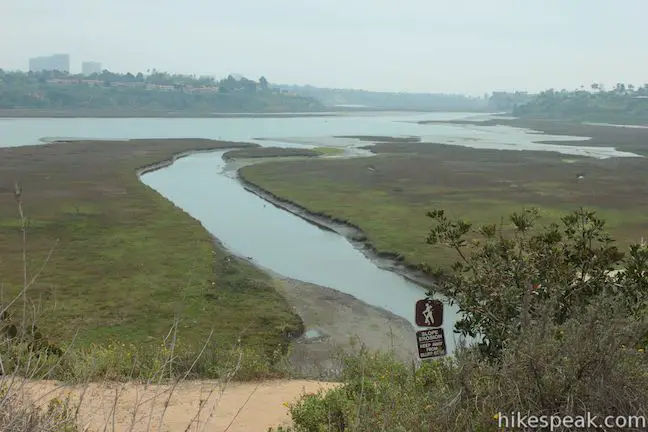
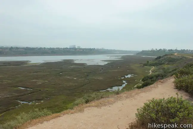
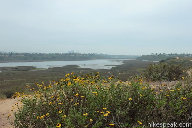
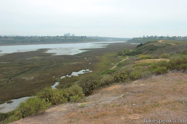
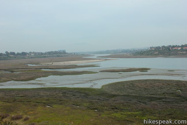
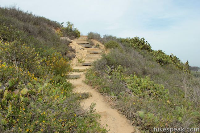
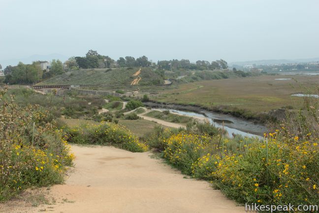
After another 1/8 of a mile, come to the first scenic overlook, half a mile from the start, which offers broad views over Upper Newport Bay and doubles as a trail junction. West Bluff Trail continues to the right along the top of the bluff, while a set of wooden steps lead off the bluff down to a narrower trail across the flats at the base of the bluff. The 2.5-mile hike covered here uses this lower trail as a return route after first hiking to the end of West Bluff Trail. A panel at the scenic overlook describes the human history of Upper Newport Bay:
Foreign visitors in and around the bay began in the late 1700s with the arrival of the Spanish Missionaries. The earliest known name for Newport Bay was Bolsa de Gengara, a Spanish name derived from the nearby Indian site. French-American colonists even stayed here in the late 1790s on their way from Boston to Oregon. Over the next two centuries, the land would change dramatically and luckily, in the 1970s, the bay was saved from becoming completely developed for recreation and residential areas.
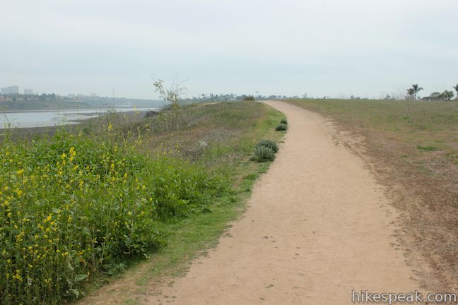
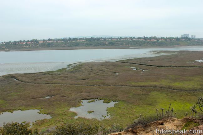
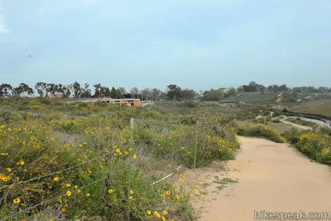
Continue hiking along West Bluff Trail. The wide dirt trail heads west and meets Bayview Trail. Turn left along the paved bike path and walk 0.05 miles to a split where West Bluff Trail resumes. Turn left on West Bluff Trail and hike out along the edge of the bluff to another viewpoint, 0.75 miles from the start. This overlook has a panel describing the restoration of Upper Newport Bay. Coastal sage is one plant the park is attempting to restore:
Costal sage is found on the bluff slopes and barrancas [ravines or precipices] surrounding the bay. Once widespread in southern California, over 90% of this habitat has been lost.
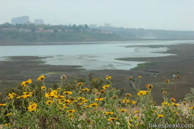
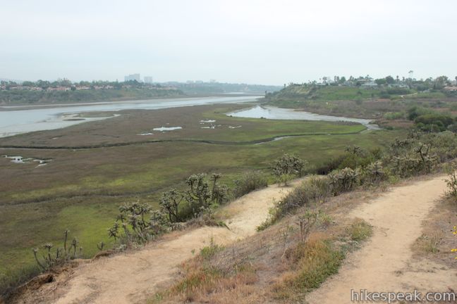
The panels along West Bluff Trail are positioned at scenic spots, so if you don’t want to read them, you can just admire the views across the bay. Another overlook with a panel comes a little farther down the trail. This panel describes Newport Bay’s important roll in bird migration.
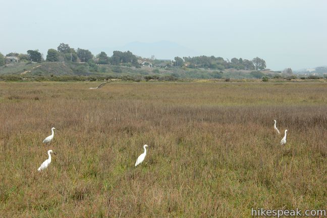
Each year, more than 56,000 birds traveling along the North American Pacific Migratory Route visit Upper Newport Bay. They are attracted by the “stopover” opportunity to feed, roost, breed, or merely rest during their long journey.
With California’s wetlands disappearing at an alarming rate, the preservation of Upper Newport Bay as a migratory stopover is critical. Some birds travel thousands of miles from breeding areas in North America to warmer wintering grounds in the southern parts of the US and South America. Without the bay as a stopover, many bird species might not be able to make their long journey.
August through April is consider the best season for spotting migrating birds, so if you visit Upper Newport Bay Preserve in the winter, you should see some interesting birds passing through. Other birds are permanent residents of Upper Newport Bay, so you’ll have birds to see year round.
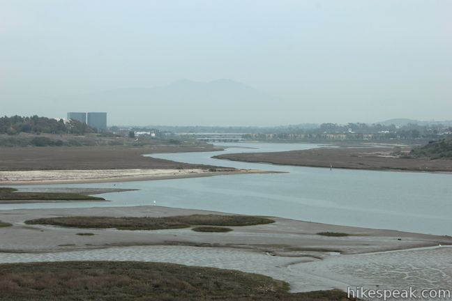
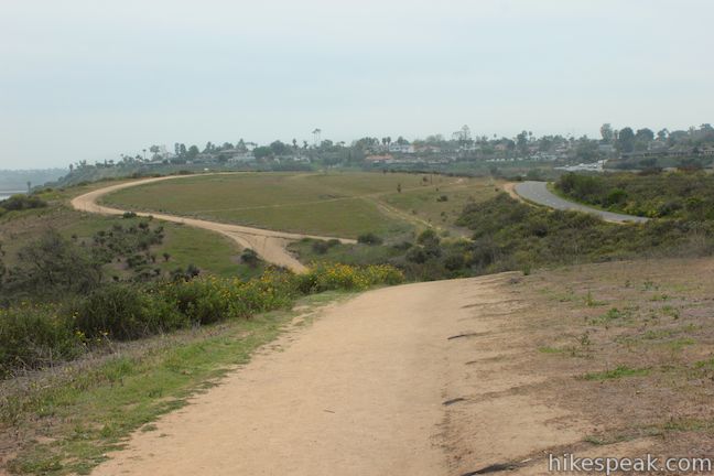
Just past the migration viewpoint, you’ll come to another trail junction, 0.85 miles from the start. Continue straight along West Bluff Trail, unless you want to turn right and loop back to the start on Bayview Trail. West Bluff Trail proceeds southwest along the bluff, opening up newer views down the bay toward the developed harbor on the coast. You will cross a prominent dip in the terrain a mile from the start and come to another junction. The trail to the right connects back to Bayview Trail, so turn left to continue down West Bluff Trail. You will soon arrive at one more great viewpoint with a panel describing park wildlife:
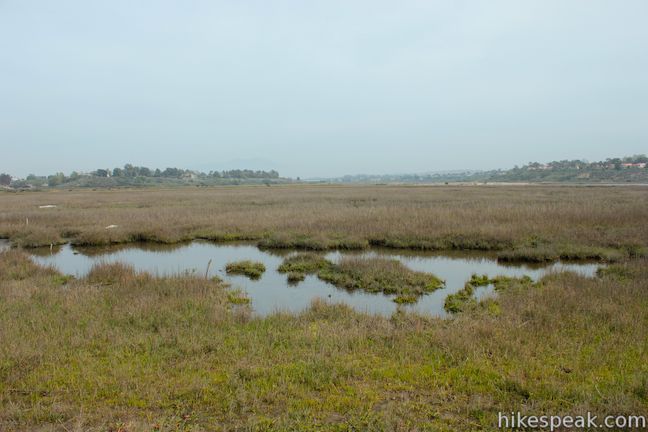
Several different habitats are found in and around Upper Newport Bay allowing for a wide variety of wildlife. Marine life is abundant in the open water of the bay. The mudflats, exposed at low tide, are host to numerous worms, mollusks and other marine creatures. The wetland habitat includes fresh and salt water marshes and serve as critical components for many birds and animals. Coastal sage scrub, on the bluffs around the bay, host coyote, deer mice, numerous snakes, lizards, rabbits, skunks, and the California ground squirrel. Other animals living in and around the bay include raccoons, opossums, burrowing owls, and even our local bobcats!
That’s right, bobcats have been observed here, even through Upper Newport Bay is enclosed by the communities of Newport Beach and Costa Mesa. Don’t fret though, bobcats are much smaller and less aggressive than mountain lions.
A short distance past the wildlife panel, you will come to a split. West Bluff Trail continues straight ahead, while another path bends off to the right. If you take the detour this way, you can follow steps down to a fenced in area where there are a few more information panels. Beyond the panes, a path quickly returns you north to West Bluff Trail. From there, it is just a short distance to the end of West Bluff Trail.
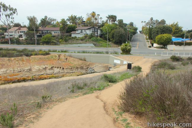
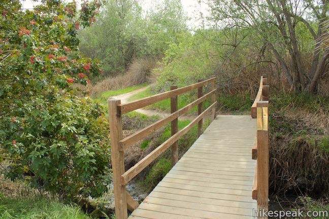
West Bluff Trail descends to a creek where it meets both Bayview Bike Trail and a trail descending along the creek toward points below the bluff. At this point, 1 1/3 miles from the start, you have a few options for how to get back. Option one would be to turn around and hike back on West Bluff Trail. Option two would be to turn right up the dirt trail alongside Bayview Bike Trail and follow that back to the start (although that would mean hiking along the roadway with few views). The most enjoyable option is to circle back on the trail below the bluff. To reach that trail, turn left and walk down the wide trail on the left side of the creek, which appears to be filled by runoff water from a small lake in the neighborhood above.
Descend along the creek to a T-junction. To the right. a trail crosses a footbridge and continues toward the south end of the nature preserve. If you turn this way, you could extend your hike with one extra loop. Otherwise, turn left and follow the single track northeast below the bluff.
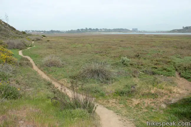
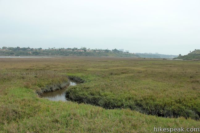
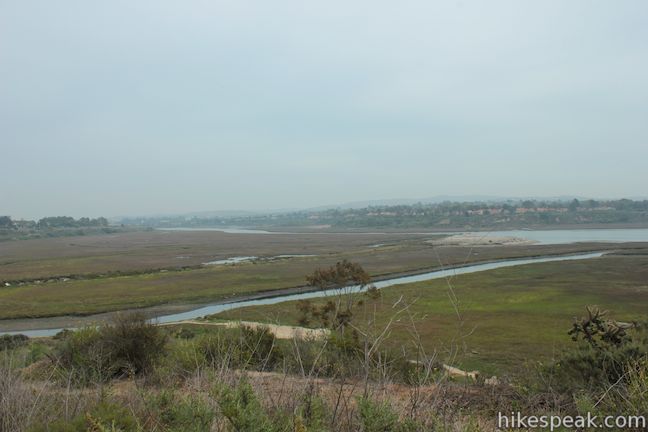
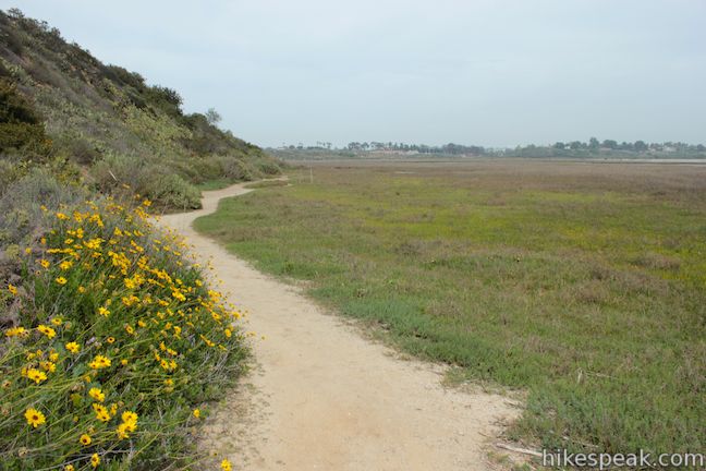
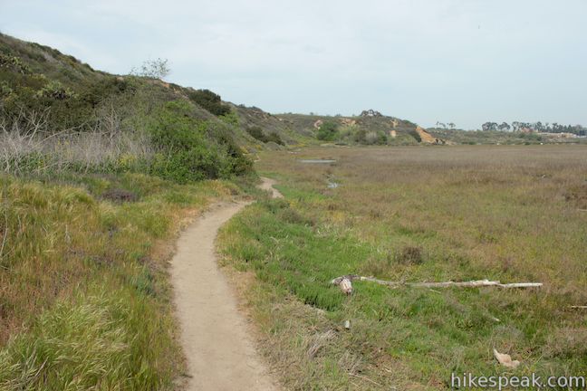
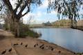
You might find a few wet spots on this trail after it rains because the trail borders the mudflats and grassy areas on the edges of Upper Newport Bay Preserve. Now beneath the bluff, you will get a close view of the streams flowing through the estuary and spot smaller pools in the grasses where birds like white herons gather. As you hike along this track, who will definitely get a more intimate experience of the bay, away from the traffic and road noise above the bluff.
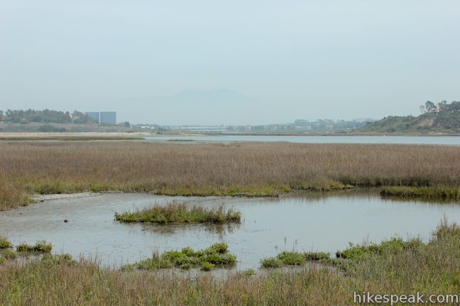
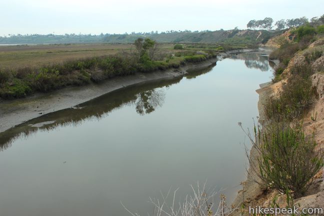
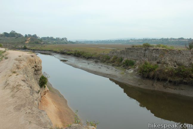
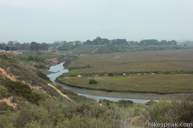
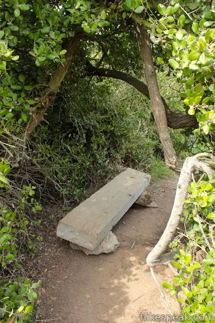
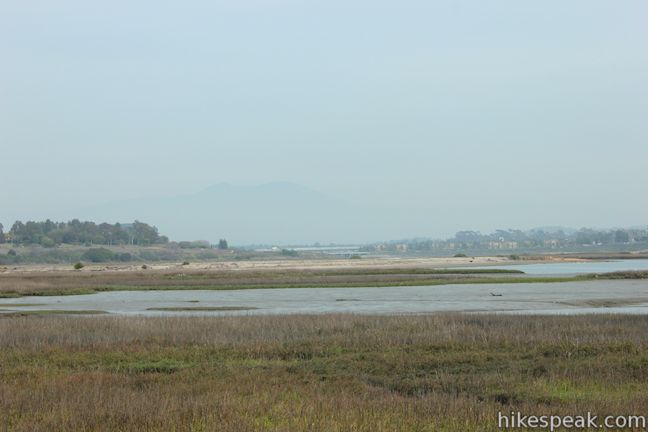
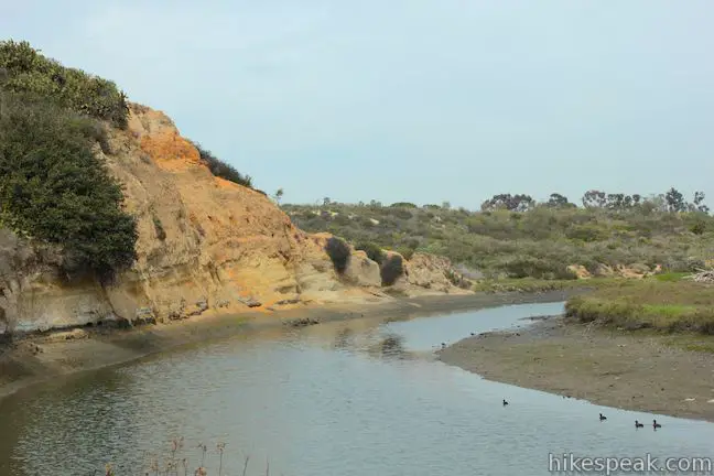
After 0.3 miles, you will pass a makeshift bench built in one of the few shaded spots along the trail. Just after the bench, stay to the right past a path heading back up the bluff. After another 0.3 miles, you will reach the banks of Delphi Channel, at a bend in the creek where it cuts into the orange soil of the West Bluff. This is a nice place to watch the ducks on the water and look back over the bay. In addition to birds, you will see a lot of planes flying over the nature preserve that take off from nearby John Wayne Airport.
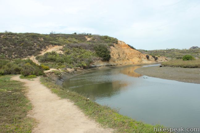
Delphi Channel blocks any additional progress below the bluff, so follow the trail as it goes back up, using the wooden steps that you probably spotted earlier near the scenic overlook with the panel on the history of Upper Newport Bay.

When you return to West Bluff Trail, turn right and follow the trail for just over 0.4 miles back to the parking lot. When you meet the other trail down to Delphi Channel and the Muth Interpretive Center, remember to stay to the left and follow West Bluff Trail for the final 0.15 miles to the trailhead parking area.
Upper Newport Bay Nature Preserve is open daily from 7 a.m. to sunset. The Muth Interpretive Center is open Tuesday through Sunday from 10 a.m. to 4 p.m. (closed Mondays). Dogs are allowed on leashes on the hiking trails in Upper Newport Bay Nature Preserve. The parking lot is free and no permit is required to hike West Bluff Trail, so get out and enjoy!
To get to the trailhead: From the 405 Freeway in Irvine, take Route 55 south for two miles to the Del Mar Avenue exit. After merging onto Newport Boulevard, drive two blocks and turn left onto Fair Drive. After one block, Fair Drive becomes Del Mar Avenue (continue straight) and half a mile later, Del mar Avenue becomes University Drive (continue straight). Cross Irvine Avenue and make the next right into the parking area for Upper Newport Bay Nature Preserve.
Trailhead address: 2301 University Drive, Newport Beach, CA 92660
Trailhead coordinates: 33.654468, -117.886134 (33° 39′ 16.08″N 117° 53′ 10.08″W)
You may also view a regional map of surrounding Southern California trails and campgrounds.


 | Lake View Loop & East Ridge Overlook This 3.65-mile loop expands on the 2.7-mile Lake View Loop with a small loop to the high point of Peters Canyon Regional Park. |
 | Lake Huntington This level and easy 3/4-mile loop circles a small lake in Huntington Beach Central Park. |
 | Geology Discovery Trail This 9-mile loop in Crystal Cove State Park follows guide markers exploring geology in the beautiful backcountry of this Orange County wilderness. |
 | Moro Beach This 2-mile round trip hike ventures down Moro Canyon to a picturesque beach in Crystal Cove State Park. |
 | Little Sycamore Canyon - Serrano Ridge - Camarillo Canyon - Stagecoach South Trails Loop This 5-mile loop uses four trails to explore two canyons and a ridge in Laguna Coast Wilderness Park. |
 | More hikes in Southern California Explore more trails in Orange, Riverside, San Bernardino, and San Diego counties. |
Hidden gem? Good hike with the lagoon, marshlands, loose soil…and some traffic zooming by near some part of the trail! Lower bluff trail was closed for renovation. Make sure to check before you go.