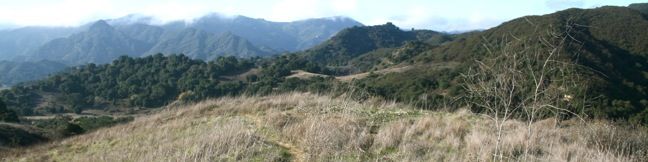
Talepop Loop explores the north end of Malibu Creek State Park through a region long inhabited by Chumash Indians who had a village here named Talepop. Hikers today are exposed to signs of modern humanity like ranches and electric lines, but despite being suspiciously close to two major roadways, Talepop Trail escapes the man-made world to explore a beautiful patch of the Santa Monica Mountains. While on the trail, hikers are nearly as likely to hear a red-tailed hawk crying overhead as the Chumash were centuries ago. This scenic 4.75-mile lollipop loop with 500 feet of elevation gain incorporates four different trails to create a surprisingly enjoyable hike.
The basic directions for Talepop Loop are:
- Hike north from Mulholland Highway on North Grassland Trail (0 miles)
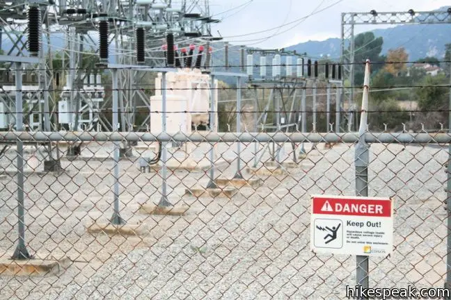
- Follow the trail on a bit of paved road to get around a substation (0.3 miles)
- Cross Liberty Canyon Creek, reach a junction with Liberty Canyon Fire Road and turn left (0.75 miles)
- Leave Liberty Canyon Fire Road and turn left up Talepop Trail (0.95 miles)
- At the end of Talepop Trail, turn right on Las Virgenes Fire Road (2.7 miles)
- Complete the loop and turn left onto North Grassland Trail (4 miles
- Return to Mulholland Highway (4.75 miles)
Hiking Talepop Loop
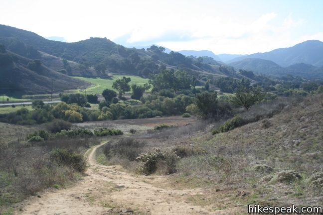
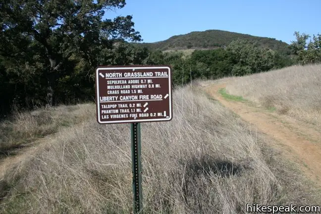
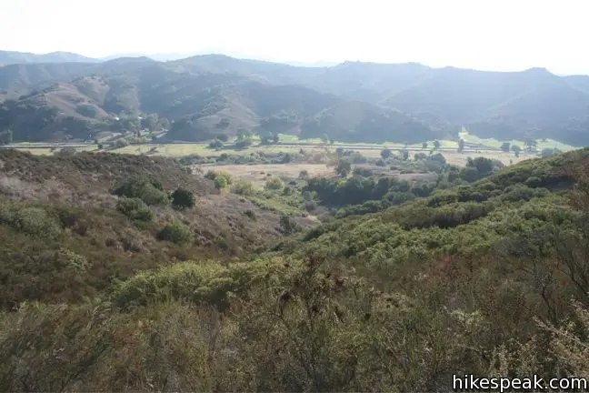
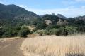
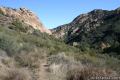
Start out up North Grassland Trail from a trailhead on Mulholland Highway, just west of Las Virgenes Road. This level single-track heads north away from the center of Malibu Creek State Park. Ahead, Las Virgenes Canyon and Liberty Canyons separate in the shape of a V. Talepop Loop offers level hiking in the bellies of both wide canyons, with a more intimate and elevated trek across the mountain in between.
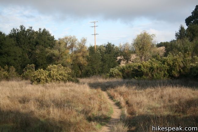
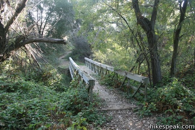
After 0.3 miles, North Grassland Trail circumnavigates an obtrusive electrical substation, briefly joining a paved road to get to the other side. From here, Grassland Trail continues north looking much the same as it did before the substation. Fields are to the left and a wooded creek is to the right. A sudden hairpin turn brings hikers down to an alluring bridge that crosses Liberty Canyon Creek. Just beyond the bridge, and 0.75 miles from the start, North Grassland Trail comes to an end at a T with Liberty Canyon Fire Road. This is the beginning of the loop portion of the hike, so you may proceed in either direction.
To the left, Talepop Trail is just 0.2 milers away. Since you are probably ready for something other than level terrain, turn left and get straight to it.
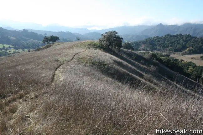
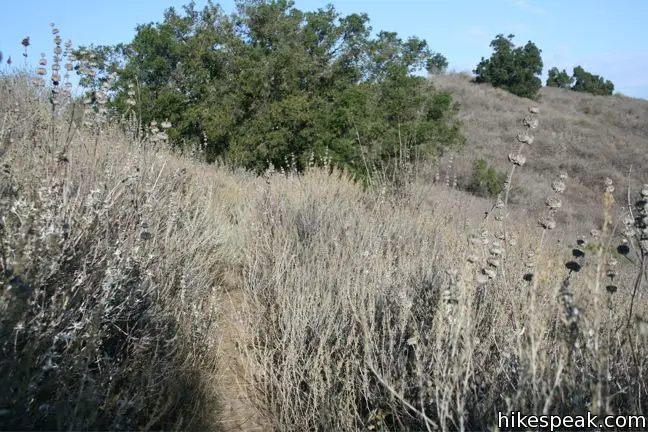
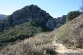
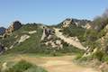
At the next junction, turn right onto Talepop Trail, taking this narrow single track up a grassy slope. Prepare to be impressed! After hiking past the substation and being subject to the pervasive sound of motorists, the trail enters a wilderness space that feels immediately more remote. As you ascend a grassy ridge, Talepop Trail becomes so thin as to make you think you are one of the first hikers to even trek this way.

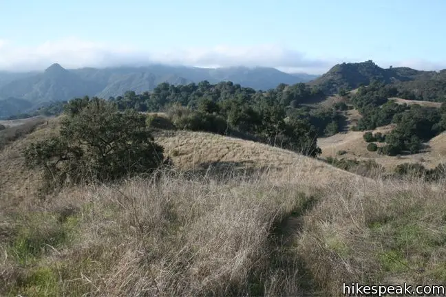
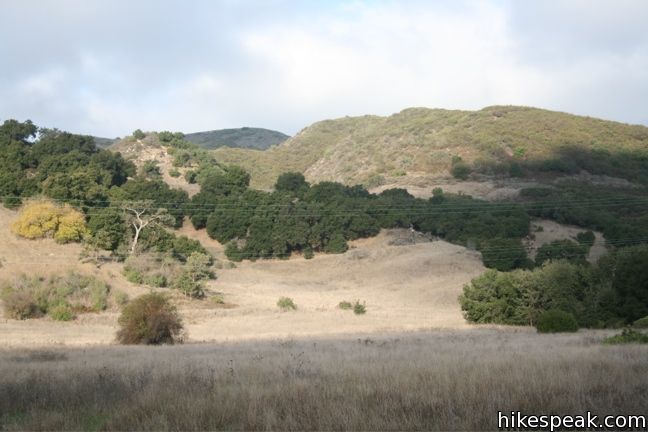
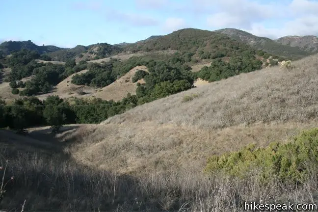
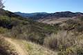
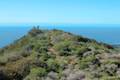
After gaining the ridge, Talepop Trail turns left and continues to climb. Be sure to check your rearview mirror as the best views may be behind you. Sights expand to the south toward Castro Peak and the Santa Monica Mountains. Talepop Trail ascends 400 feet over half a mile before tapering out. The now tremendously overgrown trail continues north across an undulating ridge. Shoulder high brush crowds the trail; you will definitely want to wear long pants on this one, or expect to have your legs scratched.
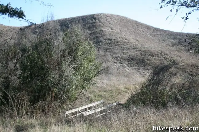
Lost Hills and the 101 Freeway come into view as you descend the northern slope, curving east toward Las Virgenes Canyon. Songbirds sing and play in the brush along the trail, and this is clearly an area beloved by wildlife. In total, Talepop Trail is 1.75 miles long, reaching a high elevation of 1,065 feet before coming to an end at a meeting with Las Virgenes Fire Road.
The junction is somewhat puzzling because the sign for Talepop Trail is set back a hundred feet from the fire road. If you were to hike the loop in the opposite direction, you could easily miss the sign completely. Those hiking up Las Virgenes Fire Road to Talepop Trail should look for an immense oak in front of a small trail breaking off to the left. If you come to a wooden bridge crossing the creek, you just missed it.
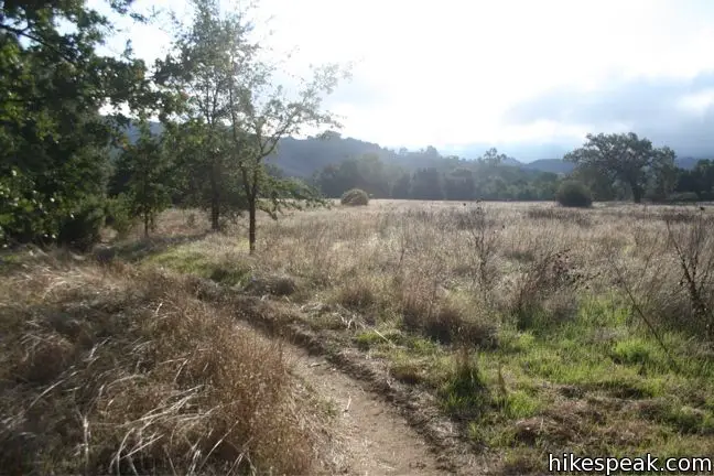
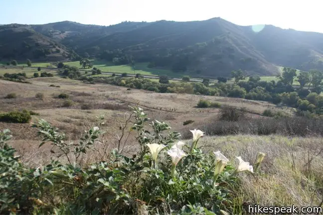
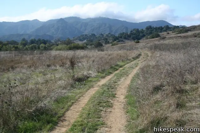
The junction is not confusing as you hike down Talepop Trail to Las Virgenes Fire Road. Simply turn right and follow the jeep trail for 1.3 miles as it journeys south and eventually west. The trail is level and in sight of well-traveled Las Virgenes Road. The hiking is easy, and while the views aren’t as good as those up on Talepop Trail, the surrounding landscape is still satisfying. Las Virgenes Fire Road joins Liberty Canyon Fire Road at the junction with North Grassland Trail, completing the loop.
Hike back out on North Grassland Trail to complete this refreshing 4.75-mile hike through a picturesque parcel of the Santa Monica Mountains. On the other side of Mulholland Highway, South Grassland Trail ventures south toward Crags Road in Malibu Creek State Park. If you haven’t yet been to Rock Pool, Century Lake, and the old MASH set, you should hike that way next. No fee or permit is required to hike Talepop Loop, so get out and enjoy.
Woolsey Fire Update: Talepop Loop and most of Malibu Creek State Park have reopened following the November 2018 Woolsey Fire, which burned through the park. Check the Malibu Creek State Park page for more information.
To get to the trailhead: Take Las Virgenes/Malibu Canyon Road to the intersection with Mulholland Highway, 6.3 miles from the coast and 3.3 miles from the 101 Freeway in Lost Hills. Turn west at the light on Mulhollad Highway and drive 0.15 mile to the trailhead on the right. Street parking is available on the both sides of the road.
Trailhead address: 26989 Mulholland Highway, Agoura Hills, CA 91301
Trailhead coordinates: 34.10353, -118.7137 (34° 06′ 12.7″N 118° 42′ 49.3″W)
View Santa Monica Mountains in a larger map
Or view a regional map of surrounding Los Angeles trails and campgrounds.


 | Grassland Trail to Crags Road and Rock Pool This easy 3-mile hike enters Malibu Creek State Park on South Grassland Trail, then forms a loop around Crags Road to visit Rock Pool, a popular park retreat. |
 | Las Virgenes View Trail This 4.95-mile hike patiently weaves its way across hills along Las Virgenes Road and rises up a canyon to ridgetop views over Malibu Creek State Park and mountains in Calabasas. |
 | Malibu Creek Traverse This adventure hike explores the C-shaped gorge between Rock Pool and Century Lake in Malibu Creek State Park. |
 | Phantom Trail This 4.8-mile round trip hike crosses a panoramic ridge on the north side of Malibu Creek State Park. |
 | Cistern, Lookout, and Cage Creek Trails This team of single tracks make a scenic descent to Century Lake in Malibu Creek State Park, providing a short loop or longer hikes to other destinations. |
 | Lake Vista Trail This 4.1-mile hike crosses the west end of Malibu Creek State Park and climbs to a scenic view over Malibu Lake. |
 | M*A*S*H Set This hike visits the site where the exteriors of the television show MASH were filmed, a 4.75-mile trek from the park entrance. |
 | Lost Cabin Trail This 1.5-mile round trip extension to the MASH set hike dead-ends in a mountain canyon at the site of a now nonexistent cabin. |
 | Mesa Peak from Corral Canyon Road This 6.5-mile hike travels along a ridge adorned with sandstone outcroppings to approach a peak with ocean views over Malibu. Shorten the outing to 5.35 miles round trip by stopping at a crest above Mesa Peak with a prominent boulder. |
 | Mesa Peak from Malibu Canyon Road (Piuma Trailhead) This 6.5-mile round trip hike ascends 1,375 feet up the Backbone Trail from Malibu Creek State Park to a subtle summit with substantial ocean views. |
 | More trails in the Santa Monica Mountains Explore other destinations in the range. |
 | Zuma Canyon Ocean View Trail - Canyon View Trail Loop This 3.1-mile loop demands more effort than Zuma Canyon Trail and provides great ocean and canyon views. |
 | Corral Canyon This 2.5-mile loop offers ocean and canyon views from a unspoiled section of the Santa Monica Mountains in Malibu. |
 | Temescal Canyon This 2.6-mile loop offers a variety of scenery and decent exercise, despite its relative brevity. |
 | Runyon Canyon Tour Hollywood's most popular dog park on loops of various lengths, offering good exercise and views over Los Angeles. |
 | Sandstone Peak This 6.25-mile loop summits the tallest peak in the Santa Monica Mountains. |
 | Malibu Creek State Park The year-round campground has 63 sites with picnic tables, fire rings, flush toilets, coin showers, and a dump station. |
Excellent spring hike. Lots of wildflowers along the trail. I’d not do this trail after June, as flowers will be gone, grass will be tall, and ticks will own the place. But for a spring hike, this one has a lot of payoff. Great vistas, fields of flowers, lots of sages along some parts. Both beginning and end of the hike is open grassland, plenty hot in mid-day. But in March it is perfection.