Summit to Summit Motorway
in the Santa Monica Mountains
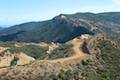
Summit to Summit Motorway is a 3.2-mile road along a ridgeline between the high points of Old Topanga Canyon Road and Topanga Canyon Boulevard (hence the name Summit to Summit). Less than half a mile of the road is paved and the rest is packed dirt perfect for hiking, biking, or jogging. At the northeast end, Summit to Summit Motorway finishes across from Top of Topanga Overlook, a park with views across the San Fernando Valley. At the southwest end, Summit to Summit Motorway is opposite Calabasas Peak Motorway, which offers another hiking opportunity.
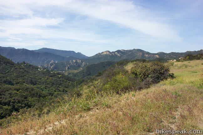
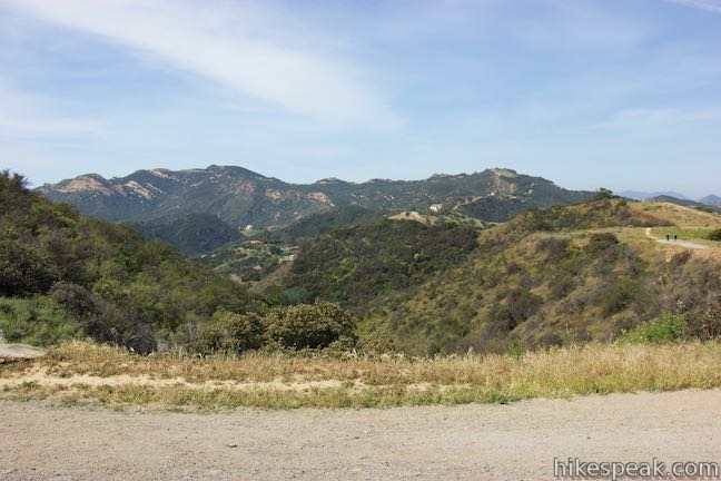
Summit to Summit Motorway can be hiked as a point-to-point trek with the use of an impractical car shuttle. Starting from Old Topanga Canyon Road, go beyond the end of the motorway to visit Top of Topanga Overlook for a 6.6-mile hike. You may also wish to turn around at a landing just before the final paved descend to Topanga Canyon Boulevard for a 6-mile round trip hike from Old Topanga Canyon Road. With less time, you could hike about two miles round trip and grab many of the hike’s biggest views. There is 245 feet of rolling elevation change between the high and low points of Summit to Summit Motorway. Thanks to lofty access points, there are panoramic views over Topanga and the rest of the Santa Monica Mountains for much of the hike.
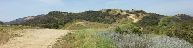
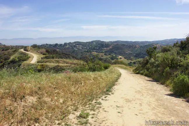
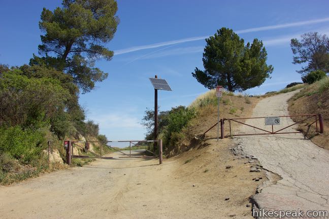
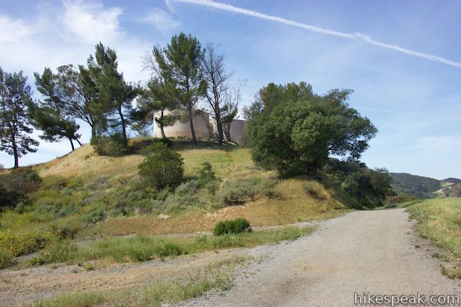
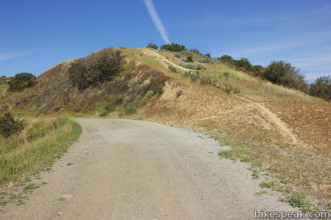
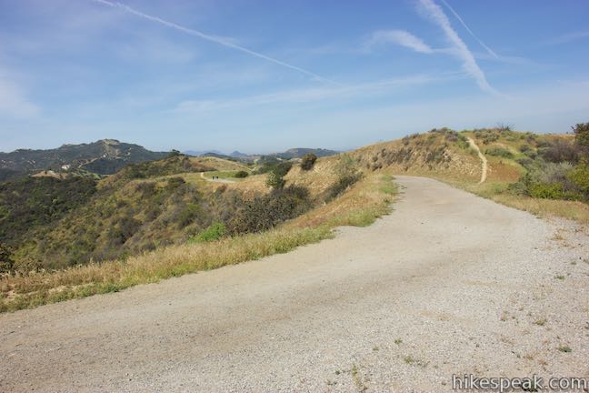
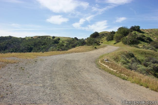
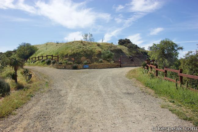
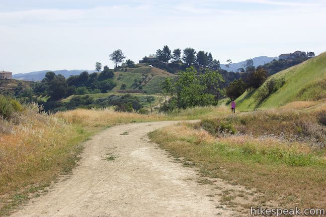
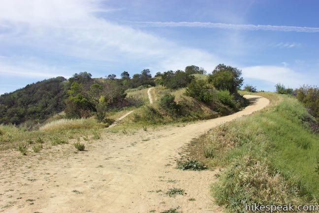
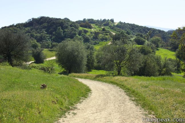
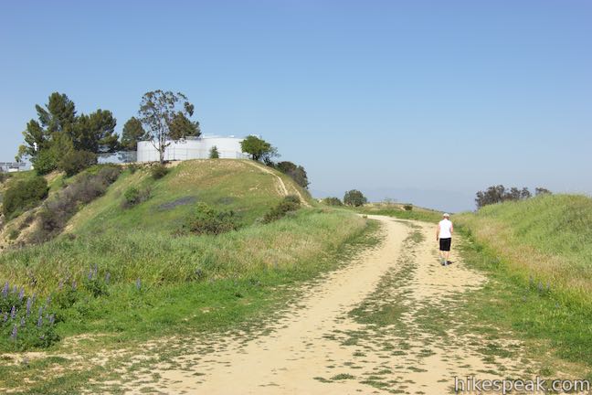
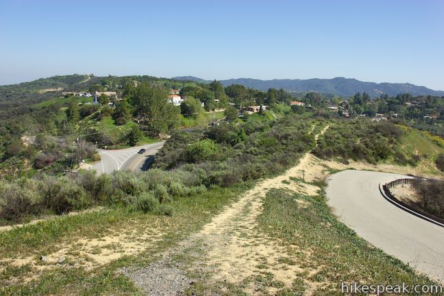
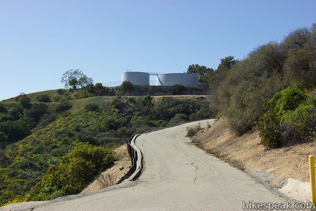
While you can start Summit to Summit Motorway from either end, these directions begin from Old Topanga Canyon Road, where it is easy to park on a less busy road. A sign for Summit to Summit Motorway, marks the start of the wide dirt road where it leaves Old Topanga Canyon Road (Calabasas Peak Motorway is just across the road heading southwest). Don’t try to go up the road to the right of Summit to Summit Motorway, which ascends to holding tanks. Instead, take the gradual Summit to Summit Motorway behind the brown gate.
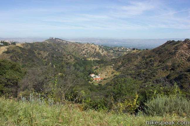
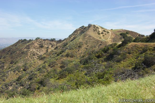
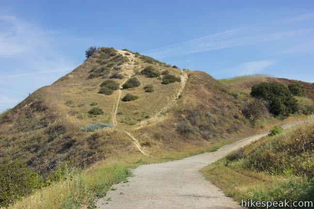
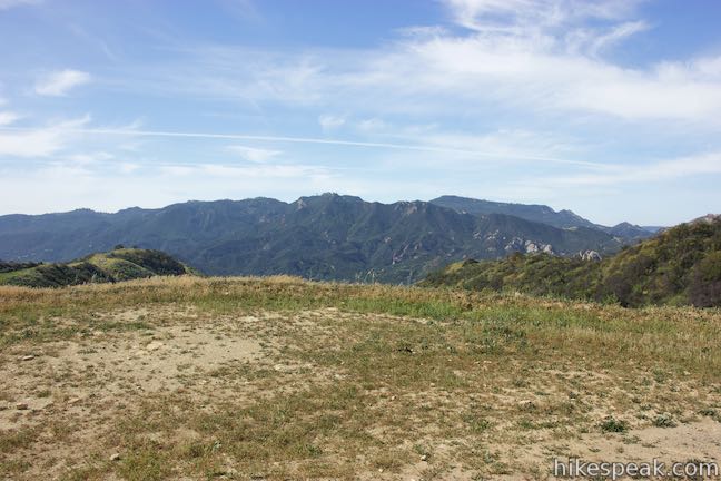
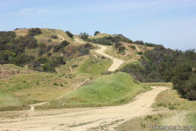
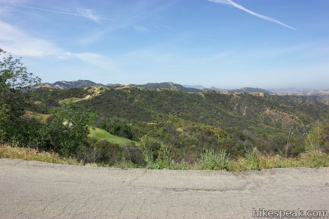
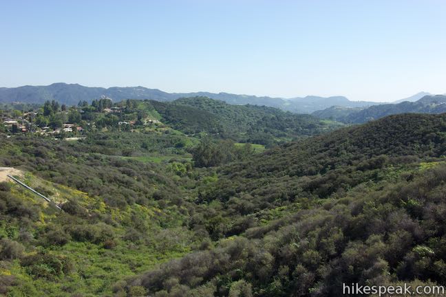
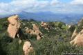
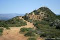
The road passes through a gap and presents views over a valley to the west. The trail weaves toward a crest on the ridge and passes below it. A path parting from the road goes up to the top of the crest. This single-track path runs alongside Summit to Summit Motorway, crisscrossing it at several points to hit all the bumps on the ridgeline.
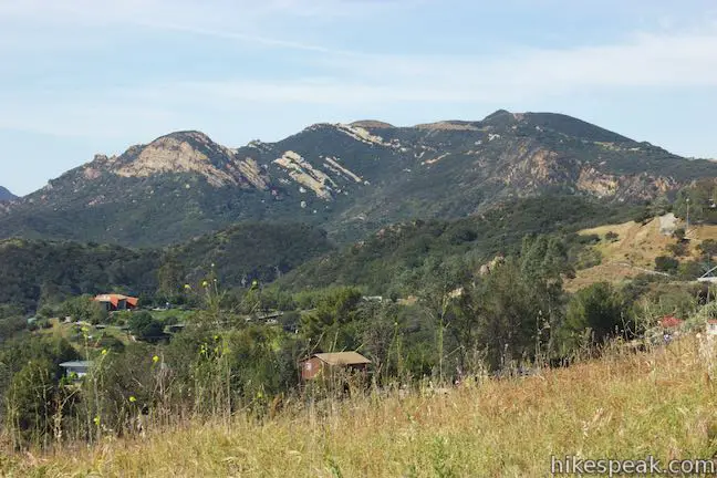
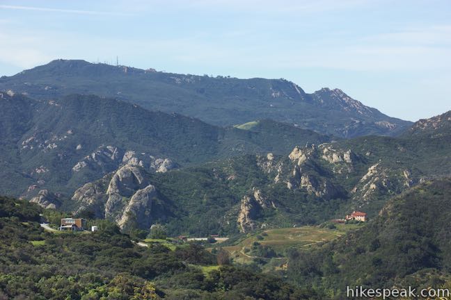
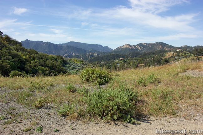
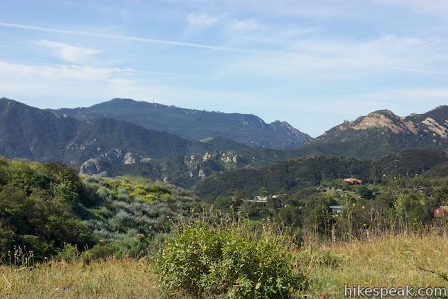
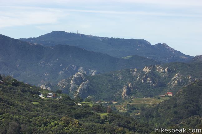
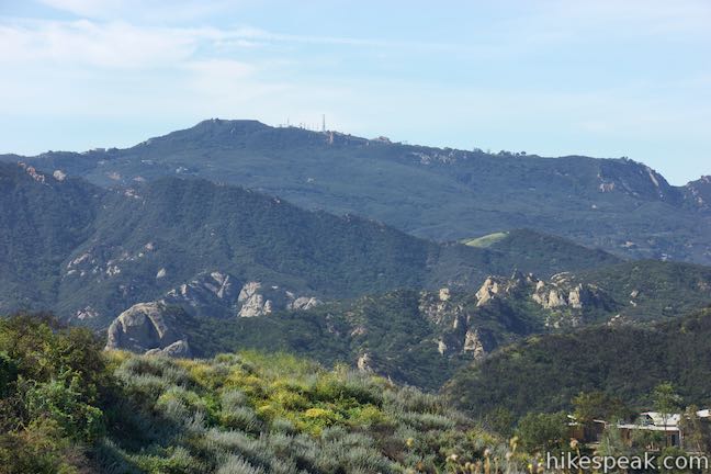
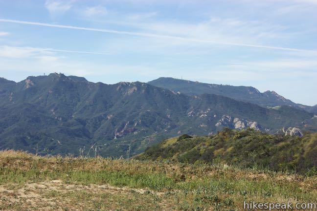
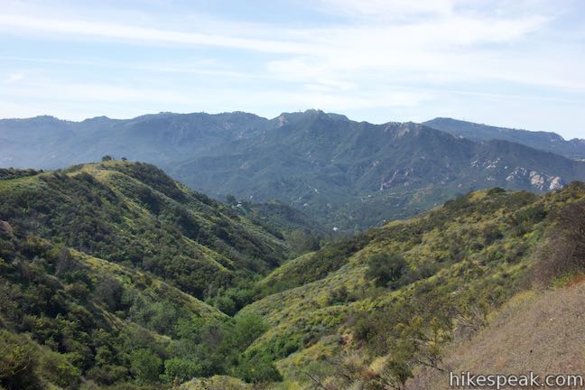
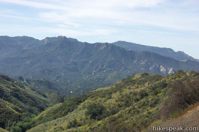
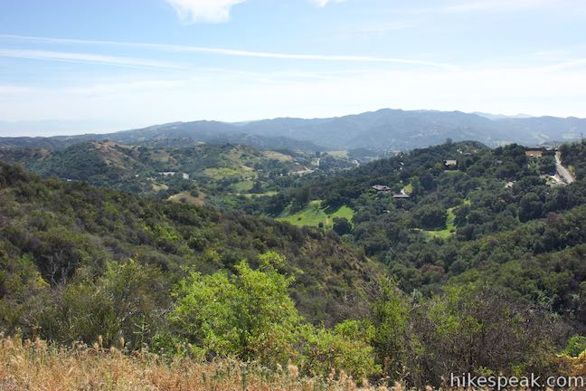
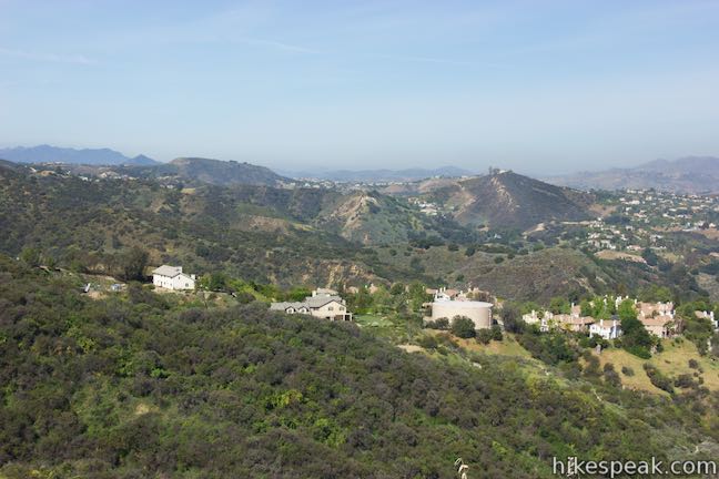
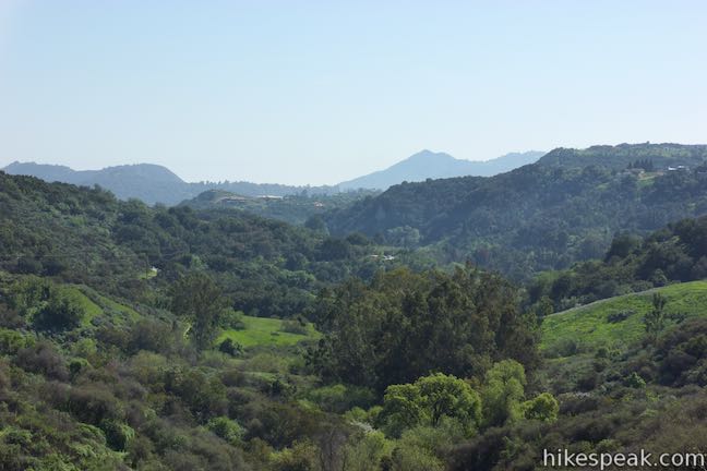
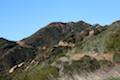
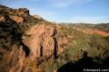
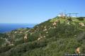
Half a mile in, Calabasas Peak looks grand to the southwest. A jumble of tall boulders stand at the base of Calabasas Peak. This is Red Rock Canyon, which you will get good perspectives of as you continue up the trail. Above the inspiring views into Red Rock Canyon, you’ll see a long green ridge that’s home to Topanga Lookout. Beyond that, Saddle Peak stands tall, topped by a cluster of towers.
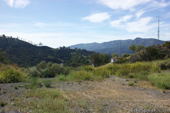
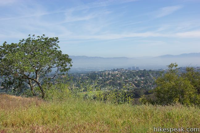
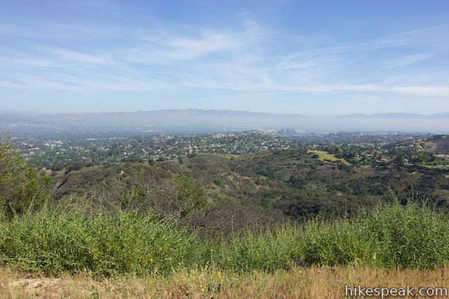
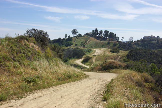
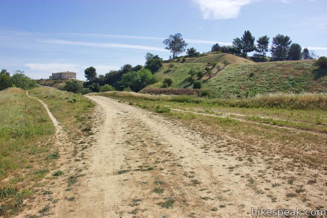
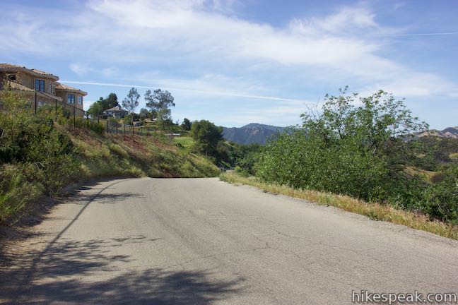
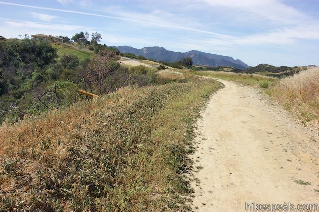
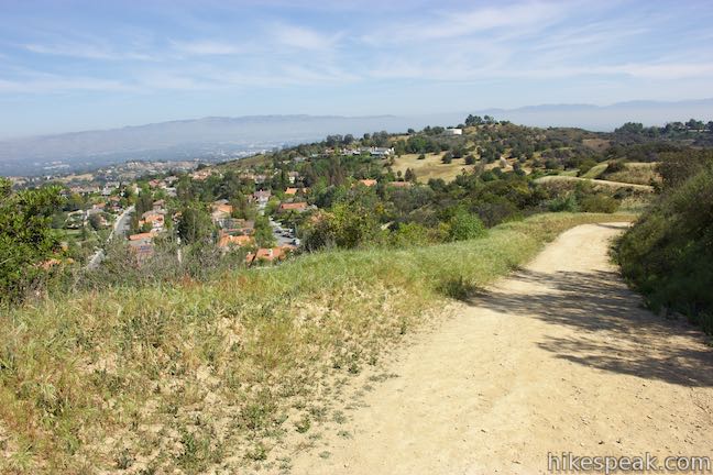
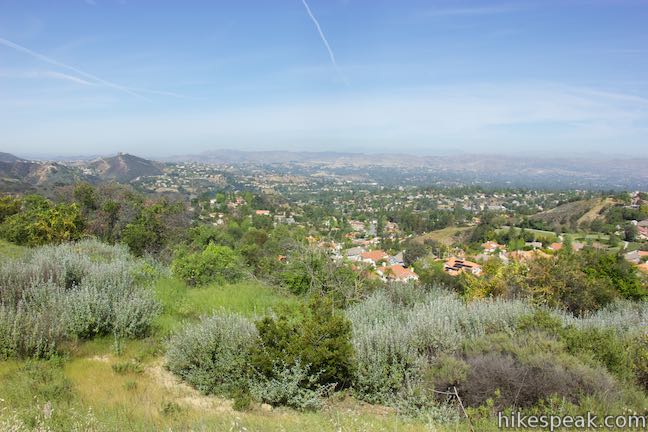
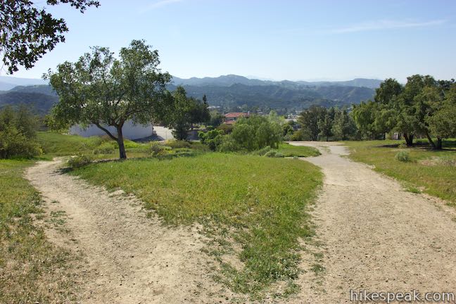
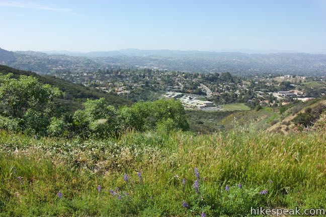
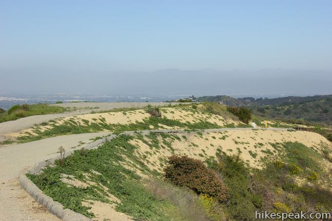
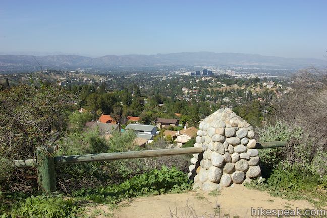
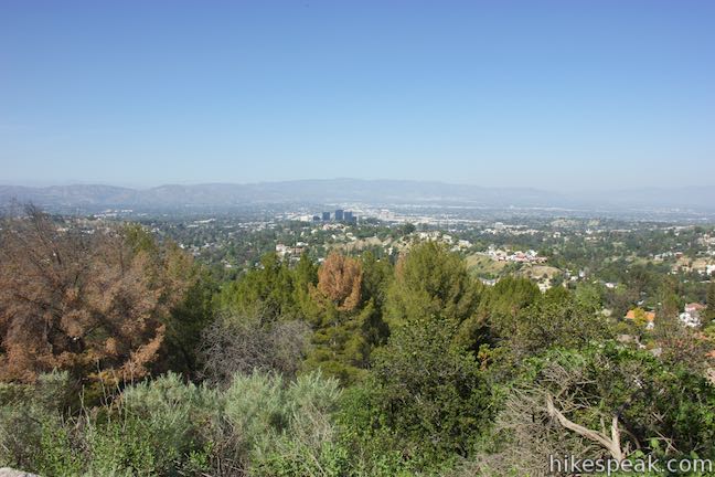
At around 3/4 of a mile from the start, pause to enjoy views off the north side of the trail overlooking the west end of the San Fernando Valley, which is backed by the Santa Susana Mountains. The trail continues to ascend gradually. Walk along wooden fence and bear left past a private driveway, 0.9 miles from the start.
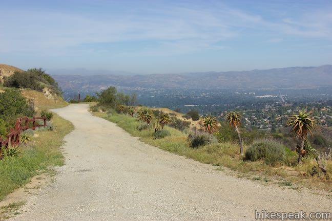
Rise to a 1,745-foot crest at the high point of Summit to Summit Motorway and then drop across a pronounced saddle. This stretch presents more northward views toward the San Fernando Valley and additional views east over Topanga. Past the saddle, the trail turns uphill again and approaches some houses along the ridge.
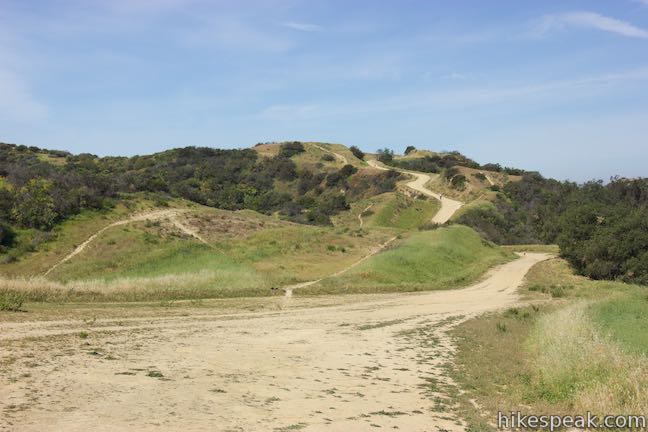
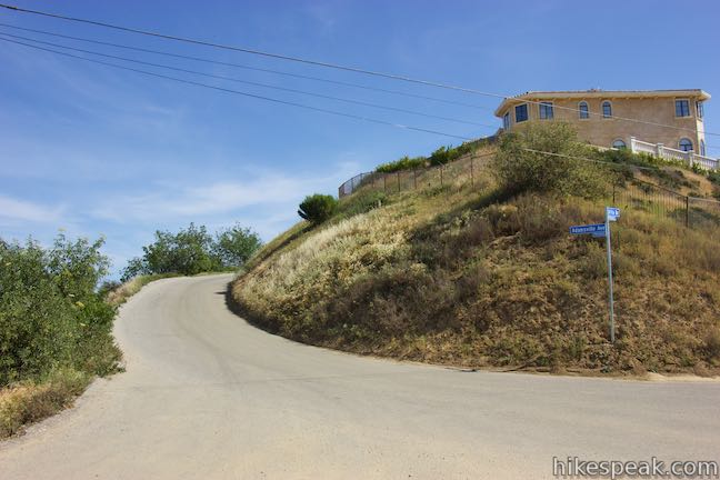
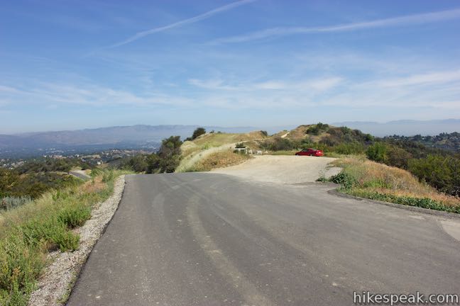
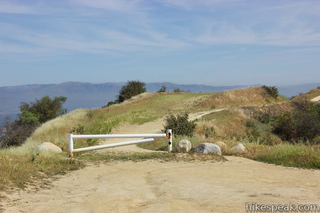
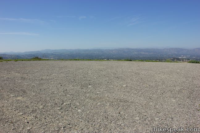
At 1.55 miles from the start, hit pavement and come to a gate at the end of the first section of Summit to Summit Motorway. There is an intersection here with paved and unpaved roads heading off in several directions. To find the resumption of the trail, turn left on Adamsville Avenue. Hike less than two tenths of a mile over a crest and turn right, crossing a dirt parking area at the start of the second section of Summit to Summit Motorway, where there is a white gate. The trail gets back to following the ridgeline and leaves the houses behind.
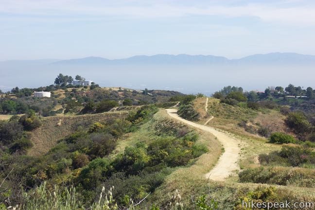
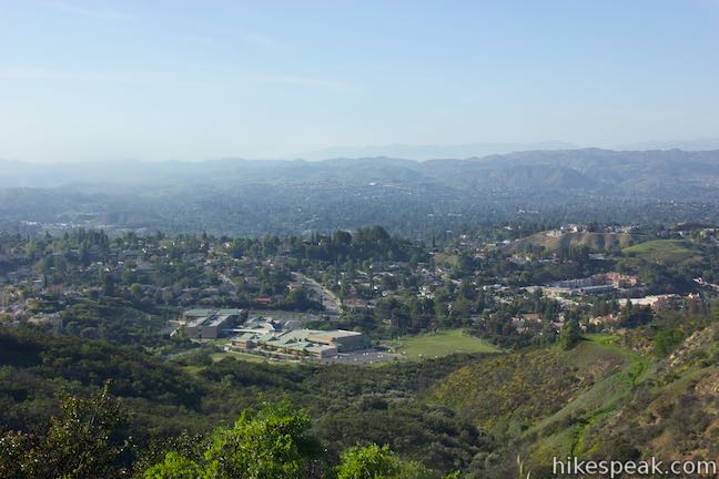
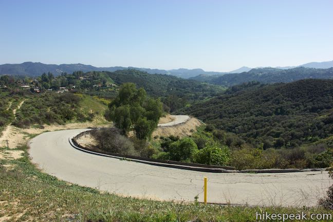
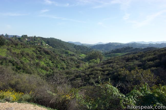
After ascending gradually to a crest, the road turns downhill in what is probably the steepest stretch of the hike. This northern section of Summit to Summit Motorway has panoramic views over Summit Valley, an undeveloped valley above Topanga that lies below the ridge to the east. Houses can be seen on the west side of the ridge.
At the base of the descent, and 2.35 miles from Old Topanga Canyon Road, Summit to Summit Motorway passes a path on the right that drops off the ridge and connects to other trails in Summit Valley Edmund D. Edelman Park.
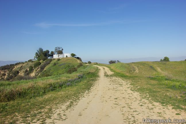
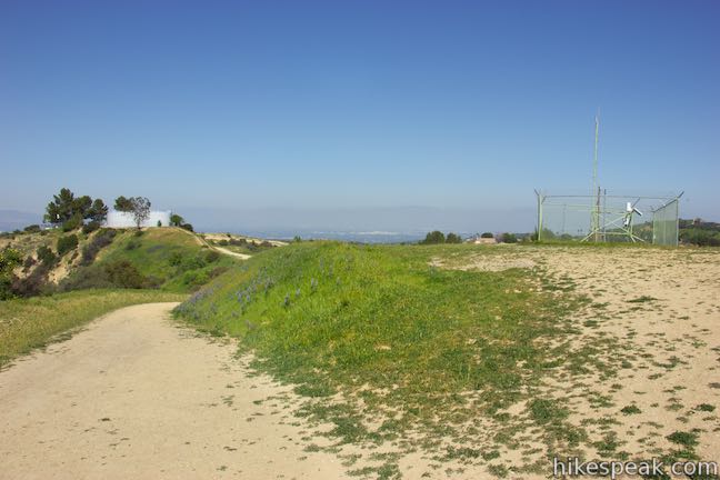
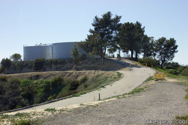
Take Summit to Summit Motorway gradually uphill for another quarter mile. Reach a split in the trail as you pass a holding tank on the left. Straight ahead, Summit to Summit Motorway comes to a T-junction. Bear right at the split (or at the T) to continue up the trail. Around the next bend, by a line of trees, a short tower on the right is framed by a square chain-linked fence. On the far side of this tower, another trail goes down a ridge into Summit Valley, useful for incorporating Summit to Summit Motorway into a loop hike in Summit Valley Edmund D. Edelman Park.
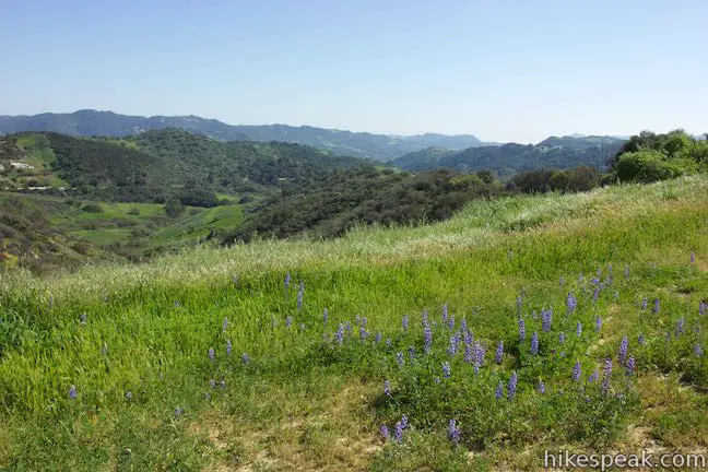
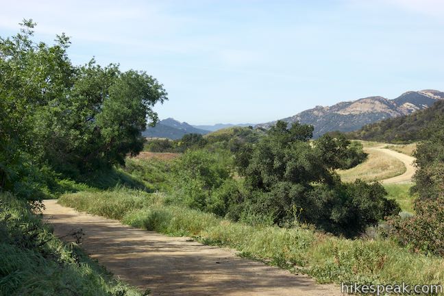
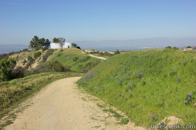
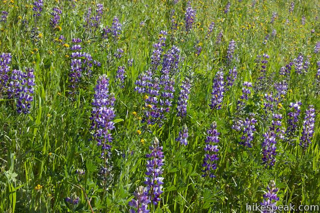
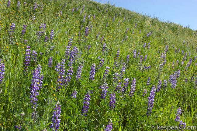
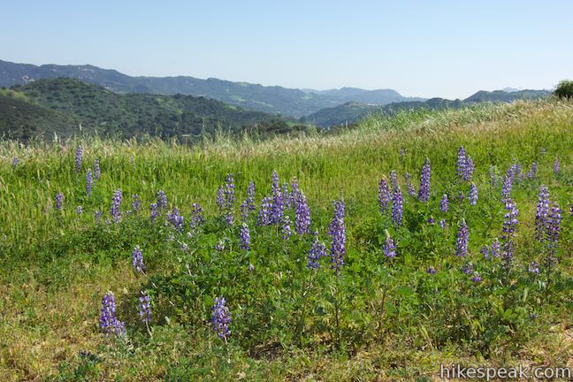
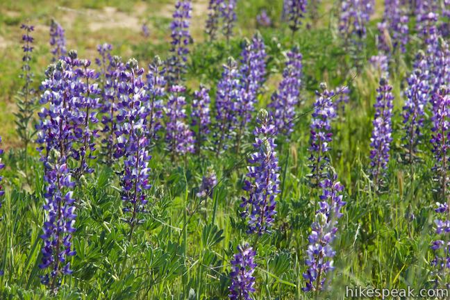
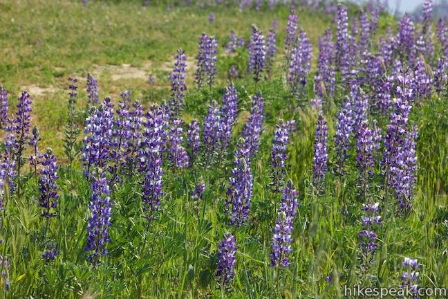
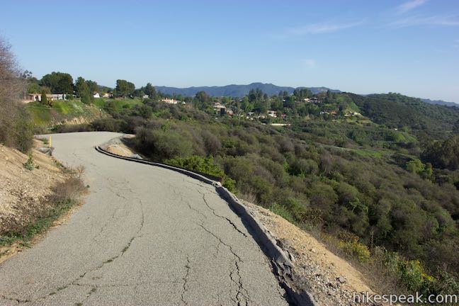
Proceed along Summit to Summit Motorway, which dips across another saddle. Around February and March, this is an excellent area to spot lupines and other wildflowers blooming in the grasses along the road. After another quarter mile, and 2.9 miles from the start, pass below a final pair of holding tanks on the ridge where the pavement begins. The final 0.3 miles of the road are paved, leading down to Topanga Canyon Boulevard.
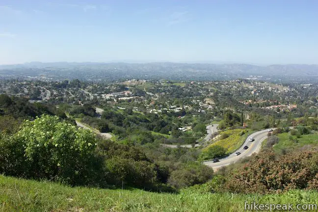
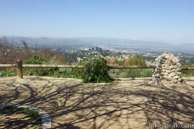
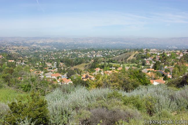
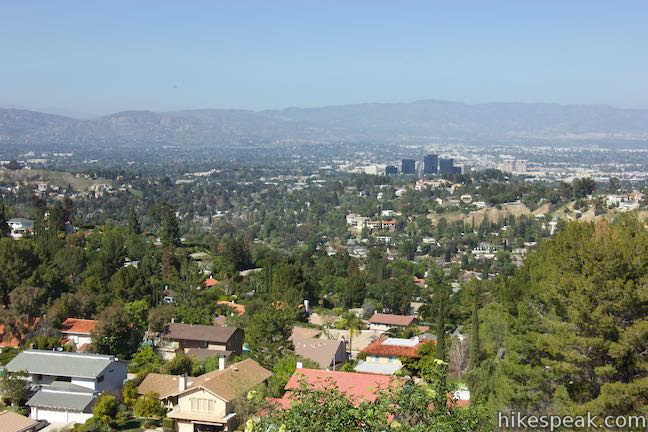
If you’re heading back to Old Topanga Canyon Road and would rather skip this paved 100-foot descent, walk out to a level landing off the left side of the road and take in panoramic views over the San Fernando Valley that best those found at Top of Topanga Overlook, which is visible below. Having bagged this over-the-top-of-Topanga view, you can turn around for a rewarding 6-mile trek.
If you intend to hike every inch of Summit to Summit Motorway, pavement be damned, proceed down the road around a pair of curves. You will get nice views looking south over Summit Valley over this last stretch of the road.
Cross a yellow gate at the bottom to reach Topanga Canyon Boulevard (Route 27). Top of Topanga Overlook lies just across this busy road. There is no crosswalk and curves in the road limit visibility of the speedy oncoming traffic, so be careful if you decide to cross.
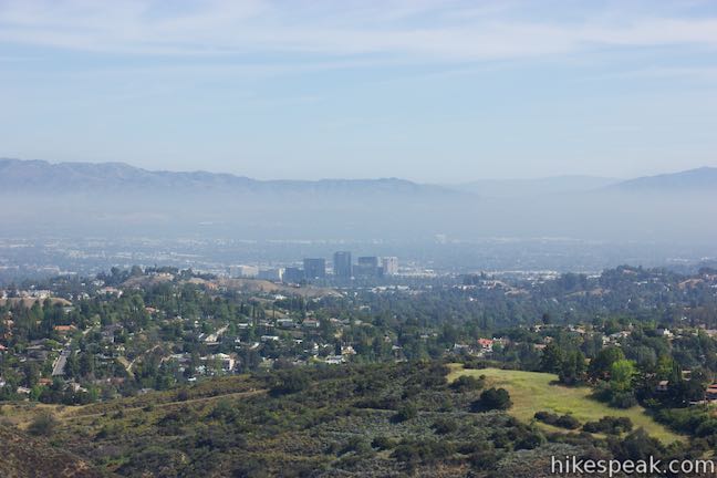
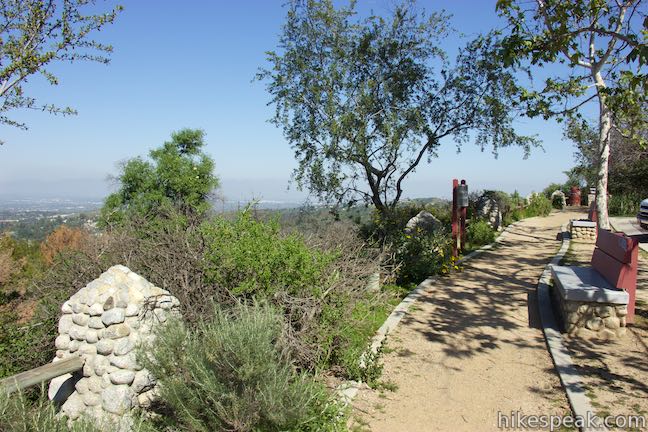
Walking over to Top of Topanga Overlook, you will find a parking area, picnic tables, and a path with panels describing the history of the viewpoint. One panel has an image of San Fernando Valley from Topanga Summit in 1937 that shows just a couple farms and roads in the valley below. It sure looks different from the view today, which is completely developed from the overlook all the way to the Santa Susana Mountains on the other side of the valley. Heading back to Old Topanga Canyon Road from Top of Topanga Overlook creates at 6.6-mile hike.
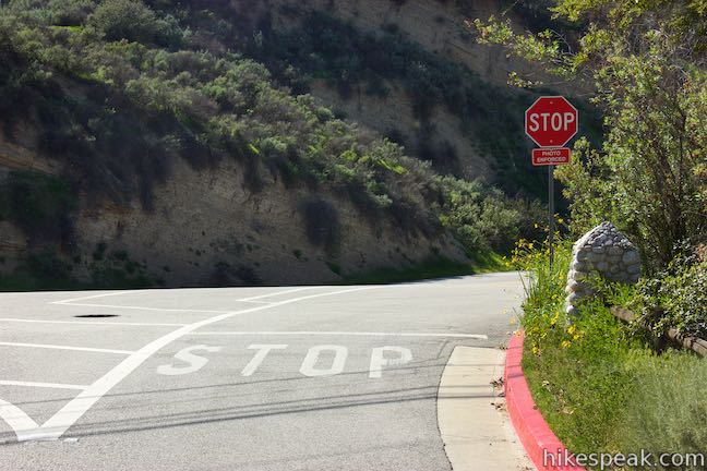
Whether you hike 6 to 6.6 miles for the full run of Summit to Summit Motorway or just hike a couple miles round trip to get the best views of the mountains surrounding the south end of the trail, you’re in for a rewarding outing. Shade along the road is minimal. There is free parking at both ends of Summit to Summit Motorway. If you park at Top of Topanga Overlook, pay attention to the photo enforced stop sign at the exit (or risk getting a ticket). Top of Topanga Overlook Park is closed from sunset to sunrise. Dogs are allowed on leashes in the park and on Summit to Summit Motorway. Bikes are welcome as well. No fee or permit is required to explore Summit to Summit Motorway, so get out and enjoy!
To get to the trailhead: From the 101 Freeway, take exit 29 for Valley Circle Boulevard/Mulholland Drive. At the end of the ramp, turn south on Mulholland Drive (which is called Valley Circle Boulevard north of the freeway). Drive south for 0.6 miles and turn right on Valmar Road. Valmar Road becomes Old Topanga Canyon Road after 0.4 miles. Stay on Old Topanga Canyon Road for an additional 0.8 miles and turn right at an intersection with Mulholland Highway. Drive less than a quarter mile and turn left up Old Topanga Canyon Road. Drive 1.6 miles and cross the top of Old Topanga Canyon Road to reach the start of Summit to Summit Motorway, which is on the left across from Calabasas Peak Motorway. Roadside parking is available just past Calabasas Peak Motorway along the south side of Old Topanga Canyon Road.
Trailhead address: Old Topanga Canyon Road & Summit to Summit Motorway, Topanga, CA 90290
Trailhead coordinates: 34.12509, -118.63485 (34° 07′ 30.32″N 118° 38′ 05.46″W)
View Santa Monica Mountains in a larger map
Or view a regional map of surrounding Los Angeles trails and campgrounds.
 | Calabasas Peak from Old Topanga Canyon Road This 4.2-mile hike on Calabasas Peak Motorway approaches Calabasas Peak from the northeast, providing big views over Topanga and other parts of the Santa Monica Mountains. |
 | Summit Valley Edmund D. Edelman Park This park's main area offers a relatively easy 1.65-mile loop and a slightly tougher 2-mile loop that ascends to Summit to Summit Motorway and provides loftier views over Summit Valley in Upper Topanga Canyon. |
 | Viewridge Trail This 3-mile hike in Summit Valley Edmund D. Edelman Park travels down a canyon on Viewridge Trail (also known Santa Maria Canyon Trail) to Summer Hill Ranch Road where there are sweeping views over Topanga and the Santa Monica Mountains from Canyon Overlook. |
 | Calabasas Peak via Calabasas - Cold Creek Trail This 4.5-mile round trip hike starts up a scenic single track formerly know as the Secret Trail and ascends 750 feet to the summit of Calabasas Peak. |
 | Stunt Road to Calabasas Peak This 3.6-mile hike travels an easy-to-follow fire road, climbing 900 feet to panoramic views of the Santa Monica Mountains and San Fernando Valley. |
 | Red Rock Canyon The trails in the beautifully sculpted Red Rock Canyon are 2.5 and 5.2 miles in length. |
 | Stunt High Trail to Saddle Peak This 7.5-mile hike combines Stunt High Trail and a section of the Backbone Trail to visit the 6th tallest summit in the Santa Monica Mountains. |
 | Backbone Trail to Saddle Peak This 2-mile hike approaches Saddle Peak from the east. |
 | Topanga Lookout This 2-mile visits the site of an old fire tower that still offers great views of the surrounding mountains. |
 | More trails in the Santa Monica Mountains Explore other destinations in the range. |
Go the extra miles...
Submit a rating of this hike to go with your comment. Contribute to the average trail rating.