
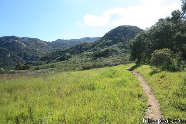
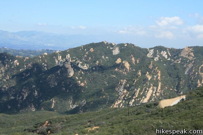
Stunt High Trail begins with a gentle walk along Cold Creek, and then ascends through meadows and chaparral up the northern slope of Saddle Peak to offer great views of the Santa Monica Mountains. Stunt High Trail ends at a road, 2.17 miles from the start, which is a rather anti-climactic high point. From there, pick up the Backbone Trail and hike to the top of Saddle Peak, the sixth tallest summit in the range, where wide views over Malibu and the Pacific can be enjoyed. This excellent excursion to Saddle Peak is 7.5 miles round trip with 1,675 feet of elevation gain.
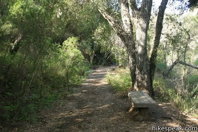
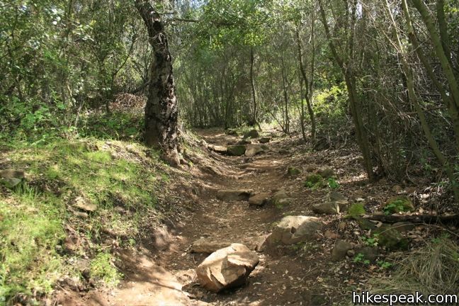
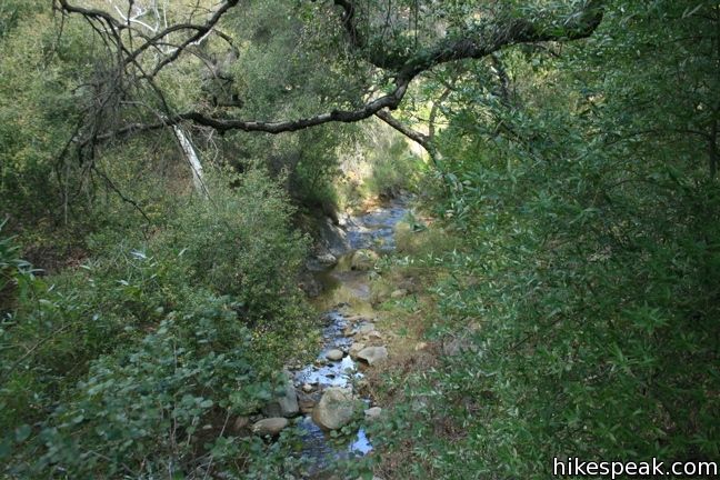
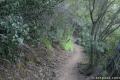
From the trailhead, descend through an oak grove along the banks of Cold Creek, a year round water source. After half a mile, turn left at the first junction, leaving Cold Creek Trail. Head uphill on Lower Stunt High Trail through green fields with open views. The trail narrows to a single track as it crosses the UCLA-owned eco-classroom Stunt Ranch, a pristine preserve that UCLA is kind enough to let non-students enjoy. Continue straight through the next junction to remain on Stunt High Trail, passing a path leading to the right into Stunt Ranch.
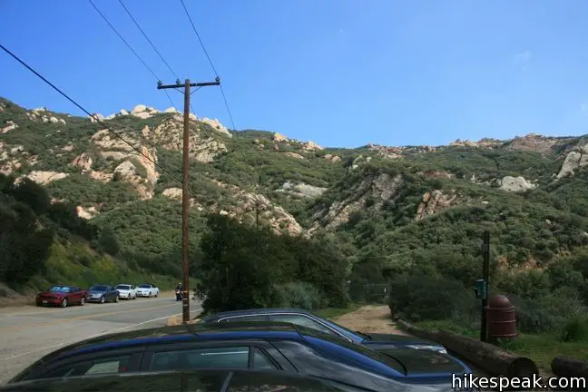
Stunt High Trail progresses southward, crossing a paved service road, 1.15 miles from the start. A short distance farther, reach the top of Lower Stunt High Trail as it hits Stunt Road (for the first time). There is a parking area here for those wishing to join the hike 1.25 miles from the start. Turn right and cross the road, heading uphill a few hundred feet. The start of the next leg of the trail is just past mile marker 1.94 and difficult to see if you are not looking carefully.
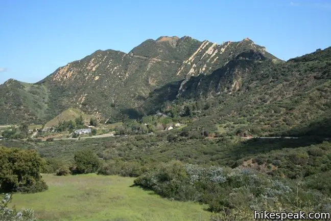
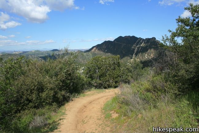
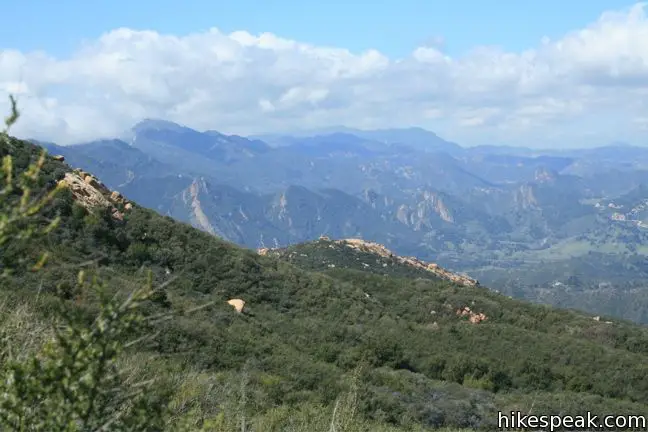
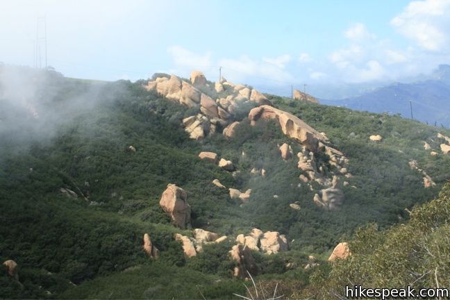
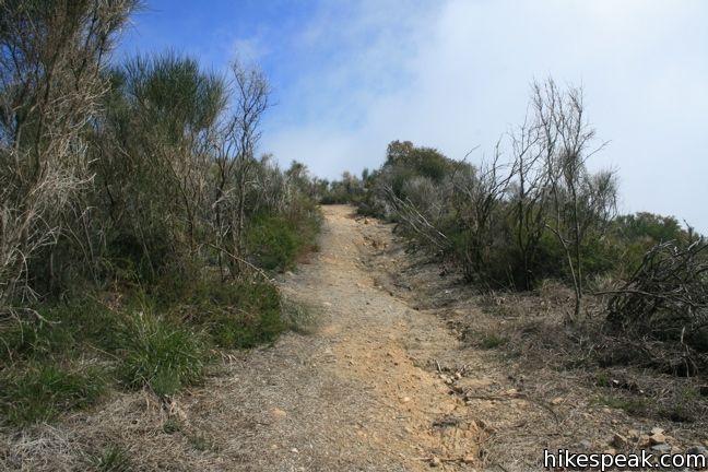
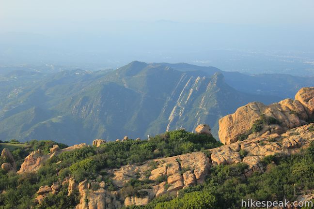
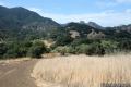
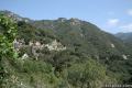
Upper Stunt High Trail climbs quickly over switchbacks through a forest of bays, giving way to more gradual trail up chaparral-covered slopes. The views across Cold Creek Canyon toward the 2,163-foot Calabasas Peak will inspire you to hike that peak next if you haven’t already.
At 2.17 miles from the start, comes to the top of Upper Stunt High Trail where it again reaches Stunt Road by another dirt turnout where hikers can park. You could turn around here, but there is something inherently dissatisfying about hiking to a road and back. Fortunately, you have the option to continue. Just a few hundred feet to the right, on the other side of Stunt Road, is a connector trail to the Backbone Trail, which can be taken up to a much more satisfying destination, the summit of Saddle Peak.
Hike 0.2 miles up Stunt Road-Backbone Trail Connector and turn left onto the Backbone Trail (if you turn right instead, you will be hiking 3.2 miles down to Piuma Road).
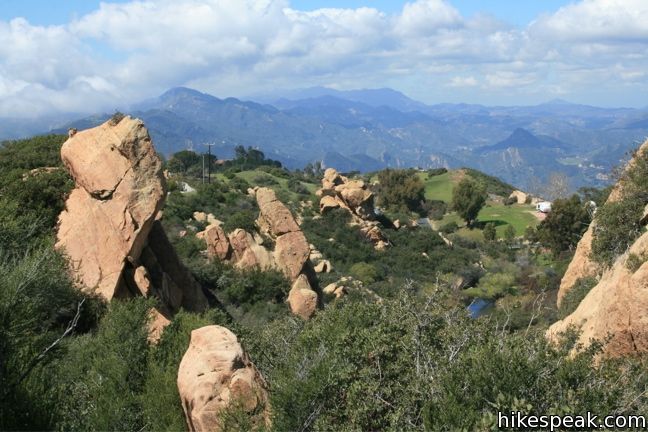
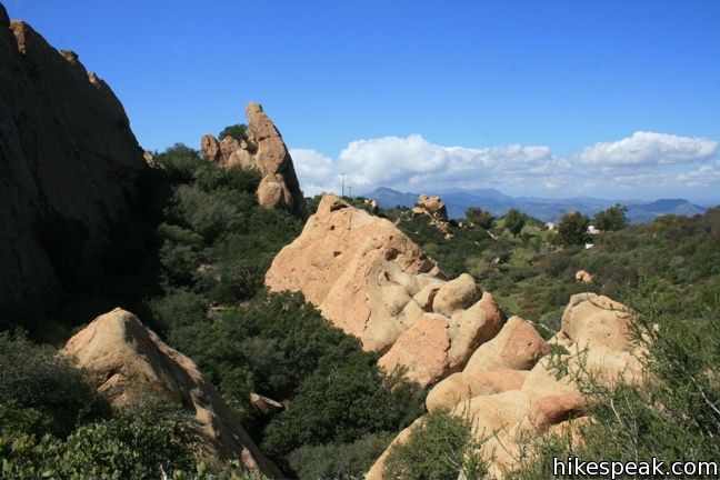
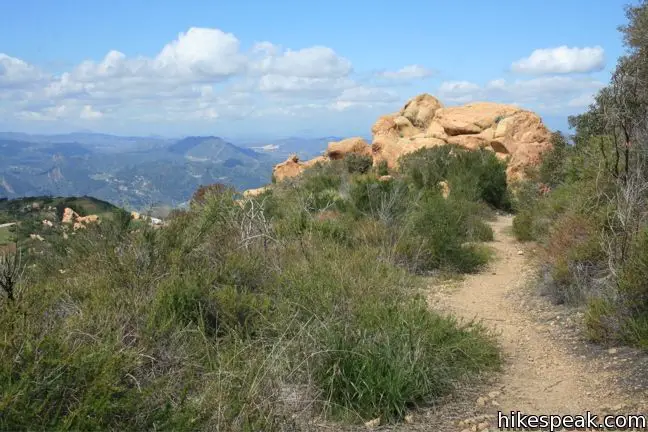
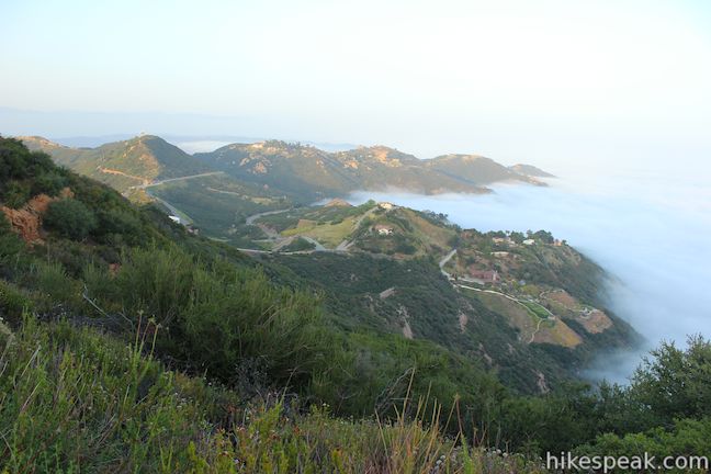
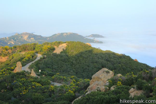
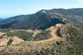
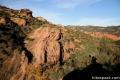
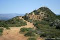
Over the next 1.1 miles, the Backbone Trail ascends 720 feet to a junction below the summit of Saddle Peak. Along the way, the Backbone Trail goes up the northern slope of Saddle Peak where the views of the Santa Monica Mountains keep expanding. Pass through manzanita trees to cross a collection of large sandstone formations that beg to be climbed.
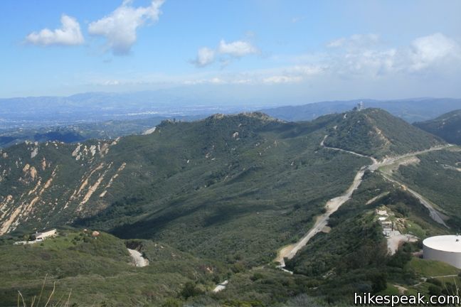
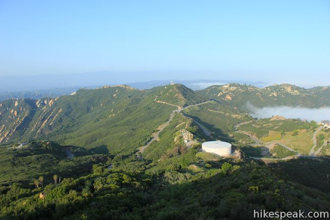
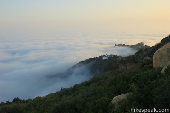
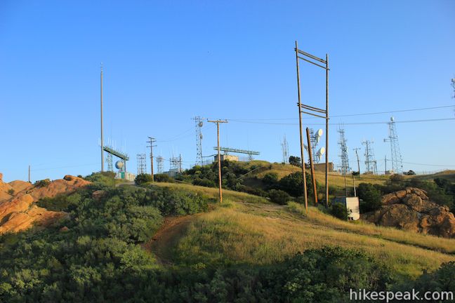
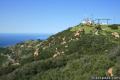
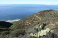
The trail turns to the east, bringing into view a radio tower-covered lower summit. Turn right at the next junction, leaving the Backbone Trail for a wide path that climbs to the 2,805-foot summit of Saddle Peak. Walk an eighth of a mile up this trail and turn left to reach the summit. From the mountaintop, you can have a look down on Malibu estates on the slopes below, and out at the Pacific Ocean.
The directions to remember are:
- Turn left at the first junction leaving Cold Creek Trail (0.5 miles)
- Stay to the left past a trail into Stunt Ranch (0.7 miles)
- Cross a paved service road (1.15 miles)
- Turn right onto Stunt Road to find the upper section of the trail (1.25 miles)
- Turn right onto Stunt Road again at the top of Stunt High Trail to find the connector trail to the Backbone Trail (2.17)
- Turn left up Stunt Road-Backbone Trail Connector (2.45)
- Turn left toward Saddle Peak on the Backbone Trail (2.45 miles)
- Turn right to leave the Backbone Trail for a trail to the summit (3.55 miles)
- Turn left to reach the summit (3.67 miles)
- Summit Saddle Peak (3.75 miles)
Do the reverse on the return for a 7.5-mile round trip hike with great views of Malibu and Calabasas. Despite having 3 different pavement crossings, this trail immerses hikers into diverse greenery. No fee or permit is required, so get out and enjoy. For a shorter hike to the summit, and to see photos from the top of Saddle Peak that aren’t covered by clouds, check out the two-mile round trip hike up the Backbone Trail to Saddle Peak.
The parking lot at the base of Shunt High Trail is a popular one as it also services the Calabasas Peak Motorway trailhead, delivering hikers to Calabasas Peak and Red Rock Canyon Park (both excellent hikes).
Directions to the Trailhead
- From the 101 freeway, exit Las Virgenes Road and head south toward Malibu.
- After 2.8 miles turn left (east) on Mulholland Highway.
- After 4 miles, turn right on Stunt Road and drive one mile.
- There is plentiful parking along the right side of the road next to the trailhead.
- From PCH, take Malibu Canyon Road until it becomes Las Virgenes Road.
- Turn right on to Mulholland Highway and take that to Stunt Road as described above.
- Another option for those coming from the west side is to take PCH north to Las Flores Road (across from Duke's restaurant).
- Drive 3.4 miles up this narrow twisting canyon and turn right onto Rambla Pacifico Street.
- After 0.6 miles, make a sharp right onto Schueren Road and descend the backside of the mountain for 5 miles to arrive at the parking for Stunt High Trail from the other direction.
- This scenic route offers a high view on Malibu and the Pacific.
Trailhead Location
Trailhead address: 1673 Stunt Road, Calabasas Highlands, CA 91302
Trailhead coordinates: 34.09505, -118.64855 (34° 05′ 42.2″N 118° 38′ 54.8″W)
View Santa Monica Mountains in a larger map
Or view a regional map of surrounding Los Angeles trails and campgrounds.


 | Calabasas Peak from Stunt Road This 3.6-mile hike on Calabasas Peak Motorway approaches Calabasas Peak from the south, ascending through sandstone formations to panoramic views of the Santa Monica Mountains and San Fernando Valley. |
 | Calabasas Peak from Old Topanga Canyon Road This 4.2-mile hike on Calabasas Peak Motorway approaches Calabasas Peak from the northeast, providing big views over Topanga and other parts of the Santa Monica Mountains. |
 | Calabasas Peak via Calabasas - Cold Creek Trail This 4.5-mile round trip hike starts up a scenic single track formerly know as the Secret Trail and ascends 750 feet to the summit of Calabasas Peak. |
 | Red Rock Canyon Park The trails in the beautifully sculpted Red Rock Canyon are 2.5 and 5.2 miles in length. |
 | Topanga Lookout This 2-mile visits the site of an old fire tower that still offers great views of the surrounding mountains. |
 | Backbone Trail to Saddle Peak This 2-mile hike approaches Saddle Peak from the east. |
 | Hondo Canyon This section of the Backbone Trail crosses fields of grains and forests of bays, climbing 1,550 feet over 3.8 miles to a small ocean view. Extend the hike to Topanga Lookout for an incredible perspective over the Santa Monica Mountains. |
 | Talepop Loop This 4.75-mile hike climbs 500 feet over a scenic mountain between Liberty Canyon and Las Virgenes Canyon on the north end of Malibu Creek State Park. |
 | Grassland Trail to Crags Road and Rock Pool This easy 3-mile hike enters Malibu Creek State Park on South Grassland Trail, then forms a loop around Crags Road to visit Rock Pool, a popular park retreat. |
 | More trails in the Santa Monica Mountains Explore other destinations in the range. |
 | La Jolla Canyon Loop This 11.75-mile hike explores Point Mugu State Park on the west end of the Santa Monica Mountains, offering extraordinary ocean views. |
 | Sandstone Peak This 6.25-mile loop summits the tallest peak in the Santa Monica Mountains. |
 | Parker Mesa Overlook This steep out-and-back hike rewards the effort with excellent views of the Pacific Ocean. |
 | Mount Lee This 6.4-mile hike crosses Griffith Park from Canyon Drive to the top of Mount Lee directly behind the landmark Hollywood Sign. |
 | Santa Anita Canyon Loop This 9.5-mile loop visits two peaceful creeks in sylvan canyons, passing a 60-foot waterfall and plenty of beautiful wilderness. |
Common Questions about Stunt High Trail to Saddle Peak in the Santa Monica Mountains
- Is the trail open?
- Yes. You should expect to find that Stunt High Trail to Saddle Peak is open. There are no recent reports of trail closures. If you discover that the trail is closed, please help your fellow hikers by reporting a closure.
- Is this trail free to access?
- Yes, Stunt High Trail to Saddle Peak is free to access. No entrance fee, pass, or permit is required. If you discover that access rules have changed, please provide feedback on your experience.
- How much time does this hike take?
- It takes approximately 4 hours 30 minutes to hike Stunt High Trail to Saddle Peak. Individual hiking times vary. Add extra time for breaks and taking in the views.
- How long is this hike?
- The hike to Stunt High Trail to Saddle Peak is a 8.2 mile out and back with 1675 feet of elevation change.
- Are dogs allowed on this trail?
- No, dogs are likely not allowed on Stunt High Trail to Saddle Peak. The trail is primarily open to hikers.
- Is Stunt High Trail to Saddle Peak a difficult hike?
- This hike should be considered strenuous. Hikers should be prepared for a workout covering 8.2 miles and 1675 feet of climbing.
- Does this trail go to a summit?
- Yes, Stunt High Trail to Saddle Peak reaches a summit with panoramic views.
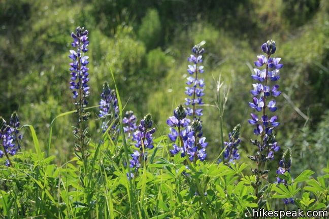
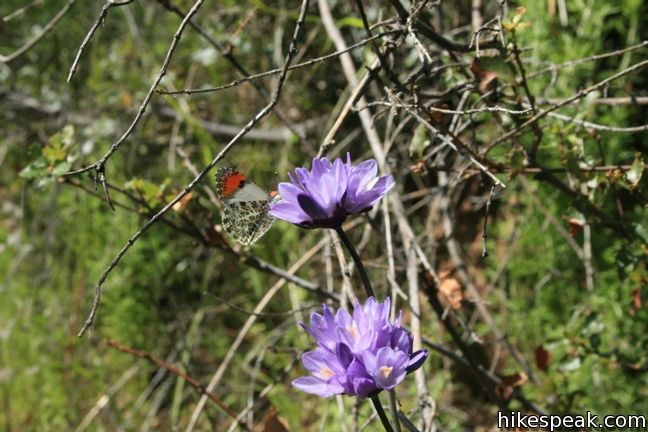
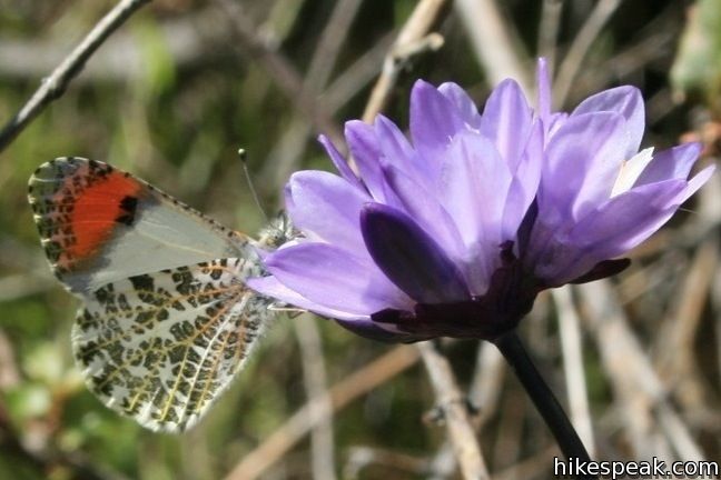
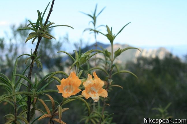
- Is this a good hike for wildflowers?
- Yes, Stunt High Trail to Saddle Peak is known for its seasonal wildflower displays.
- What mountain range is this trail in?
- Stunt High Trail to Saddle Peak is located in the Santa Monica Mountains.
- Where is the trailhead located?
- The trailhead for Stunt High Trail to Saddle Peak is located in Calabasas Highlands, CA.
Trailhead Address:
1673 Stunt Road
Calabasas Highlands, CA 91302
Trailhead Coordinates:
34.09505, -118.64855 - What are the driving directions to the start of the hike?
To get to the trailhead: From the 101 freeway, exit Las Virgenes Road and head south toward Malibu. After 2.8 miles turn left (east) on Mulholland Highway. After 4 miles, turn right on Stunt Road and drive one mile. There is plentiful parking along the right side of the road next to the trailhead.
From PCH, take Malibu Canyon Road until it becomes Las Virgenes Road. Turn right on to Mulholland Highway and take that to Stunt Road as described above.
Another option for those coming from the west side is to take PCH north to Las Flores Road (across from Duke's restaurant). Drive 3.4 miles up this narrow twisting canyon and turn right onto Rambla Pacifico Street. After 0.6 miles, make a sharp right onto Schueren Road and descend the backside of the mountain for 5 miles to arrive at the parking for Stunt High Trail from the other direction. This scenic route offers a high view on Malibu and the Pacific.
View custom Google Maps directions from your current location.
- Are there other trails near Stunt High Trail to Saddle Peak?
- Yes, you can find other nearby hikes using the Hikespeak Hike Finder Map.

12 Comments on Stunt High Trail to Saddle Peak in the Santa Monica Mountains
What hikers are saying:
✨ Generated summary of user commentsHikers find this trail stunning and appreciate the lush greenery that persists even during dry seasons. While the summit views are rewarding, the route includes paved road sections that feel disjointed to some. Dogs are strictly prohibited on the Saddle Peak portion of the trail. Zach recommends this path for its ample shade and vibrant growth.
“Shaded, plenty of greenery and growth even when most everything in the area is dead, and a stunning view once you go over the summit.” Jump to comment ↓
I’m looking for a trail that has a rusty old Dodge truck on it. I photographed it in 2008 and I’m hoping that it is still there. But I don’t know which trail it is. My photo caption just says “Cold Creek”.
the tral is cold creek preserve, but that portion has been closed to the public for about a year. the trailhead is on stunt road, but the gate is padlocked.
Did this trail a couple weeks ago, definitely one of my favorites in LA. Shaded, plenty of greenery and growth even when most everything in the area is dead, and a stunning view once you go over the summit.
An excellent hike. I would just caution that the final leg on the backbone trail to the top must be longer than 1.1 miles.
Yeah, definitely agree with you there
[…] *Additional info and location of trail: Stunt Hill/ Saddle Peak Trail […]
Completely agree with the description: “there is something inherently dissatisfying about hiking to a road and back.” Not a fun part of this Frankenstein, pieced-together but beautiful trail. If you or your precious feet (&knees) are avoiding pavement, I would suggest skipping the roads and starting at the Backbone trail. Beautiful drive!
We went to the top today, June 11, and the bench was missing. We were just there 3 months ago and I know where the bench WAS, and what it looked like, and am convinced that it is gone. Somebody either dragged it off or pitched it over the edge.
Can I bring my dogs in this hike? Fully vaccinated…
Dogs are not allowed on Saddle Peak Trail, but may be allowed for the lower trails.
I am looking for a statue of a person meditating with a heart through the middle of its chest and I heard it was around this area is that true.
Stunning hike. Did the hike solo on a weekday and there were very few people but just enough that I felt safe should anything happen. People were all very considerate and pulled their masks up when passing others. The directions on this website are key, I followed them and didn’t have any issues at the junctions and road crossings. Been hiking the SM Mountains for 25 years – can’t believe it took me this long to venture on this trail. I will be back for sure.