
Spencer Butte rises high above the south end of the Willamette Valley near Eugene, Oregon. A 5.2-mile round trip hike to the mountaintop crosses through a lush forest covered in ferns and ascends to a nearly treeless 2,060-foot summit where there are round-the-compass views over Lane County’s bucolic valleys and evergreen-covered hills. The woodland walk at the start is pleasant enough to be its own attraction, and the panoramic summit really puts this hike over the top.
A few trailheads can be used to hike to Spencer Butte. Start from the Willamette Trailhead on the north side of Spencer Butte Park for a 5.2-mile hike with 1,100 feet of elevation change. There is a dirt parking lot and a trail kiosk with a posted map. Spot the sign for Ridgeline Trail and set out southward toward Spencer Butte. The hike is gradual until just below the summit.
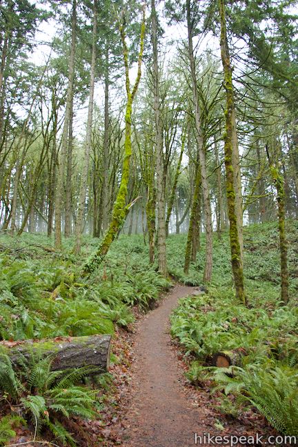
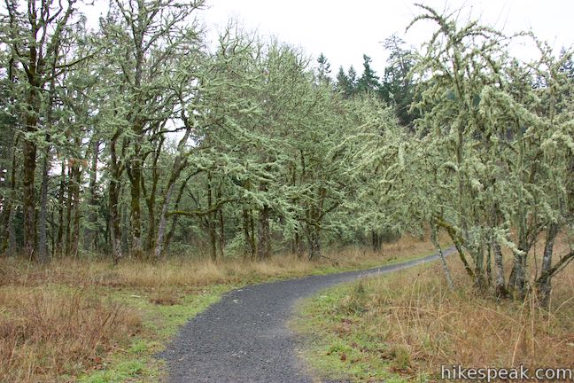
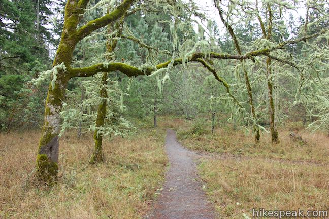
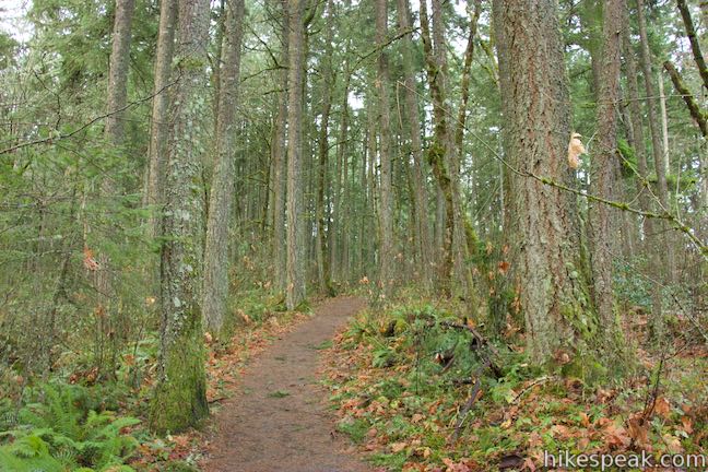
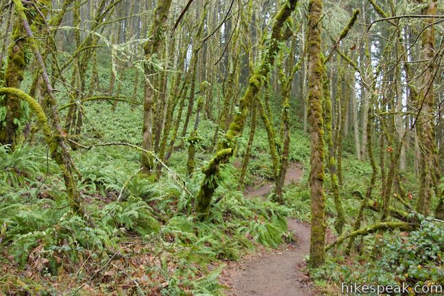
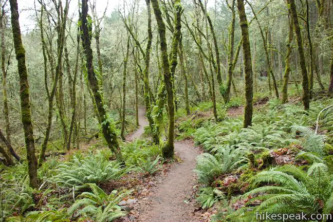
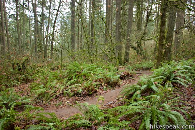
The trail crosses a grass field at the start (where you can pick berries in the summer) and approaches a line of oaks decorated in lichens. The trail runs along the trees and enters a denser forest. Before you know it, the ground all around will be covered in sword ferns. At half a mile from the start, a switchback escorts you up a hillside of ferns, bringing you farther into this verdant, enchanting forest. When fog rolls in, these woods can feel almost prehistoric.
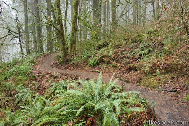
In another quarter mile, stay to the left past a closed path coming down the north side of the mountain. Ridgeline Trail maintains a steady course wrapping around the east side of Spencer Butte.
At 1.2 miles from the start, come to the first of two junctions with trails that connect to other trailheads. You will turn right at both. Follow the sign for Spencer Butte Summit and head west from the junction. The trail to the left goes to a trailhead on Fox Hollow Road.
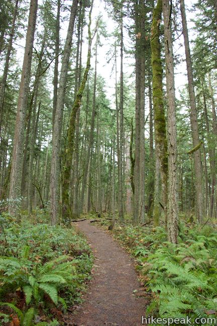
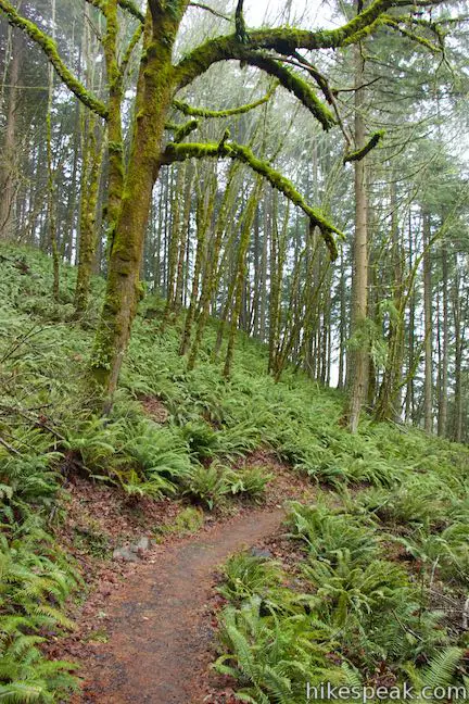
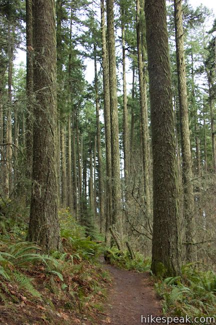
Ascend gradual switchbacks and ease higher up Spencer Butte through a forest of mossy Douglas firs and an expanse of ferns. The trail enters a small clearing as you reach the next junction after another 0.8 miles (2 miles from the start). Turn right again to continue heading toward the mountaintop. The trail to the left goes west to Spencer Butte Trailhead, another trailhead off Willamette Street.
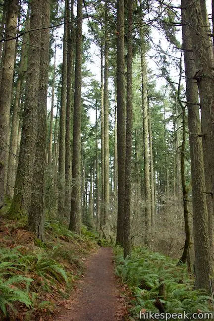
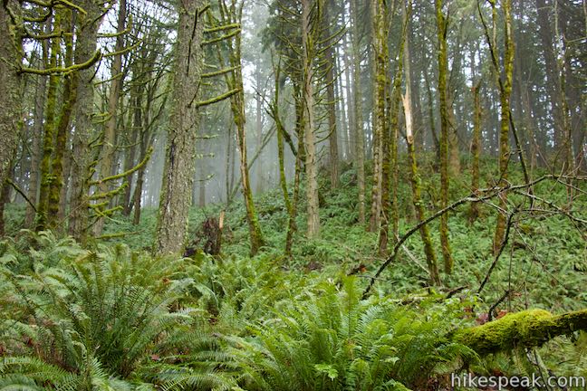
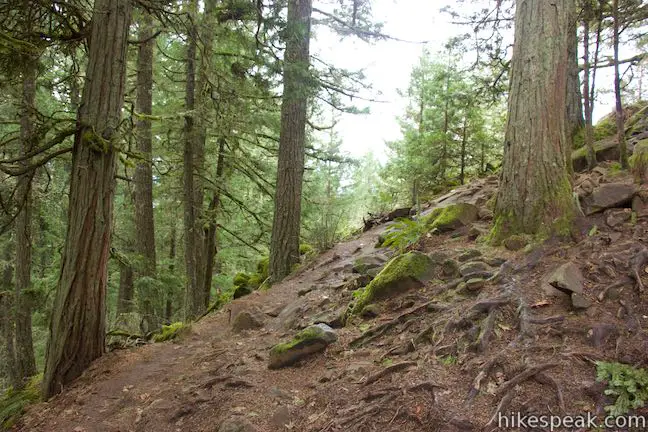
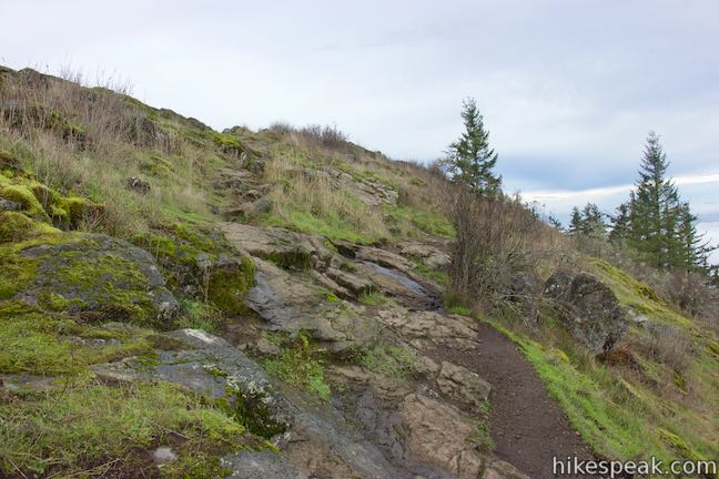
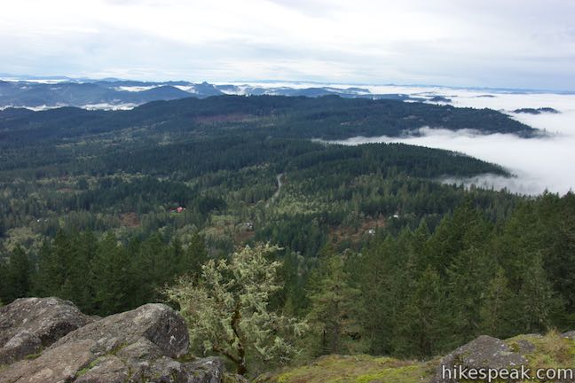
As the trail continues up the mountain, the firs seem to get larger and more brush crowds out the ferns. In another 1/3 of a mile, the trees dwindle as the trail reaches a rocky area at the bottom of the summit’s open slopes. Here the trail seems to splinter on the final push to the top (Note: refinements to this section of the trail made in the spring of 2015 should make it easier for hikers to reach the summit). A footpath goes roughly straight ahead and climbs up the south end of the butte. This route (which may get closed off to better protect the plants) provides enjoyable views over Creswell in the valley to the southeast. The track gives way to a steep off-trail climb up the rocky ridge leading to the summit.
For the easiest route to the top, take the most worn path and make a sharp right turn when you reach the rocky area at the edge of the forest. This trail hugs the trees for a stretch and then crosses grassy slopes for a more moderate ascent, wrapping around the eastern face toward the north end of Spencer Butte. Climb the final 260 feet to the summit, which you will reach in under a quarter mile.
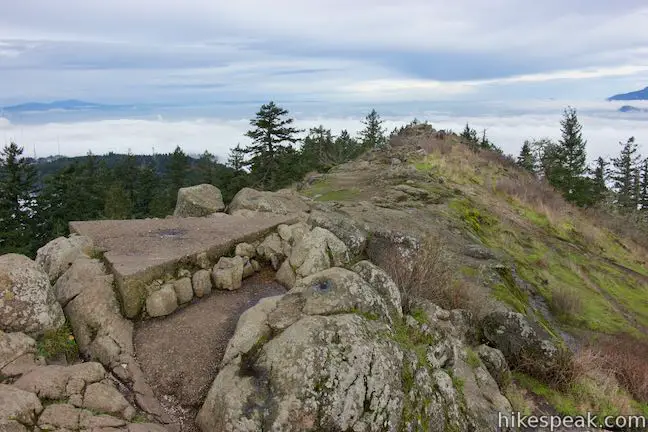
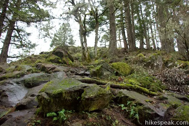
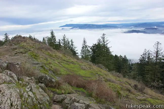
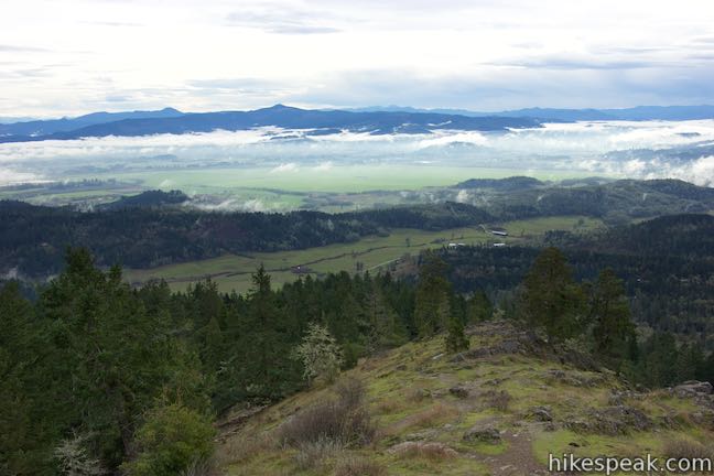
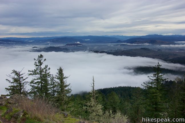
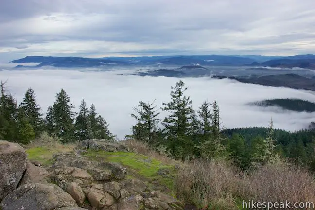
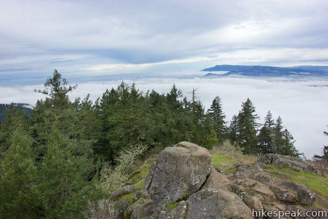
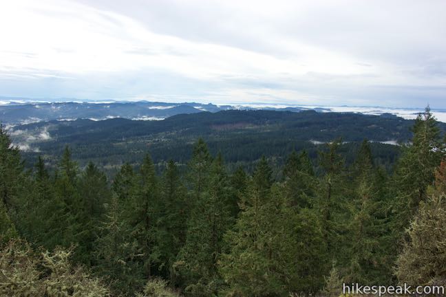
The trail approaches the east side of a rocky north-south running line of boulders across the top of Spencer Butte. You will be drawn to a rocky point at the north end of Spencer Butte. The outcropping offers sweeping views to the west, north, and east. The foothills of the Coast Range lie to the west. The fertile basin of the Willamette Valley spreads out to the north. The city of Eugene fills the valley below Spencer Butte to the north and east. The Cascade Mountains rise to the east where Mount Jefferson and the Three Sisters can be seen in clear conditions. Even if the sky isn’t clear and the valley is filled with fog, the views are still impressive.
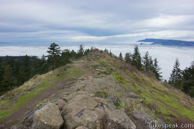
To reach the real summit, hike south a short distance up the rocky spine to the obvious high point. Climb up on the boulders and discover a triangular slab of concrete marking the summit. From here, there are views to the south to complete the panorama. Spencer Butte is surrounded by farm-filled valleys and evergreen-covered ridges. Enjoy the views!

When you’re ready to leave the butte, hike back the way you came. It’s almost all downhill on the return to the trailhead. No fee or permit is required to hike in Spencer Butte Park. The exposed mountaintop can definitely be windy, so pack an extra layer. Bikes are not allowed, but dogs are welcome on leashes, so get out and enjoy!
To get to the trailhead: Take Interstate 5 south of Eugene to exit 189. Drive three miles west on 30th Avenue and turn left onto Hilyard Street. Go three blocks and turn right onto 33rd Avenue. In half a mile, reach Willamette Street and turn left. Drive 1.8 miles south and turn into the trailhead parking area on the left, just south of 52nd Avenue.
Trailhead address: South Willamette Street, Eugene, OR 97405
Trailhead coordinates: 43.99593, -123.0997 (43° 59′ 45.34″N 123° 05′ 58.91″W)
View Spencer Butte in a larger map
Or view a regional map of surrounding Oregon trails and campgrounds.


 | South Falls This 1.1-mile hike goes up to and behind a 177-foot waterfall that is the jewel of Silver Falls State Park. |
 | Trail of Ten Falls This 7.9-mile loop passes ten acclaimed waterfalls in Silver Falls State Park on a picturesque and exciting hike that actually goes behind four of the waterfalls. |
 | Maple Ridge Loop This 2.8-mile hike in Silver Falls State Park ventures behind both South Falls and Lower South Falls and also explores a ridge-top forest. |
 | Terwilliger Hot Springs This 0.9-mile hike leads to a natural hot springs in Willamette National Forest where bathers can soak in a series of terraced pools. |
 | Lower Macleay Trail to Stone House This 1.8 to 2-mile hike starts by following Balch Creek to fern-covered ruins and can finish with a loop that exits Forest Park and passes through the Willamette Heights Neighborhood in Northwest Portland. |
 | Lower Macleay Park to Pittock Mansion This 5.4-mile hike in Forest Park takes Lower Macleay Trail to the Stone House ruins and ascends Wildwood Trail to Pittock Mansion, bagging a big view over Portland. |
 | Cornell Road to Pittock Mansion This 2.5-mile hike on Wildwood Trail and Upper Macleay Trail in Forest Park goes up a wooded hillside to Pittock Mansion, a landmark with panoramic views over Portland. |
 | Powell Butte This 2.15-mile lollipop loop combines Mountain View Trail and Summit Lane to explore the top of Powell Butte and its big views from Southeast Portland. |
 | More trails in Oregon Explore other hikes in Oregon including the Columbia River Gorge. |
Are there pet requirments?
[…] Ninety per cent of visitors to the summit of Spencer Butte use the main trail. Make is a slightly longer hike and avoid some of the crowds. Try this 5.2 mile out-and-back hike from Hike Speak. […]
[…] Mary’s Peak, which takes you to the highest point on the coastal range, Clear Lake Loop, or Spencer Butte. To be frank though, any state park, national forest, or riverfront park in the area will often […]