Mulholland Drive to San Vicente Mountain
in the Santa Monica Mountains
The shortest route up San Vicente Mountain approaches the peak from the east. This 2-mile round trip hike follows an unpaved portion of Mulholland Drive and climbs just 335 feet.
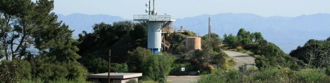
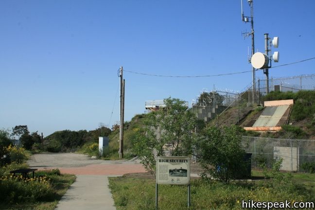
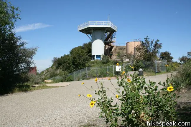
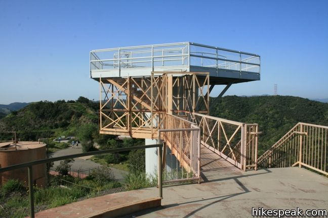
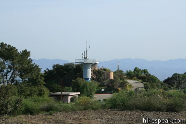
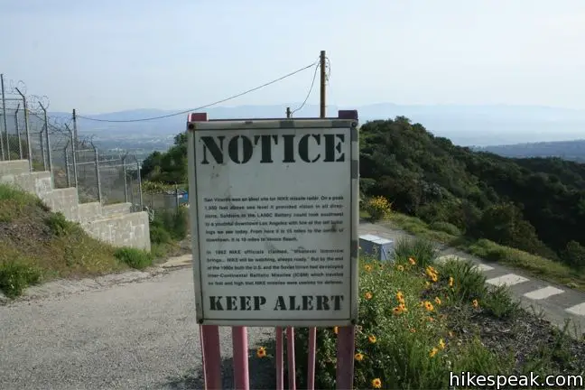
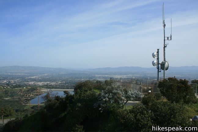
In the 1950s, San Vicente Mountain was used to defend Los Angeles from soviet missile attacks. Like Mount Disappointment in the San Gabriel Mountains and White Point on the Palos Verdes Peninsula, San Vicente Mountain was used as a Nike missile defense site to detect and intersect missiles directed at Los Angeles. After a decade, Nike missiles were made obsolete by long-range technology, but the Santa Monica Mountains Conservancy has done an excellent job preserving this old site, adding informative panels to keep this history alive.
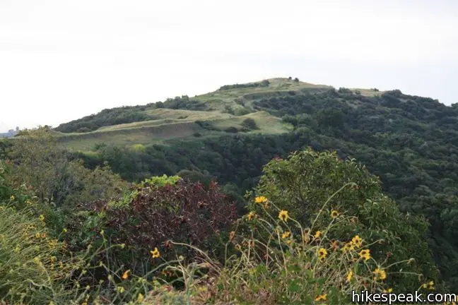
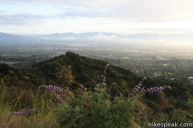
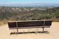
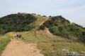
Today, the 1,960-foot peak provides visitors with a look back at this chapter in the city’s history. The summit remains wrapped in fencing, but in spite of its history, San Vicente Mountain is a very peaceful spot. There are several benches and tables spread out around the old buildings, along with restrooms and a water fountain, making San Vicente Mountain perfect for a picnic.
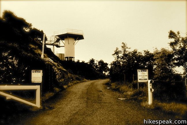
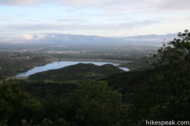
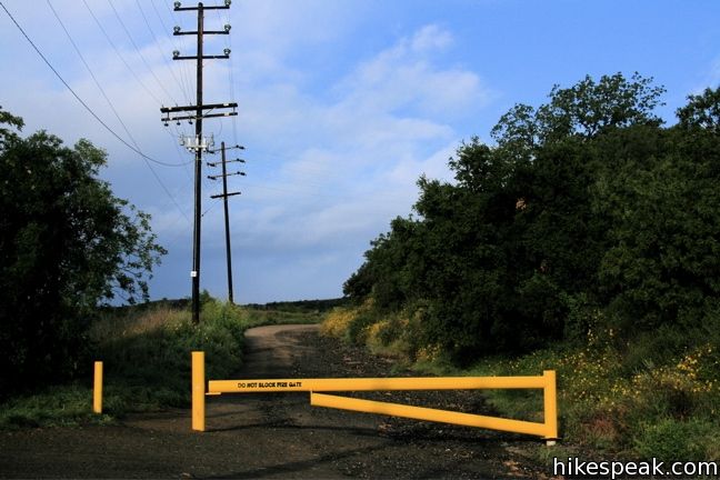
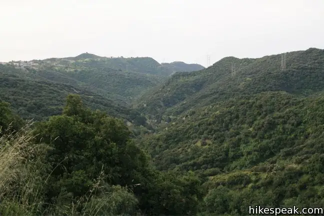
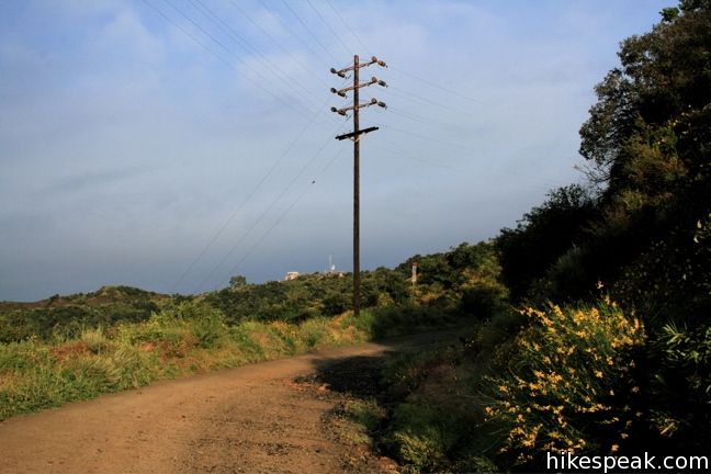
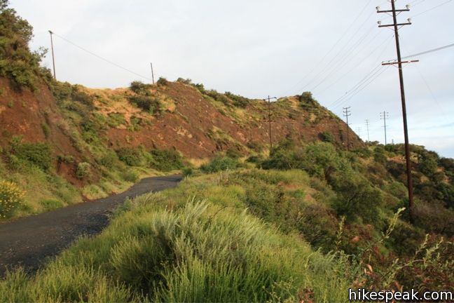
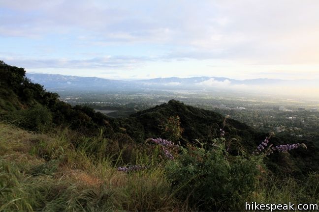
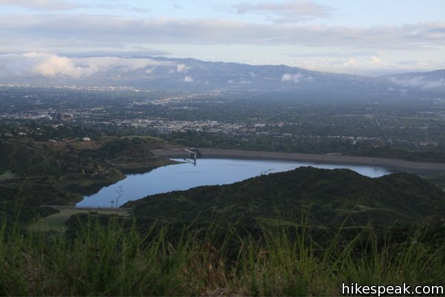
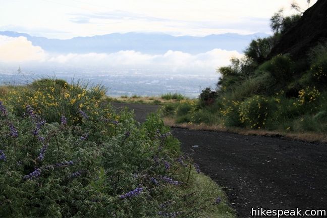
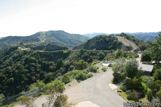
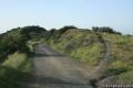
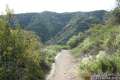
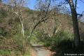
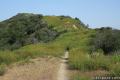
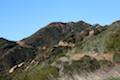
The hike begins at end of the drivable portion of Mulholland Drive two miles east of the 405 at Skirball Pass. On occasion the gate is opened up, allowing visitors to drive all the way up to San Vicente Mountain. Otherwise, hike past the yellow gate up unpaved Mulholland Drive. The radio towers on San Vicente Mountain can be seen straight ahead. To the south, the trail overlooks Mandeville Canyon, Westridge, and Canyonback Ridge. As unpaved Mulholland continues, the views expand in the opposite direction, down on Encino and the rest of the valley. The Verdugo and San Gabriel Mountains form an Arcadian horizon beyond the urban expanse.
The wide gravel road curves around to the north side of the mountain, arriving at a junction beneath the summit 0.85 miles from the start. Straight ahead, unpaved Mulholland continues across the Santa Monica Mountains all the way to Santa Maria near Topanga, where the pavement resumes. Turn left instead and march up to the mountaintop military base. Explore the old installations and take in the panoramic views, before returning the way you came. No fee or permit is required, so get out and enjoy.
For a longer hike, consider approaching San Vicente Mountain from the south on the 7.4-mile round trip Westridge Trail.
To get to the trailhead: From the 405 freeway take the Shirball Center Drive exit. Follow signs for Mulhollad Drive and head west. After 2 miles, Mulhollad Drive becomes unpaved and makes a hairpin turn to the left. Continue a quarter of a mile till you can drive no farther. Park behind the yellow gate and start hiking up the road (the trailhead for Canyonback Ridge is to the left of the trailhead for San Vicente Mountain). If the gate on Mulholland Drive is open, you are allowed to drive all the way up to the junction below San Vicente Mountain.
Trailhead address: 17024 Mulholland Drive, Los Angeles, CA 90049
Trailhead coordinates: 34.12815, -118.50275 (34° 07′ 41.3″N 118° 30′ 09.9″W)
View Santa Monica Mountains in a larger map
Or view a regional map of surrounding Los Angeles trails and campgrounds.


 | Caballero Canyon Trail This 3.4-mile round trip hike ascends a canyon on the north side of the Santa Monica Mountains with views over the San Fernando Valley. |
 | Vanalden Cave This 0.6-mile round trip hike visits a unique sandstone cave that you can stand inside and above. The hike can be extended to 1.55 miles round trip to visit a nearby vista point with a panoramic perspective of the Santa Monica Mountains. |
 | Westridge Trail to San Vicente Mountain This 7.4-mile hike travels a scenic ridge between a Brentwood neighborhood and a summit that was once used as a Nike Missile site. |
 | Mandeville Canyon to San Vicente Mountain Loop This 5-mile hike incorporating a few trails, taking a DWP road up to Westridge to visit San Vicente Mountain, before crossing Mulholland Drive and Canyonback Ridge to return to Mandeville Canyon via Hollyhock Fire Road. |
 | Upper Canyonback Trail This 3 mile hike descends Canyonback Ridge from Mulholland Drive to the Mountain Gate Country Club Estates. |
 | Sullivan Canyon This 8.5-mile round trip hike follows a wide trail up the center of a sycamore-filled canyon. |
 | Sullivan Ridge A prominent lone-standing Live Oak along Sullivan Ridge makes a natural turnaround point and a 7.5 to 8.3 mile round trip hike. |
 | Murphy Ranch This 3.85-mile loop descending from Sullivan Ridge Fire Road into Rustic Canyon, where hikers can visit abandoned buildings once occupied by Nazi sympathizers. |
 | Getty View Park This 3-mile out and back hike crosses East Sepulveda Fire Road (Casiano Fire Road) on a ridge east of the 405 Freeway that offers light traffic and plentiful views of the Getty Museum and Santa Monica Bay. |
 | More trails in the Santa Monica Mountains Explore other destinations in the range. |
 | Parker Mesa Overlook This steep out-and-back hike rewards the effort with excellent views of the Pacific Ocean. |
 | Temescal Canyon This 2.6-mile loop offers a variety of scenery and decent exercise, despite its relative brevity. |
 | Calabasas Peak This 3.6-mile hike travels an easy-to-follow fire road, climbing 900 feet to panoramic views of the Santa Monica Mountains and San Fernando Valley. |
 | The Grotto This 3-mile out and back hike visits a remote grotto in the Santa Monica Mountains National Recreation Area. |
[…] not much of a hiker but I had a wonderful time hiking an easy trail on San Vicente Mountain. I especially enjoyed the friendly hikers –this is a trail that attracts families with kids […]
[…] Nike Missile Station: This hike is one of my favorites because it’s the jumping off point for a whole system of trails. […]
Can you get on Sullivan canyon from the antenna base?
Yes. Head west on Mulholland Highway for about a mile. Turn left down Sullivan Ridge Trail. After half a mile, you’ll come to the top of Sullivan Canyon Trail on the left.