Mount Lowe Road to San Gabriel Peak
in the San Gabriel Mountains
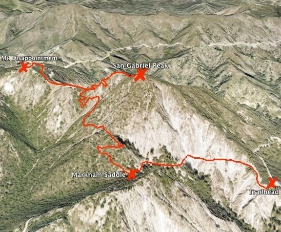
One of the routes to San Gabriel Peak begins on Mount Lowe Road, creating a 3.2-mile round trip hike that climbs 1,050 feet. This trek leaves from a trailhead at Eaton Saddle along Mount Wilson Road and delivers great views the entire way to the summit.
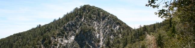
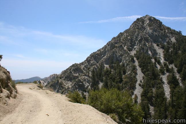
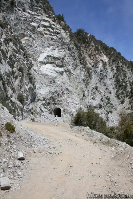
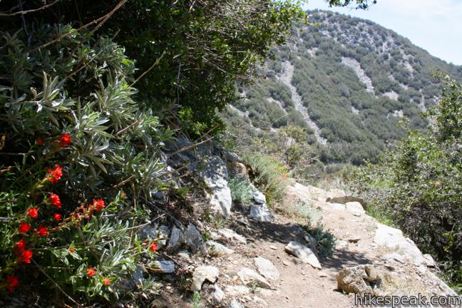
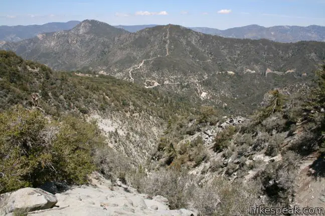
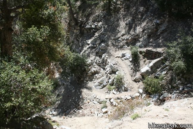
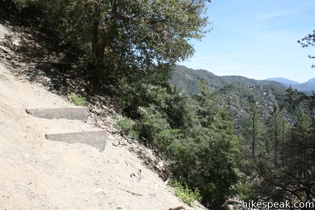
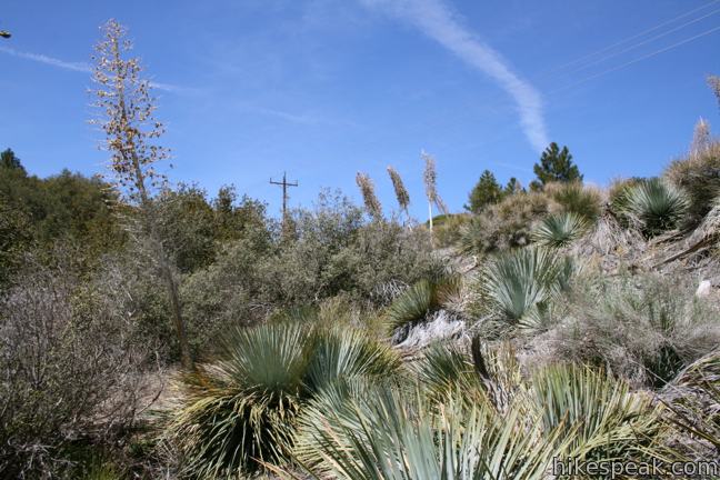
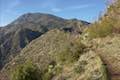
Start hiking up Mount Lowe Road (Mount Lowe Fire Road) where you will be greeted immediately by a head-on view of Mount Markham. On the left side of the wide trail, the mountainside drops away into Eaton Canyon to the east below Mount Wilson and Occidental Peak. The dirt road bends to the right toward San Gabriel Peak and continues gradually uphill to Mueller Tunnel, which cuts through the steep face of San Gabriel Peak.
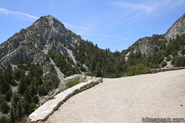
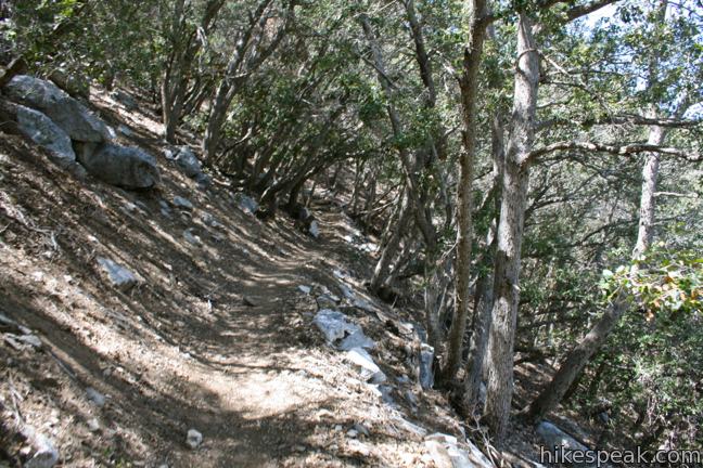
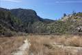
A short distance beyond the tunnel, which was built in 1942, and 0.6 miles from the start, the trail arrives at Markham Saddle. If you continued straight down Mount Lowe Road, you would reach Inspiration Point and Mount Lowe Trail Camp. To the right is a cement water tower and a single-track heading west to San Gabriel Peak. Turn right here up San Gabriel Peak Trail. The next 3/4 of a mile are spent weaving up the slope of San Gabriel Peak. The trail carves around several adventurous outcroppings with great views to the south and west where the mountains give way to the city below.
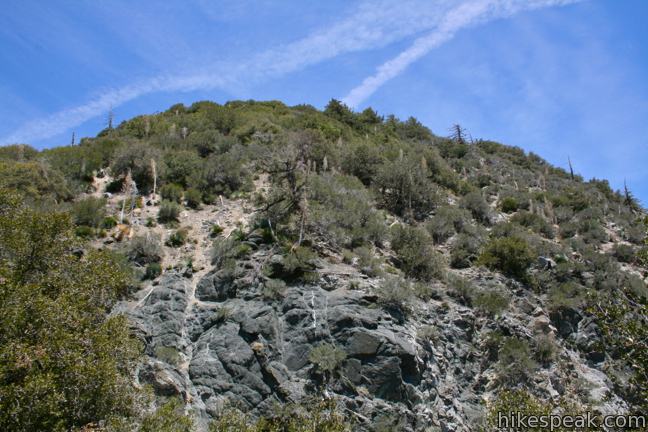
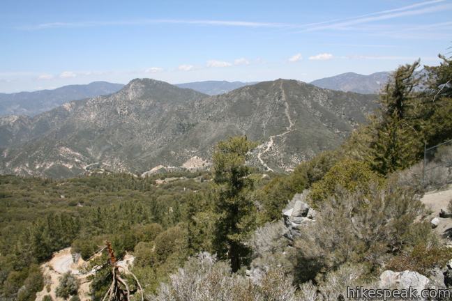
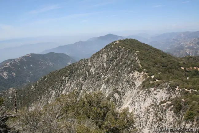
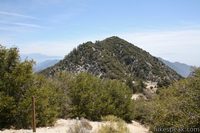
The trail Ts at a saddle half a mile from the top. To the left is Mount Disappointment, whose summit offers a great view of San Gabriel Peak and surrounding mountains. To the right is San Gabriel Peak, the second tallest mountain in the front range of the San Gabriel Mountains (Strawberry Peak is three feet taller).
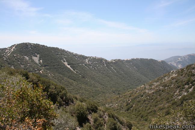
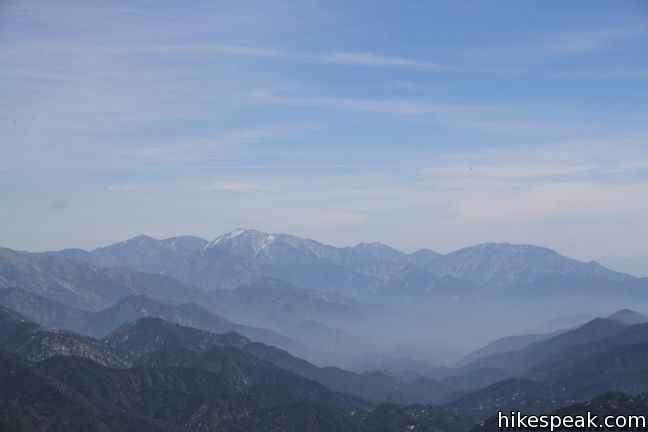
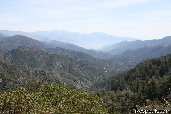
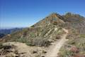
Turn right and press on for San Gabriel Peak. The trail switches steeply through chaparral before reaching the summit at 6,161 feet, which offers fine views of the lower San Gabriel Mountains. One can see Mounts Baldy, Wilson, and Lowe, and legend has it, Catalina Island is visible on a clear day (though you probably won’t see much beyond Pasadena).
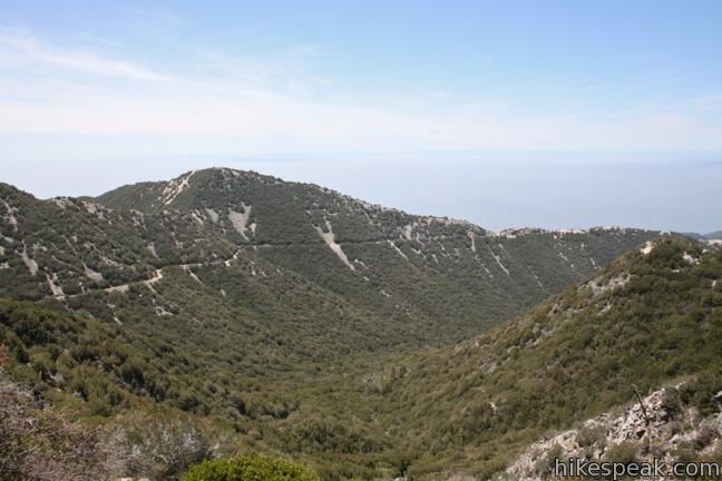
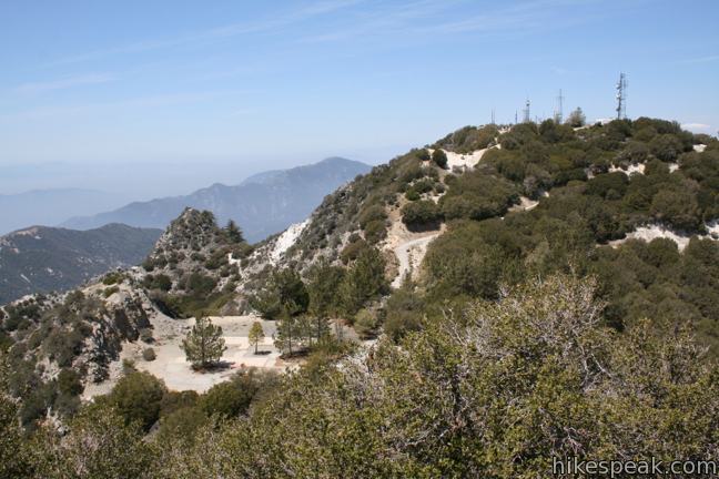
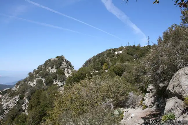
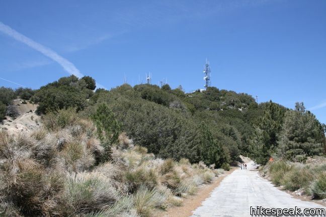
The adjacent Mount Disappointment has clearer views because the mountaintop was leveled and cleared during the Cold War to host a military satellite installation. Mount Disappointment served as an air-defense Nike Missile site. Radio towers and other military installation still stand on the summit.
Over a hundred years ago, surveyors gave Mount Disappointment its name. After reaching the top, they realized that the high peak they sought was actually San Gabriel Peak, which is two hundred feet taller.
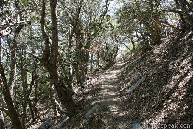
To get to Mount Disappointment, descend to the saddle at the T in the trail and continue straight to a clearing filled with cement slabs. Follow the paved Mount Disappointment Fire Road up to the summit. This adds about half a mile (round trip) to the hike, and yes the views are different enough to warrant the extra effort.
The round trip distance of this hike to San Gabriel Peak is 3.2 miles (or 3.7 miles if you visit Mount Disappointment).
An alternate route to the summit from Mount Disappointment Fire Road starts farther down Mount Wilson Road. This is a slightly longer hike with more elevation gain (1,400 feet vs. 1,050 feet). Subjectively, the route from Eaton Saddle is the more enjoyable of the two. The trail offers better views and packs more into a shorter excursion than the longer and steeper alternative.
This hike down Mount Lowe Road begins from an amenity-free trailhead within the Angeles National Forest where an Adventure Pass (day use pass) is no longer required. Dogs and mountain bikes are welcome. No fee or permit is required to hike to San Gabriel Peak, so get out and enjoy!
To get to the trailhead: From the 210 Freeway in La Cañada Flintridge, head northeast on Angeles Crest Highway (CA 2) for 14 miles and turn right on Mount Wilson Road Box Road (after mile marker 38). Drive 2.3 miles to the Markham Trailhead at Eaton Saddle and pull into the dirt lot on the right at the start of Mount Lowe Road.
Trailhead address: Mount Wilson Red Box Road & Mount Lowe Road, Angeles National Forest, Altadena, CA 91001
Trailhead coordinates: 34.2393, -118.0934 (34° 14′ 21.5″N 118° 05′ 36.2″W)
View San Gabriel Peak in a larger map
Or view a regional map of surrounding Los Angeles trails and campgrounds.
The trail from Mount Lowe Road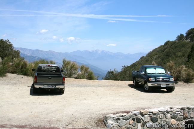


Views from San Gabriel Peak and Mount Disappointment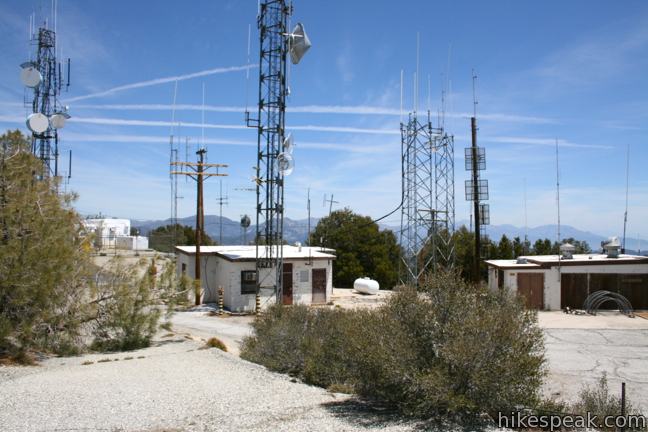


The trail from Mount Disappointment Fire Road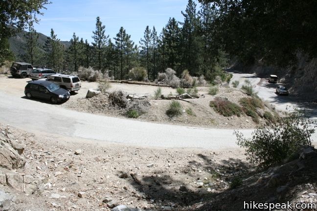


 | Inspiration Point & Mount Lowe Trail Camp This 7.25-mile round trip hike descends Mount Lowe Road into the San Gabriel Mountains to a historic scenic overlook and a trail camp built on interesting ruins. |
 | San Gabriel Peak from Mount Disappointment Fire Road This 6,161 foot peak is reachable via a 4-mile round trip hike from Mount Disappointment Fire Road. |
 | Strawberry Peak This 7.5-mile hike to the highest summit in the front range of the San Gabriel Mountains starts out gradual and becomes steep, presenting grand views of surrounding mountains and the cities below. |
 | Strawberry Meadow This 9 to 11-mile hike goes around Strawberry Peak to a remote and scenic flat below a massive cliff on the north side of the mountain, offering views of Big Tujunga Canyon and surrounding peaks along the way. |
 | Switzer Falls This 4.5-mile hike starts out above and finishes below a 50-foot tall waterfall. |
 | Colby Canyon Trail to Josephine Peak This 8.7-mile hike ascends an infrequently visited canyon off Angeles Crest Highway up to a saddle below Strawberry Peak and then takes a wide dirt road up to a summit in the front range of the San Gabriel Mountains with 360-degree over Big Tujunga Canyon and cities to the south. |
 | More trails in the San Gabriel Mountains Explore other destinations in the range. |
[…] Mt Lowe Fire Road to San Gabriel Peak – Hikespeak […]
I love your site and I use it all the time when I need extra information.My latest adventure in the Angeles National Forrest ( Now a National Monument). Did a 6.4 Mile trek covering 3 peaks in the front range of the San Gabriel Mountains. Check out my video, make sure you Subscribe & Like. Hope you enjoy the video, I do enjoy making them.
https://www.youtube.com/watch?v=KHBSsDt0FOk
Your website is a wonderful public service! I took a friend visiting from London on this hike–not planned in advance, and having no trail map; we saw a few cars parked at the trailhead and decided to risk not having an Adventure Pass (which I now find out from your writeup was not required after all, but I’m going ahead and buying an annual pass to support the parks agency). My friend’s smartphone battery died, and neither of us had a camera, so we resigned ourselves to having only memories of our walk. But your site (which I found via Bing), with its fine narrative, photos, and map, will enable us to relive our experience and share it with others. Now we know the name of the flattened peak whose name belies the stunning views from it. Mt. Disappointment surely didn’t disappoint!
It’s a beautiful trail, but BIG WARNING, if it starts to rain RUN don’t walk back as fast as you can. We laughed off the first sprinkles, but turned back about a mile out when we heard thunder. Then the rain picked up and that lovely trail along the ridge suddenly became ankle deep. And that tall mountain rock wall started producing waterfalls down onto the trail – especially large on either side of the tunnel. Half the tunnel was blocked by this waterfall which was also spilling out rocks and eroding the trail. Another hiker encouraged us to run through it anyway since sundown was approaching and it could certainly get worse. So we ran through the waterfalls and all the way back to the cars getting pelted with falling rocks. Fortunately no one was hit by any rock too big.
The drive back was also not too safe. Some falling rocks hit our car.
Anyway, otherwise, it’s a gorgeous trail that I hope to attempt again on a cloudless day.