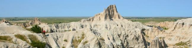
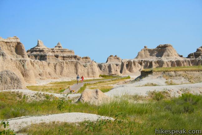
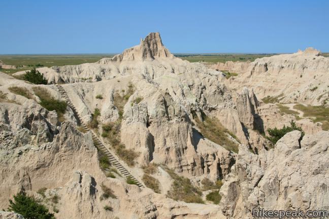
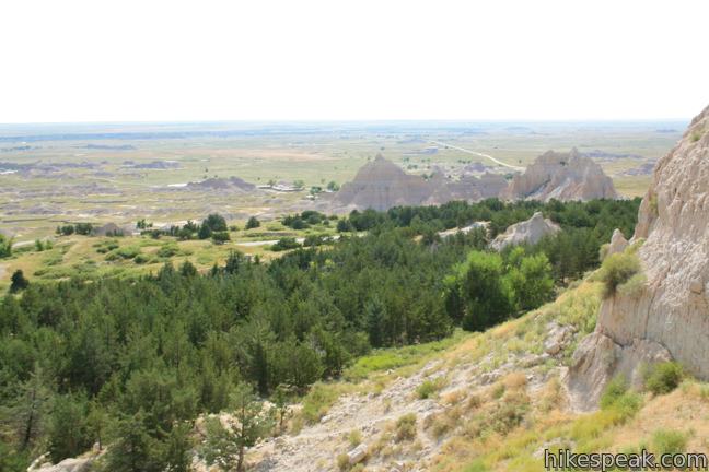
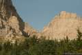
This trek travels up a badlands canyon to an overlook with massive views over the Great Plains. The hike is 1.33 miles round trip with 125 feet of elevation gain. This hike does not have a boardwalk to follow, just a dirt trail and a steep wooden ladder. Notch Trail also traces a cliff’s edge so it is not a good option for hikers with a fear of heights. For those interested in a little adventure, this hike has a lot to offer.
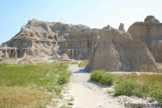
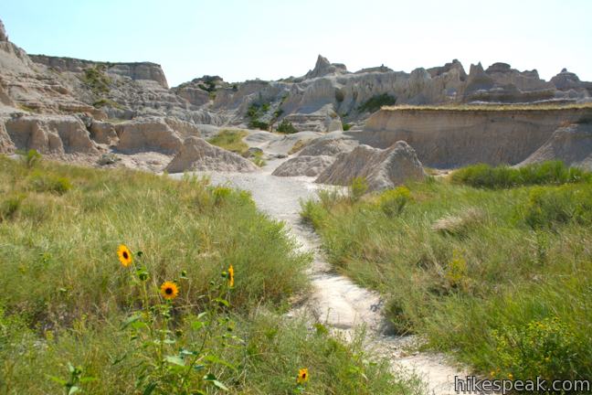
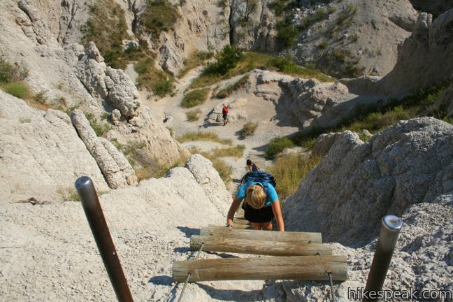
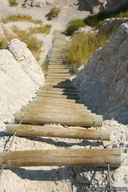
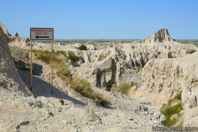
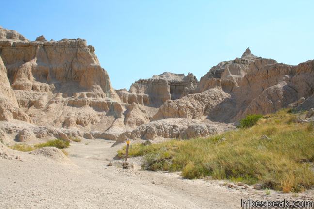
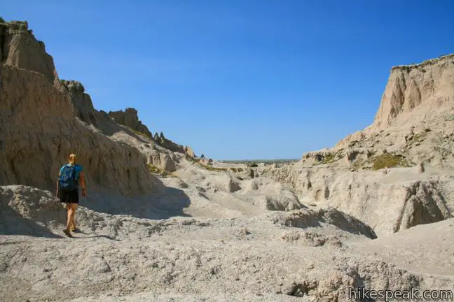
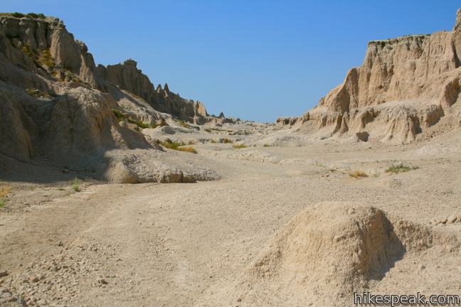
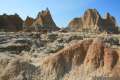
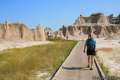
Begin at the south end of the shared trailhead for Door Trail, Window Trail, and Notch Trail. The dirt path heads southward into a canyon of eroded sediment spotted by juniper and brush. A third of a mile from the start, the canyon walls narrow, heading toward a dry falls. Luckily, no scaling is required. A wooden ladder presents itself, bolted to the right side of the canyon.
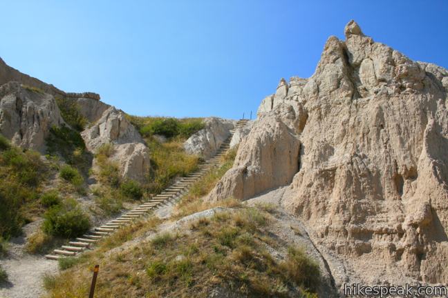
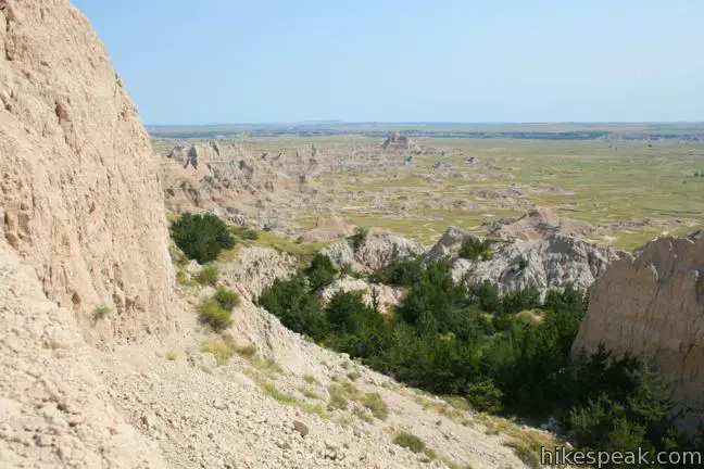
Take it up a notch! Climb over 50 rungs to the top of a ledge that lines the canyon. When your feet are back on solid ground, turn left and skirt a cliff to return to the canyon floor above the dry falls.
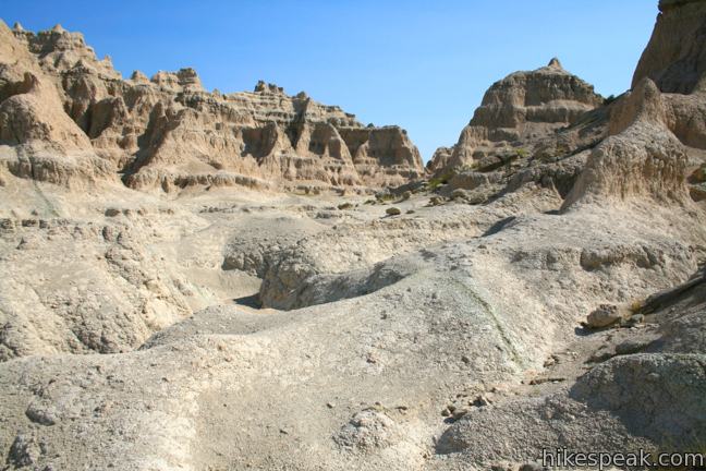
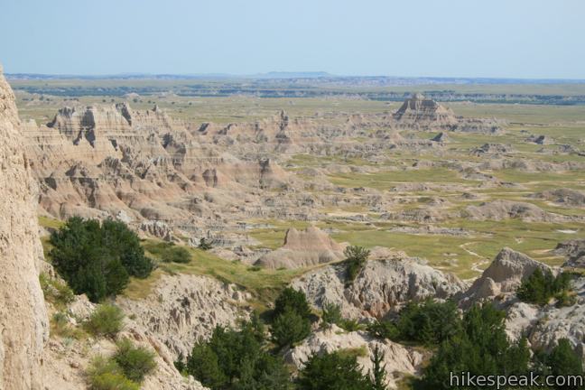
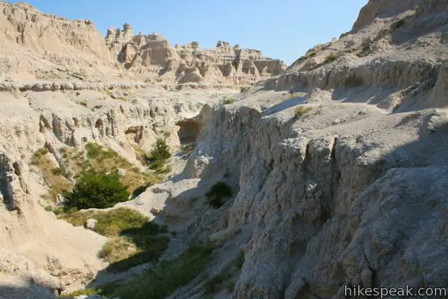
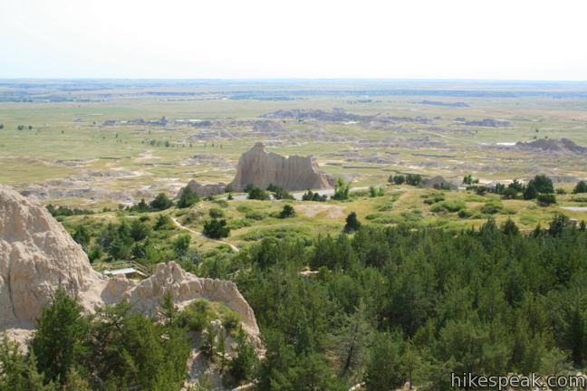
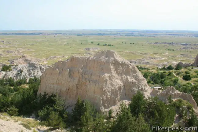
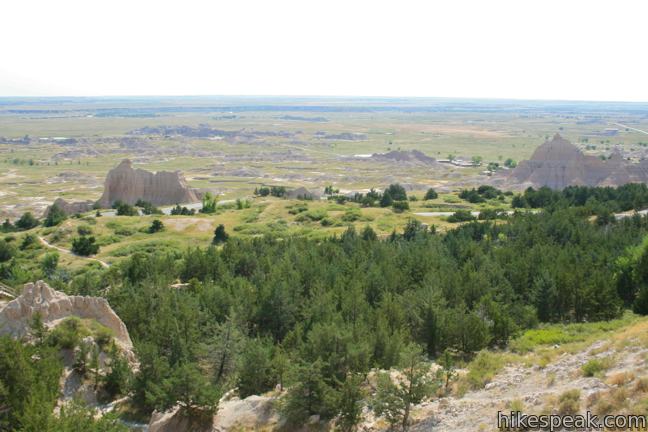
The trail, which had been faint through this area, is now easy to follow with posts with reflective markers to keep your on course. Come to a split in the ravine and stay to the right, observing the trail markers. The hike comes to a sudden end at a cliff dropping steeply into the badlands to the south. The overlook has sweeping views of this unique landscape as well as miles and miles of prairie grasses. Cliff Shelf Nature Trail is visible below. Take in the view before returning the way you came. The ladder is a little trickier going down, so exercising caution on the descent. No permit is required to hike Notch Trail, but Badlands National Park has an entrance fee.
To get to the trailhead: Take Badlands Loop Road (Route 240) two miles east of the Ben Reifel Visitor Center to a large turnout on the east side of the road for Door, Window, and Notch Trails. Notch Trail begins from the south end of the lot.
Trailhead address: Badlands Loop Road (SD 240), Badlands National Park, Interior, SD 57750
Trailhead coordinates: 43.76012, -101.92825 (43° 45′ 36.42″N 101° 55′ 41.7″W)
You may also view a regional map of surrounding South Dakota trails and campgrounds.


 | Door Trail This one-mile hike passes through a gap in Badlands Wall to a viewing platform followed by a cross-country path into the rugged badlands. |
 | Window Trail This level 0.25-mile round trip hike leads to an opening in the Badlands Wall overlooking the rugged landscape beyond. |
 | Cliff Shelf Nature Trail This half-mile hike loops through a juniper forest on the south side of the Badlands Wall, reaching a viewpoint below the notch. |
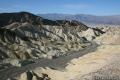 | Zabriskie Point in Death Valley National Park Zabriskie Point offers a stunning panorama of the badlands near Furnace Creek. |
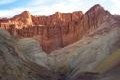
 | Badlands Loop in Death Valley National Park This 2.5-mile loop offers a great immersion into the terrain beneath Zabriskie Point. |
 | Golden Canyon - Gower Gulch Loop in Death Valley National Park This 4-mile loop visits stunning terrain in the badlands region near Furnace Creek. |
[…] The Notch Trail: THIS! This was the best part of my trip. While the trail is technically only 1.5 miles roundtrip, it’s got adventure around every corner (especially in the eyes of a young one). Be sure to wear sturdy shoes, pack water and plenty of snacks and wear sun protection. We packed a full lunch to enjoy at the top (the “notch) and it was a glorious reward. I liked not having to tell my kids to stay on the path the whole time and they loved the ladder climb. It’s a relatively steep rope-and-wood ladder in the middle of the hike and provides a confidence-building challenge for youngsters. There is one spot post-ladder that advises you to stay away from the cliff edge – you better believe I was attempting to hold 6 tiny hands at that point. But overall, great hike for children and definitely beautiful for adults as well. […]
This walk sounds amazing.
Is it possible to walk up with a hiking backpack with a 2yrs old in it?
(The ladder doesn’t look that steep)
I just did this hike 2 days ago. The pictures are deceiving because the ladder is steep at the top. However, we did see several people packing kids on their back. Just take it slow.
Can a wheelchair be pushed as far as the ladder?