Mount Ollivier
in Aoraki Mount Cook National Park

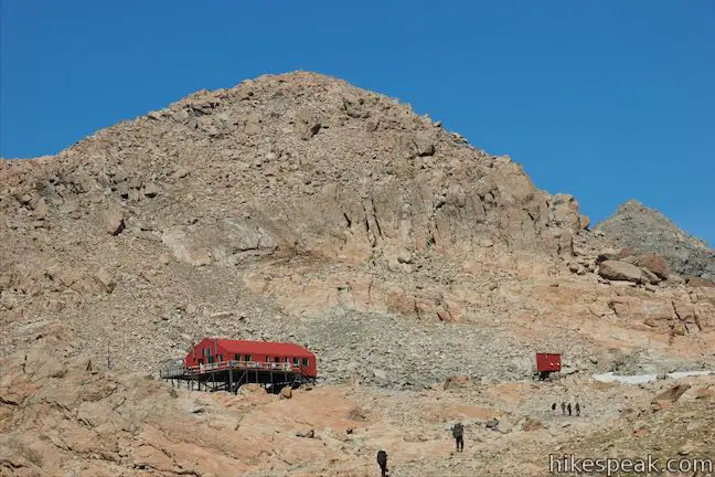
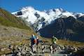
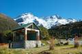
Mount Ollivier is a 1,933-meter tall peak in the Sealy Range of the Southern Alps in Aoraki Mount Cook National Park. In 1939, Sir Edmond Hillary summited the mountain in what is recognized as his first major climb. (He went on to bag some other noteworthy peaks as well…) To get to the top of Mount Ollivier, you will first need to make your way to Mueller Hut, which is accomplished by trekking up Sealy Tarns Track and Mueller Hut Route, gaining 1,045 meters over 5.4 kilometers. If you’re still feeling energetic after that steep effort, it only takes about thirty minutes to ascend another 125 meters to the summit. No pole-guided route leads to the mountaintop, so the path is yours to forge. It should be about 1.2 kilometer round trip from hut to summit.
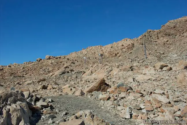
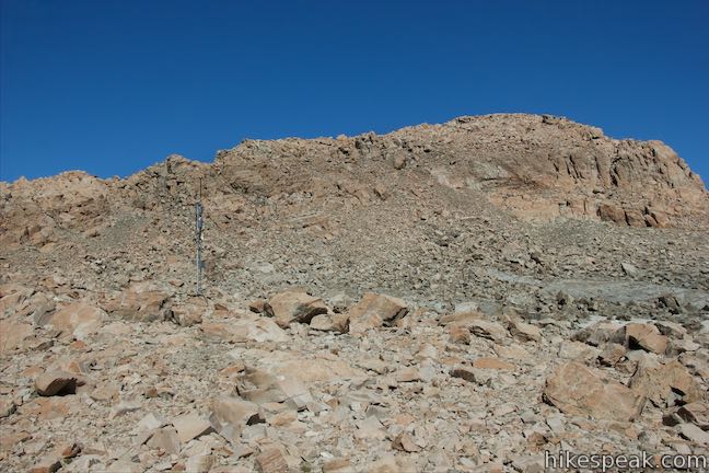
Leaving Mueller Hut, you have a few potential courses to take up the mountain. You could make your way over to the ridge to the left and follow that up to the summit or head straight for the crown up a slope of looser-looking rock. Splitting the difference actually seems like the best option, joining the ridge partway up the side of the mountain. Walk away from the hut toward a collection of weather survey stations or radio towers and find a faint path to follow toward the ridge that extends northeast from the summit.
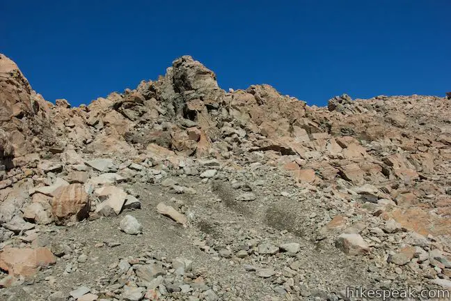
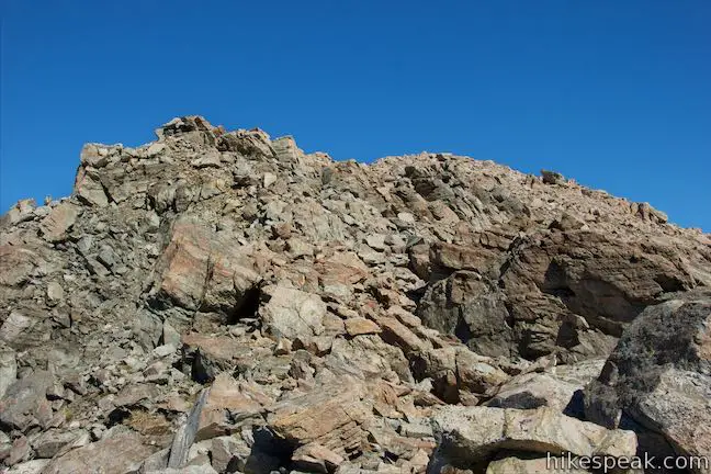
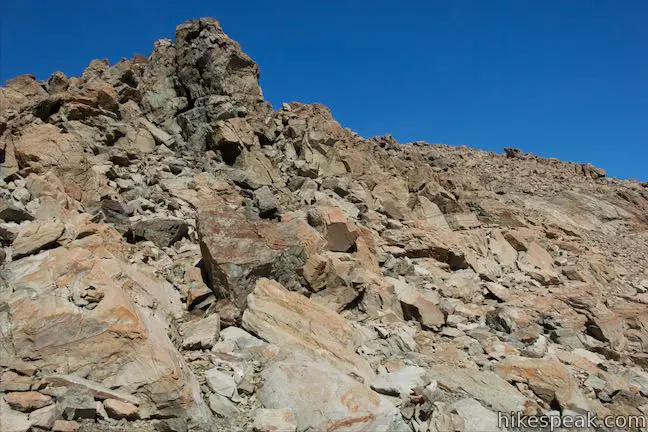
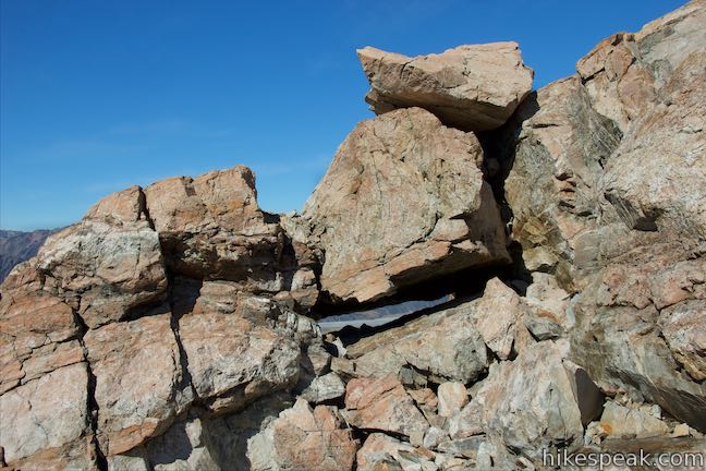
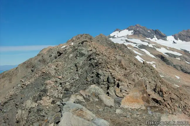
Bear toward a darker rock that stands out on the ridge and employ a few short switchbacks to get up among the larger rocks on the spine of the ridge. At this point you may need to use your hands and do a bit of climbing to get up onto the ridgeline. The rest of the ascent is easy class 2. Hoist yourself up onto boulders, being conscious to stay on the right side of the divide. The other side of the ridge is much more precarious, with long, steep drops to the valley below.
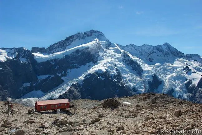
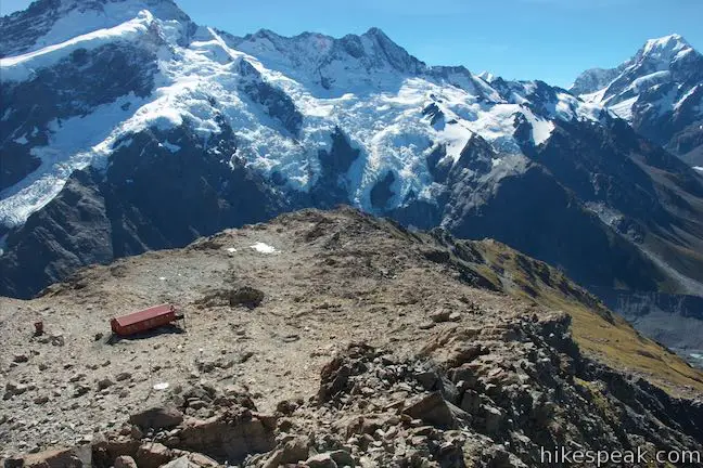
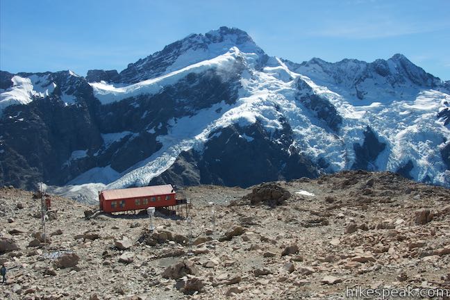
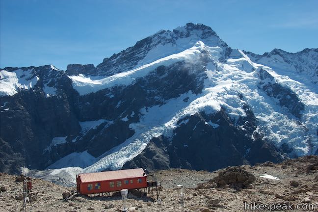
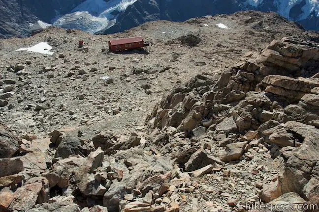
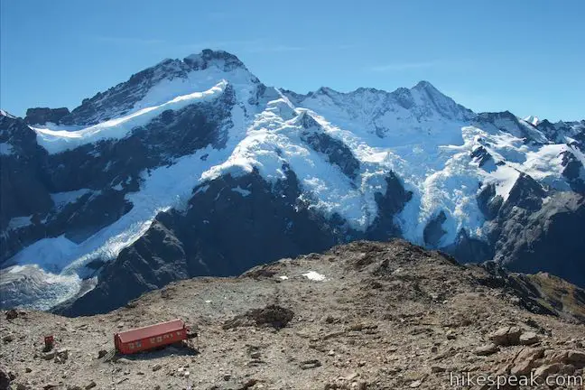
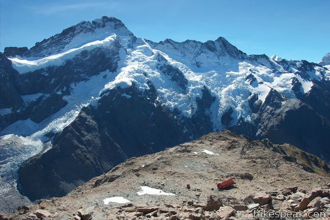
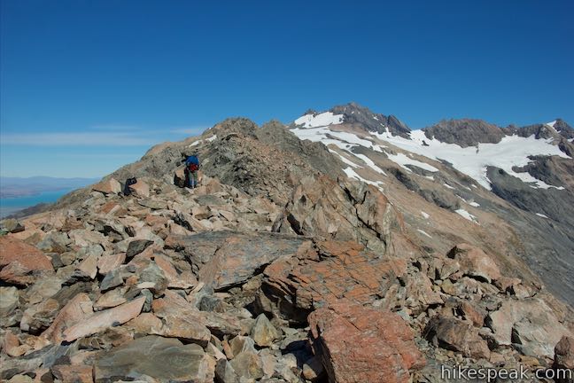
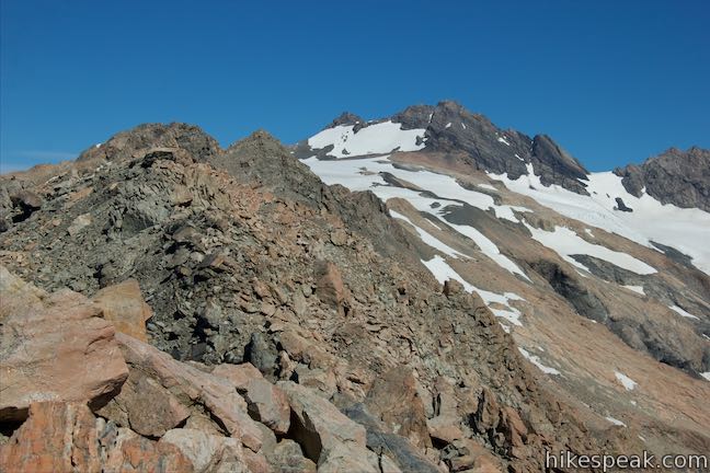
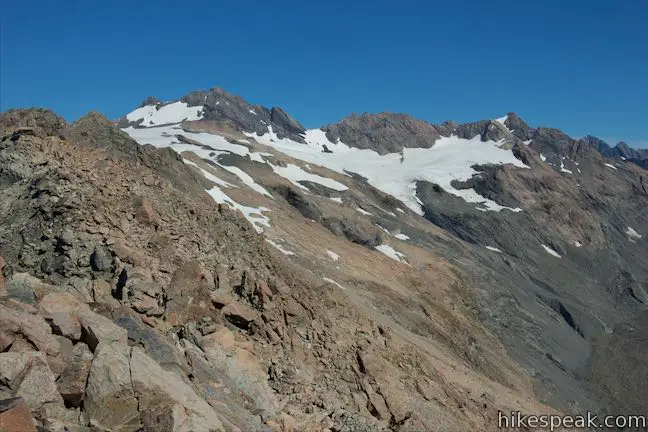
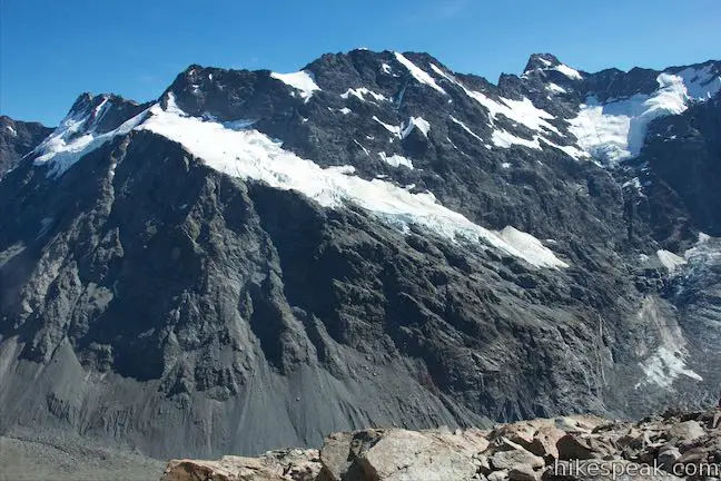
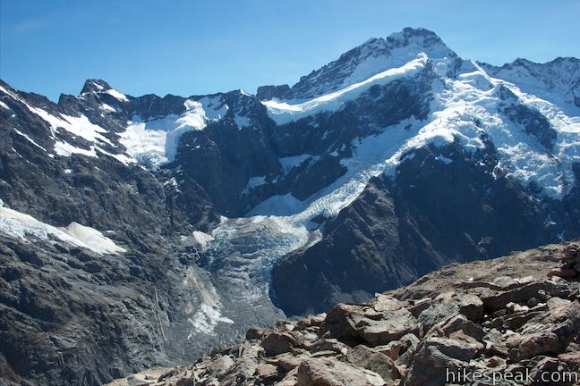
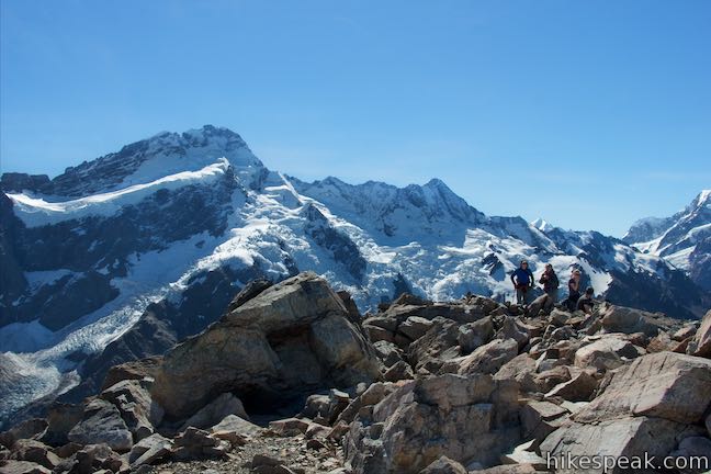
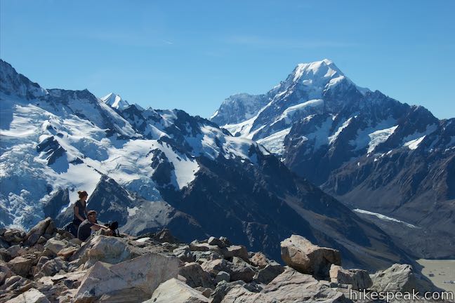
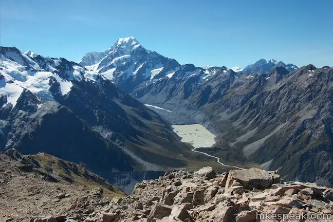
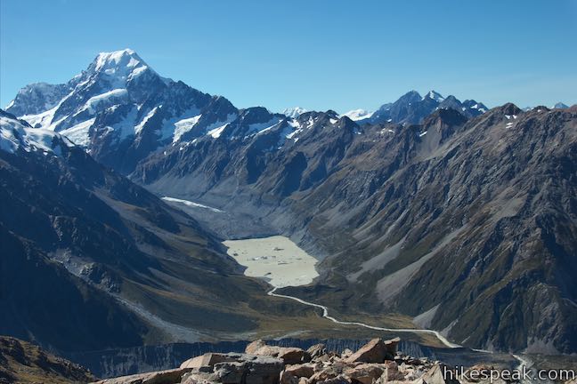
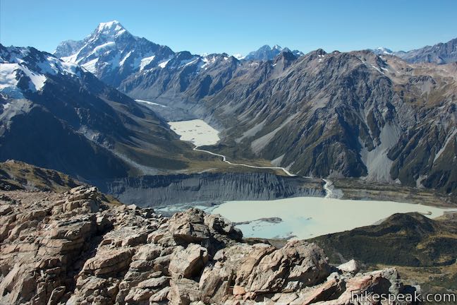
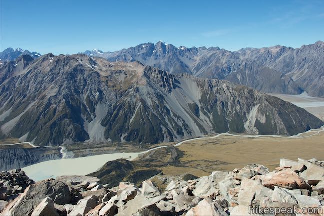
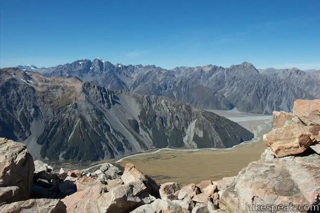
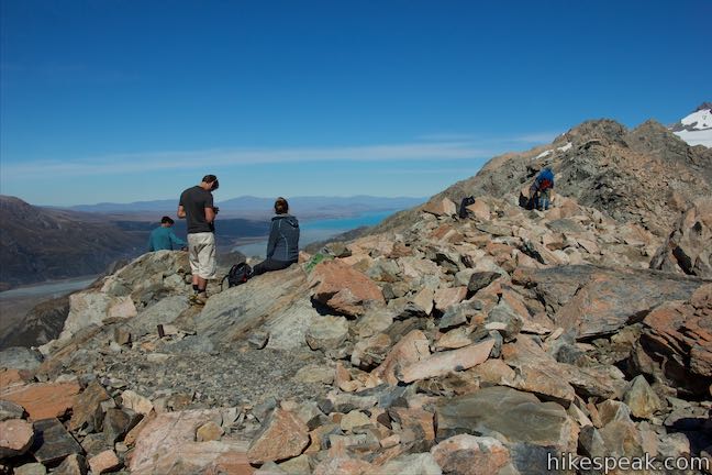
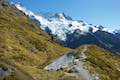
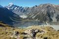
Cairns, or stacks of rocks, mark a course for you to follow. Go over and around small and large boulders. As you make your way up the steep side of the mountain, Mueller Hut gets smaller and smaller behind you as more of the surroundings come into view. These perspectives of Mueller Hut and the vast beauty around it are a great reason to head up Mount Ollivier. About that surrounding beauty… Mount Ollivier offers broader views of the landscapes you’re familiar with from the trek to Mueller Hut, looking north toward Mount Sefton and northeast toward Mount Cook. From this lofty vantage, it might seem like you’re approaching a similar elevation to Mount Cook, but that great mountain is actually 1,800 meters taller!
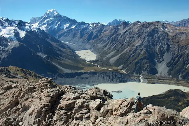
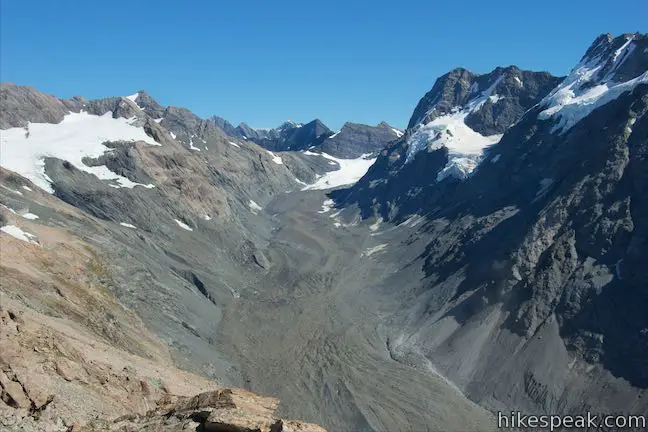
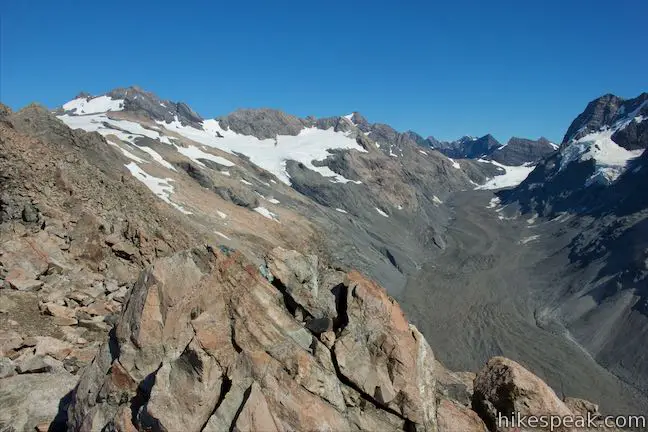
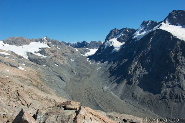
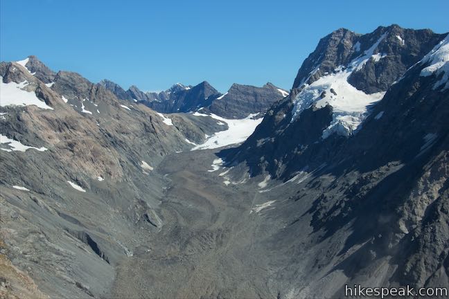
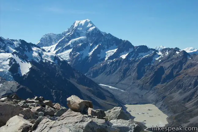
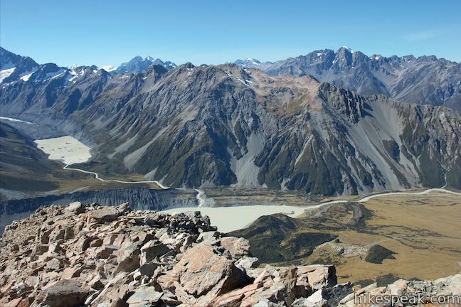
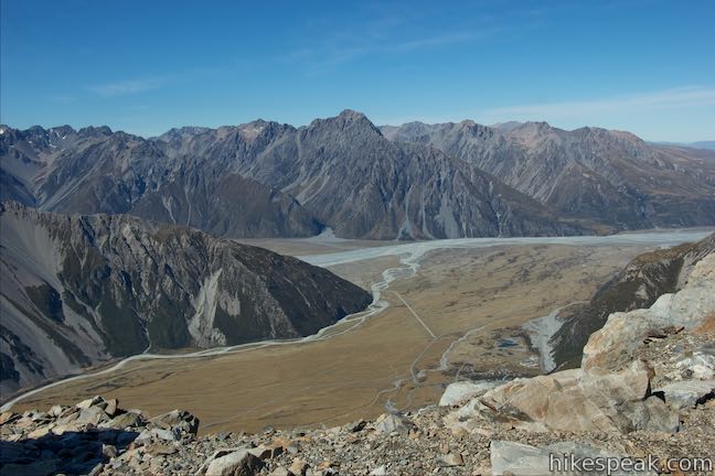
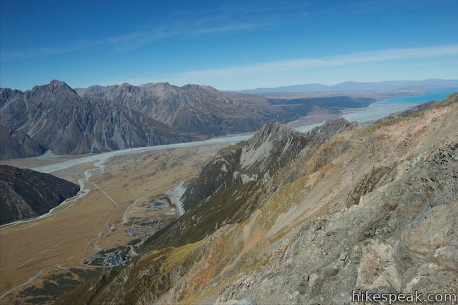
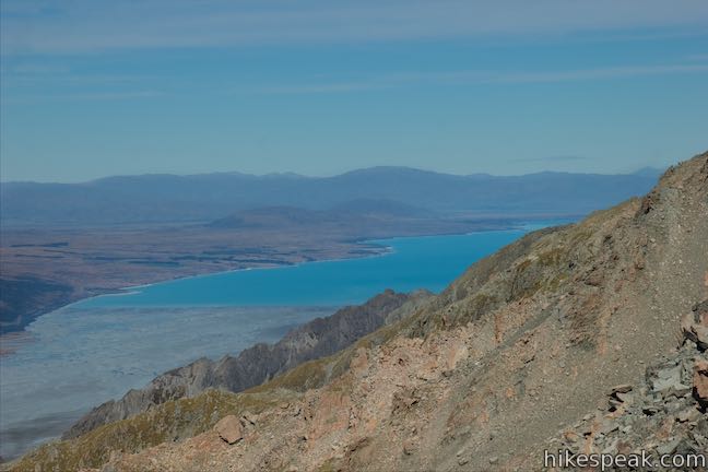
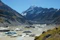
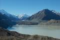
Peering off the side of the mountain, you can look down on White Horse Hill Campground where the trek began. How small does the car park look now, 1,150 meters below? Beyond the valley to the south, you’ll see the turquoise body of Lake Pukaki standing out from the surrounding landscape. Mueller Glacier dominates the land to the west and Mount Ollivier’s summit offers views to the south that are not visible from Mueller Hut.
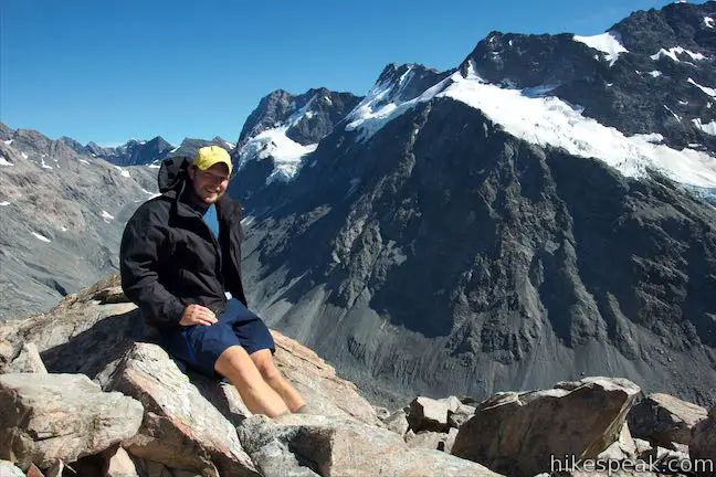
The climb eventually gets easier as the mountain tapers toward the top, coming to a false summit. Many hikers stop right here, across a shallow saddle from the true summit, which is 100 meters farther to the south and marked by a large cairn. Hikers are warned not to continue farther along the ridge beyond the summit as the crossing becomes dangerously steep and loose. Looking down the plunging slope to the left should certainly inspire plenty of caution.
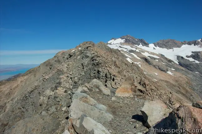
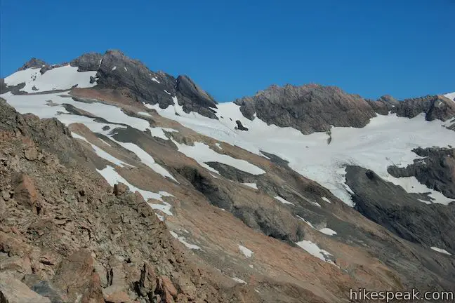
Beyond Mount Ollivier, the ridgeline continues southwest to Mount Sealy, a 2,627-meter tall summit draped in glaciers. Metelille Glacier clings to the upper mountain slopes above the trough carved by Mueller Glacier. Have a seat on a boulder and enjoy round-the-compass views.
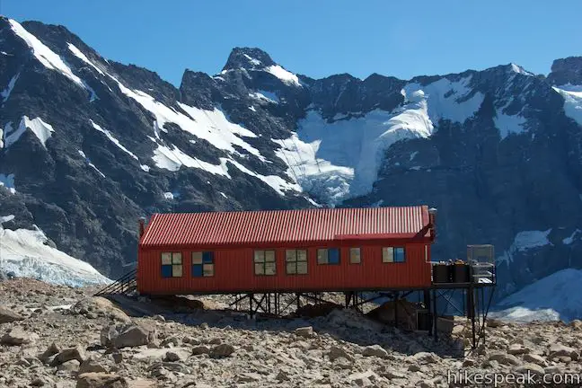
When you are ready to head back, return the same way. The common path may actually be a little tougher to follow on the way down, but the bright red box of Mueller Hut is an easy target to hit. Get back to the hut and relax before continuing with the descent. All in, it is about 11.7 kilometers round trip from White Horse Hill Campground to the top of Mount Ollivier with 1,170 meters of elevation change (or 7.3 miles round trip with over 3,840 feet of elevation change). Mount Ollivier is a satisfying summit to bag and perhaps, like Sir Edmond Hillary, you’ll be inspired to tackle taller mountains in the future, even if they aren’t Mount Everest.
No fee is required to enter Aoraki Mount Cook National Park and you do not need a permit to hike up Sealy Tarns Track and Mueller Hut Route to Mount Ollivier. For overnight treks, visitors should reserve a bunk at Mueller Hut.
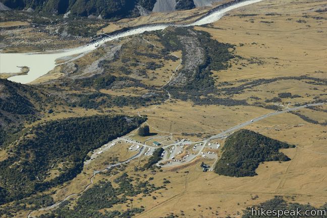
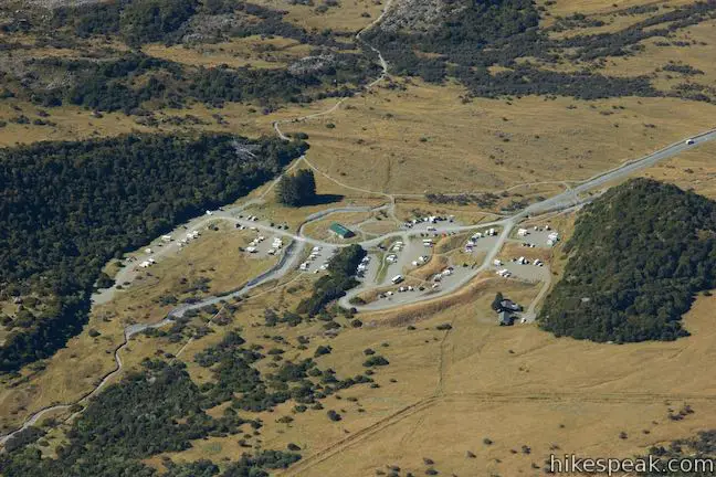
Directions: Take State Highway 8 to State Highway 80 (Mount Cook Road), at the south end of Lake Pukaki. Drive north on SH 80 for 54.5 kilometers. Before reaching Mount Cook Village, turn right on Hooker Valley Road. After 2 kilometers, the road ends at White Horse Hill Campground. Day use parking is available in front of the campground on the left where the track begins.
Trailhead address: Hooker Valley Road, Aoraki Mount Cook National Park, Canterbury, 7999, New Zealand
Trailhead coordinates: -43.71875, 170.0926 (43° 43′ 07.50″S 170° 05′ 33.36″E)
View Aoraki Mount Cook National Park in a larger map
Or view a regional map of surrounding New Zealand tracks, campgrounds, and lodging.


 | Kea Point Track This easier 3-kilometer round trip walk goes to landing above Mueller Lake with views of Mount Sefton and Mount Cook. |
 | Sealy Tarns Track This incredibly steep and incredibly scenic 5.8-kilometer round trip hike uses a string of staircases to ascend a mountainside to pools that reflect views of Mount Sefton and Mount Cook. |
 | Mueller Hut Route Ascend past Sealy Tarns on a rough route to a famed hut for a 10.5-kilometer round trip hike with spectacular views. |
 | Hooker Valley Track This superb 11-kilometer round trip hike heads up Hooker Valley to an iceberg-filled lake at the end of an impressive glacier below Mount Cook. |
 | Tasman Glacier View & Blue Lakes This pair of tracks combine for a hike of 1.85 kilometers round trip (or more) with views of small emerald pools and a large milky lake below Tasman Glacier. |
 | More trails in New Zealand Explore other destinations for walking and hiking (as well camping and lodging) in New Zealand. |
 | White Horse Hill Campground This 60-site campground is surrounded by great hiking tracks and just a few kilometers from Mount Cook Village, making it an ideal place to stay during a visit to Aoraki Mount Cook National Park. |
Mount Ollivier on wikipedia.org
Mount Ollivier on summitpost.org
Mount Ollivier on worldtrippy.com
The Department of Conservation brochure for walking and cycling in Aoraki Mount Cook National Park
Kea Point Walk on rankers.co.nz
The Department of Conservation webpage for Aoraki/Mount Cook Village Walks
The Department of Conservation webpage for Aoraki Mount Cook National Park
[…] summited Mt Cook before anyone else. The Mueller Hut is currently located just below the peak of Mt Oliver, which was the first mountain Hilary ever summited making it a significant place for him. […]