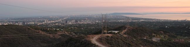
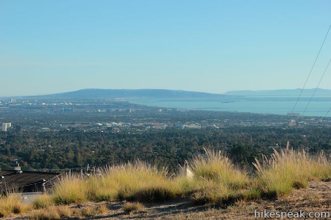
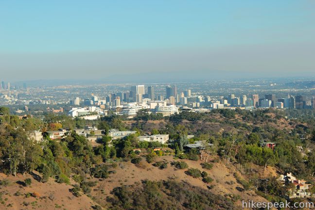
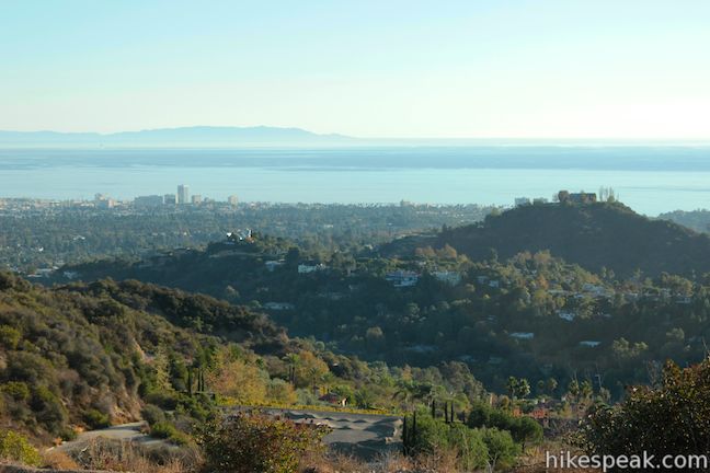
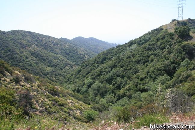
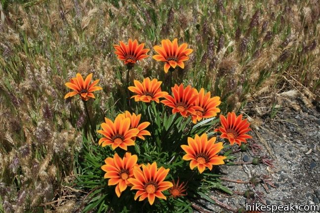
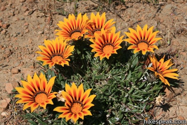
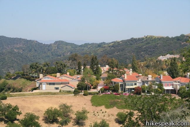
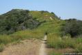
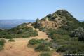
Lower Canyonback Trail crosses Canyonback Ridge between Brentwood and a development of estate homes built along the ridge. The trail offers views of west Los Angeles, Santa Monica Bay, and neighboring ridges in the Santa Monica Mountains. The Getty Museum to the east is also in view and on the same plane with trail. From the top of Kenter Avenue to Mountain Gate Country Club Estates is 4.2 miles round trip. Hiking the full length of the ridge through the development and across Upper Canyonback Trail to Mulholland Drive is an 8-miles round trip trek. For something shorter, you only need to hike a mile up the ridge to reach great ocean views from a bench and swinging seats beneath an oak tree.
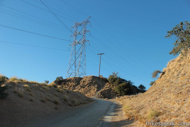
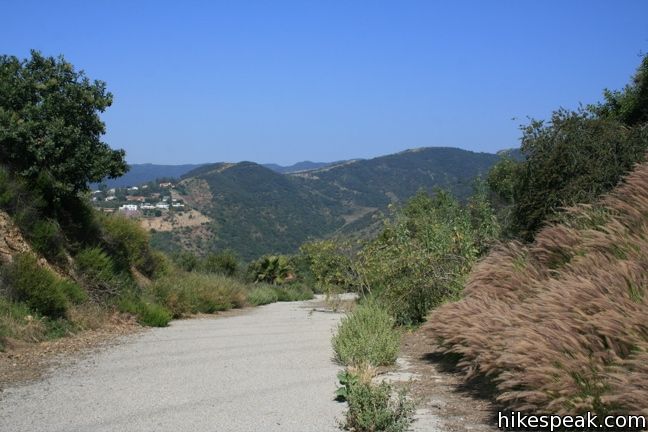
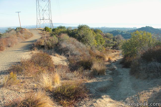
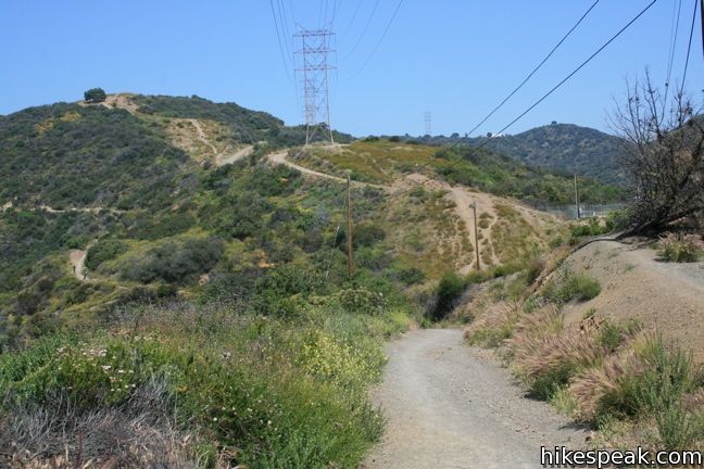
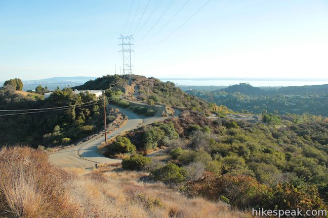
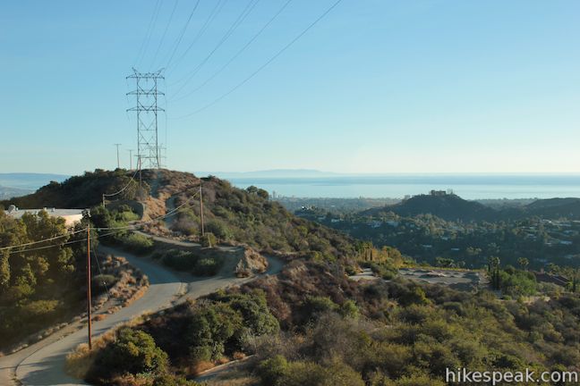
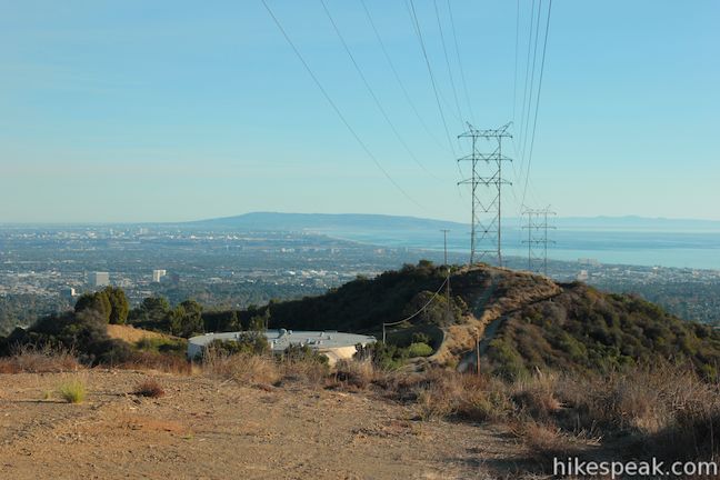
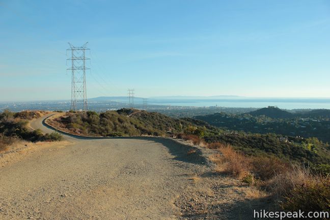
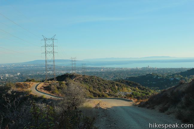
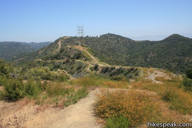
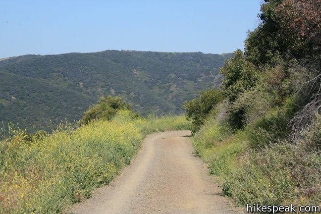
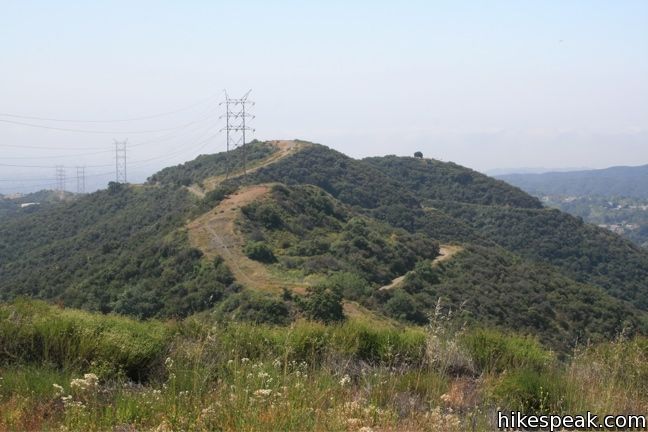
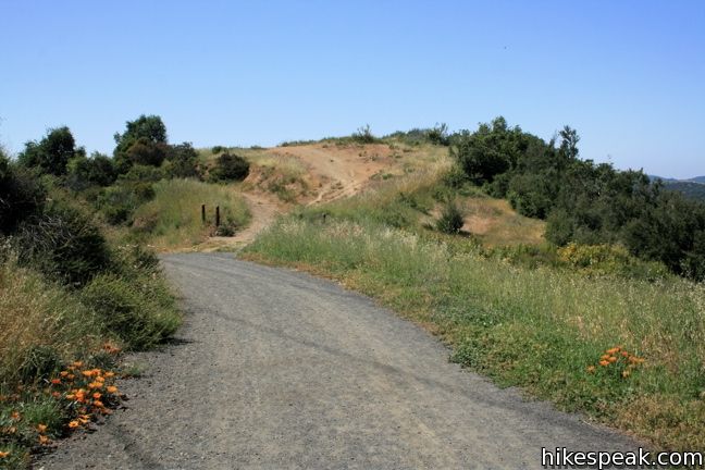
Like the neighboring ridges in the Big Wild (Westridge, Sullivan Ridge, and Temescal Ridge), there is both a fire road and a single-track trail ascending the ridge. The fire road is gradual, while the trail has steeper sections and offers more dramatic views. Lower Canyonback Trail is much like Upper Canyonback Trail with a couple of exceptions. The freeway sound is not present, but a high-voltage powerline is. The trail shares the ridge with heavyweight lines that obscure the view somewhat and give off a distracting buzzing sound at times. Nevertheless, when the air quality is good, Lower Canyonback Trail has some fantastic views.
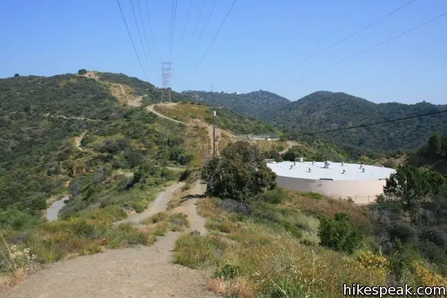
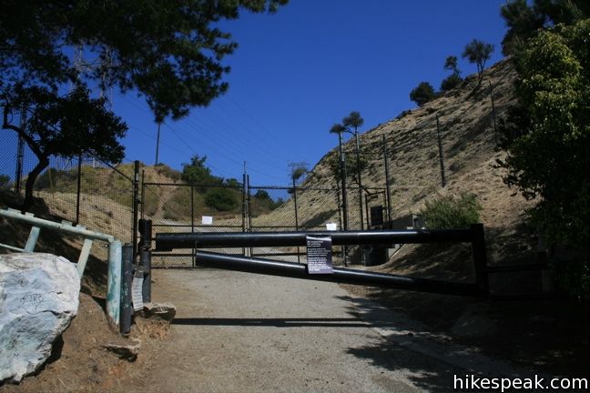
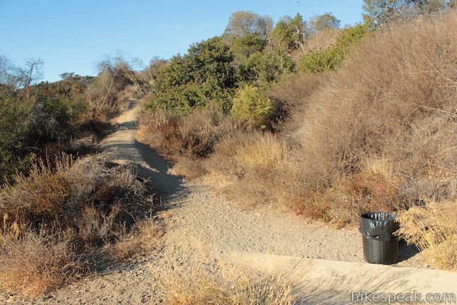
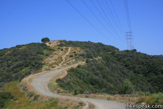
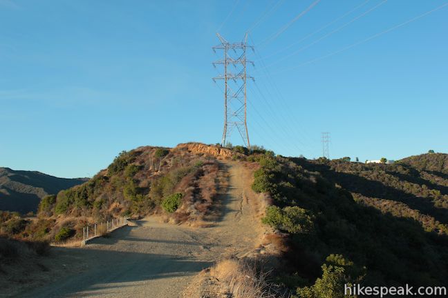
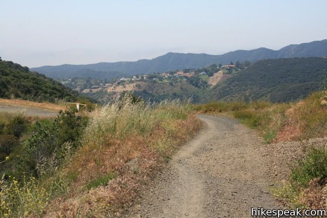
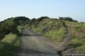
Begin by hiking through the forbidden-looking black gate at the top of Kenter Ave. Beyond the gate, the pavement turns left, meeting a gravel road that continues up the ridge. As the road makes its first bend to the left, you’ll be treated to an already impressive view of Santa Monica Bay. Bear right up a wide dirt trail, or a path that precedes it, to join Lower Canyonback Trail beneath the power lines.
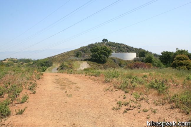
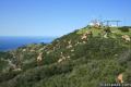
Cross over a rise in the ridge and pass the first of two municipal water tanks. As you continue up the trail you will spot the Getty Center sitting on the second ridge to the east. The museum is backed by the skyscrapers in Century City, and farther off you’ll spot the skyline of downtown Los Angeles.

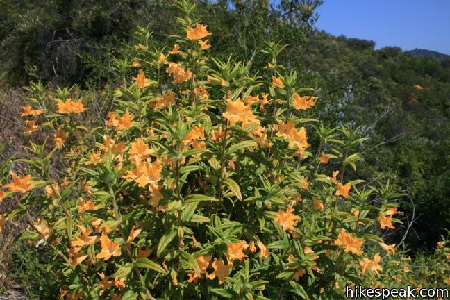
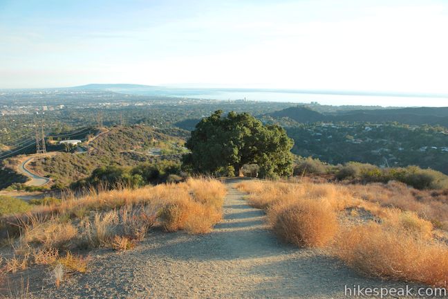
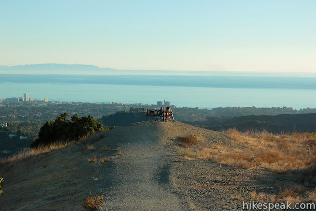
The road gains elevation, swinging sharply through a hairpin turn. When the road turns back to the east, 2/3 of a mile from the start, you will see a narrow trail breaks off to the left, climbing up the ridge to a coast live oak that provides alluring shade. There is a swinging bench hanging from the tree as well as a tire swing, so this is definitely a place that hikers can linger.

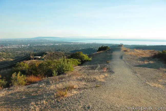
The path to the tree continues up the spin of the ridge to a crest. Upon the crest you will find a bench that has been placed for a sweeping view across Santa Monica Bay.
Leaving the ocean views behind, the path continues north, dropping back down to the main trail up Canyonback Ridge. It is definitely worthwhile to take this parallel path off the road at least once while you hike on the ridge. It is a third of a mile hike up to the crest on the ridge above the coast live oak, so you can also use this as your destination for a shorter 2-mile round trip hike.
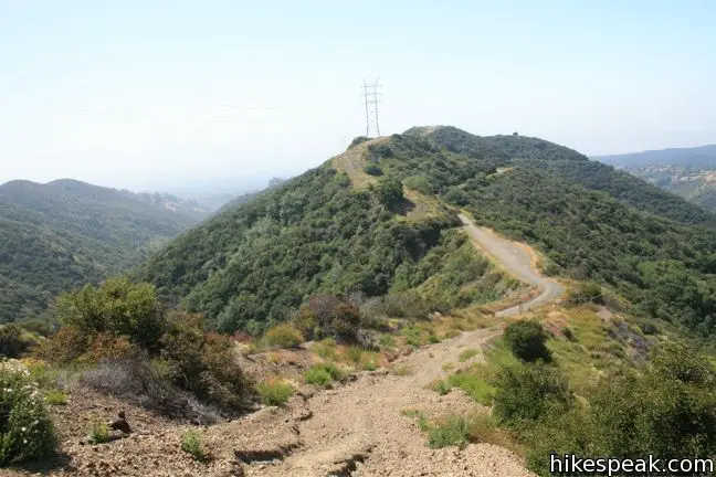
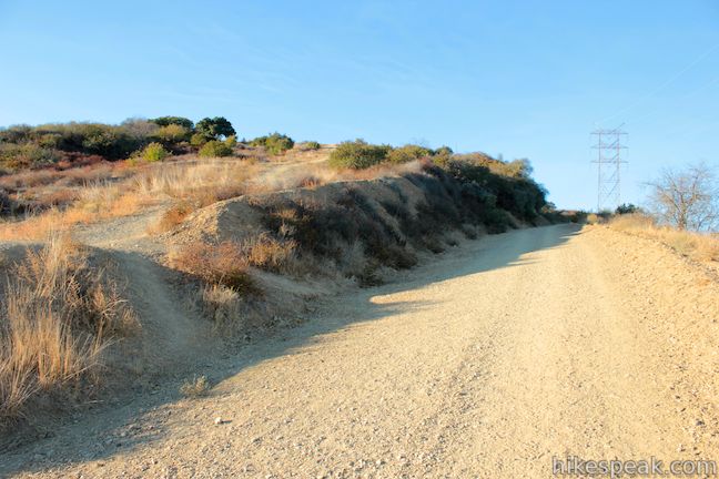
After coming together, the two routes separate again, with the wide fire road continuing gradually up the east side of the ridge and the single-track trail making a very steep ascent up the ridge, cutting about 0.25 miles from the hike and raising heart rates in the process. The routes reunite and the ridge levels out, arriving at a second water tank 1.8 miles from the start (taking the fire road).
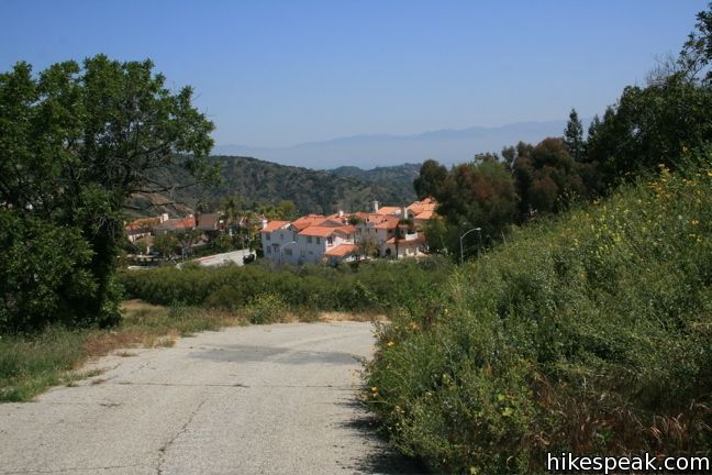
The road is paved over the last third of a mile dropping into Mountain Gate Country Club Estates. From here, walk 0.4 miles across the lofty neighborhood to resume hiking on Upper Canyonback Trail. For those not planning to hike that far, feel free to turn around at the upper water tower. The views do not change much beyond that point and hiking on pavement isn’t really hiking…
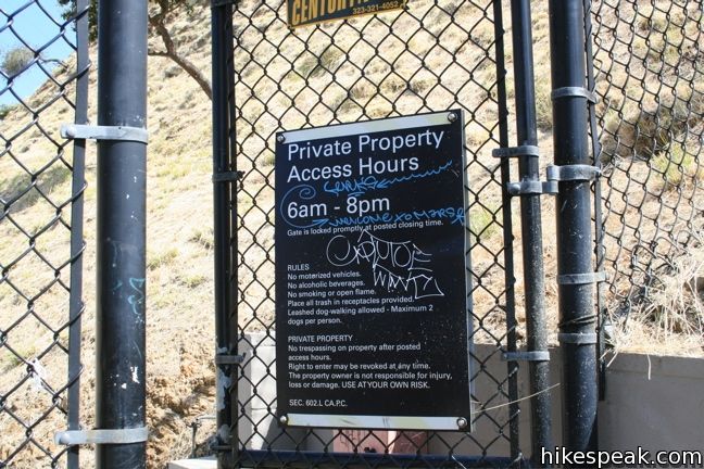
No fee or permit is required to hike Canyonback Trail. Dogs are allowed, and walking them is a popular use of the trail.
To get to the trailhead: From Sunset Boulevard 1.5 miles west of the 405, turn north on Kenter Ave. Drive 2.1 miles up the ridge and park along the street in front of the gate.
Trailhead address: 1567 North Kenter Avenue, Los Angeles, CA 90049
Trailhead coordinates: 34.0818, -118.49459 (34° 04′ 54.5″N 118° 29′ 40.5″W)
View Santa Monica Mountains in a larger map
Or view a regional map of surrounding Los Angeles trails and campgrounds.


 | Getty View Park This 3-mile out and back hike crosses East Sepulveda Fire Road (Casiano Fire Road) on a ridge east of the 405 Freeway that offers light traffic and plentiful views of the Getty Museum and Santa Monica Bay. |
 | Upper Canyonback Trail This 3 mile hike descends Canyonback Ridge from Mulholland Drive to the Mountain Gate Country Club Estates. |
 | Mandeville Canyon to San Vicente Mountain Loop This 5-mile hike incorporating a few trails, taking a DWP road up to Westridge to visit San Vicente Mountain, before crossing Mulholland Drive and Canyonback Ridge to return to Mandeville Canyon via Hollyhock Fire Road. |
 | Westridge Trail to San Vicente Mountain This 7.4-mile hike travels a scenic ridge between a Brentwood neighborhood and a summit that was once used as a Nike Missile site. |
 | Mulholland Drive to San Vicente Mountain This 2-mile hike approaches the peak from the east and offers views to the north and south en route to the old Nike Missile site. |
 | Sullivan Canyon This 8.5-mile round trip hike follows a wide trail up the center of a sycamore-filled canyon. |
 | Sullivan Ridge A prominent lone-standing Live Oak along Sullivan Ridge makes a natural turnaround point and a 7.5 to 8.3 mile round trip hike. |
 | More trails in the Santa Monica Mountains Explore other destinations in the range. |
 | Topanga Lookout This 2-mile visits the site of an old fire tower that still offers great views of the surrounding mountains. |
 | Backbone Trail to Saddle Peak This 2-mile hike approaches Saddle Peak from the east. |
 | Temescal Canyon This 2.6-mile loop offers a variety of scenery and decent exercise, despite its relative brevity. |
[…] most recent meet up took us to a coastal hike in Santa Monica, CA. The trail is called the Lower Canoynback Trail, in Kenter Canyon. The whole trail is about 4 miles (roundtrip). The first mile leads to a […]
Is there public access for mountainbike along chalon rd. from mandeville canyon rd. to north kenter avenue.
Is it possible to hike the Canyonback Trail east to Santa Monica, or does it connect with a trail that does?
This trail was closed when I went Friday, May 28th 2020. The gate was locked and a local resident said it had been locked for over a week.
You can access to trail from “taekwood trailhead”(google it)