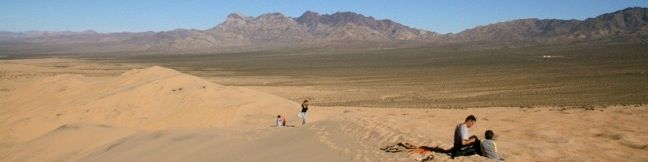
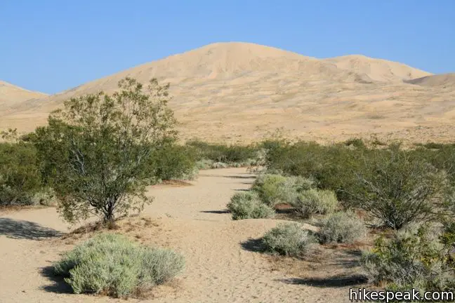
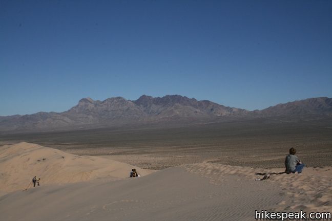
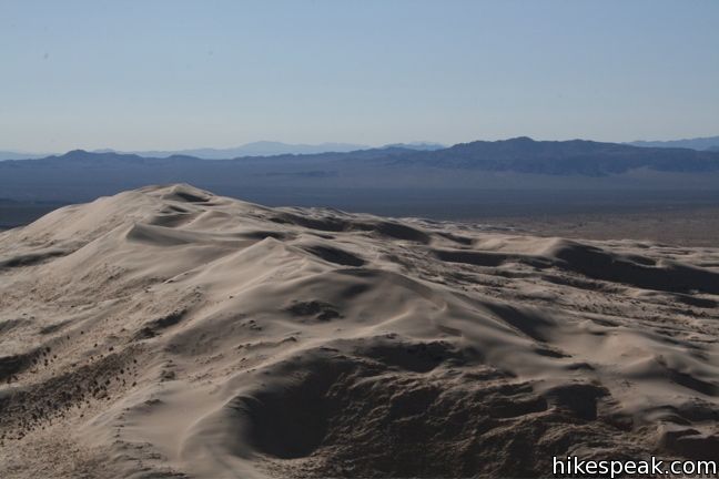
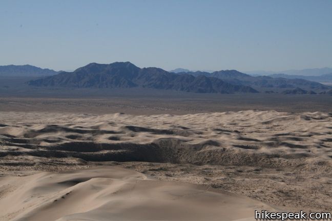
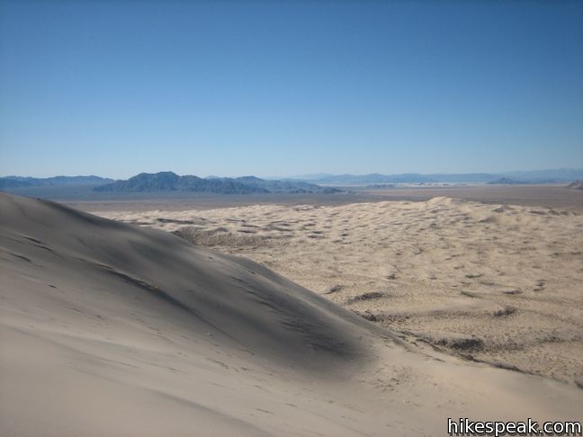
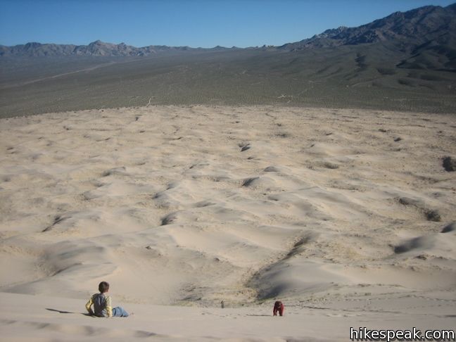
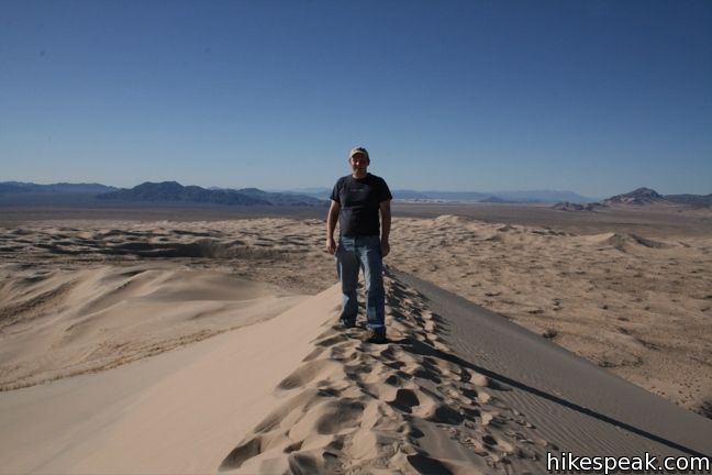
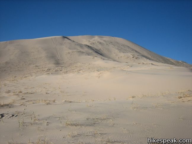
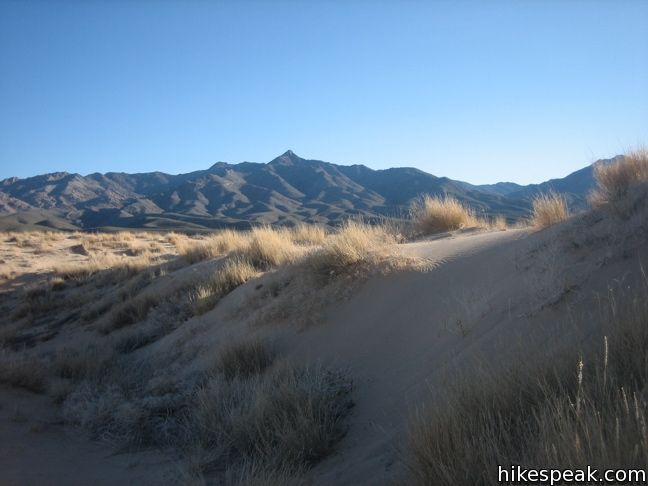
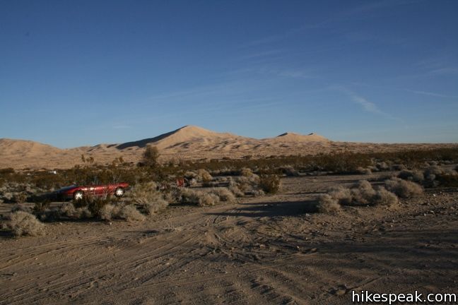
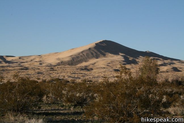
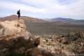
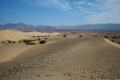
The Kelso Dunes cover 45 square miles and rise 650 feet above the desert floor. What do you do with such a big pile of sand? Climb it! Even if you have hiked other dunes before, Kelso will be an interesting experience. The 3-mile round trip hike to the top features fantastic views of the surrounding dunes and peaks in Mojave National Preserve.
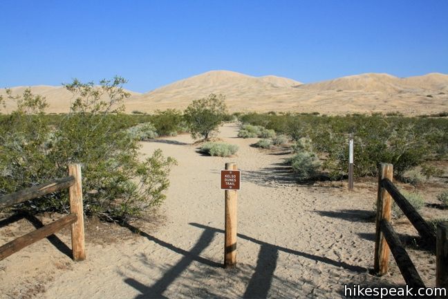
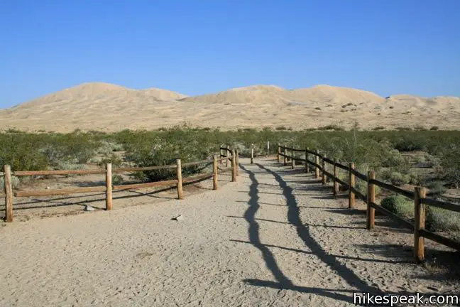
A concentrated trail leaves from the parking area, but dissolves away the farther you go. The wind and sand constantly reshapes the dunes, preventing the formation of a permanent trail. No matter, just aim for the summit and make your own way.
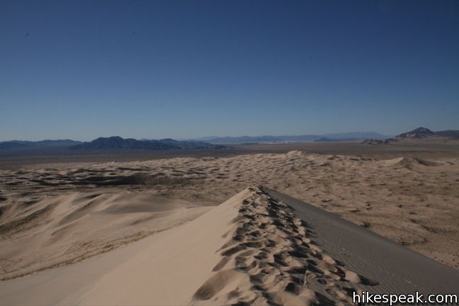
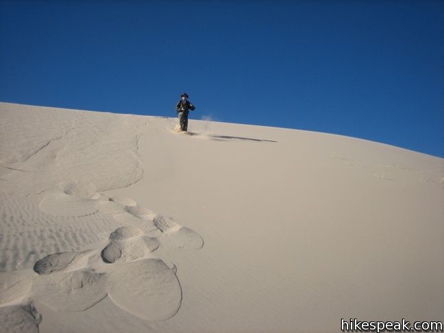
As you start up the steeper slopes, your steps will become strenuous. You will start to create small sand avalanches every time you lower your boot. Don’t be alarmed if a booming sound rises beneath your feet. This is caused by hot surface sand breaking over the colder sand below. The somewhat unique rumble know as “singing sand” actually sounds more like a low-frequency jet engine or flatulence.
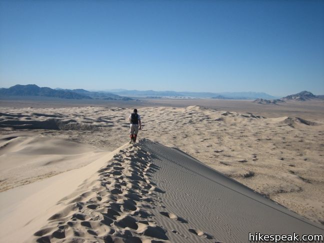
Spurred on by the curious excitement inspired by the vibrations, make your way up the dune. Ridgelines and old tracks offer slightly more stable footing. As your pace inevitably slows toward the top, remind yourself that it will take you much less time on your way down, when running and sliding are highly recommended. No fee or permit is required to visit Kelso Dunes in Mojave National Preserve, so get out and enjoy!
To get to the trailhead: From Barstow, drive east on Interstate 40. Take exit 78 on to Kelbaker Road. Head north for 15 miles and turn left on Kelso-Dunes Road. Take this refined dirt road 4 miles to the trailhead.
Trailhead address: Kelso-Dunes Road, Mojave National Preserve, CA 92309
Trailhead coordinates: 34.89235, -115.69906 (34° 53′ 3.5″N 115° 41′ 56.6″W)
View Mojave National Preserve in a larger map
Or view a regional map of surrounding California Desert trails and campgrounds.


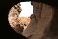
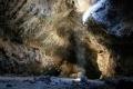 | Lava Tube This short 0.6-mile hike drops below the surface into an old lava tube. |
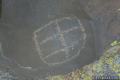 | Petroglyphs near Seventeen Mile Point This quarter-mile path visits ancient engravings in the volcanic rock at the western rim of the cinder fields just off Kelbaker Road. |
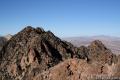
 | Silver Peak This 8.5-mile hike summits a 6,365-foot peak in the Granite Mountains. |
 | Teutonia Peak This 3.4 to 4-mile round trip hike crosses the world's densest Joshua tree forest, passing an abandoned silver mine to reach a rocky summit with views of Cima Dome. |
 | Hole-in-the-Wall Rings Trail This 1.5-mile loop takes visitors through a landscape of pocketed rocks. Ringbolts allow fun passage through narrow canyons. |
 | Rock Spring Loop Trail This 1 1/3-mile loop visits a rare desert spring, a Rock House built in the 1920s, a miners' mill site, and an old U.S. Army post on a short and scenic circuit. |
 | New York Peak This 7 to 9-mile round trip hike summits the highest point of the New York Range in the northeast corner of the preserve. |
 | Fountain Peak This 5-mile off trail trek summits a peak with commanding views over the Providence Mountains. |
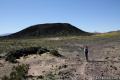 | Amboy Crater This 3-mile round trip hike travels up and into this crater adjacent to Mojave National Preserve. |
 | Hikes in the California Desert Explore more trails in Death Valley National Park, Joshua Tree National Park, Anza-Borrego Desert State Park, and Mojave National Preserve. |
 | Mesquite Flat Sand Dunes in Death Valley This 1 + mile hike explores the most visible (but not the largest) sand dunes in Death Valley. |
 | Mojave National Preserve There are a few campgrounds and endless roadside camping within the preserve. |
This trail was seriously so much fun!! thanks for recommending
Is the path clearly marked? Sorry if that is a dumb question but I’m new to hiking and the area in general so I thought it best to ask.
It’s very clear! Once you get to the dunes it’s not really a clear trail as you just need to find the best way up, which can change day to day depending on the wind and weather. It’s a good hike! Take the more gradual route up on the right side rather then climbing straight up the middle (unless you want a better workout of course). The views are amazing.
I went about a year ago and it was a really cool experience, and I got to hear the singing sands phenomenon!
I documented my whole hike in detail here if you’re looking for more info or a first hand account of these dunes: http://realisticwanderlust.com/2018/03/18/kelso-dunes/
Will my car navigation system work in the Mojave desert to guide me back to the highway after I visit Kelso Dunes
You should download all info or bring a paper copy. Service is not guaranteed