Colby Canyon Trail to Josephine Peak
in the San Gabriel Mountains
Want to hike to a mile-high summit in the San Gabriel Mountains with grand views over Los Angeles? Set your aim for Josephine Peak in the front range of the San Gabriel Mountains next to Strawberry Peak.
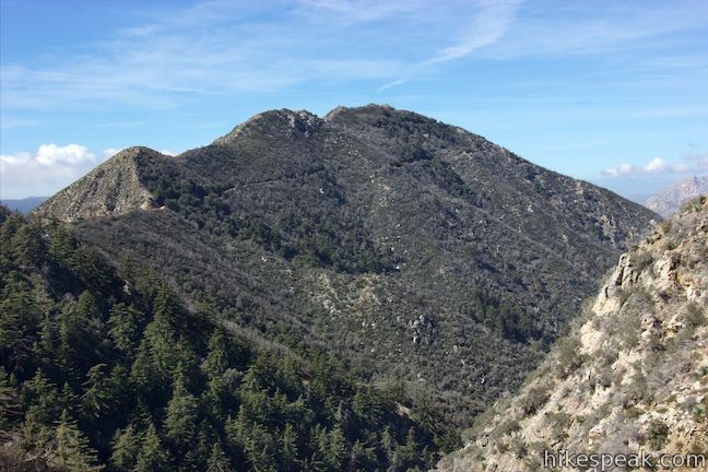
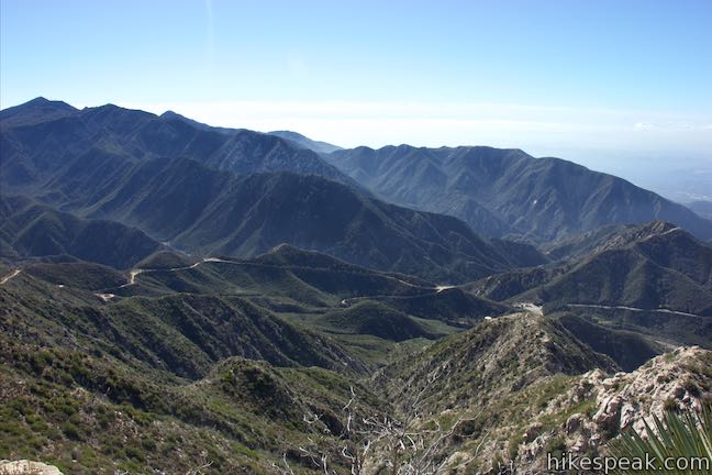
Colby Canyon Trail offers a scenic route to the summit, traveling from Angeles Crest Highway up a withdrawn canyon to Josephine Saddle, a dip in the ridgeline west of Strawberry Peak. Cross the ridge to take Josephine Peak Road up to the 5,558-foot summit and pull in expansive views north and west over Big Tujunga Canyon and southwest out of the mountains toward downtown Los Angeles and surrounding cities. This less-visited (but not less-rewarding) summit hike is 8.7 miles round trip with 2,050 feet of elevation change.
Colby Canyon Trail to Josephine Saddle
Colby Canyon Trail begins from an parking area along Angeles Crest Highway. The trail has reopened after Station Fire damage that occurred in 2009. The start of the trail was unmarked for several years after the fire, but the trailhead signage has reportedly returned (so that the trail is easier to find again). Set out from a turnout on north side of Angeles Crest Highway, 10 miles up from La Cañada Flintridge (0.8 miles past Clear Creek Information Center) and just under 4 miles before Red Box Station.
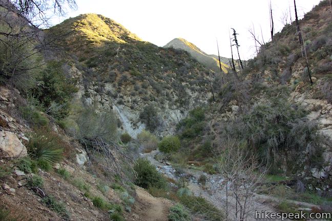
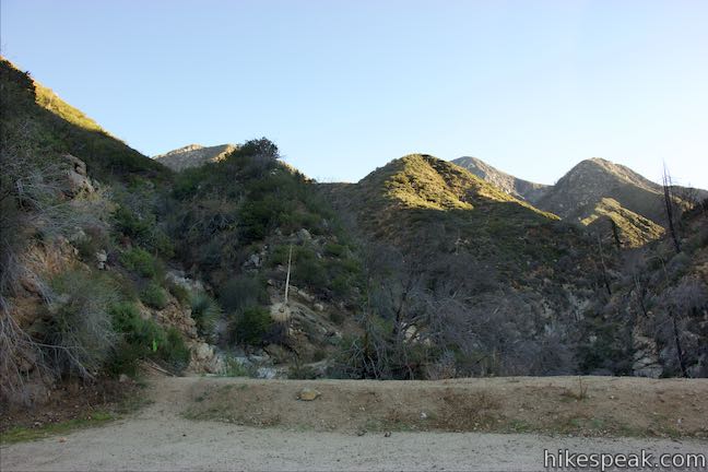
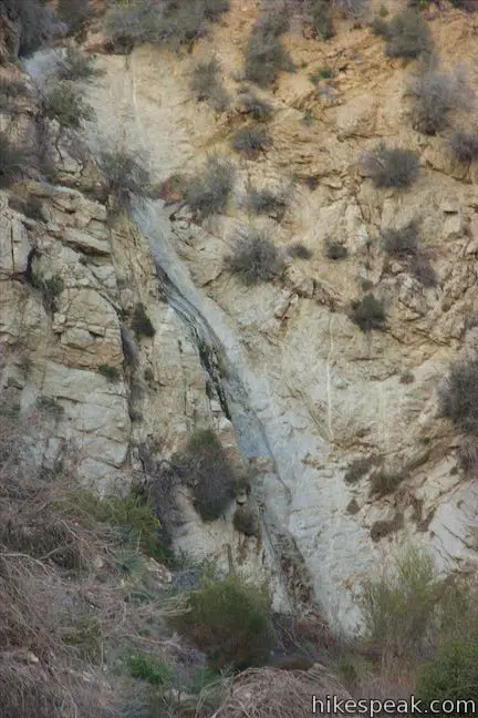
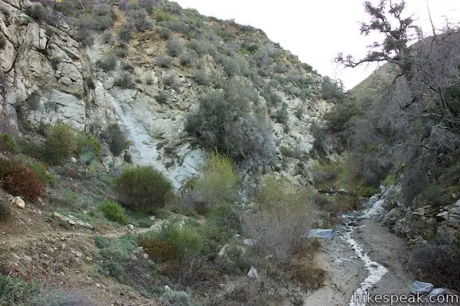
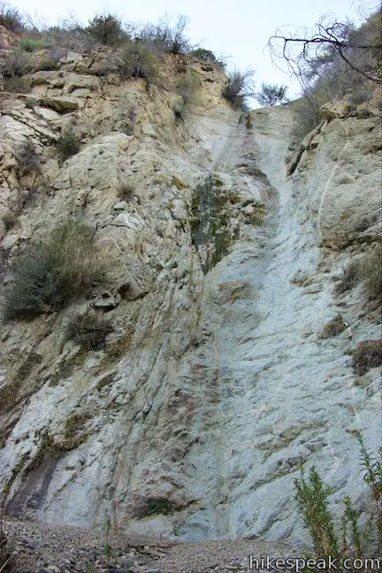
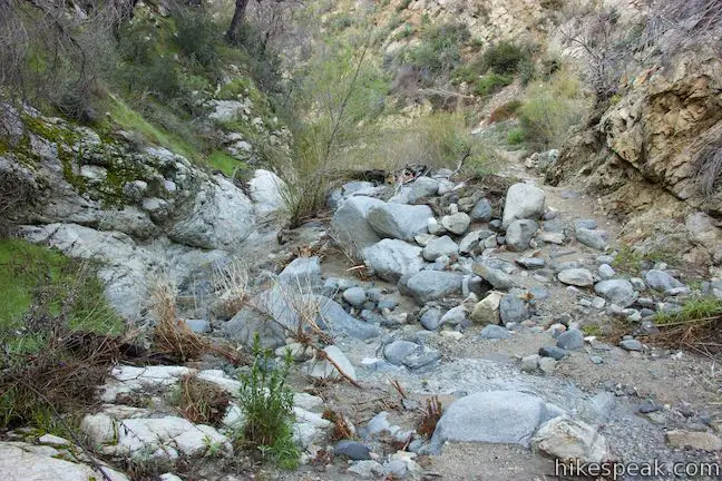
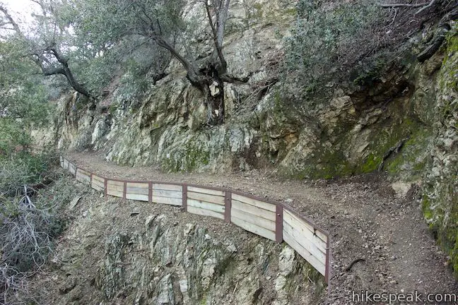
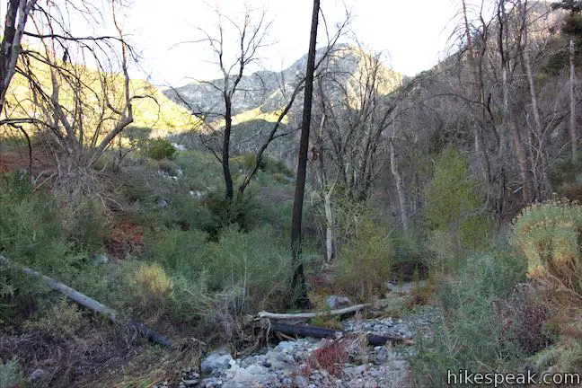
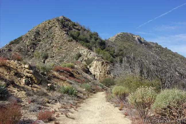
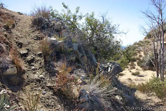
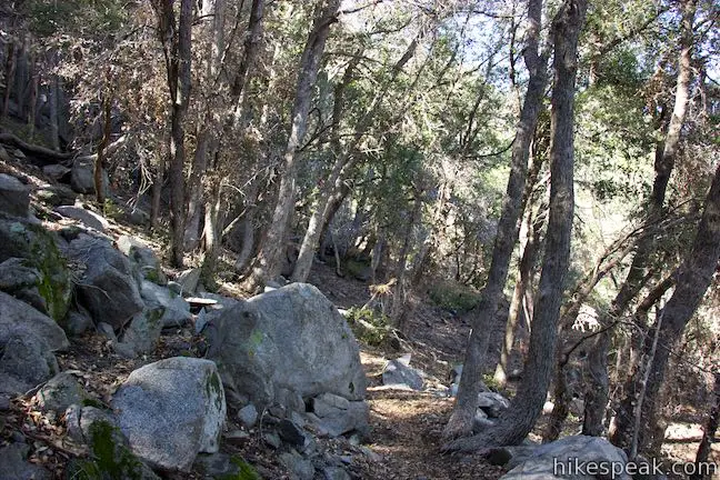
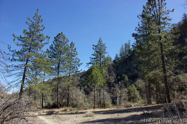
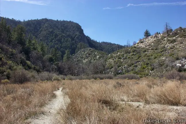
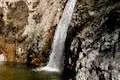
Start from west side of the dirt parking area on a single track that heads down into canyon on left side a creek bed. Pass a thin 30-foot waterfall on the left that will be a dry chute unless it has rained recently. Proceed up the canyon, crossing the creek bed a few times. Water will be present after rainstorms. After less than a quarter mile, the trail turns up the right (east) side of the canyon, leaving the canyon floor. Upstream you can see an interesting area where the canyon is narrowed by walls of exposed bedrock.
Over the next tenth of a mile, the trail weaves its way up to a ledge above a confluence in the canyon. This spot is like an unofficial overlook, with nice views up Colby Canyon. You may be able to hear a cascade to your right that is just out of sight, where a small stream drops into the canyon. You’ll cross over the stream above this cascade on the trail ahead. To continue with the hike, bear right up a switchback.
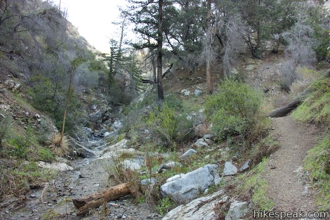
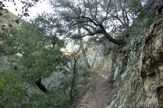
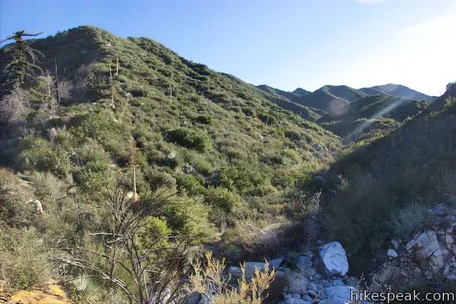
Colby Canyon Trail ascends into a side canyon with a peaceful wooded gully. Continue up the trail and cross the bed of a creek just before it tumbles to your left down into the canyon. You have now hiked half a mile, with another 1.75 miles to go to Josephine Saddle.
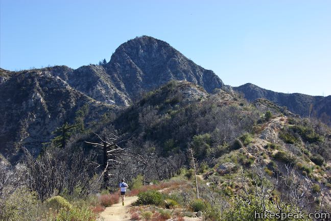
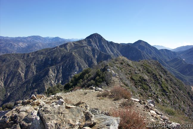
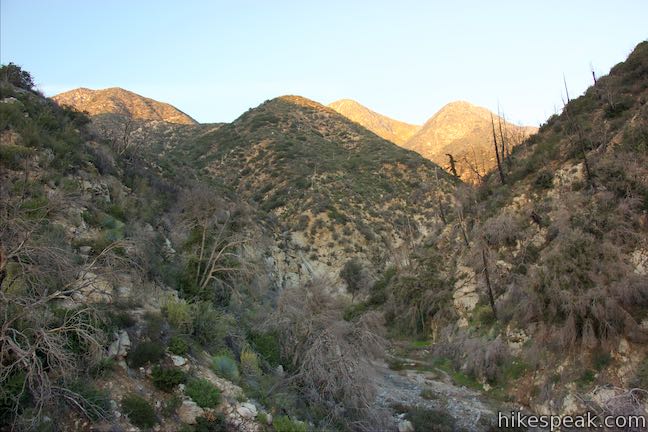
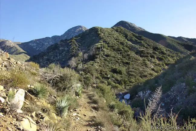
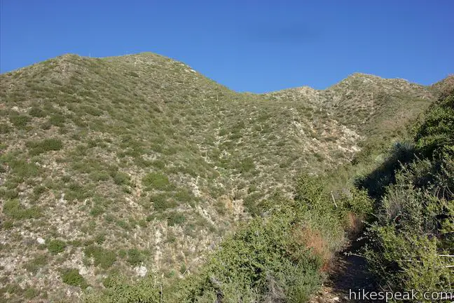
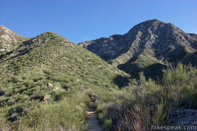
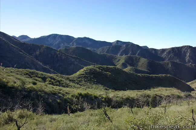
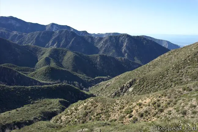
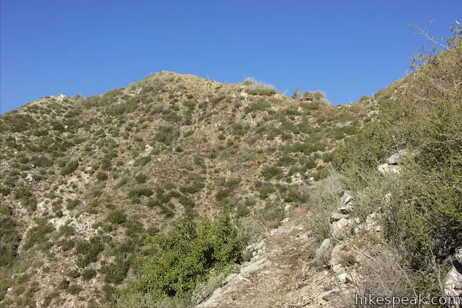
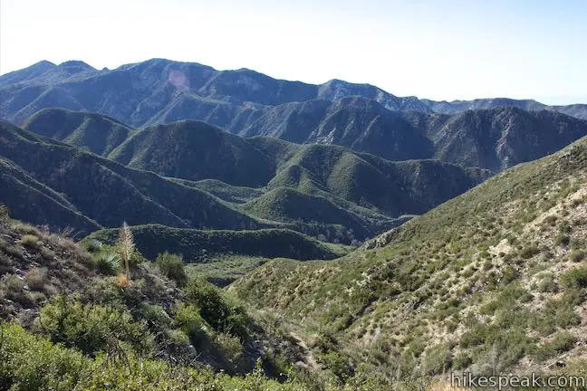
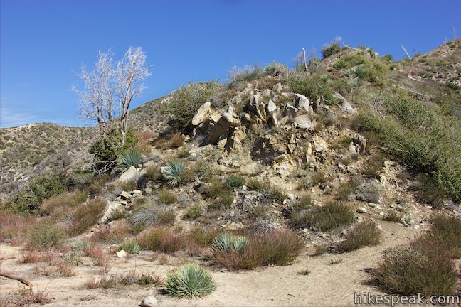
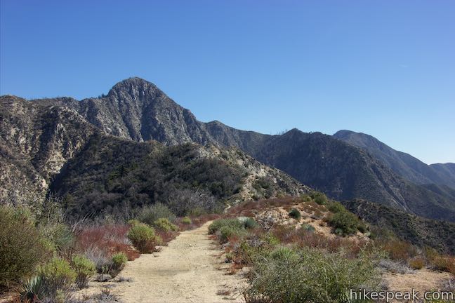
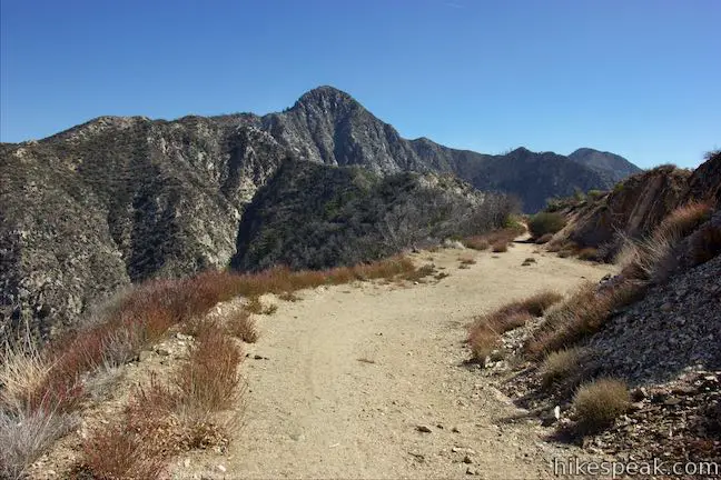
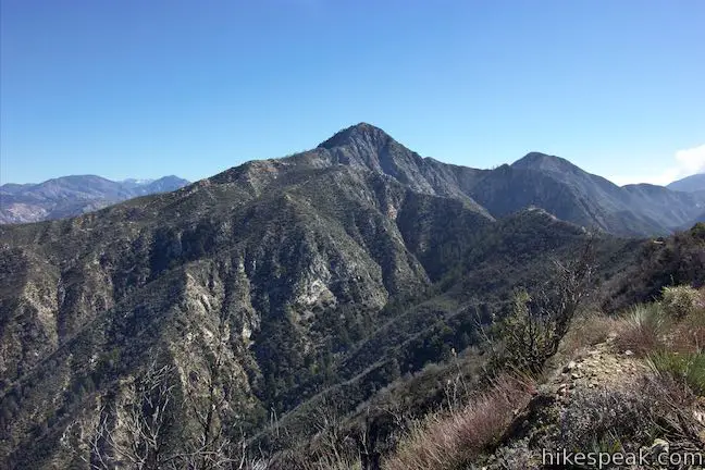
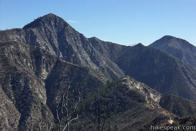
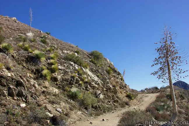
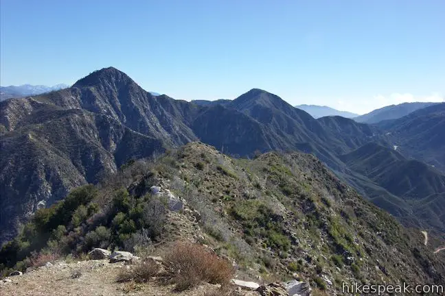
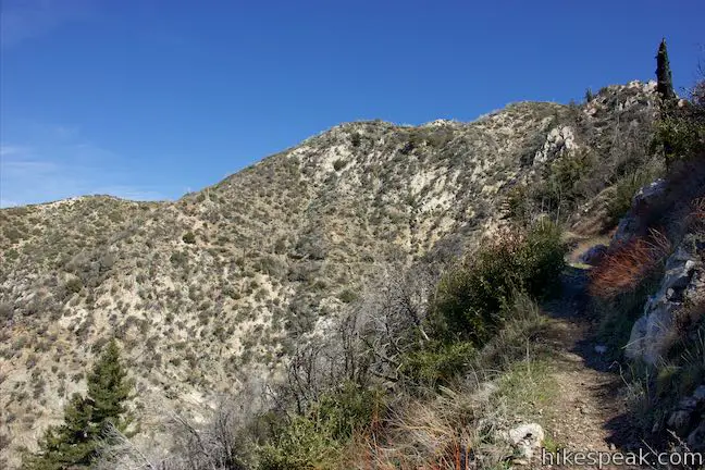
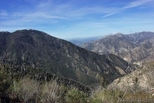
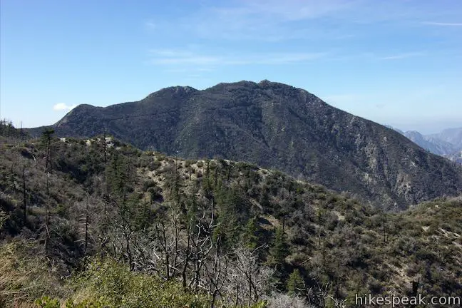
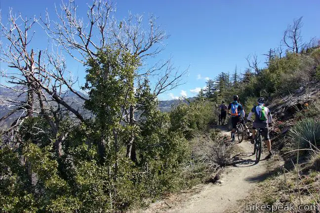
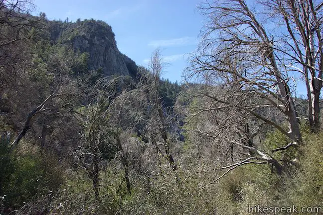
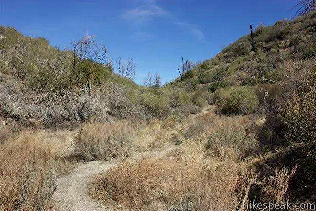
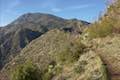
Take the trail up along the side of a smaller side canyon. The trail makes its way out on to the spine of a ridge that separates the two forks of Colby Canyon. The larger, deeper part of Colby Canyon is to your left. Straight ahead, Strawberry Peak rises high. Does it look like a strawberry to you? (Picture it with the stem-side down.) Chaparral-covered ridges can be seen in all directions and you’ll approach views east up Daisy Canyon.
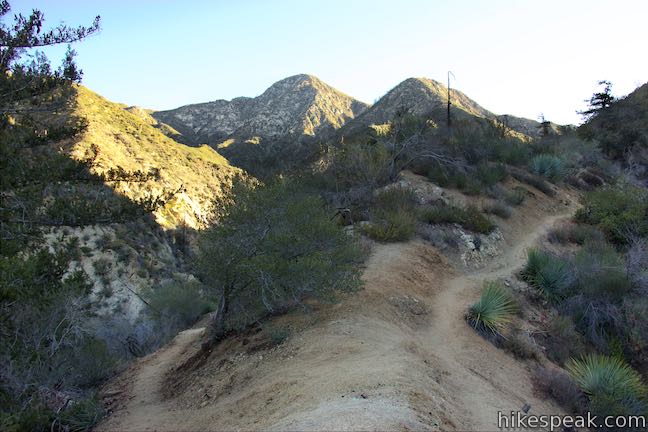
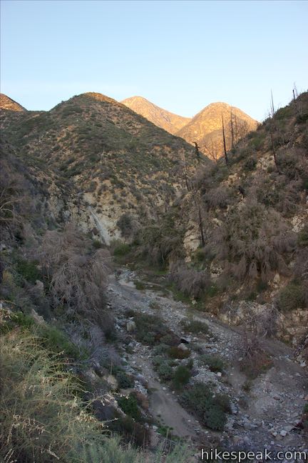
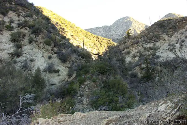
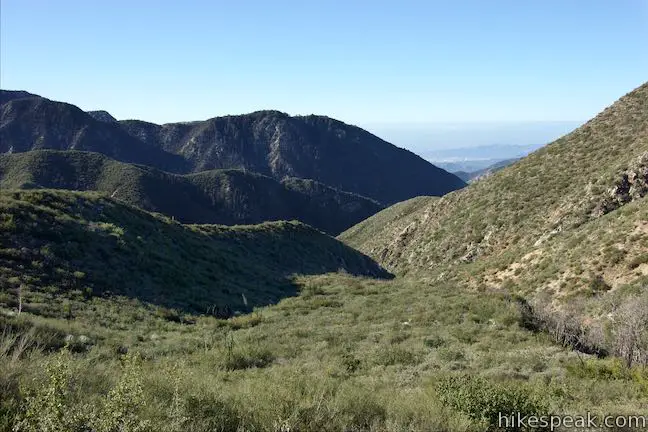
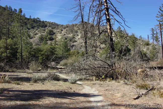
Come to the mountainside at the other end of this ridge where the trail turns left and cuts across a steep slope above Colby Canyon. The terrain drops away to the left to the bottom of the canyon, affording a large perspective. Hike down into a grove of fire-destroyed trees that stand as leafless reminders of the Station Fire. The trail comes back to the canyon floor, 0.9 miles from the start. Cross the creek bed here to take the trail up out of the opposite side of the canyon, heading north.
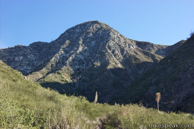
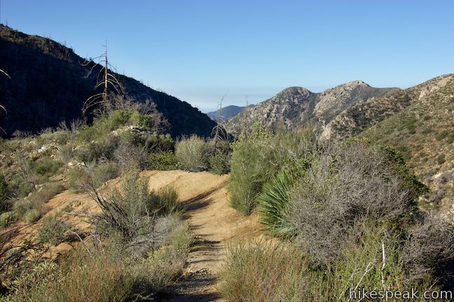
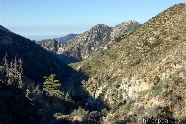
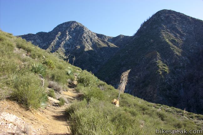
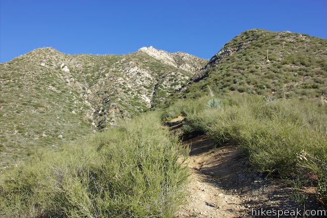
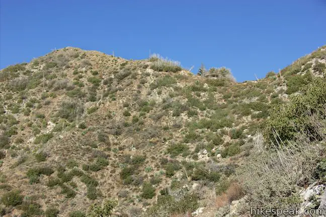
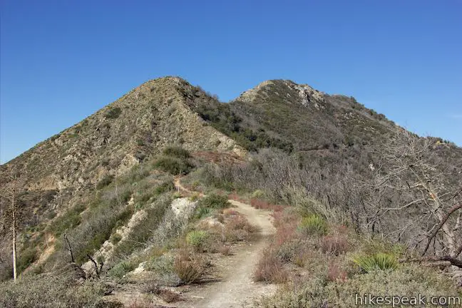
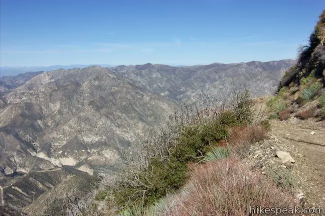
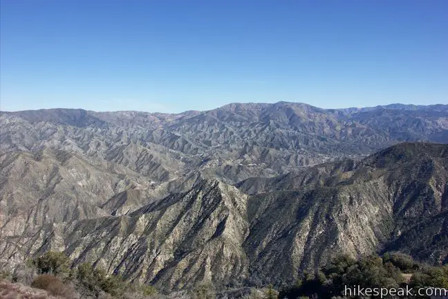
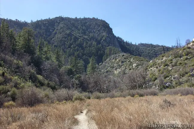
The trail ascends a chaparral-covered slope on the other side, leaving the canyon behind. The views south and east expand as you go up a ridge between a split in Colby Canyon. Proceed toward closer views of the steep southern face of Strawberry Peak. The trail drops off the west side of the ridge and crosses the back of a side canyon, 1.6 miles from the start. Resume up the other side, going through switchbacks up toward a saddle west of Strawberry Peak. As you climb, enjoy big views down Colby Canyon and across ridges toward San Gabriel Peak to the southeast.
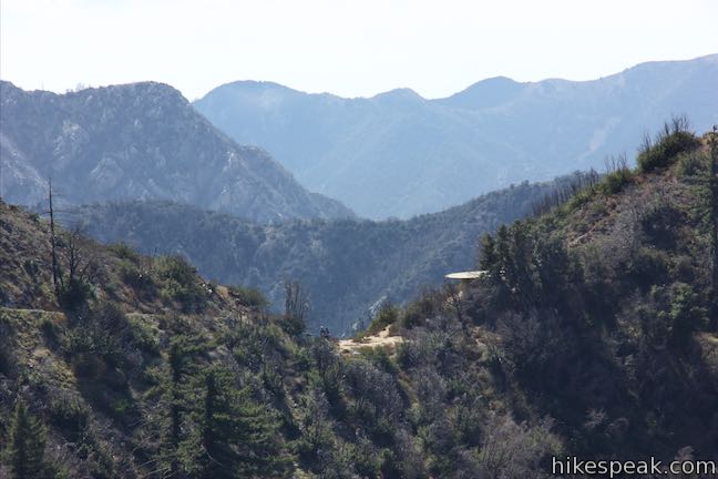
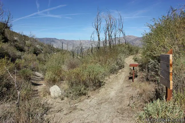
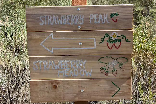
After 2.25 miles, the trail reaches Josephine Saddle and a junction. A concrete holding tank stands just to the west. Next to that, on its right, is a trail that ventures west toward Josephine Peak, taking a level course around a rise on the ridge to another saddle below that mountain.
Colby Canyon Trail continues on the other side of the saddle, bearing to the right to wrap around Strawberry Peak toward Strawberry Meadow (Strawberry Potrero). A few feet up this trail, a mountaineers route breaks off to ascend to the summit of Strawberry Peak, with scrambling climbs along the way.
Josephine Saddle to Josephine Peak
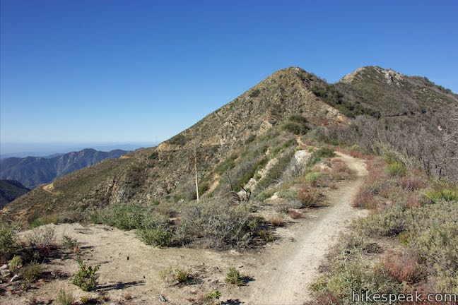
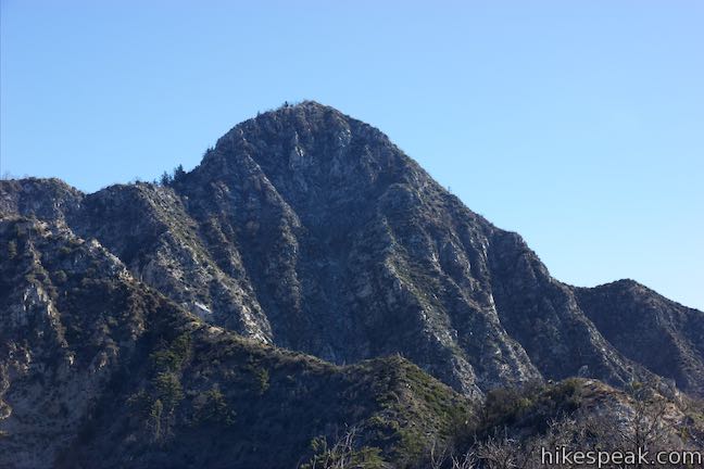
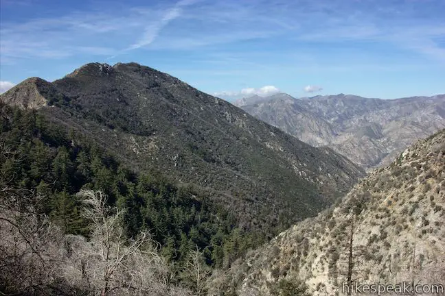
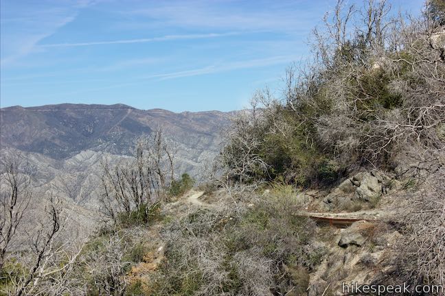
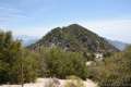
Josephine Peak Road is a wide dirt trail that goes up to the summit of Josephine Peak. To reach it, take the single track west from Josephine Saddle. The trail takes a level course around the north side of a bump on the ridge. To your right, look down a depression carved by Lucas Creek toward Big Tujunga Canyon. Behind you, observe the steep western face of Strawberry Peak, supported by ledges of exposed rock.
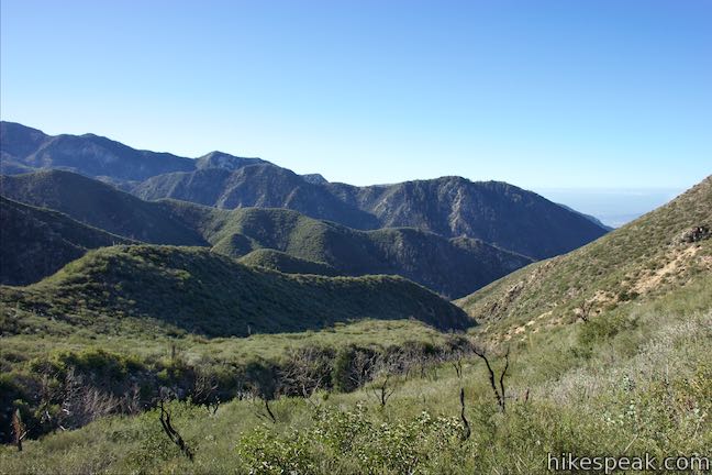
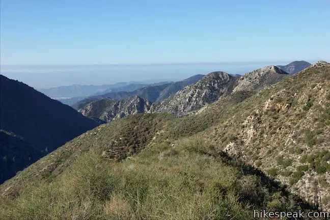
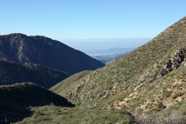
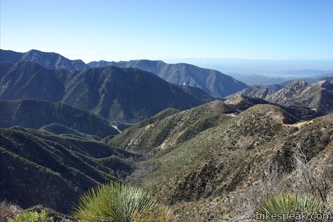
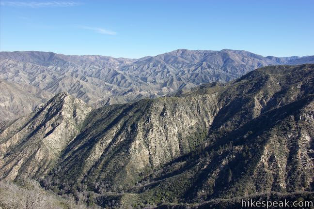
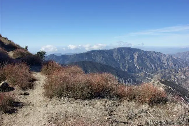
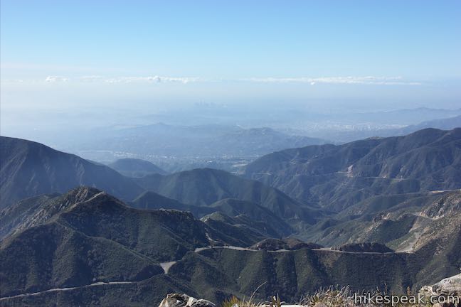
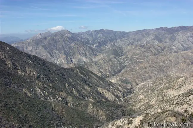
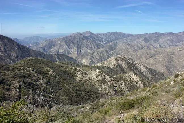
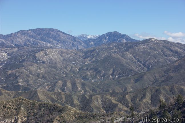
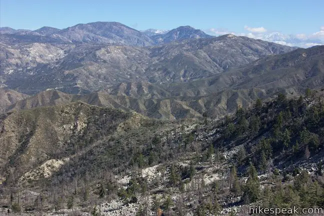
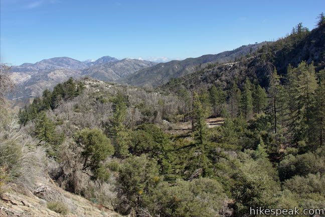
Arrive at a second saddle between the two peaks that has fantastic views southwest down the course of Angeles Crest Highway toward the cities below. Gaze out over ridges and peaks in the front range of the San Gabriel Mountains toward Glendale and downtown Los Angeles.
Walk across this long flat saddle to a junction with Josephine Peak Road. This wide dirt road begins from the top of Angeles Forest Highway near its intersection with Angeles Crest Highway by the Clear Creek Information Center.
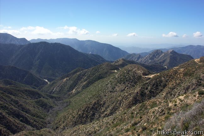
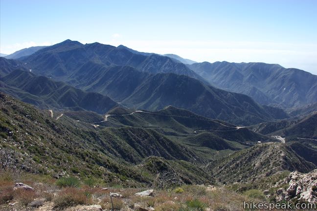
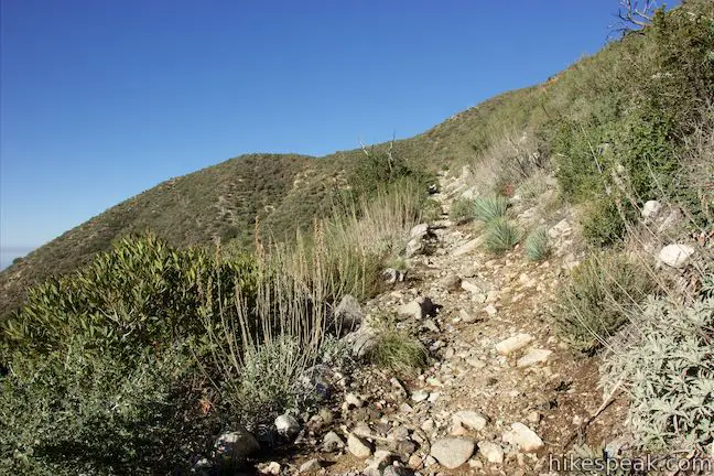
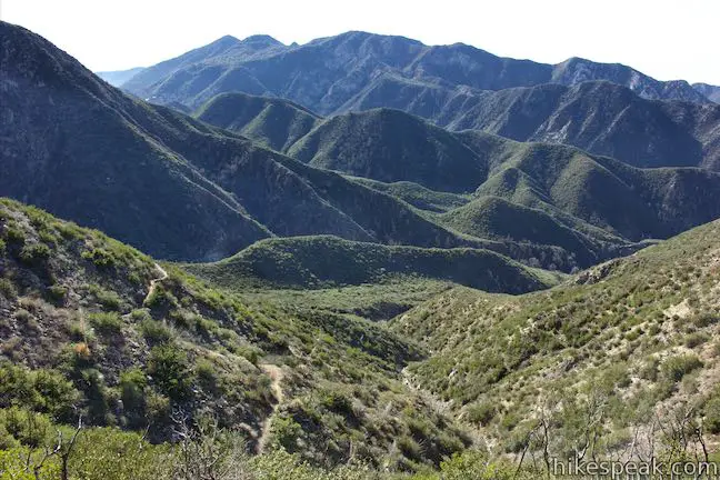
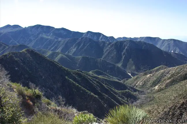
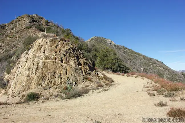
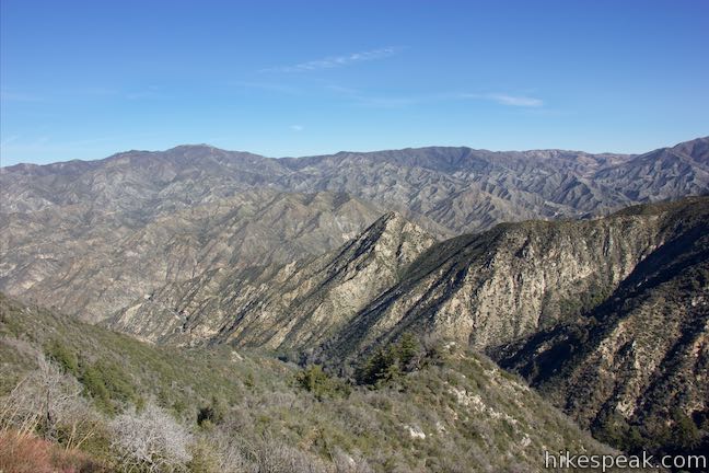
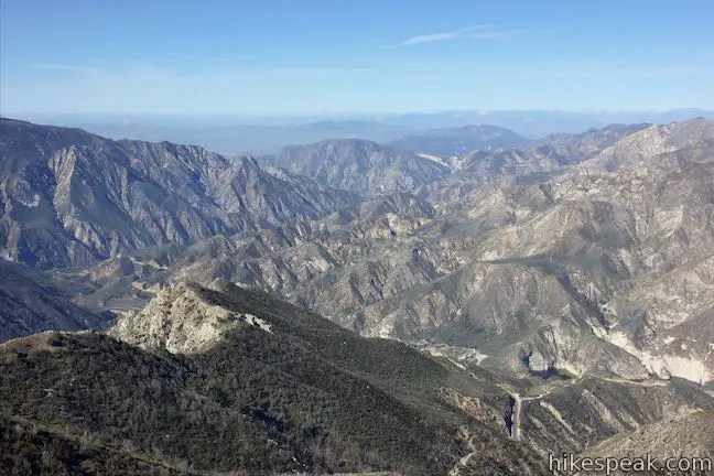
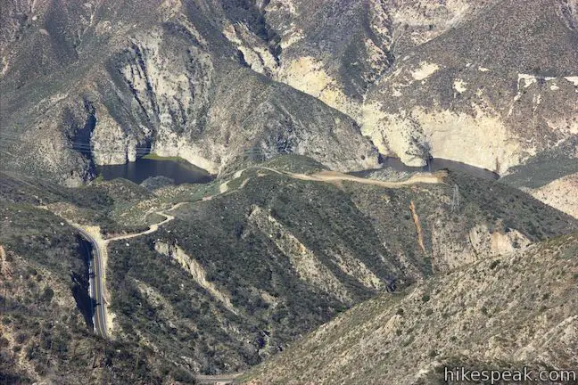
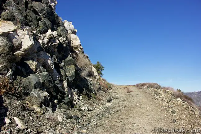
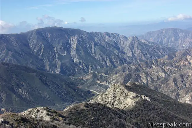
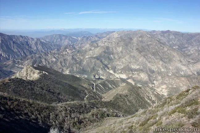
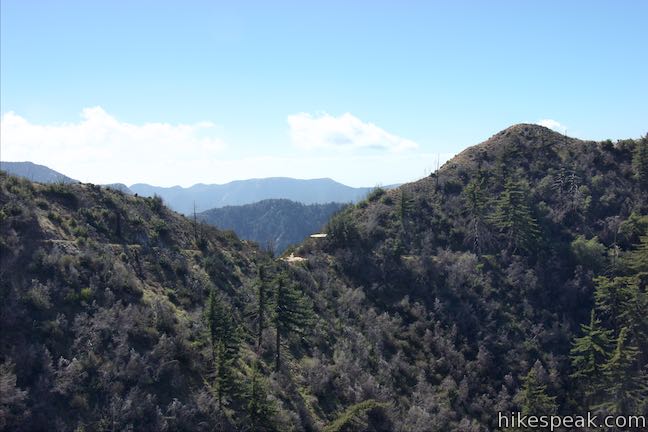
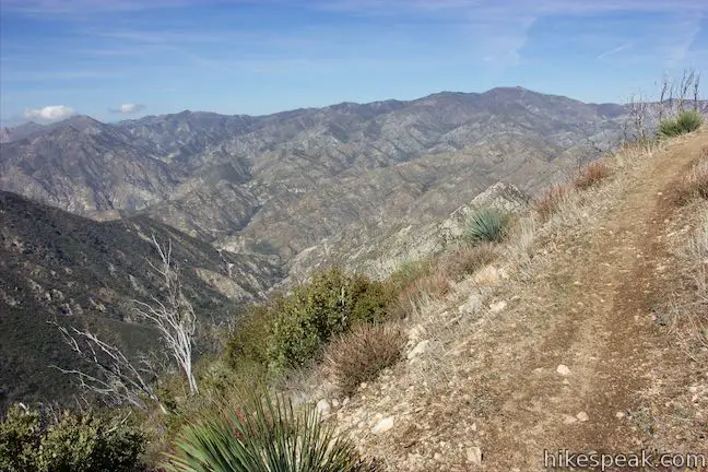
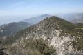
Turn right up Josephine Peak Road to approach the summit, tackling 650 feet over the next 1.6 miles. The road heads up and around the north side of the mountain, using a couple long switchbacks. After 1.3 miles, the road wraps around to the west side of the mountain for a whole new perspective. Look west down Big Tujunga Canyon, which cuts a major divide through the San Gabriel Mountains. A reservoir is visible in the canyon below. Mount Lukens rises to the southwest, towering above the canyon.
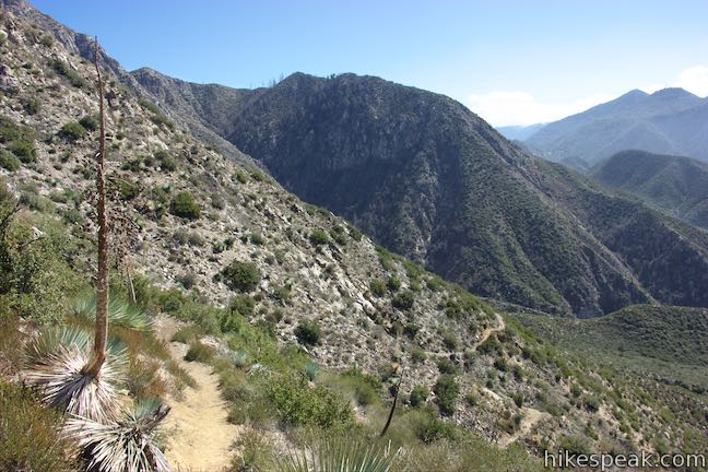
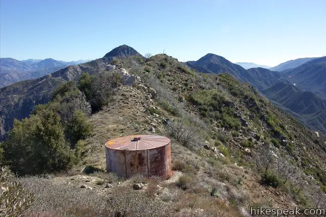
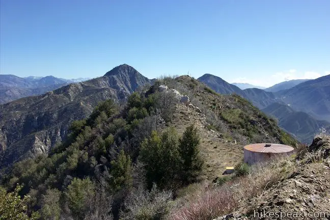
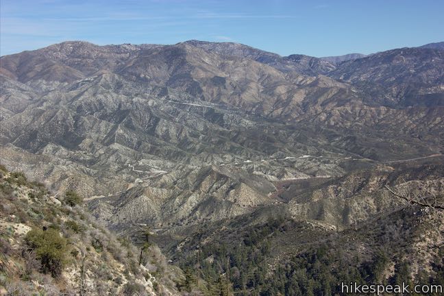
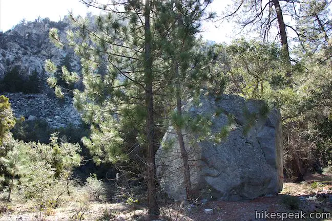
The road continues to wrap up the mountain leading to views to the south. Look out over the bottom of Josephine Peak Road and follow the route of Angeles Crest Highway down out of the mountain past canyons carved by Arroyo Seco. As you keep wrapping up the mountain, you’ll pass a ridge that runs east the summit. A holding tank sits just below the road along this ridge.
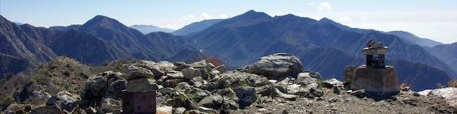
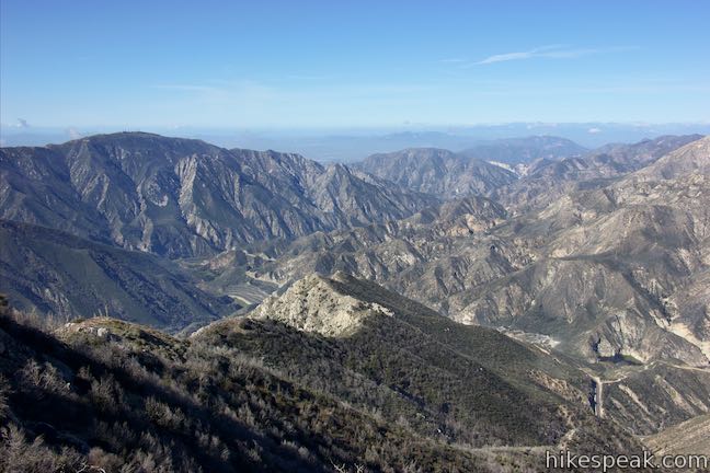
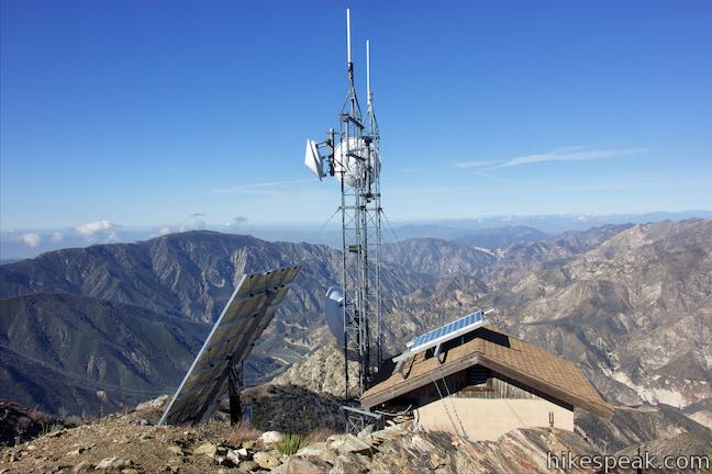
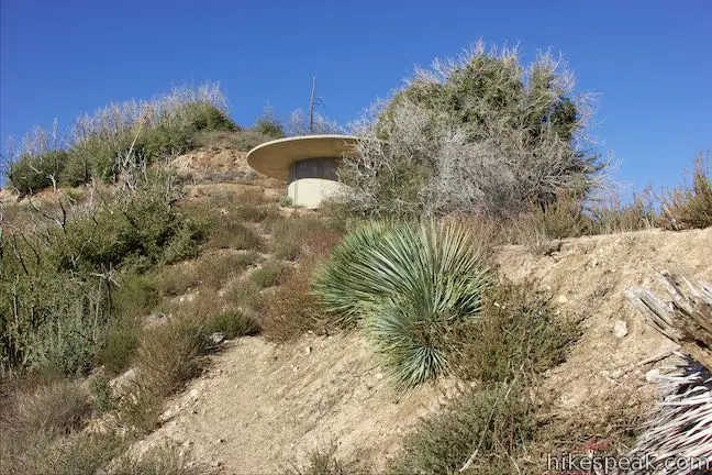
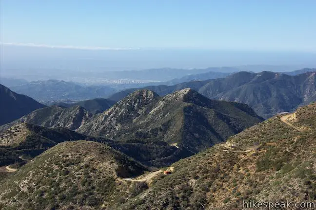
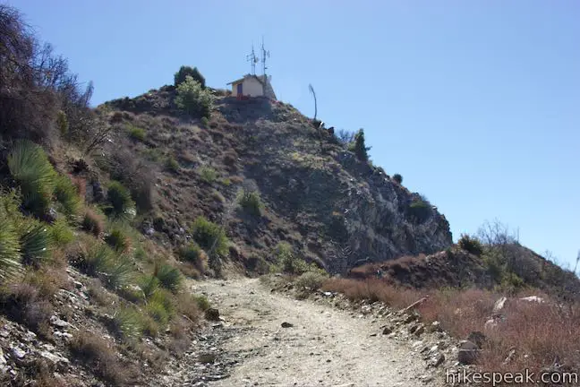
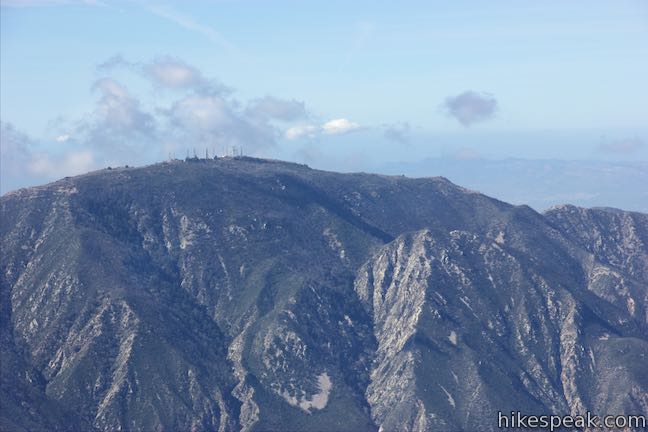
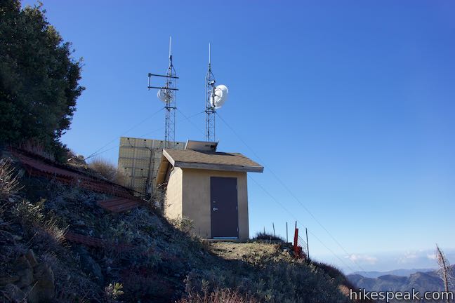
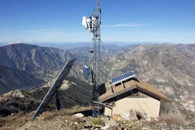
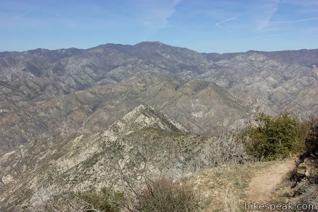
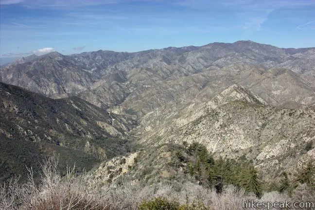
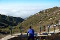
Keep winding your way up the summit to come to the end of the road. A helicopter landing site is on the right across from a footpath that goes to the very top. Turn left up this path past a small building with towers and solar panels. Find concrete feet at the summit that appear to have been left behind from a former lookout tower. The pointed summit has clear 360-degree view.
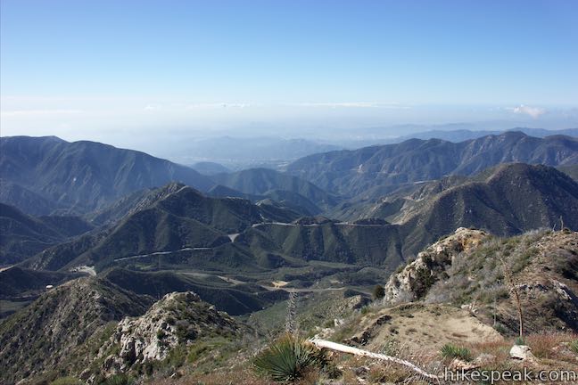
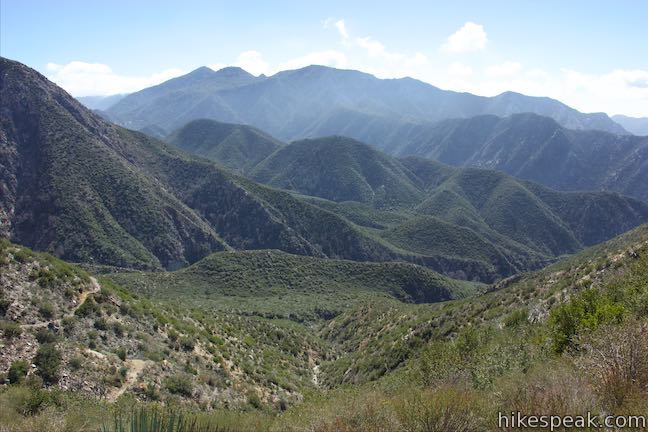
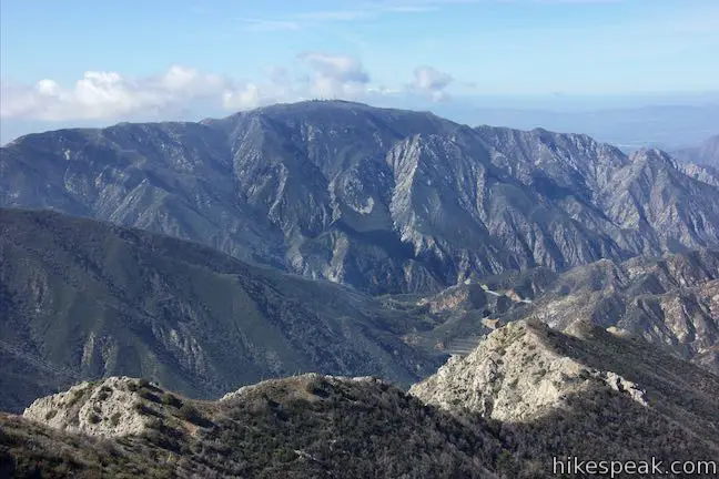
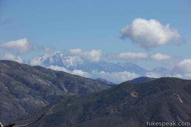
The views from Josephine Peak sure are grand! Look east toward Strawberry Peak, southeast toward San Gabriel Peak, south toward San Gabriel Valley, southwest toward Mount Lukens, and west and north over Big Tujunga Canyon. When you’re done basking in the summit glory, hike 2.1 miles back down to Josephine Saddle and another 2.25 miles down to the Colby Canyon Trailhead, completing this 8.7-mile round trip with 2,050 feet of elevation change. Extend the hike by continuing north on Colby Canyon Trail to Strawberry Meadow.
Josephine Saddle to Strawberry Meadow
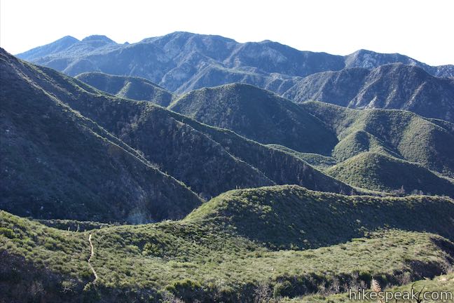
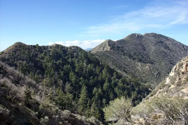
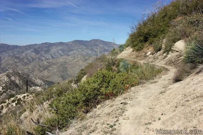
Coming up Colby Canyon Trail, bear right at Josephine Saddle to proceed on this trail as it wraps around Strawberry Peak toward Strawberry Meadow. A few steps up this trail, a path breaks off to the right to climb the ridge up the west side of Strawberry Peak. This is a mountaineers route to the summit, with a couple sheer cliffs along the way. Moving away from the saddle, Colby Canyon Trail levels out and stays quite gentle as it goes across a steep mountainside. The narrow trail curves around the top of a canyon carved by Lucas Creek, which descends to the north. Going around this big counter-clockwise curve, you’ll find views of Josephine Peak, rising to the west.
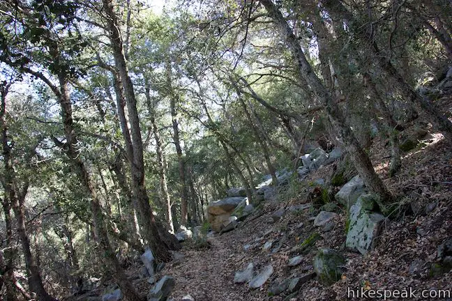
A third of a mile from Josephine Saddle, make your way around the far side of the bend and get views looking back toward the saddle. Go around a shorter carved-out curve in the terrain to a bend that puts the trail on a northbound path. This sets hikers up for grand views northwest over Big Tujunga Canyon. This broad canyon dominates the views going forward. The gentle trail gets a bit more rolling as it passes through uneven terrain in an area made up of boulders and pines.
Curve to the right past the top of a northbound ridge, 1.3 miles from Josephine Saddle. Big Tujunga Canyon is spread out below to the north and west. The trail aims east now, dipping into a forest of larger trees that offer a bit of shade. Drop across seasonal creek beds and wrap around neighboring ridges.
Half a mile from the previous ridge running north, the trail crosses another crest by a ridge that drops away to the northeast. You can step off the trail here to enjoy a short break with big views.
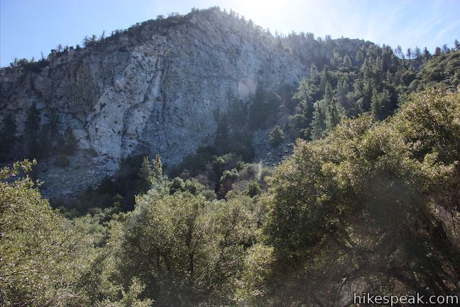
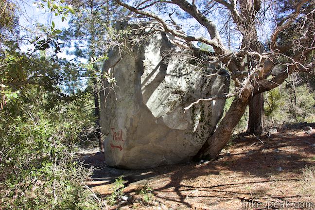
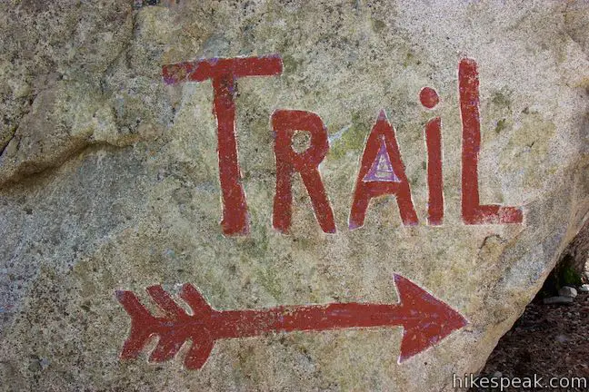
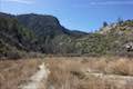
Moving on, you will discover a massive cliff of granite on the north side of Strawberry Peak. Colby Canyon Trail aims southeast toward the cliff, dropping through a heavily shaded grove. Cross through these trees and pass into thinner brush to approach the rock face, which must be about 400 feet tall. A switchback to the left takes you down to a flat area that is filled with grasses and tall pines. This looks like a nice place to have a picnic or make a backcountry campsite. Pass a large boulder with “trail” written on it with red paint. You are now 0.8 miles from a junction with Strawberry Peak Trail by Strawberry Meadow.
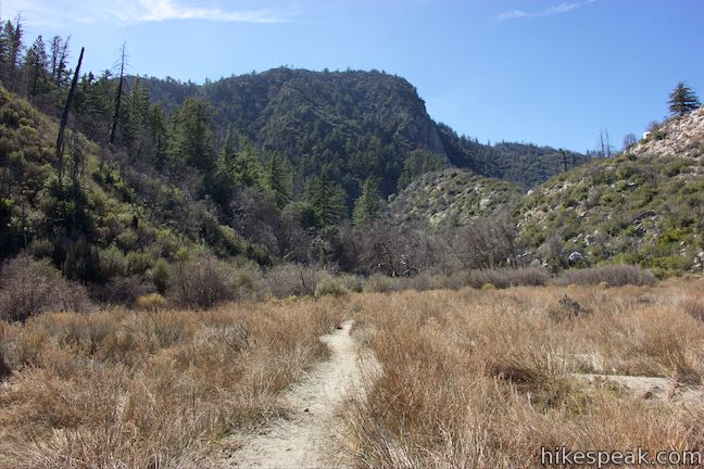
As you continue across the field, look up at the grand cliffs on the north side of Strawberry Peak. Standing in this setting you can easily imagine that you are somewhere in Yosemite National Park, and not so close to Los Angeles in the San Gabriel Mountains. Go uphill from this flat and drop through a rocky gap to a lower flat area. Pass a few numbered posts as you walk out across an open field. This is Strawberry Meadow. Look back toward the cliffs, before coming to a junction with Strawberry Peak Trail that is marked by a trail register and a wooden sign with painted strawberries.
Turning right, you could hike 4.35 miles up Strawberry Peak Trail, crossing over Lawlor Saddle on the east side of Strawberry Peak to a trailhead by Red Box Picnic Area, 3.8 miles farther up Angeles Crest Highway from the Colby Canyon Trailhead. This creates a through hike on Colby Canyon Trail and Strawberry Peak Trail to Strawberry Meadow. Otherwise, hike 5.5 miles back on Colby Canyon Trail to return to the trailhead.
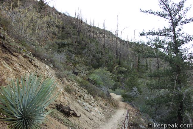
Poodle-dog Brush Warning: Avoid the poodle-dog bush (Turricula parryi) that became abundant after the 2009 Station Fire, but is now easy to stay away from. Poodle-dog brush can irritate skin and cause itching, rashes, and blisters. Do not touch poodle dog-brush (or its purple trumpet-shaped flowers). After your hike, wash exposed areas with cold running water and wash any clothes that may have touched these plants. Symptoms may take 12 to 36 hours to appear and can be similar to poison oak. The poodle-dog brush should be avoidable, but wearing long pants is recommended.
To get to the trailhead: From the 210 Freeway in La Cañada Flintridge, take Angeles Crest Highway (CA 2) northwest for 10 miles to a dirt turnout on the left (north) side of the road, 0.8 miles past Clear Creek Information Center. Colby Canyon Trail begins from the left (west) side of the turnout.
Trailhead address: Angeles Crest Highway, Angeles National Forest, Altadena, CA 91001
Trailhead coordinates: 34.2696, -118.1407 (34° 16′ 10.55″N 118° 08′ 26.51″W)
View Josephine Peak in a larger map
Or view a regional map of surrounding Los Angeles trails and campgrounds.
Colby Canyon Trail to Josephine Saddle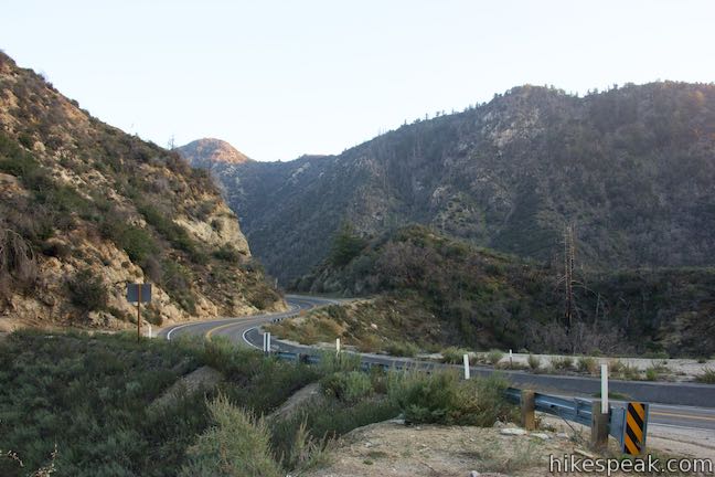


Josephine Saddle to Josephine Peak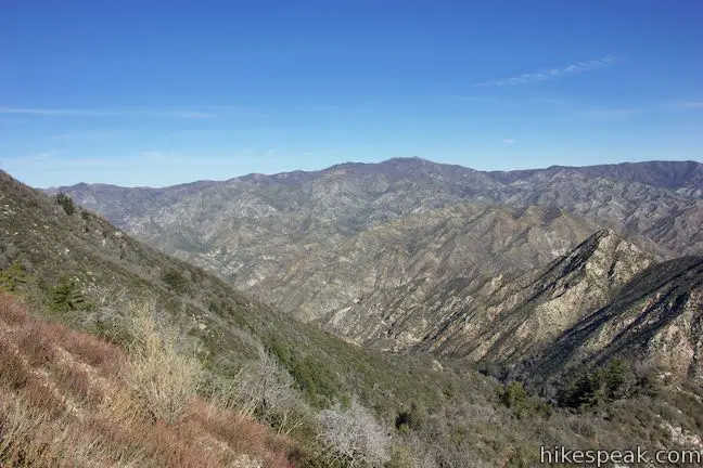


Josephine Saddle to Strawberry Meadow


 | Strawberry Peak This 7.5-mile hike to the highest summit in the front range of the San Gabriel Mountains starts out gradual and becomes steep, presenting grand views of surrounding mountains and the cities below. |
 | Strawberry Meadow This 9 to 11-mile hike goes around Strawberry Peak to a remote and scenic flat below a massive cliff on the north side of the mountain, offering views of Big Tujunga Canyon and surrounding peaks along the way. |
 | San Gabriel Peak from Mount Lowe Road This 6,161 foot peak is also reachable via a 3.2-mile round trip trail from Eaton Saddle. |
 | San Gabriel Peak from Mount Disappointment Fire Road This 6,161 foot peak is reachable via a 4-mile round trip hike from Mount Disappointment Fire Road. |
 | Inspiration Point & Mount Lowe Trail Camp This 7.25-mile round trip hike descends Mount Lowe Road into the San Gabriel Mountains to a historic scenic overlook and a trail camp built on interesting ruins. |
 | Switzer Falls This 4.5-mile hike starts out above and finishes below a 50-foot tall waterfall. |
 | More trails in the San Gabriel Mountains Explore other destinations in the range. |
Colby Canyon Trail to Josephine Peak on summitpost.org
Colby Canyon Trail to Josephine Peak on nobodyhikesinla.com
Colby Canyon Trail to Josephine Peak on silenthiker.com
Colby Canyon Trail to Josephine Peak on hikingangelesforest.com
Colby Canyon Trail to Josephine Peak on livingauthenticallylesley.com
Josephine Peak on hundredpeaks.org
Colby Canyon on wildsouthland.blogspot.com
Josephine Peak Road to Josephine Peak on modernhiker.com
Josephine Peak Road to Josephine Peak on myown100hikes.blogspot.com
I’m looking to do this as a backing trip. Is there an issue with setting up a campsite at the peak? is there somewhere else neat the peak we should look to set up a campsite? We are all experienced backpackers and understand leave no trace so that’s not a problem. Im mostly worried about the legalities of setting up camp.
Also, are there any water sources along or near this route?
Dann! I realize you commented over a year ago now, but I am curious as to whether you indeed backpacked this trail?
The trailhead marker is back! As of when I am not sure, but I hiked this trail on Saturday and the Colby Cyn Trailhead is clearly marked