Inspiration Point via Tunnel Trail and Jesusita Trail from Tunnel Road in Santa Barbara
Located in the Santa Ynez Mountains, 1,800-feet above the Santa Barbara Coast, Inspiration Point attracts hikers with panoramic views over city and sea. Two routes lead to this picturesque perch. If you want to make a day of it, you can approach the viewpoint from the west on a moderate 7.55-mile round trip trek up Jesusita Trail to Inspiration Point from San Roque Road. For something less ambitious, yet completely satisfying, connect Tunnel Trail with the east end of Jesusita Trail for a 3.75-mile round trip hike with 825 feet of elevation change. The hike crosses Mission Canyon and holds your attention with ocean views and perspectives of prominent sandstone peaks in the mountains above.
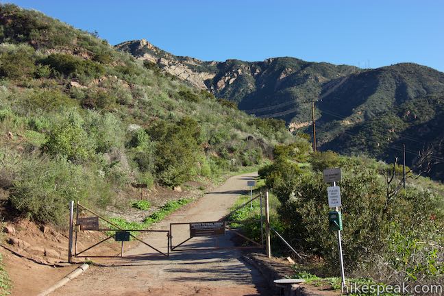
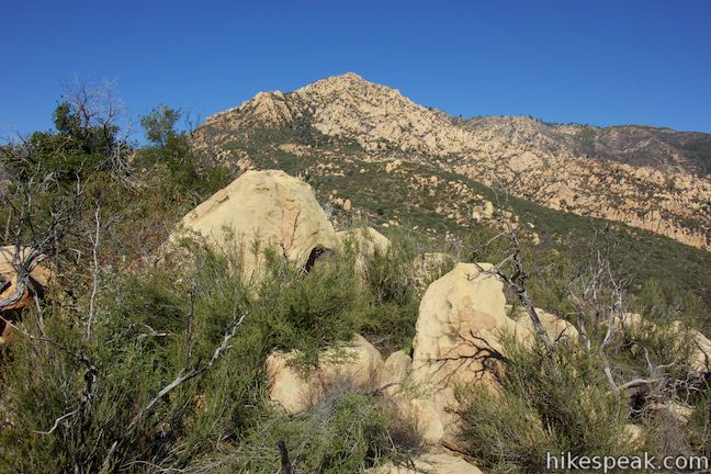
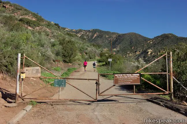
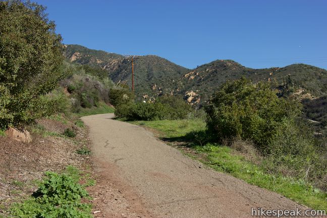
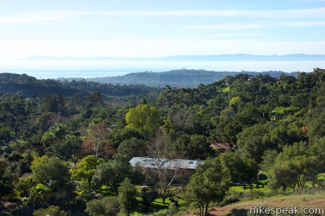
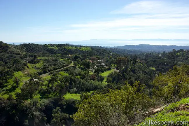
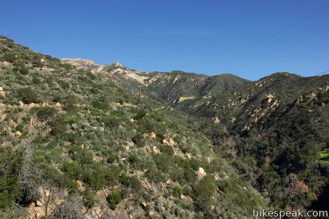
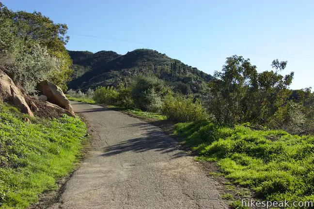
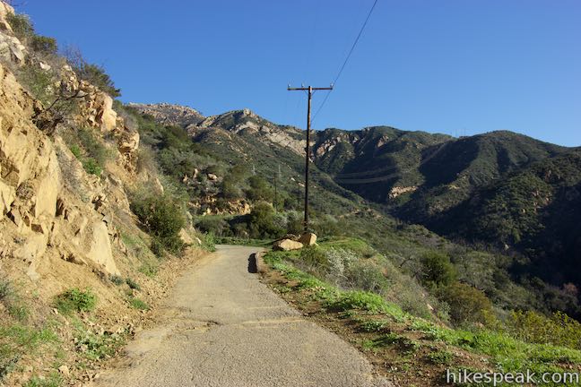
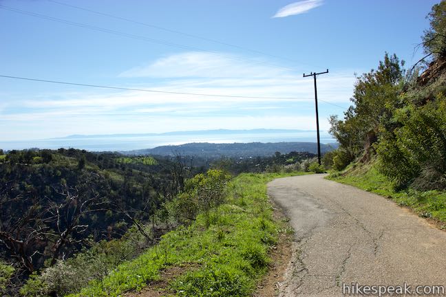
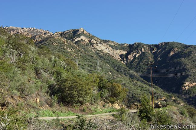
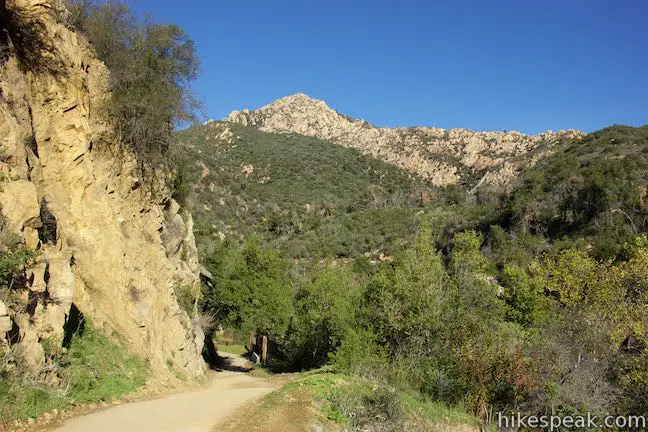
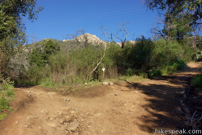
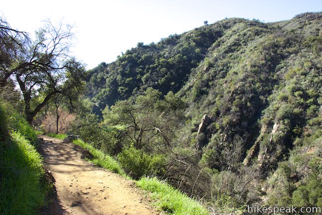
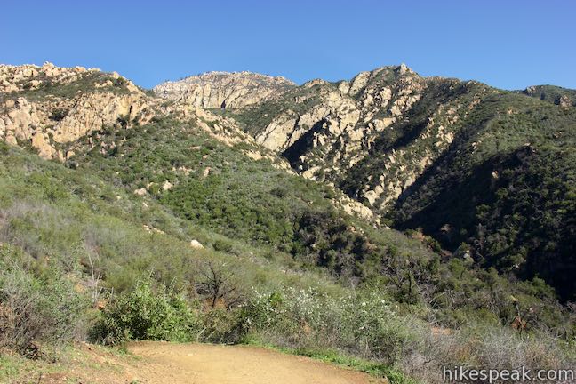
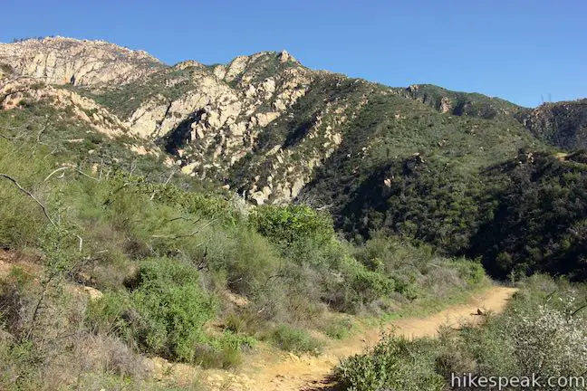
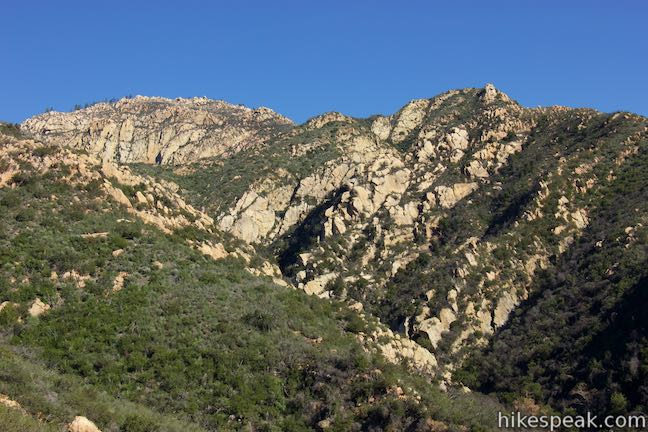
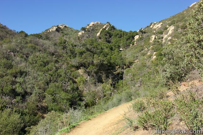
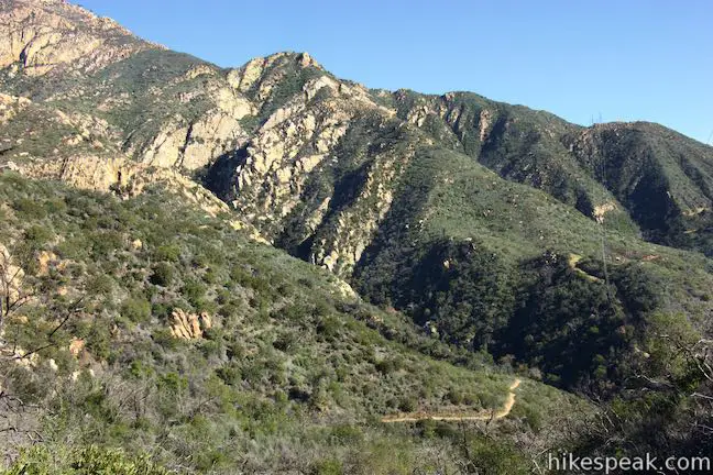
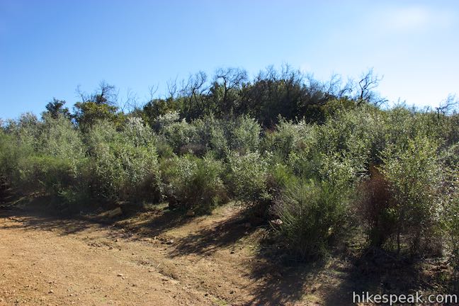
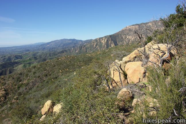
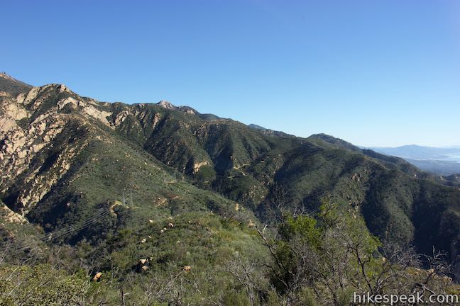
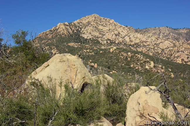
Begin from roadside parking along Tunnel Road and walk about 125 yards up to a gate where the hike officially starts. The next 0.8 miles of Tunnel Trail are wide and paved, but don’t get discouraged. The trail weaves up the west side of Mission Canyon, offering big open views. Ahead, you’ll see interesting sandstone formations like the Mission Crags rising above the canyon. Looking back, the ocean shimmers below the canyon.
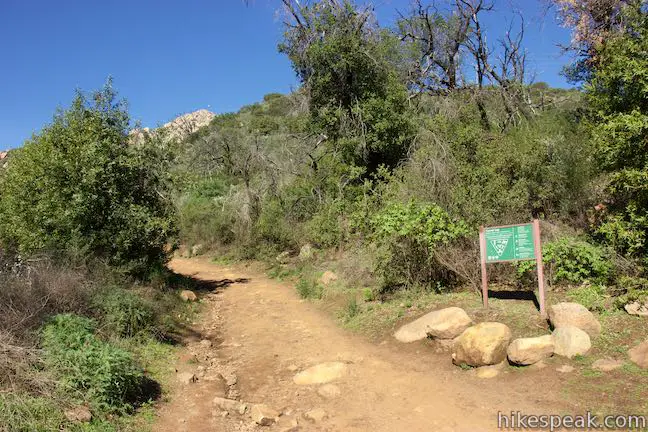
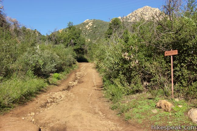
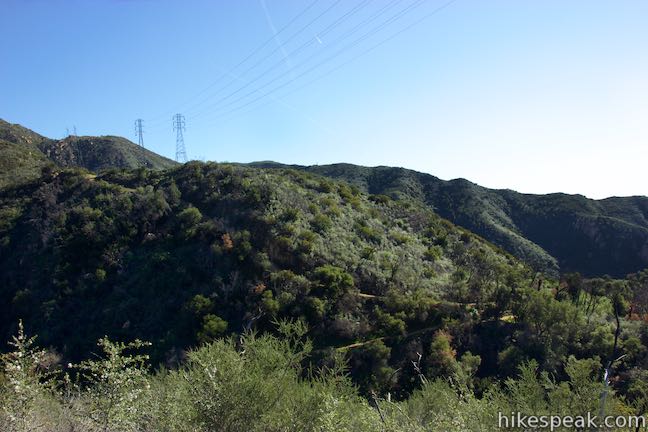
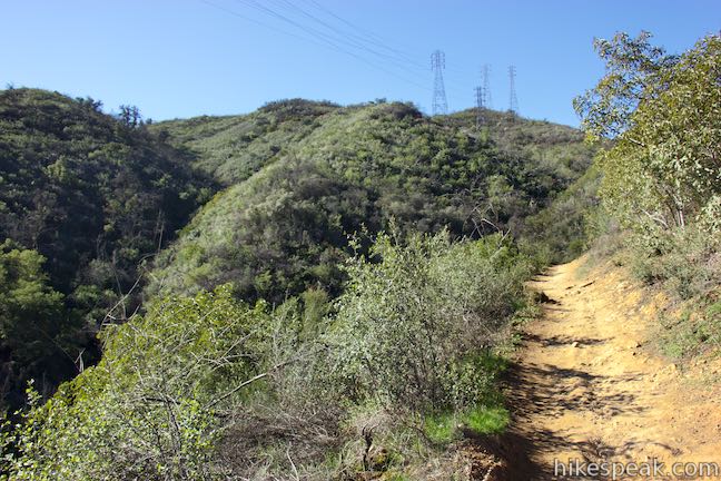
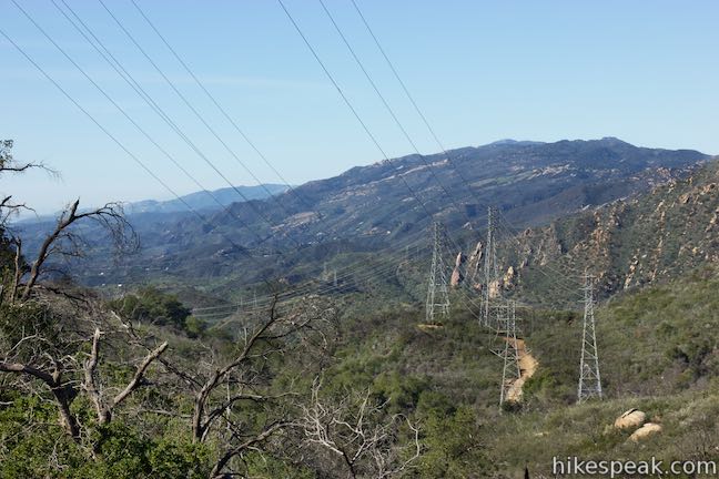
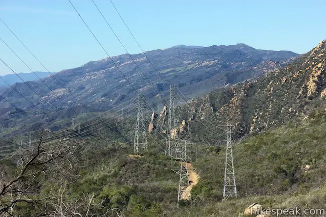
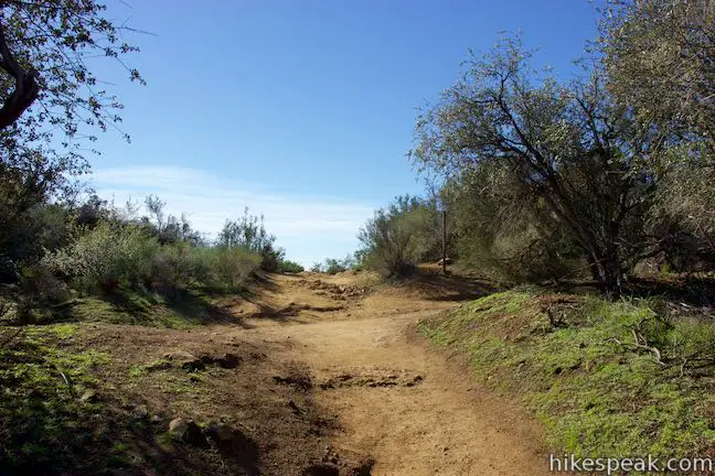
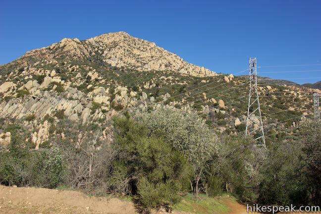
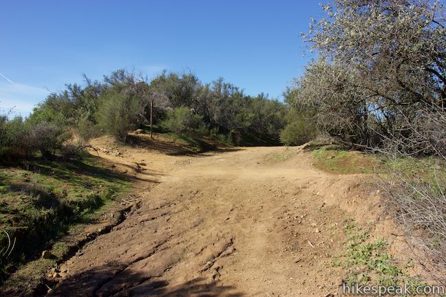
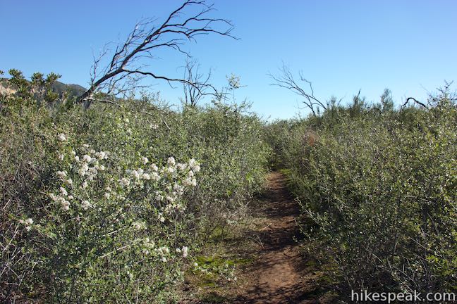
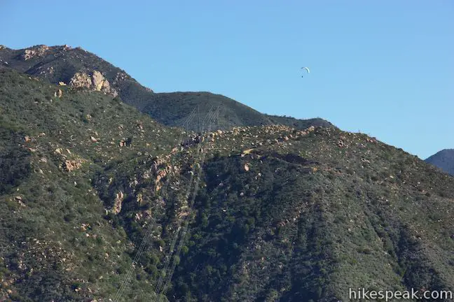
After 2/3 of a mile, the trail curves to the left and descends to a wooden bridge over Mission Creek above a flood control dam. Cross the bridge, 3/4 of a mile from the start and continue uphill where the pavement finally ends as you come to a split. Bear left to stay on Tunnel Trail and walk a short distance up to another split. Now turn left onto Jesusita Trail, at this junction 0.95 miles from the start. Keep the left turn trend going when you reach an unmarked split after another 250 feet. The wide dirt road ascending to the right will dead end at a tower for the power lines that run across the canyon. Bear left to stay on Jesusita Trail, which is a single track from this point on.
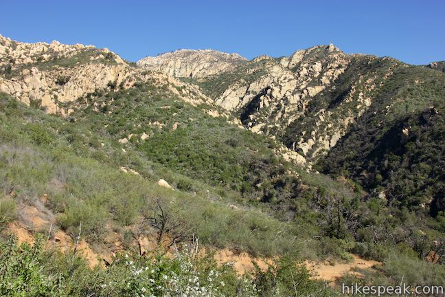
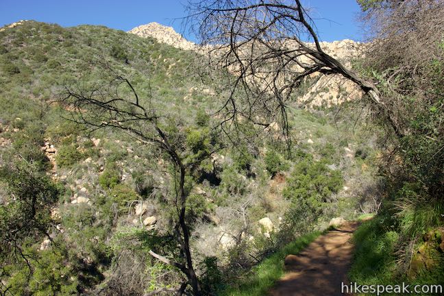
Jesusita Trail turns downhill and drops to a crossing of Mission Creek, 1.15 miles from the start. Look for pools in the creek just below the trail. The Seven Falls area of Mission Creek lies upstream and can be reached by trekking off of Jesusita Trail at this point (although the creek may be disappointingly dry outside the rainy season). To reach Inspiration Point, continue up Jesusita Trail, which immediately crosses a smaller side canyon and begins to ascend toward Inspiration Point. Jesusita Trail gains 350 feet over the next 2/3 of a mile. Enjoy views looking higher into the Santa Yney Mountains and out the canyon toward the coast below.
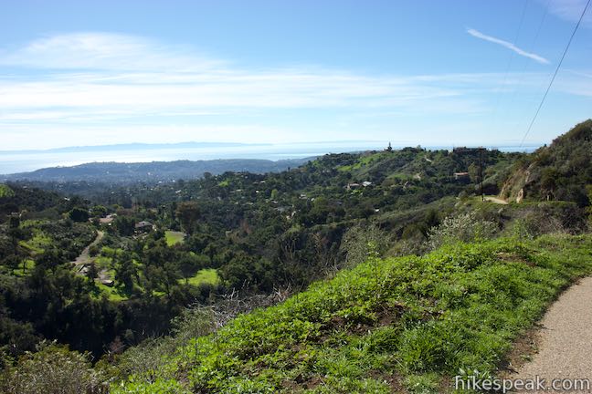
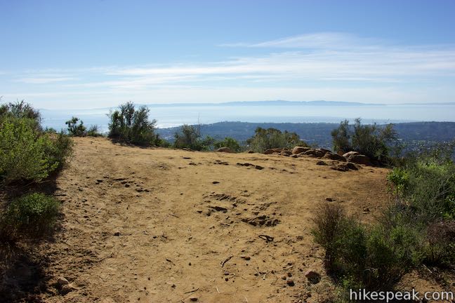
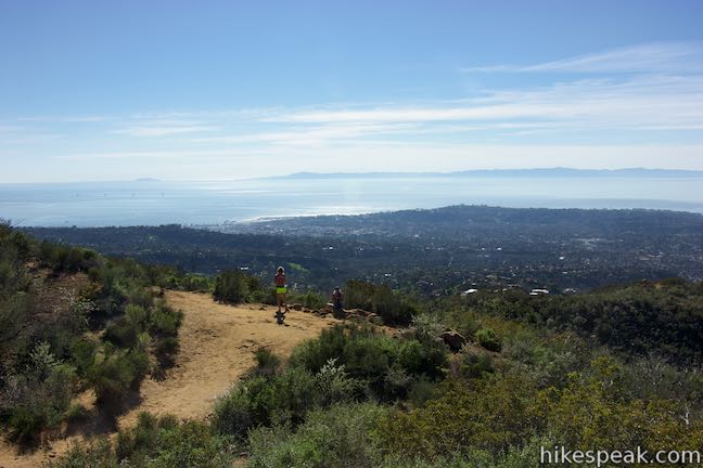
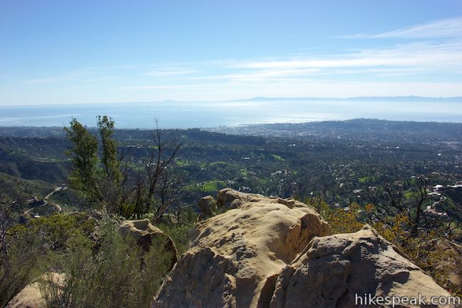
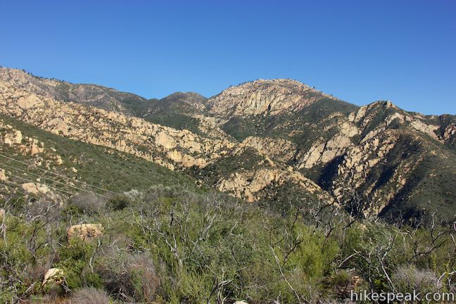
The trail switchbacks up the west side of the canyon and comes up onto a ridge where it passes below some large power lines. Shortly thereafter, and 1.85 miles from the start, the trail reaches an important but unmarked intersection with a dirt service road. The road to the left, which heads down into the canyon and dead ends by electrical towers, can be used to reach Historic Inspiration Point (described below). The trail to the right is the other half of Jesusita Trail, used by those taking the longer route to Inspiration Point. To reach Inspiration Point, cross the road and walk a hundred feet out to a worn dirt landing where panoramic views await.
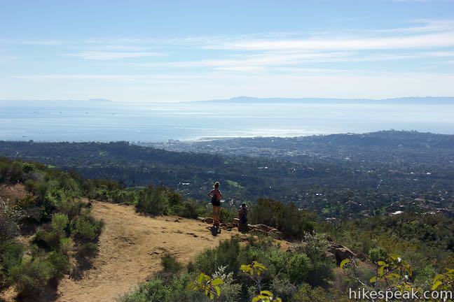
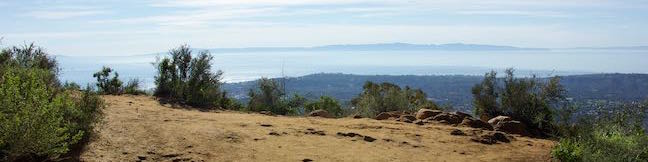
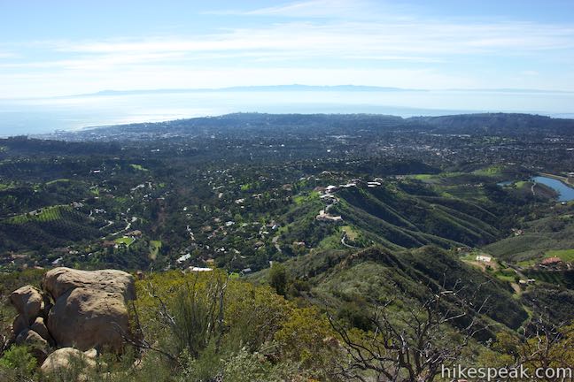
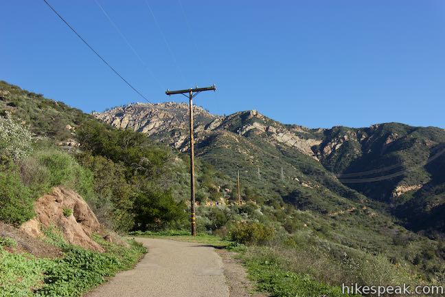
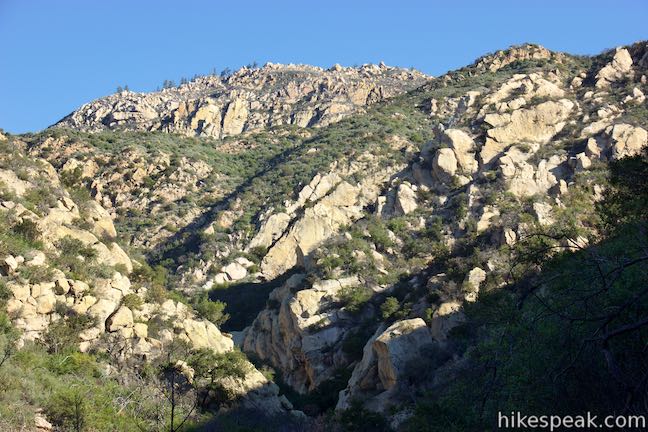
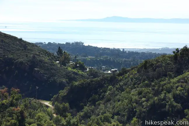
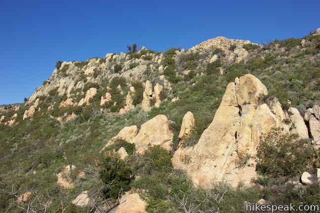
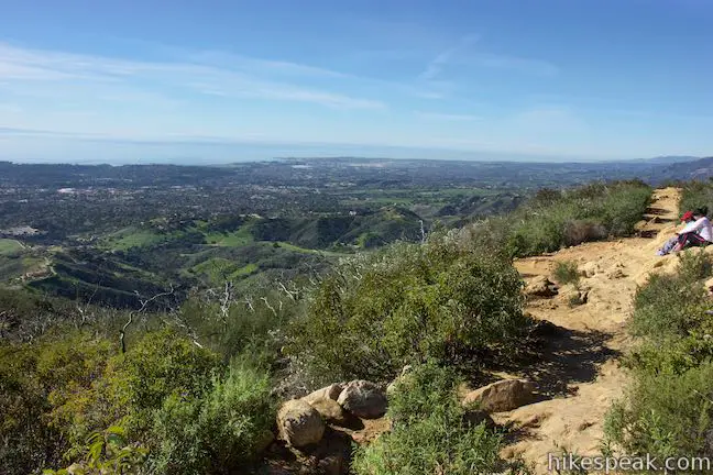
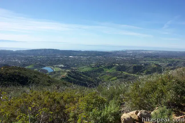
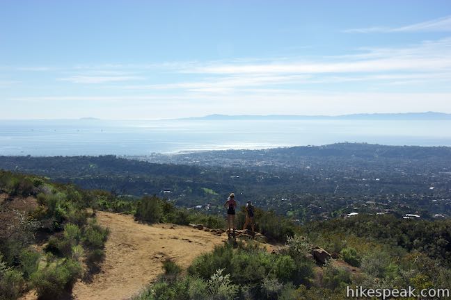
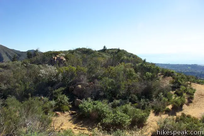
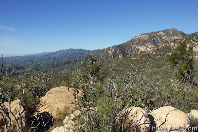
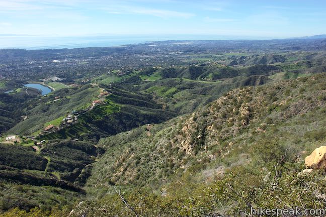
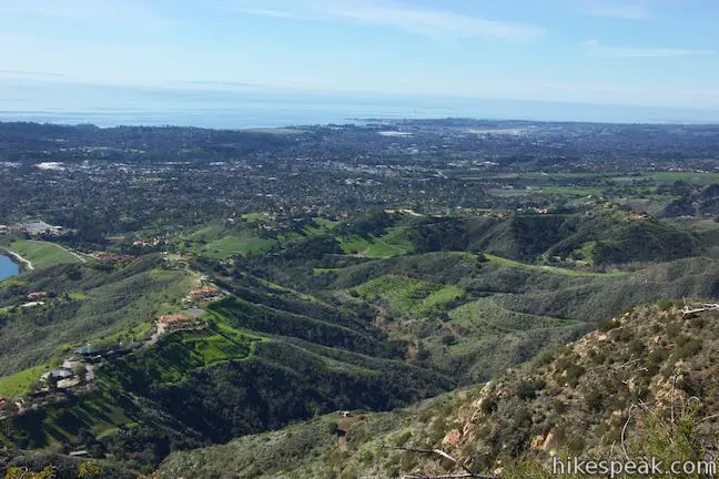
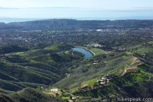
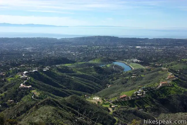
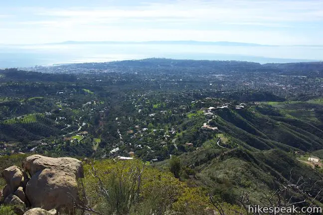
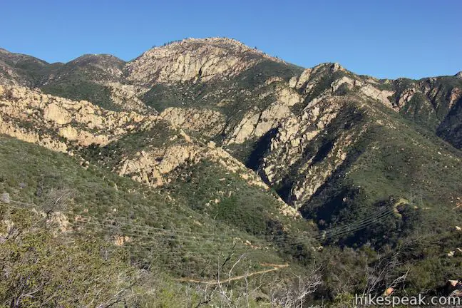
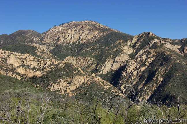
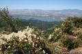
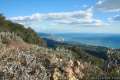
Inspiration Point provides clear views over the coast of Santa Barbara and across the Pacific Ocean toward the Channel Islands. You can also also views looking west down miles and miles of the Santa Ynez Mountains, the dramatic backdrop behind Santa Barbara. To let the inspiration sink in, you can head up to the right and find a boulder to sit on, or trek a tenth of a mile down a footpath to a panoramic bluff about 75 feet lower than Inspiration Point. This worn path goes past several charred trees in an area recovering from the 2009 Jesusita Fire. Inspiration Point is only about halfway up the mountain range in terms of elevation, so there are tall sandstone summits like Arlington Peak, Cathedral Peak, and the Mission Crags jutting skyward high above Inspiration Point to the north.
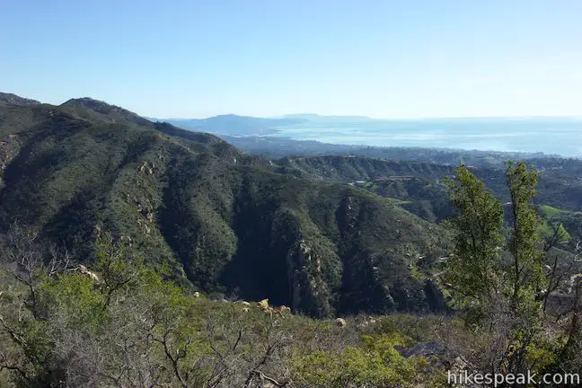
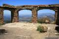
If you need extra inspiration, you can take a path to Historic Inspiration Point, which offers expanded views to the southeast along with privacy that can be fleeting at Inspiration Point. To reach Historic Inspiration Point, head back to the junction at the top of Jesusuta Trail and go east along the road for just 150 feet. At the bottom of a shallow dip, a hard-to-spot path breaks off to the right and heads out to the crown at the end of the ridge. Take this path out to a clusters of sandstone boulders that you can sit down on or stand up on and enjoy sweeping views over Santa Barbara. Look up the coast to the west or down the coast to the east toward Ventura. Views extend to the northeast up Mission Canyon toward the tops of the Santa Ynez Mountains and a jumbled cluster of sandstone called the Rock Garden. This extension to Historic Inspiration Point adds about 0.4 miles round trip to the hike to Inspiration Point.
Once you’ve been inspired, return the way you came down Jesusita Trail to Tunnel Road. The hike is 3.75 miles to Inspiration Point and back, or about 4.05 miles round trip if you add the side trail to Historic Inspiration Point.
No fee or permit is necessary to hike to Inspiration Point. Dogs and mountain bikes are welcome. Dogs must be on leashes. While the parking spaces at the trailhead are numerous, they do fill up (requiring you to walk some extra distance up the paved road). It is best to hike at less busy times (or use a ride share service to get to the trailhead). Tunnel Trail does not have bathrooms, potable water, or trash collection.
Parking is permitted within white painted lines on the road so that the lanes remain clear for firetrucks and cars (evacuations can occur in this high-fire area). Do not park in front of fire hydrants. If you have to park farther down the road, be courteous as you walk up the road to minimize the impact on the trailhead’s neighbors (like keeping dog waste off their yards).
To get to the trailhead: From the 101 Freeway in Santa Barbara, take exit 99 for Mission Street. At the end of the offramp, turn north up Mission Street. Drive 0.8 miles and turn left on Garden Street. Go two blocks and make a right on Los Olivos Street. This will become Mission Canyon Road as you drive 0.8 miles up to Foothill Road. Turn right and then make the next left to continue up Mission Canyon Road. After a quarter mile, bear left at a split onto Tunnel Road. Drive a mile up this road and find parking on the right side before reaching the turnaround by the trailhead for Tunnel Trail.
Trailhead address: Tunnel Road (near 1488 Tunnel Road), Santa Barbara, CA 93105
Trailhead coordinates: 34.46492, -119.71272 (34° 27′ 53.71″N 119° 42′ 45.79″W)
View Inspiration Point in a larger map
Or view a regional map of surrounding Central Coast trails and campgrounds.


 | Inspiration Point via Jesusita Trail from San Roque Road This 7.55 to 7.95-mile round trip hike ascends 1,400 feet up the western side of Jesusita Trail to a panoramic perch in the Santa Ynez Mountains with great views over Santa Barbara. |
 | Chumash Painted Cave This very short trail looks in on Native American rock art in the Santa Ynez Mountains. |
 | Knapp's Castle This easy 0.8-mile hike visits the scenic ruins of an estate home built atop the mountains behind Santa Barbara. |
 | Lizard's Mouth This half-mile hike visits a unique rock formation with amazing views over Santa Barbara and the Pacific. |
 | Tequepis Trail This invigorating 8.4-mile round trip hike offers views of Lake Cachuma as it climbs the Santa Ynez mountains to views of Santa Barbara and the Pacific. |
 | Montecito Peak This 7.1-mile partial loop climbs to a panoramic summit in Los Padres National Forest overlooking Montecito and Santa Barbara. |
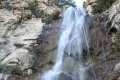 | Tangerine Falls This 2.5-mile hike visits a beautiful waterfall on the edge of Los Padres National Forest near Santa Barbara. |
 | McMenemy Overlook This 3.7-mile hike uses four trails to form a loop through the mountains behind Montecito, California. |
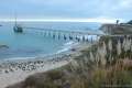 | Carpinteria Bluffs Trail to Carpinteria Seal Sanctuary Overlook This 1 to 2-mile hike goes from Carpinteria Bluffs Nature Preserve to a viewing area above a harbor seal rookery, offering beach access and beautiful oceanfront hiking. |
 | More Central Coast Hikes Explore other destinations along the California coast between Ventura and Monterey. |
Are trails such as Inspiration Point open or closed due to area wildfires?
[…] For more logistics, check out this website, which offers a much more detailed description of the route, driving directions, and connecting trails […]