Inspiration Peak from Keys View
in Joshua Tree National Park
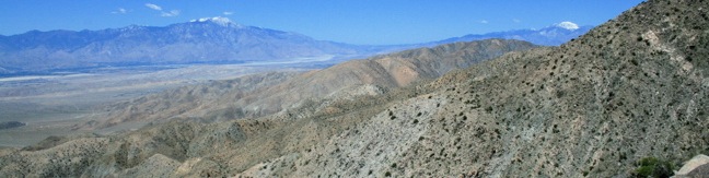
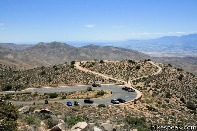
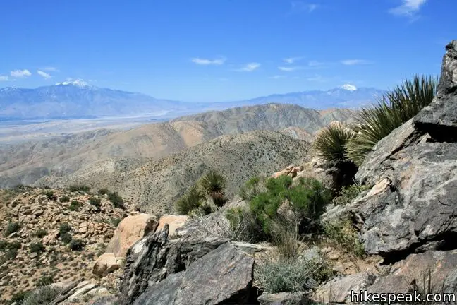
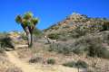
With its vast view of Coachella Valley, the Salton Sea, and Mount San Jacinto, Keys View is the principal overlook in Joshua Tree National Park. The excellent vantage more than justifies the 7-mile drive from Park Boulevard, but why stop there? Keys View is also the starting point for a short trek to Inspiration Peak. Leave the crowds behind and visit this 5,550-foot summit, which is just 0.6 miles (and 425 vertical feet) away.
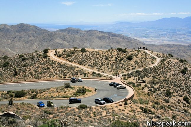
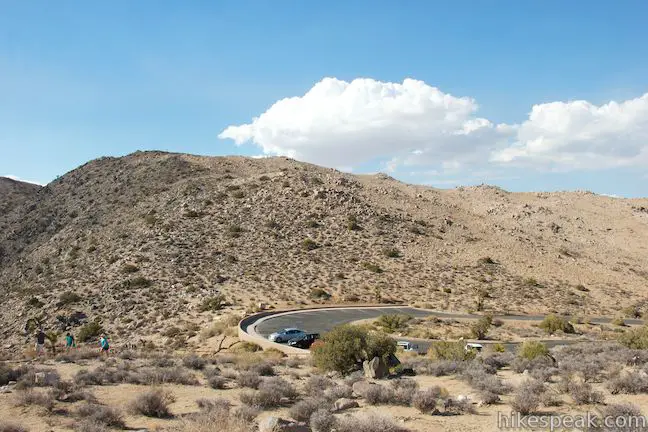
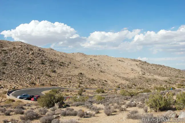
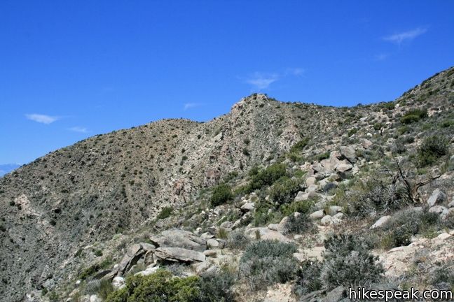
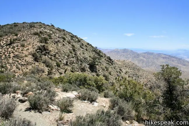
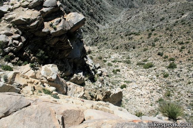
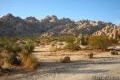
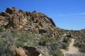
The trailhead is unmarked, but easy to locate. Look for the path heading west from the southwest corner of Keys View (if you are looking at the information panel about the San Andreas Fault, turn right and you will see the path headed uphill). A few switchbacks are built into the trail, but mostly it is a straight shot up the rocky slope, climbing 400 feet over 0.3 miles to a crest in the ridge. This is the halfway point, and while the views from here are quite good, keep hiking west to Inspiration Peak, a high point in the Little San Bernardino Mountains with a vertical southern face.
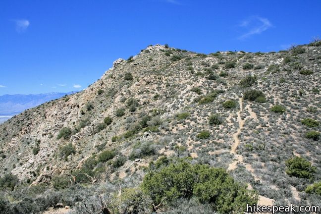
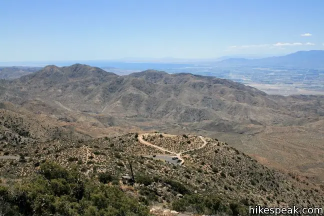
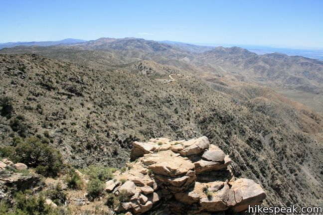
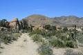
The trail drops down across a saddle, losing 100 feet, before climbing again to the summit. While a bit faint in places, the unmaintained trail is not too hard to follow. As you reach the peak, have a look over your shoulder. The cars and people at Keys View now look minuscule within the larger desert landscape.
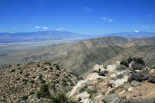
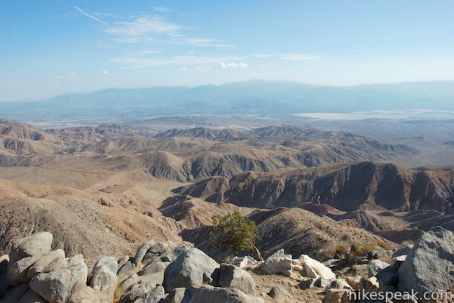
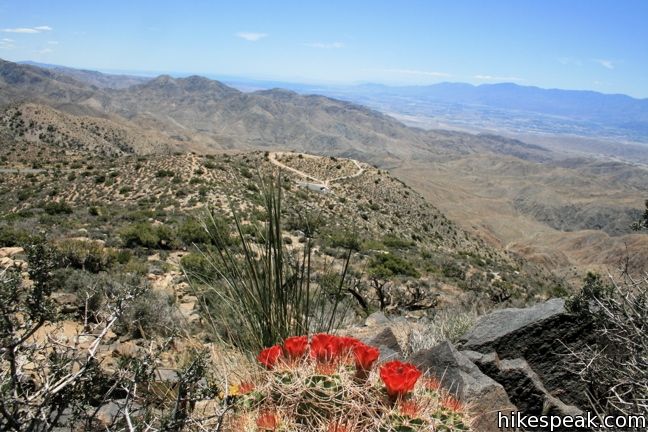
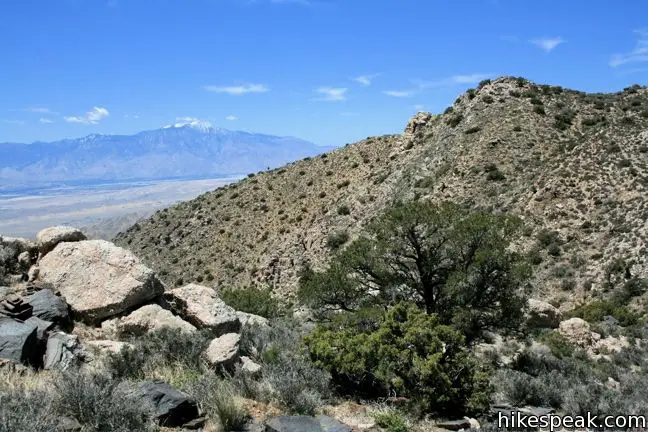
The views from Inspiration Peak are truly panoramic. To the southwest Mount San Jacinto rises above Palm Springs. To the west is an even taller mountain, the 11,499-foot Mount San Gorgonio (the highest point in Southern California). And unlike Keys View, Inspiration Peak also looks northward over the park toward Ryan Mountain and the Wonderland of Rocks.
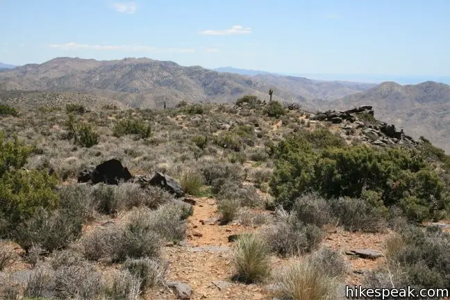
After taking in the views, return the way you came for a 1.2-mile round trip hike. For those interested in extending the hike, a clear path continues west along the ridge.
To get to the trailhead: From Park Boulevard 10.3 miles west of the intersection with Pinto Basin Road, take Keys View Road south for 7 miles to road’s end at Keys View (passing the turnoff for Lost Horse Mine).
Trailhead address: Keys View Road (Salton View Road), Joshua Tree National Park, CA 92277
Trailhead coordinates: 33.9272, -116.18745 (33° 55′ 37.9″N 116° 11′ 14.8″W)
You may also view a regional map of surrounding California Desert trails and campgrounds.


 | Lost Horse Mine This 4-mile hike visits a well-preserved mine and mill. |
 | Hidden Valley This one mile loop circles the interior of a small valley surrounded by tall rocks that serves as an excellent bouldering arena. |
 | Ryan Mountain This 3-mile hike offers summit views from the center of Joshua Tree National Park. |
 | Ryan Ranch This 0.8 or 1.2-mile round trip hike visits the ruins of an old adobe homestead beneath Ryan Mountain. |
 | Warren Peak This 5.5-mile hike summits a peak with impressive views over the west side of Joshua Tree. |
 | High View Nature Trail This 1 1/3-mile loop climbs a ridge on the west side of the park that offers views of San Gorgonio Mountain and Yucca Valley, along with an introduction to desert plants. |
 | Lucky Boy Vista This level 2.5-mile hike visits a modest overlook at the site of an old mine. |
 | Desert Queen Mine This 1.6-mile hike follows a level trail to an overlook before crossing a canyon to visits the ruins of one the most profitable gold mines in the California desert. |
 | Wall Street Mill This level 1.55 to 2.15-mile hike visits a well-reserved gold mill, exploring the mining history of Joshua Tree National Park. |
 | Barker Dam This level 1.5-mile loop visits a small foreign-looking reservoir within the Wonderland of Rocks. |
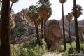
 | Fortynine Palms Oasis The 3-mile round trip hike visits a cool desert oasis. |
 | Indian Cove The 101-site campground is home to a 0.6-mile interpretive trail and endless bouldering and rock climbing opportunities. |
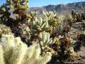 | Cholla Cactus Garden This quarter-mile loop allows visitors to stroll through an intense concentration of cholla cacti. |
 | Mastodon Peak This 2.6-mile loop visits a 3,400-foot summit with panoramic views of southeastern Joshua Tree. |
 | Lost Palms Oasis This 7.2-mile hike visits a desert oasis nestled between mountains in the southeast corner of the park. |
 | Hikes in the California Desert Explore more trails in Death Valley National Park, Joshua Tree National Park, Anza-Borrego Desert State Park, and Mojave National Preserve. |
 | Joshua Tree Campgrounds Nine campgrounds with 500 total sites are spread throughout the park to facilitate your visit. |
 | Joshua Tree Wildflowers The desert in bloom is something any outdoor enthusiast in California should see. |
[…] (many climbers), followed by the Keys view overlook (http://www.hikespeak.com/trails/inspiration-peak-joshua-tree/), and then a quick scramble up “Cap Rock”. So great to be in the desert, in the sun, trying to […]
Just hiked this yesterday with my sister. The trail is now nearly impossible to see from Keys parking lot, and the far right (Northeast?) side of the first hill is blocked to hikers. We scrambled along the southwest face, which was pretty strenuous. If you’re thinking of hiking this, just start ascending the hill directly south of the parking lot and the trail will become visible. Once you crest the first hill, the path is much easier hiking up to the Peak. Absolutely recommend this hike – the best views in the park in our opinion.
[…] Inspiration Peak at Keys View […]
We had no trouble locating the trail, and we’re surprised Inspiration Peak is not listed by NPS. If you’ve hiked Ryan Mountain, for example, you’ll find this much easier. The views from the peak are well worth the effort, and should be recommended to most people visiting Keys View. Keys View does look tiny from atop this peak – and the views to the north and east are excellent. One question to which we have not found an answer: When looking southeastward across the Salton Sea, what is the large stand-alone mountain in the distance beyond Salton Sea? Is it in AZ or MX?