Picture yourself standing on the Continental Divide overlooking a crackling glacier that feeds a string of sparkling turquoise lakes. That is only part of the panorama you’ll enjoy from Glacier Overlook, a no-nonsense notch on a section of the Continental Divide in Glacier National Park named the Garden Wall. Approached from the west, Glacier Overlook offers a window looking east over a glacier and a trio of subalpine lakes. To reach the stellar overlook, Garden Wall Trail climbs a thousand feet in one mile. If that sounds intimidating, there is more tough news. The bottom of Garden Wall Trail is located 6.8 miles up Highline Trail from the trailhead at Logan Pass on Going-to-the-Sun Road. While Glacier Overlook is not easily reached, the views are worth any effort.
The bottom of Garden Wall Trail is located near a backcountry lodge, Granite Park Chalet. In addition to Highline Trail, Garden Wall Trail may also be reached by hiking up Granite Park Trail from a sharp hairpin turn on Going-to-the-Sun Road called The Loop. This route requires 2,000 feet of elevation gain and 4.75 miles of hiking prior to tackling Garden Wall Trail. As a comparison, 500 feet of elevation gain are spread out across the 6.8 miles on Highline Trail. The ideal way to see Glacier Overlook is to combine both routes for a 13.5-mile through-hike. A free park shuttle between the trailheads makes this hike possible without a second vehicle.
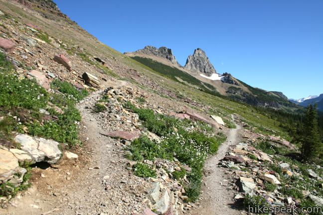
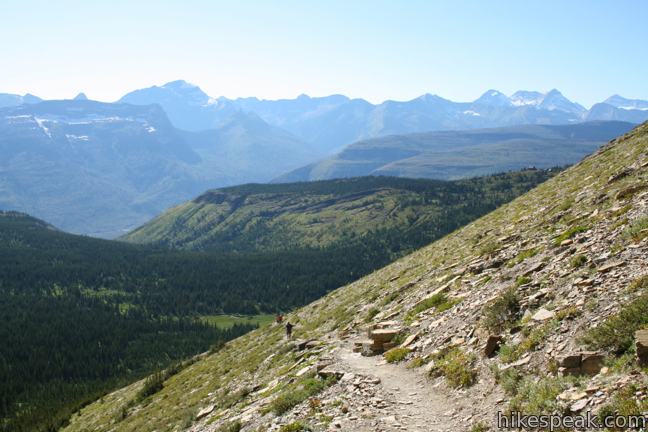
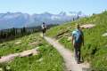
Start by hiking north from Logan Pass on Highline Trail. This incredibly scenic trail is pleasantly gradual, gaining just 500 feet over its first 6.8 miles.
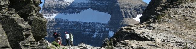
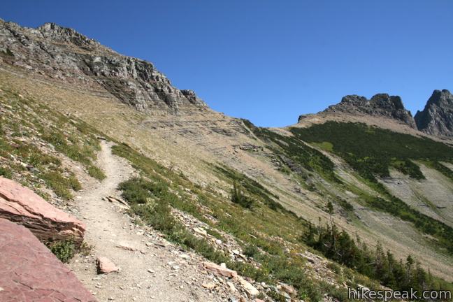
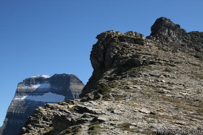
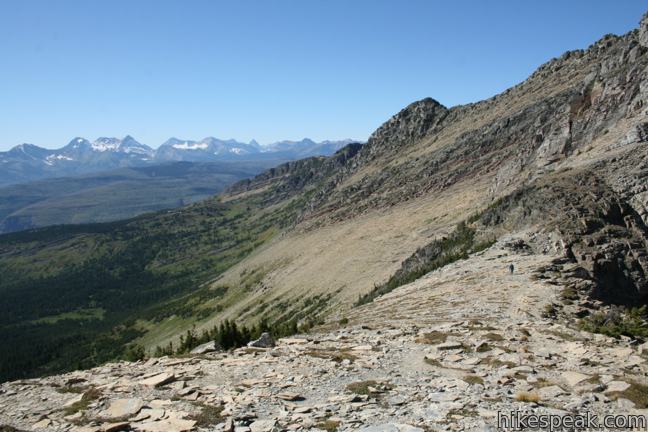
After a long gentle descent, Highline Trail comes to its first marked junction, about 3/4 of a mile before Granite Park Chalet. To the right, Garden Wall Trail climbs a steep gravel slope toward the top of the divide. More challenging than anything that has come so far, this trail tackles 950 feet over 0.87 miles to a dip on the Continental Divide.
A sign at the junction lists the distance at 0.6 miles, but unfortunately this is an understatement. Take your time hiking up the rocky track, which is un-apologetically tough on tired legs.
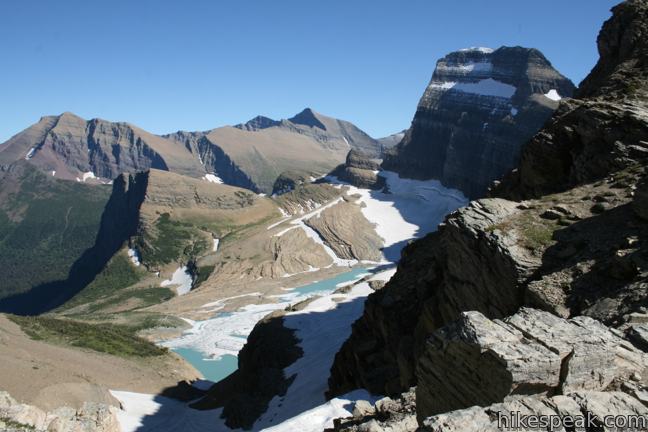
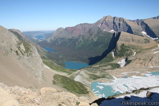
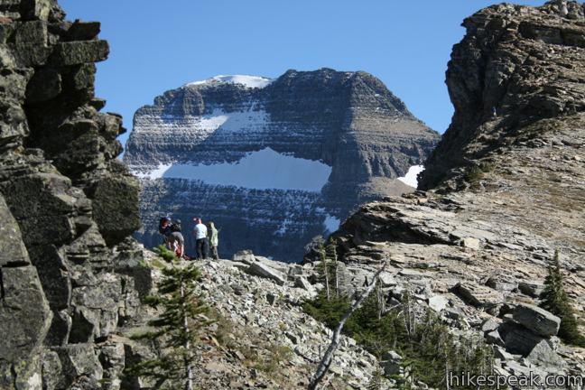
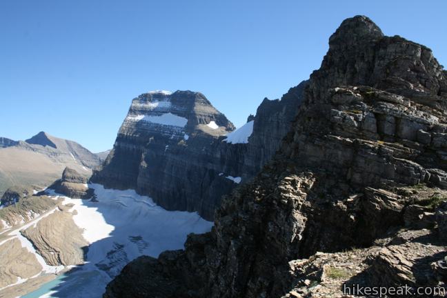
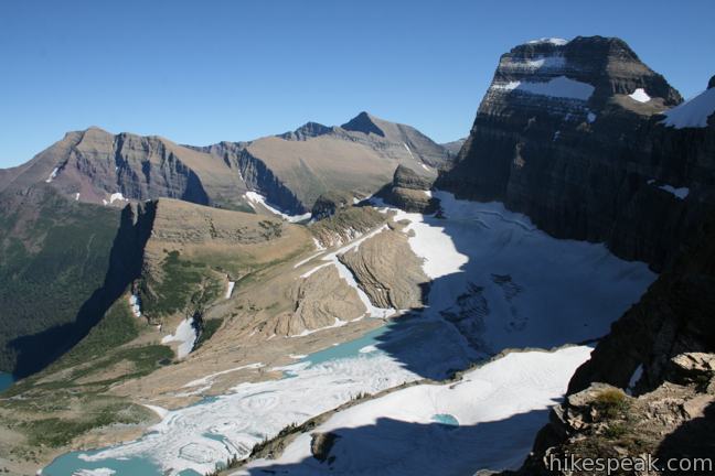
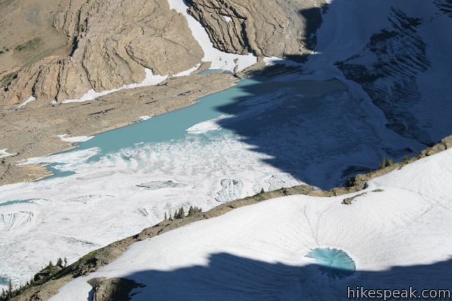
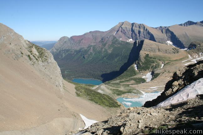
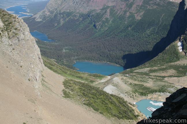
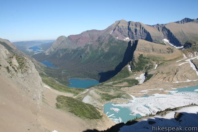
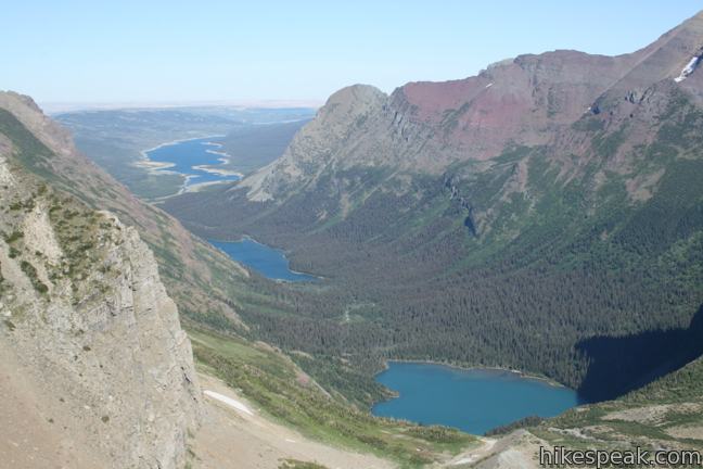
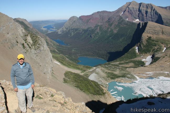
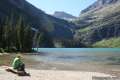
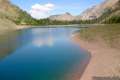
The view from Glacier Overlook justifies the effort. It is unlike anything previously seen on Highline Trail. Glacier Overlook peers eastward on to the ice fields and melted pools of Grinnell Glacier. The glacier spills into Grinnell Lake and a string of lakes to the northeast in the Many Glacier region of the park.
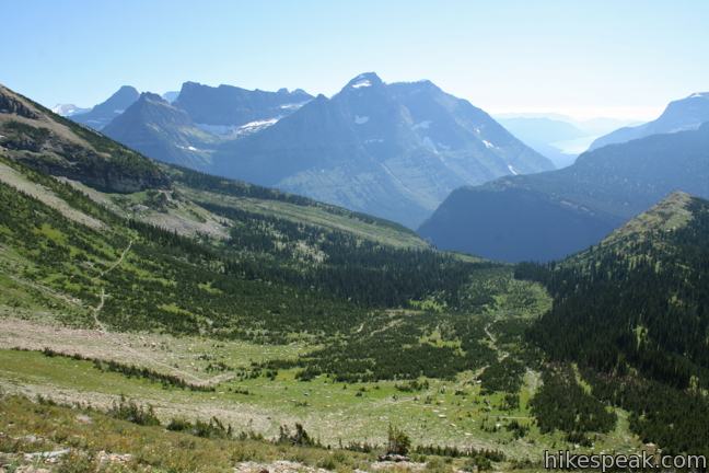
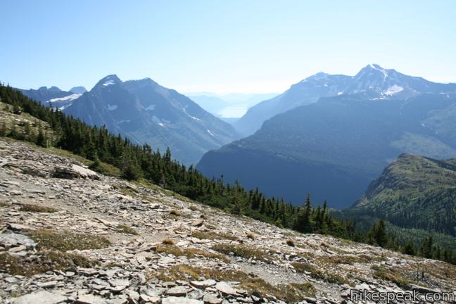
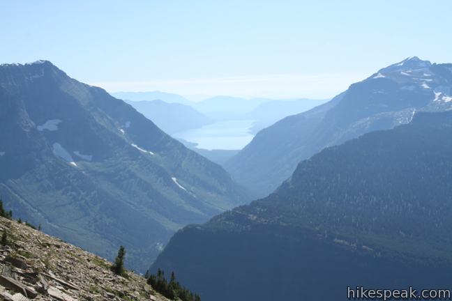
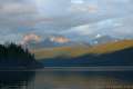
The divide-straddling destination also delivers a whopping westward view toward McDonald Creek Valley and the mountains cradling the 10-mile long Lake McDonald.
Pro tip: Once you’ve reached Glacier Overlook, you owe it to yourself to follow the footpath south up the ridge for a broader view of Grinnell Glacier, gaining another 200 feet for even better views. This extra effort extends the view down the lakes. Beneath Grinnell Glacier are the subalpine bodies Grinnell Lake, Lakes Josephine, and Swiftcurrent Lake. At the end of this third lake is Many Glacier Hotel, a historic lodge that looks like a speck from this high perch.
Not surprisingly, the hike back down to Highline Trail takes a fraction of the time. While strenuous, Garden Wall Trail is a worthwhile undertaking. Glacier Overlook offers incredible views. Hike back along Highline Trail for a 15.6-mile hike or continue to Granite Park Chalet and descend Granite Park Trail to The Loop for a 13.5-mile through-hike. No permit is required to day hike to Glacier Overlook, but there is an entrance fee for Glacier National Park.
To get to the trailhead: Highline Trail starts at Logan Pass on Going-to-the-Sun Road at the Continental Divide. The Loop is located 7.75 miles down the west side of the Divide. The free park shuttle stops at both locations.
Trailhead address: Going-To-The-Sun Road, Glacier National Park, Browning, MT 59417
Trailhead coordinates: 48.696343, -113.7176 (48° 41′ 46.83″N 113° 43′ 03.35″W)
View Glacier National Park in a larger map.

 | Highline Trail This stunning trail presents hikes of several lengths from 7 miles to 15 miles, like an amazing 13.5-mile through-hike that includes a spur trail to an exceptional Glacier Overlook. |
 | Johns Lake Loop This 2-mile loop visits a small lake in a mossy fores and then follows McDonald Creek past McDonald Falls to return to the trailhead. |
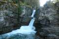 | Saint Mary Falls and Virginia Falls This 3-mile hike visits two waterfalls in the forest above Saint Mary Lake on the east side of Glacier National Park. |
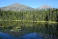
 | Grinnell Lake Trail This long but level 7.5-mile hike passes a triplet of beautiful turquoise glacier-fed lakes in the Many Glacier region of the park. |
 | Crypt Lake Trail in Waterton Lakes National Park, Canada This adventurous 10.8-mile hike is considered one of Canada's best, passing waterfalls, a natural tunnel, and a cable traverse to reach a pristine lake on the US border. |
 | Glacier National Park Campgrounds Thirteen campgrounds with over 1,000 total sites are spread throughout the park in picturesque locations. |
is it possible to hike the Garden wall trail in May?
Thanks!
No, May is too early. Many years you can’t even get up to Logan Pass until late June. This year (2014) the Highline Trail didn’t open until mid-July due to late spring snows.
Hi!
Which is more recommended: to hike from The Loop to Logan Pass or vice versa?
Hi-
Haven’t started from The Loop, but leaving from Logan Pass seems preferable.
Starting from the loop is a lot of elevation gain and no shade due to previous fire.
How long time did it take for you to hike this trail? ( we are normal/good physical condition persons)
When you combine the trail to Glacier Overlook with Highline Trail (as a through hike), you get a 13.5-mile hike that will take most of the day.
Can you hike this trail in September? Meeting a family member in glacier park near the end of their continental divide journey
Yes. That’s usually a good snow-free time to visit.
[…] hiking for approximately 6.5 miles, we came to the Garden Wall Trail – the trail that takes you up to Grinnell Glacier Overlook. The trail to the overlook is located […]