Dragoon Gulch Trail is the primary trail in the city of Sonora in the foothills of the Sierra Nevada Mountain. The loop is made up of five short sections, which combine to form a 2.5-mile loop with 325 feet of elevation gain. If you prefer to avoid hiking on pavement, the loop can be reduced to 1.5 miles, without sacrificing the trail’s most enjoyable areas.
The city of Sonora, nicknamed the Queen of the Southern Mines sprang up in 1848 as the gold rush consumed the Sierra Foothills. Shortly thereafter a group of U.S. cavalry soldiers (dragoons) began mining for gold in what is now called Dragoon Gulch. The gulch yielded mixed results for miners during the gold rush, but it did produce one spectacular nugget weighing 116 ounces that was sold for $1,600 in 1852. Another interesting event took place in the canyon in 1851, when two men lured Captain George W. Snow to their camp in Dragoon Gulch under false pretenses in order to rob and murder him. After being viciously stabbed, Snow fled the tent and cried for help. Aid arrived and he was taken home where he eventually died, but not before describing the affair and identifying his attackers. The murderers (who had dug a grave beneath their tent and hidden it with a rug and table) where arrested, tried, and sentenced to be hanged in Dragoon Gulch at the site of the murder. Evidence of the gulch’s dramatic past has disappeared over time, but a sylvan woodland remains that Sonora has set aside for hikers to enjoy.
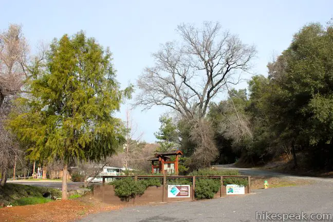
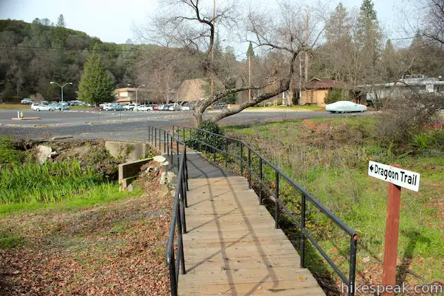
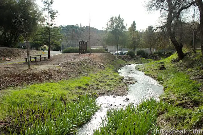
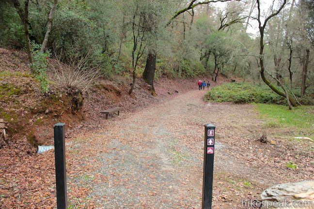
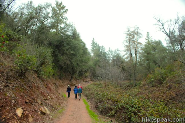
Dragoon Gulch Trail begins from a parking area at the top of Woods Creek Rotary Park (where there is also a baseball field, playground, and public bathrooms). The start of the trail is easy to spot. As you begin hiking north, the trail makes an immediate left turn across a bridge to North Forest Road. Turn right up the road, following trail signs painted on the pavement that direct you north up the residential street. Follow these markers through an intersection and continue to the left up North Forest Road. This first leg of the loop, North Forest Trail, is not so much a trail as it is a painted off walkway on a paved road. After 1/3 of a mile, you will cross a creek and reach the bottom of Dragoon Gulch. Turn right, leaving North Forest Road to begin up South Creekside Trail, the next section of Dragoon Gulch Trail.
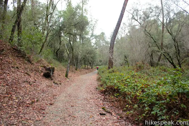
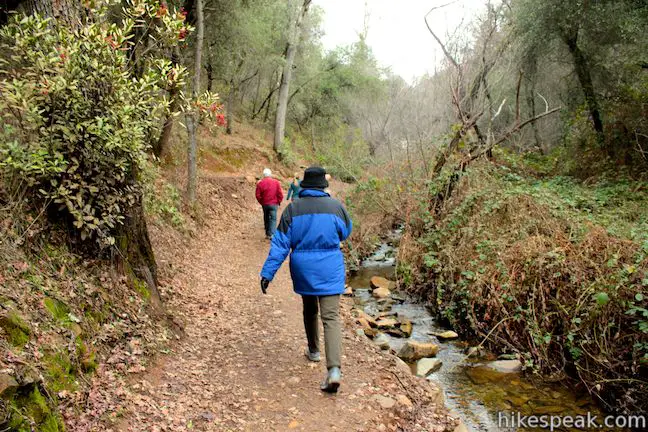
South Creekside Trail is a wide trail of crumbling blacktop that borders a seasonal creek for just under a quarter of a mile. South Creekside Trail is joined by a short trail on the right leading to the Alpine Lane Trailhead. The nearby parking area is visible through the trees from South Creekside Trail. Those who wish to avoid hiking over pavement can begin their hike from Alpine Lane and cut North Forest Trail and South Creekside Trail from the loop, reducing the hike to 1.5 miles with 200 feet of elevation gain.
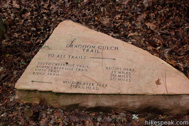
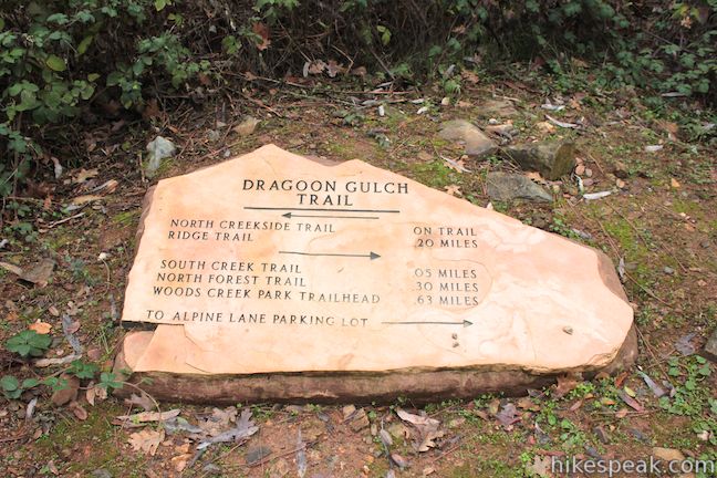
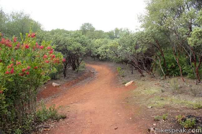
Just past the Alpine Lane Trailhead, South Creekside Trail reaches the start of the loop. This junction, along with all other junctions on Dragoon Gulch Trail, is made obvious by an easy-to-read trail marker carved into a boulder. To the left, Vista Trail ascends a steep ridge cloaked by manzanita trees toward panoramic views. This will be the return route of the loop. First continue straight ahead on North Creekside Trail.
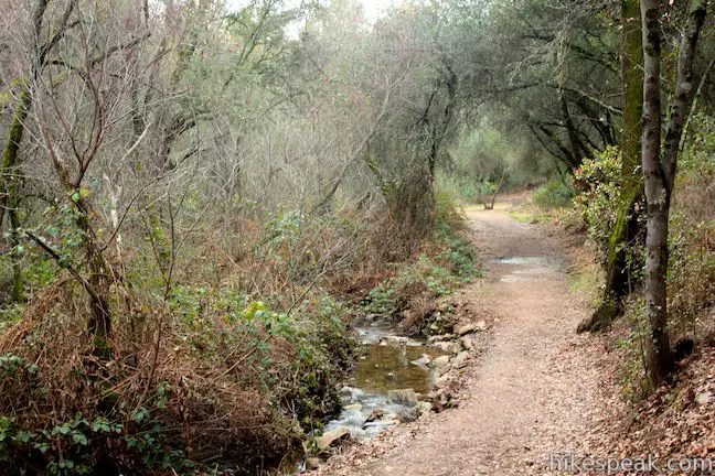
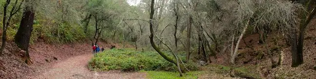
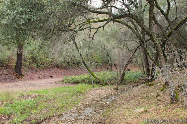
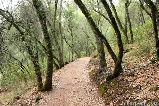
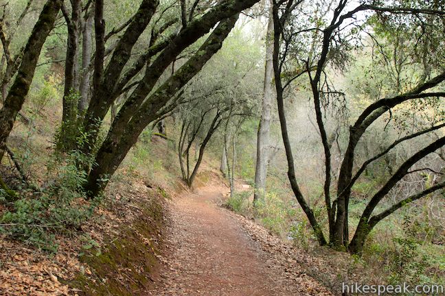
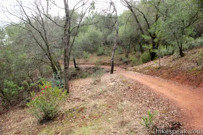
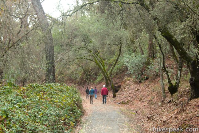
North Creekside Trail continues along the seasonal stream for another quarter mile, coming to an end at a junction with the bottom of the Ridge Trail. Turn left up the Ridge Trail, leaving behind the riparian brush for tall oaks that shadow the trail.

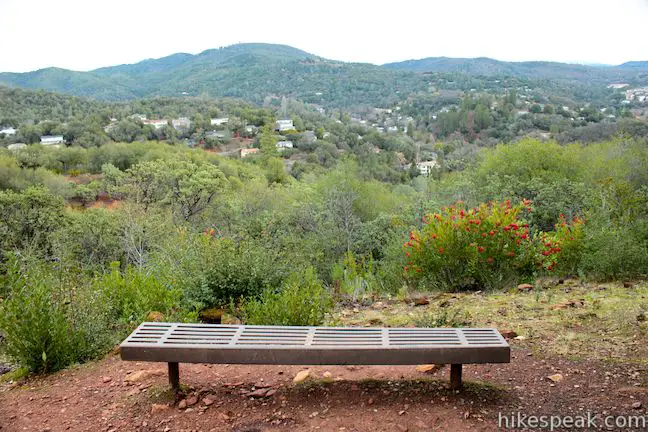
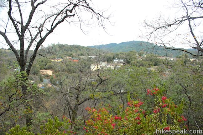
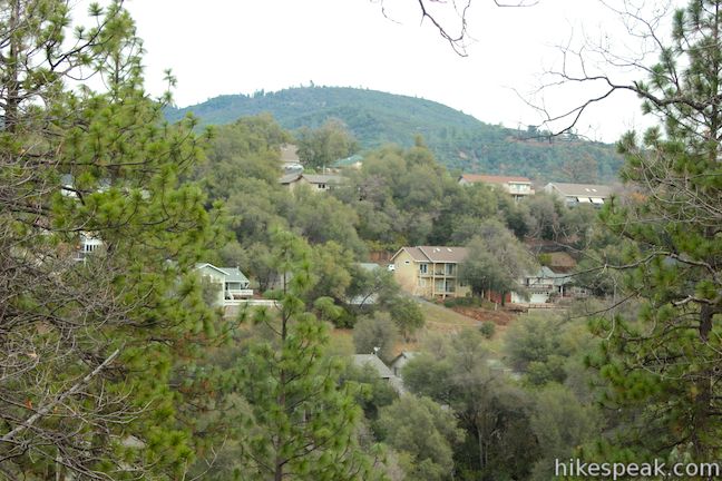
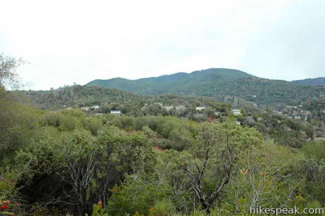
A few benches are located along the Ridge Trail in case you need a break from the gradual climb. At the third bench you’ll find a nice view through the trees over the house and pine-covered hills surrounding Sonora. This view is a taste of things to come. Hike a total of 0.7 miles up the Ridge Trail, climbing 125 feet to another bench at a junction with Vista Trail.
To reach the vista, turn right and hike a tenth of a mile to the high point of the loop. Vista Trail ends at a 2,050-foot perch, complete with a bench of course, that offers a clear look over Sonora and the surrounding mountains to the southeast.
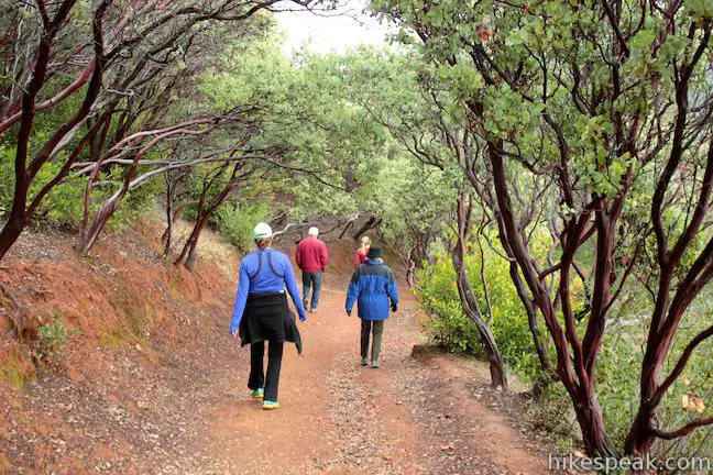
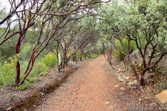
To complete the loop, hike back down Vista Trail, staying to the right through the junction with the Ridge Trail that you took up from Dragoon Gulch. Beyond the junction, Vista Trail descends through rows of manzanita trees whose red branches arch over the trail to create a beautiful canopy.
After descending 185 feet over 0.4 miles on the Vista Trail, you will meet back up with the start of the loop. Turn right down South Creekside Trail and return to the trailhead you started from. The full Dragoon Gulch Trail Loop (North Forest Trail to South Creekside Trail to North Creekside Trail to Ridge Trail to Vista Trail and back down South Creekside Trail to North Forest Trail) is 2.5 miles long with 325 feet of elevation gain. While it might seem like a bit of a chore to keep track of all the named sections of the trail, in practice the loop is very easy to follow.
Dragoon Gulch Trail is a short, pleasant loop with rewarding views. Dogs are welcome. No fee or permit is required to hike Dragoon Gulch Trail, so get out and enjoy!
To get to Woods Creek Rotary Park: From downtown Sonora, drive half a mile west of Washington Street (Route 49) on Stockton Street (Route 49) and turn right (north) onto Woods Creek Road. Drive a quarter mile to the top of Woods Creek Rotary Park where you will find the start of Dragoon Gulch Trail.
Trailhead address: Woods Creek Rotary Park, 641 Woods Creek Drive, Sonora, CA 95370
Trailhead coordinates: 37.982397, -120.39055 (37° 58′ 56.62″N 120° 23′ 25.98″W)
To get to the Alpine Lane Trailhead: From downtown Sonora, drive north on Washington Street (Route 49) to Snell Street and turn left. Drive 0.3 miles down Snell Street and continue straight on Bonanza Road. Make the next right on Calaveras Way. Turn left at the next block onto Alpine Lane. Drive 1/3 of a mile to the trailhead at the end of the road.
Trailhead address: 545 Alpine Lane, Sonora, CA 95370
Trailhead coordinates: 37.987285, -120.394616 (37° 59′ 14.22″N 120° 23′ 40.61″W)
You may also view a regional map of surrounding Sierra Nevada trails and campgrounds.


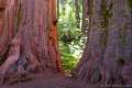 | North Grove - Big Trees Trail in Calaveras Big Trees State Park This easy 1.5-mile loop explores the first giant sequoias discovered by settlers in California in the North Grove of Calaveras Big Trees State Park |
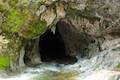 | Upper Natural Bridge Trail This fun 2-mile round trip hike descends into a canyon to a limestone tunnel in a creek (that you can swim through). |
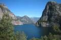 | Hetch Hetchy Reservoir and Wapama Falls This 5-mile hike tours a flooded valley to a thundering waterfall in the northwest corner of Yosemite National Park. |
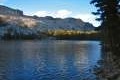 | May Lake This short east hike off Tioga Road visits a peaceful alpine lake in the high elevation region of Yosemite north of Yosemite Valley. |
 | More trails in the Sierra Nevada Mountains Explore other destinations in the Sierra including Yosemite National Park and Sequoia National Park. |
This is an awesome trail for it’s location- downtown Sonora! If you want a trail similar in caliber for a little further away from the bustling “city.” Check out Lyon’s Reservoir just a little further up highway 108.