Dog Mountain
in Columbia River Gorge National Scenic Area
It isn’t pack mentality that makes Dog Mountain one of the most popular hikes on the Washington side of the Columbia River Gorge. The grassy slopes near the summit put on a winning display of spring wildflowers, enhancing year-round views over the gorge’s beautiful surroundings. Dog Mountain Trail is steep and largely forested, ascending 2,825 feet in 3 1/3 miles. Two viewpoints along the trail provide motivation to reach the top. Rather than simply trekking up and back (6 2/3 miles round trip), you can incorporate Augspurger Trail for a 7.4-mile loop that explores more of Dog Mountain.
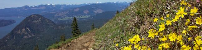
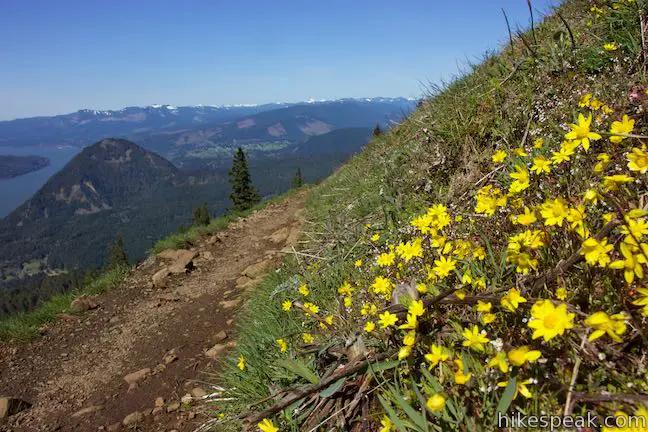
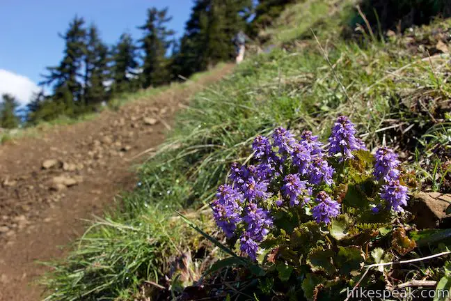
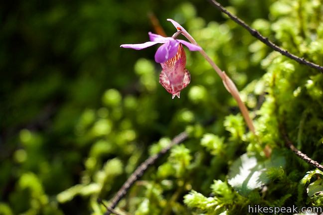
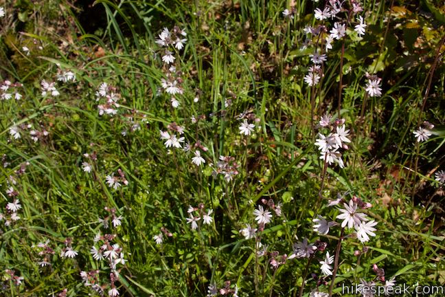
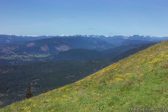
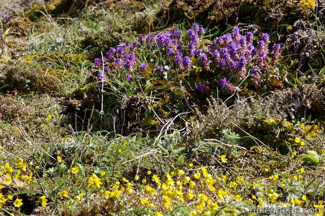
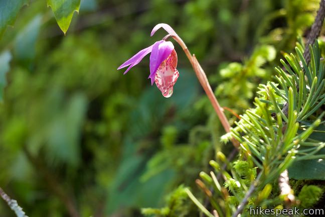
Seeing wildflowers: Visit around the month of May to cross a yellow carpet of balsamroot blooming on the high meadows of Dog Mountain. Other floral standouts include Columbia kittentails, slender woodland star, and fairy slipper orchids (as well as lupines, oaks toothwort, penatemon and phlox).
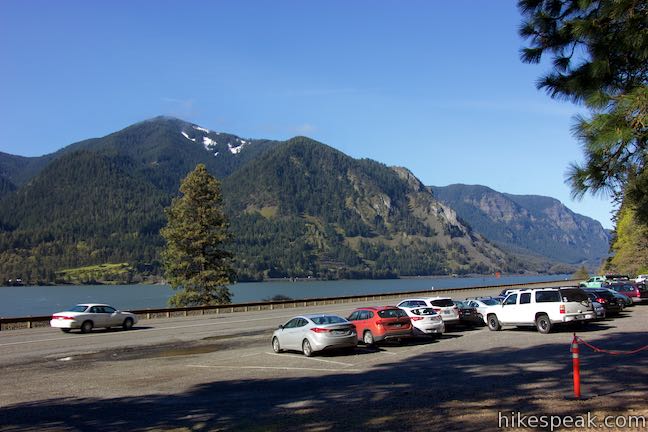
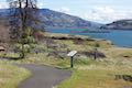
Start from the Dog Mountain Trailhead, which is located along Washington 14 west of White Salmon. The parking area fills up early on weekends. A shuttle increases trail access during the busy season from mid-April to mid-June. Leave from the east side of the trailhead, passing a self-service pay station and a picnic table. Augspurger Trail rises to the left toward Augspurger Mountain and can be used to connect to Dog Mountain Trail for the loop. Past Augspurger Trail, come to the signed start of Dog Mountain Trail, which proceeds straight ahead and rises to the east above Washington 14.
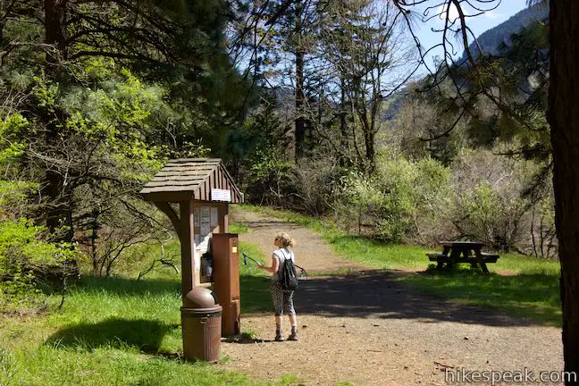
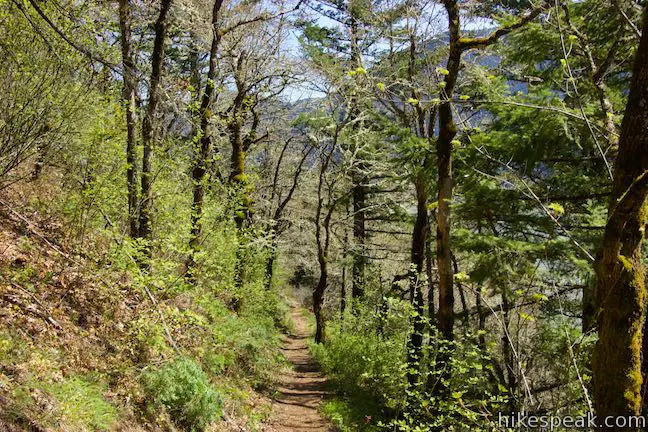
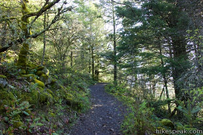
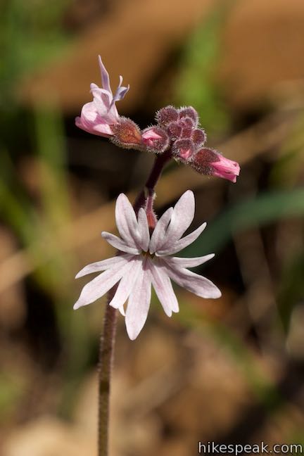
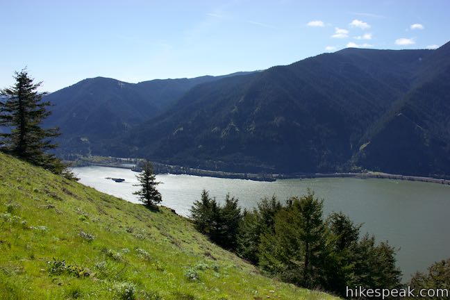
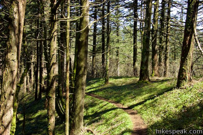
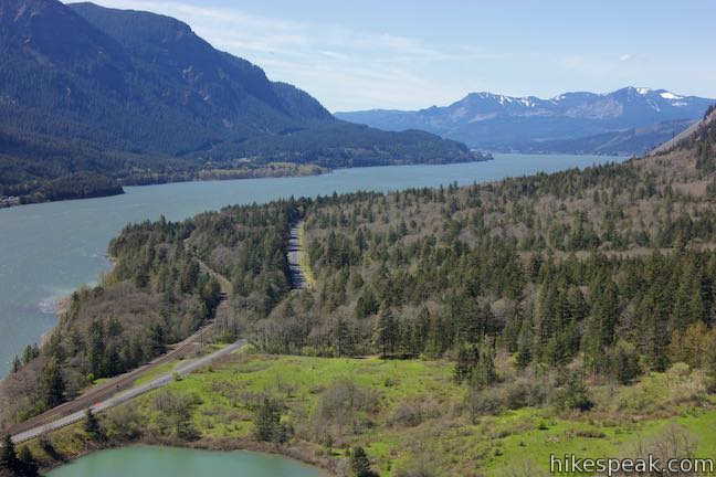
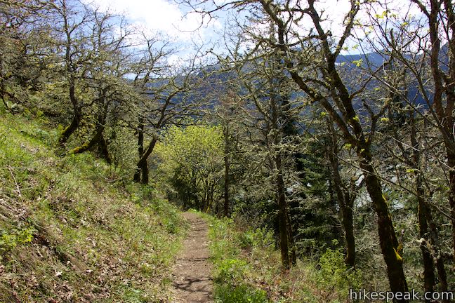
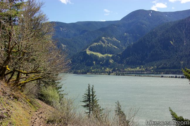
While you won’t find bathrooms at the trailhead, you will pass a vault toilet a hundred yards up the trail. Switchbacks then twist up the side of the gorge. The light pink pedals of slender woodland star bloom in the sunnier sections of the slope, while ferns thrive in the shade. Partial views of the Columbia River appear as well, offering a small taste of the bigger sights above.
After 2/3 of a mile, the grade briefly relents as you come to a trail split. Avoid the Old Trail angling to the left and turn right on Dog Mountain Scenic Trail, which goes past Lower Viewpoint, a stellar perch above the Columbia.
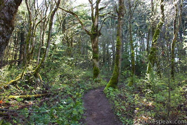
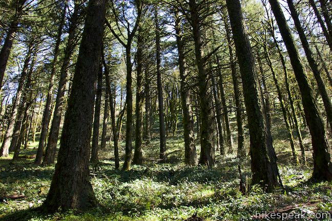
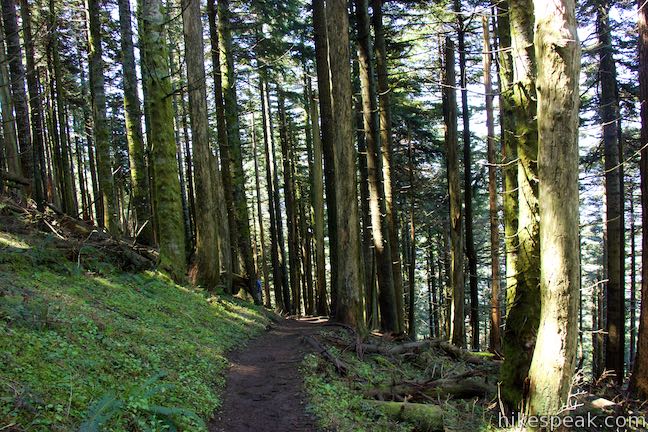
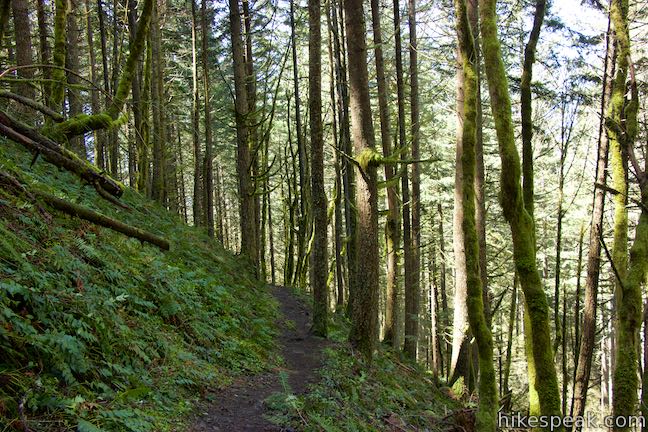
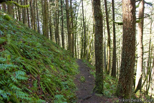
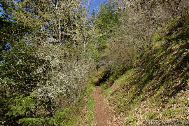
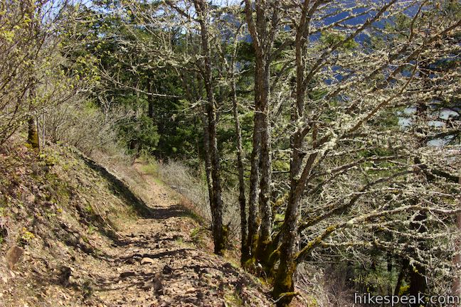
The trail narrows and curves to the right, passing through a forest of tall firs. After another half mile of steady climbing on longer switchbacks, the trail level out and actually goes slight downhill as it curves to the left. You won’t have too long the catch your breath before the ascent resumes.
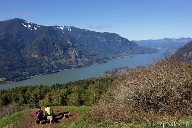
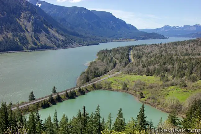
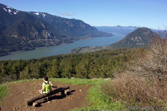
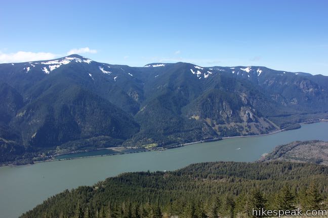
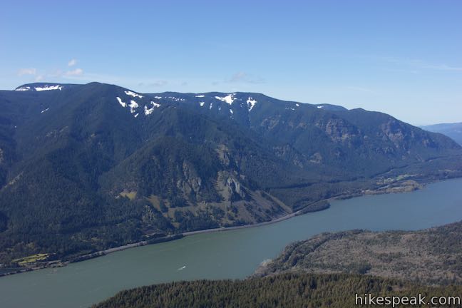
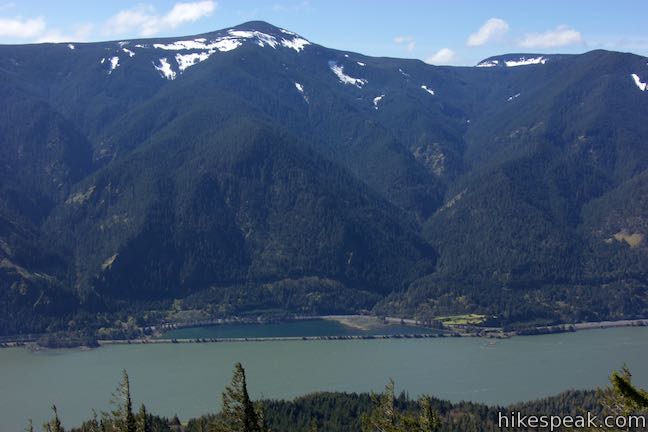
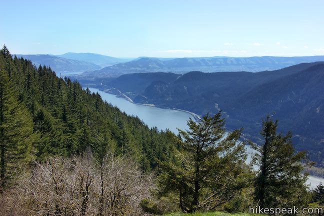
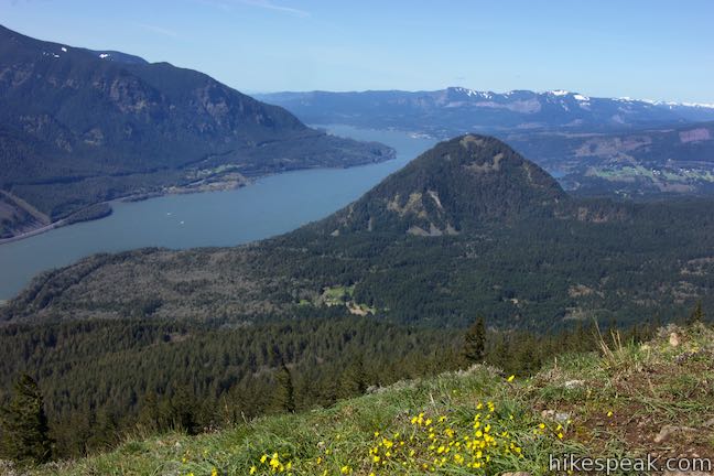
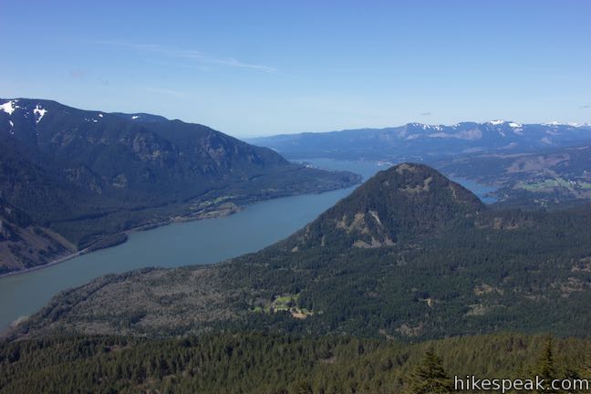
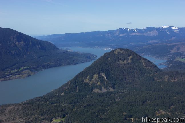
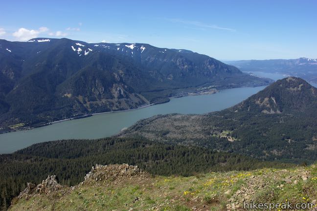
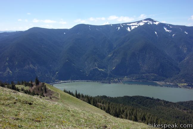
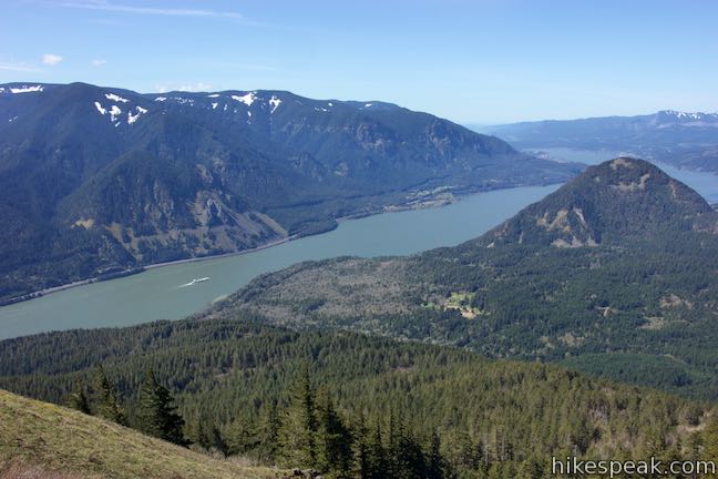
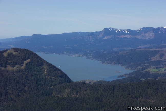
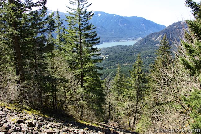
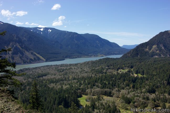
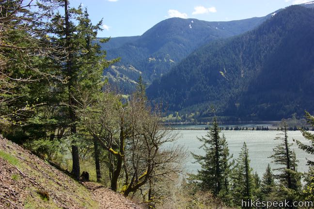
Proceed up the wooded trail, gaining more elevation. To reward the effort, the trail pops out of the forest to cross a small grassy opening. Arrive at Lower Viewpoint, 1.85 miles from the trailhead where you can drop off the right side of the trail to a bench with a grand view of Columbia River Gorge. Pause and enjoy a lovely look west down the river, over 1,500 feet below. Turning around, you can look farther up Dog Mountain toward the wildflower paradise above.
Leave Lower Viewpoint and slip back into the forest on Dog Mountain Trail. The shaded ascent angles north toward a second junction with the Old Trail. Stay to the right past the top of Old Trail, 2.4 miles from the trailhead. A bench offers a place to linger in the forest.
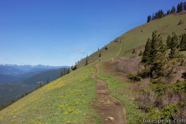
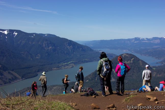
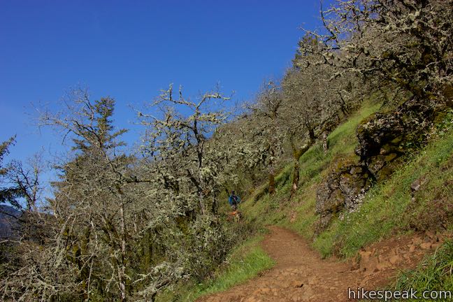
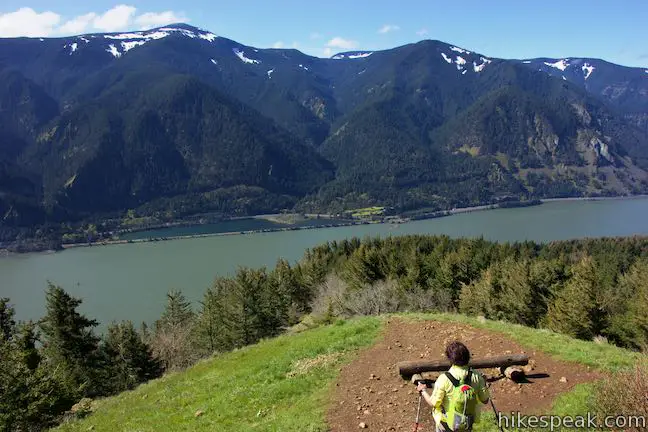
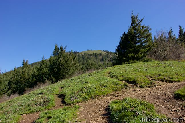
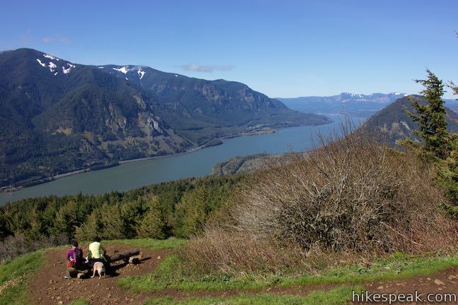
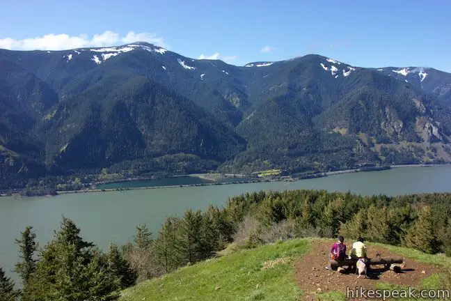
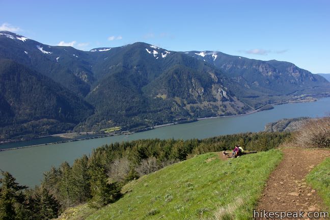
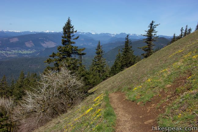
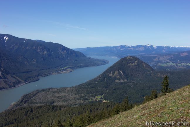
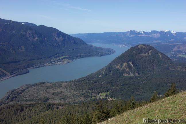
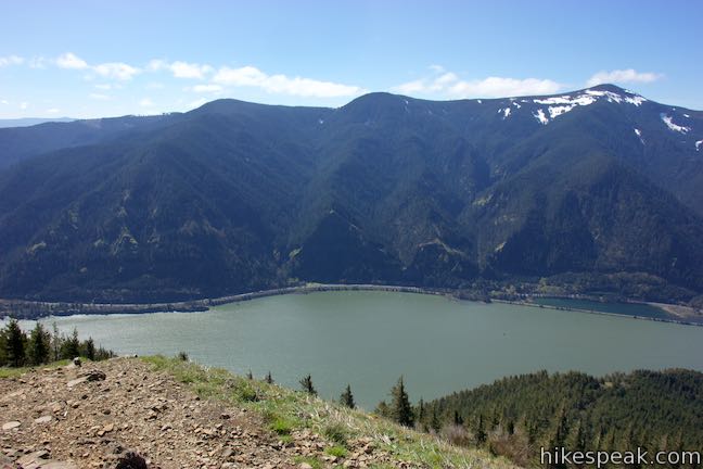
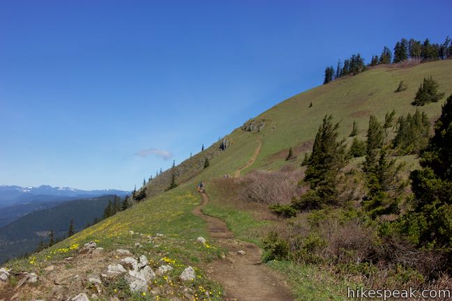
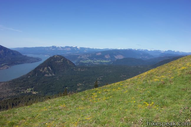
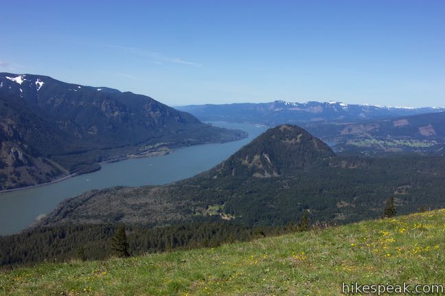
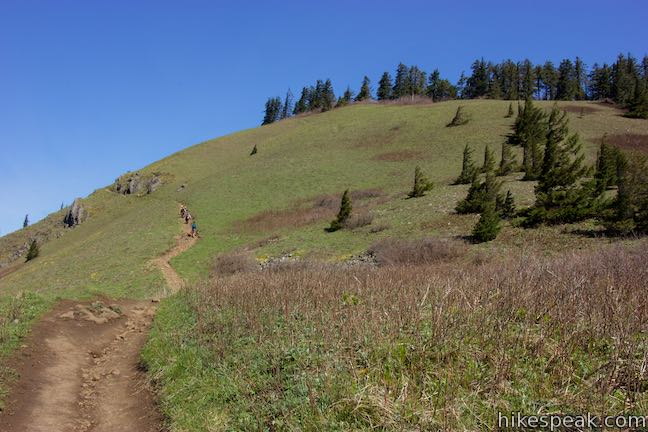
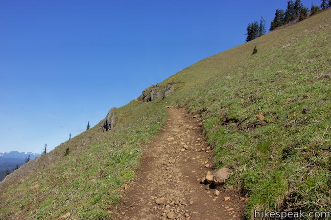
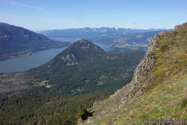
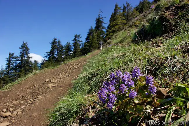
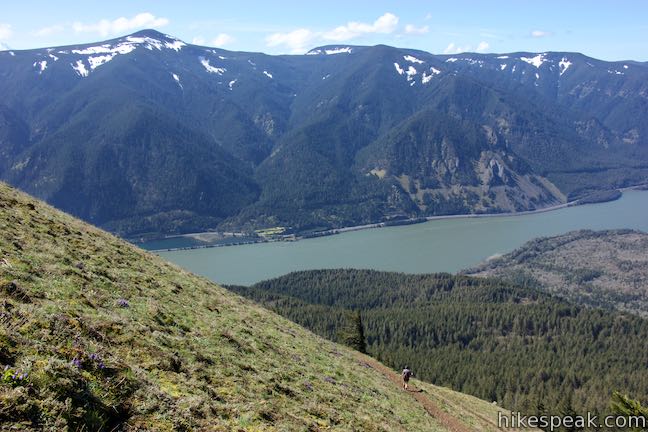
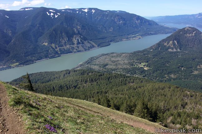
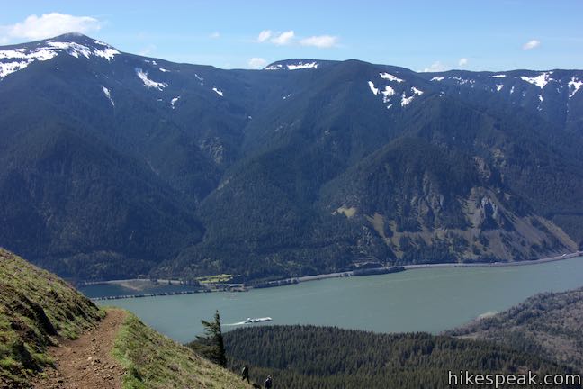
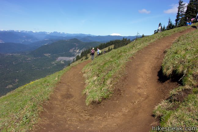
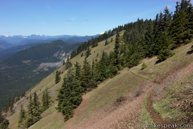
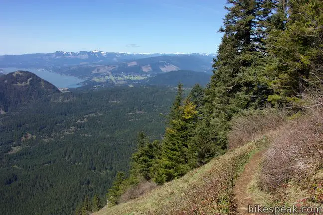
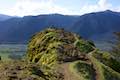
Hike through a pair of long switchbacks to rise out of the forest onto grassy slopes that host colorful wildflowers and dramatic views. Cross the mountainside for a tenth of a mile up to a sharp left turn in the trail. At the outside of this bend, find a vistapoint called Puppy Dog Lookout. Having gained 2,400 feet over 2.85 miles of hiking, it’s now time to take a break and enjoy a sweeping look across the Columbia River Gorge.
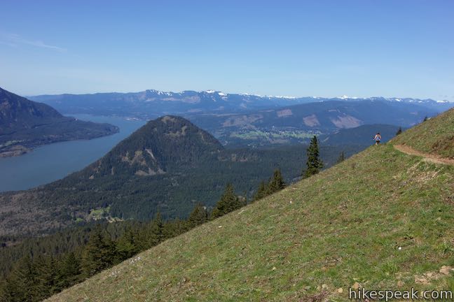
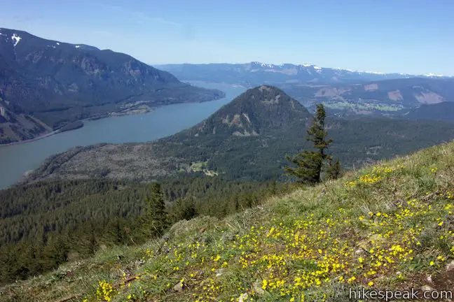
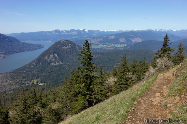
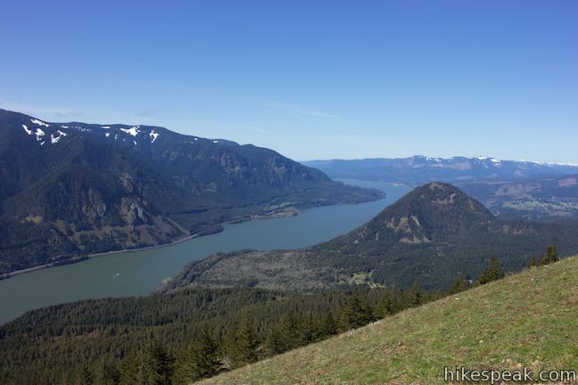
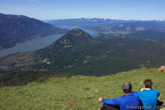
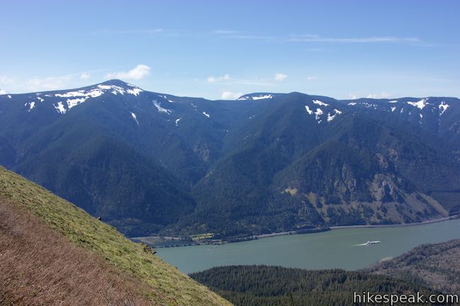
Significantly higher than the Lower Viewpoint, Puppy Dog Lookout presents a broader panorama with views looking east up the Columbia River as well. Gaze across the wide river toward mountains in Oregon.
If the ground has turned from green to yellow, it means that the balsamroot is in bloom. This sunflower-like ground cover thrives on the sunny south-facing slopes of Dog Mountain.
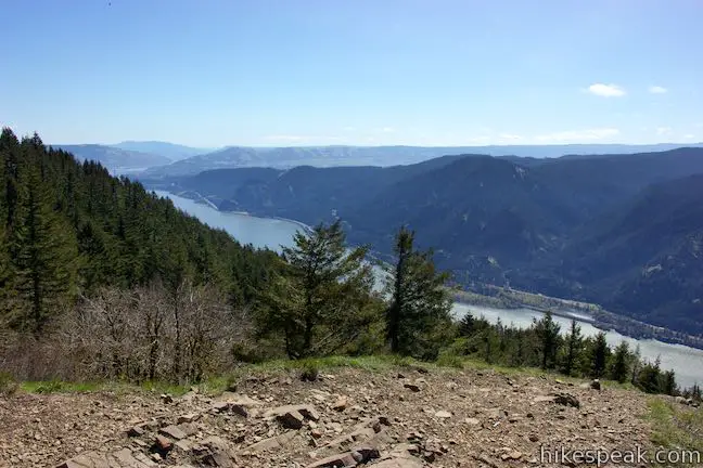
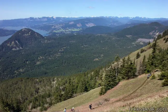
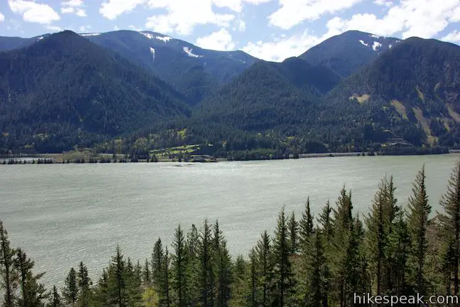
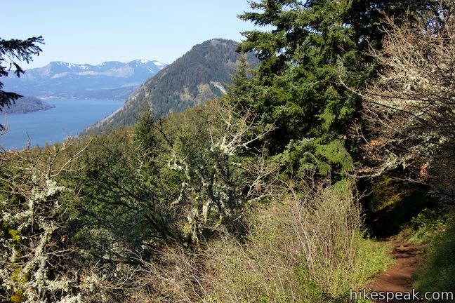
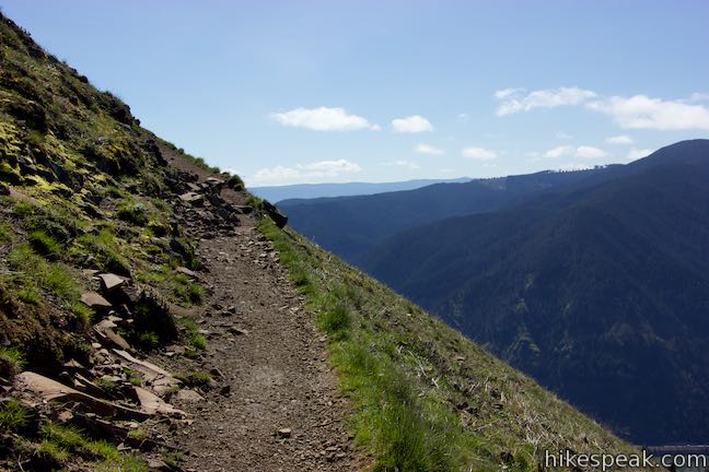
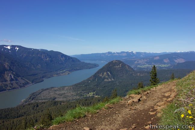
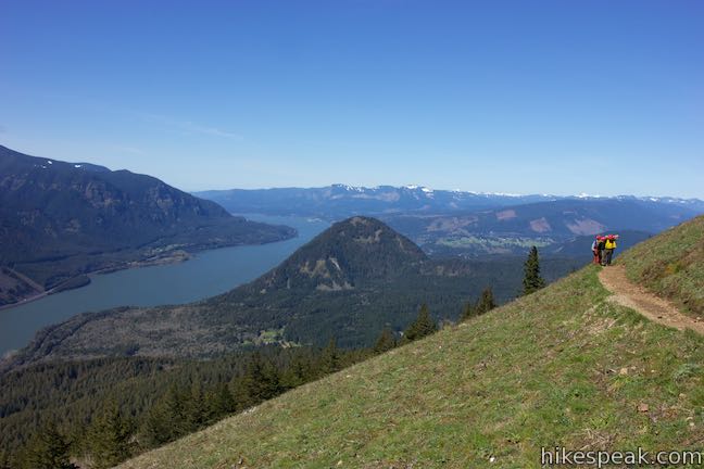
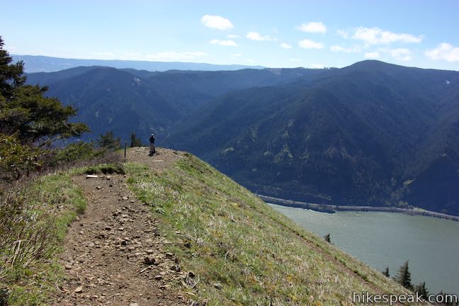
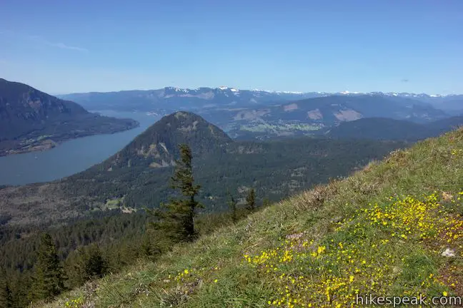
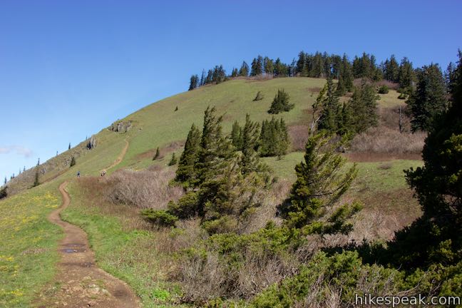
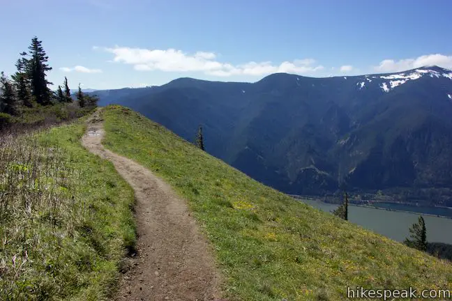
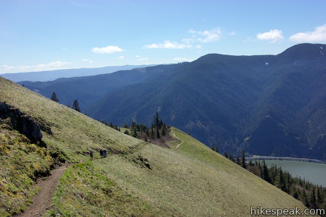
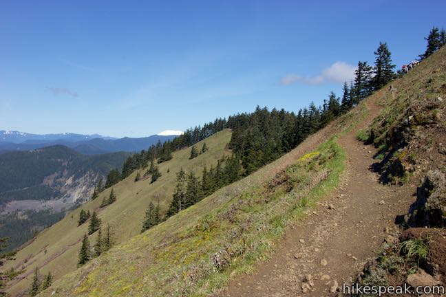
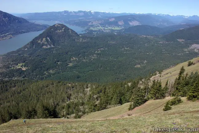
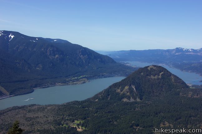
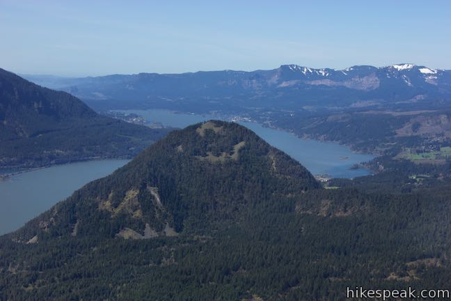
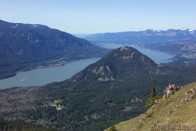
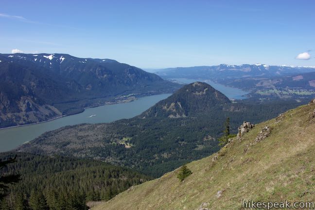
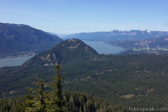
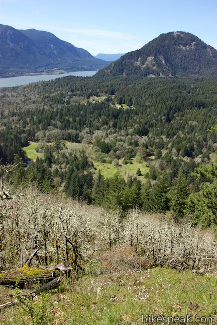
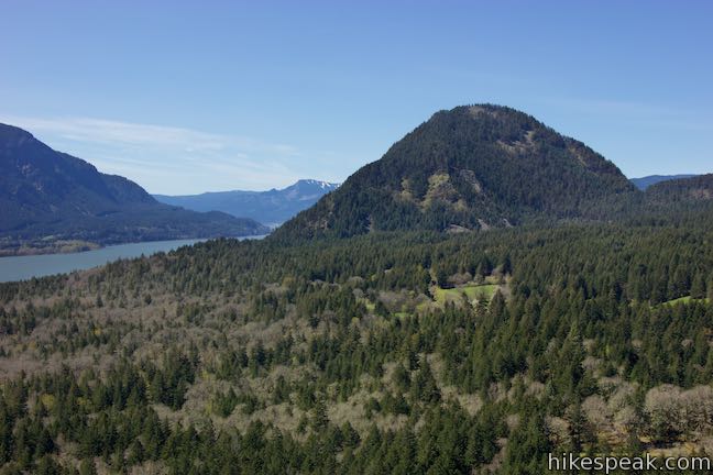
Proceed up the final half-mile of Dog Mountain Trail, which crosses the spine of a ridge before rising to the top of Dog Mountain. Leave Puppy Dog Lookout and pass through flower-laden grasses with spectacular views west down the Columbia River. Wind Mountain rises prominently in front of a bend in the flow.
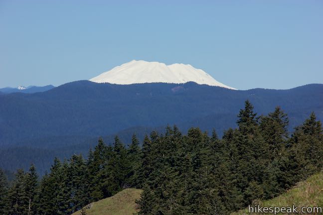
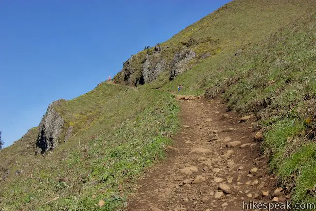
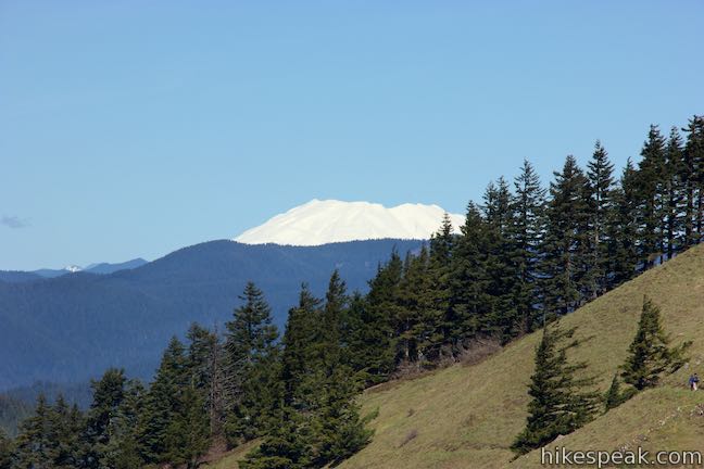
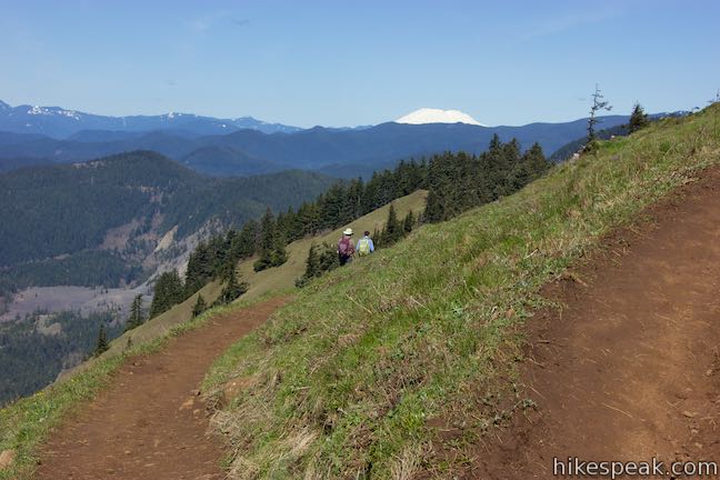
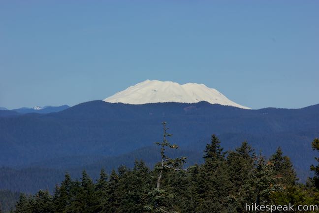
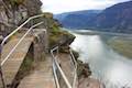
The trail rises around the west side of the mountain, passing through rock outcroppings. While your eyes will be drawn to the left, gazing down the gorge, looking up the trail yields its own reward. The snowy white top of Mount Saint Helens rises above the conifers to the north.
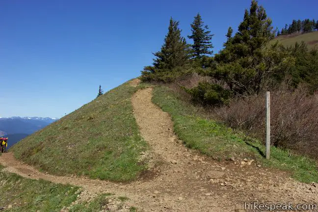
Come to a marked junction with a trail to the left that connects to Augspurger Trail. You can use this trail to form a loop on the descent. For now, stay to the right and climb the final 0.15 miles to the top of Dog Mountain.
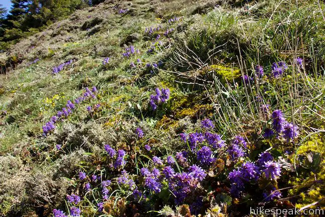
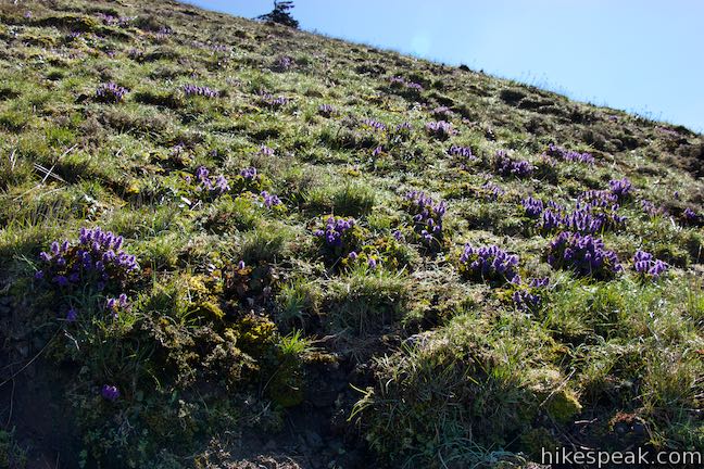
If funky-looking purple flowers start replacing the balsamroot, you’re looking at Columbia kittentails, which seem to love the highest slopes of Dog Mountain.
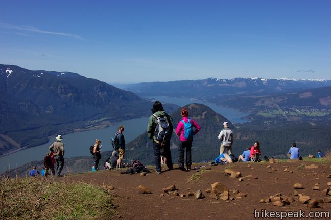
The top of Mount Hood pops out over the mountains to the south as you approach the top. Turn left just below the summit toward a landing on the edge of the forest at the top of Dog Mountain. You are likely to find a crowd gathered at Dog Mountain’s summit, gazing out down Columbia River Gorge. After an ascent of 2,825 feet in 3 1/3 miles, you’ve certainly earned the right to take a break and enjoy a picnic lunch.
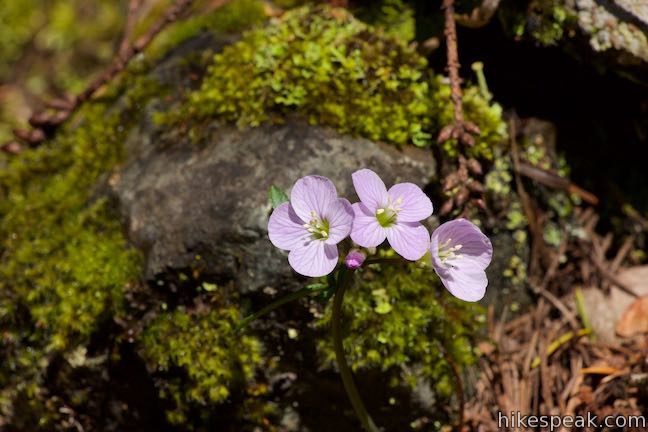
What to do next? You can return the way you came or incorporate Augspurger Trail on the descent, extending the hike by 3/4 of a mile. Making the hike into a loop adds more views of Mount Saint Helens and gives you a more gradual descent through a shaded forest where fairy slipper orchids may add delightful pops of color.
Dog Mountain Loop
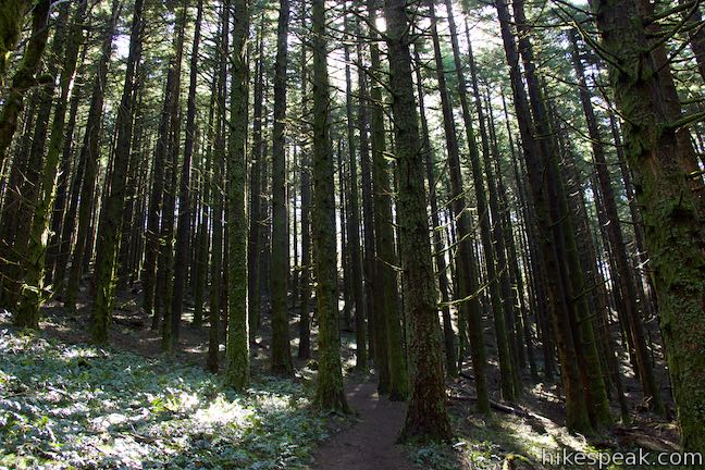
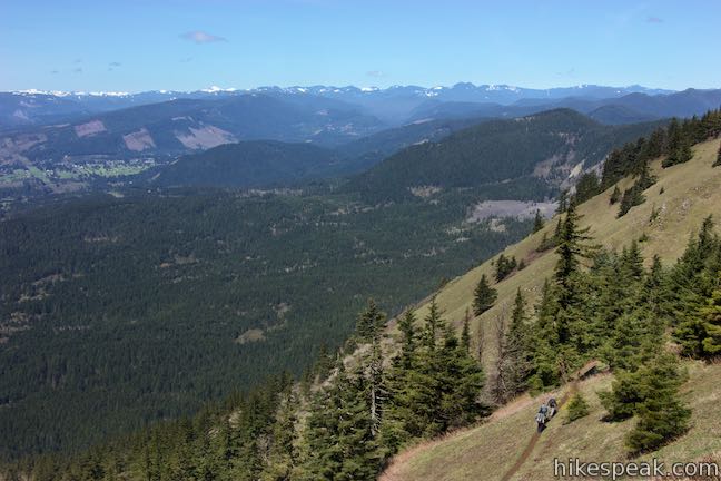
Descend 0.15 miles from the summit and turn right toward Augspurger Trail. The top of the new trail crosses more grassy slopes with chances to admire Mount Saint Helens, surrounding wildflowers, and views down Columbia River Gorge. After about 0.4 miles, the trail dips into the trees and reduces your views. Enjoy a mostly shaded descent through the forest. Go through a couple switchbacks and make your way down the spine of a wooded ridge, 2/3 of a mile from the junction.
Descend for another third of a mile to a junction with Augspurger Trail. Unless you’ve got the energy for a long ascent of Augspurger Mountain (the summit is 4.7 miles away), turn left toward Dog Mountain Trailhead (2.95 miles below).
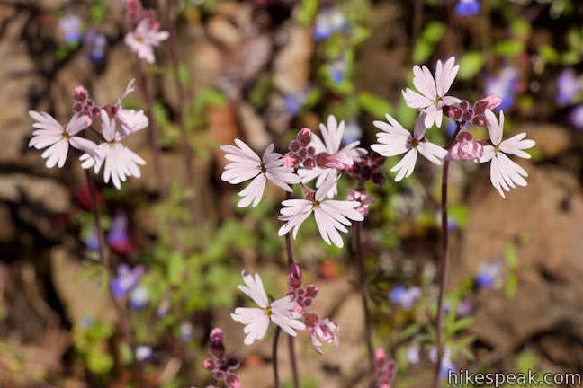
Augspurger Trail descends to the south, doubling back in the direction you came from. Take switchbacks down a bulge in the terrain where the curious purple creations known as fairy slipper orchids can be spotted on the ground along the trail during the late-winter and spring.
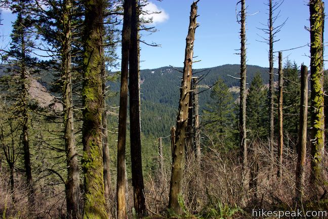
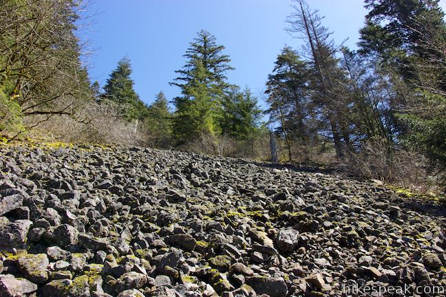
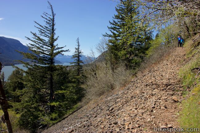
The dense forest is interrupted a couple times in the fifth mile of the loop as you cross slopping terrain covered in fallen volcanic rocks. These openings in the forest offer glimpses down the Columbia River. The forest thins as you enter the sixth mile of the loop, bestowing greater views toward Wind Mountain and the Columbia River.
Slender woodland star reappear in sunny areas along Augspurger Trail toward the bottom of the descent. Come to the loop’s final junction, where it should be obvious to stay to the right past the diminutive Old Loggers Trail that rises to the left.
Proceed around Dog Mountain, looking down on a pond alongside Washington 14. The trail curves to the left and heads east for a long half mile, gradually descending back to the east side of Dog Mountain Trailhead where the loop began.
The basic directions for this loop are:
- Begin up Dog Mountain Trail (0 miles)
- Turn right to stay on Dog Mountain Scenic Trail past the bottom of the old trail (0.7 miles)
- Pass Lower Viewpoint (1.85 miles)
- Stay to the right past the top of the old trail (2.4 miles)
- Reach Puppy Dog Lookout and turn left to continue the ascent (2.85 miles)
- Bear right past a connector to Augspurger Trail (3.18 miles)
- Turn left just below the top of Dog Mountain (3.28 miles)
- Reach the summit of Dog Mountain (3.33 miles)
- Hike 0.15 miles back down the trail and turn right, following the sign for Augspurger Trail (3.48)
- Turn left down Augspurger Trail (4.45 miles)
- Stay to the right past Old Loggers Trail (6.7 miles)
- Return to Dog Mountain Trailhead (7.4 miles)
True to its name, Dog Mountain Trail welcomes hiker-accompanied dogs. Mountain bikes are also permitted but do not appear to regularly use the trail. During the buys spring season, a shuttle bus provides access to the early-to-fill trailhead.
A $5 day use fee is required to park at the trailhead in Columbia River Gorge National Scenic Area (price as of 2018). A Northwest Forest Pass or America the Beautiful public lands pass can be used in place of the day use fee.
As of 2018, a permit is needed to hike up Dog Mountain on Saturdays and Sundays from the end of March to the beginning of July. A permit can be obtained by purchasing the $2 shuttle bus ticket or by making an online reservation at recreation.gov. No permit on week days or on weekends outside the popular spring wildflower season.
To get to the trailhead: From the intersection of Interstate 205 and Interstate 84 in Northeast Portland, take Interstate 84 east for 35 miles to exit 44 for Cascade Locks. The offramp leads into Route 30 (Cascade Locks Highway). Make the first right, following signs for Bridge of the Gods. Go around a sweeping bend, pay the toll, and cross Bridge of the Gods into the state of Washington. Across the bridge, turn right on Highway 14. Drive east for 12 miles and turn left into the large parking area for Dog Mountain Trailhead.
Trailhead address: Dog Mountain Trail #147, Washington 14, Stevenson, WA 98648
Trailhead coordinates: 45.6992, -121.7080 (45° 41′ 57.1″N 121° 42′ 28.8″W)
View Dog Mountain in a larger map
Or view a regional map of surrounding Washington trails and campgrounds.


 | Hamilton Mountain The beautiful 7.75-mile lollipop loop visits bombastic waterfalls and panoramic cliffs on the Washington side of the Columbia River Gorge in Beacon Rock State Park. |
 | Beacon Rock Trail This 1.6-mile hike follows an impressively engineered trail packed with switchbacks that scale a monolith along the Columbia River. |
 | Coyote Wall This partial loop covers 5.8 miles as it ascends Coyote Wall to great views of its basalt cliffs and across Columbia River Gorge. |
 | Catherine Creek Arch This 1-mile round trip hike leads to the base of a curious natural arch in a basalt bluff. |
 | Catherine Creek Interpretive Trail This short, paved loop explores meadows that burst with seasonal wildflowers, passing an overlook for a small waterfall and plentiful gorge views. |
 | Guler Ice Cave in Gifford Pinchot National Forest This short hike goes underground to explore an old lava tube with frozen stalactites and stalagmites, plus other interesting cave features. |
 | June Lake This 2.6-mile hike visits a small lake and a waterfall on the southern slopes of Mount Saint Helens. |
 | Lava Canyon Trail This 1.25-mile loop explores a colorful canyon re-carved by the 1980 eruption of Mount Saint Helens. |
 | Ape Cave This adventurous underground hike in Mount Saint Helens National Volcanic Monument travels through one of the longest lava tubes in the world. |
 | Trail of Two Forests This short nature trail in Mount Saint Helens National Volcanic Monument tours a landscaped that was transformed by a molten lava flow. For extra fun, crawl through a 50-foot long lava tube beneath the trail. |
 | More trails in Washington Explore other hikes in the Evergreen State, including Mount Rainier National Park and Mount Saint Helens National Volcanic Monument. |
Go the extra miles...
Submit a rating of this hike to go with your comment. Contribute to the average trail rating.