Castle Peak and Heart Lake
in Shasta-Trinity National Forest
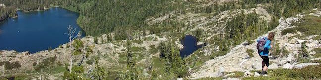
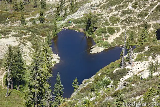
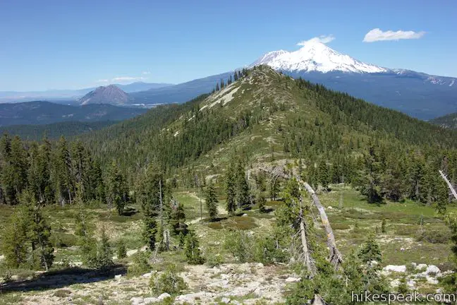
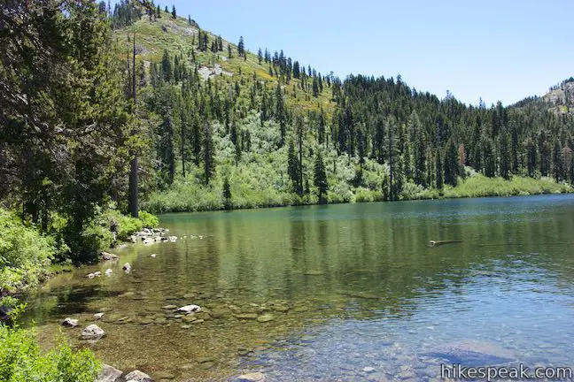
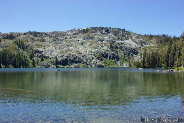
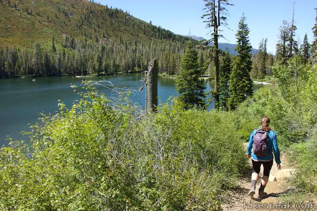
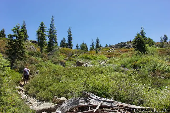
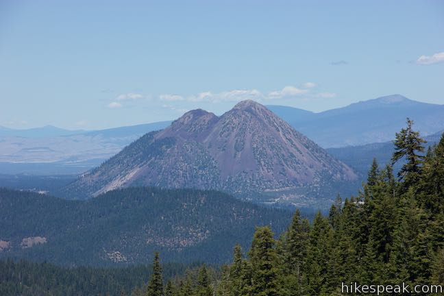
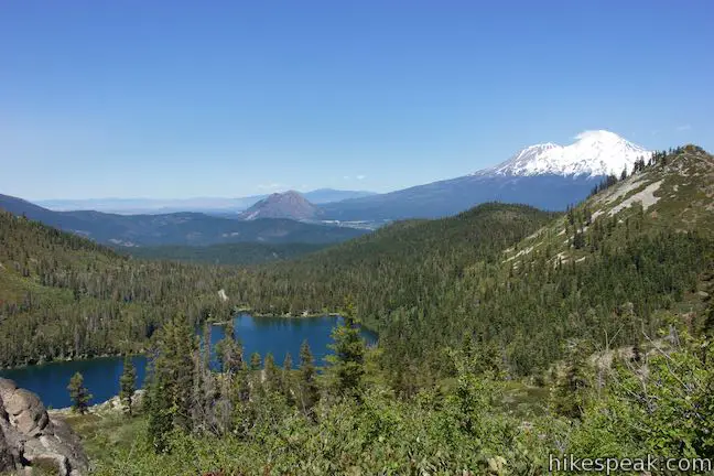
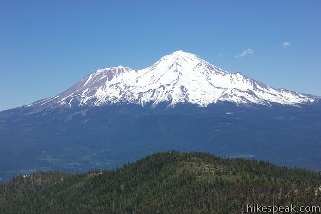
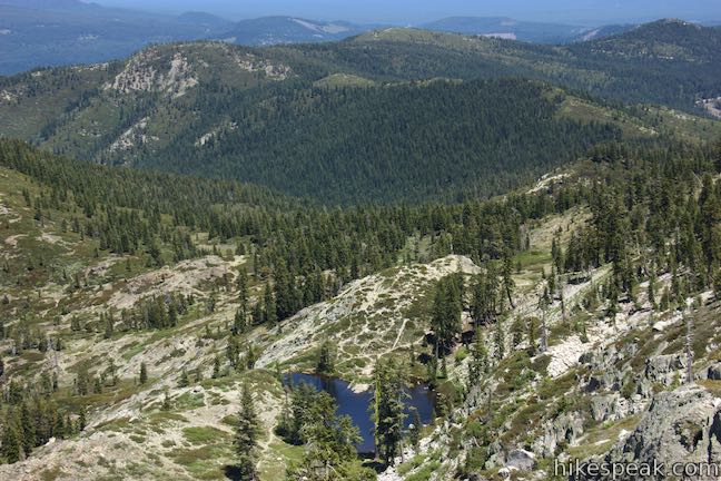
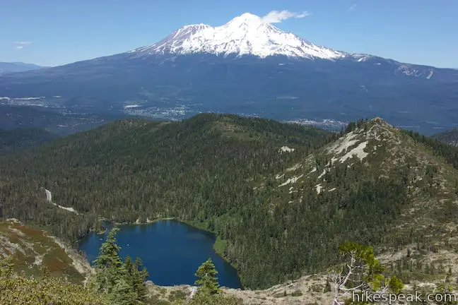
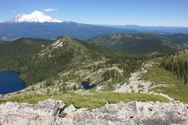
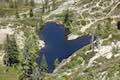
The short hike from Castle Lake to Heart Lake explores a scenic part of Shasta-Trinity National Forest near Mount Shasta. The fun doesn’t need to stop once you reach that endearing lake. Hike off trail up a ridge from Heart Lake to a summit with extraordinary views that has been given the unofficial name of Castle Peak. You will feel like royalty when you stand on this mountaintop, taking in a bold perspective of the Castle Crags and at least three snow-capped volcanoes (Mount Lassen, Mount Shasta, and Mount McLoughlin) while also looking down over Heart Lake and Castle Lake.
Routes up the north and east sides of Castle Peak make it possible to visit the summit on a loop above Heart Lake. Hiking from Castle Lake to Heart Lake to Castle Peak and back down is around 3.2 miles round trip with 1,180 feet of elevation change. Castle Peak has awesome views and, as off trail summits go, is not too hard to reach.
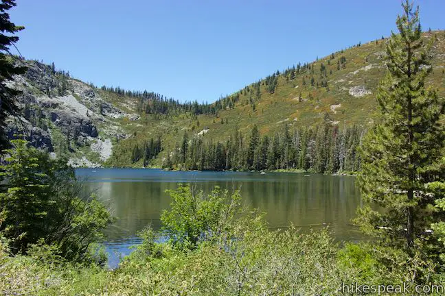
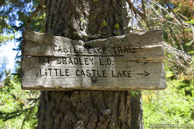
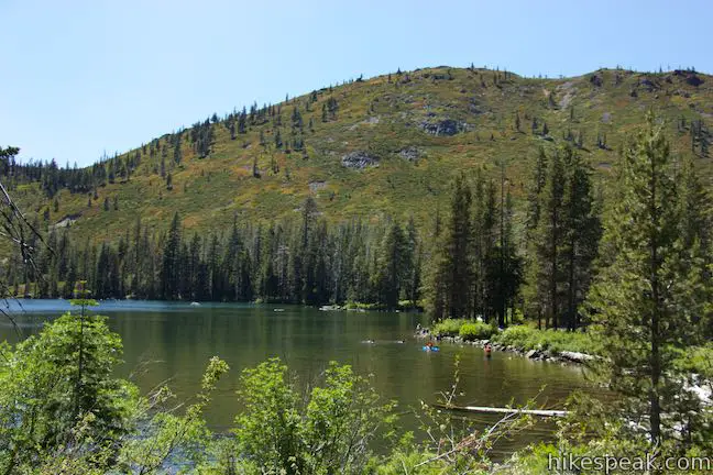
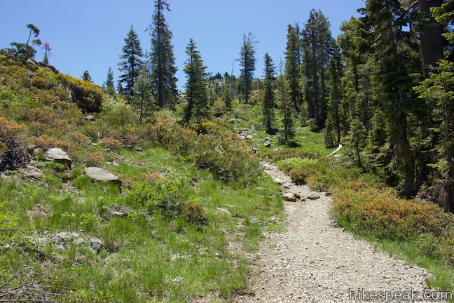
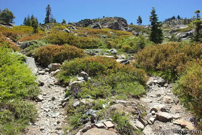
The route to and above Heart Lake is not well marked. Review the hiking directions to Heart Lake and nearby Little Castle Lake, which could be added to this itinerary to extend the hike from around 3.2 miles to just over four miles. The hike starts from Castle Lake, which is a beautiful mountain lake and a great hike-free attraction in the national forest.
The basic directions to Heart Lake are:
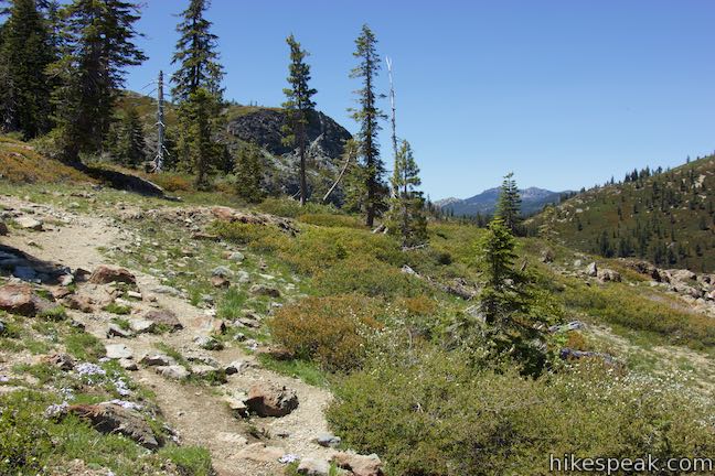
- Set out from the end of Castle Lake Road on Castle Lake Trail (0 miles)
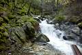
- Cross Castle Lake Creek and turn right at the split (0.07 miles)
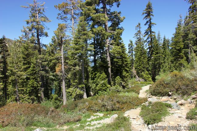
- Leave the forest and turn right at the first of two unmarked junction onto Heart Lake Trail (0.57 miles)
- Bear right as the trails to Heart Lake come together (0.64 miles)
- Stay to the right through an unclear junction (0.67 miles)
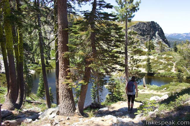
- React the outlet of Heart Lake (1 mile)
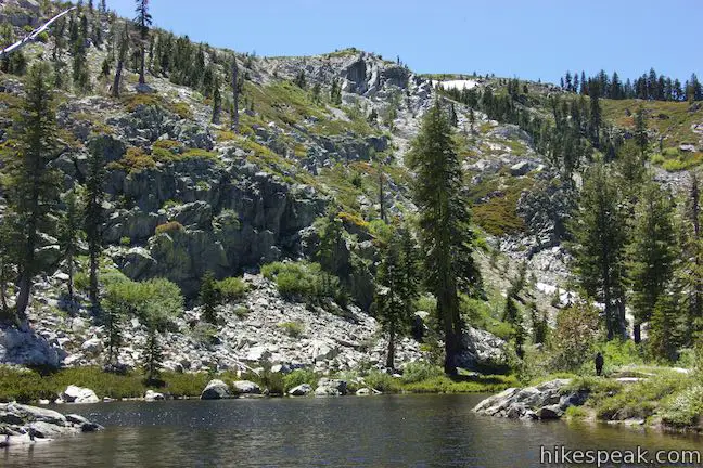
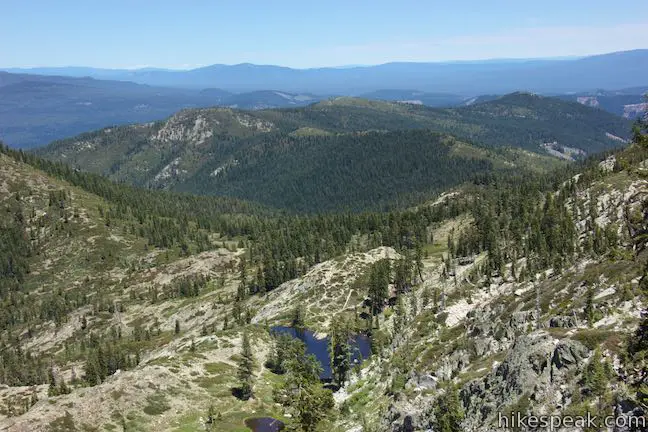
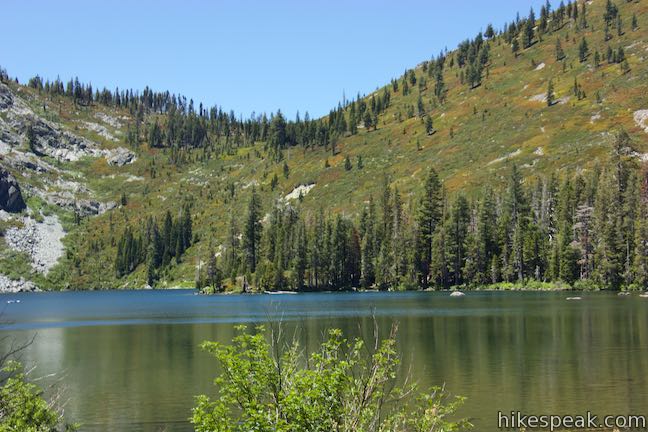
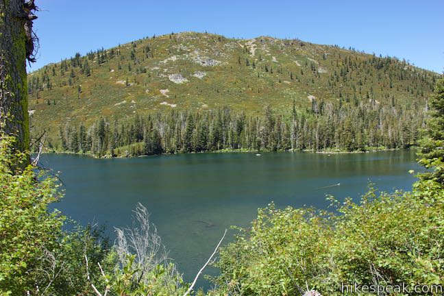
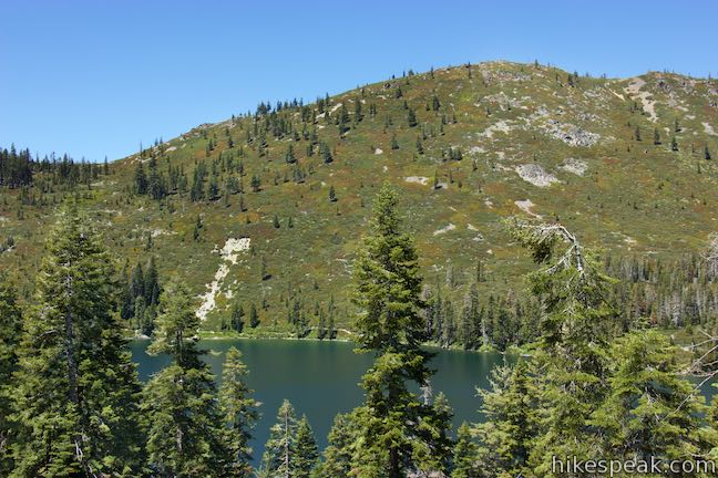
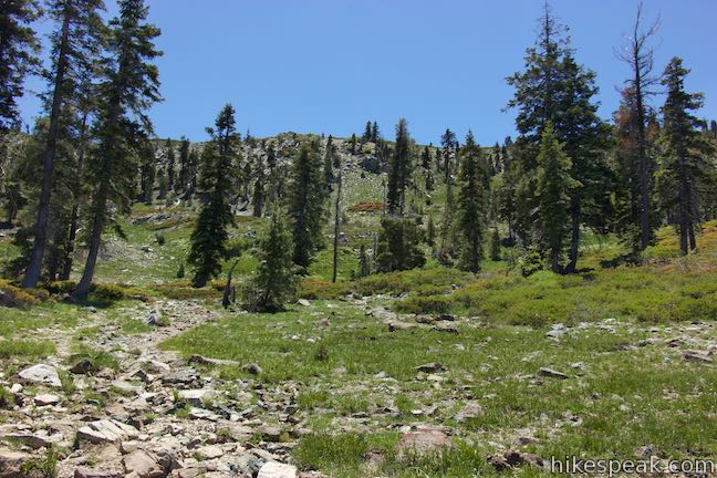
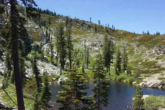
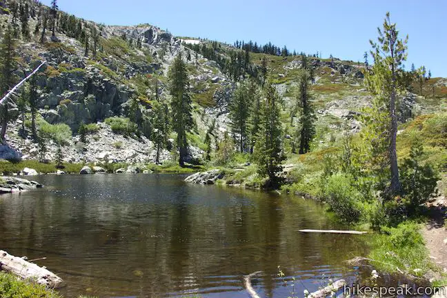
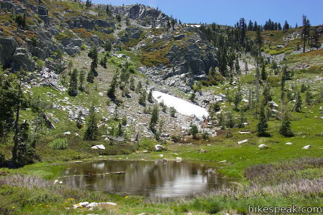
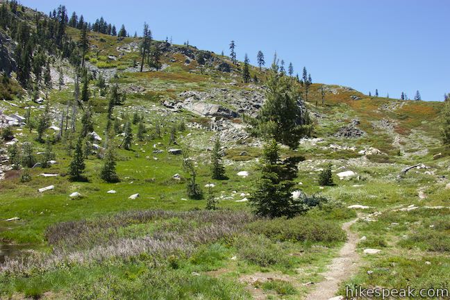
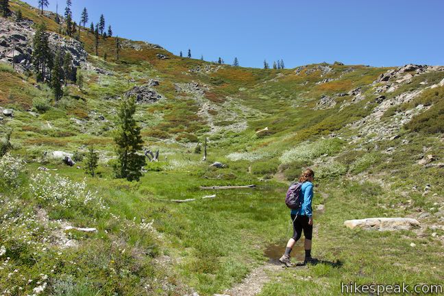
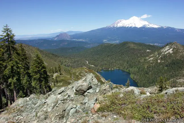
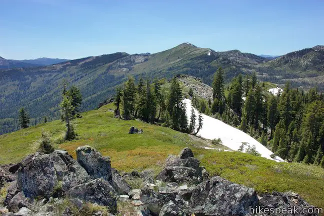
It is a 0.7-mile ascent from Heart Lake to the summit of Castle Peak, gaining 585 feet. At the point where Heart Lake Trail crosses the creek that flows from Heart Lake, you’ll have a wide-open view down over Castle Lake toward Mount Shasta and Black Butte. The trail continues around the far side of Heart Lake and comes to a split. Staying to the left, you could continue around the lake to the bottom of the heart shape for a perspective back across the water toward Mount Shasta. To get up to Castle Peak, bear right at this split. The trail dwindles to a footpath as it passes a few trees toward a grassy area above the lake with a small, potentially dry, pond.
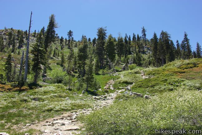
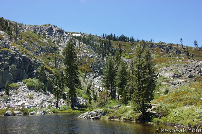
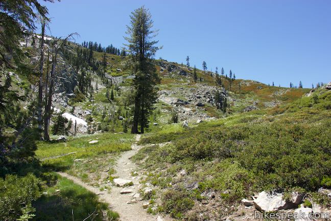
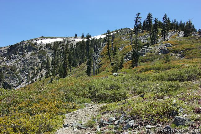
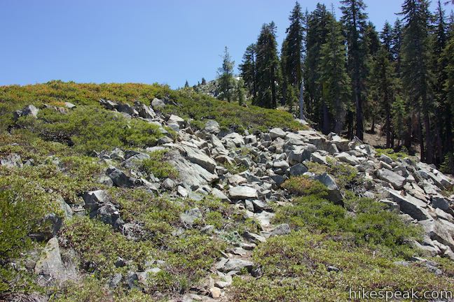
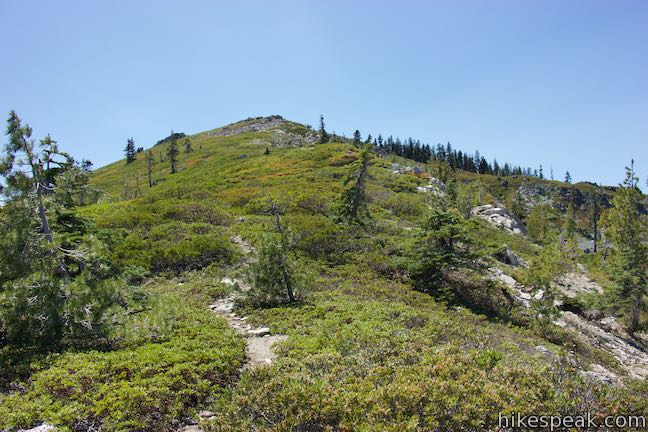
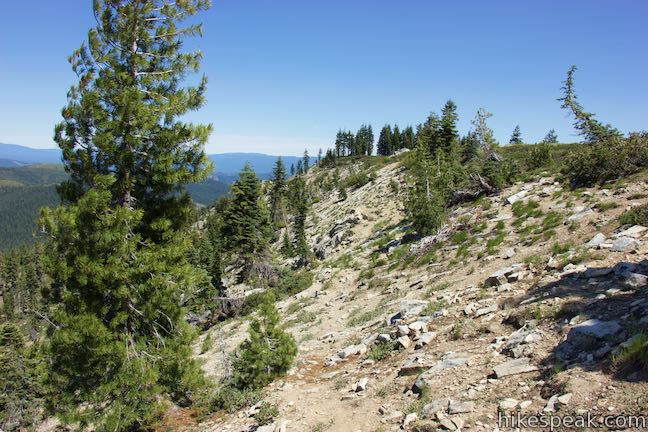
Just past the pond, bear right as the path splits again. The steep slope on the north side of Castle Peak is ahead of you. The trail, to the extent that their still is one, really breaks up once you reach the base of this slope, about 0.15 miles from Heart Lake. Begin a steep 150-foot climb up the side of the ridge in front of you. You can take multiple paths up this slope and any route to the top of the ridge will do. One option is to angle to the right toward the ledge at the end of the ridge. Here you can hike along the edge of the thick brush atop the steep granite cliffs above Castle Lake. This would be a precarious route to take when snow and ice are present, but during summer months, you’ll be rewarded with views over Castle Lake toward Mount Shasta.
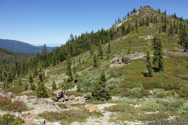
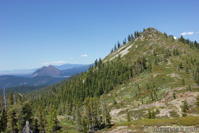
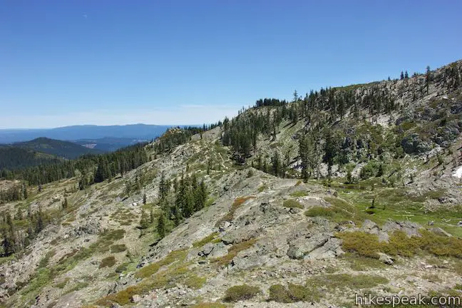
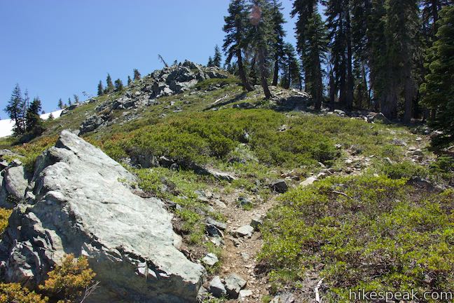
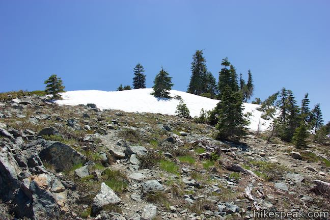
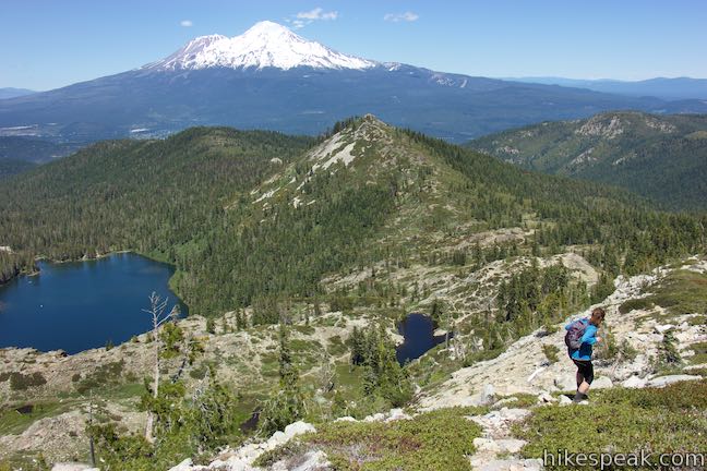
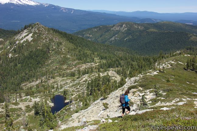
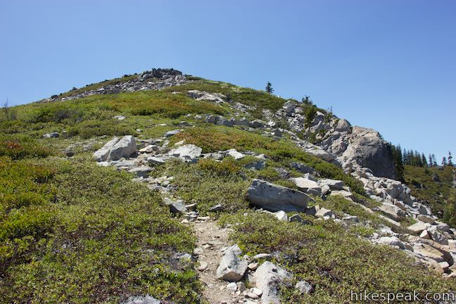
Ascend along the cliff’s edge or cut back to the left for a less daunting approach. Once you come over the top of a rounded ridge, the various footpaths consolidate and form an easier-to-follow path. Turning to the right, the route heads south following the ridge to the summit. The trail weaves through clusters of manzanitas and climbs across boulder piles toward a grove of pines on the east side of the ridge. Stay to the left of the trees and push up the spine of the ridge. Patches of snow can be present on this side of the mountain even in summer months. Safely make your way over or around the snow to arrive at the mountaintop.
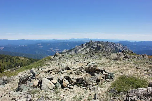
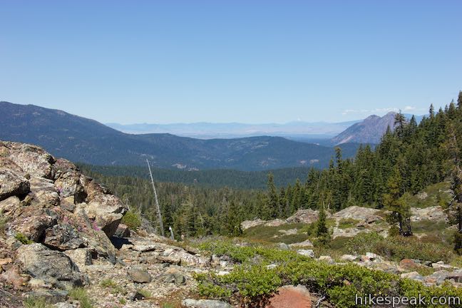
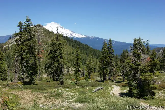
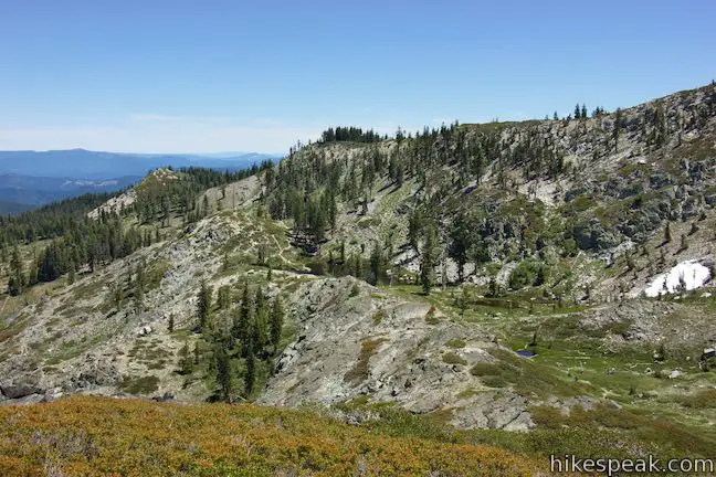
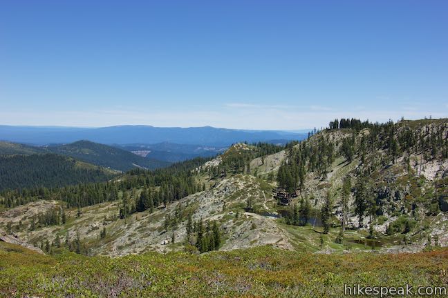
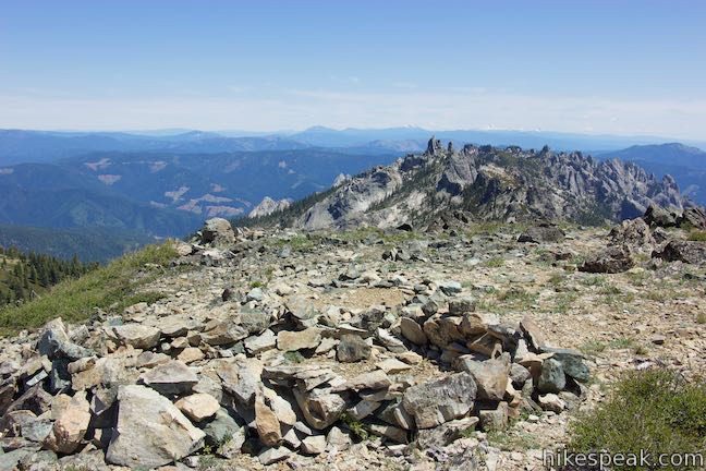
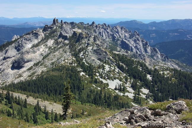
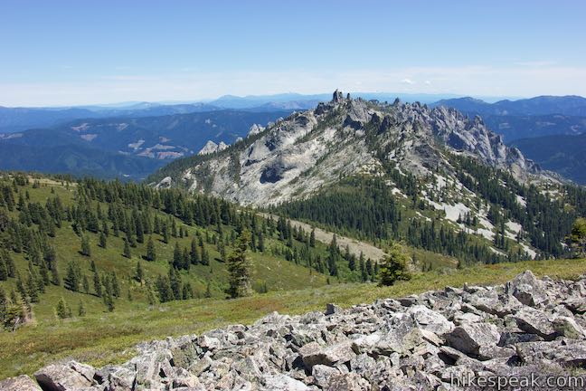
The route up the ridge reaches a level spot where fellow hikers have built a circular stone shelter as a refuge from the wind. To the right, a short path leads west to an outcropping of rocks at the true summit. From the high spot, you can look south and west over surrounding ridges in the Klamath Mountains. The finest views are visible right from the rock shelter, looking southeast toward the Castle Crags and northeast over Heart Lake and Castle Lake.

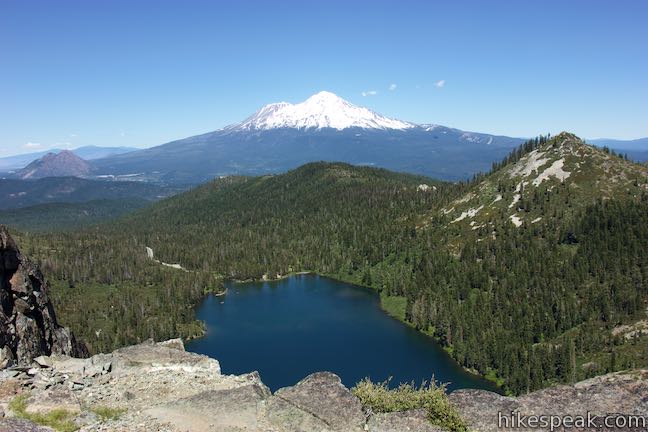
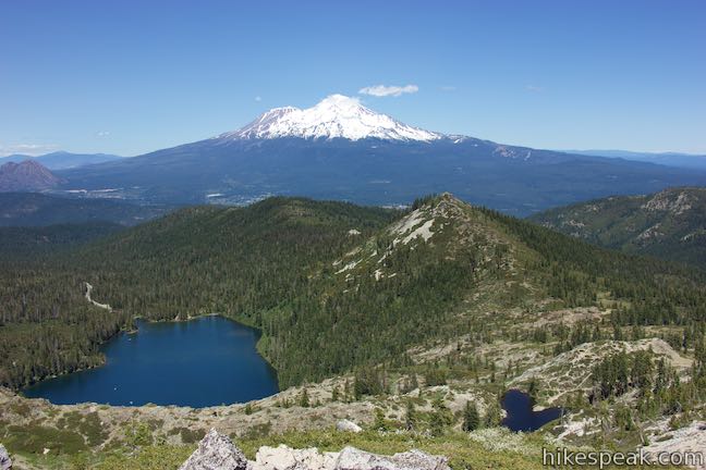
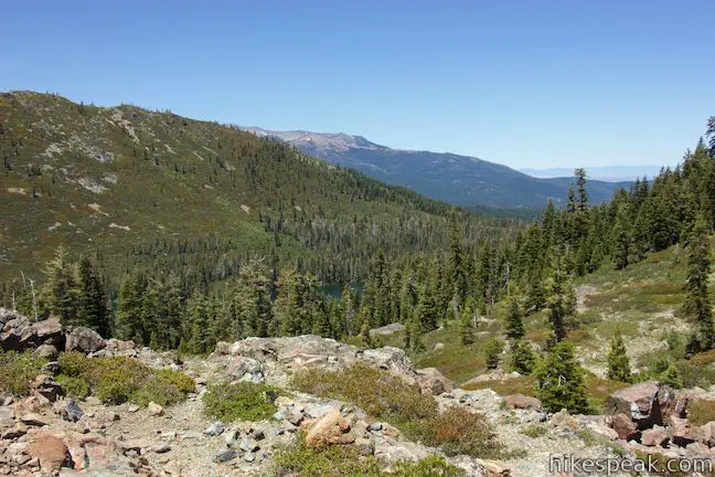
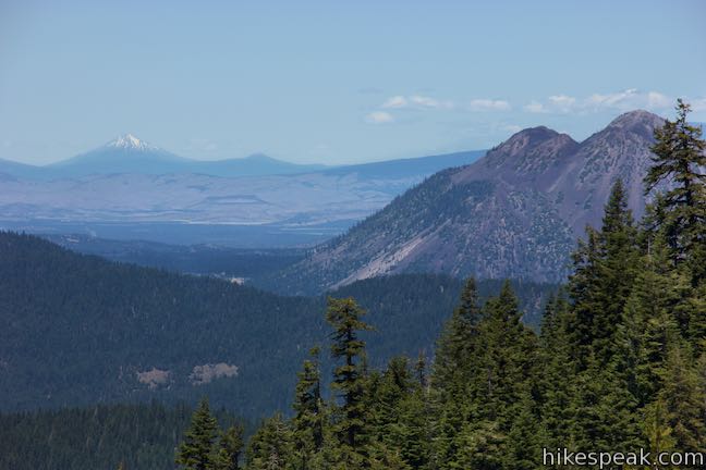
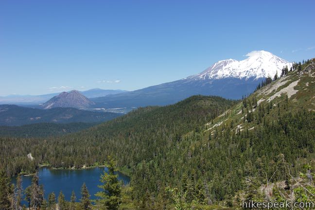
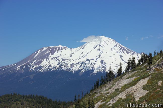
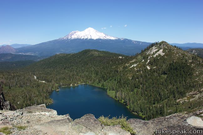
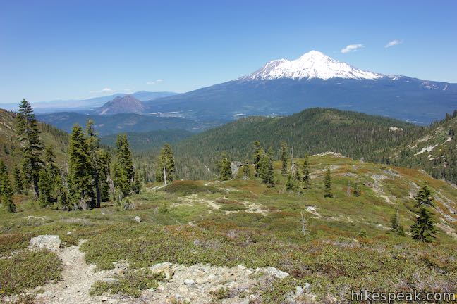
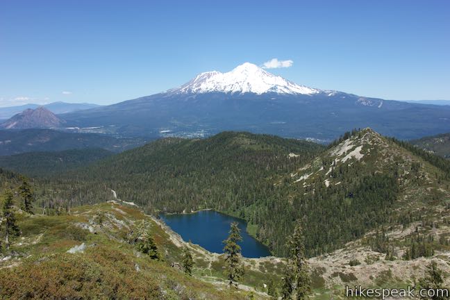
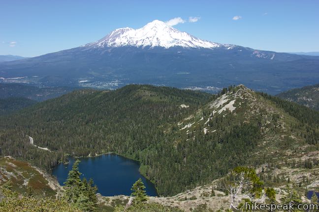
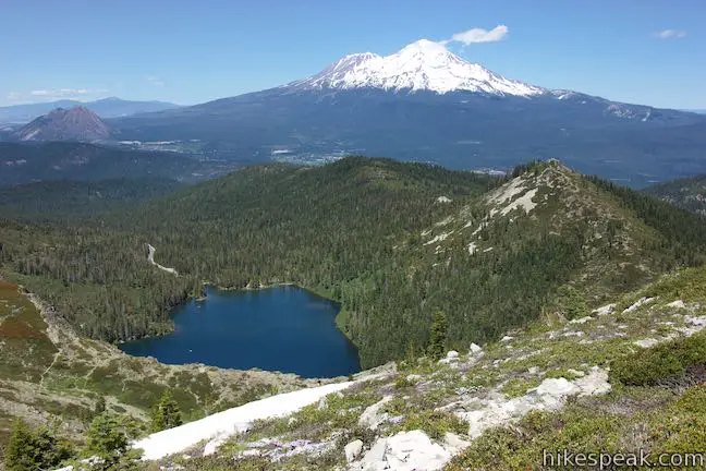
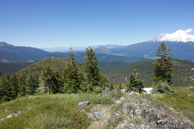
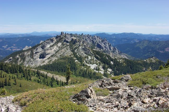
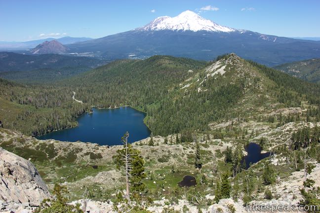
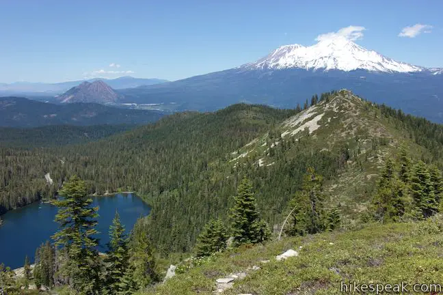
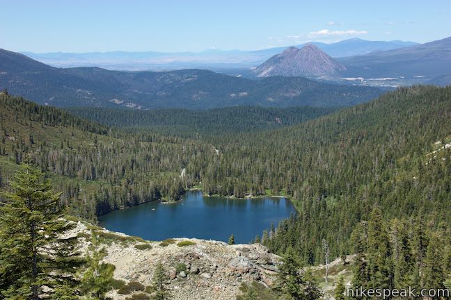
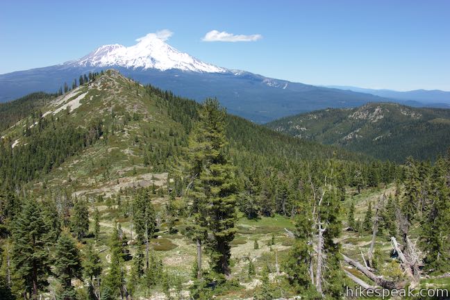
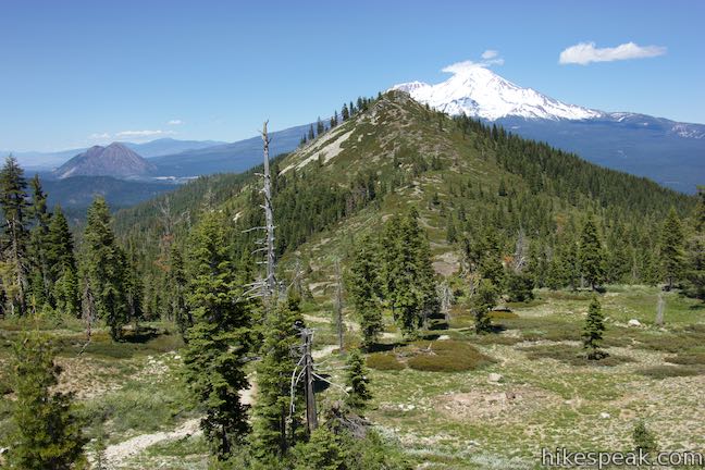
Look northeast to see familiar features from the hike up. Heart Lake is cradled beneath the peak and below that you’ll see the much larger Castle Lake. The snow-covered mass of Mount Shasta rises beyond the immediate forest. The smaller Black Butte sits to the left of the 14,180-foot volcano. In the distance, you should see the snowy peak of Mount McLoughlin, 85 miles away in Oregon.
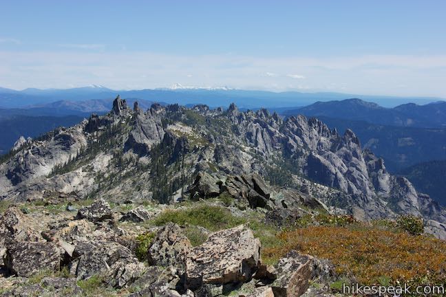
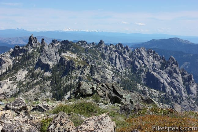
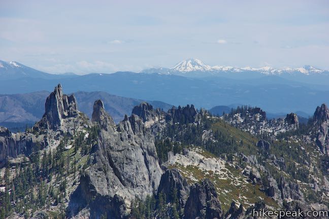
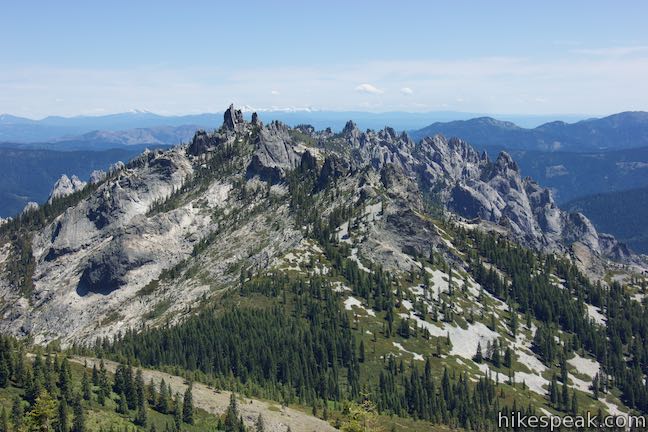
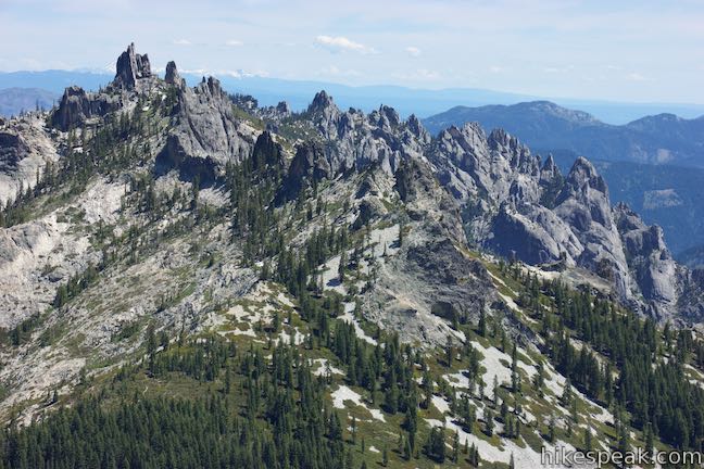
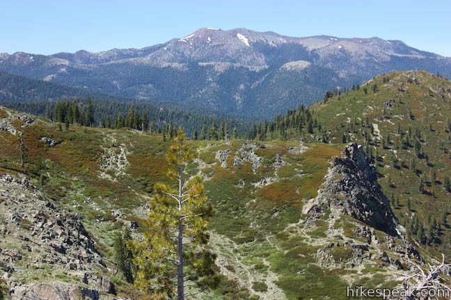
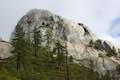
The view to the southeast is completely new and captivating. Look over Castle Crags Wilderness toward a crown of jagged, sawtooth peaks, each with its own dramatic shape. This exotic cluster of granite points known as the Castle Crags is out-of-place from the surrounding landscape and is mesmerizing to look at. In the distance, beyond this daunting gathering of peaks, you should have a view of Mount Lassen, nearly 70 miles away. Pacific Crest Trail crosses the slopes on the south side of Castle Peak and you will see the trail as it wraps around the base of the Castle Crags Formation in the foreground to the east.
Enjoy all the views from this 6,615 summit before moving on. You could return the way you came, which was a roughly 1.7-mile long ascent from Castle Lake. Alternatively, you can hike down the east side of the peak. The previously described route up the north side is easier to follow, which is one reason it is recommended for the ascent. The route on the east side of the mountain is less defined, which is less of a concern on the hike down. Also by hiking down the east side, you’ll face the Castle Crags and can spend the descent admiring every sheer granite point.

Set out down the east side of Castle Peak, hiking over loose rock and boulders. A path leads over step-sized rocks and through a few patches of brush. Just do your best route finding as you descend the mountainside. Spectacular views of the Castle Crags are joined by a perspective looking down the steep ridge toward Heart Lake. The heart shape is very defined from this nearly overhead angle.
About a quarter mile below the summit, a path drops off the side of the steep ridge toward Heart Lake. You could take this route, but it seems better to stick with the ridge until it reaches more tapered terrain.
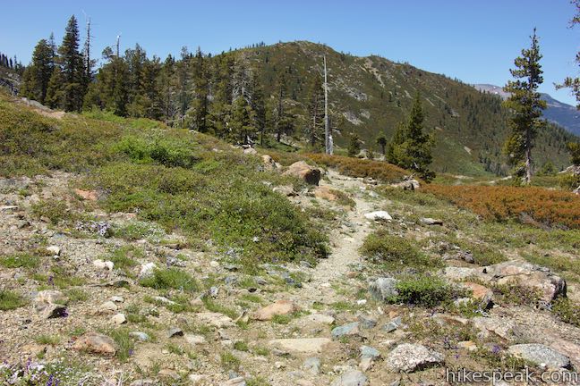
In another tenth of a mile, you will hit a split. One path branches off to the left and takes a gradual route down the side of the ridge. The other path sticks with the top of the ridge. Ahead, the ridge curves to the left around a bowl-shaped depression in the terrain and curls toward the mountain pass at the junction of Heart Lake Trail and Castle Lake Trail. You could continue along the ridge to drop down to Heart Lake Trail at a lower point, but it seems to make just as much sense to leave the ridge top here.
Bearing left at the split, 0.35 miles below the summit, the path gradually cuts along the side of the ridge through a pine forest. You will only sacrifice a bit of elevation as the trail runs parallel to the ridge. As the path reaches the bowl in the terrain that is formed by the ridge, the slope becomes less steep. The path seizes on this opportunity and turns left to go downhill more quickly. Make your way down a few switchbacks as the path breaks up into different routes used by previous hikers. The paths are narrow, but easy enough to follow over the open terrain. Looking back up the slope, the paths are much harder to identify, making this route more difficult to track in reverse.
Hike down the slope toward Heart Lake Trail. As you get close to the trail, the paths seem to disappear completely. Just curve to the left and find Heart Lake Trail near the steep spot below Heart Lake.
When you hit the actual trail, turn right to return to Castle Lake. If you hike farther along the ridge, you’ll return to Heart Lake Trail at a lower point. Either way, hike down to Castle Lake Trail and turn left to get back to the trailhead (or make a right turn to check out Little Castle Lake).
This hike up to Heart Lake and Castle Peak ascends 1,180 feet and is around 3.2 miles round trip depending on your route. Dogs are welcome on this outing as well. No permit is required to day hike in Shasta-Trinity National Forest. Parking at the trailhead does not require a fee, so get out and enjoy! Camping is available just 0.3 miles down the road at Castle Lake Campground. Other nearby hikes include Lake Siskiyou Trail (South Shore Loop), Faery Falls, and Spring Hill.
To get to the trailhead: Take interstate 5 to exit 73B in Mount Shasta. At the end of the offramp, head west (away from the city) on Lake Street toward Hatchery Lane, following signs for Lake Siskiyou. Turn left on Old Stage Coach Road and drive south for 0.2 miles. Veer right onto Barr Road and drive another 2.3 miles to Ney Springs Road. The intersection comes after you cross the outlet of Lake Siskiyou. Turn left up Ney Springs Road and make the next right onto Castle Lake Road. Drive 7 miles up to the end of the road at a parking area by Castle Lake where the hike begins.
Trailhead address: Castle Lake, Castle Lake Road, Dunsmuir, CA 96025
Trailhead coordinates: 41.2303, -122.3816 (41° 13′ 49.07″N 122° 22′ 53.76″W)
View Castle Lake Area in a larger map
Or view a regional map of surrounding Northern California trails and campgrounds.


 | Heart Lake and Little Castle Lake This 2 to 3-mile hike visits lakes in a beautiful area of Shasta-Trinity National Forest, including the charming-contoured waters of Heart Lake. |
 | Faery Falls and Ney Springs This short hike travels along a creek up to an impressive 50-foot waterfall, passing the ruins of an old resort along the way. |
 | Lake Siskiyou Trail (South Shore Loop) This short and easy lakefront loop offers great views across Lake Siskiyou toward Mount Shasta and the surrounding evergreen wilderness. |
 | Spring Hill This 2.9-mile hike hits a short summit near Mount Shasta with excellent views of Mount Shasta, Black Butte, and the surroundings. |
 | Crags Trail to Castle Dome This 5.6-mile round trip hike in Castle Crags State Park ascends 2,150-feet through a garden of granite crags to the base of Castle Dome. This hike can be extended to 6 miles round trip by taking a worthy side trail to Indian Springs. |
 | Root Creek Trail This 2.2-mile round trip hike in Castle Crags State Park takes a level and easy course to a tumbling creek in a mossy forest. |
 | Vista Point Trail This short hike reaches the principal viewpoint in Castle Crags State Park, which has a great perspective of granite peaks known as the Castle Crags, along with views of Mount Shasta and the surrounding wilderness. |
 | Hedge Creek Falls Trail This short hike leads to a forest-wrapped waterfall, passing behind the falls to arrive at a Sacramento River Overlook. |
 | Bailey Cove Trail This easy 3.1-mile loop circles a hill-covered peninsula on the McCloud Arm of Shasta Lake, providing both lake views and shade. |
 | More hikes in Northern California Explore more trails in Northern California, including redwood grove and oceanfront parks along the North Coast. |
 | Castle Crags State Park Campground There are 76 developed campsites within this state park that are nestled within a pine forest with access to nearby trails. |
 | Antlers Campground This well-shaded 59-site campground in Shasta-Trinity National Forest has level sites on a bluff next to Shasta Lake. |
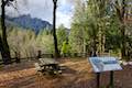
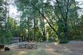
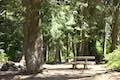 | Castle Lake Campground This six-site campground in Castle Lake is shaded by conifers in Shasta-Trinity National Forest. |
Is this trail still accessible?
My wife and I are not great route-finders. The part of the hike up to Heart Lake looks pretty straightforward but the loop up and around Castle Peak is probably not well-marked. Is there a way to download a gps, gpx, or similar version of the Castle Peak loop portion of the hike? We usually use Gaiagps.com and have the ability to download a gpx file to our Gaia app.
Thank you for your great website and your assistance.
Philip