Gaviota State Park Campground
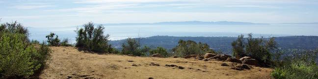
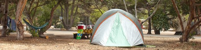
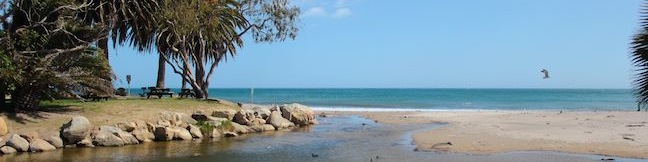
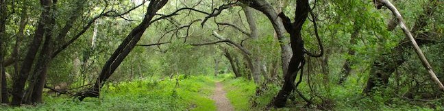
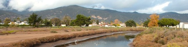
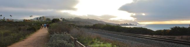
Pack the tent and your flip-flops when you visit the campground at Gaviota State Park. Each site is ambling distance from a sandy beach along the scenic coast west of Santa Barbara. A railroad trestle, pier, and hiking trails are close to the campground, which is just off Highway 101, making it a convenient place to camp near the ocean. Gaviota State Park is about 30 miles west of Santa Barbara in the area around the Gaviota Tunnel. ...Read more.
By: Published: January 6, 2016 Last updated: April 19, 2026
Inspiration Point via Tunnel Trail and Jesusita Trail from Tunnel Road in Santa Barbara
Located in the Santa Ynez Mountains, 1,800-feet above the Santa Barbara Coast, Inspiration Point attracts hikers with panoramic views over city and sea. Two routes lead to this picturesque perch. If you want to make a day of it, you can approach the viewpoint from the west on a moderate 7.55-mile round trip trek up Jesusita Trail to Inspiration Point from San Roque Road. ...Read more.
Distance: 3.75 miles · Elevation change: 825 feet
By: Published: January 28, 2015 Last updated: April 9, 2026
Nature Trail in El Capitán State Beach
On the beautiful coast west of Santa Barbara, you'll find El Capitán State Beach, a 2,600-acre California State Park with a large campground and hiking trails. The park's top draw is the beach, and while you can drive right up to a strip of surf-friendly sand, you may also want to stretch your legs on the park's short nature trail. The Nature Trail loops through a lush sycamore grove bordering El Capitán Creek to approach the rocky shore at the end of El Capitán Point. ...Read more.
Distance: 0.35 miles · Elevation change: 18 feet
By: Published: September 5, 2013 Last updated: April 9, 2026
El Capitán State Beach Campground
Santa Barbara County is famous for its beautiful beaches, and El Capitán State Beach is one worth noting, allowing visitors to camp on a low bluff just above the ocean. El Capitán State Beach is a fun place to camp with family and friends, relaxing by the ocean and falling asleep to the sound of the waves each night. The campground is located on a point 17 miles west of Santa Barbara, between Highway 101 and the Pacific Ocean. ...Read more.
By: Published: September 4, 2013 Last updated: April 19, 2026
Refugio State Beach Campground
Located along the Pacific Ocean, twenty miles west of Santa Barbara, Refugio State Beach has 66 standard sites and one group site that can be reserved in advance for an ocean view camping experience. Palm trees line the beachfront campground, which is split down the middle by the leisurely flowing Refugio Creek. The meeting of the Refugio Creek and the Pacific Ocean makes the campground a haven for birds. ...Read more.
By: Published: May 4, 2013 Last updated: April 19, 2026
Ennisbrook Trail in San Ysidro Creek Preserve in Montecito
If you are looking for a peaceful stroll in the peaceful Central Coast city of Montecito, examine Ennisbrook Trail. This 1.85-mile lollipop loop with 150 feet of elevation change explores an oak woodland in the 44-acre San Ysidro Creek Preserve. The easy trail is charmed by old stone bridges spanning San Ysidro Creek, which you will follow on this creekside hike. ...Read more.
Tagged with · Free Trails · Montecito · Wildflowers
Distance: 1.85 miles · Elevation change: 150 feet
By: Published: April 24, 2013 Last updated: December 6, 2025
Carpinteria Salt Marsh Nature Park in Carpinteria
Since so much of the coastline of Southern California has been developed upon, it comes as a relief to find a 230-acre estuary that has been set aside and preserved as a vital ecosystem for shorebirds. Carpinteria Salt Marsh Nature Park offers a level 1.2-mile round trip hike through part of El Estuaro past several observation areas and benches. While this might not appear to be the most picturesque park on the Central Coast, it is one of the area's most important wetlands and you have a good chance of seeing great egrets and other interesting waterfowl. ...Read more.
Distance: 1.2 miles · Elevation change: 10 feet
By: Published: January 17, 2013 Last updated: December 6, 2025
Carpinteria Bluffs Trail to Carpinteria Seal Sanctuary Overlook in Carpinteria Bluffs Nature Preserve
You could call a hike easy if it was less a mile long and almost completely level. You could call a hike easy to reach if the trailhead was right at the end of a freeway offramp. You could call a hike easy to enjoy if it offered lovely coastal views and almost guaranteed wildlife viewing. Introducing the easy-to-reach, easy-to-enjoy, and all around easy hike from Carpinteria Bluffs Nature Preserve to Carpinteria Seal Sanctuary Overlook! ...Read more.
Distance: 2 miles · Elevation change: 100 feet
By: Published: December 13, 2012 Last updated: December 5, 2025
Gaviota Pass Overlook Loop in Gaviota State Park
Gaviota State Park preserves 2,787 oceanfront acres in the rugged and beautiful Santa Ynez Mountains west of Santa Barbara. If the park was not sliced down the middle by Highway 101, it would surely be one of the most popular state parks on the Central Coast. The presence of the freeway certainly cuts down on crowds, enabling hikers to enjoy the largely untainted scenery in relative solitude. ...Read more.
Distance: 6.5 miles · Elevation change: 650 feet
By: Published: December 11, 2012 Last updated: April 7, 2026
Inspiration Point via Jesusita Trail from San Roque Road in Santa Barbara
Located in the Santa Ynez Mountains, 1,800-feet above Santa Barbara, Inspiration Point provides panoramic views over The American Riviera. It is a moderate 7.55 to 7.95-mile round trip trek from San Roque Road up Jesusita Trail to Inspiration Point, gradually checking off 1,400 feet of elevation gain. Those who prefer a shorter alternative, can hike from Tunnel Road and take a 3. ...Read more.
Distance: 7.55 miles · Elevation change: 1800 feet
By: Published: November 21, 2012 Last updated: April 9, 2026